GULF AVIATIONBiblio.com
194 résultats
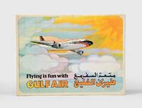
1974168084Bahrain: Gulf Public Relations 1974. First edition first printing of this pop-up book published by Gulf Air Public Relations in around 1970 with dual Arabic-English text by Ib Penick and illustrations by Gloria Nixon. The narrative revolves around Ahmed a boy who is flying from Manama to London with his parents. Quarto. 8 double-page full-colour illustrations by Gloria Nixon each one with a pop up all except the last with moving parts. Original coloured pictorial boards spine lettered in gold covers illustrated in colour and lettered in black and gold. Boards lightly toned spine lettering faded covers slightly soiled contents bright all moving parts in working order. A very good copy. hardcover
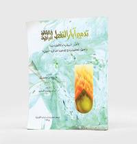
1995182920Kuwait: Markaz al-buhuth wa-al-dirasat al-Kuwaytiyah 1995. First edition of this well-illustrated study on the environmental impact of the destruction of oil wells in Kuwait based on government documents issued by the Iraqi government during the Gulf War. The work presents this damage substantiated by copious data as a main goal of the Iraqi war strategy of delayed sabotage. An appendix lists names of Iraqi officers accused of being "environmental criminals" as they took part in the identification of targets and methods and the execution of the plan - phases which are carefully described in the first part. The second part discusses subsequent damages to the economy public health and the environment including air and water pollution and their impact on living organisms. The third part describes the strategies employed to limit the damage such as the efforts of firefighters in extinguishing burning oil wells. Quarto. With facsimiles of documents colour illustrations and maps. Text in Arabic. Original pictorial wrappers wire-stitched as issued. Pencilled Arabic word at head of last verso. Extremities a trifle rubbed or creased contents clean: a very good copy. unknown
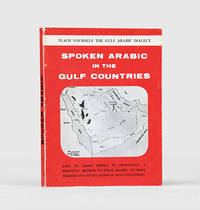
1971171721al-Khobar: The International Publications Industries 1971. Keep the following in mind and everything will be easy Fourth printing of this institutionally rare phrasebook which adopts "a short cut method simple and easy enough for a businessman to teach himself the spoken Arabic while relaxing in the Aircraft or in his Hotel room. Many of the oil industry people in Arabia owe their local friendship to this book". Arranged by topic the book has sections on greetings shopping food and drink and other practicalities such as taking one's car to a mechanic. The unnamed author places a premium on language as a key to understanding local culture: "you will find the Gulf Arabs intensely loyal to their friends as well as to their families. Most of them are blessed with a keen sense of humor. For these and other reasons such as their hospitality and courtesy you will enjoy getting acquainted with them". Further sections discuss the etiquette of being a guest at a traditional wedding and how to behave if invited to a private house as a guest. WorldCat lists only four copies in institutions Oxford National Library of Wales National Library of Israel Bilkent University. Small octavo 115 x 117 mm. Wire stitched in the original printed wrappers spine lettered in black. Minor wear to wrappers contents lightly toned not affecting text. A very good copy. unknown
1902997<p>D. Appleton NY 1902. HB NODJ 1902 1st edition 1st printing with #1 on last page of Text as Required Green decorated Cloth with minor Rub Wear Tiny Chip Tears Extremities Interior Nice & Tight with light Fox Wear & few loose protruding pages reattached with small tape at Inner Hinge & Vox NF/NF AS-IS NODJ 328 pages page with pencil underlining. Signed by Illustrator. First Edition. Hard Cover.</p> D. Appleton NY hardcover
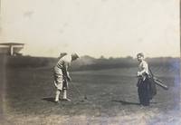
192658065Youngstown OH: n.p. 1926. Oblong folio. 17 x 9.5 in. 13 leaves unnumbered. on thick gray-green textured boards all mounted on linen hinges at gutter margin with 35 tipped-in silver gelatin photographs sized from 4.5 x 9.5 in. up to 6.75 x 14 in. Full green morocco gilt lettering stamped on front cover decorative Italian patterned endpapers minor scuffing & wear to fore-edges very light sunning to front cover still a VG exemplar. This excellent souvenir photo album depicts the golf tourney hosted by the Youngstown Country Club in honor of Campbell’s 1854-1933 72nd birthday in 1926. The opening photo depicts all the participants and dignitaries at the Country Club followed by images of players on the greens. The 18-hole course was built on the 131-acre Holland Farm and designed by Walter Travis featuring a $ 60000 Clubhouse which was noted for elegance and model comfort. These images depict the quintessential 1920’s golfing excursion including those of players the greens the roughs caddies and even an image of what appears to be Walter Travis himself taking a turn on the links. The year before in 1925 the Youngstown Country Club had hosted the 25th Open Championship of the Western Golf Assoc. and legends of the game including Walter Hagen Gene Sarazen and Tommy Armour III all played the course. Campbell was an enthusiastic golfer until his death holding a similar tourney in 1929 on his 75th birthday. He had begun his business career by forming the Youngstown Ice Co. in the summer of 1884 and by 1890 was hired as manager of the Trumbull Iron Co. later consolidated into Union Iron & Steel Co. In 1901 he founded Youngstown Steel and Tube Co. but after a failed merger at the beginning of the Great Depression his health declined. See: Ted Heineman James A. Campbell Riverside Cemetery Journal 2009; History & Golf Outings Youngstown Country Club 2021; James A. Campbell’s 75th Birthday Celebration Youngstown Sheet & Tube Audiovisual Archives YHC MSS 0140 Box 10 Folder 186 n.p., hardcover
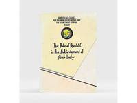
1985177401Bahrain: Printed by the Arab Printing and Publishing Establishment 1985. Second edition of this booklet produced to showcase the Arab Thought Forum held in Riyadh in April 1985. The first part comprises "Arab Unity: A General Outlook" a speech delivered by Prince Saud al-Faisal Foreign Minister of the Kingdom of Saudi Arabia. It is concerned with the difference between the "failed" concepts of Arab unity and Arab nationalism and their relationship with Islamic doctrines. The second part is devoted to a research paper by the GCC Secretary General concerning the role of the GCC in the achievement of Arab unity. It analyzes regional changes in the decade 1971-1981 and the "Arab degeneration and decline and the downfall of the unity of Arab security" before the establishment of the GCC. Octavo 240 x 165 mm. Text in English and Arabic. Original yellow printed wrappers wire-stitched as issued. Extremities and covers a bit rubbed sunned and foxed first recto and last verso toned: a very good copy. unknown
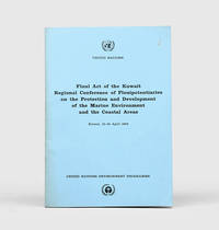
1978172055Perhaps Kuwait: United Nations Environment Programme 1978. First and sole edition untraced in Middle Eastern libraries of this plan enshrining environmental protection as a priority for future development along the Arabian coast. The regional conference highlighted the dangers posed by oil spills and committed to pollution-control measures for future projects. Participants included delegates from Bahrain Iran Iraq Kuwait Oman Qatar Saudi Arabia and the UAE. Attendees also agreed on a regional trust fund funded in different proportions by eight governments including the UAE and Saudi Arabia to finance initiatives. In the United Kingdom copies can be found at the universities of Oxford Durham and Southampton. We have also located three each in the US and Canada two in Germany two in Switzerland and one each in Austria and Sweden. Octavo. Original pale blue wrappers wire-stitched as issued front cover lettered in black. Light peripheral toning to covers small rust mark at top corner of front cover back cover slightly creased: a very good copy. unknown
191175830Edinburgh: R. and R. Clark 1911. First Edition. Hardcover. Very Good. Edinburgh R. and R. Clark 1911. Octavo viii 150 pages plus 2 plates. Original blue cloth slightly rubbed at the extremities and lightly marked; tiny bump to the leading edge of the front cover; bottom corner of the rear board cracked creating a ripple in the cloth along the fracture and cracking the pastedown but the corner is firm and stable; edges endpapers and first and last pages foxed; a very good copy. Inscribed and dated 26 December 1913 by the author. R. and R. Clark hardcover
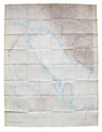
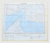
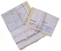
1967L6CEZZVCL8UFSt Louis: Aeronautical chart and information center United States Air Force 1967. Two maps colour printed on both sides of a sheet of silk 103 x 78.5 cm on a scale of ca. 1:1000000. The two maps ONC-H-6 & ONC-H-7 show one continuous area. Rayon pilot's map of the Arabian Gulf region focusing on the Trucial States modern UAE Qatar Bahrain Oman Iran and Saudi Arabia including main oil installations. Items of specific interest to aircraft such as airfields and even seaplane bases are particularly listed. Warnings to stay within the specific flying routes while in Iran are placed on multiple locations. While the map depicts a continuous area on both side on of one sheets it actually consist of two maps originally published separately. Slightly frayed at the edges. In very good condition. Aeronautical chart and information center, United States Air Force, unknown
192549705Pittsburgh PA & Port Arthur TX: Gulf Refining Co. ca. 1925. Folio. 11.5 x 14.25 in. 5 large oversize folding leaves of typed descriptions measurements specifications; mounted 7 linen-backed photo leaves 2 folding -- w/ 39 images printed on 34 silver gelatin photos. Original split-pin post-binder blue silk red cloth corners brass split pins minor edgewear rubbing minor fraying to corners first typed leaf w/ creasing minor closed tears still a VG exemplar from the library of John W. Jackson former Marketing & Sales executive with Gulf Oil Corporation Tulsa OK. This spectacular packaging catalogue for Gulf Oil Company petroleum products in the 1920s provides an incomparable photographic reference for all of the available products their dimensions sizes specific directions about tin lithograph colours as well as the cardboard and wooden shipping crates. Gulf Oil Corporation was initially organized in May 1901 by J.M. Guffy Andrew W. Mellon and others. By 1907 they had built a 400-mile pipeline from Port Arthur to the Glenn Pool Field in Oklahoma and started refining Oklahoma crude by 1907. By the 1920s this integrated Oil Company had built service stations across the country sold Good Gulf Gasoline and actively promoted automobile travel with Gulf Maps marketing promotions and more. This catalogue begins with photos of 1 5 10 and 25 lb. tins of Gulf Supreme Grease Transmission Grease Red Top Axle Grease Gulf Petrol-atum Gulf High Pressure Grease and Gulf Lubricant with all of the product tins carefully sized by stack showing their side graphics sizes lids and lid configurations. The oil cans include Tractor Oil Auto Oil Harvester Oil Gulf Motorcycle Oil small illustration of 1920s era motorcycle with Gulf Logo and even the blank tin soldered cans of assorted sizes. Of particular interest are the images of all the specialty products Gulf Oil was marketing during the Flapper Era including Venom pesticide & bug killer in glass bottles with screw-top tin lids & corks; Gulf Gas-o-Clenz cans in 1/2 pint 1 pint 1 quart and 1 gallon sizes; Gulf Gleam Cans Gulf Jelly Clens tubes Gulf Grease tubes and more. The last group of photos show all of the varieties of Gulf Venom Jelly-Clenz Gulf Pressure Grease Gulf Gleam cardboard and wooden packaging complete with printed labels lithograph labels Venom hand-sprayers and packaging and crates in assorted sizes and amounts. These types of photographic sales catalogues for the Petroleum industry are quite scarce and often unique items. Gulf Refining Co., hardcover
1957182684London: War Office; Printed for D. Survey WO and AM by Balding and Mansell Ltd 1957. A bright example of this detailed Gulf map Classified "restricted" and issued for military use at the time of the Jebel Akhdar War this double-sided sheet shows much of the modern-day UAE extending northwards from the latitude of Abu Dhabi and the Buraimi Oasis as well as the eastern Arabian Peninsula from the Trucial Coast to Jubail. As with other contemporary GSGS maps the sheet covers six degrees of longitude and highlights towns of significance and other standout features for example oil pipelines and wells water systems and roads and railways. Rayon sheet 630 x 710 mm printed both sides in colour folded as issued. A fine example. unknown
1963153757London: Geographical Section General Staff 1963. Scarce charts of Bahrain and the Straits of Hormuz A rare and historically interesting pair of adjacent maps of the Arabian Gulf covering six degrees of longitude each the geographical area encompassing the whole of Qatar Bahrain and part of what was to become the United Arab Emirates Al-Hofuf being the major city in the Al-Ahsa Oasis Eastern Province Saudi Arabia; sixth and fifth editions respectively. Maps of the period issued by the GSGS Geographical Section General Staff use a 7-colour tint scale to distinguish altitude and a glossary that highlights towns of significance and other standout features which provided steady references for army personnel to aid navigation in the challenging conditions of the region. The Bander Abbas map was compiled by the US Army Map Service Corps of Engineers from a number of sources including USAF Aeronautical Approach Charts of 1951-55 and the US Geological Survey of the Arabian Peninsula 1958. The Hofuf chart is based inter alia on 512 Field Survey Royal Engineers charts 1942-4. WorldCat lists just three individual copies for Hofuf NG39 SUNY at Buffalo University of Notre Dame and Eastern Illinois University alongside four copies of Bandar Abbas NG40 University of Exeter University of Notre Dame Eastern Illinois University and University of South Florida. It should be noted that major national institutions - BL for example - will have holdings of these maps within the complete GSGS series. Most copies would be discarded on supersession making these an important record of cartographic progress in the region. Two two-colour printed maps 1:1000000 scale 690 x 610 & 750 x 610 mm respectively. Ex- libris stamp of Arizona State Library both stamped "superseded" in blank margin and "withdrawn" on verso some pencilled marginalia; both in excellent condition. unknown
1956153759London: Geographical Section General Staff 1956 & 1957. Scarce maps of Oman and south-east Arabia dating to the Jebel Akhdar War A pair of decidedly uncommon and impressively sized regional maps both second editions Muscat-Musira following the first of 1945 S. E. Arabia first published in 1956. The Muscat-Masira map drawn up by D Survey of the Ministry of Defence reaches as far north as Khaburah Oman on the coast south beyond Masirah Island and westward reaching beyond Lahus and Hadhi. It is based on several mappings including Bertram Thomas's map of Rub' al Khali the "Empty Quarter" 1931 the sand desert covering most of the southern third of the Arabian Peninsula Samuel Barrett Miles 1910 map of Oman and Captain F. F. Hunter's map of Arabia 1935 revision. The aeronautical chart goes into greater detail reaching beyond Sur in the North South to Masirah Island and Manadhif and West to Uruq ash Shaybah UAE; this was drawn up by No. 1 SPC.RE i.e. Survey Production Centre Royal Engineers and is based largely on the USAF Aeronautical Approach Charts 1956 and World Aeronautical Chart 563 1951. During the mid to late-1950s Britain was involved in a number of disputes in Oman perhaps the most serious involving the Imam Ghalib al-Hinai and his brother Talib bin Ali who led the Imamate's revolt against Sultan Said bin Taimur which resulted in the Jebel Akhdar or Oman War 1954-1959. In this the RAF played a leading role not least because aircraft could at the same time expedite oil exploration operations in the interior of Oman. Pembrokes light transport aircraft and heavier Avro Ansons from 1417 Communication Flight RAF carried out reconnaissance "and other tasks during this operation against the Imamate and were the first aircraft ever to land at Nizwa marked "Nazwa" on the chart on a roughly cleared strip which proved extremely hazardous for the pilots but which was later transformed into a passable airfield" Lee p. 22. The present chart has two pencilled lines radiating from Masira airfield one of which passes through Nizwa near which is marked the "approx. position" of an airstrip. The chart bear the proviso that they should "not be taken as an authority on names" and that "the alignment of all tracks is approximate". Users were also directed to update information and highlight errors which were to be directly sent to the Director of the Military Survey in the War Office. There are noticeable graphical variations between the chart and map as fitting their usage. Before the Second World War pilots flew using landmarks - such as train tracks or roads - as pointers which meant that they relied on perfect weather conditions. However technological advances in aviation alongside the use of radio for more accurate navigation meant that to a degree pilots could work in more challenging conditions. This meant that maps with their focus on terrain and details relevant from the perspective of ground troops would become irrelevant when observed from a plane's altitude. Therefore a number of countries started to produce charts highlighting key information by reducing the contour structure and focusing on key landmarks necessary for aviators. The Muscat-Masira map uses a five-colour tint scale to distinguish altitude includes a glossary and key the latter identifying towns given four categories of importance significant ruins geographical features such as mountains hills marshes saddles and passes rivers water holes and man-made features such as railways roads tracks telegraph lines pipelines and pumping stations mosques and temples; tribal and regional names are also given. However reflecting the simplification required by pilots the S. E. Arabia chart only uses fives tones to highlight land mountains paths and the sea. These maps intended for use in the field would have had a high rate of attrition; WorldCat locates just a handful of copies of the Muscat-Masira map whilst S.E. Arabia 4802 is well represented institutionally but decidedly uncommon on the market. Two colour printed maps the first 1: 1000000 scale 860 x 640 mm the second 1:500000 scale 1100 x 825 mm. Both with creases from old folds and some minor marginal splits and spots the second with pencil lines marking a flight route from Masira Island and a notation in the margin; both remain very good. Sir David Lee The RAF in the Mediterranean and Middle East 1945-71 1978. unknown
1969L95DV18L9VQZSt Louis: Aeronautical chart and information center United States Air Force 1969. Two copies of two folding maps colour printed on both sides of a sheet of silk 103 x 78.5 cm on a scale of ca. 1:1000000. The two maps ONC-H-6 & ONC-H-7 show one continuous area. Rayon pilot's map of the Arabian Gulf region focusing on the Trucial States modern UAE Qatar Bahrain Oman Iran and Saudi Arabia including main oil installations. Items of specific interest to aircraft such as airfields and even seaplane bases are particularly listed. Warnings to stay within the specific flying routes while in Iran are placed on multiple locations. While the map depicts a continuous area on both side on of one sheets it actually consist of two maps originally published separately. We here include two copies so the whole area can be displayed. The maps are reproduced after the third and fourth edition.In very good condition. Aeronautical chart and information center, United States Air Force, unknown
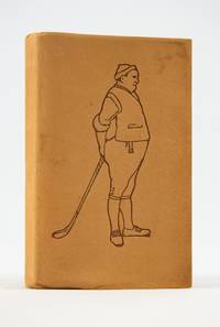
1903ST20237New York: The Gorham Manufacturing Co 1903. FIRST EDITION. ONE OF 500 COPIES. 102 x 64 mm. 4 x 2 1/2". 4 p.l. 9-148 pp. <br/> CHARMING PUBLISHER'S LIMP SUEDE illustrated covers with a rotund golfer on front and a long-suffering caddy at rear top edge gilt other edges untrimmed. In a later glassine wrapper. Housed in a very sturdy custom-made buckram folding box with inlaid marbled spine label. Color floral and foliate headpieces tailpieces and title page and 16 DELIGHTFUL MOUNTED COLOR PLATES BY JOHN HASSALL. Front endpaper with the ownership inscription "W. P. Rockwell November 1905." Murdoch 888; Donovan & Murdoch 19030. Trivial smudges to the suede but A NEARLY PRISTINE COPY of this delightful little book an item that is simply never found this well preserved.<br/> <br/> This is a diminutive golf manual with immense charm and offered in the most immaculate condition possible. In a small-pocket format the book provides the golfer with the game's rules etiquette technical terms names of golf clubs and their various uses a list of American champions since the organization of the United States Golf Association and a roster of the "leading players in the United States." Accompanying the text are a group of quite charming colored plates done by John Hassall 1868-1948 an active and celebrated watercolorist poster designer and illustrator from 1895 onwards. Houfe calls him "an original and versatile designer." As can be seen in the present volume Hassall seems to have been influenced by "the flat colors and two-dimensional decorative quality of Japanese prints which he adapts to his own work with thick outline and careful patterning." Whatever the influence one can't help but smile when looking at his work. Hassall depicts golf costume through the ages here including golfers in kilts trousers cloaks knickers and other attire; he also shows us a pair of disarmingly shabby young caddies two women and a boy incongruously dressed in Napoleonic greatcoat and tricorn hat. The most memorable thing about this item is its condition: as a book intended to be put in one's pocket and as a volume that was never sturdy to begin with there is absolutely no explanation for how our copy has survived to the present day in its remarkable state of preservation. When this copy without its box was sold in 2004 at PBA Galleries the most prominent auction purveyor of golf books and equipment the catalogue called it "the finest copy we have ever offered of this exceedingly scarce and fragile book.". The Gorham Manufacturing Co unknown
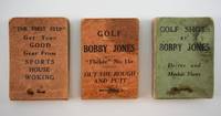
1930ST20235London: Harrods Ltd 1930s. FIRST EDITION. 76 x 51 mm. 3 x 2". 100 pp. <br/> Original green or orange paper wrappers side stitched titling on front cover and imprint on spine. In a custom-made folding buckram box with book wells for the three books and gilt-stamped marbled paper label inset on spine of the box. Consisting of three bound sets of 50 sequential photographs that when flipped either from back to front or front to back generate a stop motion animation of Bobby Jones demonstrating the proper form for executing a shot with various golf clubs see below. Advertisements on inside wrappers. Donovan & Murdoch 22610. One volume with portions of spine gone at either end with partial loss of imprint wrappers inevitably somewhat soiled corners a bit rounded as expected but still remarkably well preserved especially considering its inevitable hard use being entirely sound and with the photographs in excellent condition.<br/> <br/> This is a scarce grouping of some of the most charming sports as well as miniature books we've ever offered for sale. In the 1930s the famous London department store Harrods published a series of so-called sports "flicker" books of which these three are perhaps the most famous other sports books involved cricket tennis lacrosse soccer badminton swimming and greyhound racing. Our three "flicker" books when the pages are riffled with one's thumb or fingers show the famous smooth-swinging American golfer Bobby Jones executing shots with various clubs. The first book #11a in the Harrods series features the driver and the mashie. The modern equivalent for this latter piece of equipment is slightly elusive but the "mashie" is an iron club with considerable loft meant to hit a golf ball a relatively short distance with a high trajectory Jones' "driver" has the same meaning today as it did 90 years ago. The second book features shots with a "brassie" roughly equivalent to today's 3- or 4-wood and an "iron" also called a "driving iron" which is like today's 1- or 2-iron. The third book shows Jones putting and escaping from heavy rough with a high-lofted club like today's sand wedge. It is great fun--not to mention still instructive--to riffle through these photographs watching one of the world's most celebrated golf swings come to life complete with Jones' knickers white shirt and flapping tie. It is also a fact of some interest that this English series would feature an American player at a time when British dominance in golf was beginning to erode. Given the physical use to which these items have been subjected it is difficult to believe that they are still intact let alone that they are solid enough to be handled without worry. Harrods Ltd unknown
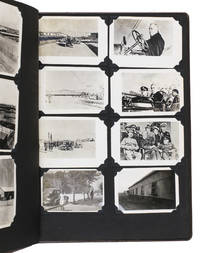
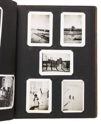
1943ABC_484281943. Contemporary embossed brown cloth with the title embossed in silver on the front board and the green shoulder sleeve insignia of the Persian Gulf Command embedded in the front board. Ca. 32.5 x 26 cm. With 150 gelatin silver photographs various sizes. Unusual military photo album with 150 photographs of the activities of the Persian Gulf Command PGC at the base in Andimeshk Iran. The PGC was a branch of the United States Army established to facilitate the supply of material from the U.S. Lend-Lease programme through the Persian Corridor. This material was sent to the Soviet Union to strengthen it so it could help defeat Nazi Germany. The photographs in this album which cannot be found anywhere else offer a visual documentation of this time. However they show the simple soldiers; the men tasked with driving trucks maintaining oil supply lines or working alongside Iranians at the two factories producing trucks for the war effort. The work therefore offers a fascinating insight into daily life of PCG members in Persia in the Second World War.This album was compiled by John Stefano dates unknown a technician fourth grade in the PGC. It includes photographs of the Tehran conference in 1943 the first World War II conference between the Soviet Union the United States and the United Kingdom where it was decided to open a second front against Germany. Other than this there are photographs of the barracks the men lived in the military vehicles they used the marches and excercises they partook in but also the surrounding landscape and the local people.Inserted in the album is a booklet with images and information about Persia with a letter by PCG commander Donald Prentice Booth 1902-1993 which was sent to PCG members after the war to congratulate them on a job well done. He hoped the booklet would serve as a memento. Together with the album it continues to do so until this day.With the shoulder sleeve insignia of the Persian Gulf command mounted on the inside of the frfont board some of the photographs are captioned on the back. The eyelets for the string on the front board have come loose. The corners of the leaves are slightly creased. Overall in very good condition. hardcover
1943ABC_484291943. Contemporary embossed brown cloth with the title embossed in silver on the front board the name of the owner painted in silver and the green shoulder sleeve insignia of the Persian Gulf Command embedded in the front board. Ca. 32.5 x 26 cm. With 76 gelatin silver photographs various sizes. Remarkable military photo album with 76 photographs of the activities of the Persian Gulf Command PGC at various locations in Iran. The PGC was a branch of the United States Army established in 1941 to assure the supply of U.S. Lend-Lease war material to the Soviet Union through the Persian Corridor. After the war members of the PCG received an empty album to fill with personal memories of their time in Iran. These albums are now relatively rare. The present one was compiled by Colonel S. Morgan Thomas dates unknown a PGC member who carried out inspections of the railroads. It includes various photographs of him at work.This album also contains photographs of PCG commander Donald Prentice Booth 1902-1993 a visit by Soviet soldiers and a young child military activity in Teheran locals and soldiers sending telegrams. Loosely inserted in the album are maps of Iran the lands surrounding Hamadan and the Trans Iranian Railroad which would have been important to carry for someone who inspected the railroads. The work offers a rare insight into life of a PGC member stationed in Iran.The corners of the boards are somewhat scuffed. One of the inserted maps is somewhat foxed and another has a tear that has been repaired with tape in the lower margin not affecting the image some leaves are missing one of the corner mounts the photographs are mounted on possibly missing a photograph on the verso of leaf 4. Otherwise in very good condition. hardcover
1917000214<p><strong>We believe this to be the first complete collection of its kind</strong> including several items that we have not encountered in public libraries or archival sources. In any case it represents the most comprehensive collection of issues that we have traced over a period of twenty-five years of Ottoman state publications many of which are difficult to assemble. The collection essentially consists of official reports most of which were prepared by the two ambassadors <strong>Fakhr al-Din Rûm Bey Oğlu</strong> and <strong>Muhammad Nâbi</strong>. These reports are highly restricted official documents.</p>Description of the Collection<p>The reports were prepared in <strong>Ottoman Turkish</strong> except for four items written in modern Turkish after the alphabet reform; these were prepared by <strong>İsmail Hakkı Tevfik</strong> and <strong>Abdulgani Seni Bey</strong>.</p>1. <em>Najd Issue</em> Najd Question<p>Ottoman Turkish report published by the Ministry of Foreign Affairs Istanbul 1918. 15 pages octavo.<br />Prepared by Ambassador Fakhr al-Din Rûm Bey Oğlu and the Ottoman Ambassador in Rome Muhammad Nâbi dated 11 March 1917.</p><p>The report discusses the political borders of Ottoman Najd; the treaty signed between Süleyman Şefik Pasha and Abdulaziz ibn Saud; the Ottoman–British treaty concerning Najd including Qatar; and the Ottoman treaty with Ibn Saud converting Najd from a <em>mutasarrifate</em> into a province <em>vilayet</em> appointing Ibn Saud as governor and commander-in-chief including military organization.</p><p>Topics include:<br />Midhat Pasha's report; Wahhabis; the conflict between Saud and Abdullah ibn Faisal; the sheikhs of Muscat Mukalla Oman Hadhramaut and Bahrain and their relations with Britain; Saudi movements along eastern Najd; Ottoman naval response under Midhat Pasha; the administrative difficulty of Najd; support of Mubarak al-Sabah for the Ottomans; coercion of Abdullah al-Faisal to sign the al-Ahsa treaty; Ibn Rashid's advances; tribal dynamics; British support of Al-Sabah; British protection; Ibn Saud and the Muntafiq sheikh; Ottoman–Wahhabi agreements 10 April 1905; British protests regarding Ibn Saud's border violations and interference in Qatar and Oman; the 12-article Ottoman–Ibn Saud treaty of 12 July 1913 including the separation of Qatar from Najd; maritime boundaries; recognition of Jasim Al Thani; compensation to the Sheikh of Bahrain.</p>2. <em>Muscat Issue</em><p>Ottoman Turkish report Ministry of Foreign Affairs Istanbul 1918. 6 pages.<br />Prepared by Fakhr al-Din Rûm Bey Oğlu and Muhammad Nâbi dated 27 November 1916.</p><p>Covers Muscat modern Oman the Imamate foreign involvement Ottoman views rejecting Muscat's independence from the Arabian Peninsula; relations between Najd Muscat and British India; strategic location; occupation history; Al-Sa'id relations with Wahhabis; British and French recognition of Omani independence in 1862; Ottoman perspective on Oman's connection to Arabia.</p>3. <em>Qatar Coasts Issue</em><p>Prepared 8 January 1917. Printed at the Imperial Press. 7 pages plus 9 pages of French appendices.</p><p>Topics include British expansion from Bahrain to Qatar; Ottoman claims; British intervention since 1891; correspondence with the Ottoman state; Bahrain–Qatar disputes over Zubarah and al-'Udayd; appointment of Abd al-Rahman Al Thani; British encroachments; Qatar within the Kuwait treaty framework; confirmation of Jassim Al Thani's authority in 1913.</p>4. <em>Kuwait Issue</em><p>Fakhr al-Din Rûm Bey Oğlu & Muhammad Nâbi. Imperial Press Istanbul 1334 AH. 34 pages.</p><p>Geography population sect history of Al-Sabah; Ottoman administration of Baghdad and Basra; British policy; secret treaties 1899–1904; borders; railways; maritime flags; taxation refusal; British attempts to place Kuwait under protection; Ottoman responses; oil islands Bubiyan Khor Abdullah; Sheikh's declaration of being an officer in the British army. Dated 31 August 1918.</p>5. <em>Basra Gulf Issue</em> Bahrain Qatar Pirate Coast/Emirates<p>İsmail Hakkı Tevfik. Ankara 1931. 32 pages.<br />Political tribal and documentary history in Turkish English and French.</p>6. <em>Irrigation in Arabia</em><p>Fakhr al-Din Rûm Bey Oğlu & Muhammad Nâbi. 14 pages.<br />Ottoman irrigation projects; British interference since 1910; German involvement.</p>7. <em>Asir Revolt of 1911</em><p>Report by Consul General İsmail Hakkı. 31 pages.<br />Ottoman military actions; Idrisi revolt; tribal loyalties; Wahhabi involvement; detailed military maps.</p>8. <em>Aqaba Issue</em><p>By Rashdi Infantry Brigade Commander. Istanbul 1326 AH. 154 pages.<br />Ottoman–British relations; Egypt's role; Hijaz railway; Aqaba dispute.</p>9. <em>War in Arabia between Ibn Saud and the Imam of Yemen</em><p>By Abdülgani Sünni Bey. Ankara 1934. 20 pages.<br />Unique copy. Covers causes tribal alignments Asir Aden Najran foreign involvement.</p>10. <em>Guide to the Gulf of Aden</em><p>Ottoman Turkish. Istanbul 1310 AH. 276 pages.<br />Includes maps; authored by naval officer Süleyman Nutqi.</p>11. <em>Tripoli Benghazi and the Twelve Islands Issue</em><p>Report dated 27 November 1916. 24 pages French treaty texts.<br />Ottoman North Africa American conflicts Italian ambitions Lausanne Treaty.</p>12. <em>Sheikh Sa'id Island Issue</em><p>Istanbul 1916. 4 pages.<br />Strategic Bab al-Mandab island dispute with France.</p>13. <em>Palestine Issue – Zionist Claims</em><p>Istanbul 3 March 1918. 43 pages.<br />Origins of Zionism; European diplomacy; Jerusalem administration.</p>14. <em>Notes on the Iraq War</em><p>Military Press 1333 AH. 88 pages.<br />Translated from English for official use only. Rare.</p>15. <em>Bahrain Issue</em><p>Report dated 8 January 1917. 12 pages French texts.<br />History British protection treaties 1820–1898 inclusion in 1913 Gulf treaty.</p>16. <em>Muhammarah Issue</em><p>Report dated 1 March 1917. 8 pages.<br />Borders oil Sheikh Khaz'al Anglo-Iranian-Ottoman relations.</p>17. <em>Oil Concessions in Arabia</em><p>Report dated 26 March 1917. 9 pages English treaty.<br />Mosul Baghdad Basra Shell Najd Kuwait.</p>18. <em>Baghdad Issue</em><p>Report dated 31 August 1917. 53 pages French texts.<br />Baghdad Railway; British–Ottoman rivalry; Gulf politics.</p>19. <em>Farasan Islands Issue</em><p>Report dated 28 November 1916. 8 pages.<br />German coal depot request; British occupation; oil and gas.</p>20. <em>Hadhramaut Issue</em><p>Report dated 11 March 1917. 6 pages.<br />Tribal governance; British relations via Aden.</p>21. <em>Aden and the Nine Districts</em><p>Report dated 27 November 1916. 39 pages French annexes.<br />Portuguese Ottoman British rule; Yemen administration; sovereignty claims.</p>22. <em>Memorandum on British Claims Regarding the Baghdad Line and Basra Gulf</em><p>Istanbul 21 January 1911. 35 pages appendices.<br />Detailed diplomatic negotiations since 1903.</p>23. <em>Guide to the Red Sea</em><p>Istanbul 1307 AH. 459 pages.<br />Comprehensive nautical and railway guide with ports and routes.</p>24. <em>South Arabia Issue</em> Hadhramaut Socotra etc.<p>İsmail Hakkı Tevfik. Bulgaria 1935. 132 pages with photographs and maps.</p>25. <em>The Egyptian Issue</em><p>Prepared March 1918. 186 pages.<br />Ottoman legal and political analysis of Egypt from Muhammad Ali to British occupation.</p>26. <em>Shatt al-Arab Issue</em><p>Istanbul 1917. 30 pages.<br />1913 treaty with Britain; navigation borders Iran Muhammarah.</p><p><strong>Note</strong><br />İsmail Hakkı Tevfik was a senior Ottoman and Republican diplomat and son-in-law of Sultan Mehmed VI. Fakhr al-Din Rûm Bey Oğlu and Muhammad Nâbi were leading Ottoman statesmen. Other contributors include Süleyman Nutqi naval officer and Abdulgani Seni Bey later a key Republican thinker.</p><ul><li><strong> 26 items</strong></li></ul> Ottoman Ministry of Foreign Affairs paperback