Vandermaelen, Philippe Marie GuillaumeBiblio.com
415 résultats
1827M2904Bruselles 1827. Excellent. Size : 464x557 mm 18.25x21.875 Inches Coloring: Original Outline Coloring Category: ; Maps Central America unknown
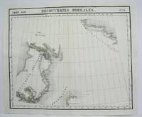
182736261Brussels Belgium: Lithographed By H. Ode. Very Good. 1827. Map. Map # 17 A Very Good primitive and early map showing the North Hampton Bay area. Includes the Welcome Strait. Latitude of the map is 60 degrees to 66degrees and longitude is 82 degrees to 98 degrees. Of course almost all localities shown are French or Indian names. The atlas from which this is extracted is extremely rare and originally composed 6 volumes this map being from the North America volume. Lithographer Ode and Cartographer Vandermaelen produced the first lithographed atlas ever done. Condition is overall Very Good. Browning to the centerfold crease caused by glue used in attaching the tab to the original volume the two page spread measures 21" x 26 1/2" when opened out. Topigraphical features are accentuated see image. Shipping will require extra care and cost due to insurance. Photo available upon request. ; 21" x 26 1/2"; 1 pages . Lithographed By H. Ode unknown
1825M4489Brussels 1825. Excellent. Notes: The first atlas of the world on a uniform scale. If assembled as a globe gores forms a very large globe. Size : 480x575 mm 18.875x22.625 Inches Coloring: Original Outline Coloring Category: Maps Canada North; unknown
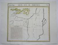
1825M4527Brussels 1825. Very Good minor worming to the lower portion of the map on along the central fold proficiently repaired. Notes: The first atlas of the world on a uniform scale. If assembled as a globe gores forms a very large globe.<br><br>This map shows the are of southern Newfoundland and the Grand Banks Size : 470x524 mm 18.5x20.625 Inches Coloring: Original Outline Coloring Category: Maps Canada East Newfoundland unknown
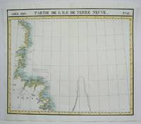
1825M4479Brussels 1825. Excellent. Notes: The first atlas of the world on a uniform scale. If assembled as a globe gores forms a very large globe. Size : 475x570 mm 18.75x22.375 Inches Coloring: Original Outline Coloring Category: Maps Canada East Newfoundland unknown
1826234571826. Paris Imprimerie de Gaultier-Laguionie / chez l'auteur 1826 1827 au premier plat de la couverture papier originelle. Un fort vol. au format in-8 203 x 131 mm de 1 f. n.fol. xi - 255 pp. Reliure lÂŽgÂrement postÂŽrieure de plein veau glacÂŽ fauve dos ˆ nerfs ornÂŽ de filets gras ˆ froid doubles filets dorÂŽs larges fleurons dorÂŽs piÂce de titre de maroquin marine titre dorÂŽ tranches mouchetÂŽes premier plat de couverture conservÂŽ. Edition originale rare ; ici revÂtue d'une ÂŽlÂŽgante reliure. L'ouvrage s'agrÂŽmente de nombreuses planches dÂŽpliantes gravÂŽes de partitions. ''Pierre Galin s'est occupÂŽ de la thÂŽorie de la Musique ; il a portÂŽ dans cette science le flambeau de l'analyse et de la logique. M. de Geslin don digne ÂŽlÂve a recueilli son hÂŽritage ; se montrant dans ce TraitÂŽ l'ÂŽmule de son ma”tre. La thÂŽorie de Galin concernait seulement la mÂŽlodie il restait l'harmonie ˆ traiter. Une thÂŽorie nouvelle fruit des mÂŽditations de de Geslin rendra cette science accessible ˆ toutes les intelligences''. Le Bibliographe musical 88. Quelques rousseurs dans le texte et papier parfois oxydÂŽ. Plusieurs planches brunies ; pouvant en outre prÂŽsenter des cernes. Nonobstant bonne condition. Rare. b42961 unknown
18033603192Madrid.: Imprenta Real. 1803. Hardcover. Cubierta deslucida. Good. 19 cm. 438 p. Encuadernación en tapa dura artesanal en plena piel con tejuelo. Pinel Philippe 1745-1826. Traducida al castellano por el Dr. D. Luis Guarnerio y Allavena. Nosografía filosófica . Cubierta deslucida. Imprenta Real. hardcover
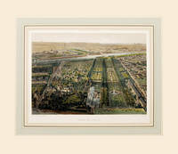
186164184Paris. 1861. Wonderful bird's eye view of the Jardin de Plantes the main botanical gardens of Paris published in 'Paris Dans Sa Splendeur' by Henri Charpentier Size: 250 x 360 mm. Original lithograph. Hand coloured. Mounted size: 490 x 570 mm. Fine condition. unknown
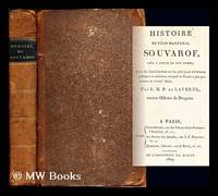
1809271796Paris : Chez Desenne Lenormant Au bureau des Annales de l'impr. d'A. Égron 1809. First Edition. Softcover. Poor copy in the original stiff-card wrappers; wear and tear as with age. Text remains in fine condition and without blemish. Physical description; xvi 490 p. ; 22 cm. Subjects; Suvorov Aleksandr Vasil evich kni az Itali ski 1730-1800. Suvorov Aleksandr Vasil evich kni a z Itali ski 1730-1800. Russia — History — Catherine II 1762-1796. Genre; Biography. Paris : Chez Desenne, Lenormant, Au bureau des Annales, de l'impr. d'A. Égron paperback
182736262Brussels Belgium: Lithographed By H. Ode. Very Good. 1827. Map. Map # 37 A Very Good primitive and early map showing Newfoundland present day and eastern part includes the city of Bonavista. Nice color depiction of the coastline. Latitude of the map is 48 degrees to 54 degrees and longitude is 47 degrees to 59 degrees. Of course almost all localities shown are French or Indian names. The atlas from which this is extracted is extremely rare and originally composed 6 volumes this map being from the North America volume. Lithographer Ode and Cartographer Vandermaelen produced the first lithographed atlas ever done. Condition is overall Very Good. Browning to the centerfold crease caused by glue used in attaching the tab to the original volume the two page spread measures 21" x 26 1/2" when opened out. Topigraphical features are accentuated see image. Shipping will require extra care and cost due to insurance. Photo available upon request. ; 21" x 26 1/2"; 1 pages . Lithographed By H. Ode unknown
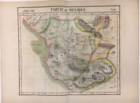
182736259Brussels Belgium: Lithographed By H. Ode. Very Good. 1827. Map. Map # 70 A Very Good primitive and early map showing the southwest Mexico coastline with portions of Guerrrero Province. Includes Acapulco. Has nice multi-color contrasts also includes a large geological diagramatic illustration. Map is based on the excursion of nautralist Alexander Humboldt in 1802. Latitude of the map is 15 degrees to 18 degrees and longitude is 100 degrees to 108 degrees. Of course almost all localities shown are French or Indian names. The atlas from which this is extracted is extremely rare and originally composed 6 volumes this map being from the North America volume. Lithographer Ode and Cartographer Vandermaelen produced the first lithographed atlas ever done. Condition is overall Very Good. Browning to the centerfold crease caused by glue used in attaching the tab to the original volume the two page spread measures 21" x 26 1/2" when opened out. Topigraphical features are accentuated see image. Shipping will require extra care and cost due to insurance. Photo available upon request. ; 21" x 26 1/2"; 1 pages . Lithographed By H. Ode unknown
1827202378Brussels: Phillippe Marie Vandermaelen 1827. unbound. very good. Map. Large format lithograph with original hand coloring. Image measures 18.5" x 22.25".<br/> <br/> Double page with centerfold. From Vandermaelen's 6 volume "Atlas universel de geographie physique politique statistique et mineralogique sur l'echelle de 1/16411836". Can be combined as gores to form an immense globe. The atlas was the first to map the world on a uniform scale.<br/> <br/> Phillippe Marie Vandermaelen unknown
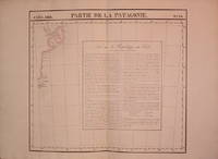
1827278526Brussels: Phillippe Marie Vandermaelen 1827. unbound. Map. Lithograph with original hand outline. Image measures 18.5" x 22.25".<br/> <br/> Minimal yet beautiful map of east-central portion of the Argentine coast just south of Buenos Aires. Includes notes in French on the capital city. Double page with centerfold. From Vandermaelen's 6 volume "Atlas universel de geographie physique politique statistique et mineralogique sur l'echelle de 1/16411836". Phillippe Marie Vandermaelen 1795-1869 was a Belgian cartographer and publisher. His Atlas universal was both the first lithograph atlas and the first atlas to map the world on a uniform scale. The maps were meant to join together to form a huge globe. This map is a fine example of his work.<br/> <br/> Phillippe Marie Vandermaelen unknown
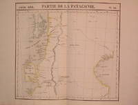
1827204795Brussels: Phillippe Marie Vandermaelen 1827. unbound. very good. Map. Lithograph with original hand outline. Image measures 18.75" x 20.5".<br/> <br/> Map of southern portion of Argentina and Chile from the Chonos Archipelago and the Golf of Corcouado in the west to the Golfe of St. George in the east. Double page with centerfold. From Vandermaelen's 6 volume "Atlas universel de geographie physique politique statistique et mineralogique sur l'echelle de 1/16411836". Can be combined as gores to form an immense globe. The atlas was the first to map the world on a uniform scale.<br/> <br/> Phillippe Marie Vandermaelen unknown
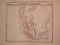
1827204810Brussels: Phillippe Marie Vandermaelen 1827. unbound. very good. Map. Lithograph with original hand outline. Image measures 19" x 22.5".<br/> <br/> Exquisite map of the southern portion of the continent including the Strait of Magellan and the Andes of Patagonia. Double page with centerfold. From Vandermaelen's 6 volume "Atlas universel de geographie physique politique statistique et mineralogique sur l'echelle de 1/16411836". Can be combined as gores to form an immense globe. The atlas was the first to map the world on a uniform scale.<br/> <br/> Phillippe Marie Vandermaelen unknown
1827204796Brussels: Phillippe Marie Vandermaelen 1827. unbound. very good. Map. Lithograph with original hand outline. Image measures 18.5" x 20.75".<br/> <br/> Map of St. Joseph's Peninsula known today as the Valdes Peninsula south to Camarones. Includes notes in French on Chile perhaps in reference to an adjacent map. Double page with centerfold. From Vandermaelen's 6 volume "Atlas universel de geographie physique politque statistique et mineralogique sur l'echelle de 1/16411836". Can be combined as gores to form an immense globe. The atlas was the first to map the world on a uniform scale.<br/> <br/> Phillippe Marie Vandermaelen unknown
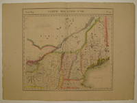
1827225532Brussels: Phillippe Marie Vandermaelen 1827. unbound. very good. Map. Large format lithograph with original hand color wash. Image measures 18.25" x 20".<br/> <br/> Beautiful double page map of New England showing Maine New Hampshire Vermont and parts of New York Massachusetts and Canada. Features counties towns waterways topographical and geographical features population size indicated in pink circles mineral deposits and the area of each state yellow circles. Minor wear to edges light scattered staining and offsetting. Expert repair to chip to bottom centerfold. From Vandermaelen's 6 volume "Atlas universel de geographie physique politique statistique et mineralogique sur l'echelle de 1/16411836" in which each map can be combined as gores to form an immense globe. The atlas was the first to map the world on a uniform scale as well as the first lithographed atlas.<br/> <br/> Phillippe Marie Vandermaelen unknown
1827279853Brussels 1827. Map. Lithograph with original hand coloring. 18" x 21".<br/> <br/> Beautiful depiction of Western Mexico with a focus on elevation from Mazatlan to Manzanillo -Mexico's busiest Pacific port. Phillippe Marie Vandermaelen 1795-1869 was a Belgian cartographer and publisher. His Atlas universal was both the first lithograph atlas and the first atlas to map the world on a uniform scale. The maps were meant to join together to form a huge globe. This map is a fine example of his work.<br/> <br/> unknown
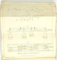
1829487251829. Jb. k.k. polytech. Inst. 14. - Hrsg. Johann Joseph Prechtl. - Wien Gedruckt und verlegt bei Carl Gerold 1829 8° VI 410 pp. mit acht Kupfertafeln orig. Broschur. Erstdruck! "Der Erfinder glaubt indem er diese Maschine bekannt macht daß dieselbe das Interesse welches sie haben kann mehr in der Sonderbarkeit als ihrer Nützlichkeit verdankt; weil sie obschon theoretisch zur Auflösung von Gleichungen aller Grade geeignet sehr enge Grenzen in der parktischen Ausführung findet und nur mit Schwierigkeit für mehr als fünf Grade oder einige darüber in Anwendung kommt." "In 1826-27 Girard was in London to present a new invention of his a calculating machine to the Royal Society but was disappointed to hear that Babbage had recently made a presentation of a similar machine. A tract was published in 1827 to explain the differences between the author's and Babbage's machines a copy of which is held in the Royal Society achives Equations machine invented by Ph. de GIRARD "a description with figures London : John Churchill 1827. PHILIPPE HENRI DE GIRARD 1775-1845 "French mechanician was born at Lourmarin Vaucluse on the 1st of February 1775 . He is chiefly known in connexion with flax-spinning machinery . Napoleon having in 18ro decreed a reward of one million francs to the inventor of the best machine for spinning flax Girard succeeded in producing what was required . But he never received the promised reward although in 1853 after his death a comparatively small pension was voted to his heirs and having relied on the "money to pay the expenses of his invention he got into serious financial difficulties . He was obliged in 1815 to abandon the flax mills he had established in France and at the invitation of the emperor of Austria founded a flax mill and a factory for his machines at Hirtenberg . In 1825 at the invitation of the emperor Alexander I. of Russia he went to Poland and erected near Warsaw a flax manufactory round which grew up a village which received the name of Girardow . In 1818 he built a steamer to run on the Danube . He did not return to Paris till 1844 where he still found some of his old creditors ready to press their claims and he died in that city on the 26th of August 1845 . He was also the author of numerous minor inventions." Encyclopedia Britannica 1911 unknown
180859375Paris Treuttel et Würtz 1808. 4to. Uncut and unopened in original blank wrappers. original printed title-label on spines. XXIX405;XX404;VI211164816 pp. Wide-margined. Internall clean and fine. Atlas missing. unknown
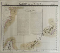
182564091<p>RARE original hand-colour lithograph text vignette on China shows Northern Taiwan Ryukyu Islands Okinawa and Southern part of coast of province of Quangdong and part of Fujian. Map from 'Atlas Universel de Geographie.' Asie no. 88. This 6 vol. Atlas contains 382 lithographed mapsheets and 40 plates of statistical data by Henri Ode mostly hand-coloured in outline. The maps in the atlas constitute not only the first atlas of the world on a uniform scale but also the first lithograph atlas. Constructed on a modified conical projection if assembled they form a 775 m diameter globe although only one such was known to have been assembled by the author himself and requiring a specially designed room. Reference: atlas: Koeman III Vdm 1; Phillips Atlases 749. Condition: very good condition.</p> published in Brussels.
189128709Genève Geneva & Paris: A. CherbuliezG. Fischbacher 1891. Fine. A. Cherbuliez G. Fischbacher Genève Geneva & Paris 1891 9.50 x 16.50 cm relié First edition of which there were no deluxe copies. Half rust-colored morocco with corners spine with five raised bands set with gilt fillets and decorated with triple gilt compartments date at foot gilt fillet frames on marbled paper boards marbled endpapers and pastedowns covers and spine with small lacks preserved bookplate pasted on endpaper top edge gilt elegant binding signed by Semet & Plumelle. Rare and very handsome copy in perfect condition. Provenance: from Albert Natural's collection of French Swiss poets which he assembled from the nineteen twenties. A. CherbuliezG. Fischbacher hardcover
1829ZB1289589Paris: Bachelier 1829. first editions; 3 volumes xxviii 508 2 504 xxi 3 563 1 57 3 pp. later 19th century gilt stamped quarter leather & leather covered boards by E. Watson; edges rubbed light to moderate foxing throughout else very good. - If you are reading this this item is actually physically in our stock and ready for shipment once ordered. We are not bookjackers. Buyer is responsible for any additional duties taxes or fees required by recipient's country. Photos available upon request. Paris: Bachelier hardcover
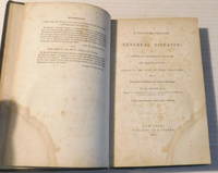
184298429New York: Published by P. Gordon 1842. 1842. Good. - Octavo 9 inches high by 5-1/2 inches wide. Hardcover bound in floral decorated dark brown cloth titled in gilt on the spine. The covers are rubbed & stained with wear to the corners and the head & tail of the spine are chipped. 2 pages of recommendations followed by pages i - vi 1 8-339 with 5 illustrations in the text. The endpapers are darkened and stained and the bottom front corner of the pages are dampstained. There is some occasional light soiling and foxing throughout with creases to the bottom edge of a few pages. Good. <p>First American edition. "With a view to present a valuable work to the medical profession in America the American publisher procured a translation of M. Ricord's Treatise by Mr. Drummond Henry Pilkington Drummond M.D. which was printed in London in 1841. But on comparing the translation with the original it was found that much had been omitted; for instance some forty or fifty cases of a highly practical character and much too on the score of treatment. Hence it has been necessary to revise the entire work; and it will be found that the present translation is in fact a new one." - from the Advertisement to the First American Edition. The book includes a "Special Formulary of the Medicaments used in my wards of the Hopital des Veneriens" and a table of contents.<p>Philippe Ricord 1800-1889 was an American-born French physician who specialized in Venereal diseases. He was renowned for his specialty and received the Montyon prize in 1842.<p>RARE. New York: Published by P. Gordon, 1842. hardcover
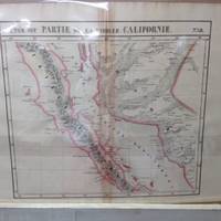
182736242Brussels Belgium: Lithographed By H. Ode. Very Good. 1827. Map. Map # 58 A Very Good primitive and early map of the Baja Peninsula and the western coast of Mexico showing the province of Sonora. Latitude of the map is 24 degrees to 30 degrees and longitude is 110 degrees to 118 degrees. Of course almost all localities shown are French or Indian names. The atlas from which this is extracted is extremely rare and originally composed 6 volumes this map being from the North America volume. Lithographer Ode and Cartographer Vandermaelen produced the first lithographed atlas ever done. Condition is overall Very Good. Browning to the centerfold crease caused by glue used in attaching the tab to the original volume the two page spread measures 21" x 26 1/2" when opened out. Topigraphical features are accentuated see image. Shipping will require extra care and cost due to insurance. Photo available upon request. ; 21" x 26 1/2"; 1 pages . Lithographed By H. Ode unknown