415 résultats
184849472Paris Bachelier 1848. 4to. No wrappers. In: "Comptes Rendus Hebdomadaires des Séances de L'Academie des Sciences" Tome 26 No 8. Pp. 233- 264. Entire issue offered. Semmelweis's paper: pp. 254-255. Clean and fine. <br/><br/><em>First French announcement of this epochal event in the history of medicine the discovery of the etiology and prevention of childbed fever. First announce by Ferdinand von Hebra in December 1847 then followed only 2 months after by the French announcement."Although Semmelweis's importent discoveries were made in the 1840s he did not publish them immediately. The first printed reports of his findings were written by his collegues and were published in various German French or English Journals. Semmelweis himself gave three lectures before the Imperial and Royal Medical Society of Vienna in 1850 but did not publish his complete discussion of "The etiology concept and prophylaxis of childbeed fever" until 1861 having previously contributed several shorter accounts to Hungarian medical journals."Norman "One Hundred Books famous in Medicine" p. 265.Semmelweis demonstrated that puerperal fever also known as childbed fever was contagious and that this incidence could drastically be reduced by appropriate hand washing by medical care-givers. He made this discovery in 1847 while working in the Maternity Department of the Vienna Lying-in Hospital. His failure to convince his fellow doctors led to a tragic conclusion. However he was ultimately vindicated. While employed as assistant to the professor of the maternity clinic at the Vienna General Hospital in Austria in 1847 Semmelweis introduced hand washing with chlorinated lime solutions for interns who had performed autopsies. This immediately reduced the incidence of fatal puerperal fever from about 10 percent range 5-30 percent to about 1-2 percent.Toward the end of 1847 accounts of Semmelweis's work began to spread around Europe. Semmelweis and his students wrote letters to the directors of several prominent maternity clinics describing their recent observations. Ferdinand von Hebra the editor of a leading Austrian medical journal announced Semmelweis's discovery in the December 1847 and April 1848 issues of the medical journal. Hebra claimed that Semmelweis's work had a practical significance comparable to that of Edward Jenner's introduction of cowpox inoculations to prevent smallpox.Garrison & Morton: 6275 German version. </em> unknown
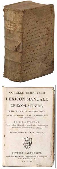
1806326029Lutetiae Parisiorum Paris: Aug. Delalain 1806. Hardcover. Very Good. New edition. Edited by Jean Philippe Jannet. Thick octavo. 4 viii 1251pp. Bound in contemporary boards covered with an old vellum manuscript with the hand written text running horizontally across the front and back boards. Small owner's name in pencil on the front pastedown. Soiling and scattered small tears to the vellum lacking a rear free endpaper very good. Aug. Delalain hardcover
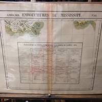
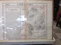
182736245Brussels Belgium: Lithographed By H. Ode. Very Good. 1827. Map. Map # 61 A Very Good primitive and early map showing the mouth of the Mississippi river shows the New Orleans delta area and also Appalachee Bay of Florida with Port St. Joseph. There is an inset in French with Tables of Population for 1823. Latitude of the map is 24 degrees to 30 degrees and longitude is 86 degrees to 94 degrees. Of course almost all localities shown are French or Indian names. The atlas from which this is extracted is extremely rare and originally composed 6 volumes this map being from the North America volume. Lithographer Ode and Cartographer Vandermaelen produced the first lithographed atlas ever done. Condition is overall Very Good. Browning to the centerfold crease caused by glue used in attaching the tab to the original volume the two page spread measures 21" x 26 1/2" when opened out. Topigraphical features are accentuated see image. Shipping will require extra care and cost due to insurance. Photo available upon request. ; 21" x 26 1/2"; 1 pages . Lithographed By H. Ode unknown
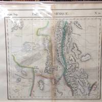
182736260Brussels Belgium: Lithographed By H. Ode. Very Good. 1827. Map. Map # 66 A Very Good primitive and early map showing the Yucatan Penninsula coastline. Includes present day provinces of Yucatan Ouintara Roo Compecha and Tobasco. Also includes a small portion of Northern Belize. Cities include Merida Compeche Chetumal and Cuido del Carmen eastern tip of Cuba is shown. Latitude of the map is 18 degrees to 24 degrees and longitude is 86 degrees to 94 degrees. Of course almost all localities shown are French or Indian names. The atlas from which this is extracted is extremely rare and originally composed 6 volumes this map being from the North America volume. Lithographer Ode and Cartographer Vandermaelen produced the first lithographed atlas ever done. Condition is overall Very Good. Browning to the centerfold crease caused by glue used in attaching the tab to the original volume the two page spread measures 21" x 26 1/2" when opened out. Topigraphical features are accentuated see image. Shipping will require extra care and cost due to insurance. Photo available upon request. ; 21" x 26 1/2"; 1 pages . Lithographed By H. Ode unknown
182736264Brussels Belgium: Lithographed By H. Ode. Very Good. 1827. Map. Map # 75 A Very Good primitive and early map showing the lesser Antilles shows St. Croix on the north and Grenada on the south. Includes the island of St. Croix St. Bartholome St Christophe-Nevis Antigue Barbude Guadeloupe Dominica Martinque St. Lucia Grenade Barbados and others. Very nice color contrasts. Latitude of the map is 12 degrees to 18 degrees and longitude is 60 degrees to 68 degrees. Of course almost all localities shown are French or Indian names. The atlas from which this is extracted is extremely rare and originally composed 6 volumes this map being from the North America volume. Lithographer Ode and Cartographer Vandermaelen produced the first lithographed atlas ever done. Condition is overall Very Good. Browning to the centerfold crease caused by glue used in attaching the tab to the original volume the two page spread measures 21" x 26 1/2" when opened out. Topigraphical features are accentuated see image. Shipping will require extra care and cost due to insurance. Photo available upon request. ; 21" x 26 1/2"; 1 pages . Lithographed By H. Ode unknown
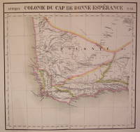
1827202230Brussels: Phillippe Marie Vandermaelen 1827. unbound. very good. Map. Large format lithograph of South Africa with original hand coloring. Image measures 18.5" x 22.25".<br/> <br/> Double page with centerfold. From Vandermaelen's 6 volume "Atlas universel de geographie physique politique statistique et mineralogique sur l'echelle de 1/16411836". Can be combined as gores to form an immense globe. The atlas was the first to map the world on a uniform scale.<br/> <br/> Phillippe Marie Vandermaelen unknown
1827802Brussels: Vandermaelen Phillipe 1827. 20 1/2 x 18 1/2 inches. Very good condition. This map shows the West Coast inward into the Tonto Apache territories. Also shown is the land of the Papagos which also includes western Arizona and southern Arizona. Located on the east side of the map is Tumacacori site of a cluster of mission buildings indicating the long arm of religious colonialism. On the west coast is Cape Loma and San Diego. Above this is San Juan Capistrano located in present day Orange County California. This antique map rare map is an original artifact of a period oof little direct knowledge of the area. Vandermaelen, Phillipe unknown
189247343Paris: Librairies-Imprimeries réunies 1892. Fine. Librairies-Imprimeries réunies Paris 1892 14.50 x 21.50 cm relié The first edition of which there were no deluxe copies. Half cherry red sheep binding spine with four raised bands with gilt fillets marbled paper boards marbled endpapers and pastedowns. Work illustrated with numerous wood-engraved vignettes in the text. Librairies-Imprimeries réunies hardcover
1814ZB527446Paris: Chez les Marchands de Noiuveautes 1814. first edition; 36 pp an attempt to neutralize the pamphlet that Louis XVIII thought was worth an army to him; sewn into plain paper wrappers one leaf damp stained at tip a few leaves dog eared but a very good and untrimmed copy. - If you are reading this this item is actually physically in our stock and ready for shipment once ordered. We are not bookjackers. Buyer is responsible for any additional duties taxes or fees required by recipient's country. Photos available upon request. Paris: Chez les Marchands de Noiuveautes, unknown
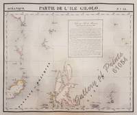
182561054<p>original hand-colour lithograph with a text vignette on Borneo. This important map for the Philippines shows Southern Mindanao and the area between Sulawesi Mindanao and Gilolo today: Halmahera part of the Moluccas. From 'Atlas Universel de Geographie…' Oceanique no. 6; This 6 vol. Atlas contains 382 lithographed mapsheets and 40 plates of statistical data by Henri Ode mostly hand-coloured in outline and was published in instalments over 3 years. The maps in the atlas make up the first map of the world on a uniform scale and the first lithograph atlas created on a modified conical projection and if assembled form a globe with a diameter of 7.75m although only one such was known to have been assembled by the author himself and requiring a specially designed room. A text box gives extensive information on Borneo. Reference: Reference: NOT in Quirino atlas: Koeman III Vdm 1; Phillips Atlases 749; National Maritime Museum 179; Wellens-De Donder L. Philippe Vandermaelen 1795-1869 4-5; DavidRumseydotcom with cpl. Info. Condition: very good example with some age-toning and a few faint spots wide margins.</p> published in Brussels.
183811331838. Paris Just Rouvier & E. le Bouvier 1838 8° 808 pp. Halbledereinband; pp.801-808 restaur. Includes the description of 'Ricord's chancre' the initial lesion in syphilis. Ricord re-demonstrated the specific character of syphilis and divided it into the three stages primary secondary and tertiary. After Hunter he was the greatest authority on venereal disease. Heirs of Hippocrates No.906: Born in Baltimore of French parents Philippe Ricord 1800-1889 received his medical education in Paris. As surgeon to the Hôpital du Midi which at that time was devoted solely to treating male venereal afflictions. Ricord gained international fame as a brilliant lecturer and scientist. In this his major work Ricord details the results of over 2.500 experiments proving the distinction between syphilis and gonorrhea thus overthrowing the teaching of John Hunter who considered the two to be identical. Ricord's descriptions of the three phases of syphilis and the accompanying case histories remain as accurate today as when he wrote them. Garrison & Morton No.2381 5202; Waller 7974; One hundred names famous in Urology unknown
1846353241846-1855. Paris Labé 1846-1855 8° XV 1 712 pp.; 4 924 pp.; 2 4 840 pp.; contemporary half morocco gilt spine decorations. First Edition in a well preserved set of the classical treatise of 19th-century medicine. Alfred Hardy 1811-1893 an eminent specialist of dermatology with the publication of the first atlas of dermatology illustrated by photographic plates to his credit was professor of clinical medicine at the medical faculty of Paris. His co-author the celebrated clinician Louis-Jules Béhier 1814-1876 was professor of medicine in Paris. Their joint venture "gehört durch seine Genauigkeit der Beschreibung zu den besten Lehrbüchern der französischen Literatur und ruht wie all seine sonstigen Schriften auf der soliden Basis der pahtologischen Anatomie; es wurde vom Conseil d'instructuion publique als Lehrbuch eingeführt" Hirsch.-H. Baas History of Medicine II pp.800-902; Hirsch-H. I pp.429ff.; III pp.56-57 unknown
1874004717Paris: Michel Levy Freres/Colmann Levy 1874. Hardcover. Very Good. Seven volumes published between 1874-1890; 5.5" x 9" three-quarter marbled paper boards with blue raised band gilt paneled spines and red gilt-lettered spine panels; books are ex-library with the book-plate of The Royal United Services Institution a dime-sized embossed stamp on the title page and a duplicate stamp on the book-plate top and inside back cover no other marks noted -- the preliminary pages and back six pages are moderately foxed within the texts the foxing is variable from predominately none to very light with a very few pages moderate --- overall all volumes are very good; the covers are good or better with wear to leather corner tips and spines two spines have conserved tears with piece missing at the top; top edges are "dusty" and remaining two sides are moderately spotted; Premier Tome: 598 pages Tome Deuxieme: 569 pages; Tome Troisieme: 691 pages; Tome Quatrieme: 732 pages; Tome Cinquieme: 779 pages; Tome Sixieme: 790 pages et Tome Septieme: 790 pages. ON THE TITLE PAGE OF THE FIRST VOLUME IS WRITTEN "DE LA CARTE DE L'AUTEUR LOUIS PHILIPPE D'ORLEANS" --- NO ATLAS <br/> <br/> Michel Levy Freres/Colmann Levy hardcover
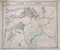
1827283421Brussels: Vandermaelen Phillipe Marie 1827. unbound. very good. Map. Large format lithograph with original hand outline color. Image measures 18.75" x 19 1/8". Sheet measures 21" x 27". Shows some foxing and a few tears to edges.<br/> <br/> Beautifully detailed map that shows Bejing "Pekin" and surrounding provinces. Mountains are delicately treated with hachure marks and major rivers and waterways are also shown. From Vandermaelen's 6 volume "Atlas universel de geographie physique politique statistique et mineralogique sur l'echelle de 1/16411836". The atlas was the first to map the world on a uniform scale; maps were meant to join together to form a huge globe.Phillippe Marie Vandermaelen 1795-1869 was a Belgian cartographer and publisher. This map is a fine example of his work.<br/> <br/> Vandermaelen, Phillipe Marie unknown
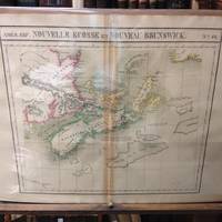
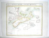
182736247Brussels Belgium: Lithographed By H. Ode. Very Good. 1827. Map. Map # 44 A Very Good primitive and early map showing Nova Scotia and New Brunswick in Canada. Map has wonderful color and many small text descriptions of the coast lines. Latitude of the map is 42 degrees to 48 degrees and longitude is 60 degrees to 70 degrees. Of course almost all localities shown are French or Indian names. The atlas from which this is extracted is extremely rare and originally composed 6 volumes this map being from the North America volume. Lithographer Ode and Cartographer Vandermaelen produced the first lithographed atlas ever done. Condition is overall Very Good. Browning to the centerfold crease caused by glue used in attaching the tab to the original volume the two page spread measures 21" x 26 1/2" when opened out. Topigraphical features are accentuated see image. Shipping will require extra care and cost due to insurance. Photo available upon request. ; 21" x 26 1/2"; 1 pages . Lithographed By H. Ode unknown
182736258Brussels Belgium: Lithographed By H. Ode. Very Good. 1827. Map. Map # 51 A Very Good primitive and early map showing Vancouver British Columbia and Vancouver Island in Canada. Includes some of extreme NW Washington state adjacent to but not including Seattle also includes the city of Victoria. Very nice multi-color depiction of the larger British Columbia coastline. Latitude of the map is 48 degrees to 54 degrees and longitude is 119 degrees to 131 degrees. Of course almost all localities shown are French or Indian names. The atlas from which this is extracted is extremely rare and originally composed 6 volumes this map being from the North America volume. Lithographer Ode and Cartographer Vandermaelen produced the first lithographed atlas ever done. Condition is overall Very Good. Browning to the centerfold crease caused by glue used in attaching the tab to the original volume the two page spread measures 21" x 26 1/2" when opened out. Topigraphical features are accentuated see image. Shipping will require extra care and cost due to insurance. Photo available upon request. ; 21" x 26 1/2"; 1 pages . Lithographed By H. Ode unknown
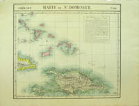
182740377Bruxelles: Ph. Vandermaelen 1827. First edition. Very good bright copies a few minor spots or marginal finger soiling. 2 sheets. Hand-colored lithographic maps. 46 x 53 cm and 50 x 56 cm. Large scale map of Haiti on two sheets usually sold separately.<br /> <br /> 1. Amer. Sep. Haiti ou St. Domingue. No. 68. Also includes parts of Cuba and the Bahamas and has a text box entitled: Iles Bahamas ou Lucayes.<br /> <br /> with<br /> <br /> 2. Amèr. Sep. Curacao. No. 74. Includes the southern and remaining portion of Haiti plus Aruba Bonaire and small parts of Puerto Rico and Venezuela. Text box entitled: Republique d'Haiti. Redigee par A. Delavault. <br /> <br /> Sheets from Phillipe Vandermaelen "Atlas universel de geographie physique politique statistique et mineralogique." a magnificent and ground breaking six volume atlas of the entire world which was the first Atlas to use lithography to show the entire world using such a large uniform scale approximately 26 miles to the inch and which was designed to be joined together into a three-dimensional globe with a diameter of approximately 25 feet. [Ph. Vandermaelen] unknown
1827798Brussels: Vandermaelen Philippe 1827. 18 1/2 x 20 1/2 inches. Very good. An antique map of epic proportions for the Texas collector. This map shows Arkansas and portions of eastern Texas in 1827. It has place names and locations of Native American tribes. Multiple rivers are shown and details of topography well labeled. Overall this is a fine cartographic presentation in the for of a rare map. Vandermaelen, Philippe unknown
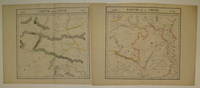
1827220293Brussels: Phillippe Marie Vandermaelen 1827. unbound. very good. Map diptych. Large format lithograph with original hand outline color. Each image measures 18 3/8" x 19 1/8".<br/> <br/> Beautifully detailed set of two maps of eastern central China including part of Hubei Henan Anhui Jiangsu Shanxi Shandong Gansu Sichuan and Shaanxi provinces. Mountains are delicately treated with hachure marks and major rivers and waterways are also shown. Minor overall toning and a few tears to edges. From Vandermaelen's 6 volume "Atlas universel de geographie physique politique statistique et mineralogique sur l'echelle de 1/16411836". Can be combined as gores to form an immense globe. The atlas was the first to map the world on a uniform scale.<br/> <br/> Phillippe Marie Vandermaelen unknown
1851219281851. Deutsch bearbeitet von Dr. C.Liman prakt. Arzt in Berlin. - Berlin August Hirschwald 1851 8° VIII 354 pp. Leinenband der Zeit. Seltene erste deutsche Ausgabe in der Übersetzung von Carl Liman 1818-1891. - "Die Geschichte der modernen Syphilidologie beginnt mit Philippe Ricord 1800-1889 dem großen Experimentator und Reformator." Bloch. - Enthält im Nachtrag u. a. zwei Antwortschreiben des R. R. von Welz Würzburg 18 Seiten ehem. Arzt im Juliusspital und Dozent an der dortigen Universität einem Ricord-Schüler über die Einimpfung der Syphilis auf Tiere. Proksch I 65. Hirsch-H. III 787. unknown
1857ARVsKERV91Ghent: L.Hebbelynck 1857-58. 1857. 2 Volumes. 8vo. pp. 3 p.l. viii 352; 2 p.l. 395 1. with half-titles. 20 plates some tinted 3 double-page; incl. 3 coloured lithographs heightened with gold. 13 text illus. later quarter roan spines worn. First Edition. F. Ghent: L.Hebbelynck, 1857-58. unknown
1827M2906Bruxelles 1827. Excellent. Size : 470x530 mm 18.5x20.875 Inches Coloring: Original Outline Coloring Category: ; Maps Canada East Nova Scotia; Maps Canada East Prince Edward Island; Maps Canada East New Brunswick; Maps Canada East Newfoundland unknown
1897ST15557-17London: Published by David Nutt 1897. 210 x 152 mm. 8 1/4 x 6". Two volumes. Englished by Thomas Danett. <br/> VERY ATTRACTIVE BROWN CRUSHED HALF MOROCCO BY BICKERS & SON stamp-signed on verso of front endpaper smooth russet linen sides spines gilt in ruled compartments raised bands decorated with double rules and small tool at either end top edge gilt other edges untrimmed. Publisher's original buckram covers bound in at rear. Decorated title page initials printer's devices. Title pages printed in red and black; front pastedowns with bookplate of Sir James Dunn. ◆Hint of rubbing to bottom edges upper covers with a handful of small lights scratches and tiny nicks half-title in volume I a little loose but in excellent condition the contents pristine and obviously never read.<br/> <br/> In the introduction to the present edition Whibley says that the translation "is a masterpiece untouched by age"--a description equally applicable to the book itself whose contents have scarcely been touched. The French courtier Comines ca. 1445 - ca. 1511 chronicles the reign of Louis XI and the Italian expedition of Charles VIII covering most of the three decades beginning in 1464. The work comprises the first critical and philosophical history to be written after antiquity and it earned for Comines the appellation of "father of modern history." Britannica says that "the graphic style of his narrative and above all the keenness of his insight into the motives of his contemporaries an insight undimmed by undue regard for principles of right and wrong make this work one of the great classics of history." Our translation by Danett the first in English was originally published in 1596 and the present edition uses the 1601 version which includes a life of Comines. The introduction by Charles Whibley gives a biography of Comines and an analysis of his style and ideas. Danett fl. 1566-1601 also translated from various authors a sequel to Comines' work and an epitome of descriptions of the Low Countries drawn from the works of Guicciardini. Published by David Nutt unknown
182736233Brussels Belgium: Lithographed By H. Ode. Very Good. 1827. Map. Map # 47 A Very Good primitive and early map of eastern Nevada the State of Utah also including part of northern Arizona and the Grand Canyon. The Great Salt Lake is shown but further south and west than later surveyed to be. Of course almost all localities shown are French or Indian names. Another large lake is shown probably Bear Lake is shown in Nevada. The atlas from which this is extracted is extremely rare and originally composed 6 volumes this map being from the North America volume. Lithographer Ode and Cartographer Vandermaelen produced the first lithographed atlas ever done. Condition is overall Very Good. Browning to the centerfold crease caused by glue used in attaching the tab to the original volume the two page spread measures 21" x 26 1/2" when opened out. Approximately 1/3 of the map consists of a lengthy description in French of the Mexican territory which comprised Nevada and Utah. Other contiguous maps are shown as parts of the "New Mexico territory" but this map describes itself as part of Mexico as was California in 1824. Topigraphical features are accentuated see image. Shipping will require extra care and cost due to insurance. Photo available upon request. ; 21" x 26 1/2"; 1 pages . Lithographed By H. Ode unknown
182736234Brussels Belgium: Lithographed By H. Ode. Very Good. 1827. Map. Map #54 Very Good The map includes present day New Mexico a small part of Northern Mexico and some of very northwestern Texas. It is double page 3 color and black and white topographical features are accentuated. A fifteen line description in French is super imposed on the left side of the map - covers about 6" x 1 3/4". The condition is very good. Darkening appears along the centerfold where map was attached by a tab to the atlas. Scale of the map is 26 miles per one inch. Lithograpy was done by Henri Ode. In conjunction with cartographer Philippe Vandermaelen they produced the first lithographed atlas ever done. It provides on a large scale a picture of many newly explored areas as in this case the Western United States. Photo available upon request. ; 21" x 26 1/2"; 1 pages . Lithographed By H. Ode unknown