FORBIN, Count Nicolas Philippe deBiblio.com
415 résultats
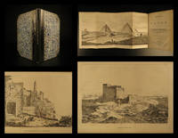
181914024<p><b>1819 1st ed Forbin Travels in EGYPT Levant Voyages Pyramids Sphinx Jerusalem</b></p><p>Nicolas Philippe de Forbin was an early 19th-century French historian and art antiquary who in 1817 set out on a voyage to the Levant to view study and acquire ancient pieces of art. The voyage took Forbin and his traveling party to the Holy Land and Jerusalem Syria Athens Constantinople and even the Dead Sea.</p><p>His journal of the excursion covers his discoveries giving special attention to the Egyptian pyramids and the Great Sphinx. This undated first English edition includes impressive sketch illustrations of ruins the Temple of Karnak ruins of ancient Jericho Castle at Cairo the Pyramids at Giza and the ancient walls of Jerusalem. A highly desirable work of Middle Eastern voyages! </p><p>Item number: #14024</p><p>Price: $499</p><p>FORBIN Count Nicolas Philippe de</p><p><b><i>Travels in Egypt being a continuation of the Travels in the Holy Land in 1817-18</i></b></p><p>London : Printed for Sir Richard Phillips 1819. First edition.</p><p><br /></p><p><u>Details</u>: </p><p>· Collation: Complete with all pages</p><p>o 4 95 1</p><p>o 7 engraved plates</p><p>· Language: English</p><p>· Binding: Leather; tight & secure</p><p>· Size: ~8.75in X 5.5in 22cm x 14cm</p><p>Our Guarantee:</p><p>Very Fast. Very Safe. Free Shipping Worldwide.</p><p>Customer satisfaction is our priority! Notify us with 7 days of receiving and we will offer a full refund without reservation!</p><p>14024</p><p>Photos available upon request. </p> for Sir Richard Phillips hardcover
184350162Firmin Didot Freres Paris 1843. First Edition. Hardcover Quarter Leather. Very Good Condition/No Dust Jacket. LARENAUDIERE PHILIPPE FRANCOIS de and LACROIX FREDERIC. Mexique Guatemala et Perou Vol. 4 of LUnivers Pittoresque ou Histoire et Description de Tous les Peuples Paris: Firmin Didot Freres 1843. Octavo first edition pp. 4 525 2 3 folding maps 85 engraved plates quarter-bound in morocco over marbled boards neatly rehinged gilt lettering on spine. Very good with chipping at head and tail of spine and in backstrip little to no foxing throughout light soiling at top edge former owner inked name onto front pastedown. Also somebody tipped in three little color plates which I left but they could be easily removed. Text is French. Larenaudiere wrote the Mexican section. This book was part of a set that ran over 20 volumes using many authors in an attempt to describe the entire world. Sabin 39030 Size: Octavo standard book size. 4 525 2 . Text is in French. Text body is clean and free from previous owner annotation underlining and highlighting. Binding is tight covers and spine fully intact. All edges clean neat and free of foxing. Quantity Available: 1. Shipped Weight: Under 1 kilo. Category: Antiquarian & Rare; Mexico; 19th century; French Language; Travel & Places. Pictures of this item not already displayed here available upon request. Inventory No: 50162. . Firmin Didot Freres hardcover
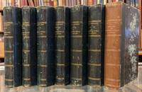
1874108551Michele Levy 1874. Hardcover. Very good/No jacket. 7 volumes. In French. Inscribed in the first volume by the author Prince Philippe le Comte de Paris the disputed "King of the French" who ruled for a mere 2 days after his grandfather Louis-Philippe was deposed in 1848. An historian and journalist Philippe joined the Union Army at the outbreak of the American Civil War and rose to Adjutant General under George MacLellan during the first year before leaving for France in 1862. He ended up writing a seven volume history of the Civil War plus an accompanying atlas. This set is only the seven volume text. Green leather spine with marbled boards save volume 7 where the green has faded from the spine and the boards and endpapers differ from the others. Shelfworn. Some hinges cracked but still in very good shape. Michele Levy hardcover
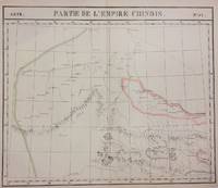
1827283424Brussels: Phillippe Marie Vandermaelen 1827. unbound. very good. Map diptych. Two double-page lithographs with original hand outline color. Each image measures 18.75" x 19 1/8". Sheets measure 21" x 27". Both show some foxing and some chips and tears to edges.<br/> <br/> Beautifully detailed map that shows northwest China including parts of the Silk Road. Mountains are delicately treated with hachure marks and major rivers and waterways are also shown. From Vandermaelen's 6 volume "Atlas universel de geographie physique politique statistique et mineralogique sur l'echelle de 1/16411836". The atlas was the first to map the world on a uniform scale; maps were meant to join together to form a huge globe.<br> <br> Phillippe Marie Vandermaelen 1795-1869 was a Belgian cartographer and publisher. This map is a fine example of his work.<br/> <br/> Phillippe Marie Vandermaelen unknown
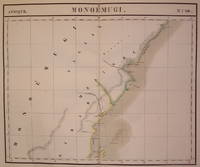
1827202229Brussels: Phillippe Marie Vandermaelen 1827. unbound. very good. Map. Large format lithograph of East Africa with original hand coloring. Image measures 18.5" x 22.25".<br/> <br/> Includes Kenya Mombasa Tanzania and Lamme Lamu. Double page with centerfold. From Vandermaelen's 6 volume "Atlas universel de geographie physique politique statistique et mineralogique sur l'echelle de 1/16411836". Can be combined as gores to form an immense globe. The atlas was the first to map the world on a uniform scale.<br/> <br/> Phillippe Marie Vandermaelen unknown
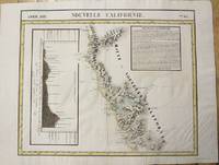
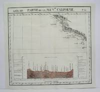
1827801Brussels: Vandermaelen Phillipe 1827. 19 3/4 x 18 1/2 inches. Very good condition. Vandermaelens map sheet on California and the coast. It shows the Westcoast line of Southern California A very nice map and the earliest us of lithography in a cartographic enterprise. Senefelder published his volume on lithography in 1819 in French. Vandermaelen, Phillipe unknown
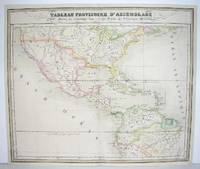
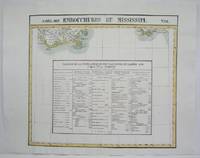
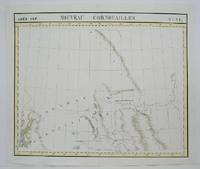
1827M2740Bruxelles 1827. Good; some restoration in lower left corner. Notes: From Vandermaelen's "Atlas Universel de Geographie Physique Politique Statistique et Mineralogique" Brusseles 1827. Size : 478x567 mm 18.75x22.25 Inches Coloring: Original Outline Coloring Category: Maps North America;; Maps Central America unknown
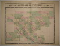
1827224090Brussels: Phillippe Marie Vandermaelen 1827. unbound. very good. Map. Large format lithograph with original hand color wash. Image and title measures 19 3/8" x 24 1/8".<br/> <br/> Beautiful double page map of North America. Shows states towns waterways and topographical and geographical features. Includes an inset of northeastern North America. From Vandermaelen's 6 volume "Atlas universel de geographie physique politique statistique et mineralogique sur l'echelle de 1/16411836" in which each map can be combined as gores to form an immense globe. The atlas was the first to map the world on a uniform scale. This map is the part of the assembly key with color coded and numbered squares indicating where each gore belongs. In excellent condition.<br/> <br/> Phillippe Marie Vandermaelen unknown
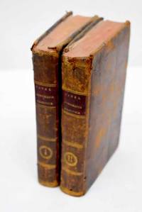
18032992439Madrid.: en la Imprenta Real. 1803. Hardcover. Cubierta deslucida. Good. 18 cm. 2 v. 4 334 p. 1 h. pleg. ; 438 p. 1 h. pleg. Encuadernación en tapa dura artesanal en plena piel con tejuelo. Pinel Philippe 1745-1826. Traducida al castellano por el Dr. D. Luis Guarnerio y Allavena. Nosografía filosófica. Tomo I-II. Título de la anteportada. Sign. : ² A-Z AA BB¹ ; A-Z AA-DD EE³. Notas al pie. Las hojas plegadas son tablas de clasificación de enfermedades. Guarnerio y Allavena Luis. traductor. Imprenta Real Madrid. impresor . Cubierta deslucida. lit y filosofía Dermatología. Siglo XVIII. 616.502"17" 616.5 en la Imprenta Real. hardcover
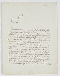
1892679981892. Paris 13.V.1802 2 Seiten auf 4° Doppelblatt. Philippe Petit-Radel 1749-1815 French surgeon and literary scholar brother of Louis Charles François Petit-Radel and Louis François Petit-Radel; editor of the two volumes devoted to Surgery by the Encyclopédie méthodique; in 1798 he was elected to the chair of surgical clinic at the Paris School of Medicine where he distinguished himself by his severity and his zeal to re-establish the ancient practice of speaking Latin. One of the rare letters written by him in Englsih: "Sir The circumstances of your being overcharged under the load of public and private affaires which disturb you from receiving every one who are addressed to you is more the cause that has impeded me to cultivate your kindness than the carelessness i should be faulty of towards such a respectable person as you are. Mr Banket a friend of mine having assured me of the remembrance you keep of the very little titles littler i can have to your estimation and on my part desirous of putting those in a more proper light i venture this letter to let you know the satisfaction i should have if your acquaintance that was formed under the auspicies of the officious M.r Graff would take its former force to be not afterwards disclaimed. After a great many works in physic i have published to make known to the learned men my ability in the theoretical and practical part of my profession i ventured to write in the elegiae linguages of Ovidium a train of sentiments that the pure heart of every one can avow/wow. drawn in the scientific style as i have exposed them. But notwithanding the lucubration was accepted with indulgence and i dare say with distinction by the judicious readers as it appears from the flattering account the news papers have given of it the antiquity of the language proving me happy to its fates i resolved to translate it into French; desirous as i was of saving the original from the claws of oblivion. The work i send you is this i am speaking of: i should require of your benevolence to read the preface in which every circumstances relating to my person are exposed in a shorter way than in the first work. If the matter and the marrow itself of the book can deserve your attention i will sure seek for a new admission to you for supplying to the brevity that imposes me this present letter. It is in the hope you will kindly answer to my wishes that i dare intrude me in your time; mean while i remain you the most respectful of yours. Your very humble and obedient servant Petit-Radet rüe Chirong/Chiroux 897 Paris 23 Prairial an 10" unknown
18514328Paris: Rouvier 1851. First Edition. Hardcover. Very Good. Small folio. 1/4 leather and marbled boards rubbing along the spine corners bumped. Handcolored plates one more challenging to look at than the next. "Ricord's extensive work with veneral diseases at the Hopital du Midi is chronological here in sixty-six superb colored lithographs illustrating a multitude of conditions at various levels of infection in both sexes. The illustrations were drawn from nature by Bion and Beau and are accompanied by case histories and treatment modes". Complete with the portrait often lacking. <br/><br/> Rouvier hardcover
1827M2722Bruxelles 1827. Very Good; several wormholes on the upper and lower parts of the fold. Notes: From Vandermaelen's "Atlas Universel de Geographie Physique Politique Statistique et Mineralogique" Brusseles 1827. Size : 472x572 mm 18.625x22.5 Inches Coloring: Original Outline Coloring Category: Maps United States West California unknown
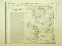
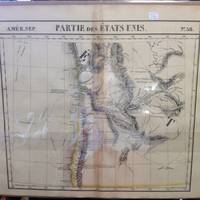
182740379Bruxelles: Ph. Vandermaelen 1827. First edition. A very good sharp copy. 1 sheet. Hand-colored lithographic map. 47 x 57 cm. Shows the ranges of eight Indian tribes. Covers parts of Utah Colorado and northern Arizona and New Mexico. Includes text: Note sur le Mexique. At a time when American map publishers were virtually ignoring the western United States Vandermaelen's large scale work -which includes sections of Utah Wyoming Arizona and Nevada then still considered part of Mexico along with the location of Indian tribes and shows Lake Timpanagos- was a landmark in the history the cartography of the Transmississippi West. Large text box on the left entitled: Note sur le Mexique by A. Delavault. From Phillipe Vandermaelen Atlas universel de geographie physique politique statistique et mineralogique. a magnificent and ground breaking six volume atlas of the entire world which was the first atlas to use lithography to show the entire world using such a large uniform scale approximately 26 miles to the inch and which was designed to be joined together into a three-dimensional globe with a diameter of approximately 25 feet. Wheat Transmississippi 378. Sabin 43762. Phillips 749. [Ph. Vandermaelen] unknown
1825M4525Brussels 1825. Very Good minor worming on upper and lower portion of the map along the central fold proficiently repaired. Notes: The first atlas of the world on a uniform scale. If assembled as a globe gores forms a very large globe. Size : 460x523 mm 18.125x20.625 Inches Coloring: Original Outline Coloring Category: Maps United States South States; unknown
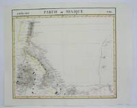
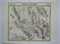
1825M4515Brussels 1825. Very Good minor worming on upper and lower portion of the map along the central fold proficiently repaired. Notes: The first atlas of the world on a uniform scale. If assembled as a globe gores forms a very large globe. Size : 460x536 mm 18.125x21.125 Inches Coloring: Original Outline Coloring Category: Maps Central America Mexico unknown
1825M4512Brussels 1825. Very Good minor worming on upper and lower portion of the map along the central fold proficiently repaired. Notes: The first atlas of the world on a uniform scale. If assembled as a globe gores forms a very large globe. Size : 460x500 mm 18.125x19.625 Inches Coloring: Original Outline Coloring Category: ; Maps United States West California unknown
1825M4514Brussels 1825. Very Good minor worming on upper and lower portion of the map along the central fold proficiently repaired. Notes: The first atlas of the world on a uniform scale. If assembled as a globe gores forms a very large globe. Size : 465x540 mm 18.25x21.25 Inches Coloring: Original Outline Coloring Category: Maps Central America Mexico unknown
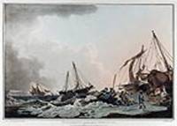
180813510London: Published by I. & W. Macgavin No. 107 New Bond Street 1808. Coloured aquatint. Printed on wove Whatman paper. In excellent condition. Image size: 13 5/8 x 20 1/4 inches. A dramatic view of fishermen at Worthing from Philippe Loutherbourg's great work "Picturesque Scenery of Great Britain".<br/> <br/> This impressive aquatint is plate six of Phillip Jacques Loutherbourg's seminal work "Picturesque Scenery of Great Britain." This accomplished text is comprised of six large aquatint views engraved after Loutherbourg's acclaimed paintings. The work which was first engraved in 1801 by J. C. Stadler was later re-engraved in 1808 by J. Hill. Reminiscent of Rowlandson's superb paintings this image depicts fisherman rowing out from the seashore on a stormy day. The son of a court painter in Darmstadt the versatile artist Philippe Jacques Loutherbourg was born in Fulda Germany and was a pupil of J. H. Tischbein and Carle Vanloo and Francis Casanova the elder in Paris. His romantic landscapes battle scenes portraits and biblical subjects were highly esteemed and lauded by influential colleagues such as Diderot. He frequently exhibited at the Salon and became a venerated member of the Académie Royale in 1767. In 1771 he moved to England where he was employed as the principal scenery designer at London's Drury Lane Theatre. His creative and minutely detailed sets revolutionized the genre of scene painting and he soon began dabbling in costume design. Loutherbourg once again astounded contemporaries in 1782 with his pioneering invention of the "Eidophusikon" a novel variety of moving panorama that was accompanied by music. His substantial and varied oeuvre also included book illustrations and a series of aquatints of British scenery that was published in 1801 and 1805. Aside from a brief trip to Switzerland in 1782 he remained in London for the duration of his life and became heavily engrossed in mysticism.<br/> <br/> Abbey Scenery of Great Britain and Ireland in Aquatint and Lithography 1770-1860 no.6 plate 6. Published by I. & W. Macgavin, No. 107 New Bond Street unknown
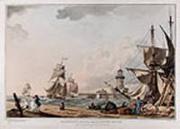
180813508London: Published by I. & W. Macgavin No. 107 New Bond Street 1808. Coloured aquatint. Printed on wove paper. In excellent condition. Image size: 13 1/2 x 20 inches. A beautiful view of Ramsgate Pier from Philippe Loutherbourg's great work "Picturesque Scenery of Great Britain."<br/> <br/> This impressive aquatint is plate two of Phillip Jacques Loutherbourg's seminal work "Picturesque Scenery of Great Britain." This accomplished text is comprised of six large aquatint views engraved after Loutherbourg's acclaimed paintings. The work which was first engraved in 1801 by J. C. Stadler was later re-engraved in 1808 by J. Hill. Reminiscent of Rowlandson's superb paintings this image depicts the stormy docks of Ramsgate pier. While a group of hardy sailors converse at ease a party of three figures are battered by the fierce winds that beat the shoreline. The son of a court painter in Darmstadt the versatile artist Philippe Jacques Loutherbourg was born in Fulda Germany and was a pupil of J. H. Tischbein and Carle Vanloo and Francis Casanova the elder in Paris. His romantic landscapes battle scenes portraits and biblical subjects were highly esteemed and lauded by influential colleagues such as Diderot. He frequently exhibited at the Salon and became a venerated member of the Académie Royale in 1767. In 1771 he moved to England where he was employed as the principal scenery designer at London's Drury Lane Theatre. His creative and minutely detailed sets revolutionized the genre of scene painting and he soon began dabbling in costume design. Loutherbourg once again astounded contemporaries in 1782 with his pioneering invention of the "Eidophusikon" a novel variety of moving panorama that was accompanied by music. His substantial and varied oeuvre also included book illustrations and a series of aquatints of British scenery that was published in 1801 and 1805. Aside from a brief trip to Switzerland in 1782 he remained in London for the duration of his life and became heavily engrossed in mysticism.<br/> <br/> Abbey Scenery of Great Britain and Ireland in Aquatint and Lithography 1770-1860 no.6 plate 2. Published by I. & W. Macgavin, No. 107 New Bond Street unknown
1827220303Brussels: Phillippe Marie Vandermaelen 1827. unbound. very good. Map set of 4. Large format lithograph with original hand outline color. Each image measures 18.75" x 20 5/8" 18 5/8" x 20 5/8" 18.5" x 20 3/8"<br/> <br/> Beautifully detailed set of four regional maps of northern China and southern Mongolia. Mountains are delicately treated with hachure marks and major rivers waterways and cities are also shown. Notable inclusions from the west to the east: Plate 44 shows the very northwestern tip of China Xinjiang province and part of south central Mongolia with Lac Nor and Hami. Plate 45 shows the eastern portion of Xinjiang province and western Mongolia with Karakorum called here Karakum the medieval capital of Ghengis Khan and the Mongol Empire. Plate 46 demarcates the tribal regions of Khalkha and Tzakhares Mongolians. Plate 47 shows the western portion of the Wall of China delineating the border between Tartary and China. Some minor offsetting several tears and chips to edges. From Vandermaelen's 6 volume "Atlas universel de geographie physique politique statistique et mineralogique sur l'echelle de 1/16411836". Can be combined as gores to form an immense globe. The atlas was the first to map the world on a uniform scale.<br/> <br/> Phillippe Marie Vandermaelen unknown
182736239Brussels Belgium: Lithographed By H. Ode. Very Good. 1827. Map. Map # 38 A Very Good primitive and early map of western and southern Oregon territory including southern Washington state. It especially emphasizes the coast. Latitude of the map is 42 degrees to 48 degrees and longitude is 120 degrees to 130 degrees. Of course almost all localities shown are French or Indian names. The atlas from which this is extracted is extremely rare and originally composed 6 volumes this map being from the North America volume. Lithographer Ode and Cartographer Vandermaelen produced the first lithographed atlas ever done. Condition is overall Very Good. Browning to the centerfold crease caused by glue used in attaching the tab to the original volume the two page spread measures 21" x 26 1/2" when opened out. Topigraphical features are accentuated see image. Shipping will require extra care and cost due to insurance. Photo available upon request. ; 21" x 26 1/2"; 1 pages . Lithographed By H. Ode unknown
1825M4496Brussels 1825. Very Good minor woming on upper portion of map not affecting the map proficiently repaired. Notes: The first atlas of the world on a uniform scale. If assembled as a globe gores forms a very large globe. Size : 475x575 mm 18.75x22.625 Inches Coloring: Original Outline Coloring Category: Maps Canada West British Columbia; Maps Canada West Alberta unknown
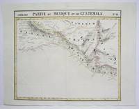
1825M4519Brussels 1825. Very Good minor worming on upper and lower portion of the map along the central fold proficiently repaired. Notes: The first atlas of the world on a uniform scale. If assembled as a globe gores forms a very large globe. Size : 465x520 mm 18.25x20.5 Inches Coloring: Original Outline Coloring Category: Maps Central America Mexico unknown
1825M4521Brussels 1825. Very Good minor worming on upper and lower portion of the map along the central fold proficiently repaired. Notes: The first atlas of the world on a uniform scale. If assembled as a globe gores forms a very large globe. Size : 465x551 mm 18.25x21.625 Inches Coloring: Original Outline Coloring Category: Maps Central America Mexico unknown
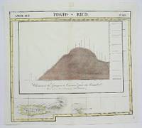
1825M4499Brussels 1825. Very Goodminor worming appear at the upper and lower portion of the map along the central fold proficiently repaired. Notes: The first atlas of the world on a uniform scale. If assembled as a globe gores forms a very large globe. Size : 480x535 mm 18.875x21 Inches Coloring: Original Outline Coloring Category: Maps West Indies Dominican Republic / Haiti & Puerto Rico; unknown