MUSARD, Philippe 1792-1859Biblio.com
415 résultats
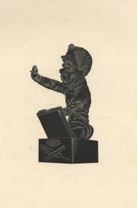
183929818Paris 1839. 117 x 73 wide margins sheet size 260 x 168 mm. Printed on wove paper. A fine impression. <br /> <br /> Based on a bust by Dantan executed in 1838 depicting Musard conducting a quadrille at a "Bal de l'Opéra." Sorel 199. Dantan 124.<br /> <br /> "After the July Revolution Musard returned to France and conducted at masked balls at the Théâtre des Variétés. He then became artistic director of a series of popular open-air concerts and dances on the Champs-Elysées which marked the beginning of the Concerts-Musard; these were an immediate and enormous success. He also conducted for masked balls at the Salle Ventadour and the Opéra-Comique and eventually in 1835 and 1836 for the balls at the Opéra itself. He continued to be a popular conductor until 1845. In France he was considered the doyen of dance composers and popular conductors until 1852." Gérard Streletski Gustave Chouquet and David Charltonin Grove Music Online.<br /> <br /> Dantan's caricatures of writers artists and particularly musicians are highly regarded. He is said to be the inventor of the "sculptural caricature." Wikipedia. unknown
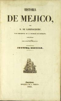
185131809Barcelona: A. Frexas 1851. 8vo 2 parts in 1 as issued; pp. 4 252 8; 127 1; text in double column 3 engraved folding maps 86 plates; full Mexican tree calf smooth gilt-decorated spine lettered in gilt marbled edges; minor scuffing; very good. First published in 1843. The text includes Historia de Méjico & Tejas 252 p.; Historia de Guatemala p. 1-42; and Historia de la República del Perú & Bolivia p. 45-124. The plates include a number of the pre-Columbian ruins. Palau 131639; this edition not in Sabin but see 39027-30. A. Frexas unknown
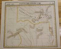
1827M2726Bruxelles 1827. Good; some worming on the upper and lower parts of the fold. Notes: From Vandermaelen's "Atlas Universel de Geographie Physique Politique Statistique et Mineralogique" Brusseles 1827.<br><br>"The map trade in the 1820s had taekn notice of the enormous interest in Texas and had begun to supply maps catering to it. In 1827 Phillipe van der Maelen's 'Atlas Universel' the most lavish and detailed cartographic production of the decade and the first major lithographed atlas included five maps depicting parts of Texas. These maps were based primarily on the outmoded models of Humboldt and Pike and contributed no new knowledge." Martin & Martin 32 Size : 470x515 mm 18.5x20.25 Inches Coloring: Original Outline Coloring Reference: Martin & Martin 32 Category: ; Maps United States South Texas unknown
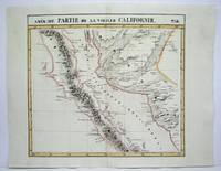
182736276Brussels Belgium: Lithographed By H. Ode. Very Good. 1827. Map. Map # 52 A Very Good primitive and early map showing the central California coast with Santa Barbara and others. Map has wonderful color and many small text descriptions of the coast lines. Latitude of the map is 30 degrees to 36 degrees and longitude is 120 degrees to 128 degrees. Of course almost all localities shown are French or Indian names. The atlas from which this is extracted is extremely rare and originally composed 6 volumes this map being from the North America volume. Lithographer Ode and Cartographer Vandermaelen produced the first lithographed atlas ever done. Condition is overall Very Good. Browning to the centerfold crease caused by glue used in attaching the tab to the original volume the two page spread measures 21" x 26 1/2" when opened out. Topigraphical features are accentuated see image. Shipping will require extra care and cost due to insurance. Photo available upon request. ; 21" x 26 1/2"; 1 pages . Lithographed By H. Ode unknown
1820EINSSAIN31Paris: Le Normant 1820. 1820. 8vo. pp. 2 p.l. 640 2table inserted between pp. 416 & 417. with half-title. contemporary mottled calf gilt stamps of the Society of Writers to the Signet on covers spine worn & chipped joints cracked some moderate foxing mainly to outer leaves. First Edition. In Palgrave's opinion Saint-Chamans "was the most distinguished of the upholders of the theory of the balance of trade." Most of his works seem to be on popular economic topics of the day i.e. Examen des fautes du dernier gouvernement 1815 Sur le Budget de 1818 1817 Des Causes et des résultats de la révolution de 1830 1832 and Traité d'économie publique suivi d'un aperçu sur les finances de la France 1852. Coquelin & Guillaumin II p. 564. Einaudi 4934. Goldsmiths' 22857. Palgrave III p. 345. F. Hardcover. Paris: Le Normant, 1820. Hardcover
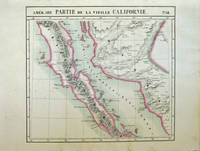
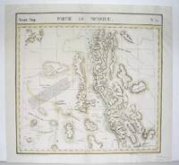
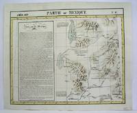
182740378Bruxelles: Ph. Vandermaelen 1827. First edition. Very good bright copies a few minor spots or marginal finger soiling. 2 sheets. Hand-colored lithographic maps. 46 x 51 cm and 46 x 54 cm. Large scale map of Baja. Map 58 includes parts of Baja California Sonora Sinaloa and Chihuahua. Map 65 includes the tip of Baja California and the "Iles Revillagigedo" and a text box: Note sur le Mexique . de Humboldt. Sheets from Phillipe Vandermaelen Atlas universel de geographie physique politique statistique et mineralogique. a magnificent and ground breaking six volume atlas of the entire world which was the first Atlas to use lithography to show the entire world using such a large uniform scale approcimately 26 miles to the inch and which was designed to be joined together into a three-dimensional globe with a diameter of approximately 25 feet. Phillips 749. Sabin 43762. [Ph. Vandermaelen] unknown
182736275Brussels Belgium: Lithographed By H. Ode. Very Good. 1827. Map. Map # 53 A Very Good primitive and early map showing the southern California coast with San Diego and others. Map has wonderful color and many small text descriptions of the coast lines. Latitude of the map is 30 degrees to 36 degrees and longitude is 112 degrees to 120 degrees. Of course almost all localities shown are French or Indian names. The atlas from which this is extracted is extremely rare and originally composed 6 volumes this map being from the North America volume. Lithographer Ode and Cartographer Vandermaelen produced the first lithographed atlas ever done. Condition is overall Very Good. Browning to the centerfold crease caused by glue used in attaching the tab to the original volume the two page spread measures 21" x 26 1/2" when opened out. Topigraphical features are accentuated see image. Shipping will require extra care and cost due to insurance. Photo available upon request. ; 21" x 26 1/2"; 1 pages . Lithographed By H. Ode unknown
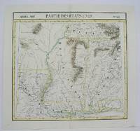
1825M4504Brussels 1825. Very Good minor worming on upper and lower portion of the map along the central fold proficiently repaired. Notes: The first atlas of the world on a uniform scale. If assembled as a globe gores forms a very large globe. Size : 460x495 mm 18.125x19.5 Inches Coloring: Original Outline Coloring Category: Maps United States East Carolinas; Maps United States South States; unknown
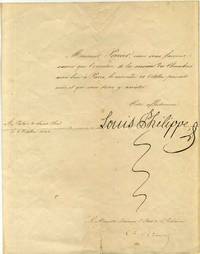
1840015856France: No publisher 1840. Autograph. Very good condition. Unbound. Signed by Authors. First Edition. Quarto 4to. One page letter signed by Louis Philippe. Countersigned by Charles Remusat 1797-1875 Le Ministre Secretaire d'Etat de l'Interieur Ministry of the Interior. The letter was folded into fourths. The letter reads "Monsieur Perrier nous vous faisons savoir que l'ouverture de la session des Chambres aura lieu a Paris le mercredi 28 Octobre present mois et que vous dever y assister. Votre affectionne signed Louis Philippe." It was sent from "Au Palais de Saint-Cloud le 8 Octobre 1840". No publisher Paperback
1827M2724Bruxelles 1827. Good; some worming on the upper and lower parts of the fold wormholes professionally filled. Notes: From Vandermaelen's "Atlas Universel de Geographie Physique Politique Statistique et Mineralogique" Brusseles 1827. Size : 468x490 mm 18.375x19.25 Inches Coloring: Original Outline Coloring Category: Maps United States West States; unknown
1827M2720Bruxelles 1827. Very Good; several wormholes on the upper and lower parts of the fold. Notes: From Vandermaelen's "Atlas Universel de Geographie Physique Politique Statistique et Mineralogique" Brusseles 1827. Size : 460x554 mm 18.125x21.75 Inches Coloring: Original Outline Coloring Category: Maps United States West States; unknown
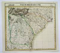
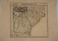
182716375Brussels 1827. Scarce original hand colored lithographed map of Georgia South Carolina North Carolina & Northern Florida. From the six volume atlas by Vandermaelen 'Atlas Universel de Geographie.'. This atlas was the first lithographed world atlas and the first of the entire world with all the maps on the same scale. Image size: 21 5/8 x 18 3/4". Paper size: 29 1/2 x 22". Very good condition. unknown
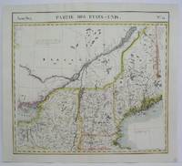
1825M4528Brussels 1825. Very Good. Notes: The first atlas of the world on a uniform scale. If assembled as a globe gores forms a very large globe. Size : 460x505 mm 18.125x19.875 Inches Coloring: Original Outline Coloring Category: Maps Canada East Quebec;; Maps United States New England unknown
1825M4500Brussels 1825. Very Good minor worming on the upper and lower portion of the map along the central fold proficiently repaired. Notes: The first atlas of the world on a uniform scale. If assembled as a globe gores forms a very large globe. Size : 460x495 mm 18.125x19.5 Inches Coloring: Original Outline Coloring Category: Maps United States South Louisiana; Maps United States South States; unknown
1825M4470Brussels 1825. Very Good minor worming holes along the lower portion of the central fold proficiently repaired. Notes: The first atlas of the world on a uniform scale. If assembled as a globe gores forms a very large globe. Size : 465x566 mm 18.25x22.25 Inches Coloring: Original Outline Coloring Category: Maps United States West States; unknown
1886KC8047Paris: Alcan-Levy 20 May 1886. Limited Edition. Paperback. Very Good. 28pp 2. 245 x 152mm. Limited edition number 29 of 100 printed on papier Hollande. Original printed wrappers edges uncut preserved and bound possibly for Paul Verlaine in 19th-century marbled boards spine stamped with author title and Ex. De Paul Verlaine. Pierre Quillard dedicates this copy to friend Philippe Martinon 1859-1917 a French linguist philologist and translator À mon ami ce petit livre ancien en souvenir dancienne et présente amitié To my friend this little old book old memories of past and present friendship and autograph of Quillard. Martinon is best remembered for his classic text translations of Greek and Latin and other studies on French metric. It is possible Martinon gave this presentation copy to Verlaine who in turn had it bound with his ex-libris on the spine. Both men were of great literary reputation and frequented the same poetic circles of the burgeoning symbolist movement. <br/><br/>It was a new symbolist mystery play to be presented in two simple tableaux as opposed to acts and scenes with minimal direction and the barest of staging directions. In effect the speaker became a central character and the intention thus emphasized the lyricism of the verse. Therefore the verse has a continuous prose accompaniment which explains the changes in time and space indicating different entities and slowly revealing the facts. Quillards verse is freed to reveal the expression of the characters souls -- it becomes a book of masks and symbolic portraits. This Quillards manifesto performance aimed to establish a new aesthetic for stageable drama. The schematic story line of this work arguably made one of the boldest attempts to put such ideas into action. In it Quillard represents the medieval story of St. Uliva a young virgin who agrees to amputate her hands to save her from the incestuous caresses of her brutal father. The story is imbued with vague mysticism supernatural journeys and resurrections. This copy was well admired in the circle of symbolist artists and writers with a definite association with Martinon and perhaps the great Verlaine. Alcan-Levy paperback
1824122875Napoli R. Marotta e Vanspandoch / C. Bompard 1824/1836. Opera completa in 21 grossi volumi in 8° massimo mezza pergamenta molto semplice fine '800 con titoli calligrafici ai dorsi. Buoni esemplari con gialliture dovute al tipo di carta e minima usura. Politico e giurista francese. Avvocato al Parlamento di Fiandra legato agli Orléans fu deputato del terzo stato agli Stati generali del 1789 e uno dei più esperti legislatori dellAssemblea Costituente. fu uno degli artefici della caduta di Robespierre." Treccani Napoli, R. Marotta e Vanspandoch / C. Bompard unknown
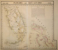
182715843Brussels 1827. Scarce hand colored early lithographed map of Florida and the Bahamas with a notable degree of detail for the time period including under the inset titled 'Florides' information on the variety of trees and plants fruit and iron mining. From the six volume atlas by Vandermaelen 'Atlas Universel de Geographie.'. This atlas was the first lithographed world atlas and the first of the entire world with all the maps on the same scale. Early roads are indicated here as well as a Native American Trail the Everglades several early colonies & Saint Augustine Cape Canaveral Tampa and Cape Sable. Image size: 21 5/8 x 18 3/4". Paper size: 29 1/2 x 22". Very good condition. unknown
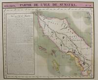
1815M9661Brussels c.1815. Very Good. Notes: Map of the northern half of Sumatra from the early 19th century. The map shows topographical features and has a short history of the island . <br>Philippe Vandermaelen 1795-1869 was an eminent Belgian geographer and cartographer famous for having founded the geographical establishment of Brussels. Size : 480x570 mm 18.90x22.44 Inches Coloring: Hand Colored Category: Maps Asia South East Indonesia & Papua New Guinea; unknown
182736277Brussels Belgium: Lithographed By H. Ode. Very Good. 1827. Map. Map # 46 A Very Good primitive and early map showing the northern California coast with San Francisco and Monterey. Map has wonderful color and many small text descriptions of the coast lines. Latitude of the map is 36 degrees to 42 degrees and longitude is 120 degrees to 150 degrees. Of course almost all localities shown are French or Indian names. The atlas from which this is extracted is extremely rare and originally composed 6 volumes this map being from the North America volume. Lithographer Ode and Cartographer Vandermaelen produced the first lithographed atlas ever done. Condition is overall Very Good. Browning to the centerfold crease caused by glue used in attaching the tab to the original volume the two page spread measures 21" x 26 1/2" when opened out. Topigraphical features are accentuated see image. Shipping will require extra care and cost due to insurance. Photo available upon request. ; 21" x 26 1/2"; 1 pages . Lithographed By H. Ode unknown
1825M4513Brussels 1825. Very Good minor worming on upper and lower portion of the map along the central fold proficiently repaired. Notes: The first atlas of the world on a uniform scale. If assembled as a globe gores forms a very large globe. Size : 464x515 mm 18.25x20.25 Inches Coloring: Original Outline Coloring Category: ; Maps United States West California unknown
1833LA - HAY178501833 - 1ère édition. Paris Paulin Libraire-Editeur. relié demi-cuir marron éditeur. Un feuillet avec quelques plissures et une faible tache sinon reliure et intérieur en très bon état. pt in-8. avec dos orné d'un grand motif floral et du titre dorés ; toutes tranches moirées. unknown
1819elala968Paris: Garnery 1819-30. 1819. 9 Volumes bound in 8. 4to. with half-titles. text in double columns. contemporary quarter roan with arms of the Law Society of Upper Canada stamped in blind on front covers spines rubbed & extremities chipped institutional lettering on spines Vol. VIII rebacked embossed institutional stamps some foxing. Third Edition of Vols. I-II & IV-IX & Fifth Edition of Vol. III. Camus-Dupin 2557. cfBrunet III 1654. Hardcover. Paris: Garnery, 1819-30. Hardcover
186413458Paris: Dusacq & Cie. Editeurs 1864. Hand-coloured lithograph after a painting by Linder. Very good condition apart from some mild rippling a small loss in the top margin and a few skillfully repaired tears in the bottom margin. A beautifully coloured humorous plate that was most likely part of a series published by Dusacq of images by various artists depicting railway related scenes.<br/> <br/> During the mid-nineteenth century the technological advancement and financial prosperity of France under Napoleon III hastened the development of the railway and other modern modes of transportation such as the omnibus. These improvements brought about a culture of mass tourism as members of various classes flocked to the railroad to take day trips. An archetypal symbol of modern life the railway station became a popular subject during the period and was represented and parodied by artists such as Honoré Daumier and William Powell Frith. It was an ideal place to observe a varied cross-section of society and the idiosyncrasies of human behavior. In the tradition of Daumier's satiric railway scenes from the 1840s and 1850s Linder exploits the comic possibilities of this bustling modern subject in this charming print. The title 'Pleasure Train' was most likely intended as an ironic play on words since pleasure is the last thing enjoyed by the swelling crowd of people on the platform many of whom scream in frustration as they are pushed and prodded in an effort to exit and enter the train. A pupil of the celebrated artist Charles Gleyre Philippe Jacques Linder was a genre and portrait painter who regularly exhibited works at the Salon between 1857-1880.<br/> <br/> Cf. Benezit Dictionaire des Peintres Sculptteurs Dessinateurs et Graveurs vol. 8 p. 679. Dusacq & Cie. Editeurs unknown
1828421937Bruxelles Belgium: Romantique 1828. Hardcover. No jacket. Two volume set. First edition. Text is in French. Several marks on boards. Leading corners edges and spine ends are lightly bumped. Lettering plate on spine of volume 2 is slightly chipped. Page blocks are marked. Foxing in the volumes. Hinge of volume 2 is reinforced with tape on pastedowns. Page 3 and 293 of volume 1 have small chips on lower edges. Tears on lower edges of page 17 and 159 of volume 2. Some pages have pencil underlining and annotations. Bindings are intact contents are clear. AM. hardcover. Good/No Dust Jacket. Used. Romantique Hardcover