415 résultats
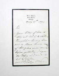
1890028753UK 1890. First Edition . Paper. Very Good. 8vo - over 7¾" - 9¾" tall. An Original Hand Written and Signed Letter by Writer Prince Philippe of Orléans Count of Paris. The letter discusses a pamphlet by George Brinton McClellan who was an American Civil War Military Officer politician engineer businessman and writer who served as the 24th governor of New Jersey. The prince did not receive the pamphlet at Stowe House but was sent to Sheen House instead. Dated 1890.Prince Philippe of Orléans Count of Paris Louis Philippe Albert; 1838-1894 was disputedly King of the French from 24 to 26 February 1848 as Louis Philippe II although he was never officially proclaimed as such. He was the grandson of Louis Philippe I King of the French. He was the Count of Paris as Orléanist claimant to the French throne from 1848 until his death. From 1883 when his cousin Henri Count of Chambord died he was often referred to by Orléanists as Philippe VII.Philippe volunteered to serve as a Union Army officer in the American Civil War along with his younger brother Prince Robert Duke of Chartres. He was appointed as an assistant adjutant general with the rank of captain on 24 September 1861 and served under the name of Philippe d'Orléans the Count of Paris. He served on the staff of the commander of the Army of the Potomac Major General George B. McClellan for nearly a year. He distinguished himself during the unsuccessful Peninsular Campaign. He resigned from the Union Army along with his brother on 15 July 1862. Philippe's History of the Civil War in America is considered a standard reference work on the subject. From a autograph book kept by A. P. Watt 1834-1914 founder of A. P. Watt & Son in 1875 the world's first literary agents. Size of letter is 150mm x 100mm. Good condition. Folding centre crease. More images can be taken upon request. Ref18423 <br/> <br/> unknown
183638556HB1836. Paris J.-B. Baillière 1836. 234 S. Späterer Pappband mit goldgeprägtem Rückentitel unbeschnittene Original-Broschur 1 gefaltete Tafel mit 12 lithogr. Abbildungen. Titelblatt mit hinterlegter Fehlstelle. Altersbedingt etwas gebräunt sonst schönes Exemplar. unknown
183719200Bruxelles: Delfosse 1837. SECOND EDITION. Folding lithographed plate. Contemporary gilt sheep-backed marbled boards edges sprinkled red. A nice complete copy. Second edition an anatomical guide to human and animal teeth. The first chapters cover tooth formation parts of the tooth tooth loss functions of individual teeth and differences in teeth between men and women and among different races of people. The second part of the book focuses on animal teeth across four orders: mammals birds reptiles and fish. The plate features 8 figures and is accompanied by explanatory text. <br /> <br /> Blandin 1798-1849 was a French surgeon and anatomist. He was a pioneer in the field of plastic surgery and is credited with coining the term autoplasty. Delfosse unknown
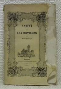
185267602Anneci : Typographie et lithographie de F. Saillet 1852. 215x140mm. frontispice: Ã’Vue dÕAnneciÓ brochÂŽ. Les pemiÂres pages sont tachÂŽes. Les bors latÂŽrales de la couverture supÂŽrieure de la page de garde et de la page de faux titre sont rongÂŽs. Coiffe supÂŽireure usÂŽe. Les coins supÂŽrieure des pages sont aussi tachÂŽs. 180 Typographie et lithographie de F. Saillet unknown
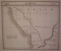
1827202217Brussels: Vandermaelen Philippe Marie 1827. unbound. very good. Map. Large format lithograph of West Africa with original hand coloring. Image measures 18.5" x 22.25".<br/> <br/> Includes the Congo Congo River and Gabon. Double page with centerfold. From Vandermaelen's 6 volume "Atlas universel de geographie physique politique statistique et mineralogique sur l'echelle de 1/16411836". Can be combined as gores to form an immense globe. The atlas was the first to map the world on a uniform scale.<br/> <br/> Vandermaelen, Philippe Marie unknown
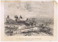
18379563<p>lithograph laid on India paper. EXTREMELY RARE view by Arthus Bertrand Paris. Baron de Bougainville 1781-1846 was a French naval officer the son of famous voyager Louis-Antoine de Bougainville. He became Rear-Admiral in 1838. The unachieved main intention of the voyage was: to extend French influence in Indochina but Manila Sydney and Rio de la Plata areas were also visited and documented with these superbly executed artworks published nine years before the official account of the voyage. <br />Condition: with tight top margin with slight smudges and water stains small paper and image loss on upper right.</p> Arthus Bertrand, Paris.
189360459Neuch‰tel : Attinger 1893. 205x135mm. XV- illustrÂŽ demi-parchemin ˆ coins piÂce de titre au dos plats papier marbrÂŽ quelques rousseurs au dÂŽbut du livre. 433 Attinger unknown
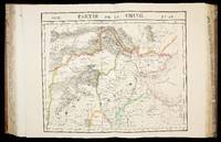
1827283421Brussels: Vandermaelen Phillipe Marie 1827. unbound. very good. Map. Large format lithograph with original hand outline color. Image measures 18.75" x 19 1/8". Sheet measures 21" x 27". Shows some foxing and a few tears to edges.<br/> <br/> Beautifully detailed map that shows Bejing "Pekin" and surrounding provinces. Mountains are delicately treated with hachure marks and major rivers and waterways are also shown. From Vandermaelen's 6 volume "Atlas universel de geographie physique politique statistique et mineralogique sur l'echelle de 1/16411836". The atlas was the first to map the world on a uniform scale; maps were meant to join together to form a huge globe.Phillippe Marie Vandermaelen 1795-1869 was a Belgian cartographer and publisher. This map is a fine example of his work.<br/> <br/> Vandermaelen, Phillipe Marie unknown
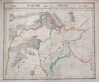
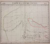
1827283424Brussels: Phillippe Marie Vandermaelen 1827. unbound. very good. Map diptych. Two double-page lithographs with original hand outline color. Each image measures 18.75" x 19 1/8". Sheets measure 21" x 27". Both show some foxing and some chips and tears to edges.<br/> <br/> Beautifully detailed map that shows northwest China including parts of the Silk Road. Mountains are delicately treated with hachure marks and major rivers and waterways are also shown. From Vandermaelen's 6 volume "Atlas universel de geographie physique politique statistique et mineralogique sur l'echelle de 1/16411836". The atlas was the first to map the world on a uniform scale; maps were meant to join together to form a huge globe.<br> <br> Phillippe Marie Vandermaelen 1795-1869 was a Belgian cartographer and publisher. This map is a fine example of his work.<br/> <br/> Phillippe Marie Vandermaelen unknown
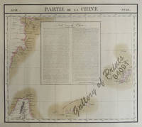
182564091<p>RARE original hand-colour lithograph text vignette on China shows Northern Taiwan Ryukyu Islands Okinawa and Southern part of coast of province of Quangdong and part of Fujian. Map from 'Atlas Universel de Geographie.' Asie no. 88. This 6 vol. Atlas contains 382 lithographed mapsheets and 40 plates of statistical data by Henri Ode mostly hand-coloured in outline. The maps in the atlas constitute not only the first atlas of the world on a uniform scale but also the first lithograph atlas. Constructed on a modified conical projection if assembled they form a 775 m diameter globe although only one such was known to have been assembled by the author himself and requiring a specially designed room. Reference: atlas: Koeman III Vdm 1; Phillips Atlases 749. Condition: very good condition.</p> published in Brussels.
184458482Paris Chez l'Auteur - Saint-Petersburg Issakoff 1844-48. Small folio. 35 x 27 cm. In a worn contemp. hcalf. Spine cracked and broken. Boards detached. All parts stitched a few loose. All parts uncut and unopened. All parts clean and fine. Each part separately paginated and with own title-page. Text to each part from 8-12 pp. Each part having a large folded engraved general map and from 11 to 27 engraved folio-maps. In all 292 textpages and 441 engraved maps. <br/><br/><em>The parts volumes comprises: 1. Turquie. 2. Afrique. 3. Grèce et Iles Ioniennes. 4. Portugal. 5. Mer des Indes 1ere Division. 6. Autriche Mer Adriatique. 7. Espagne Cotes N. Mer de Biscaye. 8. Espagne Mer Méditerranée. 9. Sardaigne. 10. Brésil. 11. Amérique Équatoriale Colonies européennes 1re Section. 12. Amérique Équatoriale et Continentale. 13. Prusse. 14. Russie Mer Blanche. 15. Russie Mer Baltique. 16. Russie Mer Noire. 17. Norvège. 18. Suéde. 19. Deux Siciles 1re Section. 20. Deux Siciles 2e Section. 21. Danemarck. 22. Hanovre. 23. Pays-Bas. </em> hardcover
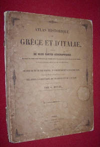
184545592Paris: Chez P. Dumenil Editeur. 1845. Hardcover. Good. Travel and Exploration Classical Studies Most Recent Listing; 13" x 10"; Paris: Good. 1845. Avec une notice sur tous les faits importants et l'indication des lieux ou ils se sont passes; destine a faciliter la Lecture et l'Intelligence de tous les ouvrages relatifs a l'histoire de la Grece et de l'Italie et redige d'apres les meilleures sources par A. Houze. Contents clean and complete; maps in very nice condition original boards detached and quite worn. Title page dated 1845 front board dated 1844. Maps measure 13 inches by 10 inches. Later printing of OCLC 66119840 . . Chez P. Dumenil, Editeur hardcover
182715962Brussels 1827. 540 by 410mm. 21.25 by 16.25 inches. 6 volumes. Folio 6 letterpress half-titles and title-pages dedication leaf 42 pages of text 'Statistique de l'Europe' 7 lithographed index maps one of comparative heights with contemporary hand-colour in full and 382 numbered double-page maps by Henri Ode with contemporary hand-colour in outline some very occasional spotting; contemporary half tree calf drab paper boards some wear. The maps in the atlas make up the first map of the world on a uniform scale constructed as a modified conical projection and if assembled forming a globe with a diameter of 7.75 metres although only one such was known to have been made by the author himself and requiring a specially designed room. "Philippe Vandermaelen was born in Brussels in 1795 the son of a rich soap manufacturer. After his father's death in 1816 he devoted himself to maps and eleven years later produced this quite remarkable atlas. It was totally at his own expense and like so many innovations in the past it came about through the single-minded efforts of a man who could afford failure. It offered the largest picture of the earth's surface available in the nineteenth century thereby giving the lesser known areas such as Australia South Africa and the West coast of America all developing countries a much greater coverage than before. And perhaps most importantly of all it was the first atlas to be produced by lithography" Wardington Catalogue. cf. Koeman III Vdm 1; NMM 3:179; Philips Atlases 749 hardcover
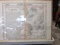
182736233Brussels Belgium: Lithographed By H. Ode. Very Good. 1827. Map. Map # 47 A Very Good primitive and early map of eastern Nevada the State of Utah also including part of northern Arizona and the Grand Canyon. The Great Salt Lake is shown but further south and west than later surveyed to be. Of course almost all localities shown are French or Indian names. Another large lake is shown probably Bear Lake is shown in Nevada. The atlas from which this is extracted is extremely rare and originally composed 6 volumes this map being from the North America volume. Lithographer Ode and Cartographer Vandermaelen produced the first lithographed atlas ever done. Condition is overall Very Good. Browning to the centerfold crease caused by glue used in attaching the tab to the original volume the two page spread measures 21" x 26 1/2" when opened out. Approximately 1/3 of the map consists of a lengthy description in French of the Mexican territory which comprised Nevada and Utah. Other contiguous maps are shown as parts of the "New Mexico territory" but this map describes itself as part of Mexico as was California in 1824. Topigraphical features are accentuated see image. Shipping will require extra care and cost due to insurance. Photo available upon request. ; 21" x 26 1/2"; 1 pages . Lithographed By H. Ode unknown
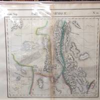
182736234Brussels Belgium: Lithographed By H. Ode. Very Good. 1827. Map. Map #54 Very Good The map includes present day New Mexico a small part of Northern Mexico and some of very northwestern Texas. It is double page 3 color and black and white topographical features are accentuated. A fifteen line description in French is super imposed on the left side of the map - covers about 6" x 1 3/4". The condition is very good. Darkening appears along the centerfold where map was attached by a tab to the atlas. Scale of the map is 26 miles per one inch. Lithograpy was done by Henri Ode. In conjunction with cartographer Philippe Vandermaelen they produced the first lithographed atlas ever done. It provides on a large scale a picture of many newly explored areas as in this case the Western United States. Photo available upon request. ; 21" x 26 1/2"; 1 pages . Lithographed By H. Ode unknown
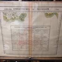
182736245Brussels Belgium: Lithographed By H. Ode. Very Good. 1827. Map. Map # 61 A Very Good primitive and early map showing the mouth of the Mississippi river shows the New Orleans delta area and also Appalachee Bay of Florida with Port St. Joseph. There is an inset in French with Tables of Population for 1823. Latitude of the map is 24 degrees to 30 degrees and longitude is 86 degrees to 94 degrees. Of course almost all localities shown are French or Indian names. The atlas from which this is extracted is extremely rare and originally composed 6 volumes this map being from the North America volume. Lithographer Ode and Cartographer Vandermaelen produced the first lithographed atlas ever done. Condition is overall Very Good. Browning to the centerfold crease caused by glue used in attaching the tab to the original volume the two page spread measures 21" x 26 1/2" when opened out. Topigraphical features are accentuated see image. Shipping will require extra care and cost due to insurance. Photo available upon request. ; 21" x 26 1/2"; 1 pages . Lithographed By H. Ode unknown
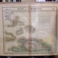
182736243Brussels Belgium: Lithographed By H. Ode. Very Good. 1827. Map. Map # 68 A Very Good primitive and early map of the Bahama Islands and the Island of Haiti or Santo Domingo also shows the eastern tip of Cuba. Latitude of the map is 18 degrees to 24 degrees and longitude is 70 degrees to 78 degrees. Of course almost all localities shown are French or Indian names. The atlas from which this is extracted is extremely rare and originally composed 6 volumes this map being from the North America volume. Lithographer Ode and Cartographer Vandermaelen produced the first lithographed atlas ever done. Condition is overall Very Good. Browning to the centerfold crease caused by glue used in attaching the tab to the original volume the two page spread measures 21" x 26 1/2" when opened out. Topigraphical features are accentuated see image. Shipping will require extra care and cost due to insurance. Photo available upon request. ; 21" x 26 1/2"; 1 pages . Lithographed By H. Ode unknown
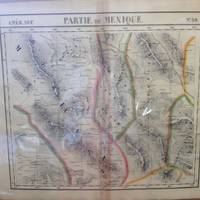
182736238Brussels Belgium: Lithographed By H. Ode. Very Good. 1827. Map. Map # 59 A Very Good primitive and early map of northwest Mexico and southwest Texas includes Chihuahua ans the southern tip of the Baja Peninsula. Latitude of the map is 24 degrees to 30 degrees and longitude is 102 degrees to 110 degrees. Of course almost all localities shown are French or Indian names. The atlas from which this is extracted is extremely rare and originally composed 6 volumes this map being from the North America volume. Lithographer Ode and Cartographer Vandermaelen produced the first lithographed atlas ever done. Condition is overall Very Good. Browning to the centerfold crease caused by glue used in attaching the tab to the original volume the two page spread measures 21" x 26 1/2" when opened out. Topigraphical features are accentuated see image. Shipping will require extra care and cost due to insurance. Photo available upon request. ; 21" x 26 1/2"; 1 pages . Lithographed By H. Ode unknown
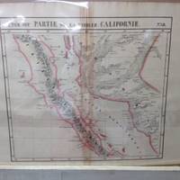
182736242Brussels Belgium: Lithographed By H. Ode. Very Good. 1827. Map. Map # 58 A Very Good primitive and early map of the Baja Peninsula and the western coast of Mexico showing the province of Sonora. Latitude of the map is 24 degrees to 30 degrees and longitude is 110 degrees to 118 degrees. Of course almost all localities shown are French or Indian names. The atlas from which this is extracted is extremely rare and originally composed 6 volumes this map being from the North America volume. Lithographer Ode and Cartographer Vandermaelen produced the first lithographed atlas ever done. Condition is overall Very Good. Browning to the centerfold crease caused by glue used in attaching the tab to the original volume the two page spread measures 21" x 26 1/2" when opened out. Topigraphical features are accentuated see image. Shipping will require extra care and cost due to insurance. Photo available upon request. ; 21" x 26 1/2"; 1 pages . Lithographed By H. Ode unknown
182736241Brussels Belgium: Lithographed By H. Ode. Very Good. 1827. Map. Map # 63 A Very Good primitive and early map of the southernmost tip of the Baja Peninsula and the Iles Revillagigedo showing Cabo San Lucas. Latitude of the map is 18 degrees to 24 degrees and longitude is 110 degrees to 118 degrees. There is a large inset note in French about Mexico. Of course almost all localities shown are French or Indian names. The atlas from which this is extracted is extremely rare and originally composed 6 volumes this map being from the North America volume. Lithographer Ode and Cartographer Vandermaelen produced the first lithographed atlas ever done. Condition is overall Very Good. Browning to the centerfold crease caused by glue used in attaching the tab to the original volume the two page spread measures 21" x 26 1/2" when opened out. Topigraphical features are accentuated see image. Shipping will require extra care and cost due to insurance. Photo available upon request. ; 21" x 26 1/2"; 1 pages . Lithographed By H. Ode unknown
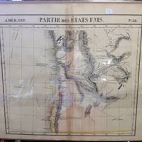
182736239Brussels Belgium: Lithographed By H. Ode. Very Good. 1827. Map. Map # 38 A Very Good primitive and early map of western and southern Oregon territory including southern Washington state. It especially emphasizes the coast. Latitude of the map is 42 degrees to 48 degrees and longitude is 120 degrees to 130 degrees. Of course almost all localities shown are French or Indian names. The atlas from which this is extracted is extremely rare and originally composed 6 volumes this map being from the North America volume. Lithographer Ode and Cartographer Vandermaelen produced the first lithographed atlas ever done. Condition is overall Very Good. Browning to the centerfold crease caused by glue used in attaching the tab to the original volume the two page spread measures 21" x 26 1/2" when opened out. Topigraphical features are accentuated see image. Shipping will require extra care and cost due to insurance. Photo available upon request. ; 21" x 26 1/2"; 1 pages . Lithographed By H. Ode unknown
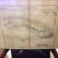
182736244Brussels Belgium: Lithographed By H. Ode. Very Good. 1827. Map. Map # 67 A Very Good primitive and early map of the Island of Cuba also shows Jamaica and Grande Cayman. There is an inset in French with the history of Cuba. Latitude of the map is 18 degrees to 24 degrees and longitude is 78 degrees to 86 degrees. Of course almost all localities shown are French or Indian names. The atlas from which this is extracted is extremely rare and originally composed 6 volumes this map being from the North America volume. Lithographer Ode and Cartographer Vandermaelen produced the first lithographed atlas ever done. Condition is overall Very Good. Browning to the centerfold crease caused by glue used in attaching the tab to the original volume the two page spread measures 21" x 26 1/2" when opened out. Topigraphical features are accentuated see image. Shipping will require extra care and cost due to insurance. Photo available upon request. ; 21" x 26 1/2"; 1 pages . Lithographed By H. Ode unknown
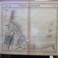
182736240Brussels Belgium: Lithographed By H. Ode. Very Good. 1827. Map. Map # 65 A Very Good primitive and early map of the southeastern Mexican coast along the Gulf of Mexico showing Vera Cruz and approaching the Yucatan. Latitude of the map is 18 degrees to 24 degrees and longitude is 92 degrees to 104 degrees. Very nice color. Of course almost all localities shown are French or Indian names. The atlas from which this is extracted is extremely rare and originally composed 6 volumes this map being from the North America volume. Lithographer Ode and Cartographer Vandermaelen produced the first lithographed atlas ever done. Condition is overall Very Good. Browning to the centerfold crease caused by glue used in attaching the tab to the original volume the two page spread measures 21" x 26 1/2" when opened out. Topigraphical features are accentuated see image. Shipping will require extra care and cost due to insurance. Photo available upon request. ; 21" x 26 1/2"; 1 pages . Lithographed By H. Ode unknown
182736246Brussels Belgium: Lithographed By H. Ode. Very Good. 1827. Map. Map # 57 A Very Good primitive and early map showing the Jamestown Virginia and Washington D. C. Area also includes Summer's island in the Bermudas. There is an inset in French with facts about the early United States. Latitude of the map is 34 degrees to 36 degrees and longitude is 77 degrees to 80degrees. Of course almost all localities shown are French or Indian names. The atlas from which this is extracted is extremely rare and originally composed 6 volumes this map being from the North America volume. Lithographer Ode and Cartographer Vandermaelen produced the first lithographed atlas ever done. Condition is overall Very Good. Browning to the centerfold crease caused by glue used in attaching the tab to the original volume the two page spread measures 21" x 26 1/2" when opened out. Topigraphical features are accentuated see image. Shipping will require extra care and cost due to insurance. Photo available upon request. ; 21" x 26 1/2"; 1 pages . Lithographed By H. Ode unknown
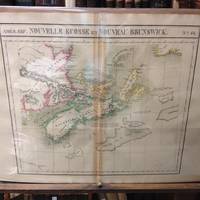
182736247Brussels Belgium: Lithographed By H. Ode. Very Good. 1827. Map. Map # 44 A Very Good primitive and early map showing Nova Scotia and New Brunswick in Canada. Map has wonderful color and many small text descriptions of the coast lines. Latitude of the map is 42 degrees to 48 degrees and longitude is 60 degrees to 70 degrees. Of course almost all localities shown are French or Indian names. The atlas from which this is extracted is extremely rare and originally composed 6 volumes this map being from the North America volume. Lithographer Ode and Cartographer Vandermaelen produced the first lithographed atlas ever done. Condition is overall Very Good. Browning to the centerfold crease caused by glue used in attaching the tab to the original volume the two page spread measures 21" x 26 1/2" when opened out. Topigraphical features are accentuated see image. Shipping will require extra care and cost due to insurance. Photo available upon request. ; 21" x 26 1/2"; 1 pages . Lithographed By H. Ode unknown