415 résultats
182736258Brussels Belgium: Lithographed By H. Ode. Very Good. 1827. Map. Map # 51 A Very Good primitive and early map showing Vancouver British Columbia and Vancouver Island in Canada. Includes some of extreme NW Washington state adjacent to but not including Seattle also includes the city of Victoria. Very nice multi-color depiction of the larger British Columbia coastline. Latitude of the map is 48 degrees to 54 degrees and longitude is 119 degrees to 131 degrees. Of course almost all localities shown are French or Indian names. The atlas from which this is extracted is extremely rare and originally composed 6 volumes this map being from the North America volume. Lithographer Ode and Cartographer Vandermaelen produced the first lithographed atlas ever done. Condition is overall Very Good. Browning to the centerfold crease caused by glue used in attaching the tab to the original volume the two page spread measures 21" x 26 1/2" when opened out. Topigraphical features are accentuated see image. Shipping will require extra care and cost due to insurance. Photo available upon request. ; 21" x 26 1/2"; 1 pages . Lithographed By H. Ode unknown
182736262Brussels Belgium: Lithographed By H. Ode. Very Good. 1827. Map. Map # 37 A Very Good primitive and early map showing Newfoundland present day and eastern part includes the city of Bonavista. Nice color depiction of the coastline. Latitude of the map is 48 degrees to 54 degrees and longitude is 47 degrees to 59 degrees. Of course almost all localities shown are French or Indian names. The atlas from which this is extracted is extremely rare and originally composed 6 volumes this map being from the North America volume. Lithographer Ode and Cartographer Vandermaelen produced the first lithographed atlas ever done. Condition is overall Very Good. Browning to the centerfold crease caused by glue used in attaching the tab to the original volume the two page spread measures 21" x 26 1/2" when opened out. Topigraphical features are accentuated see image. Shipping will require extra care and cost due to insurance. Photo available upon request. ; 21" x 26 1/2"; 1 pages . Lithographed By H. Ode unknown
182736259Brussels Belgium: Lithographed By H. Ode. Very Good. 1827. Map. Map # 70 A Very Good primitive and early map showing the southwest Mexico coastline with portions of Guerrrero Province. Includes Acapulco. Has nice multi-color contrasts also includes a large geological diagramatic illustration. Map is based on the excursion of nautralist Alexander Humboldt in 1802. Latitude of the map is 15 degrees to 18 degrees and longitude is 100 degrees to 108 degrees. Of course almost all localities shown are French or Indian names. The atlas from which this is extracted is extremely rare and originally composed 6 volumes this map being from the North America volume. Lithographer Ode and Cartographer Vandermaelen produced the first lithographed atlas ever done. Condition is overall Very Good. Browning to the centerfold crease caused by glue used in attaching the tab to the original volume the two page spread measures 21" x 26 1/2" when opened out. Topigraphical features are accentuated see image. Shipping will require extra care and cost due to insurance. Photo available upon request. ; 21" x 26 1/2"; 1 pages . Lithographed By H. Ode unknown
182736261Brussels Belgium: Lithographed By H. Ode. Very Good. 1827. Map. Map # 17 A Very Good primitive and early map showing the North Hampton Bay area. Includes the Welcome Strait. Latitude of the map is 60 degrees to 66degrees and longitude is 82 degrees to 98 degrees. Of course almost all localities shown are French or Indian names. The atlas from which this is extracted is extremely rare and originally composed 6 volumes this map being from the North America volume. Lithographer Ode and Cartographer Vandermaelen produced the first lithographed atlas ever done. Condition is overall Very Good. Browning to the centerfold crease caused by glue used in attaching the tab to the original volume the two page spread measures 21" x 26 1/2" when opened out. Topigraphical features are accentuated see image. Shipping will require extra care and cost due to insurance. Photo available upon request. ; 21" x 26 1/2"; 1 pages . Lithographed By H. Ode unknown
182736263Brussels Belgium: Lithographed By H. Ode. Very Good. 1827. Map. Map # 15 A Very Good primitive and early map showing the southern Yukon Territory and the southwestern part of the Northwest Territory. Includes the Great Slave lake depicted in black white and gray shades. Latitude of the map is 60 degrees to 65 degrees and longitude is 114 degrees to 130 degrees. Of course almost all localities shown are French or Indian names. The atlas from which this is extracted is extremely rare and originally composed 6 volumes this map being from the North America volume. Lithographer Ode and Cartographer Vandermaelen produced the first lithographed atlas ever done. Condition is overall Very Good. Browning to the centerfold crease caused by glue used in attaching the tab to the original volume the two page spread measures 21" x 26 1/2" when opened out. Topigraphical features are accentuated see image. Shipping will require extra care and cost due to insurance. Photo available upon request. ; 21" x 26 1/2"; 1 pages . Lithographed By H. Ode unknown
182736260Brussels Belgium: Lithographed By H. Ode. Very Good. 1827. Map. Map # 66 A Very Good primitive and early map showing the Yucatan Penninsula coastline. Includes present day provinces of Yucatan Ouintara Roo Compecha and Tobasco. Also includes a small portion of Northern Belize. Cities include Merida Compeche Chetumal and Cuido del Carmen eastern tip of Cuba is shown. Latitude of the map is 18 degrees to 24 degrees and longitude is 86 degrees to 94 degrees. Of course almost all localities shown are French or Indian names. The atlas from which this is extracted is extremely rare and originally composed 6 volumes this map being from the North America volume. Lithographer Ode and Cartographer Vandermaelen produced the first lithographed atlas ever done. Condition is overall Very Good. Browning to the centerfold crease caused by glue used in attaching the tab to the original volume the two page spread measures 21" x 26 1/2" when opened out. Topigraphical features are accentuated see image. Shipping will require extra care and cost due to insurance. Photo available upon request. ; 21" x 26 1/2"; 1 pages . Lithographed By H. Ode unknown
182736264Brussels Belgium: Lithographed By H. Ode. Very Good. 1827. Map. Map # 75 A Very Good primitive and early map showing the lesser Antilles shows St. Croix on the north and Grenada on the south. Includes the island of St. Croix St. Bartholome St Christophe-Nevis Antigue Barbude Guadeloupe Dominica Martinque St. Lucia Grenade Barbados and others. Very nice color contrasts. Latitude of the map is 12 degrees to 18 degrees and longitude is 60 degrees to 68 degrees. Of course almost all localities shown are French or Indian names. The atlas from which this is extracted is extremely rare and originally composed 6 volumes this map being from the North America volume. Lithographer Ode and Cartographer Vandermaelen produced the first lithographed atlas ever done. Condition is overall Very Good. Browning to the centerfold crease caused by glue used in attaching the tab to the original volume the two page spread measures 21" x 26 1/2" when opened out. Topigraphical features are accentuated see image. Shipping will require extra care and cost due to insurance. Photo available upon request. ; 21" x 26 1/2"; 1 pages . Lithographed By H. Ode unknown
182736277Brussels Belgium: Lithographed By H. Ode. Very Good. 1827. Map. Map # 46 A Very Good primitive and early map showing the northern California coast with San Francisco and Monterey. Map has wonderful color and many small text descriptions of the coast lines. Latitude of the map is 36 degrees to 42 degrees and longitude is 120 degrees to 150 degrees. Of course almost all localities shown are French or Indian names. The atlas from which this is extracted is extremely rare and originally composed 6 volumes this map being from the North America volume. Lithographer Ode and Cartographer Vandermaelen produced the first lithographed atlas ever done. Condition is overall Very Good. Browning to the centerfold crease caused by glue used in attaching the tab to the original volume the two page spread measures 21" x 26 1/2" when opened out. Topigraphical features are accentuated see image. Shipping will require extra care and cost due to insurance. Photo available upon request. ; 21" x 26 1/2"; 1 pages . Lithographed By H. Ode unknown
182736276Brussels Belgium: Lithographed By H. Ode. Very Good. 1827. Map. Map # 52 A Very Good primitive and early map showing the central California coast with Santa Barbara and others. Map has wonderful color and many small text descriptions of the coast lines. Latitude of the map is 30 degrees to 36 degrees and longitude is 120 degrees to 128 degrees. Of course almost all localities shown are French or Indian names. The atlas from which this is extracted is extremely rare and originally composed 6 volumes this map being from the North America volume. Lithographer Ode and Cartographer Vandermaelen produced the first lithographed atlas ever done. Condition is overall Very Good. Browning to the centerfold crease caused by glue used in attaching the tab to the original volume the two page spread measures 21" x 26 1/2" when opened out. Topigraphical features are accentuated see image. Shipping will require extra care and cost due to insurance. Photo available upon request. ; 21" x 26 1/2"; 1 pages . Lithographed By H. Ode unknown
182736275Brussels Belgium: Lithographed By H. Ode. Very Good. 1827. Map. Map # 53 A Very Good primitive and early map showing the southern California coast with San Diego and others. Map has wonderful color and many small text descriptions of the coast lines. Latitude of the map is 30 degrees to 36 degrees and longitude is 112 degrees to 120 degrees. Of course almost all localities shown are French or Indian names. The atlas from which this is extracted is extremely rare and originally composed 6 volumes this map being from the North America volume. Lithographer Ode and Cartographer Vandermaelen produced the first lithographed atlas ever done. Condition is overall Very Good. Browning to the centerfold crease caused by glue used in attaching the tab to the original volume the two page spread measures 21" x 26 1/2" when opened out. Topigraphical features are accentuated see image. Shipping will require extra care and cost due to insurance. Photo available upon request. ; 21" x 26 1/2"; 1 pages . Lithographed By H. Ode unknown
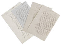
1837ABC_47451France 1837. Folded. 1 17.7 x 12 cm; 2 17.7 x 12 cm; 3 15.6 x 10 cm; 4 20.4 x 13.2 cm. All four letters written in French in an early 19th century cursive in brown ink. With the blind-stamped initials "H.B" in the top right corner of each letter. Including:1 Autograph letter from Hyacinthe de Bougainville to Gaspar baron Gourgaud.France Saturday 26 September 1835.2 Autograph letter from Hyacinthe de Bougainville to Madame Delpeche.France 25 March 1837.3 Autograph letter from Hyacinthe de Bougainville to a "Cher Ami".France 13 April 1838.4 Autograph letter from Hyacinthe de Bougainville to a "Cher Ami" and his best "Comrade".France 16 December 1845. Hyacinthe Bougainville 1781-1846 was a French naval officer son of the famous French Admiral and explorer Louis-Antoine Comte de Bougainville 1729-1811 who had circumnavigated the world in 1766-1779. Hyacinthe sailed around the world from 1824-1826 on board of the Thétis and the Espérance sent by the Minister of the Navy and the Colonies the Duc de Clermont-Tonnerre. It was virtually a diplomatic mission to Réunion Cochin-China Pondicherry in the Indian Ocean Manila and Macao. Hyacinthe returned across the Pacific and after anchoring at Port Jackson for three months he returned to France via Rio de Janeiro. Hyacinthe de Bougainville became Rear-Admiral in 1838.Ad 1: Autograph letter signed by Hyacinthe de Bougainville to Gaspar baron Gourgaud. Hyacinthe complained that he had heard nothing from him since their last "réunion gastronomique" 16 days earlier.Ad 2: Autograph letter signed by Hyacinthe de Bougainville to Madame Delpeche. She was the widow of François Delpeche an engraver who made a portrait of Hyacinthe's father Louis-Antoine de Bougainville in 1837.Ad 3: Autograph letter signed by Hyacinthe de Bougainville to a "Cher ami". He wrote that he had been presented by the Minister with some others that he didn't know to the King as an option for being made a contre admiral = Rear Admiral. "I am at the head of the list and if I stick to my titles I will be without worry ". He invokes his deeds since 1830 and says that he wants to retire "if I am not done justice; the name I bear does not allow me to serve any longer as a stepping stone for others". Three days before he was told that "le travail" was presented to the King and indeed his appointment followed the same year.Ad 4: Autograph letter signed by Hyacinthe de Bougainville to a "Cher ami" and his best "comrade". De Bougainville asks him a favour regarding the son-in-law of his "second" on the Thétis during his voyage around the globe in 1824-1826.All four letters with faint folding lines and pencil annotations; ads 2 and 4 with glue residue on the last leaf ad 2 with the remnants of a seal and a slight defect to the top corner of the last leaf where the letter was sealed and reopened. Overall in very good condition.l Howgego Encyclopaedia of Exploration 1800 to 1850 vol 2 B50. unknown
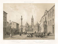
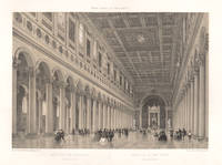
187023531870. Tinted lithograph. 245mm by 360mm image 345mm by 500mm sheet. Founded in the 4th century the Basilica di Santa Maria Maggiore Basilica of Saint Mary Major is one of the five great ancient basilicas of Rome. From a French series titled 'Rome dans Sa Grandeur' circa 1870. Benoist was one of France's most gifted topographical artists of the 19th century he was both a master lithographer and painter. He began his career in Paris and by 1836 he was exhibiting his views at the Paris Salons and continued to do so until 1879. As an original lithographic artist Philippe Benoist specialized in exterior and interior views of many famous European buildings. CONDITION : Some light soiling in margins and on the reverse of the sheet. unknown
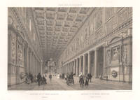
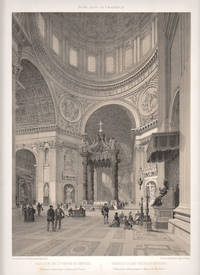
187028111870. Tinted lithograph. 250mm by 360mm image 345mm by 500mm sheet. Felix Benoist was a French painter and lithographer. Phillippe Benoist was one of France's most gifted topographical artists of the 19th century he was both a master lithographer and painter. He began his career in Paris and by 1836 he was exhibiting his views at the Paris Salons and continued to do so until 1879. As an original lithographic artist Philippe Benoist specialized in exterior and interior views of many famous European buildings. From 'Rome dans Sa Grandeur'. unknown
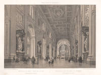
187028081870. Tinted lithograph. 250mm by 360mm image 345mm by 500mm sheet. From 'Rome dans Sa Grandeur'. Phillippe Benoist was one of France's most gifted topographical artists of the 19th century he was both a master lithographer and painter. He began his career in Paris and by 1836 he was exhibiting his views at the Paris Salons and continued to do so until 1879. As an original lithographic artist Philippe Benoist specialized in exterior and interior views of many famous European buildings. Soiling and light foxing in margins. Foxing on reverse of the sheet. unknown
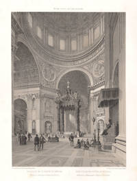
187028061870. Tinted lithograph. 250mm by 360mm image 345mm by 500mm sheet. From 'Rome dans Sa Grandeur'. Phillippe Benoist was one of France's most gifted topographical artists of the 19th century he was both a master lithographer and painter. He began his career in Paris and by 1836 he was exhibiting his views at the Paris Salons and continued to do so until 1879. As an original lithographic artist Philippe Benoist specialized in exterior and interior views of many famous European buildings. Light foxing in margins. Foxing on reverse of the sheet. unknown
187028101870. Tinted lithograph. 250mm by 360mm image 345mm by 500mm sheet. From 'Rome dans Sa Grandeur'. Phillippe Benoist was one of France's most gifted topographical artists of the 19th century he was both a master lithographer and painter. He began his career in Paris and by 1836 he was exhibiting his views at the Paris Salons and continued to do so until 1879. As an original lithographic artist Philippe Benoist specialized in exterior and interior views of many famous European buildings. Tear in margin on right edge of sheet. Foxing on reverse of the sheet. unknown
187027881870. Tinted lithograph. 360mm by 250mm image 500mm by 345mm sheet. From 'Rome dans Sa Grandeur'. Benoist was a French painter and lithographer. Some light soiling to edges of the sheet. Very faint foxing in title area. unknown
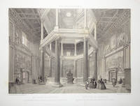
187023541870. Tinted lithograph. 250mm by 360mm image 345mm by 500mm sheet. The domed octagonal Lateran Baptistery stands somewhat apart from the Basilica di San Giovanni in Laterano Rome to which it has become joined by later construction. This baptistery was founded by Pope Sixtus III in 440 perhaps on an earlier structure for a legend grew up that Constantine the Great had been baptized there. <br /> From a French series titled 'Rome dans Sa Grandeur' circa 1870.Benoist was one of France's most gifted topographical artists of the 19th century he was both a master lithographer and painter. He began his career in Paris and by 1836 he was exhibiting his views at the Paris Salons and continued to do so until 1879. As an original lithographic artist Philippe Benoist specialized in exterior and interior views of many famous European buildings. Some light foxing in the image and light soiling to edges of the sheet. unknown
1835897AG1835. Dewasme-Pletinckx 1835. Lithographie von Charles Bauginet. Bildgrösse: 20 x 17 cm. Blattgrösse: 31 x 23 cm. Bauginet Charles 1814-1886: Belg. Maler Zeichner und Lithograph. - Etwas fleckig mit kleinen Randeinrissen. unknown
1836H22391Erlangen: Palm und Enke 1836. Hardcover. Good. First edition in German. 12mo original boards good to very good with some rubbing and wear to edges. 120 pp one plate. Palm und Enke hardcover
1886183039Paris: J. Rouam 1886. Hardcover. VG- wear to boards overall with soiling/fading and corners bumped. Pages are very clean. Tan boards with brown cloth spine gilt spine lettering; bw illustrated title page with red and black lettering; 56 4 pp; bw illustrations. Series: Les artistes célèbres. Text is in French. Includes a list of the 20 engravings and a table of contents. J. Rouam hardcover
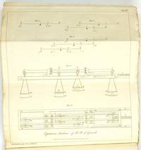
1829487251829. Jb. k.k. polytech. Inst. 14. - Hrsg. Johann Joseph Prechtl. - Wien Gedruckt und verlegt bei Carl Gerold 1829 8° VI 410 pp. mit acht Kupfertafeln orig. Broschur. Erstdruck! "Der Erfinder glaubt indem er diese Maschine bekannt macht daß dieselbe das Interesse welches sie haben kann mehr in der Sonderbarkeit als ihrer Nützlichkeit verdankt; weil sie obschon theoretisch zur Auflösung von Gleichungen aller Grade geeignet sehr enge Grenzen in der parktischen Ausführung findet und nur mit Schwierigkeit für mehr als fünf Grade oder einige darüber in Anwendung kommt." "In 1826-27 Girard was in London to present a new invention of his a calculating machine to the Royal Society but was disappointed to hear that Babbage had recently made a presentation of a similar machine. A tract was published in 1827 to explain the differences between the author's and Babbage's machines a copy of which is held in the Royal Society achives Equations machine invented by Ph. de GIRARD "a description with figures London : John Churchill 1827. PHILIPPE HENRI DE GIRARD 1775-1845 "French mechanician was born at Lourmarin Vaucluse on the 1st of February 1775 . He is chiefly known in connexion with flax-spinning machinery . Napoleon having in 18ro decreed a reward of one million francs to the inventor of the best machine for spinning flax Girard succeeded in producing what was required . But he never received the promised reward although in 1853 after his death a comparatively small pension was voted to his heirs and having relied on the "money to pay the expenses of his invention he got into serious financial difficulties . He was obliged in 1815 to abandon the flax mills he had established in France and at the invitation of the emperor of Austria founded a flax mill and a factory for his machines at Hirtenberg . In 1825 at the invitation of the emperor Alexander I. of Russia he went to Poland and erected near Warsaw a flax manufactory round which grew up a village which received the name of Girardow . In 1818 he built a steamer to run on the Danube . He did not return to Paris till 1844 where he still found some of his old creditors ready to press their claims and he died in that city on the 26th of August 1845 . He was also the author of numerous minor inventions." Encyclopedia Britannica 1911 unknown
1894004814Paris: Ém. Paul L. Huard et Guillemin 1894 8vo 23 cm VII 516 4 pp. Red cloth title gilt on spine publisher’s wrappers bound in wrappers toned. A very good copy of the first edition of Bibliographie des Éditions de Simon de Colines 1520-1546 the definitive bibliography of the publications of Simon de Colines one of the most important Parisian printers of the early sixteenth century. This work provides a comprehensive listing of Colines' editions including detailed descriptions of his typographical styles illustrations and editorial practices making it an indispensable reference for scholars of Renaissance printing book history and early modern bibliography. Ém. Paul, L. Huard et Guillemin hardcover
1851219281851. Deutsch bearbeitet von Dr. C.Liman prakt. Arzt in Berlin. - Berlin August Hirschwald 1851 8° VIII 354 pp. Leinenband der Zeit. Seltene erste deutsche Ausgabe in der Übersetzung von Carl Liman 1818-1891. - "Die Geschichte der modernen Syphilidologie beginnt mit Philippe Ricord 1800-1889 dem großen Experimentator und Reformator." Bloch. - Enthält im Nachtrag u. a. zwei Antwortschreiben des R. R. von Welz Würzburg 18 Seiten ehem. Arzt im Juliusspital und Dozent an der dortigen Universität einem Ricord-Schüler über die Einimpfung der Syphilis auf Tiere. Proksch I 65. Hirsch-H. III 787. unknown
187056626Paris Lévy Frères 1870. Contemp. hcalf. Gilt spine. Gilt lettering. Stamps on title-page. Engraved portrait as frontispiece. XCVIII4582 pp. 1 large folded engraved map l'Algerie. Internally clean and fine. unknown