VANDERMAELEN, Philippe MarieBiblio.com
415 résultats
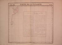
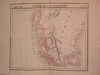
1827204810Brussels: Phillippe Marie Vandermaelen 1827. unbound. very good. Map. Lithograph with original hand outline. Image measures 19" x 22.5".<br/> <br/> Exquisite map of the southern portion of the continent including the Strait of Magellan and the Andes of Patagonia. Double page with centerfold. From Vandermaelen's 6 volume "Atlas universel de geographie physique politique statistique et mineralogique sur l'echelle de 1/16411836". Can be combined as gores to form an immense globe. The atlas was the first to map the world on a uniform scale.<br/> <br/> Phillippe Marie Vandermaelen unknown
1827204796Brussels: Phillippe Marie Vandermaelen 1827. unbound. very good. Map. Lithograph with original hand outline. Image measures 18.5" x 20.75".<br/> <br/> Map of St. Joseph's Peninsula known today as the Valdes Peninsula south to Camarones. Includes notes in French on Chile perhaps in reference to an adjacent map. Double page with centerfold. From Vandermaelen's 6 volume "Atlas universel de geographie physique politque statistique et mineralogique sur l'echelle de 1/16411836". Can be combined as gores to form an immense globe. The atlas was the first to map the world on a uniform scale.<br/> <br/> Phillippe Marie Vandermaelen unknown
1827801Brussels: Vandermaelen Phillipe 1827. 19 3/4 x 18 1/2 inches. Very good condition. Vandermaelens map sheet on California and the coast. It shows the Westcoast line of Southern California A very nice map and the earliest us of lithography in a cartographic enterprise. Senefelder published his volume on lithography in 1819 in French. Vandermaelen, Phillipe unknown
1827798Brussels: Vandermaelen Philippe 1827. 18 1/2 x 20 1/2 inches. Very good. An antique map of epic proportions for the Texas collector. This map shows Arkansas and portions of eastern Texas in 1827. It has place names and locations of Native American tribes. Multiple rivers are shown and details of topography well labeled. Overall this is a fine cartographic presentation in the for of a rare map. Vandermaelen, Philippe unknown
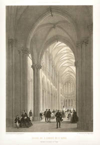
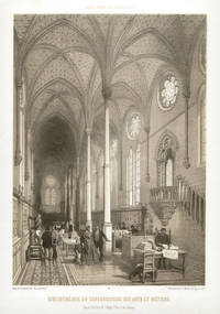
186122321861. Tinted lithograph. 325mm by 490mm sheet. From a series of lithographs depicting the famous buildings of Paris - 'Paris dans sa Splendeur' published in Nantes and Paris by Henri Charpentier in 1861.<br /> Phillippe Benoist Geneva 1813 - Paris 1881was one of France's most gifted topographical artists of the 19th century he was both a master lithographer and painter. He began his career in Paris and by 1836 he was exhibiting his views at the Paris Salons and continued to do so until 1879. As an original lithographic artist Philippe Benoist specialized in exterior and interior views of many famous European buildings. Faint foxing in title area. unknown
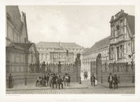
186123211861. Tinted lithograph. 245mm by 355mm image 340mm by 485mm sheet. The Palais des Beaux Arts<br /> From a series of lithographs depicting the famous buildings of Paris - 'Paris dans sa Splendeur' published in Nantes and Paris by Henri Charpentier in 1861.Phillippe Benoist was one of France's most gifted topographical artists of the 19th century he was both a master lithographer and painter. He began his career in Paris and by 1836 he was exhibiting his views at the Paris Salons and continued to do so until 1879. As an original lithographic artist Philippe Benoist specialized in exterior and interior views of many famous European buildings. One small spot in the sky. unknown
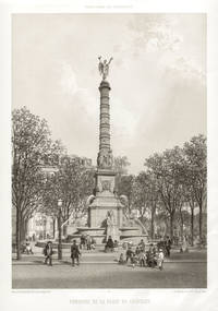
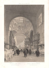
186122281861. Tinted lithograph. 490mm by 330mm sheet. From a series of lithographs depicting the famous buildings of Paris - 'Paris dans sa Splendeur' published in Nantes and Paris by Henri Charpentier in 1861.<br /> Phillippe Benoist Geneva 1813 - Paris 1881was one of France's most gifted topographical artists of the 19th century he was both a master lithographer and painter. He began his career in Paris and by 1836 he was exhibiting his views at the Paris Salons and continued to do so until 1879. As an original lithographic artist Philippe Benoist specialized in exterior and interior views of many famous European buildings. Creasing to lower right corner only visible in margins and title area. unknown
186122311861. Tinted lithograph. 490mm by 330mm sheet. From a series of lithographs depicting the famous buildings of Paris - 'Paris dans sa Splendeur' published in Nantes and Paris by Henri Charpentier in 1861.<br /> Phillippe Benoist Geneva 1813 - Paris 1881was one of France's most gifted topographical artists of the 19th century he was both a master lithographer and painter. He began his career in Paris and by 1836 he was exhibiting his views at the Paris Salons and continued to do so until 1879. As an original lithographic artist Philippe Benoist specialized in exterior and interior views of many famous European buildings. unknown
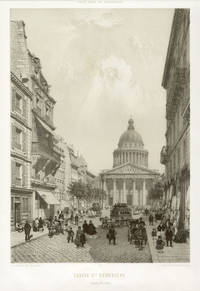
186123221861. Tinted lithograph. 355mm by 250mm image 495mm by 340mm sheet. Louis XV recovered from illness in 1744 and was so grateful he built this Neo-Classical church. Work began in 1764 and was completed in 1790.<br /> From a series of lithographs depicting the famous buildings of Paris - 'Paris dans sa Splendeur' published in Nantes and Paris by Henri Charpentier in 1861.Phillippe Benoist was one of France's most gifted topographical artists of the 19th century he was both a master lithographer and painter. He began his career in Paris and by 1836 he was exhibiting his views at the Paris Salons and continued to do so until 1879. As an original lithographic artist Philippe Benoist specialized in exterior and interior views of many famous European buildings. unknown
186122291861. Tinted lithograph. 490mm by 330mm sheet. From a series of lithographs depicting the famous buildings of Paris - 'Paris dans sa Splendeur' published in Nantes and Paris by Henri Charpentier in 1861.<br /> Phillippe Benoist Geneva 1813 - Paris 1881was one of France's most gifted topographical artists of the 19th century he was both a master lithographer and painter. He began his career in Paris and by 1836 he was exhibiting his views at the Paris Salons and continued to do so until 1879. As an original lithographic artist Philippe Benoist specialized in exterior and interior views of many famous European buildings. Light crease in left hand margin not affecting the image. unknown
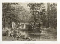
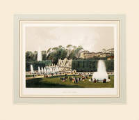
186164186Paris. 1861. Wonderful view of the Park of St Cloud on the outskirst of Paris published in 'Paris Dans Sa Splendeur' by Henri Charpentier Size: 250 x 360 mm. Original lithograph. Hand coloured. Mounted size: 490 x 570 mm. Fine condition. unknown
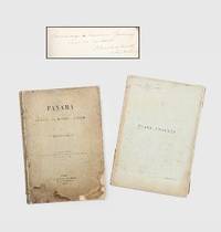
1892185348Paris: G. Masson 1892. An infrastructural and political revolution First and sole edition presentation copy signed on the dedication page "Hommage à Monsieur Gournay curé de Vertou. P. Bunau-Varilla 12 Septembre 1893". This comprehensive study was written by one of the driving forces behind the Panama Canal alongside de Lesseps. Most institutions list the text volume alone lacking the elaborate prospectus volume. Bunau-Varilla 1859-1940 was first sent to Panama in 1884 by the Compagnie Universelle du Canal Interocéanique where he rose to the position of chief engineer of the new canal. The attempt failed in 1889 and the company was dissolved after which he wrote a number of books to document and build support for the project's resumption. In this volume he both describes the work completed so far and his plan to complete the canal with locks. He "distributed copies of his book to the French Parliamentaries. However it did not meet any audience. as the Champer of Deputies' members did no want to be involved again in the burning subject of the Panama Canal" Loizillon p. 333 Bunau-Varilla tried again in 1894 and soon became a prominent figure in US-Panama relations. In particular when Colombia refused to ratify a treaty granting the United States rights to build the canal he encouraged the Panamanians to declare independence and his wife designed their new flag. He later signed the Hay-Bunau-Varilla Treaty giving the US control over the canal despite local protests. The canal would continue to occupy a central position in both the infrastructural and political development of Central America. This work contains a large number of photographic illustrations showing the construction as well as colour diagrams describing the geology of the area. The identity of Monsieur Gournay is unclear and there are no records linking Bunau-Varilla to the commune of Vertou. 2 vols quarto. With 45 half-tone photographic plates 5 folding colour folding map 5 colour diagrams 4 folding tables in text; text in French. Original buff paper wrappers spines and front wrappers lettered in black rear wrapper of text vol. decorated with publisher's device. Worn and soiled spines split sometime repaired with tape in gutters map loose in annex volume contents bright with a little toning at edges: a good copy. Gabriel J. Loizillon The Bunau-Varilla Brothers and the Panama Canal 2012. unknown
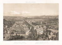
187023581870. Tinted lithograph. 250mm by 360mm image 345mm by 500mm sheet. Depicts a view of Rome taken from the top of St Peter's. From a French series titled 'Rome dans Sa Grandeur' circa 1870. Benoist was one of France's most gifted topographical artists of the 19th century he was both a master lithographer and painter. He began his career in Paris and by 1836 he was exhibiting his views at the Paris Salons and continued to do so until 1879. As an original lithographic artist Philippe Benoist specialized in exterior and interior views of many famous European buildings. CONDITION : Some light soiling to edges of the sheet. unknown
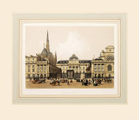
186164181Paris. 1861. Attractive image of the Palais de Justice published in 'Paris Dans Sa Splendeur' by Henri Charpentier Size: 250 x 360 mm. Original lithograph. Hand coloured. Mounted size: 490 x 570 mm. Fine condition. unknown
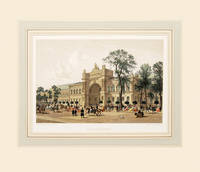
186164194Paris. 1861. Attractive view of the Palace of the Industrie in the current site of the Grand Palais and destroyed in 1897 published in 'Paris Dans Sa Splendeur' by Henri Charpentier Size: 250 x 360 mm. Original lithograph. Hand coloured. Mounted size: 490 x 570 mm. Fine condition. unknown
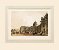
186164180Paris. 1861. Attractive image of the Institute of France published in 'Paris Dans Sa Splendeur' by Henri Charpentier Size: 250 x 360 mm. Original lithograph. Hand coloured. Mounted size: 490 x 570 mm. Fine condition. unknown
187027911870. Tinted lithograph. 360mm by 250mm image 500mm by 345mm sheet. From 'Rome dans Sa Grandeur'. Benoist was a French painter and lithographer. Some light soiling and foxing in margins. unknown
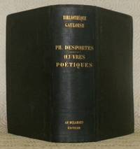
185876367Paris : Adolphe Delahays 1858. 170x125mm. frontispice XCII - 32Êpages quelques passages en latin reliure percaline de lÕditeur. Auteur et tire dors au dos. Encadrements froid sur les deux plats et guirlandes froid au dos. Nom du possesseur sur la page de garde suprieure. 465 Adolphe Delahays unknown
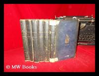
1831254144Paris : C. L. F. Panckoucke 1831. First Edition. Hardcover. Poor copy with wear tear and dust-dulling as with age. Text remains clear and without blemish. Physical description; six volumes only: I II V VI VII and VIII. Subjects; Marcus Tullius Cicero. Collected works. Roman writings. Paris : C. L. F. Panckoucke hardcover
1824006561Paris: Crapelet Imprimeur-Libraire 1824. Book. Near Fine. Leather and Marbled Boards. First Thus. 8vo - over 7¾" - 9¾" tall. In handsome red leather and marbled boards end pages marbled top edges gilt gilt titles and decorations 4 raised band Near Fine slight rubbing to leather at tips slight foxing and toning scattered throughout. Philippe Quinault 1635-1688 was a French dramatist best known for his 14 opera librettos which he wrote for Lully. Crapelet, Imprimeur-Libraire Hardcover
183376201Paris: Lecointe et Pougin 1833. Lecointe et Pougin unknown
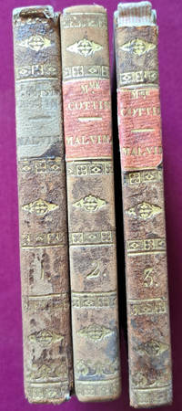
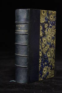
185849722Paris: Adolphe Delahays 1858. Fine. Adolphe Delahays Paris 1858 9.50 x 16 cm relié New edition printed on laid paper. Half navy blue morocco binding spine slightly faded with five raised bands set with black fillets marbled paper boards marbled endpapers and pastedowns top edge gilt. Work illustrated with a frontispiece engraving. A trace of a bookseller's description label on an endpaper. Handsome set in a charming uniform signed contemporary binding. Adolphe Delahays hardcover
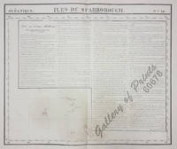
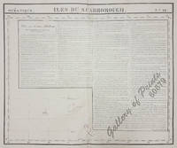
182560678<p>RARE original-colour lithograph features long text on "New Holland pl. 29" apparently due to space reasonsbare ocean…. RARE map of Kiribati with the Gilbert Islands from 'Atlas Universel de Geographie.' Oceanique no. 16. This 6 vol. Atlas contains 382 lithographed mapsheets and 40 plates of statistical data by Henri Ode mostly hand-coloured in outline. The maps in the atlas constitute not only the first atlas of the world on a uniform scale but also the first lithograph atlas. Constructed on a modified conical projection if assembled they form a 775 m diameter globe although only one such was known to have been assembled by the author himself and requiring a specially designed room. Map shows the Gilbert Islands now main part of Republic of Kiribati. But the main feature of this map is the extensive description of Australia referring to map no. 29. Prime meridian: Paris. Reference: atlas: Koeman III Vdm 1; Phillips Atlases 749. Condition: with center fold as issued with some faint stains and toning very good condition.</p> published in Brussels.
182560679<p>original-colour lithograph. RARE map from 'Atlas Universel de Geographie.' Oceanique no. 16; published in Brussels; This 6 vol. Atlas contains 382 lithographed mapsheets and 40 plates of statistical data by Henri Ode mostly hand-coloured in outline and was published in instalments over 3 years. The maps in the atlas make up the first map of the world on a uniform scale and the first lithograph atlas; constructed on a modified conical projection and if assembled form a globe with a diameter of 7.75m although only one such was known to have been assembled by the author himself and requiring a specially designed room. Map shows the <strong>Gilbert Islands now main part of Republic of Kiribati.</strong> But the main feature of this map is the extensive description of <strong>Australia</strong> referring to map no. 29. Prime meridian: Paris. Refence: atlas: Koeman III Vdm 1; Phillips Atlases 749. Condition: with center fold as issued minor creases and foxing on the outer plate and margin features long text on <strong>"New Holland pl. 29"</strong> apparently due to space reasons bare ocean.</p> published in Brussels.
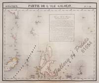
182561054<p>original hand-colour lithograph with a text vignette on Borneo. This important map for the Philippines shows Southern Mindanao and the area between Sulawesi Mindanao and Gilolo today: Halmahera part of the Moluccas. From 'Atlas Universel de Geographie…' Oceanique no. 6; This 6 vol. Atlas contains 382 lithographed mapsheets and 40 plates of statistical data by Henri Ode mostly hand-coloured in outline and was published in instalments over 3 years. The maps in the atlas make up the first map of the world on a uniform scale and the first lithograph atlas created on a modified conical projection and if assembled form a globe with a diameter of 7.75m although only one such was known to have been assembled by the author himself and requiring a specially designed room. A text box gives extensive information on Borneo. Reference: Reference: NOT in Quirino atlas: Koeman III Vdm 1; Phillips Atlases 749; National Maritime Museum 179; Wellens-De Donder L. Philippe Vandermaelen 1795-1869 4-5; DavidRumseydotcom with cpl. Info. Condition: very good example with some age-toning and a few faint spots wide margins.</p> published in Brussels.