415 résultats
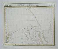
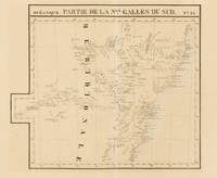
1827143929Brussells: P.M.G. Vandermaelen 1827. Very Good. Brussells P.M.G. Vandermaelen 1827. A lithographed map printed surface 471 × 547 mm sheet size 533 × 665 mm printed in black and blue. Vertical centrefold crease as issued; remnants of hinge mounts and an old guard on the verso; paper lightly tanned and foxed; in excellent condition. Plate 55 from Vandermaelen's monumental 'Atlas Universel' showing the New South Wales coast from around Batemans Bay to the Solitary Islands. Sydney the Blue Mountains and hinterland are shown including much of the Lachlan River. Vandermaelen's atlas was 'the first world atlas on a uniform scale. The sixth volume covered "Océanique" and it included seventeen maps of Australia. All the sheets were made on the same scale and projection and they were so constructed that they could form a globe of about 1000 gores 7.775 metres in diameter' Clancy: 'The Mapping of Terra Australis' 1995. P.M.G. Vandermaelen unknown
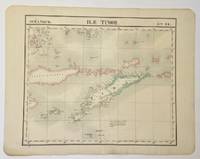
1827325002Brussels: Philippe Marie Vandermaelen 1827. Map. Hand colored engraving. Image measures 18 1/2" x 22"<br/> <br/> Beautiful and simple map of the island of Timor and surrounding islands. From Vandermaelen's 6 volume "Atlas universel de geographie physique politique statistique et mineralogique sur l'echelle.". Can be combined as gores to form an immense globe. <br> <br> Phillippe Marie Vandermaelen 1795-1869 was a Belgian cartographer and publisher. His Atlas universal was both the first lithograph atlas and the first atlas to map the world on a uniform scale. The maps were meant to join together to form a huge globe.<br/> <br/> Philippe Marie Vandermaelen unknown
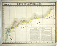
182725576Brussels: P. Vandermaelen 1827. An early map of the Exmouth Western Australia area from the North West Cape to Roebuck Bay. Lithograph with original outline color 15 3/4 x 21". Scale ca. 1:1 650 000. Plate no. 44 Partie de La Nlle. Hollande in vol. 6 Oceanique of Atlas Universal de Geographie Physique Politique Statistique et Mineralogique" by P. Vandermaelen 1827. Tooley 1286; Phillips 749; Bib ID 1553060. P. Vandermaelen unknown
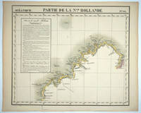
182725575Brussels: P. Vandermaelen 1827. Maps. Very good condition. An early map of the Broome & the Kimberly Western Australia area from P. Cantheaume to Cambridge Gulf including the Lacepede Islands. Broome is at the bottom of the Dampier Peninsula called "C. Boileau." Lithograph with original outline color 25 x 21.5". Plate no. 35 Partie de La Nlle. Hollande in vol. 6 Oceanique of Atlas Universal de Geographie Physique Politique Statistique et Mineralogique" by P. Vandermaelen 1827. Tooley 1282; Phillips 749; Bib ID 30855. P. Vandermaelen unknown
1827M1433Lithograph with hand colouring. An interesting chart showing Tonga or "The Friendly Islands" with extensive description of he flora and fauna of the region. Vandermaelen's Atlas Universel was the first Atlas to use the lithographic process throughout. <br /><br />Phillips 749; Koeman Vdm 1; National Maritime Museum 179<br /><br /> From "Atlas Universel"
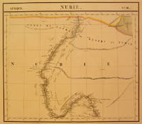
1827202375Brussels: Phillippe Marie Vandermaelen 1827. unbound. very good. Map. Large format lithograph with original hand coloring. Image measures 18.5" x 22.25".<br/> <br/> Includes Nubia Sudan and cities along the Nile River. Double page with centerfold. From Vandermaelen's 6 volume "Atlas universel de geographie physique politique statistique et mineralogique sur l'echelle de 1/16411836". Can be combined as gores to form an immense globe. The atlas was the first to map the world on a uniform scale.<br/> <br/> Phillippe Marie Vandermaelen unknown
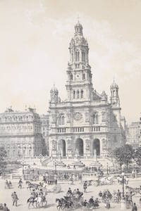
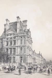
187479768Nantes Paris: Charpentier 1874. Fine. Charpentier Nantes Paris 1874 33.50 x 48.80 cm une feuille Original black and white lithograph drawn and engraved by Philippe Benoist and used as illustration for Paris et ses ruines by Victor Fournel a work documenting the devastation of the Paris Commune. Handsome copy despite some worming. Charpentier unknown
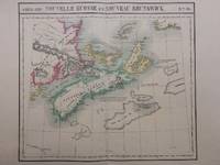
1827288092Brussels: Phillippe Marie Vandermaelen 1827. unbound. Map. Large format lithograph with original hand color wash. Image measures 18.25 x 20.75". Sheet measures 21.25 x 27.5".<br/> <br/> This scarce 1827 map of Nova Scotia and New Brunswick is one of the most detailed maps of the region published in the first half of the 19th century. It extends to Prince Edward Island St. John Cape Breton the Madelaine Islands and the Sable Islands. Topographical features of landforms water bodies and fishing banks are labeled in addition to geographical features such as ports counties towns and cities. As was typical of his cartographic style Vandermaelen has included notations throughout the map that describe the region. The map appeared in Vandermaelen's "Atlas Universal." The map is in excellent condition a dark impression on bright clean paper. Deluxe margins with no chips or tears minor wear to corners not affecting the image. Phillippe Marie Vandermaelen 1795-1869 was a Belgian cartographer and publisher. His Atlas universal was both the first lithograph atlas and the first atlas to map the world on a uniform scale. The maps were meant to join together to form a huge globe. This map is a fine example of his work.<br/> <br/> Phillippe Marie Vandermaelen unknown
1838250211838. Paris J. B. BailliÂre 1838. 2 forts vol. au format in-8 212 x 133 mm de viii - 784 pp. ; 2 ff. n.fol. et 796 pp. Reliures uniformes de l'ÂŽpoque de demi-basane glacÂŽe et marbrÂŽe caramel dos lisses ornÂŽs de quintuples filets gras et maigres dorÂŽs titre dorÂŽ tomaison dorÂŽe. Edition originale ; complÂte des deux volumes la constituant. ''Autant qu'il m'a ÂŽtÂŽ possible j'ai procÂŽdÂŽ du facile au difficile ; et j'ai toujours ÂŽtait du connu ˆ l'inconnu. Les descriptions s'encha”nent et se suivent dans l'ordre suivant lequel les ÂŽlÂves doivent se diriger dans leurs recherches thÂŽoriques et pratiques''. Angles ÂŽmoussÂŽs. Coupes nettement ÂŽlimÂŽes. Papier parfois lÂŽgÂrement oxydÂŽ. Claires rousseurs et petites cernes ÂŽparses dans les corps d'ouvrages. Du reste bonne condition. Peu courant. b42961 unknown
187479766Nantes Paris: Charpentier 1874. Fine. Charpentier Nantes Paris 1874 33.50 x 48.80 cm une feuille Original black and white lithograph drawn and engraved by Philippe Benoist and used as illustration for Paris et ses ruines by Victor Fournel a work documenting the ravages of the Paris Commune. Handsome copy despite some worming. Charpentier unknown
1825M4496Brussels 1825. Very Good minor woming on upper portion of map not affecting the map proficiently repaired. Notes: The first atlas of the world on a uniform scale. If assembled as a globe gores forms a very large globe. Size : 475x575 mm 18.75x22.625 Inches Coloring: Original Outline Coloring Category: Maps Canada West British Columbia; Maps Canada West Alberta unknown
1878ZB480719London 1878. small quarto 47 1 printer's imprint Elziver Press John C. Wilkins pp the title is misleading in that the book consists almost totally of extracts from Commynes that the author who was not George W. Russell was inspired to gather after attending a theatrical performance featuring Henry Irving undoubtedly issued in a small edition with this copy inscribed To My Mother from A. E. / May 1878. he or she has also added a long quotation from Montaigne and a few marginal notes; original quarter leather binding rubbed with a few spots of staining on front cover else good. - If you are reading this this item is actually physically in our stock and ready for shipment once ordered. We are not bookjackers. Buyer is responsible for any additional duties taxes or fees required by recipient's country. London hardcover
184849472Paris Bachelier 1848. 4to. No wrappers. In: "Comptes Rendus Hebdomadaires des Séances de L'Academie des Sciences" Tome 26 No 8. Pp. 233- 264. Entire issue offered. Semmelweis's paper: pp. 254-255. Clean and fine. <br/><br/><em>First French announcement of this epochal event in the history of medicine the discovery of the etiology and prevention of childbed fever. First announce by Ferdinand von Hebra in December 1847 then followed only 2 months after by the French announcement."Although Semmelweis's importent discoveries were made in the 1840s he did not publish them immediately. The first printed reports of his findings were written by his collegues and were published in various German French or English Journals. Semmelweis himself gave three lectures before the Imperial and Royal Medical Society of Vienna in 1850 but did not publish his complete discussion of "The etiology concept and prophylaxis of childbeed fever" until 1861 having previously contributed several shorter accounts to Hungarian medical journals."Norman "One Hundred Books famous in Medicine" p. 265.Semmelweis demonstrated that puerperal fever also known as childbed fever was contagious and that this incidence could drastically be reduced by appropriate hand washing by medical care-givers. He made this discovery in 1847 while working in the Maternity Department of the Vienna Lying-in Hospital. His failure to convince his fellow doctors led to a tragic conclusion. However he was ultimately vindicated. While employed as assistant to the professor of the maternity clinic at the Vienna General Hospital in Austria in 1847 Semmelweis introduced hand washing with chlorinated lime solutions for interns who had performed autopsies. This immediately reduced the incidence of fatal puerperal fever from about 10 percent range 5-30 percent to about 1-2 percent.Toward the end of 1847 accounts of Semmelweis's work began to spread around Europe. Semmelweis and his students wrote letters to the directors of several prominent maternity clinics describing their recent observations. Ferdinand von Hebra the editor of a leading Austrian medical journal announced Semmelweis's discovery in the December 1847 and April 1848 issues of the medical journal. Hebra claimed that Semmelweis's work had a practical significance comparable to that of Edward Jenner's introduction of cowpox inoculations to prevent smallpox.Garrison & Morton: 6275 German version. </em> unknown
181381267273Chez J.A. Brosson 1813. Hardcover. Good. 0x0x0. 3 volume set. 5th edition. Rebound in modern brown buckram. Gilt spine. Marbled page ends. Good bindings and cover. Shelfwear. Library markings. This is an oversized or heavy book that requires additional postage for international delivery outside the US. Chez J.A. Brosson hardcover
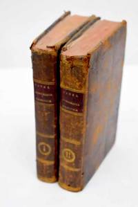
18032992439Madrid.: en la Imprenta Real. 1803. Hardcover. Cubierta deslucida. Good. 18 cm. 2 v. 4 334 p. 1 h. pleg. ; 438 p. 1 h. pleg. Encuadernación en tapa dura artesanal en plena piel con tejuelo. Pinel Philippe 1745-1826. Traducida al castellano por el Dr. D. Luis Guarnerio y Allavena. Nosografía filosófica. Tomo I-II. Título de la anteportada. Sign. : ² A-Z AA BB¹ ; A-Z AA-DD EE³. Notas al pie. Las hojas plegadas son tablas de clasificación de enfermedades. Guarnerio y Allavena Luis. traductor. Imprenta Real Madrid. impresor . Cubierta deslucida. lit y filosofía Dermatología. Siglo XVIII. 616.502"17" 616.5 en la Imprenta Real. hardcover
18033603192Madrid.: Imprenta Real. 1803. Hardcover. Cubierta deslucida. Good. 19 cm. 438 p. Encuadernación en tapa dura artesanal en plena piel con tejuelo. Pinel Philippe 1745-1826. Traducida al castellano por el Dr. D. Luis Guarnerio y Allavena. Nosografía filosófica . Cubierta deslucida. Imprenta Real. hardcover
1825MGUmoSÉG83Paris: Alexis Eymery 1825-26. 1825. 3 Volumes. 8vo. pp. 16ads 2 p.l. 488; 2 p.l. 438; 2 p.l. 601 2 leaveserrata. 3 engraved frontis. include. 2 portraits 1 folding engraved map & 2-page autograph facsimile. Uncut in original bds. joints & spine ends chipped several corners damaged scattered light foxing Vol. III shaken. Second Edition. Of particular interest are the sections of the memoirs relating to Ségur's service in the American Revolutionary War as a colonel under Rochambeau and his appointment 1784-89 as minister plenipotentiary to the court of Catherine II at St. Petersburg where he concluded a commercial treaty 1787 that was extremely advantageous to France. Sabin 71985 mentioning only 1 portrait & facsimile in 3rd Edn. cfMartin & Walter 3148 3rd Edn. Paris: Alexis Eymery, 1825-26. unknown
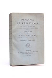
187472327Paris: P. Rouquette 1874. Fine. P. Rouquette Paris 1874 10.50 x 16 cm broché New edition one of 500 copies on laid paper the only printing with 10 on China paper. Work illustrated with a frontispiece and a facsimile. Handsome and rare copy. P. Rouquette unknown
1838HAY172921838. Paris Auguste Desrez Imprimeur-Editeur. relié pleine toile bordeaux contemporaine. Très belle reliure excellent état général. gd in-8. avec au dos une pièce de titre verte et titre doré. unknown
184019952Paris: Chez Jules Renouard et Cie 1840. CXXXVII 413 607 1 579 pp. 1840-1847 Tranches un peu abimées. Reliure demi cuir moderne. Bons exemplaires. Chez Jules Renouard et Cie, Hardcover
1837NTmoMONT70Paris: Imprimerie Royale 1837. 1837. 8vo. pp. xv 231. frontis. portrait on India paper mounted engraved by Duport after a drawing by the author. contemporary half calf gilt back binding worn & damaged internally clean & fresh. printed on 'papier vélin'. Hardcover. Paris: Imprimerie Royale, 1837. Hardcover
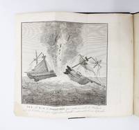
181989218Paris: Bachelier 1819. Fine. On Robert Fulton Bachelier Paris 1819 13.5 x 21.5 cm Relié First and only edition illustrated with a folding engraved frontispiece see Polak 6795; not in Sabin. Bound in bottle-green full sheep Bradel-style binding smooth spine ruled in gilt with double fillets gilt date at foot original pink paper waiting cover preserved modern binding. A waterstain affects the lower margin of the initial leaves gradually fading throughout the volume. Unique and uncommon edition the purported 1814 edition is a bibliographical ghost. The plate depicts the explosion in the roadstead of Walmer of the Danish brig ""La Dorothée"". This experiment was the work of Robert Fulton; indeed most of this very rare memoir is dedicated to the research and discoveries of the great American scientist who died in 1815. Jacques-Philippe Mérigon de Montgéry 17821839 frigate captain and member of the Naval Works Council took part in numerous campaigns and naval battles between 1794 and 1827 Ireland Concarneau South Seas La Spezia the Levant and Black Sea Senegal Guiana the West Indies the United States England. ""Montgéry developed a passionate interest in steam navigation and more broadly in scientific and technical studies As a member of the Naval Works Council he frequently visited ports to examine various technical matters A highly original mind closely connected with Auguste Comte Montgéry produced a substantial body of work often demonstrating prophetic insight far ahead of the achievements of his time."" He helped popularize Robert Fulton's research in France on torpedoes and underwater explosives"" Taillemite. Bachelier unknown
188177146Paris : Librairie de Firmin-Didot et Cie. 1881. 275x185mm. XIII - reliure demi-percaline ˆ coins. Plats papier marbrÂŽ. Couverture supÂŽrieure et dos conservÂŽs. Belle reliure. TrÂs bel exemplaire. 2551 Librairie de Firmin-Didot et Cie. unknown
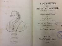
182260023Milan : chez Giegler 1822. In-8 p. mm. 220x132 mz. pelle coeva fregi e titolo oro al dorso pp. LXXXVII350 con un ritratto di Pio VII al frontespizio e 57 tavole incise in rame fuori testo alcune più volte ripiegate. Con timbri di appartenenza altrimenti ben conservato. chez Giegler, unknown
1827202229Brussels: Phillippe Marie Vandermaelen 1827. unbound. very good. Map. Large format lithograph of East Africa with original hand coloring. Image measures 18.5" x 22.25".<br/> <br/> Includes Kenya Mombasa Tanzania and Lamme Lamu. Double page with centerfold. From Vandermaelen's 6 volume "Atlas universel de geographie physique politique statistique et mineralogique sur l'echelle de 1/16411836". Can be combined as gores to form an immense globe. The atlas was the first to map the world on a uniform scale.<br/> <br/> Phillippe Marie Vandermaelen unknown