34 résultats
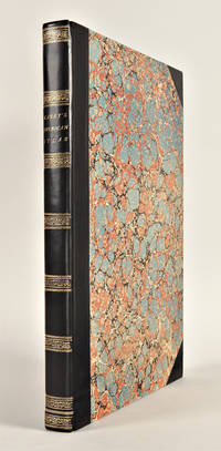
1896LV1550Los Angeles:: Elstner-Morehouse 1896. 1896. Large oblong 4to. Not paginated. 36 full page illustrations of Los Angeles with related adverts on the opposite pages 15 full page photos of individual Los Angeles Buildings. Original full gilt stamped brown cloth; inner hinges neatly repaired. Early inscription to Arthur Ellis 1927. Early Ownership signature of Sam Behrendt Los Angeles 1925. Fine. EXTREMELY SCARCE. BEAUTIFUL COPY OF THIS VERY RARE LOS ANGELES SKETCHBOOK. With 36 full-page plates depicting early Los Angeles buildings. This unequaled record of the central Los Angeles business district was created according to the preface in order ". . .to show the active business portions together with a few of the more pretentious of the office buildings and manufactories". Arthur Ellis was a founding member of the Zamorano Club. Provenance: Sam Behrendt the son of Los Angeles pioneer Caspare Behrendt d.1913 the discovery of gold brought him to California "acquired his education in the Spring Street and Eighth Street Grammar Schools at Los Angeles and after he was fifteen years old spent one year in a business college. For to years he clerked in a grocery and cigar business and remained there until 1900. Selling out and returning to Los Angeles he became connected with the San Gabriel Electric Company later merged with the Pacific Light and Power Company. He was employed as a collector and later solicited new contracts for three years. On leaving that corporation Mr. Behrendt entered the insurance business for himself and in 1907 took in Mr. I. O. Levy as a partner under the name Behrendt-Levy Company and they incorporated the business in 1908. This is a general insurance agency and the establishment now employs twenty-one people. Mr. Behrendt is also a director of the Union Bank and Trust Company and a director of the Shiff Lang & Company." He is a member of Hollenbeck Lodge no. 119 a Scottish Rite Mason and Shriner Elk Corona Parlor of the Native Sons of the Golden West B’nai Birth Los Angeles Athletic Club San Gabriel Country Club City Club Chamber of Commerce Merchants and Manufacturers Association and the Friars Club of New York. At Oakland Ca. he married Sadie Mosbacher. Together they had a son George b.1904. Behrendt was also known to be a friend of film star Roscoe "Fatty" Arbuckle holding a dinner in his honor at the Alexandria Hotel February 12 1917. – McGroarty. John Steven McGroarty Los Angeles from the mountains to the sea: with selected biography vol. II p. 422; James Miller Guinn A history of California and an extended history of Los Angeles and . . . 1915 page 124; Harris Newmark Sixty Years in Southern California. Elstner-Morehouse, 1896. hardcover books
18823554New York: Currier & Ives 1882. Lithograph printed in colours. An excellent Currier & Ives image of a racing yacht at full stretch.<br/> <br/>A valuable pictorial record of this New York Yacht Club vessel owned jointly by H.W. Johnson and William Krebs from a painting by the prolific and highly talented Charles R. Parsons.<br/> <br/>Conningham 1281; Gale 1404. Currier & Ives unknown books
18673551New York: Currier & Ives 1867. Lithograph coloured by hand. Currier & Ives view of the start of the first Trans-Atlantic yacht race.<br/> <br/>This image recalls the start of modern ocean racing: in 1866 under New York Yacht Club rules three schooners of between 32 and 32.6 metres raced from Sandy Hook N.J. to Cowes Isle of Wight. The Henrietta owned by American newspaper publisher James Gordon Bennett won arriving at 5:45 pm on Christmas day in a time of 13 days and 22 hours. The Fleetwing arrived 8 hours later followed by the Vesta 1 1/2 hours after her.<br/> <br/>Conningham 2634; Gale 2854. Currier & Ives unknown books
1852WRCAM16070Nashville 1852. Two volumes. viii374 i.e. 376; vii376pp. plus thirty-one plates. Later three-quarter black morocco and cloth spines gilt. Corners lightly worn. Ownership inscription on verso of each frontispiece bookplate on rear pastedowns. First volume with ink stamp on pastedown and titlepage. Lightly foxed. Some light wear and soiling. Very good. A very rare complete set of this interesting and important Tennessee periodical containing all twelve articles entitled "Early History of the Southwest" which constitute the main interest of the magazine for modern readers. After the magazine ceased publication with the December 1852 issue the editors followed their intention stated in their last editorial and gathered all of the narratives into a book issued in January 1853 entitled INDIAN BATTLES MURDERS SEIGES sic AND FORAYS IN THE SOUTH- WEST. ".This was a collection of narratives by various authors. These had appeared separately as articles in the SOUTH WESTERN MONTHLY MAGAZINE printed in Nashville during the years 1851-52. The magazines are considered frontier periodicals of extreme rarity - the 1853 book.is all but unobtainable. Apparently few copies of the book were printed judging from the very few times one finds records of its sale." - Allen. The actual first appearances in print of all of the items in the book are the periodical versions. <br> <br> Articles include "Sketch of the Captivity of Col. Joseph Brown" "The Indian Massacres in the Vicinity of Bosley's Spring." "Indian Murders around Nashville - Narrative of John Davis Esq." "Scalping of Thomas Everett and his two sisters near Buchanan's Fort." "Indian Battles and Murders - Narrative of General Hall" "Perils attending emigration from Virginia to the West.burning of Sigler's Fort. Narrative of John Carr" "The levy of men sent out from North Carolina.narrative of Mr. Samuel Blair" "Narrative of John Rains" "Massacre at Cavet's Station." Virtually all of the narratives describe Indian fights in Tennessee between the 1780s and the War of 1812. <br> <br> An important rarity of Indian warfare on the Old Southwest frontier. This set has a remarkably large number of plates; other sets we know of have far fewer. All seem to be remainders from New York publications used as illustrations without regard to text. HOWES W30 ref. ALLEN RARITIES 47. ALLEN IMPRINTS 3160. hardcover books
182729764Philadelphia: H.C. Carey & I. Lea 1827. Folio. Mounted on guards throughout. Letterpress title copyright notice on verso 1p. "Advertisement" to Third Edition dated "January 1827" verso blank 1p. "Contents" and "Index" verso blank plus forty-six double-page handcolored copper engraved maps most with descriptive letterpress in margins and many with supplementary text pages following; one double-page engraved plate of mountains uncolored; and one double-page colored plate of river lengths. Titlepage remargined minor foxing some faint staining along bottom edge. Later 19th-century three-quarter calf and original plain paper boards later gilt morocco label. Boards slightly rubbed.<br/> <br/>One of the most important early atlases printed in the United States: a handsome atlas of the Americas with individual colour maps of each state in the Union including a seminal map of the West by Stephen H. Long.<br/> <br/>At the time of publication this was the best and most detailed atlas to be produced in the United States. Fielding Lucas the major Baltimore printer was the principal engraver and substantial historical background text accompanies each map. Among the most noted maps in the atlas is Major Stephen H. Long's "Map of Arkansa and other Territories of the United States." That map which depicts the Missouri basin between Nashville in the east the Mandan villages in the north and the Rocky Mountains in the west was based on the surveys conducted by Long on his expeditions of 1819 and 1820. On this famous map is the printed legend which would perpetuate a myth for many years to come identifying the high plains as the "Great American Desert." The 1827 edition "Third edition Corrected and Improved" of Carey & Lea's historic atlas first published in 1822 includes much new material with all the maps and text updated except for the Washington D.C. and Michigan maps. This was the first American atlas that was modeled on Le Sage's plan of having explanatory text surrounding the maps. The maps for the most part by Fielding Lucas are beautifully drawn and colored.<br/> <br/>Howes C133 "aa"; Phillips 1373a; Sabin 15055; Wheat Transmississippi West 348 and 352. H.C. Carey & I. Lea unknown books
1823WRCAM43415APhiladelphia: H.C. Carey & I. Lea 1823. Letterpress title copyright notice on verso 1p. advertisement verso blank 1p. table of contents verso blank. Forty-six double-page handcolored engraved maps of the United States all but one with borders of letterpress descriptive text; uncolored double-page engraved view showing the comparative heights of mountains throughout the world; handcolored double-page engraved table showing the comparative lengths of the principal rivers worldwide; five letterpress tables four double-page three of these handcolored; 18pp. of letterpress text. Mounted on guards throughout. Modern half calf and marbled boards spine gilt leather label. Dampstaining along lower edge causing chipping to initial leaves. Closed tear in bottom margin of first map repaired with tissue. Very light offsetting from maps. Some dust soiling light tanning and foxing. Good plus. A handsome atlas of the Americas with individual color maps of each state in the Union including a seminal map of the West by Stephen H. Long. At the time of publication this was the best and most detailed atlas to be produced in the United States with substantial historical background text accompanying each map. Fielding Lucas the major Baltimore printer was the principal engraver. <br> <br> Among the most noted maps in the atlas is Major Stephen H. Long's "Map of Arkansa and other Territories of the United States." That map which depicts the Missouri basin between Nashville in the east the Mandan villages in the north and the Rocky Mountains in the west was based on the surveys conducted by Long on his expeditions of 1819 and 1820. The map published in Carey & Lea's atlas preceded the official account of that expedition by expedition botanist Edwin James which includes a smaller map with similar detail titled "Country drained by the Mississippi Western Section." Carey & Lea's 1823 publication of James' ACCOUNT perhaps explains the prior inclusion of this map with Long expedition information in their atlas. <br> <br> On this famous map is the printed legend which would perpetuate a myth for many years to come identifying the high plains as the "Great American Desert." Carey & Lea's atlas was first issued in 1822; this is the second issue with revised states of three maps Maine North Carolina and Louisiana with the same printing of the remaining maps and a cancel title. HOWES C133 "aa." PHILLIPS ATLASES 1373a. SABIN 15055. WHEAT TRANSMISSISSIPPI 348 352. H.C. Carey & I. Lea hardcover books
182325085Philadelphia: H.C. Carey & I. Lea 1823. Folio. 17 1/2 x 11 7/8 inches. Mounted on guards throughout letterpress title copyright notice on verso 1p. Advertisement verso blank 1p. Contents verso blank 46 double-page hand-coloured engraved maps of the United States all but one with borders of letterpress descriptive text 1 uncoloured double-page engraved view showing the comparative heights of mountains throughout the world 1 hand-coloured double-page engraved table showing the comparative lengths of the principal rivers worldwide 5 letterpress tables 4 double-page 3 of these hand-coloured 18pp. of letterpress text. Expertly bound to style in half calf over contemporary marbled paper covered boards flat spine in six compartments divided by gilt roll tools red morocco label in the second compartment the others with a repeat decoration in gilt.<br/> <br/>One of the most important early atlases printed in the United States: a handsome atlas of the Americas with individual colour maps of each state in the Union including a seminal map of the West by Stephen H. Long.<br/> <br/>At the time of publication this was the best and most detailed atlas to be produced in the United States. Fielding Lucas the major Baltimore printer was the principal engraver and substantial historical background text accompanies each map. Among the most noted maps in the atlas is Major Stephen H. Long's "Map of Arkansa and other Territories of the United States." That map which depicts the Missouri basin between Nashville in the east the Mandan villages in the north and the Rocky Mountains in the west was based on the surveys conducted by Long on his expeditions of 1819 and 1820. The map published in Carey & Lea's atlas preceded the official account of that expedition by expedition botanist Edwin James which included a smaller map with similar detail titled "Country drained by the Mississippi Western Section". Carey and Lea's 1823 publication of James Account perhaps explains the prior inclusion of this map with Long expedition information in their atlas. On this famous map is the printed legend which would perpetuate a myth for many years to come identifying the high plains as the "Great American Desert." Carey and Lea's atlas was first issued in 1822; this is the 1823 second issue substantially the same as the first but with a new title and revised states of several maps and text leaves generally minor revisions including additional shading to maps and improved resetting of several text leaves though this copy with first state settings of the Maryland and Virginia text leaves.<br/> <br/>Howes C133 "aa"; Phillips 1373a; Sabin 15055; Wheat Transmississippi West 348 and 352. H.C. Carey & I. Lea unknown books
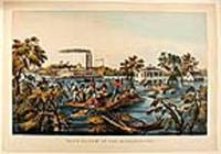
186820565New York: Currier & Ives 1868. Hand-coloured lithograph by James Merrit Ives after Fanny Palmer. A poignant image demonstrating the triumph of the human spirit and depicting the twin stack steam paddle wheel and riverboat "Stonewall Jackson."<br/> <br/>In the foreground uprooted trees bob in the current using a roof as a raft two men pole themselves and nine others to safety one of their companions holds tight to reins of a mule swimming beside the roof whilst two others rescue furniture and a barrel. In the mid-ground: a large white-painted house with second-floor balconies front and back and a smaller cook-house off to the right side. Two men in a row boat approach the back of the house a lady stands on the balcony speaking to the men; on the widow's walk on the roof a man and a woman stand: the man waves a handkerchief to the twin-stack riverboat. The riverboat "Stonewall Jackson" is travelling at speed: the near-side paddle creates a substantial wake the flags fly in the stiff breeze and the smoke from the stacks steams backwards: passengers line the rails attracted by the human drama they are passing. The overall impression is of a crisis that is being survived and dealt with by man's ingenuity whilst life continues.<br/> <br/>Conningham 2819; Gale 3057. Currier & Ives unknown books
180119020London: Printed and Published by Robert Laurie and James Whittle 1801. Folio. 21 1/8 x 15 1/4 inches. Mounted on guards throughout letterpress title verso blank and 1p. index verso blank otherwise engraved throughout. 59 engraved maps on seventy-five mapsheets all hand-coloured in outline 1 map on 3 folding sheets; 14 on 2 folding sheets; 9 on single folding sheets; 34 on single double-page sheets; 1 on a one-page sheet. Contemporary tree calf covers with roll-tool border in gilt the flat spine divided into seven compartments by gilt fillets and roll-tools blue morocco lettering-piece in the second the other compartments with repeat neo-classical decoration of a single centrally-placed tool marbled endpapers<br/> <br/>A very fine copy of the fifth edition of this important atlas of the world including a newly revised chart of world and nine other maps that were not available in the early editions of this spectacular work.<br/> <br/>Eight editions of this work were issued on an almost annual basis from 1796 until 1807. The publishers constantly changed and improved the atlas in an effort to outdo not only their competitors but also to improve on the previous edition. Maps were added the first edition included only 66 map sheets maps were replaced the present work includes two maps dated 1800 including 'A New Chart of the World' dated 25 November 1800 and maps were updated eight maps are dated 1799. The scale of some of the maps is truly spectacular: this atlas contains 15 maps that if joined would form large scale wall maps: 'Asia and its Islands' on three folding sheets ranging from the Arctic regions in the north down through Russia Indonesia and Australia would measure approximately 56 x 46 inches if assembled. The remaining maps on two folding sheets would all be approximately 40 x 46 inches if joined: these include three maps of American interest: 'A new map of the whole continent of America'; 'A new map of North America with the West India Islands'; and 'A map of South America'. The remaining areas that are covered by large scale maps are 'A general map of the World'; England & Wales; Scotland; Ireland; the Netherlands; Germany; Hindoostan; Bengal Bahar etc; Delhi Agrah Oude and Allahabad. This atlas was originally created by Thomas Kitchin. Sayer and Bennett had published the work in 1773 and Laurie and Whittle took over the Sayer business in 1794. They subsequently enlarged the work adding maps and changing the name from the General Atlas to A New Universal Atlas. The maps are based on the work of a variety of mapmakers and surveyors: Thomas Kitchin Thomas Jefferys John Rocque Robert Campbell John Armstrong John Roberts L. S. d'Arcy Delarochette James Rennell Andrew Dury Thomas Pownall and Jean Baptiste Bourguignon d'Anville. Also included is the information gathered as a result of the important Pacific voyages of Captain James Cook George Vancouver and Jean Francois Galaup de La Perouse.<br/> <br/>Phillips Atlases 3534. Printed and Published by Robert Laurie and James Whittle unknown books