Mitchell, Samuel Augustus JrBiblio.com
936 résultats
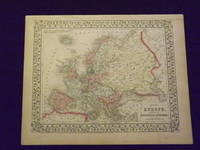
1869103234<p>Unbound colored engraved map decorative border 14"x 11". Slight toning and aging; overall bright and clear and in very good shape. Maps are wrapped with acid free board or in rigid sleeves. The Mitchell family started to produce atlases in 1846 and continued into the early 1890s. Around 1860 S. Augustus Mitchell Jr. took over and the atlas would be called Mitchell's New General Atlas. This is a nice map of Europe from the 1869 installment of that atlas. Despite the large area the map covers there is still a decent amount of detail. Extra postage may be required. Ristow 311-313. # 103234</p>
1870106799<p>Unbound colored engraved map decorative border 14" x 11". Slight toning browning and aging a little soiling in upper margin a couple of chips in upper margin; otherwise bright and clean. Maps are wrapped with acid free board or in rigid sleeves. The Mitchell family started to produce atlases in 1846 and continued into the early 1890s. Around 1860 S. Augustus Mitchell Jr. took over and the atlas would be called Mitchell's New General Atlas. This is an attractive colorful map of Ontario from the 1870 installment of that atlas. The map provides good county detail and part of Quebec New York and Pennsylvania are visible. Extra postage may be required. Ristow 311-13.</p>
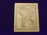
1864106805<p>Unbound colored engraved map decorative border 14" x 11". Slight toning and aging some darkening in lower margin; otherwise bright and clear and in very good condition. Maps are wrapped with acid free board or in rigid sleeves. The Mitchell family started to produce atlases in 1846 and continued into the early 1890s. Around 1860 S. Augustus Mitchell Jr. took over and the atlas would be called Mitchell's New General Atlas. This is an attractive colored map of South America from the 1864 installment of that atlas. The map shows a "New Granada" in an inset. Extra postage may be required. Ristow 311-313. </p>
1869103176<p>Unbound colored engraved map decorative border 14" x 11". Slight toning and aging small tear repaired with archival tape in bottom margin; overall bright and clear and in very good condition. Maps are wrapped with acid free board or in rigid sleeves. The Mitchell family started to produce atlases in 1846 and continued into the early 1890s. Around 1860 S. Augustus Mitchell Jr. took over and the atlas would be called Mitchell's New General Atlas. This is an attractive colored map of South America from the 1869 installment of that atlas. The map shows a "New Granada" in an inset. Extra postage may be required. Ristow 311-313.</p>
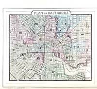
188645711Philadelphia: W.M. Bradley & Bro. 1886. Very good faint toning. Hand colored map. Plate 45: Plan of Baltimore Copyright by S. Augustus Mitchell 1884. 11.25 x 9.5 inches.<br /> <br /> On verso Plates 46 & 47:County Map of the States of Delaware Maryland Virginia and West Virginia with two insets. Copyright by Wm. M. Bradley & Bro. 1884. 22.25 x 14.5 inches.<br /> <br /> On adjacent Plate 48: Plan of the City of Washington The Capitol of the United States of America Copyright by S. Augustus Mitchell 1884. Drawn & engraved by W.H. Gamble. 13.75 x 11.5 inches.<br /> <br /> From: Mitchell's New General Atlas Containing Maps Of The Various Countries Of The World Plans Of Cities Etc. Embraced In Ninety-Three Quarto Maps Forming A Series Of One Hundred and Forty-seven Maps and Plans Together With Valuable Statistical Tables. Also A List Of Post-Offices Of The United States And Territories And Also Census Of 1880 For States Territories And Counties Also Of Cities Of Over 10000 Inhabitants. Philadelphia: Published By Wm. M. Bradley & Bro. No. 1026 Arch Street. 1886. [W.M. Bradley & Bro.] unknown
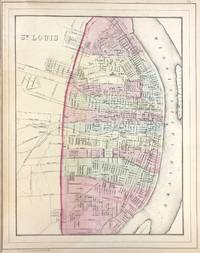
188645719Philadelphia: W.M. Bradley & Bro. 1886. Very good faint toning. Hand colored map. Plate 73: St. Louis. Copyright by S. Augustus Mitchell 1884. 11 x 14 inches.<br /> <br /> On verso Plates 74 & 75: County & Township Map of the States of Iowa and Missouri. Copyright by S. Augustus Mitchell 1884. 21.5 x 14.5 inches.<br /> <br /> From: Mitchell's New General Atlas Containing Maps Of The Various Countries Of The World Plans Of Cities Etc. Embraced In Ninety-Three Quarto Maps Forming A Series Of One Hundred and Forty-seven Maps and Plans Together With Valuable Statistical Tables. Also A List Of Post-Offices Of The United States And Territories And Also Census Of 1880 For States Territories And Counties Also Of Cities Of Over 10000 Inhabitants. Philadelphia: Published By Wm. M. Bradley & Bro. No. 1026 Arch Street. 1886. [W.M. Bradley & Bro.] unknown
1881020528Philadelphia PA: J. H. Butler and Co. 1881. Book. Good-VG. Hardcover. 4to - over 9¾" - 12" tall. Original binding with burgundy cloth library tape neatly mounted along all edges and binding providing durability. Ex-library typically marked and stamped perforation stamp to title page all maps unmarked and intact. Contents somewhat thumbed a bit toned by age. 12 pp. 6 hand-colored map pages containing a total of 11 maps lacking #5 Roman Empire. Rather surprising given incomplete state that this copy has not yet been sacrified to the plate-breakers. J. H. Butler and Co. Hardcover
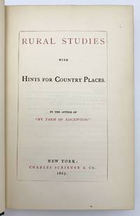
1867406583New York: Charles Scribner & Co 1867. A near fine copy with some light wear to gilt at foot of spine and pale discoloration to endpapers. 8vo 18.8 x 12 cm. 295 pages. 3-page advertisements at end. Original green cloth gilt-lettered on spine. FIRST EDITION BAL's first state with final page of Preface paged iv. The book's aim according to its preface "is to stimulate those who live in the country or who love the country to a fuller and wider range of thinking about the means of making their homes enjoyable. I have especially sought to excite the ambition of those holders of humbler estates who believe that nothing can be done in the way of adornment of country property except under the eye of accomplished gardeners." BAL 13944. Charles Scribner & Co unknown
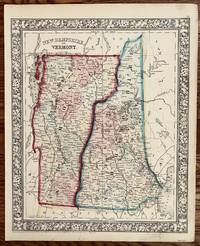
1862243Philadelphia: S. Augustus Mitchell 1862. 13 3/4 x 11 1/4. Very good. Very nice bright contemporary outline color. The counties are delineated by different full wash color. A very nice specimen of the mapmakers art during the Civil War. S. Augustus Mitchell unknown
1898909Z7None stated: The Society of Antiquaries of Scotland 1898. Leather. Very Good. 9" by 7". None. A scarce collection of chapters from the 'Proceedings of the Society of Antiquaries of Scotland' written by Arthur Mitchell describing the Scottish tours of Robertson and Loch. Segments from 'The Proceedings of the Society of Antiquaries of Scotland Volume 32'. Bound in quarter calf with cloth to the boards. A scarce work. This volume features a selection of chapters on the Scottish tours of James Robertson and David Loch written by Arthur Mitchell an antiquarian and doctor of mental illness. The chapters are taken from the yearly journal of 'The Society of Antiquaries of Scotland'. Bound in quarter calf with cloth to the boards. Externally generally smart with fading to the spine slight rubbing and bumping to the extremities and small closed tears to the tail of the spine. Offsetting to the endpapers. Internally firmly bound with clean and generally bright pages. Very Good The Society of Antiquaries of Scotland hardcover
18950176691895. Hardcover. Near Fine. New York: The Century Company 1895. Hardcover. Book Condition: Near Fine with minor edge wear. No Jacket. 1st Edition second or third printing unknown. Scarce first edition of this elusive Mitchell title. Original embossed leather with marbled endpapers and gilt edges and 1897 date on title and copyright pages with no addditional printings listed. <br/> <br/> hardcover
1897155962Glasgow: James MacLehose and Sons 1897. 1st edition. Very Good. small octavo. hardback in original cloth 141pp. John Oswald Mitchell 1826-1904 was a Scottish writer who compiled this non-fiction work regarding 18th century Scotland on the grounds of Burns' poetry with chapters detailing all aspects of life including politics agriculture fashion food and drink religion and superstition. Boards rather worn & spine partially stripped but internally very good indeed. Scarce James MacLehose and Sons hardcover
18381244E020London: John Murray 1838. 1st Edition . Hardback. Printed pages: 8vo. xx 290. Very Good. 5.75 x 8.5 inches 14.5 x 22 cm. Scarce first printing of the Thomas Mitchell edited edition. Later blue cloth binding with red speckled page edges. Browning to first and last blank. Foxing to first and last couple of pages. A few occasional spots and marks to the text. A few pencilled notes. Previous owner's name to leading blank. Greek text with notes in English. Overall condition is Very Good. Size: 5.75 x 8.5 inches 14.5 x 22 cm. John Murray hardcover
1889k6011London: The Religious Tract Society. G : in good condition without dust jacket. Covers rubbed and lightly marked. Corners bumped. Previous owner's inscription to fep. Light foxing to prelims. Marginal closed tear to one rear page. Aeg. 1889. First Edition. Green/gilt hardback cloth cover. 290mm x 200mm 11" x 8". 223pp 7pp ads. 3 maps; 124 b/w illustrations. . The Religious Tract Society hardcover
183915361839. Lithograph. 220mm by 135mm sheet. Lithograph. From 'Three Expeditions into the Interior of Eastern Australia; With Descriptions Of the Recently Explored Region of Australia Felix and of the present colony of New South Wales' by Sir Thomas Livingstone Mitchell. Published by T and W Boone 1839. <br /> Light foxing more noticeable on the reverse of the sheet. Waterstain at bottom of the sheet. unknown
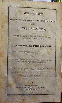
1836021344Philadelphia: Mitchell & Hinman 1836. First Edition. Hardcover. Lacks as usual the scarce accompanying map. Very Good. Contemporary half calf and marbled boards; 342 pages. Population and census data by county. Early bookplate on front pastedown and signature on front endpaper of John F. Fager of Harrisburg. <br/><br/>Samuel Augustus Mitchell and his sons were the leading publishers of maps in the United States during most of the nineteenth century. Mitchell had come to Philadelphia around 1830 with the intention of improving the standard of geography textbooks. A New American Atlas published in 1831 was his first work. Then in 1845 he acquired the rights to Tanner's New Universal Atlas and in 1846 he published his first edition of the present work. Mitchell continued to publish the atlas until 1850 when he sold the copyright to Cowperthwaite & Co. of Philadelphia who continued to publish it until the mid-1850s when It was purchased by Charles DeSilver. <br /> Mitchell & Hinman hardcover
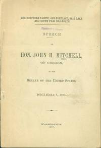
1877228588n.p. 1877. First Edition. Pamphlet. 27 pages. A speech in favor of a bill to extend the time for the construction and completion of the Northern Pacific Railroad and a readjustement of the grants to secure the construction of the Portland Salt Lake and South Pass Railroad. The proposal was to re-route the Portland connection of the transcontinental railroad from the Columbia and Snake Rivers to a route between Umatilla Oregon and Salt Lake City. By all appearances the new railroad company never went into operation. First edition first printing. A good copy folded twice perhaps for mailing. Wrappers separating and spine and neatly repaired with tissue.<br> (n.p.) unknown
1850198432New York: Baker and Scribner 1850. First edition. Foxing and some modest loss at the crown a Very good copy. Baker and Scribner unknown
1845266893United Kingdom: Simpkin Marshall & Co 1845. Book. Very Good. hardback. hardback small octavo blind stamped deep green cloth lettered gilt to spine cloth mildly faded to the leading edge of the boards the binding remains tight bookplate of a previous owner to the front pastedown figures to the text and with folding Tables viii 140 26 pp ads. Simpkin, Marshall & Co Hardcover
1864GEN2-D-7New York: Charles Scribner 1864. Cloth. Very Good. 8" by 5". None. A work of farming history from rural America written by the author and essayist Donald Mitchell. Written by the writer and novelist Donald Grant Mitchell. Many of his works were published under the pen name Ik Marvel. His works often include rural themes and travel writings. He was best known as the author under the pseudonym of "Ik Marvel" of the sentimental essays contained in the volumes Reveries of a Bachelor or a Book of the Heart 1850 and Dream Life a Fable of the Seasons 1851. His other works include About Old Story-tellers 1878 and American Lands and Letters 1897-1899. In this work Mitchell discusses his own farm Edgewood located in New Haven Connecticut. In a full cloth binding with gilt detailing to the spine. Externally generally smart. Light bumping to the head and tail of the spine and also to the extremities. Mild patches of rubbing to the boards and joints. Front and rear hinges are strained but firm. There are bookplates to the pastedown and front blank-end paper. Internally generally firmly bound with the cords visible in several places throughout the volume. Page are generally clean with the occasional handling marks and spots to several pages. Very Good Charles Scribner hardcover
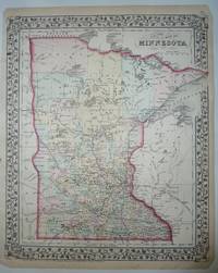
18758358New York: S. Augustus Mitchell. Very Good. 1875. Map. Hand-colored map of Minnesota from Mitchell's New General Atlas. A pretty map with the state outlined in red the counties colored in pastel green yellow and rose all with a floral border and suitable for framing. The map shows cities counties lakes and rail lines ; Hand-colored Map; 11.50 x 14.0" . S. Augustus Mitchell unknown
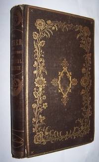
185642070Boston: Gould and Lincoln. 1856. Hardcover. Very Good. 8vo; xii 254 6 pages; Contents clean and secure in original brown cloth binding with extensive gilt decoration and lettering to spine and both boards. Lovely floral borders in gilt. All edges gilt. Engraved frontispiece of mother and son in the garde in front of their cottage. Cloth worn at ends of spine. Similar to OCLC: 16725404 The author John Mitchell 1794 – 1870 was an American minister and author. He was the son of John and Abigail Waterhouse Mitchell and was born in Chester Conn. in 1794. He graduated from Yale College in 1821 then entered Andover Theological Seminary. In January 1824 he became the editor of the Christian Spectator of New Haven. Some of his writings include The New England Churches; Notes from Over Seas 2 vol.; Scenes and Characters in College; My Mother or Recollections of Maternal Influence; and Rachel Kell. From a contemporary advertisement: "This is one of the most charming books that has been issued from the press for a long period. It is the picture of a quiet New England Family so drawn and colored as to subserve the important ends of domestic education. A writer of wide celebrity says of the book in a note to the publisher -- It is one of those rare pictures painted from life with the exquisite skill of one of the old masters which so seldom present themselves to the amateur." . Gould and Lincoln hardcover
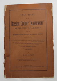
189422135Wellington: Printed by the New Zealand Times Company. Fair with No dust jacket as issued. 1894. First Edition. Softcover. Chips to spine and margins of front wrapper. Lacking the rear wrapper. Internally good. Staples rusted. ; Uncommon. xiv 15-39 1 pages 6 pages advertisements. Printed brown paper front wrapper lacking the rear wrapper. Page dimensions: 210 x 138mm. Title continues: "Enumerating the Naval and Military Forces of the European Powers and the Colonies List of Royal Naval Reserve Merchant Cruisers and Opinions of Lord Salisbury Lord Brassey Capt. Eardley Wilmot Lord Charles Berefesford Lord Roberts and Other Prominent Statesmen and Experts on the War Problem." Reference: Bagnall L1706. . Printed by the New Zealand Times Company paperback
184715492New York: Harper & Brothers 1847. 336 pp. Original brown cloth covers w/ gilt title on spine. Binding moderately soiled w/ wear to extremities. Covers slightly cocked. Faint dampstains and light foxing throughout. First Edition. Hard Cover. Fair to Good-/No Dust Jacket. 8vo - over 7¾" - 9¾" tall. Harper & Brothers Hardcover
1864101300<p>Philadelphia 1864. Unbound colored engraved map decorative boarder 14"x 11". Slight toning and aging minor chip in margin; otherwise bright and clear and in very good shape. Maps are wrapped with acid free board or in rigid sleeves. The Mitchell family started to produce atlases in 1846 and continued into the early 1890s. Around 1860 S. Augustus Mitchell Jr. took over and the atlas would be called Mitchell's New General Atlas. This is colorful attractive map of France Spain and Portugal from the 1864 installment of that atlas. Nicely presented color and detail. Ristow 311-313 Phillips 907</p> S. Augustus Mittchell,