936 résultats
1880161118002sltJ.B. Lippincott Company 1880. 1st edition. Hardcover. Read but in very good condition. First edition green cloth over boards some scuffing and rubbing to the cover bookplate on the inside cover text is clean and unmarked binding is tight. Brick and mortar bookshop since 1975! J.B. Lippincott Company hardcover
1898138293NY: MERRILL AND BAKER PUB. Good. 1898 verso. HARDCOVER. Nois. 7x9" thick. quite nice.spine strip repaired but entire rest of book is very nice clean solidbright with LEATHER POINTS AND QUARTERBOUND LEATHER TO MARBLED HARD COVERS. ATTRACTIVE MARBLED ENDPAPERS. SPINE HAS BEEN REPAIRED TO RESTORE THE BROWN ORIGINAL COLOR & MOST OF THE GOLD TITELING HAS SURVIVED ; PABE 5999 SHOWS ART PAINTING BY W. OVERAND."A FOOTBALL MATCH".as from Athletics and fotball NOISBN. ; 5849-6336pg pages; Leather tips & partial spine strip . MERRILL AND BAKER PUB hardcover
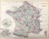
188645706Philadelphia: W.M. Bradley & Bro. 1886. Very good closely cropped margins light soiling. Hand colored map. 15 x 11.5 inches. Plate 110. France with insets of Environs of Paris ; Switzerland in cantons; and Corsica. Copyright by S. Augustus Mitchell 1884<br /> <br /> From: Mitchell's New General Atlas Containing Maps Of The Various Countries Of The World Plans Of Cities Etc. Embraced In Ninety-Three Quarto Maps Forming A Series Of One Hundred and Forty-seven Maps and Plans Together With Valuable Statistical Tables. Also A List Of Post-Offices Of The United States And Territories And Also Census Of 1880 For States Territories And Counties Also Of Cities Of Over 10000 Inhabitants. Philadelphia: Published By Wm. M. Bradley & Bro. No. 1026 Arch Street. 1886. [W.M. Bradley & Bro.] unknown
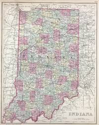
188645718Philadelphia: W.M. Bradley & Bro. 1886. Very good faint toning. Hand colored map. 11 x 14 inches. Plate 68: Indiana. Copyright by S. Augustus Mitchell 1884. <br /> <br /> From: Mitchell's New General Atlas Containing Maps Of The Various Countries Of The World Plans Of Cities Etc. Embraced In Ninety-Three Quarto Maps Forming A Series Of One Hundred and Forty-seven Maps and Plans Together With Valuable Statistical Tables. Also A List Of Post-Offices Of The United States And Territories And Also Census Of 1880 For States Territories And Counties Also Of Cities Of Over 10000 Inhabitants. Philadelphia: Published By Wm. M. Bradley & Bro. No. 1026 Arch Street. 1886. [W.M. Bradley & Bro.] unknown
188645714Philadelphia: W.M. Bradley & Bro. 1886. Very good faint soiling and toning. Hand colored map. 14 x 11.5 inches. Plate 57: North and South Carolina with insets Plan of Charleston; and Map of Charleston Harbor. Copyright by S. Augustus Mitchell 1884.<br /> <br /> From: Mitchell's New General Atlas Containing Maps Of The Various Countries Of The World Plans Of Cities Etc. Embraced In Ninety-Three Quarto Maps Forming A Series Of One Hundred and Forty-seven Maps and Plans Together With Valuable Statistical Tables. Also A List Of Post-Offices Of The United States And Territories And Also Census Of 1880 For States Territories And Counties Also Of Cities Of Over 10000 Inhabitants. Philadelphia: Published By Wm. M. Bradley & Bro. No. 1026 Arch Street. 1886. [W.M. Bradley & Bro.] unknown
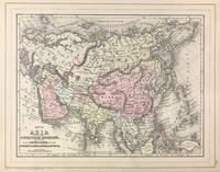
188645703Philadelphia: W.M. Bradley 1886. Very good light soiling primarily to margins. Hand colored map. Plate 115: Map of Asia Showing its Gt. Political Divisions and also the Various Routes of Travel Between London & India China & Japan &c constructed & engraved by W. Williams Philadelphia. Copyright by S. Augustus Mitchell 1884. 13.5 x 10.5 inches.<br /> <br /> On verso Plate 116: Map of Persia Arabia Turkey in Asia Afghanistan Beloochistan. Copyright by S. Augustus Mitchell 1884. 13.5 x 10.5 inches.<br /> <br /> From: Mitchell's New General Atlas Containing Maps Of The Various Countries Of The World Plans Of Cities Etc. Embraced In Ninety-Three Quarto Maps Forming A Series Of One Hundred and Forty-seven Maps and Plans Together With Valuable Statistical Tables. Also A List Of Post-Offices Of The United States And Territories And Also Census Of 1880 For States Territories And Counties Also Of Cities Of Over 10000 Inhabitants. Philadelphia: Published By Wm. M. Bradley & Bro. No. 1026 Arch Street. 1886. [W.M. Bradley] unknown
1864106096<p>Unbound colored engraved map decorative border 14" x 11". Slight toning and aging; otherwise bright and clear and very good. Maps are wrapped with acid free board or in rigid sleeves. The Mitchell family started to produce atlases in 1846 and continued into the early 1890s. Around 1860 S. Augustus Mitchell Jr. took over and the atlas would be called Mitchell's New General Atlas. This is a detailed single page map of Brazil Chilli and Bolivia from the 1864 installment of this atlas. Uncludes inset showing the harbor of Rio Janeiro. Colorful and attractive. Ristow 311-313.</p>
1870106097<p>Unbound colored engraved map decorative border 14" x 11". Slight toning and aging a few margin chips and folds; otherwise bright and clear and very good. Maps are wrapped with acid free board or in rigid sleeves. The Mitchell family started to produce atlases in 1846 and continued into the early 1890s. Around 1860 S. Augustus Mitchell Jr. took over and the atlas would be called Mitchell's New General Atlas. This is a detailed single page map of Brazil Chilli and Bolivia from the 1870 installment of this atlas. Uncludes inset showing the harbor of Rio Janeiro. Colorful and attractive. Ristow 311-313.</p>
1840106603<p>Engraved colored map 9" x11 1/2" Box like cartouche with map information. Some soiling perhaps a little margin foxing small holes in left margin where map was bound not affecting image some aging and browning otherwise very good. Attractive little map with plenty of detail and some decent color. From a school and family geography. </p> S. Augustus Mitchell,
186715Philadelphia: Mitchell S. Augustus 1867. 1867 edition. 13 1/2 x 10 3/4 inches. Very Good. Mitchell S. Augustus. Contemporary colored lithograph map of Soth American countries. Suitable for framing. Mitchell, S. Augustus unknown
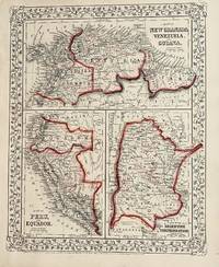
1861106100<p>Unbound colored engraved map decorative boarder 14"x 11". Slight toning and aging a few margin chips on margin edge; overall bright and clear and in very good shape. Maps are wrapped with acid free board or in rigid sleeves. The Mitchell family started to produce atlases in 1846 and continued into the early 1890s. Around 1860 S. Augustus Mitchell Jr. took over and the atlas would be called Mitchell's New General Atlas. This is a colorful map of several South American countries including Peru Venezuela and Argentina from the 1861 installment of that atlas. The map is colorful and has a fair amount of detail. Ristow 311-313.</p>
1869106105<p>Unbound colored engraved map decorative boarder 14" x 11". Slight toning darkening and aging bottom margin narrow upper margin with a few edge chips and a little rough; still fairly bright and clean and in very good condition. Maps are wrapped with acid free board or in rigid sleeves. The Mitchell family started to produce atlases in 1846 and continued into the early 1890s. Around 1860 S. Augustus Mitchell Jr. took over and the atlas would be called Mitchell's New General Atlas. This is an attractive hemispheric map of the world from the 1869 installment of that atlas. Ristow 311-313.</p>
1870106106<p>Unbound colored engraved map decorative boarder 14" x 11". Slight toning darkening and aging top and bottom margina little narrow but still ample; otherwise fairly bright and clean and in very good condition. Maps are wrapped with acid free board or in rigid sleeves. The Mitchell family started to produce atlases in 1846 and continued into the early 1890s. Around 1860 S. Augustus Mitchell Jr. took over and the atlas would be called Mitchell's New General Atlas. This is an attractive hemispheric map of the world from the 1870 installment of that atlas. Ristow 311-313.</p>
185818910Philadelphia: E. H Butler & Co. 1858. Hardcover. Fair worn covers except one double page map is loose with a tear in the Gulf of Mexico notes and names - most are in pencil - written on the blank pages and in some page margins moderate soiling and toning. The first four maps of 32 large and small maps originally present are missing. Texas map is present. Binding is intact. Oversize. ; Engraved color maps. . E. H Butler & Co. hardcover
1867001031Scribners: 1867. First published in 1867 this book is the 1884 printing 295 pages this is a re-issue of "RURAL STUDIES" "I have especially sought to excite the ambition of the holders of these humble estates who believe nothing can be done in the way of adornment of country property. The book is a tract for homeliness; and I hope it may make country proselytes." FINE- HARDCOVER. Hard Cover. Fine-/Not Issued with a Dust Jacket. 8vo - over 7¾" - 9¾" tall. Scribners: Hardcover
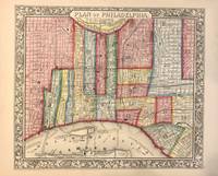
1862321541Philadelphia: Mitchell Samuel Augustus Jr. 1862. unbound. WILLIAMS Wellington. Map. Engraving with original hand coloring. Image measures 11 7/8" x 12 5/8"<br/> <br/> This vibrantly colored city plan or town plan of Philadelphia Pennsylvania is one of the most beautiful maps of Philadelphia to be included in a 19th century atlas. Map features center city Philadelphia between the Delaware and Schuylkill Rivers and extending from Norris Avenue in the north to Morris Avenue in the south along the Delaware River. Shows streets notable buildings parks railroads and ferry and steamboat routes. Stains to lower margins. <br> <br> Samuel Augustus Mitchell Sr. 1792-1868 was one of the leaders in American cartography of the 19th century and pioneered the conversion of engraved map plates to more affordable lithographic plates. His son Samuel Augustus Mitchell Jr. continued his father's successful mapmaking and publishing business and was one of the most prolific and renowned 19th century American publishers.<br/> <br/> Mitchell, Samuel Augustus Jr. unknown
1860145Philadelphia: Mitchell S. Augustus 1860. 13 1/2 x 10 1/2 inches. Very good. Classic Mitchell presentation on a small scale. It shows the Northern Ocean with Norway in the west and Asia in the east. The Adriatic in the southwest and the Caspian in the southeast frame out the presentation. Two inset maps adorn the western section. Denmark is shown in the upper window. A Map of Belgium and Holland occupies the lower left. This is an excellent cartographic artifact. Mitchell, S. Augustus unknown
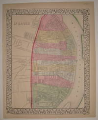
1867227682Philadelphia: Mitchell Samuel Augustus Jr. 1867. unbound. very good. Map. Engraving with original hand coloring. Image measures 13.75" x 11".<br/> <br/> Nice map of St. Louis colored according to wards. Shows streets railroads and public parks. In very good condition with a small tear and chi to bottom edge. S. Augustus Mitchell Jr. continued his father's successful mapmaking and publishing business and was one of the most prolific and renowned 19th century American publishers.<br/> <br/> Mitchell, Samuel Augustus Jr. unknown
1890H2030London: Sonnenschein 1890. Hardcover. Very Good. No date on title page ca. 1890 red cloth stamped in black 254 pp very good solid copy. Covers the history chemistry economics affects and medical aspects of alcohol and then turns a scholarly eye to the wisdom of the Temperance movement.q. Sonnenschein hardcover
188334583Boston: Houghton Mifflin 1883. Hardcover. Near Fine. Two small stains on the rear board some light overall wear and owner name on front fly else near fine. Houghton Mifflin hardcover
1900184738New York: The Century Co 1900. Hardcover. G ex-library. Spine is faded has labels. Bookplate blind stamp pocket inside. Pages are clean and tight. Black boards gilt lettering cover/spine. v pages 1 leaf 47 pages. Nice reference or reading title. The Century Co hardcover
1871D17731Philadelphia: J.B. Lippincott & Co. 1871. Hardcover. Fair. 8vo. 59 pp. Original brown cloth lettered in gilt. Dampstaining to boards bubbling to front chips to spine internally very good. Sold as is. <br/><br/> J.B. Lippincott & Co. hardcover
188706-2059Philadelphia: J. B. Lippincott Co. 1887. 76pp slight soiling & shelfwear to cover. Cloth. Very Good -/No Jacket. J. B. Lippincott Co. Hardcover
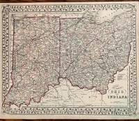
1882180Philadelphia: Bradley 1882. 21 1/4 x 14 1/4 inches. Very good condition. Detailed map of the states of Indiana and Ohio on two pages published just prior to the establishment of the Interstate Commerce Commission. The significant railroads are laid out for the reader to behold. The overall pattern reflects the great connectivity experience on the eve of the introduction of the inter-urban. Each county is designated with its appropriate color in this trip-color scheme. The hubs of connection lie within the river and lake ports along with the each states capital. The grapevine exterior neatline borders provides aa attractive presentation in this important transportation map. Bradley unknown
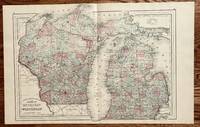
1882418Philadelphia: S. Augustus Mitchell 1882. 20 1/2 x 15 inches. Very good condition. Lake Michigan bisects this cartographic production. The two states Michigan and Wisconsin bifurcate the cartographic presentation. Obviously the compiler of the map was intent on showing the common bodies of water. Lake Superior and Lake Huron are also shown The lower sections of both states show significant development. The upper sections of woodlands have limited railroad penetration. Overall this nicely presented map is not a cartographic curiosity but rather a well done transportation map. What is lacking is the tracking of major water routes within the lakes. Theis is a very decorative map. S. Augustus Mitchell unknown