425 résultats
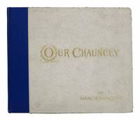
189144175New York: New York Printing Co. The Republic Press Publishers 1891. 1st edition thus Revised and Freshened with Notes by the Author. Original publisher's blue cloth spine over silver patterned paper covered boards with gilt stamped lettering. Green patterned paper paste-downs. Shelf & edgewear. Bookplate & booklabel to front paste-down. Age-toning to free eps. Removed library pocket from rear paste-down. About Very Good. 45 1 pp. Index at rear. Partially unopened. Frontis of Depew. Oblong format: 8" x 9-3/8" <br/><br/> New York Printing Co. (The Republic Press) Publishers hardcover books
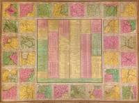
1842270733Philadelphia: S. Augustus Mitchell 1842. unbound. Map. Lithograph with original hand coloring. Sheet measures 25.5" x 34.75.<br/><br/> This 1842 case map by Samuel Augustus Mitchell offers a wealth of information about the United States. The centre of the page includes statistical data from 1840 relating to population manufacturing canals exports railroads agriculture mining rivers etc. This information is surrounded by 32 maps of major cities. Some of these include Cincinnati Detroit New York Charleston Washington New Orleans Hartford and Richmond among others. Each map is surrounded by an ornate border. This map is the pocket map version of a larger wall map. In good condition with some wear along the original folds. Some foxing and toning at places. Lined with Japanese tissue.<br><br>Samuel Augustus Mitchell Sr. 1792-1868 is one of the pioneers in American cartography of the 19th century and led the conversion of engraved map plates to more affordable lithographic plates. Bold design and hard to find.<br/><br/> S. Augustus Mitchell unknown books
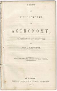
184854560New-York: Greeley & McElrath 1848. First separate edition 8vo pp. 32; removed from binding wrappers perished fore-margin trimmed close and several leaves with loss to the final letter in each line sense remains clear; else very good. A graduate of West Point Mitchel 1810-62 became professor of mathematics philosophy and astronomy at Cincinnati College in 1836. There he reluctantly began giving public lectures. These proved so successful that he embarked upon lecture tours throughout the country speaking to capacity audiences. The proceeds from these lectures enabled Mitchel to form an astronomical society with the aim of building a first-class observatory. At the time of its completion in 1845 it was the finest observatory in the United States. John Quincy Adams 77 and in ill health traveled to Cincinnati for the dedication delivering the last public speech of his career. The site of the observatory Mt. Ida was renamed Mt. Adams in his honor. For his efforts as teacher public speaker and astronomer Mitchell earned "a permanent place in the annals of American science" DAB. See also the entry in ANB Online. <br/><br/> Greeley & McElrath unknown books
183756841Lexington: Finnell & Zimmerman 1837. 12mo pp. 22 2; removed from binding wrappers wanting; an ink stain on the back of the pamphlet has eaten through the gutter and caused loss of text on the last 6 leaves pencil equations on blank leaf; fair. Mitchell was a zealous reformer of the medical profession and of society at large earning him a reputation as a "narrow-minded bigoted presumptuous puritanical Presbyterian" DAB. He served on the faculty of Transylvania University from 1837 to 1849. Wellcome NLM Transylvania Kentucky Cincinnati History Library and Texas in OCLC. <br/><br/> Finnell & Zimmerman unknown books
182655011New York: G. & C. Carvill 1826. First edition 8vo pp. 67 1; removed from binding wanting wrappers; old pressure stamp on title page else very good. Mitchell 1764-1831 a.k.a. "living encyclopaedia" and "Congressional Dictionary" was an American physician and naturalist educated in Edinburgh who taught at Columbia and later at the College of Physicians and Surgeons of New York. He also served in Washington as both a Representative and a Senator and was a great admirer of Jefferson. American Imprints 25406; Sabin 49741. <br/><br/> G. & C. Carvill unknown books
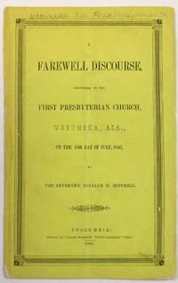
185021873Tuscumbia AL: Printed by William Rollston "North Alabamian" Office 1850. 21 3 blank pp. Original printed yellow wrappers light dust and edgewear a few small chips to back wrap stitched. Accession number stamped in blank margin of title page. Errata slip tipped in after the title page. Light vertical crease through center of text Very Good. <br/><br/> Tuscumbia birthplace of Helen Keller is located in the foothills of the Appalachians in Northern Alabama west of Huntsville and just South of Florence. Imprints from this little town are unusual; OCLC which does not record this one locates only a few Tuscumbia imprints and fewer before 1850. <br/>Owen 1062. Not in Ellison Sabin or on OCLC as of October 2019. Printed by William Rollston, "North Alabamian" Office unknown books
183859015Northampton: J. H. Butler 1838. Hardcover. Good. 300p. plus 4p. publisher's adverts. Cloth. 16cm. Substantial foxing. Ex library. Substantially expanded version of a book first published in 1835 and titled "The Practical Church Member ." <br/><br/> J. H. Butler hardcover books
1883116336New York: Dodd Mead and Company 1883. Hardbound. Very clean and tight but with ex-lib. sticker on spine and bookplate inside front cover; found one page with pencil notation; slight wear to edges of spine;. Brown cloth with gilt lettering decoration and floral motif; 766 pp. with 295 illustrations and 6 plates in phototype;. Covers the sculpture of Egypt Western Asia including Persia Ancient Greece the Age of Pheidias and Polycleitos the Age of Scopas Praxiteles and Lysippos the Hellenistic Age and Ancient Italy; with notes indeces and a table of museums. Dodd, Mead and Company hardcover books
188316075New York: Dodd Mead 1883. First Edition. hardcover. very good. 6 plates 295 text illustrations. 766pp. Tall 8vo original gilt decorative rust cloth joints expertly rehinged; ex-lib. New York: Dodd Mead 1883. Very good.<br/><br/> Dodd Mead unknown books
18958707New York: The Century Co 1895. 1st. Hardcover. Collectible; Very Good. The 1895 1st edition in its decorative light-brown suede. Clean and VG with patterned blindstamping to the panels. 64mo miniature 165 pgs. all edges gilt. An elegant celebration of the Portuguese wine Madeira. <br/><br/> The Century Co hardcover books
188730141Boston & New York: Houghton Mifflin 1887. First edition 8vo pp. 1 ads 6 63; title-page vignette original quarter cream cloth over cream boards printed paper spine label; binding is soiled a couple small chips to spine label endpapers discolored; overall a good sound copy with the signature of Shakespearean actor Edward Smith Willard on front pastedown. <br/><br/> Houghton, Mifflin hardcover books
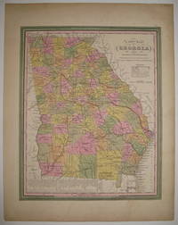
1846219154Philadelphia: S. Augustus Mitchell 1846. unbound. very good. Map. Lithograph with original hand coloring. Image measures 13 7/8" x 11 3/8".<br/><br/> Great map of Georgia showing all counties railroads major routes and waterways. A table at the bottom of the page lists steam boat routes. Minor overall toning one small tear to bottom edge and a crease to upper left corner. Samuel Augustus Mitchell Sr. 1792-1868 is one of the pioneers in American cartography of the 19th century.<br/><br/> S. Augustus Mitchell unknown books
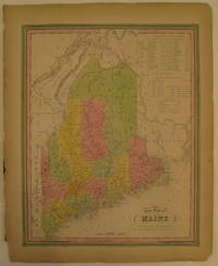
1846232149Philadelphia: H. N. Burroughs 1846. First. unbound. Map. Lithograph with original hand coloring. Image measures 14 7/8" x 12".<br/><br/> Excellent map of Maine showing all counties railroads major routes and waterways. Two tables at the top of the page list population over time. Small chips to lower margin not affecting the image. Samuel Augustus Mitchell Sr. 1792-1868 is one of the pioneers in American cartography of the 19th century. From the first edition of Mitchell's seminal New Universal Atlas.<br/><br/> H. N. Burroughs unknown books
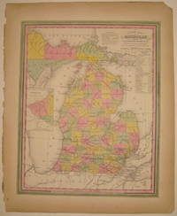
1846232287Philadelphia: H. N. Burroughs 1846. First. unbound. Map. Lithograph with original hand coloring. Image measures 14 3/8" x 11 7/16".<br/><br/> Wonderfully graphic and colorful map of Michigan amidst four Great Lakes. The map includes towns and roads in addition to canals drawn in blue and railroads drawn in orange. A small inset on the left depicts the western part of the state. Beneath the title two tables list steam boat routes from Detroit to Fort Gratiot and Fort Howard. The map is in good condition with only minor chips along the binding edge of the paper outside the margin. Samuel Augustus Mitchell Sr. 1792-1868 published this map as part of the first edition of his seminal New Universal Atlas. Mitchell is one of the pioneers in American cartography of the 19th century and led the conversion of engraved map plates to more affordable lithographic plates. First edition if this classic map.<br/><br/> H. N. Burroughs unknown books
1865103232<p>Unbound colored engraved map decorative boarder 14" x 11". Slight toning and aging a couple of nicks or chips in left margin; otherwise bright and clear. Maps are wrapped with acid free board or in rigid sleeves. The Mitchell family started to produce atlases in 1846 and continued into the early 1890s. Around 1860 S. Augustus Mitchell Jr. took over and the atlas would be called Mitchell's New General Atlas. This is a very attractive single page map of Palestine and the Holy Land from the 1865 installment of that atlas. This map is probably one of the more attractive versions of this map from the Mitchell series. Modern Jerusalem is shown in an inset. Extra postage may be required. Ristow 311-313. </p> books
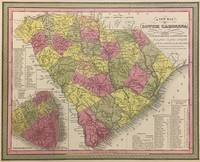
1848293169Philadelphia: S. Augustus Mitchell 1848. unbound. Map. Lithograph with original hand coloring. Image measures 11 1/4" x 14".<br/><br/> Beautifully detailed first edition map of South Carolina divided into counties. The map delineates towns waterways railroads and major routes as explained in a small key at the bottom right. Canals and railroads are marked. Also included are insets of Charleston and a table of distances. The map is in good condition with minor toning. <br><br>Samuel Augustus Mitchell Sr. 1792-1868 published this map as part of the 1848 edition of his seminal New Universal Atlas. Mitchell is one of the pioneers in American cartography of the 19th century and led the conversion of engraved map plates to more affordable lithographic plates.<br/><br/> S. Augustus Mitchell unknown books
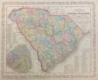
1856293171Philadelphia: S. Augustus Mitchell 1856. unbound. Map. Lithograph with original hand coloring. Image measures 11 1/4" x 14 1/4".<br/><br/> Beautifully detailed first edition map of South Carolina divided into counties. The map delineates towns waterways railroads and major routes as explained in a small key at the bottom right. Canals and railroads are marked. Also included are insets of Charleston and a table of distances. The map is in good condition.<br><br>Samuel Augustus Mitchell Sr. 1792-1868 published this map as part of the 1856 edition of his seminal New Universal Atlas. Mitchell is one of the pioneers in American cartography of the 19th century and led the conversion of engraved map plates to more affordable lithographic plates.<br/><br/> S. Augustus Mitchell unknown books
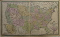
1855207430Philadelphia: Cowperthwait Desilver & Butler 1855. unbound. very good. Young J.H. Map. Engraving and lithograph with original hand coloring. Image measures 16" x 26.25".<br/><br/> Beautifully detailed map of the United States including insets of the Gold Region of California and the District of Columbia. Shows states and territories towns and cities major routes historic trails topographical features and mountain heights waterways battle sites and railroads completed and projected. Light creases to right corners. Samuel Augustus Mitchell Sr. 1792-1868 is one of the pioneers in American cartography of the 19th century.<br/><br/> Cowperthwait, Desilver & Butler unknown books
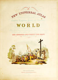
1852WRCAM31820APhiladelphia: Thomas Cowperthwait & Co. 1852. Chromolithographic title with large vignette; handcolored frontispiece of heights of principal mountains and lengths of principal rivers; contents list printed in red black and gold; seventy-three handcolored lithographic maps charts and city plans one double-page. Folio. Publisher's three-quarter red morocco and marbled boards spine ruled in gilt morocco label lettered in gilt on front board. Binding worn and rubbed front hinge tender. Contemporary bookplate on front pastedown. Some toning but generally clean internally. Very good overall. A famous atlas with handcolored maps of all the individual states and territories with the map of California showing counties in California and New Mexico for the first time and with the locations of Native American tribes shown in several western states and territories. Despite its title the atlas concentrates to a marked degree on the American continent with forty-three maps of the area including a fine double-page coast- to-coast map of the United States. <br> <br> S. Augustus Mitchell and his sons were the leading publishers of maps in the United States during most of the 19th century. Mitchell had come to Philadelphia round 1830 with the intention of improving the standard of geography textbooks Philadelphia then being the leading city in America for cartographical publications. A NEW AMERICAN ATLAS published in 1831 was his first work. In 1845 he acquired the right to Tanner's NEW UNIVERSAL ATLAS first published in 1836 and in 1846 he published his first edition of the present work. Mitchell continued to publish the atlas until 1850 when he sold the copyright to Cowperthwait & Co. of Philadelphia. Thomas Cowperthwait & Company published it until 1856 when it was purchased by Charles DeSilver. The Cowperthwait company continued to add edit alter and hand-color the maps. PHILLIPS ATLASES 807. RISTOW pp.311-13 ref. RUMSEY 553. Thomas, Cowperthwait & Co. hardcover books
1852236680Philadelphia: Thomas Cowperthwait & Co 1852. Chromolithograph title hand-colored frontispiece 73 hand-colored lithographic maps. 1 vols. Folio. Half red morocco in period style original marbled boards with printed label on upper cover very clean. Chromolithograph title hand-colored frontispiece 73 hand-colored lithographic maps. 1 vols. Folio. Mitchell & Sons first published their NEW UNIVERSAL ATLAS in 1846 having acquired Tanner's NEW UNIVERSAL ATLAS in 1845 and printed it several times subsequently until 1850 when the firm sold the rights to Cowperthwait & Co. of Philadelphia who published it until 1856 continually adding to and editing the hand-colored maps. Despite the attribute "Universal" in the title the Atlas clearly concentrates on America with 43 maps of the continent and features a large double-page transcontinental map of the U.S; and this 1852 Cowperthwait edition is the first to show counties in California and New Mexico. Phillips 809; Ristow pp.311-13; Rumsey p.240 Thomas, Cowperthwait & Co unknown books
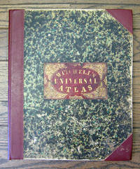
18496558Philadelphia: S. Augustus Mitchell 1849 Folio. 17 3/8 x 14 inches. Lithographed title with large vignette letterpress "Table of Contents" and 73 hand-colored lithographed maps charts and city plans. Three-quarter red morocco over marbled boards large red morocco title label on front cover elaborately tooled and lettered in gilt. Spine and corners renewed in red leather. Boards rubbed and scuffed at edges. Maps in fine condition. Overall a fine copy. A very nice copy of this very scarce atlas with hand-colored maps of all the individual States and Territories and including the rare and famous map of "Oregon Upper California & New Mexico" showing the large yellow-colored area in California labeled "Gold Region." The Atlas concentrates on the American continent with 43 maps of the area including a fine double-page coast-to-coast map of the United States. Samuel Augustus Mitchell and his sons were the leading publishers of maps in the United States during most of the nineteenth century. A New American Atlas published in 1831 was Mitchell's first work. In 1846 he published his first edition of the present work. He continued to publish the Atlas until 1850 when he sold the copyright to Cowperthwait & Co. It was with this 1849 edition that "New Mexico" was added to the title of the map as well as the words "Gold Region" added in a large yellow area in "Upper or New California." As Wheat states "We find S. Augustus Mitchell in Philadelphia publishing in 1849 a revised version of his Texas Oregon and California map taking advantage of Frémont's later work and displaying a large colored Gold Region." Also many routes are shown by red hand-colored lines including Frémont's routes. Wheat: Mapping the Transmississippi West: 630 p.284; text p.82; not noted in Wheat's Maps of the Gold Region. S. Augustus Mitchell hardcover books
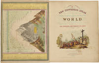
18525810Philadelphia: Thomas Cowperthwait & Co 1852. Folio. 17 x 13 3/4 inches. Chromolithographic title with large vignette hand-coloured frontispiece of the heights of the principal mountains and lengths of the principal rivers contents list printed in red black and gold 73 hand-coloured lithographed maps charts and city plans 1 double-page. Publisher's green marbled paper-covered boards with morocco title label elaborately tooled and lettered in gilt on upper cover red morocco spine and corners expertly renewed to style. Modern red cloth box morocco lettering piece<br/> <br/>A fine copy of this famous atlas with hand-coloured maps of all the individual States and Territories. The map of California shows counties in California and New Mexico for the first time.<br/> <br/>Despite its title the Atlas concentrates to a marked degree on the American continent with 43 maps of the area including a fine double-page east-to-west-coast map of the United States. S. Augustus Mitchell and his sons were the leading publishers of maps in the United States during most of the nineteenth century. Mitchell had come to Philadelphia around 1830 with the intention of improving the standard of geography textbooks Philadelphia then being the leading city in America for cartographical publications. A New American Atlas published in 1831 was his first work. In 1845 he acquired the rights to Tanner's New Universal Atlas first published in 1836 and in 1846 he published his first edition of the present work. Mitchell continued to publish the atlas until 1850 when he sold the copyright to Cowperthwait & Co. of Philadelphia. Thomas Cowperthwait & Company published it until the mid-1850s when it was purchased by Charles De Silver. The Cowperthwait company continued to add edit alter and hand-colour the maps.<br/> <br/>Phillips Atlases 807; cf. Ristow pp. 311-313; Rumsey p.239. Thomas, Cowperthwait & Co unknown books
18556365Philadelphia: Charles DeSilver 1855. Folio. 17 x 14 inches. Chromolithographic title with large vignette hand-coloured frontispiece of the heights of the principal mountains and lengths of the principal rivers contents list printed in red black and gold 71 hand-coloured lithographed maps and charts 3 double-page and 1 city plan. Publisher's red half morocco with green marbled paper-covered boards morocco title label elaborately tooled and lettered in gilt on upper cover. Modern red cloth box dark red morocco lettering piece<br/> <br/>A fine copy of this famous atlas with hand-coloured maps of all the individual States and Territories. The first edition to have DeSilver as publisher and here including 'A New Map of Nebraska Kansas New Mexico & the Indian Territories' for the first time: present here as an additional map un-numbered and not called for in the contents list<br/> <br/>Despite its title the Atlas concentrates to a marked degree on the American continent with a city plan of Washington D.C. and 42 maps of the area including a fine double-page coast-to-coast map of the United States and 30 maps of the States and Territories. The un-numbered map of Nebraska Kansas etc. is here bound between sheets numbered 37 and 38. S. Augustus Mitchell and his sons were the leading publishers of maps in the United States during most of the nineteenth century. Mitchell had come to Philadelphia around 1830 with the intention of improving the standard of geography textbooks Philadelphia then being the leading city in America for cartographical publications. A New American Atlas published in 1831 was his first work. In 1845 he acquired the rights to Tanner's New Universal Atlas first published in 1836 and in 1846 he published his first edition of the present work. Mitchell continued to publish the atlas until 1850 when he sold the copyright to Cowperthwait & Co. of Philadelphia. Thomas Cowperthwait & Company published it until the mid-1850s when it was purchased by Charles De Silver. The Cowperthwait company continued to add edit alter and hand-colour the maps.<br/> <br/>Phillips Atlases 6118; cf. Ristow pp. 311-313; Rumsey pp.240-241. Charles DeSilver unknown books
19001318926Paisley: Alexander Gardner 1900. Hardcover. Octavo; Fair hardcover; Spine blue with gold print; Boards in blue cloth worn corners and spine caps wear to hinges shelfwear; Text block has gilt top edge deckle edged cracked hinges intermittent spine breaks spotting to some page edges small stain to front endpapers newspaper clipping taped to rear pastedown stains to front endpapers and title page annotation in ink on front endpapers; 707 pages frontispiece. 1318926. FP New Rockville Stock. Alexander Gardner hardcover books
1890D17725Boston: Houghton Mifflin 1890. First Edition. Hardcover. Near Fine. 8vo. 6 70 pp. Original white cloth-backed green paper-covered boards paper spine label. Boards soiled wear to label internally fine. BAL 14141. First edition inscribed on the f.f.e.p.: "My dear Ned If you find anything within to interest I shall be glad Weir". One of 322 copies printed. Loosely inserted is a 12 line poem of Mitchell's printed on a card with a botanical illustration at top printed Corell Press from its Mount Washington Mass. shop 1917. <br/><br/> Houghton Mifflin hardcover books