SansonBiblio.com
152 résultats
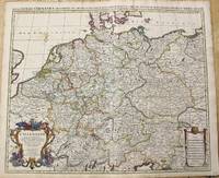
1696M10211Amsterdam: Covens & Mortier c.1696. Very Good. Size : 510x605 mm 20.08x23.82 Inches Coloring: Original Outline Coloring Category: Maps Europe Germany; Covens & Mortier unknown
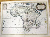
1700M11022Paris c.1700. Very Good. Notes: French map of Africa as a continent. Size : 462x645 mm 18.19x25.39 Inches Coloring: Hand Colored Category: Maps Africa Continent; unknown
1656006682Paris: Chez l'Autheur 1656. First Edition. Full Calf. Very Good. 4to. 23.5 by 17.5 cm. Unpaginated 100 pages of text plus 2 pp. of ads. With 18 copper engraved maps all two page plates each with hand-colored of boundaries. Maps include one of the entire continent then of its various regions as then known plus the islands off the continent. Also a map of Malta. Bound in contemporary calf. Condition: calf dry and rubbed on spine and joints and edges rubbed. Light to moderate soiling in the margins of the pages. Two bookplates -- one of the Marquis of Lothian the other the Newbattle Abbey Library. Chez l'Autheur unknown
1656B2984Paris: Nicolas Sanson c. 1656. Lower right corner of the first eight leaves strengthened otherwise a very good copy maps and text are clean and crisp. In protective cloth slipcase. Edition: First edition. Binding: Full contemporary calf expertly rebacked with spine in six compartments of raised bands and finely-gilt motifs morocco label on two edges speckled red. Notes: This atlas was dedicated to the Superintendent of Finances at the time Nicolas Fouquet. <br>Regarding a map of South and Central Africa published the year before which bears resemblance to this map of South Africa--‘Pays et Costes des Caffres’--in particular Norwich writes: “This map although a fine example of cartography is based on very little information; for example the desert-like coast of South West Africa is presented as a land rich in rivers. The fictitious states are given fictitious boundaries and the interior is marked with large cities such as Vigiti Magna and Monomotapa. This information led to subsequent exploration in search of these fabulous cities. Although the map is dated three years after the foundation of a settlement at the Cape by Jan van Riebeeck no mention is made of any European settlement anywhere in the south.†Size: 4to Illustration: Recent stencilled title. Complete with 18 maps of Africa and its territories in original outline colour. References: Tooley IV:103; Tooley Africa 100 Peyrounin edition; Norwich 37 & 158. Pages: P. 1-96. Category: Book Africa General; Book Atlas & Cartography Nicolas Sanson hardcover
1618281543Frankfurt-am-Main 5616 1855-56. Boards. Good . 672 pp. twelve issues bound together slight library marks title taped to spine hardcover
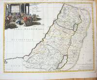
169143500Amsterdam Huguetan & Mortier 1691. 56x85 cm. Large engraved map of Terra Sancta with original colours in outline. With two large engraved cartouches. Small repairs to lower part of centerfold. <br/><br/><em>This is Jaillot's large version of Sanson's map of Palaestine divided into tribes. </em> unknown
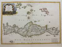
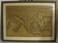
1658M9417Paris: Nicolas Sanson c.1658. Very Good upper fold area expertly repaired. Notes: A fine map of Crete from the mid 17th century. <br>The map also shows nearby islands such as Santorini Stampalia and Milo. The map has a decorative cartouche and details cities borders and geographical features. Size : 394x553 mm 15.51x21.77 Inches Coloring: Hand Colored Category: Maps Europe Greece Macedonia; Nicolas Sanson unknown
1663283501Paris 1663. unbound. very good. Map. Hand-colored engraving. 15" x 23".<br/> <br/> This map of Sicily from the 17th century shows the entire island as well as the southwesternmost tip of the Italian peninsula. The names of the surrounding bodies of water are named in Latin and rivers mountains lakes and towns are noted on the map. <BR> <BR> Nicolas Sanson 1600-1667 is considered the founder of the French school of cartography. In reaction to the prevailing trend of Dutch lavishness Sanson favored minimal details focusing rather on accurate cartography than ornament. This map is a fine example of his work.<br/> <br/> unknown
1647WB16371Lutetiae Parisiorum: Sumptibus & Impensis Autoris 1647. Hardcover. Good. 16mo. Old leather; quite worn. pp 16 246 2. Liber primus only. <br/><br/> Sumptibus & Impensis Autoris hardcover
167638217Paris: Sanson 1676. AN ATTRACTIVE MAP OF SPAIN AND PORTUGAL. 18 x 25 cm plate 23.5 x 32 cm sheet. FULLY COLORED by a later hand. Printed on fine laid paper. Reverse blank. A fine impression. A PRISTINE EXAMPLE with the paper FINE AND BRIGHT. Very scarce in such fine condition. <br/><br/> Sanson unknown
170054043Nicolas Bion: L'Usage des Globes. Amsterdam: Francois Halma. 1700. Map showing north-east South America from Trindad to the mouth of the Amazon - modern day Guyana and Surinam. Several large fictitious lakes make up much of the unexplored interior. Maps by Sanson in original colour are rare. Nicolas Sanson was founder of the French school of mapmakers at a time when the leadership in European cartography passed from the Low Countries to France. This map was published in Bion's treatise on globes. Nicolas Bion was a famous French mathematical and scientific instrument maker. Copper engraving. Very good condition. Small 1cm. very faint library stamp on border not affecting map. Original colour. Size: 27.5 x 20 cm. 11 x 8 inches. unknown
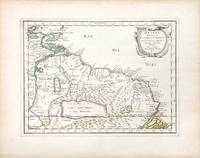
165766689Paris. c.1657. A very attractive and finely engraved map of the north eastern South American country of Guiana. The map is highlighted by numerous rivers tributaries mountains villages inlets bays and a very large inland equatorial lake that was thought to exist. Published in "Cartes Generales de toutes les parties du monde." Size: 285 x 360 mm. Copperplate engraving with original outline colouring. Fine condition. unknown
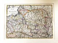
1655M5101Paris 1655. Excellent. Size : 395x560 mm 15.5x22 Inches Coloring: Original Outline Coloring Category: ; Maps Europe Poland Lithuania unknown
1660M7049Paris 1660. Very Good;. Notes: French map of the Holy Land with a decorative cartouche.<br><br>Nicolas Sanson 1600–1667 was a renowned French cartographer termed by some as the "father of French cartography." His works are known for their incorporation of the most up to date information of the time and their clean modern style. Size : 385x485 mm 15.16x19.09 Inches Coloring: Hand Colored Category: Maps Asia Middle East Holy Land & Palestine; unknown
166725060Paris: P. Mariette 1667. Other. The centre fold minor spotting else in excellent condition. 395 by 565mm 15 by 22 inches. Rare and decorative large-format historical map of Europe showing the locations of Church Councils and Synods in original outline color. By Guillaume Sanson 16331703 Géographe du Roy published by Pierre Mariette Paris 1667. Image: 395 x 565 mm 15.5 x 22 inches. Decorated with a superb allegorical title cartouche depicting a Catholic council in session a unique historical and cartographic document. Guillaume Sanson 16331703 was a leading French cartographer who inherited the celebrated family firm from his father Nicolas Sanson 16001667 known as the 'Father of French Cartography' and official Géographe du Roy to Louis XIV. Like his father Guillaume held the title of Géographe Ordinaire du Roy. Much of his work after 1671 was published in collaboration with Alexis-Hubert Jaillot and together the Sanson dynasty dominated French cartography throughout the 17th century. Their maps are held in the Bibliothèque nationale de France the British Library and major research collections worldwide.This large and striking map plots the locations of ecumenical councils national synods provincial councils and diocesan synods across Europe a unique cartographic subject of combined religious and historical significance. The coverage extends from the British Isles and Iberian Peninsula across to the eastern Mediterranean including Cyprus and Syria with North Africa also shown. Political borders are rendered in hand-applied outline color. The splendid allegorical title cartouche depicts a Catholic council in session and was engraved to the highest standard of the Parisian workshop. The Geographia Synodica is among the most unusual and collectible maps ever published of Europe: a historic document of scholarship faith and cartographic craft. In excellent condition. Original outline color fresh and vivid. The centrefold shows minor spotting as expected for a 17th-century map of this size; all else excellent. No tears or significant foxing. 395 x 565 mm. P. Mariette unknown
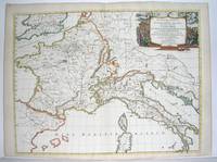
1667M2849Paris 1667. Excellent. Size : 424x563 mm 16.625x22.125 Inches Coloring: Original Outline Coloring Category: ; Maps Europe France; Maps Europe Italy unknown
16411809140021Paris : Tavernier et a present Pierre Mariette 1641. First Edition. Maps. Good. 53 x 40 cm. Original engraved double page map of France. In gilt and black frame under glass. Some browning. Scale: 1:3000000. Paris : Tavernier, et a present Pierre Mariette unknown
1678M3431Paris: Mariette Pierre 1678. Excellent. Size : 357x595 mm 14x23.375 Inches Coloring: Original Outline with later cartouche coloring Category: ; Maps Asia Near East Turkey Mariette, Pierre unknown
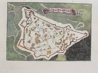
1690M9475Paris c.1690. Very Good. Notes: A charming map of Forteresse de Zante Greece during the late 17th century. Size : 104x154 mm 4.09x6.06 Inches Coloring: Hand Colored Category: Maps Europe Greece Macedonia; unknown
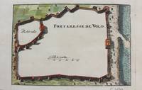
1690M9474Paris c.1690. Very Good. Notes: A charming map of Forteresse de Volo Greece during the late 17th century. Size : 104x153 mm 4.09x6.02 Inches Coloring: Hand Colored Category: Maps Europe Greece Macedonia; unknown
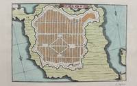
1690M9473Paris c.1690. Very Good. Notes: A charming map of Fort D'Asso Greece during the late 17th century. Size : 104x153 mm 4.09x6.02 Inches Coloring: Hand Colored Category: Maps Europe Greece Macedonia; unknown
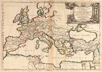
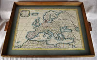
16502312280001Petrum Mariette: Lutetiae Parisiorum 1650. First Edition. Maps. Very Good. Ancient Europe : The Roman Empire Fine hand-colored double-page engraved map of Roman provinces of Europe. Mounted in wood frame with wooden side handles. Dimensions of mounted image: 40 x 56 cm. 53 x 69.5 cm in frame. Latin province names cities seas. This is an oversized or heavy book which requires additional postage for international delivery outside the US. Petrum Mariette: Lutetiae Parisiorum unknown
165556109Paris. 1655. Attractive map of Morocco and parts of Algeria. Maps by Sanson in original colour are rare. Nicolas Sanson was founder of the French school of mapmakers at a time when the leadership in European cartography passed from the Low Countries to France. Copper engraving. Very good condition. Some light browning to the centre fold. Attractive water mark. Original colour. Size: 53 x 40 cm. 21 x 15½ inches unknown
1692001000Paris: Chez H. Jaillot 1692. First edition thus. Map. Good/No jacket as issued. Large double page copper engraved map 23" x 34 1/2". Contains wide margins and a decorative cartouche. Hand-colored boundaries and cartouche. General age-toning with minor browning. Nicely framed in modern rope effected matte gold frame 32" x 42" with gilt bordered white mat and acrylic glaze. A good copy of this scarce map. All text in French Printed just 9 years after the Ottomans besieged Vienna. Extra shipping may apply for foreign orders. Chez H. Jaillot unknown
1683M11172Paris c.1683. Very Good. Notes: French map showing Poland and the surrounding region.<br>Nicolas Sanson 1600–1667 was a renowned French cartographer termed by some as the "father of French cartography." His works are known for their incorporation of the most up to date information of the time and their clean modern style. Size : 188x256 mm 7.40x10.08 Inches Coloring: Hand Colored Category: Maps Europe Poland Lithuania; unknown