Jaillot, Alexis-Hubert & Sanson, NBiblio.com
152 résultats
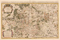
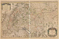
167533301Paris: Hubert Jaillot 1675. Blatt gebräunt Mittelfalz mit nicht säurebeständigem Tape hinterlegt heller Streifen. . 803 by 560mm 31 by 22 inches. Hand-Colored Original Copperplate Engraving by Alexis-Hubert Jaillot & N. Sanson depicting Le Cercle de Souabe subdivisé en tous les Estats qui le Composent Tire ´sur les Memoires les plus noueaux Par le S. Sanson Geographe Ordinaire du Roy. A Paris Ches H. Laillot joingnant les Augustins aux deux Globes Auec Priuilege du Roy pour Vingt Ans. Published Paris Hubert Jaillot 1675. Sheet: 803 by 560mm 31 by 22 inches. A fine and original hand-colored example of Jaillot's celebrated cartographic work documenting this region of Germany with the precision and decorative artistry characteristic of the 16700s. Alexis-Hubert Jaillot c.1632-1712 was one of the foremost French cartographers of the late 17th and early 18th centuries. Working in Paris he produced magnificent large-format maps of European territories often in collaboration with Nicolas Sanson -- considered the father of French cartography. Jaillot's maps are known for their striking decorative cartouches generous size and fine hand coloring representing the pinnacle of French Baroque cartography.This original copperplate engraving with original hand coloring depicts the region of Le Cercle de Souabe subdivisé en tous les Estats qui le Composent Tire ´sur les Memoires les plus noueaux Par le S. Sanson Geographe Ordinaire du Roy. A Paris Ches H. Laillot joingnant les Augustins aux deux Globes Auec Priuilege du Roy pour Vingt Ans. published in Paris Hubert Jaillot 1675. The map records the political and geographic boundaries of the region as understood in 1675 offering a fascinating window into the history of German territorial organization. Sheet measures 803 by 560mm 31 by 22 inches. In good condition overall with minor signs of age appropriate for a 17th-century engraving. Ready to frame. Hubert Jaillot unknown
169233439Paris: H. Jaillot 1692. In ausgezeichnetem Zustand. . 570 by 850mm 22 by 33 inches. Hand-Colored Original Copperplate Engraving by Charles Hubert Alexis Jaillot & Nicolaus Sanson depicting Le Cercle de Franconie subdivise entous les Estats qui le composent. Dressè sur les Memotres les plus Nouveaux Parle Sr. Sanson Geographe Ordinaire du Roy. A Paris Chez H. Iaillot joignant les grands Augustins aux dewe Globes. Avec Privilege du Roypour Vingt Ans. 1692. Published Paris H. Jaillot 1692. Sheet: 570 by 850mm 22 by 33 inches. A fine and original hand-colored example of Jaillot's celebrated cartographic work documenting this region of Germany with the precision and decorative artistry characteristic of the 16900s. Alexis-Hubert Jaillot c.1632-1712 was one of the foremost French cartographers of the late 17th and early 18th centuries. Working in Paris he produced magnificent large-format maps of European territories often in collaboration with Nicolas Sanson -- considered the father of French cartography. Jaillot's maps are known for their striking decorative cartouches generous size and fine hand coloring representing the pinnacle of French Baroque cartography.This original copperplate engraving with original hand coloring depicts the region of Le Cercle de Franconie subdivise entous les Estats qui le composent. Dressè sur les Memotres les plus Nouveaux Parle Sr. Sanson Geographe Ordinaire du Roy. A Paris Chez H. Iaillot joignant les grands Augustins aux dewe Globes. Avec Privilege du Roypour Vingt Ans. 1692. published in Paris H. Jaillot 1692. The map features a decorative Baroque cartouche containing the title inscription. A distance scale is incorporated within the cartouche or alongside it. The map records the political and geographic boundaries of the region as understood in 1692 offering a fascinating window into the history of German territorial organization. Sheet measures 570 by 850mm 22 by 33 inches. In good condition overall with minor signs of age appropriate for a 17th-century engraving. Ready to frame. H. Jaillot unknown
1700M7991Paris: S. Jallot c. 1700. Very Good. Notes: Map of Northern Germany Size : 650x460 mm 25.59x18.11 Inches Coloring: Original Hand Coloring Category: Maps Europe Germany; S. Jallot unknown
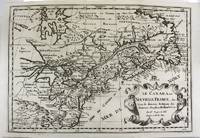
169317230Paris: Hubert Jaillot. 1693. Other. In excellent condition. Minor offsetting of the old outline colors to the paper. 465 by 610mm 18 by 24 inches. 465 by 610mm 18 by 24 inches. Copper Engraving color by Jaillot Alexis-Hubert & Sanson N published 1693 by Hubert Jaillot Paris. Image size: 465 by 610mm 18 by 24 inches. By Jaillot after Sanson a landmark of late 17th-century French cartography of North America. Alexis-Hubert Jaillot c.16321712 was one of the most important French cartographers and map publishers of the late 17th century. He collaborated with the pioneering geographer Nicolas Sanson 16001667 and his sons to produce finely engraved large-format maps of the world's regions publishing in Paris from 1670 onwards. Jaillot's maps are distinguished by their impressive scale rich baroque cartouches and the high quality of their engraving. His map of Canada and New France 1693 is a landmark document of 17th-century French geographical knowledge of North America reflecting decades of French colonial exploration and mission activity in the St. Lawrence and Great Lakes regions.Large and decorative map of Canada by the French cartographer Nicolaus Sanson and Hubert Jaillot. Published in the 'Atlas Noveau.' this atlas was a masterpiece in the French cartography in the 17th century. The atlas was specially designed for Louis XIV and due of the very large size of the plates most maps were printed from two plates it took Hubert Jaillot over 12 years to complete the 'Atlas Noveau.'. Canada is very detailled shown on the map as well Labrador Terra Neuf & Nouvelle France are shown in engraved territory borders. The map is rich in detail with many cities and place names rivers lakes mountains bays etc. In excellent condition. Minor offsetting of the old outline colors to the paper. Hubert Jaillot. unknown
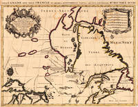
1700M11077Paris 1700. Excellent. Notes: Second state. Published in Description De Tout L'Universe-Halma.<br>An excellent example of Nicolas Sanson's map of Canada and the Great Lakes Lake Superior and Lake Michigan Lac du Puans are shown open-ended.<br>Engraved in the bottom-right corner outside the neat-line is "A.d.Winter Schulp". Additions include a latitude and longitude grid; mountains and trees filling in the blank areas east of James Bay and in northern Labrador; and the three latitude and longitude values that were previously missing in three of the corners on the border. Size : 207x308 mm 8.15x12.13 Inches Coloring: Black & White Reference: Burden #575; Kershaw #137 Plate 85 Category: Maps Canada East; Maps North America Great Lakes; unknown
1690M9477Paris c.1690. Very Good. Notes: A charming map of Athens Greece during the late 17th century. Size : 103x154 mm 4.06x6.06 Inches Coloring: Hand Colored Category: Maps City Maps; Maps Europe Greece Macedonia; unknown
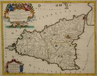
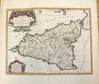
1692M7516Paris: Hubert Jaillot c. 1692. Very Good. Notes: Title cartouche in upper left features Sicilian coat of arms winged angels and merpeople while the scale in the lower left is held on each side by allegorical figures of labour and harvest. Mount Etna is represented pictorially. Size : 418x530 mm 16.46x20.87 Inches Coloring: Hand Colored in Outline Category: Maps Mediterranean Islands; Hubert Jaillot unknown
1696M10189Amsterdam: Covens & Mortier c.1696. Very Good. Size : 420x540 mm 16.54x21.26 Inches Coloring: Hand Colored Category: Maps Mediterranean Islands; Covens & Mortier unknown
16511111150111Paris 1651. Map. Very Good. Paris: Sanson Marriette 1651. 55.3 x 39.2 cm. Black-and-white copper plate engraved chart of primarily Eastern Europe with Turkey in the lower right panel. Modern hand-coloring applied to political boundaries. Title cartouche in upper right corner. Numbered 299 in upper right corner. Otherwise clean unmarked sheet with slight toning to edges. Vertical crease down center from atlas extraction. Minor chipping to edges. Colors are bright and vivid. Lines remain crisp and clear.<br><br>Nicolas Sanson was a Jesuit-trained French cartographer who attracted attention with a detailed accurate map of Gaul which he constructed when only 18. Active from 1627 Sanson issued his first map of importance the Postes de France which was published by Melchior Tavernier in 1632. After publishing several general atlases himself he became the associate of Pierre Mariette a publisher of prints.<br><br>The following map is one of the many prints Sanson collaborated with Mariette on. Unlike Jaillots future reproductions the original plates maintain a more modest decorative style with understated cartouches and less flourish or embellishment. Please feel free to view our photographs of this piece. Paris unknown
1657031360Paris: Anthoine Pas-de-Loup. 2 vols bound as one 188 284pp flower basket devices to title pages some browning minor marginal notes in contemporary full calf gilt with raised bands top of spine rubbed with some loss some loss at joint decorated panels ex-monastery library with A.W.N. Pugin designed bookplate to front paste-down rubbed . Good. Hardcover. 1st Edition. 1657. Anthoine Pas-de-Loup hardcover
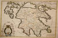
1692M7546Paris: H. Jaillot c. 1692. Very Good;. Notes: The title cartouche in the lower left corner is encased in a floral wreath at the bottom of which sits a winged lion wielding a sword and standing at a pulpit. At the top of the wreath sits a coat of arms held by two winged putti. Encircling the wreath are little diagrams of various fortifications around Greece. Size : 565x845 mm 22.24x33.27 Inches Coloring: Original Outline Coloring Category: Maps Europe Greece Macedonia; H. Jaillot unknown
1659M4916Paris 1659. Very Good. Notes: Map of Baltic region of Estonia Latvia including Riga to Vilnius Wilna and parts of Lithuania. <br><br>Nicolas Sanson 1600–1667 was a renowned French cartographer termed by some as the "father of French cartography." His works are known for their incorporation of the most up to date information of the time and their clean modern style. Size : 410x535 mm 16.125x21 Inches Coloring: Original Outline Coloring Reference: Category: Maps Europe Estonia Latvia unknown
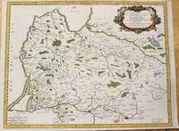
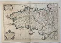
1693324404Paris: Alexis-Hubert Jaillot 1693. Map. Engraving with hand colored outline. Image measures 21" x 31"<br/> <br/> This large 17th century double-page map features the Brittany region of France. Cities towns abbeys government buildings rivers ports and harbors are labeled. Mountains forests and wetlands are depicted pictorially. The attention to detail in topography and population centers hints at the abundance of the region known for its production of Muscadet wine cheese boar seafood and other agricultural products. Executed by Nicolas Sanson in dedication to his son this map was published by Alexis-Hubert Jaillot in Paris and later reproduced in Amsterdam by Jaillot and Pierre Mortier. This early edition is scarce and hard to find. In very good condition with some offsetting to left side and a spot in the right margin. <br> <br> Nicolas Sanson 1600-1667 is considered the founder of the French school of cartography. In reaction to the prevailing trend of Dutch lavishness Sanson favored minimal details focusing rather on accurate cartography than ornament.<br/> <br/> Alexis-Hubert Jaillot unknown
1700M7994Paris c. 1700. Very Good. Notes: Engraved by Cordier.<br>A map of Central Germany. Frankfurt appears at the south-center of the map. Size : 457x648 mm 17.99x25.51 Inches Coloring: Original Hand Coloring Category: Maps Europe Germany; unknown
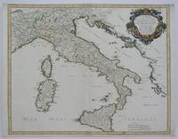
1665M5118Paris 1665. Very Good central fold reinfrced. Notes: There is a water mark on the right hand portion of the map. Size : 435x540 mm 17.125x21.25 Inches Coloring: Original Outline Coloring Category: ; Maps Europe Italy unknown
166710027Paris 1667. No Binding. Near Fine. 12 ½ x 17 inches. Original outline color; excellent. Earliest map of Martinique listed in Phillips featuring attractive original color and an elegant cartouche. This map depicts the situation on the island before 1660 when it was still largely inhabited by natives and only about half of it had been claimed by colonists for sugar cane farming. The map goes so far as to mark with a printed line the partition dividing the "demeure des François" and the "demeure des savages." However by 1660 the entirety of the native population was either dead expelled or in slavery and Martinique was a full-fledged sugar cane-farming European colony. Phillips Maps P. 389. unknown
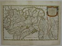
1654M5952Paris 1654. Very Good some mild discoloration along the margins. Size : 350x555 mm 13.75x21.875 Inches Coloring: Original Outline Coloring Reference: Gole 16; Nebenzahl 3.9B Category: Maps Asia South East Thailand Laos Vietnam Cambodia & Burma / Myanmar; Maps Asia Central India & Sri Lanka / Ceylon; unknown
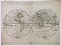
165214178Paris: Sanson 1652. Double hemisphere world map showing the rivers and water bodies of the world. Original outline color. 20 3/4 x 15 3/4". Depicts Australia prior to Tasman's discoveries and labels North Australia "Beach" according to Marco Polo and California as an island. References: Shirley R.W. World 394. Sanson unknown
1652010748twParis: Sanson. Very Good. 1652. A very rare map from Nicolas Sanson. Imprint bears the date of 1652 although it is possible that this copy came from an atlas in the later 1600s. Light toning and edgewear with one corner slightly chipped. Light soil on lower margin. Hand-colored boundaries. Map borders measure 14" x 20 3/4". California is shown as an island and Terre Australe is a vague line encircling the Antarctic. Terre de Iesso is the name given to the land mass northwest of North America. Sanson 1600-1667 published many map versions of the world and is known as "the father of French cartography." ; 16 1/2" x 22 1/4" . Sanson unknown
1696206066Amsterdam: Alexis-Hubert Jaillot 1696. unbound. very good. Map. Engraving with hand outline. Image measures 23" x 35".<br/> <br/> Stunning map showing the vast extent of the German Empire including parts of Poland Bohemia Hungary Austria Croatia Italy France and the Netherlands. Exquisite and subtle coloring beautifully detailed. Based on a plate by Nicolas Sanson reworked and published in "Atlas Nouveau" by Jaillot. Severe toning due to early acid backing chipping to edges and corners and some tears. Priced as is. Alexis-Hubert Jaillot 1632--1712 was a French sculptor engraver publisher and cartographer. He served as official geographer to King Louis XIV and worked with other prominent mapmakers of the period such as Nicolas Sanson He is best known for his Atlas Nouveau of 1674.<br/> <br/> Alexis-Hubert Jaillot unknown
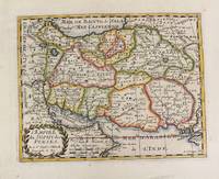
1652M4655Paris 1652. Very Good. Notes: This is an important 17th-century map of Iran published in Paris by Nicolas Sanson the greatest 17th-century French cartographer. The map depicts Iran at the time of Shah Abbas II of the Safavid dynasty. It is interesting to note that present-day Afghanistan and Pakistan and even part of India sit within Iran's borders all of which were lost in due course by the kings of the Qajar dynasty. Also as Sufism was the religion of Iran at the time of the Safavid dynasty the title of the map refers to the "Empire of the Sufi of the Persians". Size : 192x247 mm 7.56x9.72 Inches Coloring: Hand Colored Reference: Ala'i E. 107. Category: Maps Asia Middle East Iran Iraq; unknown
16626235Paris: Chez L'autheur 1662. Book. Good. Full-Leather. 4to - over 9¾" - 12" tall. 104 pages. Text only lacking all maps. Sound leather binding a little war at the top of the spine. No publication date assumed 1662. Chez L'autheur Hardcover
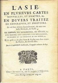
1652006683Paris: Chez l'Autheur 1652. First Edition. Full Calf. Very Good. 4to. 23.5 by 17.5 cm. Unpaginated 102 pages of text plus 2 pp. of ads 1 Royal privilege page. With 17 copper engraved maps all two page plates each with hand-colored of boundaries. Maps include one of the entire continent then of its various regions as then known plus island groups. Separate maps for China and Japan. Bound in contemporary calf. Condition: Rebacked with joints making this obvious. The original spine was re-mounted with some losses. Its blindstamped decoration of fans is discernible but somewhat vague. We think it is possible this decoration had some gilding or color originally but none survives. Still an interesting and unusual feature in our view. Calf dry and rubbed on spine and joints and edges rubbed. Light to moderate soiling in the margins of many pages and on a few pages the soiling invades inward beyond the margins and also in a few instances the marginal soiling is on the heavier side. There are a few archival tape repairs of small chips three on the title leaf one on the following leaf and after that wormhole edge damage was left untouched. That said the defect and repair isn't as glaring as it might sound. The edges elsewhere can have short spans of a chewed appearance. As a book generally we would consider this copy at best Good. As far as the maps go independent of the book we would regard them as Very Good. A few of the maps might individually fall short of such grading; on the other hand all the maps of this copy one can easily imagine someone enthusiastically framing even without an attempt to clean them up. Two bookplates -- one of the Marquis of Lothian the other the Newbattle Abbey Library. Chez l'Autheur unknown
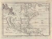
17005097Sanson being d'Abbeville Geograph du Roy. Map covers North America with a small amount of South America included. Has California as an island. 9 3/4 x 7 1/2 inches. Chez Paul Marret
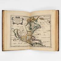
1657375003Paris: Chez L'Autheur 1657. 15 engraved double-page maps hand colored in outline. 4 40 of 42 unpaginated text leaves lacks final two leaves of text. 4to. Contemporary mottled calf gilt raised spine bands repairs at joints. Lacks final two leaves of text after the map of Brazil. 15 engraved double-page maps hand colored in outline. 4 40 of 42 unpaginated text leaves lacks final two leaves of text. 4to. First edition of important and quite handsome 17th-century French atlas of the Americas. This atlas was first published in 1657 and stands as a beautiful cartographic record of America for the 17th century. Sanson was official cartographer to the King. The maps include detailed charts of North South and Central America the West Indies Canada Mexico Florida and the southeast and a map of New Mexico showing most of the Spanish southwest territory with California depicted as an island. An impressive and detailed atlas for the time. The maps are titled as follows:<br /> 1 Americque Septentriole<br /> 2 Le Canada ou Nouvelle France &c.<br /> 3 La Floride<br /> 4 Audience de Mexico<br /> 5 Audience de Guadalajara Nouveau Mexique Californie &c.<br /> 6 Audience de Guatimala<br /> 7 Les Isles Antilles &c.<br /> 8 Amerique Meridionale<br /> 9 Terre Ferme Nouveau royme de Grenade &c.<br /> 10 Guiane divisee en Guiane et Caribane<br /> 11 Le Perou et le cours de la rivre Amazone<br /> 12 Le Chili<br /> 13 Le Brasil<br /> 14 Le Paraguay subdivise en ses principales parties suivant les dernieres relaons<br /> 15 Destroit de Magellan Terre et Isles Magellanicques &c. Sabin 76708; Phillips Atlases 1151; Streeter sale 68 undated edition; Leighley California as an Island plate 9 Chez L'Autheur unknown