CrusadesBiblio.com
Palestine during the Crusades History and Geography of Medieval Palestine Published during the British Mandate 1946
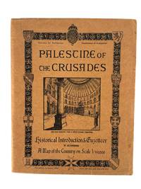
1946217431946. Palestine of the Crusades. Jerusalem: Survey of Palestine Department of Antiquities 1946. Printed by the British Mandate Survey of Palestine. Third edition. 43 pages in original printed tan wrappers illustrated with medieval heraldic devices and a vignette engraving of the Church of the Holy Sepulchre. Includes two maps one of Jerusalem in 13th century and the other of medieval Acre. <br /> <br /> A rare and richly detailed British Mandate-era gazetteer documenting the sites and historical geography of the Latin Kingdom of Jerusalem and the broader Crusader presence in the Levant. Published by the Survey of Palestine's Department of Antiquities this pamphlet opens with a comprehensive historical introduction contextualizing the Crusader kingdoms within a medieval geopolitical framework. The map "covers the greater part of the Latin Kingdom of Jerusalem one of the four European states which came into existence as a result of the armed pilgrimages to the Holy Land which is known as the First Crusade 1097-1099." It notes that the Crusader states at their height extended from the Gulf of Alexandretta to El Arish a zone approximately fifty miles deep describing how the region had long served as a cultural and military frontier: "the frontier between the Hellenic or Roman world and the Asiatic was for nearly two centuries the frontier between Christian Europe and Moslem Asia."<br /> <br /> Detailed entries trace the rise of Crusader fortifications towns and ecclesiastical sites with significant attention to the role of Saladin and the Ayyubid reconquest. One chapter details Baldwin IV's fortifications in 1178 at Jacob's Ford and the Templar castle at Beaurvoir Kawkab al-Hawa noting that it "was soon to be the focus of attention." The narrative follows Saladin's subsequent campaigns including the "brilliant victory over the Crusaders at Merj 'Ayn" and his eventual conquest of Jerusalem in 1187. The pamphlet includes multiple inset town plans reproduced from 19th-century maps e.g. a Crusader-era plan of Jerusalem and another of St. Jean d'Acre. It closes with a list of "Additions to Map" highlighting recently identified ruins or Crusader-linked locations. Light edgewear to wrappers minor foxing and soil to cover and page edges some pencil marginalia. One fold-out map present; the second larger map not included. Despite the missing map this remains a scarce and important document of British Mandate-era archaeological and historical scholarship reflecting colonial interest in medieval Christian heritage in Palestine on the eve of Israel's independence. unknown
Max Rambod Inc. · États-Unis225,00 $US≈ 190,37 €