(GARDENING). MILLER, PHILIPBiblio.com

93 résultats
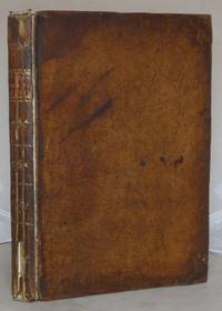
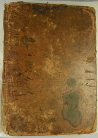
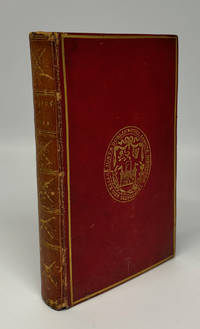
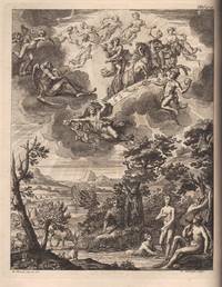
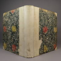
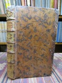
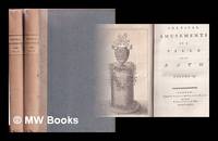
1771ST19567-172London: Printed for the Author; And Sold by John and Francis Rivington et al 1771. Sixth Edition. 270 x 200 mm. 10 1/2 x 8". 464 leaves. <br/> Early half calf over marbled boards skillfully rebacked in the 19th century with sheep raised bands spine with blind-tooled flowers gilt lettering hinges neatly reinforced. With 13 total illustrations including the engraved frontispiece and 12 folding plates depicting plants and agricultural structures. Spine with faint remnants of labels in top and bottom panels occasional marginal notations in pencil in a neat 19th century hand. Henrey 1123; ESTC T59414. Light general wear to the binding but everything sound and agreeable externally. A few spots of no consequence internally with the text generally clean and pleasing and the plates quite fresh. A pleasing copy.<br/> <br/> This is an influential work by the author DNB calls "the most distinguished and influential British gardener of the eighteenth century." A contemporary of Linnaeus and Sir Hans Sloane Philip Miller 1691-1771 was a gardener horticulturalist and Fellow of the Royal Society. Following the immense success of his "Gardeners Dictionary" in 1732 Miller released an abridged version three years later. The abridgment proved to be as popular as the original version. Swedish naturalist Pehr Kalm wrote in 1753 that "I have asked several of the greatest and best horticulturists both in England and America what author and what book they had found and believed to be the best in horticulture. . . . They have all answered with one mouth that Miller’s 'Gardener’s Dictionary' either in folio or the abstract in 8vo. i.e. the abridgment was the best of all and that when one has it no other book is afterwards required." Our sixth edition "enlarged" from the version discussed by Kalm was the final edition published during Miller’s lifetime. Printed for the Author; And Sold by John and Francis Rivington [et al] unknown
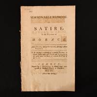
1735932Q1London: L. Gilliver 1735 . First edition. Disbound. Good. 13.5" by 8.5" . None. The first edition of this very scarce satirical poem surrounding the follies and decadence of society loosely based on Horace's satires. The first edition. Very scarce work.Disbound. Written anonymously this satire is attributed to English playwright poet and minister James Miller. Mostly known for his comedies on stage Miller became recognised as a writer of wit and intelligent parody. 'Seasonable Reproof a Satire In the Manner of Horace' was based on the extravagences and vices of the day very loosely based on Horace's satires III and IV of Book I. With sections of Latin written on the facing pages. Interestingly there is one passage dedicated to Fielding reading 'F-----g' who yesterday appear'd so rough Clad in course Frize and plaister'd down with Snuff'. Disbound. Externally wraps are bright with the odd mark. Small puncture holes to gutter. Rubbing to backstrip with remnants of leather and thread. Internally firmly bound. Pages are bright and clean. Good L. Gilliver unknown
1782828911782. C. Plummer. Doncaster. 1782. First edition. A Contemporary and Locally Printed response to the death of the Marquis who was at that time Yorkshire's most important resident. Twice Prime Minister and for his time a fair landlord who mangaed his estates in Ireland well. A slim volume - the original 30 pages have been bound with 18 blank pages before the title and with ten at rear. Full patterned calf with a modern reback and new marbled endpapers. Pages browned with occasional light foxing otherwise a clean and useful copy of a scarce item. unknown
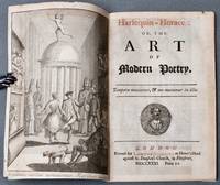
1731BB2387London: printed for Lawton Gilliver at Homer's Head against St. Dunstan's church in Fleetstreet 1731. Marbled Wrappers. Near Fine. Scarce First Edition written in 56 stanzas of rhyming verse of this satirical poem. Foxson's second state no known priority: correct catchword on p. 57 and p. 58 correctly numbered. Crown 8vo 189 x 122mm: 10591pp with folding engraved frontispiece and woodcut initials and ornaments. Later marbled wrappers paper label printed in red and black to front cover title page printed in red and black with bust vignette of Horace. A beautifully preserved copy tightly bound and clean throughout. Foxon M251. Miller was a playwright whose own works were performed at the Theatre Royal Drury Lane and who adapted plays by Molière and other French dramatists for the London stage. He only revealed his authorship of this work in the fourth edition of 1735. Harlequin-Horace is a "witty inversion of the Ars poetica attacking pantomime and opera and exuberantly depicting a topsy-turvy theatrical world. Alexander Pope approved as did his disciples on the Grub-Street Journal . . . . The poem lampooned the Italian operas of Handel but Miller admired the sacred oratorios in English and himself furnished the libretto for Joseph and his Brethren." ODNB N. B. With few exceptions always identified we only stock books in exceptional condition carefully preserved in archival removable mylar sleeves. All orders are packaged with care and posted promptly. Satisfaction guaranteed. Fine Editions Ltd is a member of the Independent Online Booksellers Association and we subscribe to its codes of ethics. printed for Lawton Gilliver at Homer's Head against St. Dunstan's church, in Fleetstreet unknown
173671988English dictionary containing etymology definitions a collection of English proverbs and the iconography mythology theogony and theology of ancient Egyptian Greek and Roman culture also contains nearly 500 wood cut illustrations Printed for T. Cox hardcover
176526259New England 1765. Pen-and-ink with grey and light green wash on two joined sheets of laid paper with an unlettered cartouche in the upper right corner in yellow wash a compass rose additionally decorated in green red and yellow period ink inscription on verso: "Kennebec River by Capt. Small." Provenance: Sir Francis Bernard Colonial Governor of Massachusetts 1712-1779; by descent to Robert Spencer Bernard Nether Winchendon House Buckinghamshire England. The earliest known survey of the upper Kennebec River here in manuscript.<br/> <br/> In November 1969 noted historian of cartography William P. Cumming discovered in the family home of Sir Francis Bernard "a collection of maps that in purpose and type differed so markedly from the more usual military coastal and general colonial maps of the time that it stands out in both interest and importance." Cumming The present manuscript map done on a scale of approximately 4 1/2 miles to the inch shows much of the length of the Kennebec from its mouth to a point approximately 100 miles north of Fort Western with its various tributaries and islands depicted. At the bottom of the map the coast of Maine is shown in much detail depicting the numerous small islands and inlets from Penobscot Bay in the north to Cape Elizabeth in the south. Numerous forts along the coast are shown including George's Fort Brunswick Fort and Pemmaquid Fort; a church is depicted at the mouth of Royall's River near North Yarmouth. West of the Kennebec a portion of the "Sagadehock" or "Amorescoggin" River is shown. Along the lower Kennebec Fort Francfort Fort Western and Fort Halifax are identified. Toponyms north of Fort Halifax include "Norridge Walk" and "An Indian Carrying Place" i.e. portage route which is drawn via hachured line. Bernard became the Colonial Governor of Massachusetts in late 1759 shortly after British troops were victorious in the Battle of Quebec. That decisive French and Indian War victory opened a vast region for renewed English settlement and trade thus necessitating the need for more accurate surveys of the roads and inland waterways. The present manuscript map was surveyed and drawn by the talented military mapmaker Francis Miller in 1765 for Bernard the details of which are recounted by Bernard in a 1766 letter to Lord Barrington: "I am desired to certify to your Lordship that at the beginning of the Year 1764 Genl Gage at my Request gave Leave to Ensign Francis Miller of the 45th regiment then stationed in Newfoundland to come to Boston to assist me in some Works of Public Surveying which I had undertaken in pursuance of resolutions of the general Assembly and partly by Orders from England. Mr Miller being then at an outpost and not easily relieved did not arrive at Boston till Nov in that Year when the Season for actual Surveying was over. He was employed that Winter and Spring following in protracting the Surveys made that Summer among which was a compleat Route from Fort Pownal on the River Penobscot to Quebec i.e. Chadwick's surveys and some other curious explorations of the Eastern parts of New England hitherto unknown to Englishmen: of which elegant Maps drawn by Mr. Miller have been transmitted to the Board of Trade." Bernard to Barrington 11 January 1766 quoted in The Barrington-Bernard Correspondence p. 103 emphasis added. The present map based on the surveys of little known Maine surveyor John Small would appear to have been among these "curious explorations." Small c.1722-1761 learned surveying from his father Samuel Small of Scarborough Maine and actively engaged surveying in that region from a young age. In 1745 he was commissioned in the Army serving at the first expedition against Louisburg and again in 1757-58 in Upstate New York including action at Ticonderoga. In 1758-59 he served as a surveyor on Pownall's Expedition to the Penobscot River and the construction of Fort Pownall and was commissioned as captain in 1759 for service in Amherst's march on Montreal. "At the expiration of his military duties January 12 1761 Captain John Small returned to his home in Scarborough. This contest i.e. the French and Indian War had been greatly protracted by the nature of the country. The problem of moving troops encumbered with baggage and artillery was most difficult. Massachusetts realized this need of roads to the utmost; and soon after the conquest of Canada a highway was projected by the government to connect Maine with that country by way of the Kennebec and Chaudiere rivers. Captain John Howard with a party of fifteen men was sent out from Fort Western on the Kennebec River to explore the immediate country ascertain the disposition of the Indians and survey the proposed road. Small joined these scouts on September 1 1761 as First Surveyor. Three weeks later while in the almost impenetrable forests of northern Maine Captain Howard shot at what he supposed to be a bear and was horrified to find that he had taken the life of one of his own men -- his first surveyor. At the death of Small since Captain Howard the commander of the expedition was entirely unfit to carry on the work the project for constructing a military road to Quebec was abandoned -- never to be resumed." Underhill Besides the inscription on verso indicating that the map was protracted after Small's surveys the map itself includes the inscription to the left of Fort Halifax "Here begins Capt. Small's Survey" as well as an inscription in the upper left corner "Here Capt. Small was killed."<br/> <br/> Barrington-Bernard Correspondence p.103. Cumming British Maps of Colonial America pp.29-30 Appendix A. Underhill Descendents of Edward Small of New England Vol. 1 164-213 pp. unknown
176525488New England 1765. Pen ink and wash on vellum done on a scale of approximately 1 inch per 9 miles. Later cartouche on paper mounted to the lower right corner reading "Map of Sir Francis Bernard's American Estate and the Adjoining Country." Mounted to board. Provenance: Sir Francis Bernard Colonial Governor of Massachusetts 1712-1779; by descent to Robert Spencer Bernard Nether Winchendon House Buckinghamshire England. An incredible eighteenth-century manuscript map on vellum accomplished for Massachusetts Colonial Governor Sir Francis Bernard: among the earliest English surveys of the interior of Maine and shows Mt. Desert Island.<br/> <br/> In November 1969 noted historian of cartography William P. Cumming discovered in the family home of Sir Francis Bernard "a collection of maps that in purpose and type differed so markedly from the more usual military coastal and general colonial maps of the time that it stands out in both interest and importance. These were domestic maps of a gentleman's estates and the roads to them." Cumming Specifically describing the present map Cumming writes: "This beautifully drawn map in black ink with bays rivers and lakes colored in green shows the coast from Broad Bay past Penobscot Bay and its islands to 'Passmaquiddy Bay' and Saint Croix River. The shoreline from Mount Desert Island to Passamaquoddy Bay is unmarked. The course of the St. Croix River to the Grand Lakes the Penobscot to Chesuncook Lake and the upper reaches of the Kennebec River to Mooshead Lake are traced carefully with the beginning of the overland trail to the River St. Lawrence." Cumming Sir Francis Bernard became the Colonial Governor of Massachusetts in late 1759 shortly after British troops were victorious in the Battle of Quebec. That decisive French and Indian War victory opened a vast region of present-day Maine for potential English settlement. To honor their new governor the Massachusetts Assembly petitioned the Crown to grant to Bernard "the Island of Mount Desart sic lying north eastward of Penboscot Bay." Bernard quickly began to establish a scheme to colonize the lands thereby affirming his grant. Writing to Viscount Barrington in June 1763 Bernard revealed his intentions to survey the region: "I propose to reconnoitre this Country this Summer with great accuracy the assembly having authorised me to employ a Mathematician to make observations all along the Coast. I have a very good Man for that purpose the Professor of Mathematics at this College i.e. John Winthrop whom I shall accompany and assist myself. And I shall make a further progress in surveying Mount Desert unless I am ordered off from home. I have concluded with 60 families with a Minister at their head and a Merchant to supply'm to settle there this Summer upon a plan already laid out: I want only power to make them a title. There are also 920 families ready to settle upon the continent adjoining to the Islands in 12 Townships already mark't out. I shall greive much setting aside my own interest if this settlement should be defeated; as it is compactly planned and laid out to great advantage. And when I consider how much it has Cost the Government of Great Britain to settle 4000 Souls in some other Parts of America I think it will be a great pity that such a Settlement should be refused when offered to be brought forward at no public expence at all. For my own part I have been drawn into this scheme imperceptibly: and now the People call on me to be their leader which I shall decline no longer than till I can learn that my establishing a New Colony in a desert which will long remain unpeopled if this opportunity is neglected will be approved." Bernard to Barrington 15 June 1763 quoted in Barrington-Bernard Correspondence p.70 The twelve townships referred to by Bernard are depicted on the present manuscript map via thin black lines. The year following that letter to Barrington the present manuscript map was drawn by the talented military mapmaker Francis Miller the details of which are recounted by Bernard in a 1766 letter to Barrington: "I am desired to certify to your Lordship that at the beginning of the Year 1764 Genl Gage at my Request gave Leave to Ensign Francis Miller of the 45th regiment then stationed in Newfoundland to come to Boston to assist me in some Works of Public Surveying which I had undertaken in pursuance of resolutions of the general Assembly and partly by Orders from England. Mr Miller being then at an outpost and not easily relieved did not arrive at Boston till Nov in that Year when the Season for actual Surveying was over. He was employed that Winter and Spring following in protracting the Surveys made that Summer i.e. the surveys by Chadwick among which was a compleat Route from Fort Pownal on the River Penobscot to Quebec and some other curious explorations of the Eastern parts of New England hitherto unknown to Englishmen: of which elegant Maps drawn by Mr. Miller have been transmitted to the Board of Trade. Early in the Last Summer I employed Miller having previously informed Genl Gage of the Intention to make an actual Survey from Boston to Albany and back again by another Way being near 200 Miles; and afterwards from Boston to Penobscot being above 200 Miles; by which Means a true Geometrical Line of 400 Miles in length through part of New York and all the habitable part of New-England has been obtained which will afford great Assistance to the Ascertaining the Geography of this Country and its Sea Coast. After this Survey was finished he was employed in protracting the Same and making Drawings thereof which he has done with great Accuracy and Elegance." Bernard to Barrington 11 January 1766 quoted in Barrington-Bernard Correspondence p.103 Chadwick's survey of 1764 would mark the beginning of the English exploration in the area. Chadwick's Journal the original in the Archives of Massachusetts and published in the Bangor Historical Magazine relates the reasons for the important and early survey: "The object of this survey was first to explore the Country secondly to view if it were practicable to make a road from Fort Pownal on Penobscot River to Quebec." His Journal continues with a direct reference to the present map: "Returned Jan. 1 1765 three plans the first directed to Lord Haliax etc. by order of His Excellency Francis Bernard etc. The second plan for the Secretary's office and a third plan for the Governor i.e. the present map; that the two last had no direction. That these plans were afterward delineated by Mr. Miller a regular officer." Thus the present manuscript map was one of two accomplished by Miller the other being in the Public Records Office London. As evidenced from Bernard's letter and Chadwick's journal this incredibly detailed map was drawn by Miller accomplished from Chadwick's surveys of 1764 and Miller's own surveys of the region. The map would also rely on Montresor's surveys of the region from 1761 as well as surveyor John Small's survey under Captain John Howard as the map extends beyond the region surveyed by Chadwick including the Kennebec River and the area to Lake Megantic. Bernard's maps would have a profound influence on the cartography of the area. In 1776 with the Revolution engendering great interest in the cartography of the colonies Thomas Pownall published a map which relied on the aforementioned surveys. Pownall's map used Lewis Evans's seminal 1755 mapping even printing it from the same plate but extended the map with a new plate to the east to encompass New England. On that portion of the map by means of two small asteriks Bernard's surveys were identified. A small caption on the Pownall map explains: "The Coast included within these marks is copied from Governor Bernard's Surveys including Mo. Desart Id. &c." Pownall's mapping of the northern New England coastline -- i.e. the mapping derived from the present survey -- would become the definitive mapping of the region and would be copied by countless cartographers into the 19th century. The origins of this influential map however began with Governor Bernard's surveys.<br/> <br/> Barrington-Bernard Correspondence p.70. Chadwick "An Account of a Journey from Fort Pownal Up the Penobscot River to Quebec in 1764" in Bangor Historical Magazine Vol.IV No.8. Cumming British Maps of Colonial America pp.29-30 Appendix A. Eckstrom "History of the Chadwick Survey" in Sprague's Journal of Maine History 14 pp.62-89. unknown
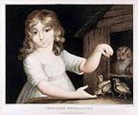
180013709London: Published by Testolini 1800. Colour-printed stipple engraving. Very good condition apart from some mild mat burn and a few tiny nicks at the edge of the top margin. A delightful intimate genre scene in a domestic interior.<br/> <br/> The scene depicted in this charming print is an allegory of innocence. It pictures a young girl who herself personifies virtue engaged in the innocent activity of feeding her pet fowl. Clad in a white dress she smiles and gazes at the viewer with a wide-eyed expression of childish wonder as she sprinkles breadcrumbs over the beak of a young bird awaiting the snack in anticipation as its mother looks on approvingly. Published by Testolini unknown
1796057955London: Printed for William Miller Old Bond Street. 1796. Second Edition . Soft cover. Very Good Plus. Engraved Frontispiece . LONDON : 1796. English version followed by German original with separate title page: Lenore: ein Gedicht von Gottfried August Burger. London: gedrucht sic bey S. Gosnell 1796. Paper-covered spine. Half-title. Engraved Frontispiece has a little light foxing. Text of both parts tight bright and clean. Engraved head-pieces. VERY GOOD INDEED. viii 13 14pp. Referenced by: English Short Title Catalog T93829. 8vo. Will be well-packed for posting/shipping. Rosley Books for Antiquarian books Cumberland Everyman Keswick Inklings Literature MacDonald Rarities Theology and History. . Printed for William Miller Old Bond Street. SCARCE. <br/> <br/> Printed for William Miller, Old Bond Street. paperback
17919818London: Printed for W. Miller 1791. Sixth Edition. Leather . Good. Full leather binding gilt chain border front and back binding worn and scuffed with loss of surface leather to front worming to spine 16.5 x 11 cm 6 1/2 x 4 1/4 inches. Both paste-downs detached from boards still attached to text block. Top of title page trimmed too close with loss to top line of title Select Portions. Notes in pencil & ink on the front end papers including "John Lawrence His Book 1817". Free end paper before tp cut out. iv 1-129 1 1 adverts rear end papers with manuscript hymn. Text complete. The leaves in this book are interspersed with manuscript tunes in four parts each sheet cut in half to allow for two tunes per side that can be opened independently. The last several manuscript pages have prayers or hymns written on them. The book is prepared for a minister or precentor who could look at the words of the psalm and the music of the tune at the same time. Tunes in manuscript on lined leaves interspersed between the printed hymns.An advert for the music verso of tp would indicate that the engraved music section was sold separately from the "Select Portions." The music in this copy is done by hand.Rev. George Hay Drummond 1761-1807 according to Julian he was b. at Westminster educated at Christ Church Oxford and in 1783 made Vicar of Brodsworth and Canon of York. John Julian Dictionary of Hymnology New Supplement 1907 at hymnary dot org.The music composer Edward Miller 1735-1807 for 50 years the organist of the Minster Church of Saint George Doncaster. In his youth he was a flautist in Handel's orchestra. He taught composed and published music; he also wrote a history of Doncaster. Printed for W. Miller hardcover
1790H10GLTBN14DLondon: W. Miller 1790. Hardback full marbled calf gilt title to spine. Corners repaired. New end-papers. Inner hinges re-inforced. 27cm x 19.5cm. xlvii 142pp. Engraved title page. Cracking to spine with small losses. A little occasional foxing/grubby marks to contents. A rather pleasing copy. h10. Hard Cover. Good. W. Miller Hardcover
17905972London: W Miller 1790. Hardback. Poor/No Jacket. 969 4to. No title page; title and year inferred chiefly from Preface i-x Edward Miller Doncaster March 1790 then an additional page and a half the Preface ending at xii. Subsequent contents: Explication of foreign words one page Musical Publications by Dr Miller a list one page Subscribers' Names all these to xlvii Index p1 and then the Psalms 2-142. The Preface is the first printed page the front free end paper the only blank page; this copy thus appears to meet the collation of the 1790 edition but missing the first 3 pages. It also meets ESTC's General Note referring to the Preface as " signed and dated: Edward Miller. Doncaster March 1790". This copy ends with page 142 so is missing 4 pages at the end. Binding is very delapidated calf with 'Millers' Psalmody' to spine. Condition notes: In a very poor way. Spine strip cracked and split with loss; text block broken; boards very worn stained and bumped. Tears to margins of some pages page 142 being the worst affected; this page is also very soiled. Some pencil scribble here and there. W Miller hardcover
17991301030014Dublin: R. E. Mercier and Co. Booksellers and Painters to Trinity College 1799-01-01. Hardcover. Very Good. Bound in contemporary leather. Front joint cracked. 4 230 p. 6 folding plates. Contemporary signature of Henry Greene on title page. Miller's work deals with gravity attraction and repulsion mechanical powers electricity and magnetism. Miller references Benjamin Franklin's contemporary work on electricity. Much of the book presents various concepts from Newtonian physics. The work of Kepler and Euclid also are prominent. ESTC T127500. R. E. Mercier and Co. Booksellers and Painters to Trinity College hardcover
179712101Dublinii Dublin: R. E. Mercier 1797. Hardcover. Very good. Octavo 257pp. plus index. A very good copy in contemporary straight-grain red morocco with eaborate oval Trinity College device stamped in gilt on the front board. Bookplates of John Deakin Heaton and Sir John Nicholson Barran on the front endpapers. Some nicks to extremities the spine panel faded otherwise a nice clean example. An essay on Longinus presented in Greek and Latin by George Miller. Miller was an influential Anglican priest and historian at Trinity College Dublin. We note fewer than a dozen holdings in worldwide libraries and none in the auction record. Scarce. ESTC T201775. R. E. Mercier hardcover
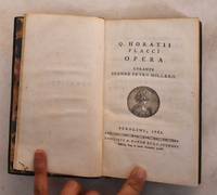
1761189582Berolini: Sumtibus A. Havde et I.C. Speneri 1761. Leather bound. VG. Green leather binding with gilt border; gilt design on spine. marble illustrated end papers; 22 260 54 pp; all edge gilt. Text is in Latin. The works of Quintus Horatius Flaccus. "Aldi Manvtii De metris Horatianis"--Page 251. Sumtibus A. Havde et I.C. Speneri hardcover
1772mon0000094068HarperCollins Distribution Servi 1772-01-01. Hardcover. Good. in x in x in. Clean copy sound binding. HarperCollins Distribution Servi hardcover
17623156Late 19th century half calf has long outlived its usefulness: boards detached spines chipped. Closed tear to title page of vol II; otherwise a very good set. Full page sur blanc engravings include frontispieces to most individual works including Volume 1: Spring; Summer; Autumn; Winter; Poem Sacred to the Memory of Sir Isaac Newton; Britannia; Liberty; The Castle of Indolence; etc. Volume 2: Sophonisba; Agamemnon; Alfred; Edward and Eleonora; Tancred and Sigismunda; Coriolanus. Not to be confused with the 12mo editions sans illustrations. With errata.; 24x30cm; 9.5x12 in.; xxvi468524 pages; Additional images and further information provided upon request. A. Millar hardcover
17655278Half vellum over hand-colored boards. Gothic German text throughout. Losses to board paper and some light soiling. 24 697 pp. 7 1/4 x 8 3/4 inches. <br /> Halle und Helmstadt hardcover
1789mon0004110286Published as the Act directs 1789. Hardcover. Very Good. . Half-leather cover with marbled paper boards shows minor wear tear rubbing edgewear joints starting. Pages are lightly tanned and foxed with 85 hand-colored botanical plates plate 20 was never printed. Volume 2 only. Published as the Act directs hardcover
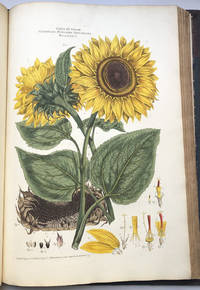
1794Flo467<p>Very good copy of the first collated edition of Miller's botanical classic</p><p>Complete with 108 handcoloured engraved plates engraved allegorical frontispiece engraved title list of subscribers explanation of classes and 108 leaves of descriptive letterpress in Latin and English</p><p>Plants include sunflowers tea pomegranate fig amaryllis peony canna mistletoe apple lemon horse chestnut rice belladonna fern mushrooms thistle mallow primrose etc.</p><p>"An immense work. illustrated in a style of unprecedented elegance." Lettsom</p><p>Miller's illustrated book on the sexual system of Linnaeus was published in twenty parts from 1770 to 1777 with the plates in two states: with letters on the uncoloured plates for science and without letters on the colored plates for aesthetics. The plants were sourced from Dr. John Fothergill's garden in Essex.</p><p>According to the list of subscribers 106 copies were ordered by 83 individuals or institutions. Queen Charlotte wife of the mad king George III subscribed for two sets along with botanists Joseph Banks Sir John Eden and Dr Daniel Solander Linnaeus' disciple actor David Garrick gardener Dr. Fothergill four sets physician Dr. William Pitcairn and booksellers P. Elmsley 10 sets and B. White 10 sets. Bristol Library Manchester Library the British Museum Jesus College Oxford and the Royal Library at the University of Gottingen all ordered a set.</p><p>Once the subscriptions had been filled there were evidently leftover sets of text and colored plates that were published with a new title page by R. Faulder in 1794. The new title-page accompanies a suite of the hand-coloured plates made up from "the surplus of the plates of the 1777 edition." Henrey Most of the plates in this copy have letters although two are without tea Camellia sinensis and arum Arum maculatum. The plates are "painted engraved and published by J. Miller in Dorset Court" and dated from 1770 to 1776.</p><p>John Miller born Johann Sebastian Mueller 1715-1792 was a botanical artist and engraver from Nuremberg who studied with engravers Johann Christoph Weigel and M. Tyroff before moving to England in 1744. Miller came to the attention of the Swedish biologist Linnæus the father of modern taxonomy through the British naturalist John Ellis. Miller sent samples of his work to Linnaeus for approval and received great praise: "More beautiful and more accurate than any since the world began." Miller also illustrated Philip Miller's <em>Most Beautiful Plants</em> 1755 a new edition of John Evelyn's <em>Sylva </em>1776 and John Stuart's <em>Botanical Tables</em> 1785.</p><p>Half-leather binding with spine with five raised bands gilt title label leather repaired and dyed with a dark stain green cloth boards rubbed and stained marble endpapers book block solid. Interior mostly clean and bright with some dust to page edges but all plates with superb handcolour. Oval blindstamps of Leyton Public Library on all plates outside the plate mark but no other markings. Title-page slightly spotted frontis repaired. Huge heavy imperial folio book.</p> R. Faulder hardcover
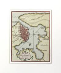
1780M1524London 1780. Very Good. Size : 125x95 mm 4.875x3.75 Inches Coloring: Hand Colored Category: Maps City Maps; Maps West Indies Cuba & Bahamas; unknown
1768049258A Yverdun: N.p. 1768. First Edition First Printing . Leather Bound. Very Good. 16mo - over 5¾ - 6¾" tall. 16mo. 332 pages. Hardcover bound in early full speckled calf with raised bands and gilt tooling on the spine. Binding housed in a modern removable clear mylar jacket. Moderate rubbing and wear to the binding. Hinges sound; headcap of the spine is chipped. The binding is rubbed and abraded at the fore edges. Marbled endpapers and all edges marbled. Text is toned and is generally clean. Not an illustrated work. Text is in French. A translation of the title into English is "Treatise on the Planting and Cultivation of the Principal Vegetable Plants Collected from the English Dictionary. <br/> <br/> N.p. hardcover
1767151933London. 1767. Seventh Edition. Leatherbound. Fair. Front and back covers are detached but still present; 1; 290 pages . hardcover
17976624London: John Murphy 1797. Mezzotint printed in colours and finished by hand by Gosse. A charming colour-printed mezzotint of English rural life<br/> <br/> Two young children are shown leaning on a stile looking out with interest at the world outside the confines of their home. The family dog looks up at the viewer. Behind them a fairly substantial cottage built of stone with two brick chimneys sits comfortably in its wooded surroundings beneath a pleasant blue sky. The whole scene is composed of richly contrasting colors and forms and could serve to illustrate the beginning of a fairy tale. John Murphy unknown
1776371213London : Printed for Edward and Charles Dilly and sold by W. Frederick at Bath 1776. Second Edition. Hardcover. Near fine set bound in the original paper boards with paper labels to the spines. Wear and tear as with age. Remains well preserved overall; bright clean and sharp-cornered. Physical description; two volumes only: II & III. Subjects. Poetry. Bath England. 18th century poetry. 18th century British Poetry. London : Printed for Edward and Charles Dilly, and sold by W. Frederick at Bath hardcover