Philip MILLERBiblio.com
93 résultats
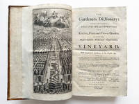
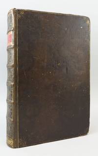
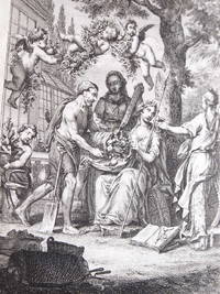
177151526London: Printed for the author 1771. Fine. Printed for the author London 1771 21 x 27.50 cm relié Sixth edition revised and expanded illustrated with an allegorical frontispiece by Wale and 12 folding plates greenhouses for melons another on greenhouses a third of a plant polygala another of a barn another of rubia plant. Some plates are bound out of order. Printed in double columns. Contemporary full blonde calf binding. Spine with raised bands decorated with fillets. Red morocco title label. Double fillet frame on boards. 2 wormholes at foot. 2 corners opened. One lack to upper board. Surface wear to boards. Lower joint split at head. Lacks to upper joint at head and lower joint at foot. The work was considered at the time by horticulturists and gardeners as the best and most comprehensive on the subject. It is a dictionary of plants according to Linnaeus's classification. Each article contains the history of the plant its region of origin its cultivation. Printed for the author hardcover
1731000750London: Printed for the Author and sold by C. Rivington 1731. 1st Edition . Hardcover. Very Good. Large 4to xvi 4 pages subscribers names unpaginated pp860 with 5 b/w engravings including frontis and other charts and illustrations throughout. Hardcover no dust jacket. Rebound in brown cloth with 5 raised bands to spine and original blind stamped leather binding re-laid to boards in good condition with some shelf wear and rubbing to tips and edges of boards. Inside in very good clean condition with no foxing or aging to pages with 10 pages that have old tape repairs to edges. In 1730 Philip Miller was asked by Nathan Bailey the English lexicographer to write the botanical entries for the Dictionarium Britannicum. With this prior experience Miller decided to produce his own Gardeners Dictionary 1731 a work that rivaled Bailey's in size and covered all aspects of gardening in kitchen- and flower-garden orchard greenhouse and tree plantations together with descriptions of plants and essays on horticultural science'. Miller's Gardeners Dictionary 1731 was the first comprehensive garden dictionary in English and was written just before he became Curator of the Chelsea Physic Garden. It was the most influential gardening book of the 18th century with readership aimed at the gentry and their head gardeners clergy academics and fellow members of the Royal Society. Eight up-dated editions were published before Miller's death in 1771. An exceptional copy of this scarce 1st Edition. <br/> <br/> Printed for the Author and sold by C. Rivington hardcover
1733876P10London: C. Rivington 1733. Leather. Very Good. 14.5" by 9". Not Stated. The second edition of Philip Miller's important dictionary on gardening an illustrated exploration of gardening in many different facets. The second edition.ESTC citation number N18273.Illustrated with a frontispiece one folding plate and three plates.Register runs as: 3 b-d2 B-10C2.Adverts to the verso of leaf 10C2.Collated complete. Collated from Jisc from a copy held at the University of Oxford Libraries. An important eighteenth century work on gardening first published in 1731.This work is an essential dictionary on gardening with noted on the cultivating and improving on the kitchen fruit and flower garden.The author Philip Miller was the chief gardener at the Chelsea Physic Garden from 1722 until his death in 1771. In a full rebacked calf binding. Externally generally smart with rubbing to the boards and spine. A small amount of loss of leather to the extremities and to the head and tail of the spine. Minor bumping to the extremities. Worming to the head of the rear board. Light discolouration to the boards and spine with a few minor marks including white marks to the head of the front board. Hinges are starting but firm. Internally firmly bound. Pages are bright and clean with a few scattered spots only. Very Good C. Rivington hardcover
1733GMM12823London: Printed for the Author 1733. .of the Present Age. Interspers'd with The History of the Plants the Characters of each Genus and the names of all the particular Species in Latin and English; and an Explanation of all the Terms used in Botany and Gardening. Together with Accounts of the Nature and Use of Barometers Thermometers and Hygrometers proper for Gardeners; And of the origin Causes and Nature of meteors and the particular Influences of Air Earth Fire and Water upon Vegetation according to the best Natural Philosophers.; The Second Edition Corrected.; Full brown leather rebacked ages ago with the origional boards skilfully laid back gilt title on faded red Morocco spine label raised bands blind panels & decoration to covers frontis engraving 2 additional full page at the back; A very nice good binding with handsome botanical bookplate inside front cover over an essentially very good bright textblock woth ink owner name/date atop title page; Unpaginated. Size: 9"x14". Hardcover. Printed for the Author Hardcover
1780C1536a<p>2 volumes in one: 320 pages with diagrams and index; 320 pages with diagrams and index. Octavo 8 1/4" x 5 1/2" bound in half leather with gilt lettering to spine. Volumes 7 and 8. Betts: 7-15 First edition.</p><p><em>The Huddersfield College Magazine</em> chess section was superseded by the <em>British Chess Magazine</em> after 1880 with no more published. In 1872 John Watkinson started a chess column in the Huddersfield College Magazine. Eventually the single page column became a small magazine exclusively devoted to chess - <em>The Huddersfield College Chess Magazine</em>. Finally this magazine evolved into the<em> British Chess Magazine</em> which is still going strong today. The columns provide an interesting glimpse of the local Huddersfield & Yorkshire chess scene at the time before eventually becoming more nationally and internationally oriented in later years. In English Descriptive notation One of the early chess magazine published.</p><p><strong>Condition:</strong> Provenance from the Franklin Chess Club of Philadelphia with their stamp on end papers and pasted down. Heavily rubbed at edges corners bumped and rubbed through some occasional internal soiling and pencil marginalia previous owner's neat pen signature on title front endpaper detached. Over all a good copy of a scarce chess item.</p> J E Wheatley & Company hardcover
17611711290002London : Printed for T. Osborne . R. Baldwin . J. Ward . W. Johnston . and S. Crowder and Co 1761. Good. Folio. No date on title circa 1760/61. xviii 1080 pp Engraved frontispiece; 12 engraved plates on ll sheets. illustrations ; 43 cm. Modern 3/4 leather over original marbled boards marbled page ends marbled endpapers. Foxing and minor toning. <br> In 1721 Bailey published the first first monolingual English dictionaries to focus on defining words in common usage rather than just difficult words. Bailey's Dictionarium Britannicum 1730 and 1736 was the primary resource mined by Samuel Johnson for his Dictionary of the English Language 1755. The "Scott-Bailey" or "Bailey-Scott" dictionary contains relatively slight revisions by Scott but mostly plagiarizes Johnson's own dictionary. "The attempt of the Bailey proprietors to enter a folio to rival Johnson's great Dictionary remained alive through 1772 three years after Scott's death." See Starnes & Noyes chapt. XXII for a full treatment; Alston V 175. London : Printed for T. Osborne ... R. Baldwin ... J. Ward ... W. Johnston ... and S. Crowder and Co hardcover
1797130418London: F. and C. Rivington et al Publication dates 1797 & 1807. Plates dated 1795-1807. Hardcover. Very good. 2 volumes in 4 books. Vol. I Part I: clxviii x 2 15 plates Unpaginated ABR-CHE. Vol. I Part II: Unpaginated. CHE-IXO. Vol. II Part I: Unpaginated. KAE-PYR. Vol. II Part II: Unpaginated. PYR-ZYG. 42 cm. 19 plates altogether. Vol. I Part I has 15 plates: first 8 plates are titled Roots Simple Leaves Compound Leaves Flower Pericarp or Fruit Fruit Seed Receptacle Linneus's Classes Linneus's Orders. 7 plates of Linnaean Classes following. Vol. I Part II has 2 Greenhouse plates and 1 Ice House plate. Vol. II Part II has one plate of a Stove. Full diced calf with gilt trim and blank tooling. Marbled endpapers and text block edges. Hinges and corners repaired. A few scuffs. Some foxing in first book mainly to AND pages. Faint stains on a page in CAR. Pages CAR onwards darkened. Some pages darkened in other volumes. Tear in Ice House plate at bottom. Dark mark in margin of VER section. <br/><br/>Title continues: "Containing the Best and Newest Methods of Cultivating and Improving the Kitchen Fruit and Flower Garden and Nursery; Of Performing the Practical Parts of Agriculture; Of Managing Vineyards and Of Propagating All Sorts of Timber Trees. By the Late Philip Miller F.R.S. Gardener to the Worshipful Company of Apothecaries at Their Botanic Garden in Chelsea and member of the Botanic Academy at Florence. To which are now first added A Complete Enumeration and Description of All Plants Hitherto Known With Their Generic and Specific Characters Places of Growth Times of Flowering and Uses Both Medicinal and Economical. The Whole Corrected and Newly Arranged With the Addition of All the Modern Improvements in Landscape Gardening and in the Culture of Trees Plants and Fruits Particularly in the Various Kinds of Hot Houses and Forcing Frames: With Plates Explanatory Both of Them and the Principles of Botany." Philip Miller 1691-1771 a commercial florist at St. George's Fields and gardener at Chelsea Physic Garden first published this volume in 1731. First known as The Gardener's Dictionary the book ran through eight editions each one recording new plants and making the author famous in European botanical circles. Thomas Martyn 1735-1825 Professor of Botany at Cambridge laid out that that school's famous botanical garden with the assistance of Miller. One of the great works on the subject ever produced in English this set is considered the starting point for the nomenclature of cultivated plants. Dedicated to Sir Joseph Banks 1743-1820 English Botanist responsible for Kew Gardens. Scarce especially in this condition. F. and C. Rivington et al hardcover
18001359539New-York: Collins & Co.; T. & J. Swords; John Forbes; 1800; 1802; 1803; 1806; 1808; 1809; 1811; 1812. Mixed Editions. Hardcover. Octavos 10 volumes 1800-1812 non-inclusive some with plates. Good- to Good; all but one volume fully bound in contemporary leather Vol V 1802 bound in marbled paper with leather to spine all have spine labels with gilt titling but of varying styles; all have tears and surface marks to covers most front hinges somewhat compromised but bindings all else tight; text blocks show age toning and several have liquid damage that extends to pages; foxing and age toning to pages throughout; plates present and intact though some with deep age toning and foxing; title page and first several pages of Second Hexade Vol. VI show insect damage; previous owner bookplate to front pastedown of Vol. V 1802 "Ex Libris Henry Barton Jacobs;" previous owner name stamped on title pages of several volumes "Isaiah Matlack;" MF consignment. Volume III 1800<br> <br /> Volume V 1802<br> <br /> Volume VI 1803<br> <br /> Second Hexade Volume III 1806<br> <br /> Second Hexade Volume V 1808<br> <br /> Volume IV 1809 Second Hexade Volume VI<br> <br /> Volume 2 1811 Third Hexade Volume II<br> <br /> Volume 3 1811 May June July<br> <br /> No. 1 Volume I 1812<br> <br /> Third Hexade Volume III 1812<br> <br /> <br /> The Second Hexade Volume III 1806 contains one of the earliest printed accounts of the Lewis and Clark expeditions in particular making reference to a manuscript copy of "A Map of those parts of North-America situated between the 35th and 51st degrees of latitude and the 89th and 124th degrees of longitude" that was been sent to the Secretary at War with other copies made under the direction of Gen. Dearborn for the inspection of Congress. 1359539. Special Collections. Collins & Co.; T. & J. Swords; John Forbes; hardcover
1739227332London: T. Read 1739. hardcover. near fine. First carefully collected in the Company and many of them transcribed from the Mouth of the Facetious Gentleman whose Name they bear; and now set forth and published by his lamentable Friend and former Companion Elijah Jenkins Esq. 2 70pp. Thin 12mo bound by Riviere in 19th century straight-grained olive green morocco a.e.g. lightly edgeworn but sound; light foxing and toning throughout; several bookplates on endpapers and one description mounted to flyleaf; housed in an attractive cloth-backed marbled board slipcase with leather spine label. London: Printed and Sold by T. Read 1739. Genuine first edition with "Price One Shilling" at bottom of title. Scarce. Near fine.<br/> <br/> Extremely scarce. First edition of the most famous collection of anecdotes and humor. Compiled by Elijah Jenkins pseudonym of John Mottley partially from several other jestbooks. Mottley named the book in honor of Josias Miller the famous comic actor who had died the previous year. --DNB; ESTC T124768.<br/> <br/> T. Read unknown
178625988Ephrata: The Cloister 1786. First edition 4to pp. 6 250 2; printed in black letter throughout; engraved vignette pasted on title page; prelims and terminals waterstained small tear in the lower margin of title not touching letterpress old ownership signature at the top of the title page of Christian Stauffer 1736-1808 and a 30-line poem also presumably by him on the final blank leaf as well as a few marginal annotations; contemporary full calf front cover detached but present; the whole in a new cloth clamshell box. An abstract of the diary of the Brotherhood which had been kept by Brother Lamech and continued and edited by Brother Jaebez Agrippa i.e. Johan Peter Miller. Brother Lamech has been identified as Jacob Gass by Seidensticker First Century of German Printing in America p. 117. Evans 19558: "This biography of Johann Conrad Beissel the founder of the Ephrata Community is the principal source of information regarding that remarkable institution. Brother Agrippa is Johann Peter Miller; and Brother Lamech's secular name is said to be Jacob Gass. An English translation was printed in Lancaster Pennsylvania in 1890." Howes G76 identifying this as the second issue of three with the title page seal pasted on. [The Cloister] unknown
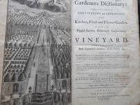
173142820897<p>FIRST EDITION. Philip Miller's Gardeners Dictionary is one of the most important books in the history of horticulture. <strong>"This work was in truth monumental; it laid the foundation for all the horticultural knowledge and taste in Europe"</strong> Green <em>History of Botany in the United Kingdom</em>.</p><p>Son of a market gardener Philip Miller 1691-1771 became head of the Chelsea Physic Garden in 1722. Miller corresponded with botanists and gardeners around the world including Linnaeus who visited Miller in London. Building a worldwide network of contacts Miller obtained innumerable specimens and introduced many plants to England. The world's leading authority on horticulture Miller was elected a Fellow of the Royal Society in 1731. By the time of his death in 1771 Miller had transformed the private medicinal garden into the leading botanical garden in Europe.</p><p>Miller's greatest achievement was his <em>Gardeners Dictionary</em> which was issued in eight folio editions 1731-68 during the author's lifetime. A smaller format abridgement appeared in multiple editions in 1735-71. The book's direct descendant is the present-day <em>Dictionary of Gardening</em> published by the Royal Horticultural Society.</p><p>The<em> Gardeners Dictionary</em> was enormously influential in America. "In the American colonies wealthy landowners laying out the grounds of stately new homes inevitably turned to England for inspiration. … The most authoritative design guide of the period was <em>The Gardeners Dictionary</em> written by Philip Miller in 1731. Alice Lockwood author of <em>Gardens of Colony and State</em> pointed to Miller's frontispiece—a symmetrical layout bisected by a canal with walled orchards and beds—as 'the ideal of many a colonial garden.'" Karson <em>A Genius for Place</em>.</p><p>Thomas Jefferson "made constant use of Miller's <em>Gardeners Dictionary</em> which is mentioned frequently in his Garden Books and in his correspondence" Sowerby <em>Catalogue of the Library of Thomas Jefferson</em>. Jefferson listed the work in his famous letter to Skipwith naming the books essential for a gentleman's library.</p><p>The Swedish botanist and explorer Pehr Kalm observed in 1753 that he had "asked several of the greatest and best horticulturists both in England and in America what author and what book they had found and believed to be the best in horticulture … They all answered with one mouth Miller's <em>Gardener's Dictionary</em> either in folio or the abstract in octavo was the best of all. … The same answer I have got from several distinguished persons who had themselves had a particular pleasure in planting trees and plants with their own hands. If any of the Lords or great 'Herren' in England wished to lay out a new garden or remake an old one Mr. Miller would always show them how it ought to be done. When the greatest lords drove out to their estates he often drove out with them in the same carriage. In a word the principal people in the land set a particular value on this man" quoted in Le Rougetel <em>The Chelsea Gardener: Philip Miller 1691-1771</em>.</p><p>Provenance: Armorial bookplate of John Rolle Baron Rolle of Stevenstone 1750-1842 on front pastedown</p><p>Folio. xvi 844 pp with 5 plates including frontispiece. Eighteenth-century sprinkled paneled calf spine gilt. Darkening and soiling to boards light wear to extremities small crack to spine. Rebacked preserving original spine. Some light spotting and staining 4-inch closed tear to 2r. An excellent copy</p> Printed for the author and sold by C. Rivington hardcover
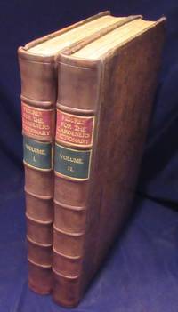
17607686<p>Two volume set. Original full speckled calf professionally rebacked in calf; pastedowns renewed; fly sheets and title mounted. Complete with 300 full-page hand-colored copper plates 2 folding. Miller was the chief gardener at the Chelsea Physic Garden where many of the engravings were made under his supervision. Drawings were taken from living plants at their greatest expression of flowering. A high point in botany. ; 200; iv pages. 10.75 x 16.25 inches; 27 x 41.4 cm.</p> Printed for the Author hardcover
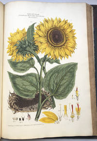
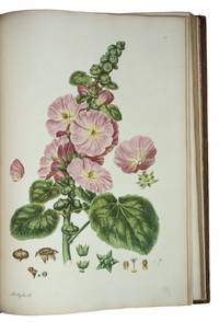
1794Flo467<p>Very good copy of the first collated edition of Miller's botanical classic</p><p>Complete with 108 handcoloured engraved plates engraved allegorical frontispiece engraved title list of subscribers explanation of classes and 108 leaves of descriptive letterpress in Latin and English</p><p>Plants include sunflowers tea pomegranate fig amaryllis peony canna mistletoe apple lemon horse chestnut rice belladonna fern mushrooms thistle mallow primrose etc.</p><p>"An immense work. illustrated in a style of unprecedented elegance." Lettsom</p><p>Miller's illustrated book on the sexual system of Linnaeus was published in twenty parts from 1770 to 1777 with the plates in two states: with letters on the uncoloured plates for science and without letters on the colored plates for aesthetics. The plants were sourced from Dr. John Fothergill's garden in Essex.</p><p>According to the list of subscribers 106 copies were ordered by 83 individuals or institutions. Queen Charlotte wife of the mad king George III subscribed for two sets along with botanists Joseph Banks Sir John Eden and Dr Daniel Solander Linnaeus' disciple actor David Garrick gardener Dr. Fothergill four sets physician Dr. William Pitcairn and booksellers P. Elmsley 10 sets and B. White 10 sets. Bristol Library Manchester Library the British Museum Jesus College Oxford and the Royal Library at the University of Gottingen all ordered a set.</p><p>Once the subscriptions had been filled there were evidently leftover sets of text and colored plates that were published with a new title page by R. Faulder in 1794. The new title-page accompanies a suite of the hand-coloured plates made up from "the surplus of the plates of the 1777 edition." Henrey Most of the plates in this copy have letters although two are without tea Camellia sinensis and arum Arum maculatum. The plates are "painted engraved and published by J. Miller in Dorset Court" and dated from 1770 to 1776.</p><p>John Miller born Johann Sebastian Mueller 1715-1792 was a botanical artist and engraver from Nuremberg who studied with engravers Johann Christoph Weigel and M. Tyroff before moving to England in 1744. Miller came to the attention of the Swedish biologist Linnæus the father of modern taxonomy through the British naturalist John Ellis. Miller sent samples of his work to Linnaeus for approval and received great praise: "More beautiful and more accurate than any since the world began." Miller also illustrated Philip Miller's <em>Most Beautiful Plants</em> 1755 a new edition of John Evelyn's <em>Sylva </em>1776 and John Stuart's <em>Botanical Tables</em> 1785.</p><p>Half-leather binding with spine with five raised bands gilt title label leather repaired and dyed with a dark stain green cloth boards rubbed and stained marble endpapers book block solid. Interior mostly clean and bright with some dust to page edges but all plates with superb handcolour. Oval blindstamps of Leyton Public Library on all plates outside the plate mark but no other markings. Title-page slightly spotted frontis repaired. Huge heavy imperial folio book.</p> R. Faulder hardcover
176526259New England 1765. Pen-and-ink with grey and light green wash on two joined sheets of laid paper with an unlettered cartouche in the upper right corner in yellow wash a compass rose additionally decorated in green red and yellow period ink inscription on verso: "Kennebec River by Capt. Small." Provenance: Sir Francis Bernard Colonial Governor of Massachusetts 1712-1779; by descent to Robert Spencer Bernard Nether Winchendon House Buckinghamshire England. The earliest known survey of the upper Kennebec River here in manuscript.<br/> <br/> In November 1969 noted historian of cartography William P. Cumming discovered in the family home of Sir Francis Bernard "a collection of maps that in purpose and type differed so markedly from the more usual military coastal and general colonial maps of the time that it stands out in both interest and importance." Cumming The present manuscript map done on a scale of approximately 4 1/2 miles to the inch shows much of the length of the Kennebec from its mouth to a point approximately 100 miles north of Fort Western with its various tributaries and islands depicted. At the bottom of the map the coast of Maine is shown in much detail depicting the numerous small islands and inlets from Penobscot Bay in the north to Cape Elizabeth in the south. Numerous forts along the coast are shown including George's Fort Brunswick Fort and Pemmaquid Fort; a church is depicted at the mouth of Royall's River near North Yarmouth. West of the Kennebec a portion of the "Sagadehock" or "Amorescoggin" River is shown. Along the lower Kennebec Fort Francfort Fort Western and Fort Halifax are identified. Toponyms north of Fort Halifax include "Norridge Walk" and "An Indian Carrying Place" i.e. portage route which is drawn via hachured line. Bernard became the Colonial Governor of Massachusetts in late 1759 shortly after British troops were victorious in the Battle of Quebec. That decisive French and Indian War victory opened a vast region for renewed English settlement and trade thus necessitating the need for more accurate surveys of the roads and inland waterways. The present manuscript map was surveyed and drawn by the talented military mapmaker Francis Miller in 1765 for Bernard the details of which are recounted by Bernard in a 1766 letter to Lord Barrington: "I am desired to certify to your Lordship that at the beginning of the Year 1764 Genl Gage at my Request gave Leave to Ensign Francis Miller of the 45th regiment then stationed in Newfoundland to come to Boston to assist me in some Works of Public Surveying which I had undertaken in pursuance of resolutions of the general Assembly and partly by Orders from England. Mr Miller being then at an outpost and not easily relieved did not arrive at Boston till Nov in that Year when the Season for actual Surveying was over. He was employed that Winter and Spring following in protracting the Surveys made that Summer among which was a compleat Route from Fort Pownal on the River Penobscot to Quebec i.e. Chadwick's surveys and some other curious explorations of the Eastern parts of New England hitherto unknown to Englishmen: of which elegant Maps drawn by Mr. Miller have been transmitted to the Board of Trade." Bernard to Barrington 11 January 1766 quoted in The Barrington-Bernard Correspondence p. 103 emphasis added. The present map based on the surveys of little known Maine surveyor John Small would appear to have been among these "curious explorations." Small c.1722-1761 learned surveying from his father Samuel Small of Scarborough Maine and actively engaged surveying in that region from a young age. In 1745 he was commissioned in the Army serving at the first expedition against Louisburg and again in 1757-58 in Upstate New York including action at Ticonderoga. In 1758-59 he served as a surveyor on Pownall's Expedition to the Penobscot River and the construction of Fort Pownall and was commissioned as captain in 1759 for service in Amherst's march on Montreal. "At the expiration of his military duties January 12 1761 Captain John Small returned to his home in Scarborough. This contest i.e. the French and Indian War had been greatly protracted by the nature of the country. The problem of moving troops encumbered with baggage and artillery was most difficult. Massachusetts realized this need of roads to the utmost; and soon after the conquest of Canada a highway was projected by the government to connect Maine with that country by way of the Kennebec and Chaudiere rivers. Captain John Howard with a party of fifteen men was sent out from Fort Western on the Kennebec River to explore the immediate country ascertain the disposition of the Indians and survey the proposed road. Small joined these scouts on September 1 1761 as First Surveyor. Three weeks later while in the almost impenetrable forests of northern Maine Captain Howard shot at what he supposed to be a bear and was horrified to find that he had taken the life of one of his own men -- his first surveyor. At the death of Small since Captain Howard the commander of the expedition was entirely unfit to carry on the work the project for constructing a military road to Quebec was abandoned -- never to be resumed." Underhill Besides the inscription on verso indicating that the map was protracted after Small's surveys the map itself includes the inscription to the left of Fort Halifax "Here begins Capt. Small's Survey" as well as an inscription in the upper left corner "Here Capt. Small was killed."<br/> <br/> Barrington-Bernard Correspondence p.103. Cumming British Maps of Colonial America pp.29-30 Appendix A. Underhill Descendents of Edward Small of New England Vol. 1 164-213 pp. unknown
1755ST13850London: Printed for the Author; And Sold by John Rivington et al. 1755-60. FIRST EDITION. 425 x 270 mm. 16 3/4 x 10 5/8". vi 200 4 pp. Two volumes in one. <br/> Contemporary calf cover with thin gilt border and small cornerpieces raised bands compartments with much gilt tooling red label with gilt lettering skillfully rebacked preserving most of original backstrip. WITH 300 LOVELY HAND-COLORED ENGRAVINGS OF FLOWERS two of which are folding. Front pastedown with armorial bookplate of John Pollexfen Bastard. Sitwell "Great Flower Books" p. 121; Hunt 566; Henrey 1097; Pritzel 6242; Nissen 1378; Hazel le Rougetel "The Chelsea Gardener Philip Miller 1691-1771" pp. 110 114. Covers somewhat scratched corners a bit worn but the restored binding solid and appealing. Occasional mild thumbing or light browning perhaps a dozen plates with minor to moderate offsetting but A VERY PLEASING COPY INTERNALLY quite clean and fresh and with attractive coloring.<br/> <br/> By a man characterized by DNB as "the most distinguished and influential British gardener" of the time this lavishly illustrated work is called by celebrated botanist W. T. Stearn the most important horticultural work of the 18th century. And Richard Pulteny the British naturalist and historian of science said that "England had not before produced any work except the 'Hortus Elthamensis' or Catesby's 'Carolina' so superb and extensive." Published in 50 monthly parts containing six plates each these two impressive folio volumes comprise in Hunt's words a "complement and fulfillment" of Miller's popular but sparsely illustrated "Gardener's Dictionary" with 300 splendid depictions of plants drawn from live specimens in the renowned Chelsea Physic Garden where Miller served as head gardener. Miller 1691-1771 published "Figures" as a means to showcase in a grand fashion a selection of species deemed to be either noteworthy useful in trade or medicine or somehow overlooked by botanists. According to DNB the lovely plates here executed by eminent artists that include Georg Ehret were "commended at the time for being drawn from nature in the best state of flowering and for including illustrations of fruit and seed as they ripened." Miller boasts in the preface that "no Expense has been spared to render it as perfect as possible: The Drawings were taken from the living Plants; the Engravings were most of them done under the Author's Inspection; and the Plates have been carefully coloured from the original Drawings and compared with the Plants in their Perfection." This book appears with some regularity in the market but it is quite difficult to find in the kind of condition seen here. Printed for the Author; And Sold by John Rivington [et al.] unknown
177740827London: Published and Sold by the Author at his House in Dorset Court near Parliament Street 1777. 3 volumes. Folio. 20 1/2 x 14 inches. First edition. 104 engraved plates in both hand-colored and uncolored states plus 4 hand-colored engraved plates of botanical details. Engraved allegorical frontispiece engraved title preface subscription list explanation of classes. Each uncolored plate with an accompanying descriptive letterpress leaf. Unpaginated. Contemporary full calf with roll-tooled gilt foliate gilt-patterned board edges seven raised bands forming eight compartments on a richly gilt-patterned spine gilt-lettered red morocco lettering-piece in second compartment and brown morocco in third all edges gilt and sprinkled red<br/> <br/> Excellent example of Miller's prodigious Linnæan herbal with plates in two states. "An immense work . . . illustrated in a style of unprecedented elegance." Lettsom<br/> <br/> Miller's esteemed illustrated botanical book on the sexual system of Linnæus was published in twenty parts from 1770 to 1777 with plates issued as completed from 1770 onward. Volume I holds a suite of 104 engraved plates in proof states before letters all colored in a fine contemporary hand with penciled names at the bottom of each leaf printed recto with blank versos. Volumes II and III have the same suite of 104 plates with 53 in Volume II and 51 in Volume III each with an engraved title and imprint and each paired with a leaf of descriptive letterpress text. These plates are uncolored with botanical text in Latin and English. An additional four hand-colored engraved plates are at the rear of Volume III. 178 varieties of plant leaves are shown across a total of 212 plates. Miller issued the plates in two states: with letters on the uncolored plates for science and without letters on the colored plates for aesthetics. The plants themselves were sourced from Dr. John Fothergill's 1712-1780 renowned garden in Essex. Fothergill was an enthusiastic supporter of Miller and served as the superintendent of his book but refused Miller's attempt to dedicate the work to him stating that dedications were a "species of literary pageantry." Lettsom The text's botanical information was initially overseen by Gowan Knight 1713-1772 the first Principal Librarian of the British Museum and a friend of Fothergill's. According to the list of subscribers 106 copies were ordered by 83 individuals or institutions. Queen Charlotte subscribed for two copies while the booksellers P. Elmsley and B. White each took ten. Once the subscriptions had been filled there were evidently leftover sets of text and colored plates. Henrey records a copy of the work in the Natural History Museum Library with a new 1794 title-page with R. Faulder as the publisher. This re-set title accompanies a suite of the colored plates made up from what appears to be "the surplus of the plates of the 1777 edition." Henrey Miller born Müeller was a botanical artist and engraver from Nuremberg who studied with Johann Christoph Weigel and M. Tyroff before moving to England in 1744. He would reside there for the rest of his life. Miller came to the attention of the Swedish biologist Linnæus the father of modern taxonomy through the British naturalist John Ellis 1710-1776. Linnæus himself was sent samples of Miller's work for approval and had nothing but praise for the artist. Miller would go on to publish Botanical Tables in 1785 with John Stuart 3rd Earl of Bute 1713-1792 who served as the Prime Minister of Great Britain from 1762 to 1763. More than a thousand of Miller's original drawings now reside at the Natural History Museum in London. DNB<br/> <br/> Blunt p.150. DNB. Dunthorne 207. ESTC T91594. Henrey III 1153. Lettsom The Memoirs of John Fothergill p.106. Nissen BBI 1372. Plesch p.336. Sitwell Great Flower Books p.120. Soulsby 667. Sprague "John Sebastian Miller's 'Icones Novae'" in Journal of Botany Vol. 74 pp. 208-209. Stafleu TL2 6482. Published and Sold by the Author at his House in Dorset Court near Parliament Street unknown
17703518London: published and sold by the author at his house . 1770. Contemporary uniform gold-tooled mottled calf sewn at 7 stations richly gold-tooled spine with red and green title labels each board with a border made with a flower roll gold-tooled board edges curl-marbled endpapers. Imperial folio 54 x 38 cm. Richly engraved frontispiece with medallion portraits of Miller and Linnaeus at the head 3 engraved title-pages identical except for the manuscript volume numbers 2 series of engraved botanical plates each series numbered in manuscript 1-104 each series printed from the same 104 plates but that in volume 1 in proof-states with no headings imprints or other text in the plates and beautifully hand-coloured that in volumes 2 & 3 in black and white with titles and imprints and 4 further plates numbered I-IV showing 178 varieties of leaves finely hand-coloured. With a full-page allegorical dedicatory pen and watercolour drawing for Queen Charlotte of England on the end-leaf before the frontispiece of the first volume and a professionally lettered index covering all 3 volumes specially made for this dedication copy at the end of volume 3. 3 volumes. Dedication copy with a stunning original pen and watercolour drawing in honour of Queen Charlotte of England of the first edition of a highly esteemed illustrated book on the sexual system of Linnaeus published in 20 parts from 1775 to 1777 with some plates issued as completed from 1770 onward. Our copy is bound in three volumes with the volume numbers professionally lettered on the title-pages in ink. Volumes 2 and 3 contain the suite of plates in black and white plus the four hand-coloured plates showing 178 varieties of plant leaves each plate with an engraved title and imprint. Volume 1 contains a suite of the same 104 plates in proof states with no lettering all in a fine contemporary hand-colouring. The present copy of this rare and impressive flower book is especially valuable for its beautiful dedicatory watercolour drawing for Queen Charlotte 1744-1818 wife of King George III of England. Probably drawn by Miller himself it shows Father Time and Britannia seated at the foot of an obelisk looking at the inscription "Charlotta Regina" that an angel just incised on it. A smoking incense burner sits on top of the obelisk which two putti adorn with garlands while a herald angel blows its trumpet emitting the word "extendo". The whole is veiled in thick clouds and below it appears the winged decorated royal device bearing the legend "honi soit qui mal y pense".Water stain in upper outside corner of one plate and one text leaf in volume 3 and 2 of the plates of leaf varieties foxed but generally in fine condition. The ink of the uncoloured plates has sometimes caused a shadow on the facing text page. The spine joints and board edges have been expertly restored with the loss of much of the gold-tooling on the spine of volume 1.l Blunt p. 150; Dunthorne 206; Henrey 1153; GFB p. 68; Nissen BBI 1372; Plesch p. 336; Pritzel 6523; Soulsby 667. published and sold by the author at his house ..., unknown
176525488New England 1765. Pen ink and wash on vellum done on a scale of approximately 1 inch per 9 miles. Later cartouche on paper mounted to the lower right corner reading "Map of Sir Francis Bernard's American Estate and the Adjoining Country." Mounted to board. Provenance: Sir Francis Bernard Colonial Governor of Massachusetts 1712-1779; by descent to Robert Spencer Bernard Nether Winchendon House Buckinghamshire England. An incredible eighteenth-century manuscript map on vellum accomplished for Massachusetts Colonial Governor Sir Francis Bernard: among the earliest English surveys of the interior of Maine and shows Mt. Desert Island.<br/> <br/> In November 1969 noted historian of cartography William P. Cumming discovered in the family home of Sir Francis Bernard "a collection of maps that in purpose and type differed so markedly from the more usual military coastal and general colonial maps of the time that it stands out in both interest and importance. These were domestic maps of a gentleman's estates and the roads to them." Cumming Specifically describing the present map Cumming writes: "This beautifully drawn map in black ink with bays rivers and lakes colored in green shows the coast from Broad Bay past Penobscot Bay and its islands to 'Passmaquiddy Bay' and Saint Croix River. The shoreline from Mount Desert Island to Passamaquoddy Bay is unmarked. The course of the St. Croix River to the Grand Lakes the Penobscot to Chesuncook Lake and the upper reaches of the Kennebec River to Mooshead Lake are traced carefully with the beginning of the overland trail to the River St. Lawrence." Cumming Sir Francis Bernard became the Colonial Governor of Massachusetts in late 1759 shortly after British troops were victorious in the Battle of Quebec. That decisive French and Indian War victory opened a vast region of present-day Maine for potential English settlement. To honor their new governor the Massachusetts Assembly petitioned the Crown to grant to Bernard "the Island of Mount Desart sic lying north eastward of Penboscot Bay." Bernard quickly began to establish a scheme to colonize the lands thereby affirming his grant. Writing to Viscount Barrington in June 1763 Bernard revealed his intentions to survey the region: "I propose to reconnoitre this Country this Summer with great accuracy the assembly having authorised me to employ a Mathematician to make observations all along the Coast. I have a very good Man for that purpose the Professor of Mathematics at this College i.e. John Winthrop whom I shall accompany and assist myself. And I shall make a further progress in surveying Mount Desert unless I am ordered off from home. I have concluded with 60 families with a Minister at their head and a Merchant to supply'm to settle there this Summer upon a plan already laid out: I want only power to make them a title. There are also 920 families ready to settle upon the continent adjoining to the Islands in 12 Townships already mark't out. I shall greive much setting aside my own interest if this settlement should be defeated; as it is compactly planned and laid out to great advantage. And when I consider how much it has Cost the Government of Great Britain to settle 4000 Souls in some other Parts of America I think it will be a great pity that such a Settlement should be refused when offered to be brought forward at no public expence at all. For my own part I have been drawn into this scheme imperceptibly: and now the People call on me to be their leader which I shall decline no longer than till I can learn that my establishing a New Colony in a desert which will long remain unpeopled if this opportunity is neglected will be approved." Bernard to Barrington 15 June 1763 quoted in Barrington-Bernard Correspondence p.70 The twelve townships referred to by Bernard are depicted on the present manuscript map via thin black lines. The year following that letter to Barrington the present manuscript map was drawn by the talented military mapmaker Francis Miller the details of which are recounted by Bernard in a 1766 letter to Barrington: "I am desired to certify to your Lordship that at the beginning of the Year 1764 Genl Gage at my Request gave Leave to Ensign Francis Miller of the 45th regiment then stationed in Newfoundland to come to Boston to assist me in some Works of Public Surveying which I had undertaken in pursuance of resolutions of the general Assembly and partly by Orders from England. Mr Miller being then at an outpost and not easily relieved did not arrive at Boston till Nov in that Year when the Season for actual Surveying was over. He was employed that Winter and Spring following in protracting the Surveys made that Summer i.e. the surveys by Chadwick among which was a compleat Route from Fort Pownal on the River Penobscot to Quebec and some other curious explorations of the Eastern parts of New England hitherto unknown to Englishmen: of which elegant Maps drawn by Mr. Miller have been transmitted to the Board of Trade. Early in the Last Summer I employed Miller having previously informed Genl Gage of the Intention to make an actual Survey from Boston to Albany and back again by another Way being near 200 Miles; and afterwards from Boston to Penobscot being above 200 Miles; by which Means a true Geometrical Line of 400 Miles in length through part of New York and all the habitable part of New-England has been obtained which will afford great Assistance to the Ascertaining the Geography of this Country and its Sea Coast. After this Survey was finished he was employed in protracting the Same and making Drawings thereof which he has done with great Accuracy and Elegance." Bernard to Barrington 11 January 1766 quoted in Barrington-Bernard Correspondence p.103 Chadwick's survey of 1764 would mark the beginning of the English exploration in the area. Chadwick's Journal the original in the Archives of Massachusetts and published in the Bangor Historical Magazine relates the reasons for the important and early survey: "The object of this survey was first to explore the Country secondly to view if it were practicable to make a road from Fort Pownal on Penobscot River to Quebec." His Journal continues with a direct reference to the present map: "Returned Jan. 1 1765 three plans the first directed to Lord Haliax etc. by order of His Excellency Francis Bernard etc. The second plan for the Secretary's office and a third plan for the Governor i.e. the present map; that the two last had no direction. That these plans were afterward delineated by Mr. Miller a regular officer." Thus the present manuscript map was one of two accomplished by Miller the other being in the Public Records Office London. As evidenced from Bernard's letter and Chadwick's journal this incredibly detailed map was drawn by Miller accomplished from Chadwick's surveys of 1764 and Miller's own surveys of the region. The map would also rely on Montresor's surveys of the region from 1761 as well as surveyor John Small's survey under Captain John Howard as the map extends beyond the region surveyed by Chadwick including the Kennebec River and the area to Lake Megantic. Bernard's maps would have a profound influence on the cartography of the area. In 1776 with the Revolution engendering great interest in the cartography of the colonies Thomas Pownall published a map which relied on the aforementioned surveys. Pownall's map used Lewis Evans's seminal 1755 mapping even printing it from the same plate but extended the map with a new plate to the east to encompass New England. On that portion of the map by means of two small asteriks Bernard's surveys were identified. A small caption on the Pownall map explains: "The Coast included within these marks is copied from Governor Bernard's Surveys including Mo. Desart Id. &c." Pownall's mapping of the northern New England coastline -- i.e. the mapping derived from the present survey -- would become the definitive mapping of the region and would be copied by countless cartographers into the 19th century. The origins of this influential map however began with Governor Bernard's surveys.<br/> <br/> Barrington-Bernard Correspondence p.70. Chadwick "An Account of a Journey from Fort Pownal Up the Penobscot River to Quebec in 1764" in Bangor Historical Magazine Vol.IV No.8. Cumming British Maps of Colonial America pp.29-30 Appendix A. Eckstrom "History of the Chadwick Survey" in Sprague's Journal of Maine History 14 pp.62-89. unknown