(Cook, Captain James) Parkinson, SydneyBiblio.com
271 résultats
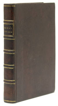
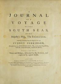
1773310853London: Printed for Stanfield Parkinson 1773. First edition with the very rare "Explanatory Remarks" by Fothergill and postscript. Complete with frontispiece and 27 engraved plates including 1 map. xxiv 22 212 2 pp. Imperial 4to. Contemporary tree calf finely rebacked with gilt spine to period style. Fine. First edition with the very rare "Explanatory Remarks" by Fothergill and postscript. Complete with frontispiece and 27 engraved plates including 1 map. xxiv 22 212 2 pp. Imperial 4to. First edition of this important account of Cook's first voyage based on the journal of Parkinson who had been engaged by Sir Joseph Banks to serve as natural history draughtsman aboard the Endeavour. Parkinson died of dysentery on the homeward voyage and his account was transcribed and published by his brother Stanfield Parkinson who was forced by injunction to delay publication until Hawkesworth's official account appeared. "Parkinson made numerous drawings of botanical and other subjects including landscapes and portraits of native chiefs . Banks spoke highly of his 'unbounded industry' in making for him a much larger collection of drawings than he anticipated. His observations too were valuable and the vocabularies of South Sea languages given in his journal are of great interest" Hill. <br /> <br /> This copy includes the rare "Explanatory Remarks" by John Fothergill a Parkinson family friend who mediated an agreement between Stanfield Parkinson and Banks both of whom laid claim to the journal which would allow for the publication of the book. When Stanfield Parkinson included a scurrilous preface attacking Banks and misrepresenting his actions an offended Fothergill purchased the remaining copies inserting into them these 22 pages of remarks which sought to set the record straight. In 1784 he brought out a new edition of Parkinson's account which included the remarks but copies of the first edition which include them are scarce on the market. Beddie 712; Hill 1308; Holmes 7; Howgego C173; Du Rietz 944; Sabin 58787 Printed for Stanfield Parkinson unknown
1783310851Hartford: Nathaniel Pattern 1783. First edition lacking the map as in almost all copies. 208 pp. 1 vols. 8vo. Contemporary sheep over boards finely rebacked with period spine to style. Highest quality conservation repairs to edges of first four leaves of text and to corner margins on last two leaves. Very good copy in a handsome binding. First edition lacking the map as in almost all copies. 208 pp. 1 vols. 8vo. Rare. "This is not only the first American book on the Northwest Coast but also the first American book on Hawaii" Streeter. <br /> <br /> Ledyard is distinguished in many respects he was the only American to sail on Cook's third voyage which explored Alaska and discovered Hawaii. He was also in the boat that carried Cook ashore on the morning of his death. Indeed this work contains a detailed account of Cook's death "distinguished by its evident authority" Hill.<br /> The purpose of Cook's third voyage was twofold. Ostensibly it was to return Omai to his homeland in French Polynesia but the main purpose was to search for the Northwest Passage. The Resolution and Discovery departed Plymouth in 1776 and made their way via the Cape to New Zealand and Tahiti. It was from there that Cook discovered Hawaii which he regarded as his greatest achievement. The boats then proceeded to the Pacific Northwest and commenced their search for a route to the Atlantic. They returned to Hawaii for the winter of 1778-9. Their initial warm welcome soon wore off and tensions between the Hawaiians and the British resulted in Cook being killed on the shore of Kealakekua Bay on February 14 1779. Charles Clerke assumed command of the expedition and proceeded north once again to pursue the voyage's objective. The two ships returned to England in 1780.<br /> A Connecticut native after the voyage Ledyard remained in England until 1782 when he was posted to the North American station - the Revolutionary War was ongoing. He promptly deserted and returned to Hartford where this account was published. This work preceded Rickman's by a matter of months though in fact Ledyard made "liberal use of the first English edition of Rickman's account in his own narrative" Hill. This is not to deride Ledyard unnecessarily; in addition to his account of Cook's death his keen observations on the fur trade in the Pacific northwest are of great value.<br /> <br /> Ledyard's account is one of the rarest works on Cook's third's voyage and Hill confirms that "only a few copies still have the map." It was wanting in both the Streeter and Brooke-Hitching copies. Beddie 1603; Evans 17998; Sabin 39691; Forbes 52; Hill 991; Howes L-181 "d"; Lada-Mocarski 36; Smith 5797; Streeter Sale VI:3477 Nathaniel Pattern unknown
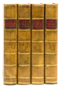
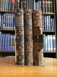
1785310841London: W. Strahan and T. Cadell 1785. Third edition. Large folding general chart of the expedition folding chart of the Island of Otaheite and 9 folding plates. lvi 362; 10 447; 8 416; 6 429 3 pp. 4 vols. 8vo. Modern calf over marbled paper boards. Occasional foxing and minor offset a very clean copy. Third edition. Large folding general chart of the expedition folding chart of the Island of Otaheite and 9 folding plates. lvi 362; 10 447; 8 416; 6 429 3 pp. 4 vols. 8vo. Third edition of this chronicle of important English south-seas expeditions including Cook's monumental first voyage which is covered in volumes 2-4. The aim of Cook's first voyage was to sail to Tahiti to observe the transit of Venus; having done so Cook left Tahiti and discovered the Society Islands explored New Zealand at great length as well as the eastern coast of Australia which he charted for 2000 miles and named New South Wales. The expedition lasted from 1768-1771 and resulted in the annexation of both Australia and New Zealand by Britain won Cook fame and led to his two subsequent voyages. Beddie 665; ESTC T165111 W. Strahan and T. Cadell unknown
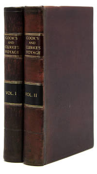
1782310848London: G. Robinson J. Sewell and J. Debrett 1782. First edition. Engraved folding map and 21 engraved plates. x 358 2 pp; 6 347 pp. Half-title volume 1 instructions to binder at end of volume 1. 2 vols. 8vo. Modern morocco. Faint foxing occasional toning neat repair to bound edge of title and half title a few small neat repairs to folding map with small tape ghost to bottom edge of same some mostly marginal worming at middle of vol 2 very good. First edition. Engraved folding map and 21 engraved plates. x 358 2 pp; 6 347 pp. Half-title volume 1 instructions to binder at end of volume 1. 2 vols. 8vo. First edition of this account of Cook's final voyage. "Ellis was a surgeon's mate during Cook's third voyage first on the Discovery and later on the Resoultion and gives quite a good history of this expedition. This account was published two years before the official narrative . It appears that needing money Ellis sold his narrative to a bookseller for fifty guineas. The fine plates are among the earliest published on the Hawaiian Islands Alaska and the Northwest" Hill. The plates include eight of Hawaii two of Alaska and three of the Northwest Coast. Beddie 1599; Forbes 41; Hill 555; Howes E-122; Sabin 22333 G. Robinson, J. Sewell, and J. Debrett unknown
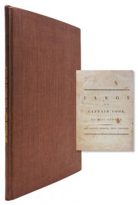
1784318236London: Printed and Sold by J.Jackson and J. Dodsley 1784. Fourth Edition. 25 pp. 4to. Modern brown buckram. Fourth Edition. 25 pp. 4to. Signed "Anna Seward" at the bottom of the last page. Seward was known as the Swan of Litchfield. She remained single and recently scholars have argued she was a lesbian. ESTC T95493 Printed and Sold by J.Jackson and J. Dodsley unknown
1781310852Dublin: Price Whitestone Chamberlain et al. 1781. First Dublin edition. Complete with 5 engraved plates including frontispiece plate of the Death of Cook and large folding map. 4 xlvii 1 396 pp. 1 vols. 8vo. Contemporary calf rebacked to style marbled endpapers. Occasional spotting and dustsoiling better than very good. First Dublin edition. Complete with 5 engraved plates including frontispiece plate of the Death of Cook and large folding map. 4 xlvii 1 396 pp. 1 vols. 8vo. The first Dublin edition of the first full account in English of Cook's third and final voyage. Rickman was a second lieutenant aboard the Discovery. "It provides an important supplement to the official account of the Third Voyage published in 1784" Forbes. Howes R-276 "aa"; Forbes 36; Wickersham 6555a; Davidson p 64; Kroepelien 1078; Beddie 1608 Price, Whitestone, Chamberlain, et al. unknown
178570772Paris 1785. 8vo. Noe senere skinnryggbind med tittelfelter i lysere brunt skinn og enkel ryggforgylling. 4 viij 519 1 blank ; 4 591 1 blank ; 4 477 1 s. Med et kobberstukket foldekart over den nordlige delen av Stillehavet. Samt et foldet kobberstikk som viser Cooks død. 8vo. Somewaht later half calf titles in light brown leather spine simply gilt. 4 viij 519 1blank ; 4 591 1 blank ; 4 477 1 pp. One engraved folding map. One folding plate showing the death of Cook. Chez Moutard. Fransk. <br/><br/><em>Fint sett.Nice copies. </em> hardcover
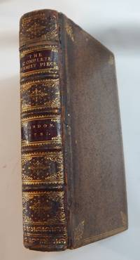
173723421London: A. Bettesworth and C. Hitch 1737. Hardcover. Very good. Second edition improved. 12mo. xii 52662 pp. Contemporary spotted calf spine gilt with red leather lettering pieces. Hinges neatly repaired some rubbing and scuffing of edges and bands else a very good copy. The first edition was published in 1736.<br /> <p><br /> Engraved fishing bookplate of Dean Sage on the inside front board.<br /> <p><br /> Contents:<br /> Part I. containing a . collection of above one thousand well-experienced practical family-receipts . Part II. containing I. Full instructions to be observed in hunting coursing setting and shooting . II. Cautions rules and directions to be taken and observed in fishing; with the manner of making and preserving of rods lines floats artificial flies &c. and for chusing and preserving several sorts of curious baits. III. A full . kalendar of all work necessary to be done in the fruit flower and kitchen gardens . Part III. containing practical rules and methods for the improving of land and managing a farm in all its branches. A. Bettesworth and C. Hitch hardcover
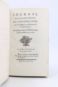
177790280Amsterdam Paris: PissotNyon 1777. Fine. Pissot Nyon Amsterdam Paris 1777 12.5 x 19.5 cm Relié Rare first edition of the French translation of the Journal of the Resolution London 1775 illustrated with a large folding copper-engraved map by E. Dussy issued without legend.Cf. O'Reilly & Reitman 380: ""Traduction de la relation apocryphe de Marra"". See Hill 60.Scattered occasional foxing a few abrasions to the boards.Contemporary full marbled tan sheep spine in five raised bands richly decorated with double gilt compartments gilt fillets to bands partly rubbed red morocco lettering-piece gilt decorative tool at foot of spine gilt rolls to board edges largely rubbed marbled endpapers single gilt fillet to edges corners worn marbled edges.This is an apocryphal account of Cook's second voyage issued anonymously eighteen months before the official edition.The author was John Marra one of the Irish gunners aboard the Resolution; Cook had previously taken him aboard the Endeavour at Batavia during his first voyage.O'Reilly notes that the work contains observations and incidents omitted from the official edition.Conversely Sir Maurice Holmes An Introduction to the Bibliography of Captain James Cook London 1936 and Captain James Cook. A Bibliographical Excursion London 1952 considered it to be a curious compilation.As Marra was incapable of composing any narrative account himself his contribution was therefore confined to factual extracts from his journal; the greater part of the work having been supplied by his editor who expanded the volume with geographical descriptions drawn from accounts of Cook's first voyage and other sources.Copy from the library of Alberto Stradelli with his bookplate mounted on the pastedown. PissotNyon hardcover
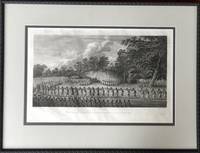
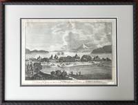
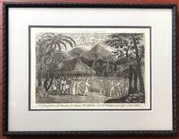
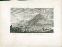
1785H14385London 1785. Very Good. Visible area of sheet measures 20 x 13 inches; double matted framed and glazed to high archival standards; frame measures approx. 27 x 21 inches. A rare image from the atlas of Cook's Third Voyage. unknown
1786H14383London: Alex. Hogg 1786. Very Good. Print from James Cook's voyages as published by Alex. Hogg in 1784-86. Visible area measures 14 x 9.75 inches double matted framed and glazed to high archival standards; frame measures 20 x 15 inches. Print shows some wear and soil to bottom edge including chip to lower right corner. Alex. Hogg unknown
1786H14134London: Alex. Hogg 1786. Very Good. Print from James Cook's voyages as published by Alex. Hogg in 1784-86. Visible area measures 13.75 x 9.5 inches double matted framed and glazed to high archival standards; frame measures 20 x 15 inches. Light soil and two small holes along bottom edge of visible area. Alex. Hogg unknown
178529430London 1785. First edition. Very good condition. A view of this Sub-Antarctic island so named by Capt Cook who spent Chritmas Day there in 1776 with resident penguins. Cook's ships Resolution and Discovery are pictured at anchor. A member of the crew hunts penguins who appear not to be afraid of him and why would they be. From the folio atlas to Cook's 3rd voyage Pacific Ocean exploration. Copper engraving from the folio atlas accompanying the publication of the voyage. A very crisp image large margins with some slight dusting around edges. Paper 16 3/8 x 22 unknown
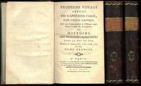
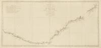
1774143635Paris: Chez Saillant et Nyon . chez Panckoucke 1774. Near fine. Paris Chez Saillant et Nyon . chez Panckoucke 1774 first thus. An original map printed surface 365 × 771 mm sheet size approximately 410 × 830 mm engraved under the direction of Robert Bénard. Trimmed outside the plate-mark leaving ample margins; vertical and horizontal folds; a couple of trifling spots of foxing; small production flaw to the edge of the right-hand margin; some very faint offsetting and other trifling signs of age; in near-fine condition. A map of the east coast of Australia from Point Hicks to Cape Cornwall by way of Botany Bay and Port Jackson as charted by Cook on his first voyage. It comes from the first French edition of the official account of the voyage 'Relation des voyages entrepris . pour faire des découvertes dans l'hémisphère méridional' 'Tome III. Pl. 16'. <p>Tooley 342; see Beddie 659. Chez Saillant et Nyon ... chez Panckoucke unknown
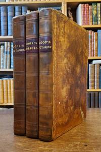
17738607<p><strong>Cook's First Voyage</strong></p><p><strong>Accounts of the not-yet-famous Cook</strong></p><p>Three Volumes. Quarto. 12 x 9 inches. 20 xxxvi 4 456 4 xiv 410 4 395 3. 52 charts and plates collated complete. Original calf rebacked in antique style calf maroon leather spine labels marbled endpapers. Library bookplates in front cover of each volume oval library stamps on verso of folding frontis map title page and p. 3 of vol. I on title page and p. 1 of vol. II on title page and p. 7 of vol. III. Small chip to bottom edge of one plate in Vol. II not affecting image closed tear to large folding map in vol. III. A few minor dampstains to top edge some light offsetting from plates. General wear to covers and corners. Overall a very good set internally quite bright and crisp.</p><p>Second edition published the same year as the first. Considered the best edition by Hill. Includes the chart of the Straight of Magellan that the first edition does not. Also includes a preface to the second edition containing a reply from Hawkesworth to a letter from Mr. Dalrymple about some groundless imputations in his account of the late voyages to the South Seas. The official account of the first voyage of the not-yet-famous Cook as prepared by Hawkesworth upon commission of the British Admirality. The voyage was primarily scientific in nature intending to sail to Tahiti to observe the transit of Venus calculate the distance of the earth from the sun and to continue the geographical discovery begun by Byron. After leaving Tahiti Cook discovered named and charted the Society Islands then continued on to New Zealand and Australia. The first volume contains narratives of the voyages of Byron Wallis and Carteret while the second and third volume relates to Cook. Beddie: 650; Hill: 783; Sabin: 30934.</p> Printed for W. Strahan; and T. Cadell
17739900042259London: W. Strahan and T. Cadell 1773. 1st edition. Hardcover. charts and engravings. 4to. Leatherbound. This is the first printing first state of the famous account of what is now described as 'Cook's First Voyage' although primary credit for the creation of this account is given to John Hawkesworth who had been commissioned by the Admiralty to edit Capt. Cook's papers. Volume I of our offering ends at page 676 and shows page 139 as numbered 139-360 as called for in Beddie 648. It contains 18 of the 21 charts and plates called for in this volume lacking two charts and one plate. Volume II has a tide mark across the top of the first thirdof the text block. Page 189 is misnumbered 191. Old worm hole to margins of pages 119-161. Contains 16 of 22 charts and plates five folding charts seven folding plates and four single page plates. The text is complete in 410 numbered pages. Volume III text commences at page 411 and concludes at page 795. All nine plates and charts are present including the very large folding chart of New Zealand Cook was the first to confirm that New Zealand was in fact an island. Lack of nine plates/ charts. The text shows foxing severe on a few pages but on the whole the text is perfectly readable and if professionally restored the plates and charts would be magnificent. The leather has deteriorated and the boards are loose. W. Strahan and T. Cadell hardcover
179519601Leiden 1795. Very good condition. A later hand colored copper engraved map of Macao China and the islands in its vicinity. From a Dutch edition of "Cook's Voyages". On fine wove paper with full impression marks from the plate visible. Contemporary folds. 8 1/4 x 10 1/2" with margin slightly trimmed at lower left. unknown
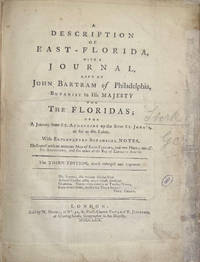
1771008201London in the Strand. and London: at No. 51 St. Paul's Church Yard; and T. JEFFERIES at Charing-Cross: T. BECKET and PA De HONDT. and NICOLL W. 1771. 1st Edition 1st Printing. Hardcover. Very Good. 4to - over 9¾ - 12" tall. JEFFERYS Thomas. The First Published Account of Cook's First Voyage to the Pacific complete with Dedication Leaf. A cornerstone of any Cook collection. Two works in one bound in modern to style half calf over marbled boards some blind edge tooling spine with raised bands gilt tooling gilt titles to red calf labels. Internally Journal of a Voyage 1771 First Edition First Issue with the Dedication and printers instructions plus the two 'Otahitee Vocabulary' leaves bound in at end. BOUND AFTER: Description of East-Florida 1769 Third Edition much enlarged 2 parts in one 3 folding engraved maps title with small library ink-stamp & repair to fore margin small ink correction to C3v professional repairs to maps some loss to the first occasional small stain some soiling and light browning scattered spotting. 281214 mm. Folding map frontis 2 title & dedication 1 ii-viii; Stork - Description of East Florida 1 2-40 1 folding map; Bartrams Journal 1 xii 35 pp 1 errata & binders list1 folding map; Magra's Voyage 1 title 2 dedication 1 2-130 pp 3 Vocabulary of the Language of the Otahitee. The 3 folding maps engraved by T. Jefferys are: 1.East Florida. 2.St. Augustine the Capital of East Florida. 3.The Bay of Espiritu Santo in East Florida. Signatures: East-Florida - 2ff b-b4 B-G1. G-G2 2ff H-M4. Voyage round the World - 2ff B-S1 2ff Vocab. Public appetite for a detailed narrative encouraged a publishing race of which this work published less than three months after the expedition's return to England and almost two years prior to Hawkesworth's authorised version was the winner. This first issue containing the dedication leaf was swiftly withdrawn following the publicly advertised consternation of the dedicatees the Admiralty Joseph Banks and Daniel Solander. Published anonymously the work is generally attributed to James Magra an American mid-shipman aboard. Hill II:1066without dedication leaf; Hocken p9; Holmes 3; O'Rielly-Reitman 362; Sabin 4246 & 16242; DuRietz-catalogue of the Kroepelien Collection p215; Frost Life of James Mario Matra: Voyager with Cook 1995; Beddie 693/4; STC T29207. The work is a short but interesting narrative of Cook's first voyage which relates his visits to Tahiti New Zealand Australia New Guinea Batavia and Rio de Janeiro. The author is noteworthy because he is one of the few to criticize Cook in any meaningful way. Despite problems with the accuracy of the text this work will always hold the place of being the first account of that voyage and the first account in print of the Australian coast. in translation it also gave the French their first account of that voyage. <br/> <br/> T. BECKET and PA De HONDT. and NICOLL W. hardcover
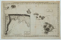
179023494London: Alexander Hogg at the Kings Arms No. 16 Paternoster Row 1790. Attractive map of the Hawaiian Islands with Cook's tracks charted as well as an inset map of Karakakooa Bay marked "Here Capt. Cook was killed". Copper engraving 13 3/4 x 9" with small margins. T. Conder Sculpt. "Accurately Engraved for Anderson's Large Folio Edition of the Whole of Capt. Cook's Voyages & Complete". Small corner replaced lower left barely affecting the plate mark a tiny nick in the upper margin outside of the plate mark. Overall a very good copy. Alexander Hogg at the Kings Arms, No. 16, Paternoster Row unknown
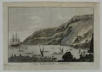
178526771London: Alex. Hogg at the Kings Arms No 16 Paternoster Row 1785. Good. Engraving titled "A View of Karakakooa in Owyhee." Paper size is 27.4 x 38.5 cm. Inside black border dimensions the main image without title are 22 x 33.9 cm. The top edge has been remargined with sympathetic laid paper where the imprint was trimmed away. "Taylor sculp." engraved lower right. Now laid down archivally on a light tissue to preserve it and ensure that previous edge tears and fraying didn't cause further deteriorate. Lightly hand colored. A penciled note on the rear reads "opposite p. 577 Cooks' Voyages 1785 edition" "Drawn by John Webber the artist on Cook's third voyage this view depicts the bay where Cook's expedition spent a total of four weeks in January and February 1779. Published as an illustration in the official narrative of Cook's third voyage this view complements the detailed plan of the bay that appeared as an inset on the published map of the island. The bay gained notoriety as the scene of Cook's death but it remained an important anchorage for European vessels until the 1820s. The village on the right corresponds to 'Kakooa' in the inset on the Roberts chart .It was the scene of many of the transactions between the Hawaiians and Cook's expedition. In the far background near the point of land appearing just aft of the two ships lies the village named 'Kowrowa'' on Roberts' chart where the famous confrontation occurred on February 14 1779 in which Cook was killed." Fitzpatrick "The Early Mapping of HAWAI'I" Honolulu:Editions Limited1986 p. 20<br /> <br /> This example lacks the publisher's imprint information just above the top black border. It would have read "London Published by Alex. Hogg at the Kings Arms No 16 Paternoster Row." This example was engraved by Taylor and is of the period. Reviewing a 1784 digitized copy of the Cook narrative titled: "A new authentic and complete collection of voyages round the world undertaken and performed by royal authority. Containing an authentic entertaining full and complete history of Captain Cook's first second third and last voyages undertaken by order of His present Majesty for making discoveries in geography navigation astronomy &c. in the southern and northern hemispheres ." and published by Hogg with the imprint as above confirms the plate was inserted opposite page 577. It was likely the same in the 1785 edition of the following year.<br /> <br /> The image is often cited as the first example of a surfing image see surfer on board lower left and it is quite notable for that fact. While missing the publisher imprint it is still a fine example for framing and display. [Alex. Hogg at the Kings Arms No 16 Paternoster Row] unknown
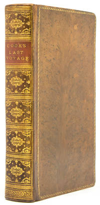
177342375London: for W. Strahan & T. Cadell 1773. 4 volumes 4to. 11 3/8 x 8 5/8 inches. Vol. I: xx xxxvi 4 138 '139-360' 361-676 pp. Vol II: xv 1 410 pp. Vol III: vi 411-799 pp. With the 'Preface to the Second Edition' the earliest state of Vol. I text and continuous pagination sequence in Vols. II-III. Complete with 52 plates maps and charts 18 folding 24 double-page including the large folding 'Chart of the Streights of Magellan.' The maps and charts are here contemporaneously bound in a separate atlas volume. Contemporary full calf spines with raised bands forming seven compartments red and green morocco lettering pieces in the second and third compartments<br/> <br/> A fine copy of the second and best edition of Hawkesworth's account of all the most important mid-18th century English voyages of exploration to the southern hemisphere: including the official account of Cook's first voyage. A fascinating narrative intended to 'embellish England's prestige as a maritime power' Hill and describing events that were to be major factors in the shaping of the subsequent history of the region. This copy with the map of the Straits of Magellan not generally issued with the first edition of the same year and all maps and charts bound in a unique fourth volume at the time of publication.<br/> <br/> One of the standard works of Pacific voyages giving an account of English voyages of the 1760s in the first volume and of Cook's first voyage in the second and third volumes. The first volume includes an account of John Byron's voyage to the Tuamoto Islands and the Gilberts as well as Capt. Wallis' voyage of discovery to Tahiti and Moorea. Captain Carteret's discovery of Pitcairn Island is also told. The majority of the book is devoted to an account of Cook's first Pacific voyage. "The first voyage under Captain Cook's command on the Endeavour was primarily of a scientific nature. The expedition was to sail to Tahiti in order to observe the transit of Venus across the disk of the sun to determine the earth's distance from the sun and also to carry on the geographical discovery that John Byron had started. Entering the Pacific around Cape Horn Cook reached Tahiti in 1769 and carried out the necessary astronomical observations.Leaving Tahiti in July Cook discovered named and charted the Society Islands and then heading southwest explored New Zealand then headed towards Australia and discovered and charted the eastern coast for 2000 miles naming the area New South Wales. Both Australia and New Zealand were annexed by Britain as a result of this voyage which began in 1768 and ended in 1771" Hill.<br/> <br/> Beddie 648; cf. Hill 2004 782; Holmes 5; Sabin 30934. for W. Strahan & T. Cadell unknown
177341891London: for W. Strahan & T. Cadell 1773. 3 volumes 4to. 11 1/4 x 8 5/8 inches. 52 plates maps and charts 18 folding 24 double-page. Contemporary full calf spines with raised bands forming six compartments red and black morocco lettering pieces in the second and fourth compartments other compartments tooled gilt.<br/> <br/> Second edition of Hawkesworth's account of all the most important mid-18th century English voyages of exploration to the southern hemisphere: including the official account of Cook's first voyage. A fascinating narrative intended to 'embellish England's prestige as a maritime power' Hill and describing events that were to be major factors in the shaping of the subsequent history of the region.<br/> <br/> One of the standard works of Pacific voyages giving an account of English voyages of the 1760s in the first volume and of Cook's first voyage in the second and third volumes. The first volume includes an account of John Byron's voyage to the Tuamoto Islands and the Gilberts as well as Capt. Wallis' voyage of discovery to Tahiti and Moorea. Captain Carteret's discovery of Pitcairn Island is also told. The majority of the book of course is devoted to an account of Cook's first Pacific voyage. "The first voyage under Captain Cook's command on the Endeavour was primarily of a scientific nature. The expedition was to sail to Tahiti in order to observe the transit of Venus across the disk of the sun to determine the earth's distance from the sun and also to carry on the geographical discovery that John Byron had started. Entering the Pacific around Cape Horn Cook reached Tahiti in 1769 and carried out the necessary astronomical observations.Leaving Tahiti in July Cook discovered named and charted the Society Islands and then heading southwest explored New Zealand.then headed towards Australia and discovered and charted the eastern coast for 2000 miles naming the area New South Wales. Both Australia and New Zealand were annexed by Britain as a result of this voyage which began in 1768 and ended in 1771" Hill.<br/> <br/> Beddie 648; cf. Hill 2004 782; Holmes 5; Sabin 30934. for W. Strahan & T. Cadell unknown
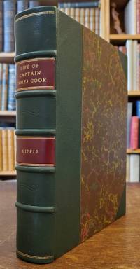
17888608<p><strong>First full-scale biography of Captain Cook</strong></p><p>Small quarto. 10 x 8 inches. Pp. xvi 527 1 ads. Engraved frontis portrait. Nicely rebound in three-quarter dark green leather marbled boards. Matching marbled endpapers. All edges marbled. Light foxing to first few leaves including frontis portrait and title small library stamp on title else a fine clean and crisp copy.</p><p>First edition of the first full-scale English biography of Captain Cook compiled from Admirality sources as well as documents that were in the possession of Sir Joseph Banks. This work was intended to give a well-balanced account of Cook's life from birth to death including his family and early years and the capacities in which he was engaged prior to the famous voyage. Cook discharged several important duties while aboard the <em>Mercury</em> on the St. Lawrence River during the siege of Quebec. The Newfoundland and Labrador surveys are discussed and the three voyages are dealt with in great narrative depth. Kippis includes most of Samwell's narrative of Cook's death at Kealakekue pp. 454-474 and gives accounts of various tributes to Cook memory. Appendix No. 2 consists of "The Morai An Ode" by Miss Helen Maria Williams. Beddie: 32; Hill: 935; Forbes:149 Sabin: 37954.</p> Printed for G. Nicol and G.G.J. and J. Robinson hardcover
1780AQ33842London: Printed for J. Almon et al. 1780. 12mo. 4 272pp. ESTC T45315. Bound with: RIDER Cardinus. Rider's British Merlin: For the Year of Our Lord God 1780. London. Printed for the Company of Stationers and sold by G. Hawkins 1780. 60pp. Title and calendar in red and black. ESTC T45019. 12mo. Contemporary gilt-tooled red calf A.E.G. marbled endpapers. A trifle rubbed and marked. Slightly shaved at head with occasional loss to pagination numerals leaves F2/3 of first mentioned work stuck together. An attractively bound copy of the Royal Kalendar for the year 1780; the final issue of the almanac to include in its list of Royal Navy officers Captain James Cook who had died the year prior. Though killed on the 13th February 1779 news of Cook's death did not reach British shores until eleven months later; no doubt accounting for the appearance of his name here. . 12mo. Printed for J. Almon et al. unknown
179379084Edinburgh:: Printed for R. Morison and Son 1793. The Fourth Edition. old full sheep. Vol. III lacks the last two leaves of text; plates missing as noted. One plate in Vol. III appears to be supplied from another edition. The text is age-toned throughout with some marginal chips and tears and moderate use to the bindings Old ink ownership notation on each front pastedown. . 16mo. Engraved frontispiece portrait and added engraved title page in Vol. I. Vol. I is lacking 3 of 7 engraved plates; Vol. II missing 2 of 7 plates; and Vol. IV is missing 1 of 4 plates. . Forbes 234 Printed for R. Morison and Son, unknown