[Hawaii] John Webber; James CookBiblio.com
271 résultats
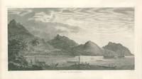
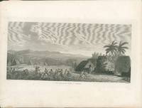
178529433London 1785. Very good overall. Copper engraved images of Hawaii from the folio atlas of Cook's 3rd voyage Pacific Ocean exploration. The images illustrate the native Hawaiians at their village on the island now called Kauai plt. 35. The ethnographic items include featherwork carving and weapons embedded with shark teeth plt. 67. Both with very wide margin. Paper sizes 21.5 x 16.25". The Atooi print with light marginal dusting and a small closed tear ikn the margin lower left. unknown
178529428London 1785. Copper engraved images of Tonga Tahiti & the Society Islands from the folio atlas of Cook's 3rd voyage Pacific Ocean exploration. The images illustrate the native islanders rowing out to receive Cook; a reception with warriors demonstrating their strength; a human sacrifice; famous image of Tahitian women dancing and the harbour at Huaheine with Cook's ships Resolution and Discovery in the harbor. Plate numbers included are #1314 25 28 & 31. All with very wide margin. Paper sizes 21 5/8 x 16". Some light marginal dusting overall very good condition. unknown
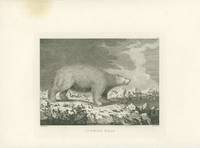
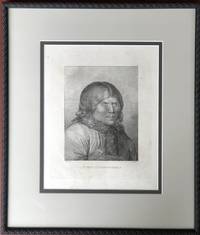
178529434London 1785. Copper engraved images of Alaska & Vancouver Island from the folio atlas of Cook's 3rd voyage Pacific Ocean exploration. The plate numbers included are #40 41 48 49. 52 57 & 73. Two images are of Alaskan natives their boats and huts going about their daily lives. <br /> Sea Horses refers to seals and the white polar bear is majestic. Two with a corner waterstain one with a slight brown circle in the margin one with marginal foxing. <br /> Paper sizes 21.5 x 16.25" and one is 22 7/8 all with wide margins. Some light marginal dusting overall very good condition. unknown
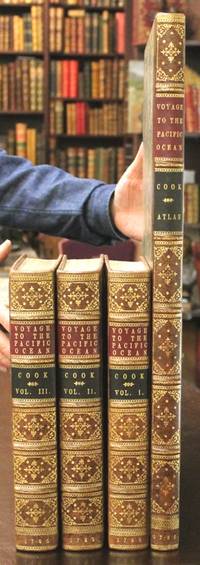
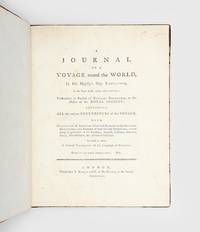
1785B6042London:: for G. Nicol Bookseller to his Majesty in the Strand; and T. Cadell in the Strand. c. 1785; . In near fine condition. Text and plates are clean and crisp. A handsome and attractive set. Several mispaginations with no loss: Vol I p. 263 as “173â€; Vol II p. 247 as “347â€; Vol III p. 379 as “579â€; Vol IV p. 172 as “72â€. Vol I: pp.293-297 marginal light browning. Edition: Second and superior Edition. Binding: Text vols: expertly rebacked saving contemporary full calf; spine with five 5 raised gilt bands forming six 6 gilt ornamented compartments; gilt-lettered title on red and black morocco labels on two and three; all edges red; endpapers renewed. Atlas volume: Half-calf with gilt dog-tooth roll bordering to marbled boards; spine with six 6 raised bands forming compartments of gilt ornamental design and gilt lettered titles on red and black morocco labels on two and three; edges slightly blue. Notes: Cook’s third voyage continued the centuries-old search for the North-West Passage beginning from the west. After passing Tasmania New Zealand and many islands in the South Pacific the crew sailed north and discovered the Christmas and Hawaiian Islands; onwards to their primary destination the Northwest Coast of America and the Bering Strait then returning south along the West Coast to California and back to Hawaii. It was during this second visit to Hawaii that Cook was killed and the expedition continued under the leadership of Clerke and Gore who led the crew to the eastern coasts of Siberia and finally returned to England in 1780. Cook contributed to the advancement of geographical knowledge of the southern hemisphere to a degree that none of his predecessors had been capable of doing. “He was really the first scientific navigator and his voyages made great contributions to many fields of knowledge" Hill. Further he states about this work that it is “…an abridgement of Captain Cook’s third voyage… preferred by some readers because the nautical and technical parts having been deleted the work reads more like an adventure.†Hill.<br><br>Taking over from Strahan and setting out to print the second edition the present example of Cook’s third voyage Hughs re-set the text; since its typography is considered superior. Forbes refers to a book presentation inscription offered to Dr. Elliotson physician of Mrs. Cook: ".the second edition being much superior to the first both in paper & letterpress." <br> Size: 4to. 297x233mm Folio Illustration: Illustrated titles with vignette medallions incl. medallion portraits of the authors; as well as all 87 illustrations as listed on the table of plates: these of varying sizes: seven 7 engravings in vol I eleven 11 in vol II six 6 in vol III and 63 in the folio atlas. Volume: Three text volumes and o References: Beddie 1575; Cowan p.654-5; Cox II p.30; Ferguson p. 281; Forbes I 298; Graff 4456; Hill 2004 1753; ; Hill 362 later edition; Howes V-23; Judd 178; Lada-Mocarski 55; O’Reilly & Reitman 635; Sabin 16251 later edition; Sabin 98443; Smith 10469; S Pages: VOL I: 2 title blank contents 8 introduction i-lxxxvi To the Memory of Capt. James Cook lxxxvii-lxxxix bl. list of plates xci-xcvi; a voyage to the Pacific Ocean 1-421 3 including 7 plates; VOL II: 2 title blank contents 12 1- 548 2 including 11 plates; VOLIII: 2 title bl. contents 10 Contents Appendix bl. 1-487 bl. Appendix 489-556 with double page folding table 2; including 6 plates; Atlas VOL: 63 plates. Category: Book Pacific; Book Plate Books General; Book Voyages General; for G. Nicol, Bookseller to his Majesty, in the Strand; and T. Cadell, in the Strand. hardcover
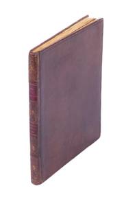
17875001042London: Alexander Shaw 1787. Quarto eight pages printed text followed by original blank leaves separating the 36 actual cloth specimens several full page as well as many smaller; original calf binding neatly lettered and decorated spine. <p><p>This rare and exotic publication of original Pacific artefacts is the most remarkable of the whole Cook canon: with a brief but significant letterpress introduction it mainly consists of actual specimens of eighteenth-century tapa cloth collected in the Pacific islands particularly Hawaii Tahiti and Tonga. </p> <p>In modern times the publication has become one of the great rarities of eighteenth-century Pacific exploration. This is an example of the first issue of the book with the strictly contemporary bookplate of Sir Corbet D'Avenant 1752-1823 Baronet of Stoke and Adderley. Donald Kerrr speculates in his census that D'Avenant was likely an original subscriber on first publication. </p> <p>Published only a few years after the return of the ships from Cook's third voyage it is not recorded how many of the cloth-books were prepared and up until the recent detective work of Erica Ryan at the NLA very little was known about the publisher Alexander Shaw either. However the limited supplies of the actual cloth must have dictated a very small edition - the most recent census of known copies by Donald Kerr stood at the tiny figure of 66 recently revised by us to 68 of which 57 were held by international libraries. This count of course includes the later issues of the book which continued to be sold often with dramatically varying contents as late as 1806. </p> <p>There has in effect never been a standard collation of the book - the fascinating dedication addressed to an unnamed "Sir" is genuinely vague on numbers - not least because it is obvious that Shaw was simultaneously selling individual samples and "fine specimens of the tree with the bark" at his shop in the Strand. </p> <p>Indeed as Forbes shows in some detail in the Hawaiian National Biography and others including Ian Morrison Maryanne Larkin Erica Ryan and Donald Kerr have all confirmed in more detail no two copies of the work are identical meaning that a precise collation is needed every time. Thus while 39 different samples are listed in Shaw's introductory list and "40" are mentioned at another point in the dedication many copies have quite different collations not least because the Jamaican sample perhaps the most surprising addition was apparently dropped in the course of publication. </p> <p>In short the present example has a total of 36 separate samples including particularly fine full-page examples of many of the more famous sheets. Almost none of the sheets have been particularly affected by the late-Georgian and Victorian practice of clipping: it is well-known that many collectors constructed what have become known as 'snippet books' of the Cook tapa cloths by cutting pieces from copies of Shaw's volume and pasting them into separate books or albums. </p> <p>As a result of this clipping habit copies of the original Shaw book survive in various states of completeness sometimes with only very small fragments of the once full-page specimens remaining. In this copy with its original blank leaves in place it is quite clear that the specimens have essentially retained their original shape with only four or perhaps five showing evidence of very minor clipping as can be shown from the ancient offsetting onto the adjoining blanks. </p> <p>The production of this book reflects the genuine curiosity aroused by tapa a fascination that drove competition between collectors of 'artificial curiosities' and generated an active market for the sheets brought home by Cook's men. The preface of the book contains descriptions of bark cloth manufacture by Cook Anderson Forster and an anonymous officer titled 'one of the navigators' and is followed by the list of the specimens compiled by Shaw. The list is indeed rich in fascinating details; for example we learn that the various uses of the tapa: 'wore sic by the people in the rainy season' or 'used at the human sacrifice'. Some of the notes in the list are longer and doubtless arise from tales told by the mariners who collected the tapa in the first place as boasted on the title page. </p> <p>Each island group used designs unique to its culture and the interest of Europeans in this material equalled the passion aroused by the extraordinary wood-carvings and exotic shells brought back by Cook. </p> <p>The Shaw Catalogue is of great significance as a repository of unique original tapa but it also speaks of the time when Cook's sailors were spreading their stories of the alluring South Seas while drawing-room chatter throughout the land luxuriated in descriptions of the new exotic. The publication forms a tangible link between these narratives the indigenous cultures of the South Pacific and Hawaiian islands the myriad personal and trading relationships that developed between the islanders and mariners and the genteel world of gentleman collectors and their cabinets of curiosities.</p> </p> . Provenance: Norton J. Whitmont collection; Kelton Foundation Los Angeles; original owner Sir Corbet D'Avenant 1752-1823 Baronet of Stoke and Adderley with armorial bookplate. Corbet d'Avenant was the son of Anne Corbet daughter of Sir Robert Corbet c.1670-1740 4th Bt of Stoke upon Tern. Upon the death of Anne's brother rector of Adderley from 1735 Sir Henry Corbet the seventh baronet on 7 May 1750 the baronetcy became extinct and the family estates passed to his nephew Corbet D'Avenant who assumed the name of Corbet and was created a baronet on 27 June 1786. Upon his death on 31 March 1823 the second baronetcy also became extinct. Alexander Shaw unknown
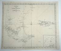
17778375London 1777. Copper engraved map of the tip of South America from Cook's 2nd voyage. The tracks of the Resolution are marked with soundings. This large map focuses on Tierra del Fuego and the Falkland Islands. Cook's tracks along Tierra del Fuego are marked and dated December 1774 to Jan. 4th 1775 when he sets off south to be the 1st to cross the Antarctic Circle. 20 1/4 x 17 1/4" with margins contemporary folds laid flat very clean copy. unknown
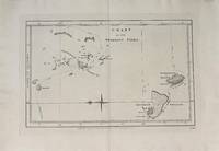
1777334561London: W. Strahan and T. Cadell 1777. unbound. Map. Uncolored engraving. London: W. Stahan and T. Cadell 1777. Image measures 8 1/4" x 13"<br/> <br/> Nautical chart of the Friendly Islands or present-day Tonga in the South Pacific. Features various islands and islets showing anchor points and topography with depths by soundings. The tracks of the Resolution in 1773 and 1774 are delineated. In excellent condition.<br> <BR> Captain Cook 1728 -1779 was among the most famous and important explorer navigator cartographer and captain of his time whose scientific and geographical knowledge influenced his successors well into the 20th century. He started sailing as a teenager and went on to join the Royal Navy in 1755. In 1766 he was commissioned to explore the Pacific and went on the sail thousands of miles across largely uncharted regions of the world. These three historic voyages led him to some of the first sightings of Antarctica his discovery of many Polynesian islands including the Hawaiian Islands first European contact with east Australia the circumnavigation of New Zealand and the first correct mapping of the Pacific Northwest.<br/> <br/> W. Strahan and T. Cadell unknown
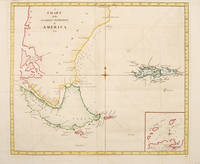
177755016London. c.1777. A simple and clear map of the southern tip of South America with the Falkland Islands showing Cook's route around Cape Horn. Inset map at lower right of New Year's Islands and part of Staten Island. From Cook's Third Voyage. Copper engraving. Very good condition. Folds as issued. Later colour. Size: 50.5 x 43 cm. unknown
1777M5272London: William Straham 1777. Very good a short tear from the left margin due to attachment to the atlas professionally repaired right margin reinforced. Notes: English edition of Cook's chart depicting his tracks and the other important explorers. Size : 560x545 mm 22x21.5 Inches Coloring: Hand Colored in Outline Category: ; Maps Polar Antarctic Regions William Straham unknown
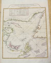
1775M6446London: Sayer & Bennett 1775. Very Good. Notes: This is the first state of the map according to Kershaw published in "The American Atlas."<br><br>An impressive nautical chart depicting the Gulf of the St. Lawrence. Depth soundings have been noted along most of the coastlines. A small table denotes place names and their associated longitude and latitude sits in the top of the image. Size : 365x512 mm 14.37x20.16 Inches Coloring: Hand Colored Reference: Kershaw 597; LC Phillips 1209 Category: Maps Canada East Prince Edward Island;Maps Canada East Nova Scotia;Maps Canada East New Brunswick;Maps Canada East Newfoundland;Maps Canada East Quebec; Sayer & Bennett unknown
1790021046London: A. Millar W. Law & R. Cater 1790. Lacking all the folding maps and charts. Six volumes octavo pp 2242 4 generally age-toned throughout lacking most of page 1445/6 a cracked hinge with weakness in volume two a few pages lacking small marginal pieces but otherwise surprisingly sound throughout with 126 of 129 engraved plates three plates repaired one with slight loss bound in a very simple and unsophiticated half calf and marbled boards rather dull the spines un-lettered apart from numerals chipped and with slight loss. The binding is a little tight and whereas the text is easily read the titles of some plates are hidden though there is a binding list with titles at the rear of the last volume. Despite some condition faults this a curiously satisfying and unassuming set. . Half Leather. Good. A. Millar, W. Law & R. Cater Hardcover
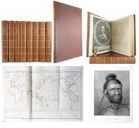
1790E00534 of 6 volumes. Volume 1: i-ix-372 pages with 23 plates including frontispiece plate of Cook and 4 folding maps; Volume II lacking; Volume III: 793-1184 pages with 11 plates including frontispiece of Possession Bay and 5 fold out maps; Volume IV: 1185-1546 pages with 26 plates including frontispiece of Woman Child and Man of Van Diemen's Land and 6 folding maps; Volume V: 1547-1938 pages with 30 plates including frontispiece of A View of Huaheine and 8 folding maps; Volume VI lacking. Octavo 8 1/2" x 5 1/2" bound in original full leather with red labels to spine with gilt lettering. Abridged by George William Anderson. An earlier Large folio edition by Anderson was published earlier. This edition originally issued in 80 weekly parts and also called the Large octavo edition. M K Beddie: 39 First edition of the bound edition.<br /><br />Captain James Cook RN was a British explorer navigator and cartographer ultimately rising to the rank of Captain in the Royal Navy. Cook made detailed maps of Newfoundland prior to making three voyages to the Pacific Ocean during which he achieved the first European contact with the eastern coastline of Australia and the Hawaiian Islands as well as the first recorded circumnavigation of New Zealand. Cook joined the British merchant navy as a teenager and joined the Royal Navy in 1755. He saw action in the Seven Years' War and subsequently surveyed and mapped much of the entrance to the Saint Lawrence River during the siege of Quebec. This helped bring Cook to the attention of the Admiralty and Royal Society. This notice came at a crucial moment both in his personal career and in the direction of British overseas exploration and led to his commission in 1766 as commander of HM Bark Endeavour for the first of three Pacific voyages. Cook charted many areas and recorded several islands and coastlines on European maps for the first time. His achievements can be attributed to a combination of seamanship superior surveying and cartographic skills courage in exploring dangerous locations to confirm the facts for example dipping into the Antarctic Circle repeatedly and exploring around the Great Barrier Reef an ability to lead men in adverse conditions and boldness both with regard to the extent of his explorations and his willingness to exceed the instructions given to him by the Admiralty. Cook was killed in Hawaii in a fight with Hawaiians during his third exploratory voyage in the Pacific in 1779.<br /><br />Condition:<br /><br />Lacks volume II and VI. First signature of volume one loose inner hinges cracked some interior soiling spine ends and corners of leather rubbed some scuffing to leather else a good set. Printed for A Millar, W Law, and R Cater hardcover
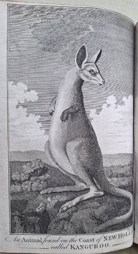
17855000614London: Strahan & Cadell; Strahan & Cadell; H. Hughs for Nicol & Cadell 1785. In generally very good condition with the inevitable odd spot or thumbmark; chart Friendly Islands at p.225 in volume 1 of the third voyage and the folding plate of coastal profiles at p.82 both with water stains. Together eight volumes quarto and folio atlas; a good set in old half calf and marbled boards double labels. <p><p>The full series of the official narratives of Cook's voyages - the cornerstone of any collection of books relating to Australia or the Pacific. Each of the three narratives is illustrated with marvellous engravings based on the work of the official artists on the voyages including Parkinson Hodges and Webber and the series stands as the great monument to Cook's achievements.</p> <p>These were the best-sellers of the second half of the eighteenth century; very expensive when published the first editions were sold out within a few days of publication. Their popularity meant that many copies were almost literally read to pieces; as a result good uniform sets of the voyages are fairly scarce.</p> <p>This set comprises the first edition of the first voyage in its first issue form; the unchanged second edition of the second voyage; and the preferred second edition of the third voyage. Sets of the voyages are seen in many combinations of editions: this particular combination generally regarded as a good way to have the set is one of those seen with some regularity.</p> <p>For full details see our analysis online. Briefly. the set is made up as follows:</p> <p>First voyage. HAWKESWORTH John. An Account of the Voyages. for making Discoveries in the Southern Hemisphere. </p> <p>First edition first issue. Three volumes quarto 51 engraved plates and maps. London 1773.</p> <p>Second Voyage. COOK James. A Voyage towards the South Pole and Round the World. </p> <p>Second edition. Two volumes quarto 64 engraved plates and maps many folding. London 1777.</p> <p>Third Voyage. COOK James and James KING. A Voyage to the Pacific Ocean.</p> <p>Second preferred edition. Three volumes quarto with 24 engraved maps and profiles; separate folio atlas containing two charts and 62 engraved plates. London 1785.</p> <p>---</p> <p>The set is made up as follows:</p> <p>First voyage</p> <p>HAWKESWORTH John. An Account of the Voyages. for making Discoveries in the Southern Hemisphere. </p> <p>Three volumes quarto 51 engraved plates and maps many folding. London Strahan and Cadell 1773.</p> <p>First edition first issue before printing of the chart of the Streights of Magellan and the "Directions for Placing the Cuts".</p> <p>Cook's great first voyage into the Pacific during the course of which he discovered and charted the entire east coast of Australia naming it New South Wales. This is in fact a compendium of four major voyage accounts to the Pacific which culminates with that of Cook's first voyage which fills two of the three large volumes giving an enthralling account of his exploration of Tahiti New Zealand and the east coast of Australia. The work was edited by the professional writer John Hawkesworth who was given the original journals of Captains Byron Wallis Carteret and Cook as well as the private journal of Joseph Banks in order to prepare it for publication a task which took almost two years. Cook himself was in the middle of his second voyage when it was finally published in London to widespread enthusiasm on 9 June 1773 Cook was actually in Cook Strait New Zealand at the time having just left Queen Charlotte Sound.</p> <p>Hawkesworth's involvement in the book was controversial and much ink has been spilt on the subject of his fitness for the task the dilettante man of letters Horace Walpole is known to have wittily criticised Cook's enthusiasm for the fishermen of 40 islands Samuel Johnson an apparent fixation with exotic insects while indignant letters to contemporary editors attacked everything from Hawkesworth's apparent lasciviousness to his godlessness but these reactions cannot distract from the fascinating story the moments of early contact and the great characters such as Banks or the Tahitian priest Tupaia. The plates charts and views are magnificent and most famously include the first astonishing engraving of a kangaroo charts of New Zealand and the east coast of Australia and the moving depiction of the Endeavour hauled on shore just north of Cape Tribulation on the north Queensland coast to fix the hole that nearly sent them to the bottom.</p> <p>Beddie 648; Hill 782; Holmes 5n; Kroepelien 535.</p> <p>Second Voyage</p> <p>COOK James. A Voyage towards the South Pole and Round the World. </p> <p>Two volumes quarto 64 engraved plates and maps many folding. London Strahan and Cadell 1777.</p> <p>Second edition: the official account of Cook's great second voyage prepared for publication by the navigator himself. The superb engravings here in fine black impressions are mostly the work of Hodges whose recording of the voyage resulted also in a famous series of oil-paintings. This was the second of four London editions of the full work there would be many abridgements and translations. Unhappy with Hawkesworth's rendering of his first voyage Cook was determined that the second would not be similarly treated: although he had the editorial help of Dr John Douglas this "is certainly Cook's book. There were to be no more Hawkesworths. 'The Journal of my late voyage' writes Cook to his friend Commodore Wilson at Great Ayton 'will be published in the course of next winter and I am to have the sole advantage of sale. It will want those flourishes which Dr Hawkesworth gave the other but it will be illustrated and ornamented with about sixty copper plates which I am of opinion will exceed every thing that has been done in a work of this kind. As to the Journal it must speak for itself. I can only say that it is my own narrative and as it was written during the voyage' ." Beaglehole. The two resulting quarto volumes with their dramatic illustrations after the expedition's official artist William Hodges 'would have given pleasure to any author' but they were never seen by Cook who had embarked on his fatal last voyage by the time they appeared.</p> <p>Early in the course of this remarkable voyage the Antarctic circle was crossed for the first time when Cook cruised as far south as possible round the edge of the Antarctic ice. His belief in the existence of a land-mass in the southern ice ring was eventually proved by the nineteenth-century explorers. In the Pacific he visited New Zealand again and either discovered or revisited many of the islands including New Caledonia Palmerston and Norfolk Islands Easter Island the Marquesas New Hebrides Tonga the South Sandwich Islands and South Georgia.</p> <p>Between February and May 1773 the two ships separated and Furneaux commander of the Adventure supplied Cook with the narrative of his experiences in the Adventure printed here: they called at Adventure Bay in Van Diemen's Land and sailed up the east coast "intending to coast it up along shore till we should fall in with the land seen by Captain Cook and discover whether Van Diemen's Land joins with New Holland". Before they stood away for New Zealand Furneaux had come to the opinion that "there is no straits between New Holland and Van Diemen's Land but a very deep bay.".</p> <p>Beddie 1216; Hill 358; Holmes 24; O'Reilly-Reitman 390; Printing and the Mind of Man 223.</p> <p>Third Voyage</p> <p>COOK James and James KING. A Voyage to the Pacific Ocean. Undertaken by Command of his Majesty for making Discoveries in the Northern Hemisphere.</p> <p>Three volumes quarto with 24 engraved maps and coastal profiles; with the separate folio atlas containing two charts and 62 engraved plates. London H. Hughs for Nicol and Cadell 1785.</p> <p>The official artist on the voyage was John Webber and his romantic views of the islands of the Pacific published here remain the most evocative portrayals of the islands - helping to create the notion of an island paradise that so affected the European public eagerly reading the voyages of discovery being published in the eighteenth century.</p> <p>This is an example of the second edition which is preferred to the first edition for a number of reasons. The most obvious difference is the use on the title-pages of the text volumes of engraved vignettes of the Royal Society Medal in volumes 1 and 2 and of an oval medallion portrait of Captain King in volume 3. The medal was awarded to Cook posthumously by the Royal Society in 1784 shortly after publication of the first edition of this book.</p> <p>This second quarto edition was printed by H. Hughs - rather than W. and A. Strahan who had printed the first edition - with the wording of the title-pages slightly modified and the text itself entirely re-set. As Forbes points out the second edition has always been "considered typographically superior to the first edition. That this was a contemporary opinion is borne out by a presentation inscription in a set Dixson Library State Library of New South Wales from Isaac Smith Mrs. Cook's relative and on her behalf addressed to Mrs. Cook's physician Doctor Elliotson: 'Clapham 5 May 1821. I am desired by Mrs Cook. to request your acceptance of the 4 books sent herewith being her Husbands last Voyage round the World as a mark of her respect. the letter press of the second edition being much superior to the first both in paper & letter press'.". It is interesting to note that the presentation on behalf of Cook's widow was made some 35 years after publication and even then Mrs. Cook chose to give a copy of the second rather than the first printing let alone the third or subsequent editions.</p> <p>The full story of the voyage and Cook's eventual murder while revisiting the Hawaiian Islands was so eagerly awaited by the English public that the entire first edition had sold out at the then huge price of four pounds fourteen shillings and sixpence within three days and copies were soon changing hands at up to ten guineas. King George III's copy of the official account preserved in the British Library is also an example of this second edition.</p> <p>Beddie 1552; Forbes Hawaiian National Bibliography 85; Hawaii One Hundred 5; Hill 361; Holmes 47n; O'Reilly-Reitman 434.</p> </p> . Provenance: Private collection Sydney. Strahan & Cadell; Strahan & Cadell; H. Hughs for Nicol & Cadell unknown
1773166239London: various publishers 1773. Eight text volumes and an atlas. Comprising: 1. Hawkesworth John AN ACCOUNT OF THE VOYAGES undertaken by the order of his present majesty for making discoveries in the Southern Hemisphere and successively performed by Commodore Byron Captain Carteret Captain Wallis and Captain Cook in the Dolphin the Swallow and the Endeavour: drawn up from the journals which were kept by the several commanders and from the papers of Joseph Banks Esq. In three volumes. Illustrated with cuts and a great variety of charts and maps relative to countries now first discovered or hitherto but imperfectly known. Pp. xiixxxviviiiPreface to the Second Edition456xiv410396last blank 52 plates including maps and charts several folding or double page tables; med. 4to; minor production trimming fault to bottom fore-corner of pages 37/8 and 303/4 in Volume I the tip torn from bottom fore-corner pages 217/8 in Volume III a little light foxing and occasional slight soiling; printed for W. Strahan and T. Cadell London 1773. Second edition. Beddie 650; Hill 783. The second edition is considered the best as it contains in the Preface Hawkesworth's reply to the pamphlet A Letter from Mr. Dalrymple to Dr. Hawkesworth occasioned by some groundless and illiberal imputations in his account of the late voyages to the South Seas. 2. A VOYAGE TOWARDS THE SOUTH POLE AND ROUND THE WORLD. Performed in His Majesty's Ships the Resolution and Adventure in the years 1772 1773 1774 and 1775 . . . In which is included Captain Furneaux's Narrative of his proceedings in the Adventure during the separation of the ships. In two volumes. Illustrated with maps and charts and a variety of portraits of persons and views of places drawn during the voyage by Mr. Hodges and engraved by the most eminent masters. Pp. xl378viii396including an unpaginated title page to A discourse upon some late improvements of the means for preserving the health of mariners . . . by Sir John Pringle 64 engraved plates including a frontispiece portrait of Cook by William Hodges plus maps and charts many folding 2 with original tissue guards all but a couple with publisher's imprint a few small text figures several tables 1 folding Vocabulary of the language of the Society Islands; med. 4to; light damp stains to corners of frontispiece portrait and tiny hole affecting last numeral of page number on pages xxxix/xl in Volume I a couple of tiny wormholes to margins of last few leaves in Volume II with pages 213/4 reinserted onto stub minor production trimming fault to bottom fore-corner pages 299/300 & 357/8 and bottom fore-corner torn from pages 231/2 no text loss in same volume most of the plates faintly offset a couple of mainly small closed marginal tears occasional browning slight foxing and soiling; printed for W. Strahan and T. Cadell London 1779. Third edition. Beddie 1226. 3. A VOYAGE TO THE PACIFIC OCEAN. Undertaken by the command of His Majesty for making discoveries in the northern hemisphere. Performed under the direction of Captains Cook Clerke and Gore in His Majesty's ships the Resolution and Discovery; in the years 1776 1777 1778 1779 and 1780. In three volumes plus Atlas. Volumes I and II written by Captain James Cook F.R.S.; Volume III by Captain James King LL.D. and F.R.S. Published by order of the Lords Commissioners of the Admiralty. Pp. xxcvi422last blankxiv548xiv556 87 engraved plates including maps or charts several folding or double page 62 of the plates being in the atlas volume title page vignette each volume folding table in Volume III appendices; small closed tear to fore-edge margin pages 293/4 Volume I the plates in text volumes lightly offset tiny hole to fore-edge margin pages 247-250 Volume II light water stain to margins of most of the plates and neat repair to closed tears to two plates in the atlas volume occasional slight creasing a little mainly light foxing; printed for G. Nicol and T. Caddell London 1785. Second edition. Beddie 1552. Nine volumes including atlas. Seven of the med. 4to text volumes are uniformly bound in 19th century calf the boards with gilt edges double gilt rule surrounding a decorative blind border and gilt dentelles. The edges of the leaves in the first and third voyage volumes are marbled. Volume III of the Hawkesworth volumes is in a very similar binding but with a single gilt rule border no blind border and slightly different gilt edge decorations to the boards. All text volumes are neatly rebacked with later but not recent calf spines lettered and decorated in gilt and later endpapers. The boards are a trifle marked and rubbed with two tiny surface holes to upper board of Volume II of the Second Voyage; the spines are lightly rubbed. The impl. folio atlas is bound in 20th century half calf and brown cloth boards which are slightly scuffed and flecked. various publishers unknown
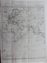
1777M9006London c.1777. Very Good backed on acid free tissue paper for long term preservation. Notes: The Asia part of the World map by Capt. James Cook which depicts his various paths and discoveries. Size : 593x465 mm 23.35x18.31 Inches Coloring: Hand Colored Category: Maps Asia Continent; unknown
178676764London England: Alexander Hogg 1786. First Edition of Three Voyages in 3 Volumes Single Binding. Leather-bound. Good Plus. NOTE: DAMAGED and Incomplete; see specifics below: Folio approximately 15.75" x 9.75". Half-bound red calf over buckram. Gilt labeling to spine "Cook's Voyages"; "Hogg"; "Bancroft Library". Fabulously wild marbling to endpapers with thousands of tiny gilt flecks throughout. Occasional browning and foxing; most pagesclean and bright. Illustrated with lovely copperplate etchings maps elevations charts About 155 other copperplate engravings the majority of which are full-page. Solidly bound. <br /> <br /> MISSING: Title page frontis engraving of Captain Cook Image of Death of Captain Cook p. 587; 4-page undated list of Subscribers. NOTE that the Folding Map pasted onto a new sheet at the beginning is missing about 20%. ESTC: T222766. In addition to Captain Cook's first second and third voyages this massive work includes accounts of the voyages of Sir Francis Drake Lord Anson Philip Carteret Samuel Wallis John Byron and Lord Mulgrave. Originally published in parts -- another dealer cites "80 six-penny numbers" this is the one-volume edition entitled instead of "NEW" "A Genuine and Complete History. Alexander Hogg unknown
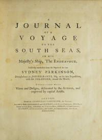
1773310853London: Printed for Stanfield Parkinson 1773. First edition with the very rare "Explanatory Remarks" by Fothergill and postscript. Complete with frontispiece and 27 engraved plates including 1 map. xxiv 22 212 2 pp. Imperial 4to. Contemporary tree calf finely rebacked with gilt spine to period style. Fine. First edition with the very rare "Explanatory Remarks" by Fothergill and postscript. Complete with frontispiece and 27 engraved plates including 1 map. xxiv 22 212 2 pp. Imperial 4to. First edition of this important account of Cook's first voyage based on the journal of Parkinson who had been engaged by Sir Joseph Banks to serve as natural history draughtsman aboard the Endeavour. Parkinson died of dysentery on the homeward voyage and his account was transcribed and published by his brother Stanfield Parkinson who was forced by injunction to delay publication until Hawkesworth's official account appeared. "Parkinson made numerous drawings of botanical and other subjects including landscapes and portraits of native chiefs . Banks spoke highly of his 'unbounded industry' in making for him a much larger collection of drawings than he anticipated. His observations too were valuable and the vocabularies of South Sea languages given in his journal are of great interest" Hill. <br /> <br /> This copy includes the rare "Explanatory Remarks" by John Fothergill a Parkinson family friend who mediated an agreement between Stanfield Parkinson and Banks both of whom laid claim to the journal which would allow for the publication of the book. When Stanfield Parkinson included a scurrilous preface attacking Banks and misrepresenting his actions an offended Fothergill purchased the remaining copies inserting into them these 22 pages of remarks which sought to set the record straight. In 1784 he brought out a new edition of Parkinson's account which included the remarks but copies of the first edition which include them are scarce on the market. Beddie 712; Hill 1308; Holmes 7; Howgego C173; Du Rietz 944; Sabin 58787 Printed for Stanfield Parkinson unknown
1783310851Hartford: Nathaniel Pattern 1783. First edition lacking the map as in almost all copies. 208 pp. 1 vols. 8vo. Contemporary sheep over boards finely rebacked with period spine to style. Highest quality conservation repairs to edges of first four leaves of text and to corner margins on last two leaves. Very good copy in a handsome binding. First edition lacking the map as in almost all copies. 208 pp. 1 vols. 8vo. Rare. "This is not only the first American book on the Northwest Coast but also the first American book on Hawaii" Streeter. <br /> <br /> Ledyard is distinguished in many respects he was the only American to sail on Cook's third voyage which explored Alaska and discovered Hawaii. He was also in the boat that carried Cook ashore on the morning of his death. Indeed this work contains a detailed account of Cook's death "distinguished by its evident authority" Hill.<br /> The purpose of Cook's third voyage was twofold. Ostensibly it was to return Omai to his homeland in French Polynesia but the main purpose was to search for the Northwest Passage. The Resolution and Discovery departed Plymouth in 1776 and made their way via the Cape to New Zealand and Tahiti. It was from there that Cook discovered Hawaii which he regarded as his greatest achievement. The boats then proceeded to the Pacific Northwest and commenced their search for a route to the Atlantic. They returned to Hawaii for the winter of 1778-9. Their initial warm welcome soon wore off and tensions between the Hawaiians and the British resulted in Cook being killed on the shore of Kealakekua Bay on February 14 1779. Charles Clerke assumed command of the expedition and proceeded north once again to pursue the voyage's objective. The two ships returned to England in 1780.<br /> A Connecticut native after the voyage Ledyard remained in England until 1782 when he was posted to the North American station - the Revolutionary War was ongoing. He promptly deserted and returned to Hartford where this account was published. This work preceded Rickman's by a matter of months though in fact Ledyard made "liberal use of the first English edition of Rickman's account in his own narrative" Hill. This is not to deride Ledyard unnecessarily; in addition to his account of Cook's death his keen observations on the fur trade in the Pacific northwest are of great value.<br /> <br /> Ledyard's account is one of the rarest works on Cook's third's voyage and Hill confirms that "only a few copies still have the map." It was wanting in both the Streeter and Brooke-Hitching copies. Beddie 1603; Evans 17998; Sabin 39691; Forbes 52; Hill 991; Howes L-181 "d"; Lada-Mocarski 36; Smith 5797; Streeter Sale VI:3477 Nathaniel Pattern unknown
1771008201London in the Strand. and London: at No. 51 St. Paul's Church Yard; and T. JEFFERIES at Charing-Cross: T. BECKET and PA De HONDT. and NICOLL W. 1771. 1st Edition 1st Printing. Hardcover. Very Good. 4to - over 9¾ - 12" tall. JEFFERYS Thomas. The First Published Account of Cook's First Voyage to the Pacific complete with Dedication Leaf. A cornerstone of any Cook collection. Two works in one bound in modern to style half calf over marbled boards some blind edge tooling spine with raised bands gilt tooling gilt titles to red calf labels. Internally Journal of a Voyage 1771 First Edition First Issue with the Dedication and printers instructions plus the two 'Otahitee Vocabulary' leaves bound in at end. BOUND AFTER: Description of East-Florida 1769 Third Edition much enlarged 2 parts in one 3 folding engraved maps title with small library ink-stamp & repair to fore margin small ink correction to C3v professional repairs to maps some loss to the first occasional small stain some soiling and light browning scattered spotting. 281214 mm. Folding map frontis 2 title & dedication 1 ii-viii; Stork - Description of East Florida 1 2-40 1 folding map; Bartrams Journal 1 xii 35 pp 1 errata & binders list1 folding map; Magra's Voyage 1 title 2 dedication 1 2-130 pp 3 Vocabulary of the Language of the Otahitee. The 3 folding maps engraved by T. Jefferys are: 1.East Florida. 2.St. Augustine the Capital of East Florida. 3.The Bay of Espiritu Santo in East Florida. Signatures: East-Florida - 2ff b-b4 B-G1. G-G2 2ff H-M4. Voyage round the World - 2ff B-S1 2ff Vocab. Public appetite for a detailed narrative encouraged a publishing race of which this work published less than three months after the expedition's return to England and almost two years prior to Hawkesworth's authorised version was the winner. This first issue containing the dedication leaf was swiftly withdrawn following the publicly advertised consternation of the dedicatees the Admiralty Joseph Banks and Daniel Solander. Published anonymously the work is generally attributed to James Magra an American mid-shipman aboard. Hill II:1066without dedication leaf; Hocken p9; Holmes 3; O'Rielly-Reitman 362; Sabin 4246 & 16242; DuRietz-catalogue of the Kroepelien Collection p215; Frost Life of James Mario Matra: Voyager with Cook 1995; Beddie 693/4; STC T29207. The work is a short but interesting narrative of Cook's first voyage which relates his visits to Tahiti New Zealand Australia New Guinea Batavia and Rio de Janeiro. The author is noteworthy because he is one of the few to criticize Cook in any meaningful way. Despite problems with the accuracy of the text this work will always hold the place of being the first account of that voyage and the first account in print of the Australian coast. in translation it also gave the French their first account of that voyage. <br/> <br/> T. BECKET and PA De HONDT. and NICOLL W. hardcover
17715000651London: Printed for T. Becket and P.A. De Hondt in the Strand 1771. A fine copy. Quarto; a fine copy in a Sangorski-style binding of half green morocco spine panelled in gilt between raised bands. <p><p>First edition of the earliest published account of Cook's first voyage to the Pacific: the rare first issue with the leaf of dedication to "The Right Honourable Lords of the Admiralty and to Mr. Banks and Dr. Solander" inserted by the publishers to add authenticity. This copy also has the first state of p. 90 recently identified and to be distinguished from an amended state where text begins "quantities.".</p> <p>This was the first of a series of so-called "surreptitious accounts" of Cook's various voyages to appear in print: the Admiralty found it practically impossible to enforce their ruling that no unofficial publications should pre-empt the official and lengthier accounts of the voyages naturally much slower in the press. In this case however legal action was taken against the publisher for using an unauthorised dedication forcing removal of the leaf during publication. "It is accordingly of the greatest rarity and copies of the book containing the dedication are far more valuable than those without it." Davidson. In this large copy the offending leaf has generous margins and retains its printed instruction to the binder "Place this next the title" which also interestingly indicates that the leaf was printed quite separately from the rest of the work.</p> <p>The British public's eagerness for news of the voyage needed more than newspaper accounts while the officially sanctioned narrative would be a long time coming. Published anonymously some two months after the return of the Endeavour and nearly two years before Hawkesworth's official account the Cook scholar Beaglehole demonstrated that the sailor James Magra was the author. His illicit sale of his journal to the publishers might well have confirmed Cook's opinion of him: 'one of those gentlemen frequently found on board Kings Ships that can very well be spared or to speake more planer good for nothing.'. He was a New Yorker and a loyalist. Whatever his skipper and the authorities may have thought of him it was Magra who got the first description of the voyage into print - the earliest printed account of the east coast of Australia published even before acceptance of the name Botany Bay here called Sting-ray Bay as Cook originally christened it.</p> <p>Magra later changed his name to Matra to claim a family inheritance. As Alan Frost has shown "The Precarious Life of James Mario Matra: Voyager with Cook; American Loyalist; Servant of Empire" 1995 Matra used his experiences on the east coast of Australia to draft his 1783 proposal for a penal colony at Botany Bay. Never shy in self-promotion he announced his hope of being made Governor. His plan like Sir Joseph Banks's before and George Young's after him had its effect on the planners of the First Fleet and he was called as an expert witness to the committee in charge of solving the question of transportation see Frost pp.113-122. His life has prompted a considerable literature with multiple studies of his career and importance including those by G.B. Barton George Anthony Wood James Watson who christened him the "Father of Australia" an accolade more often awarded to Joseph Banks and more recently Antonio Giordano who has him as "Australia's Spiritual Father" and Andrew Tink.</p> </p> . Printed for T. Becket and P.A. De Hondt, in the Strand unknown
17835001095Hartford Connecticut: Nathaniel Patten 1783. Small octavo lacking the map as do virtually all known copies top four lines of title-page in well prepared facsimile; as always a little browned throughout but generally in rather better condition than most copies; in the original dark calf binding. <p><p>Highly important personal account of Cook's third voyage: the first American account of Cook's third voyage and thus the very earliest American account of the discovery of the Hawaiian Islands later to become the fiftieth state of America. This rare and significant book is notoriously hard to find in good shape. </p> <p>Ledyard one of several Americans on the voyage and the only one to publish an account of the expedition sailed as a corporal of marines. It is now generally acknowledged that he got hold of a copy of Rickman's narrative which he used to help him compile this account after his return to America. He himself describes the sealing of all diaries drawings memorandums and charts of all officers and crew aboard ship at Canton. However the narrative contains considerable information not available elsewhere including the first published description of the Russian presence on Unalaska the first permanent Russian settlement in northwest America only Ledyard Samwell and Edgar visited the settlement. The chart supposed to have been issued with the book which seems to have been an almost direct copy of the Rickman map is missing in almost every copy known and in view of the erratic nature of American eighteenth-century publishing it is nowadays accepted that it was not generally issued.</p> <p>Ledyard's description of his stay at Hawaii his expedition inland and the death of Cook occupies sixty-four pages of the text. The account of New Zealand and Australia is short but includes his observation that 'the island of New-Holland for its boundaries are now ascertained is by much the largest known and most eligably sic situated on the map of nature. even the Empress of Russia might be gratified with such a portion'.</p> </p> . Nathaniel Patten unknown
1785B571<p>London E. Newbury 1785 Second and enlarged edition Contemporary calf gilt with a folding engraved map and 10 engraved plates one folding which is the first representation of Hawaii.</p><p>This work is attributed to Lieutenant John Rickman who served as second lieutenant on the 'Discovery' Charles Clerk Commander. This is the first full account in English of Cook's third voyage and has an important description of the death of Cook in Hawaii.It was first published in 1781 three years before the official account.</p><p> "This anonymous journal of Captain Cook's third voyage was once believed to have been written by John Ledyard who had actually made liberal use of Lieutenant Rickman's account; hence the confusion. This narrative anticipated the government's authorized account by two years. All the journals kept on board were claimed by the Admiralty thus the author remained strictly anonymous. The text especially as regards details of Cook's death differs considerably from other accounts." Hill</p><p>Hill p.253; Holmes 53; Howes R276; Streeter 3474.</p><p>Please go to www.marshallrarebooks.com for many more books on this subject.<br /></p><br /> E. Newbury
1771169427London: Printed for T. Becket and P. A. de Hondt 1771. The first published account of Cook's first circumnavigation First edition published two months after the return of the Endeavour and preceding Hawkesworth by two years. This copy has the leaf addressing the Lords of the Admiralty Joseph Banks and Daniel Solander. Written by Cook's mutinous midshipman "this was the first in a series of so-called 'surreptitious accounts' of Cook's various voyages to appear in print: the Admiralty found it practically impossible to enforce their ruling that no unofficial publications should pre-empt the official and lengthier accounts of the voyages naturally much slower in the press" Parks. This account was formally attributed to a host of figures including Banks Hawkesworth and even Cook himself. Arnold Wood in his Discovery of Australia 1922 was the first to suggest that the author was the American midshipman James Magra later Matra - subsequently a leading proponent of establishing a convict colony at Botany Bay - and this attribution supported by the editor of Cook's journals James Beaglehole is now widely accepted. Magra neglects to mention his unsavoury conduct on the voyage. "In May 1770. suspecting that Magra was implicated in the drunken cropping of his clerk's ears Cook suspended the midshipman from duty noting that he was 'one of those gentlemen frequently found on board Kings Ships that can very well be spared or to speake more planer good for nothing'" ADB. Magra was also likely the ringleader of an attempted mutiny at Tahiti which only failed because of a wave of venereal disease. Copies were sold with or without the leaf addressing the Admiralty "which has been misdescribed as a dedication. It is nothing of the kind but rather a provocative and brazen attempt to rebut an official notice which called into question the authenticity of the work and which is breathtaking in its temerity and even insolence. Because a relatively small number of copies of the book have survived with this additional leaf it is clear that the Admiralty responded by demanding the removal of this offending leaf" McCourt p. 145. The presence of the leaf is not conclusively indicative of first issue. This copy also has McCourt's uncancelled state of leaf N1. Quarto 269 x 211 mm pp. iv 130 3 1 blank. Nineteenth-century half calf green spine label spine ruled in gilt marbled sides edges sprinkled red. Binding refurbished abrasions where bookplate removed from front pastedown worming in upper margin but text unaffected couple of closed tears: very good. Beddie 694; ESTC T29208; Hill 1066; Holmes 3; Parks 6; Sabin 16242; Spence 229; Streeter 2405. James McCourt "A Second Cancel Leaf in A Journal of a Voyage round the World in His Majesty's Ship Endeavour in the Years 1768 1769 1770 and 1771" Script & Print vol. 46 no. 3. 2022. unknown
1784H14381London 1784. Fine. Visible portion of sheet measures 13.5 x 10.5; frame with double matting to high archival standards measures approx. 22 x 18 inches. Not examined outside of frame. unknown
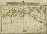
179814495Philadelphia 1798. The Columbia River is added to what is a later imprint of the 1795 edition of this early American map showing Cook's explorations of Hawaii and Alaska. Cary re-engraved a British map of 1784 and added changes reflecting American patriotism. Longitude is measured west from Philadelphia & Greenwich. "Engraved for Cary's American Edition of Guthrie's Geography improved." & "J.T. Scott Sculp." are erased from the printing plate with some light traces left in the impression. Copper engraving impression 292x197 mm engraved surface 283x189 mm. The number "58" is scratched into the top corner as well as penned in the top margin. Rumsey #2542020 is a similar plate although the sizes are a couple of millimeters different possibly because this map is mounted on light card. <br /> <br /> The chart centers on the Pacific Northwest Coast from the Gulf of California the Baja Peninsula to the Alaska Coast Prince William Sound Cook's River the Bering Strait the Aleutian Islands and Russian Kamtschatka. This edition includes the Columbia River which earlier editions did not and it first appeared on a British map of 1798 connecting it with the Missouri from Vancouver's explorations. According to Fiske Captain Gray a New England trader of the ship "Columbia" charted it and shared his maps with Vancouver. The tracks of Capt. Cook in his ship "The Resolution" and Capt. Clerke in "The Discovery" are shown crossing the Pacific from Hawaii to the NW Coast & Kamtschatka. Capt. Clerke took over as Master of "The Resolution" after Cook's death in Hawaii in 1779. Samuel Hearne's discoveries to the north of Hudson's Bay are depicted as well as the area where he located the Coppermine River in 1770. Hearne was the first white man to to cross overland from Hudson's Bay tracing the river to the Arctic Ocean. A faint water mark in the right side of the map with early outline color on the continents. Very good condition overall. unknown