7 491 résultats
SLIVCN-9781786310040Cicerone Press (2/2020)
1982100145589M E SHARPE INC 1982 301 pages 22 606x2 286x14 732cm. 1982. Broché. 301 pages. Ce recueil d'essais présente les théories économiques de Hyman Minsky sur l'instabilité financière endogène du capitalisme. L'auteur analyse la crise de 1933 et la quasi-crise de 2008 en examinant si de tels effondrements peuvent se reproduire et en soulignant le rôle de la politique fiscale pour les prévenir

19424190The National Gallery of Canada In-8 Softcover Ottawa/Ontario 1942
2016500183314Hachette 2016 192 pages 12 6x17 9x1 4cm. 2016. Broché. 192 pages.
2014100148599Oxford University Press(UK) 2014 376 pages 16 3x3x24cm. 2014. Cartonné jaquette. 376 pages.
500082423HATIER 192 pages 21 3x1 5x28 7cm. Sans date. Relié. 192 pages.
187547271(Paris, Gauthier-Villars), 1875. 4to. No wrappers. In: ""Comptes Rendus Hebdomadaires des Séances de L'Academie des Sciences"", Tome 81, No 12 and No 23. Pp. (485-) 508 a. (1065-) 1148. (2 entire issues offered). Boisbaudran's papers: pp. 493-495 a. pp. 1100-1105.
31302, Brepols Publishers, 2011 Hardcover, VII 654 p., 0 b/w ill. 336 colour ill., 225 x 300 mm, . ISBN 9781905375486.
DCM11395Fantasy Concord CD COMME NEUF PHOTOS SUR DEMANDE
2008100111641Arthaud 2008 2x32x25cm. 2008. Relié jaquette.
2008100121500Arthaud 2008 2x32x25cm. 2008. Broché.
1964RO80063578McLEAN Donald. 1964. In-12. Broché. Bon état, Couv. convenable, Dos satisfaisant, Intérieur frais. 221 pages. Nombreuses figures et photos en noir et blanc, dans le texte et en hors-texte. Ouvrage en anglais.. . . . Classification Dewey : 355.8-Armes
47542, Brepols, 2005 Paperback 332 p., 127 b/w ill. + 18 colour ill. + + ills., 240 x 280 mm,. ISBN 9782503515083.
lc_47360Gottmer; 1er édition (15 avril 2012)
2004500170291BORDAS 2004 184 pages 10 8x1x16 2cm. 2004. pocket_book. 184 pages.
65852, Brepols, 2020 Hardback, clvii + 201 pages, Size:155 x 245 mm, Illustrations:5 col., Languages: English, Latin, Greek. ISBN 9782503551746.
64879, Brepols, 2022 Hardback, 298 pages, Size:156 x 234 mm, Illustrations:17 col., Language: English. ISBN 9782503594101.
2007100140357POMMIER 2007 142 pages in4. 2007. Cartonné jaquette. 142 pages.
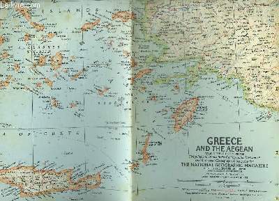
1958R150175980MELVILLE BELL GROSVENOR.. 1958. In-Folio. Broché. Bon état, Couv. convenable, Dos satisfaisant, Pliures. Carte dépliante en couleurs de 63.5 cm / 48.5 cm.. . . . Classification Dewey : 912-Atlas, cartes et plans
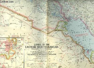
1959R150175982MELVILLE BELL GROSVENOR.. 1959. In-Folio. Broché. Etat d'usage, Couv. convenable, Dos satisfaisant, Pliures. Carte dépliante en couleurs de 48.5 cm / 63cm. Petits manques dans les pliures .. . . . Classification Dewey : 912-Atlas, cartes et plans
1978RO80153913CHEZ L'AUTU. 1978. In-12. Broché. Etat d'usage, Couv. légèrement passée, Dos satisfaisant, Intérieur acceptable. Carte dépliante en couleurs, de 39 x 60 cm. Echelle 1 : 500000.. . . . Classification Dewey : 912-Atlas, cartes et plans
169316120Large engraved seechart, measuring 46 x 89 cm. in original outline colouring. The chart showing the South-east coast of England from Sandwich to Clay. With inset view of The Thames between London and Greane Island. A fine impression on good thick paper with watermark: BYCOLUMBIER. Folded down the center.
169316116(No place, no date(1693)). Very large engraved seechart, measuring 60 x 86,5 cm. in original outline colouring. The chart showing the Northern part of England from Lancaster to Banf, of Ireland from Blackrock to Carlingford and all the Islands to the north: Shetland, Orkney, Faroe etc. etc. A fine impression on good thick paper with the watermark: BYCOLUMBIER. Folded down the center.
175545938(Paris, Imprimerie Royale, 1755). 4to. Extract from ""Mémoires fe Mathematique et de Physique, Présentés à l'Academie des Sciences par divers Savans"", Tome II. Pp. 607-608 and 1 folded engraved map ""Carte dee Etoiles des Pleiades ajoutées a celles qui ont etes observées par Mr. le Monnier, suivant divers Alignements &c. par Mr. l'abbé Outhier"" (ca. 25x19 cm.).
1910228611910 Antique Double Sided World Map by The Scarborough Company c1910 Grande carte toilée double face pliée sous étui avec itineraires et distances.This map has Europe, Asia, Africa & Australia on one side and North America & South America on the other and was published by the Scarborough Company, London, England, around 1910 (latest copyright date) but was printed in Boston, Mass, USA and was originally priced at 15 shillings (£0.75)- quite a sum at that time - equivalent to about £80 now. It includes principal ocean steamship lines, distances in nautical miles along steamship routes andthe routes shown in red on the map, principal places etc. It measures 39 inches wide by 41 inches high (100 x 104 cm) and is printedon cloth. It's in reasonable condition for its age - a bit of foxing, a couple of other marks and some slight frayingbut no splits or tears- see pictures - they form part of the description.