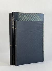
The Virginias: A Mining Industrial and Scientific Journal devoted to the Development of Virginia and West Virginia Volume 1-4; 1880-1884
18839696Staunton VA: Printed by S. M. Yost & Son for Jed Hotchkiss 1883. Hard Cover. Good binding. Quarto. xi 1 196 192; 6 196; 1 iii 196 pp. maps illus. First edition. Volume 1 & 2 bound together in library buckram; Volume 3 in marbled boards with modern bonded leather spine and corners; Volume 4 in library buckram. Volume II is lacking volume title page and index. All volumes trimmed some closer than others. Ex-library with typical markings; bindings are a trifle worn but sturdy; contents are a bit brittle with some closed tears to the folds of the maps a couple of maps have cleanly separated along those tears; occasional early tape repairs to a few leaves and a few maps. Rogers’s geological map is quite crisp and bright. Relatively well-preserved volumes from this landmark publication. <br /> <br /> An important periodical that ran from 1880 through Volume VI 1885 before being merged into the Industrial South. Jedediah Hotchkiss the editor and publisher is perhaps most remembered as the staff officer of Stonewall Jackson and employed his topographical and cartographical skills to the great benefit of Jackson during the Civil War. After the war Hotchkiss established himself in Staunton VA as a consulting engineer and geologist among other endeavors eventually editing and publishing this present periodical. Given the wealth of information related to natural resources it's easy to imagine that these efforts brought significant funding into the commonwealth at a time it was greatly needed. <br /> <br /> While there are contributions by most significant geologists of the day as well as maps and sections by Hotchkiss J. Peter Lesley James P. Kimball R. O. Currey John L. Campell and others. But certainly the most notable inclusions is William Barton Rogers’s 1841 geological map of Virginia. This first systematic geological survey of Virginia began in 1835 when Rogers a recognized expert was engaged by the Virginia General Assembly to undertake the task. The manuscript of the map was largely complete when funding for the project was cut off in 1841. This map languished for decades until a version of it Marcou 592 was published in Virginia: A Geographical and Political Summary. Hotchkiss a friend and colleague of Rogers further added to the map and issued it in Vol. I No. 6 of The Virginias 1880. Of this map E. M. Sanchez-Saavedra writes: "The geological map of Virginia is modest in appearance but it contains more information than first meets the eye. Its topography was based on the 1827 Boye nine-sheet map altered to emphasize natural drainage and erosion patterns. The large patches of color representing different formations were the result of Rogers's years in the field—digging climbing and analyzing rock strata." Finally noting that this color coding seems to have been of Roger's invention it would be employed to some degree in subsequent years by John Wesley Powell as he embarked on his ambitious undertaking to map the entirety of the country. This map remains an important piece of Virginia geologic and cartographic history. Sanchez-Saavedra A Description of the Country: Virginia's Cartographers and Their Maps 1607-1881. pp. 103-118. Marcou 612. Printed by S. M. Yost & Son for Jed Hotchkiss unknown