Abraham OrteliusBiblio.com
155 résultats
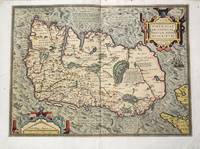
1581M10680Antwerp c.1581. Very Good backed on old paper. Notes: First separate printed map of Ireland by Ortelius in his "Theatrum Orbis Terrarum".<br> Size : 350x478 mm 13.78x18.82 Inches Coloring: Original Hand Coloring Reference: Van den Broecke #22. Category: Maps Europe Ireland; unknown
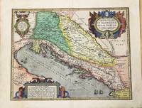
1590M9803Antwerp c.1590. Very Good. Notes: Latin text on verso. A beautiful map of the Balkans. Size : 352x455 mm 13.86x17.91 Inches Coloring: Original Hand Coloring Category: Maps Europe Balkans; unknown
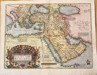
1574M10044Antwerp Belgium 1574. Very Good. Notes: Detailed and decorative map of the Ottoman Empire.<br>It depicts the Middle East by one of the founding fathers of cartography during the late 16th century. This important map features a decorative cartouche. The map depicts cities towns geographical features and has short paragraphs giving the reader information on certain areas. <br>Latin text on verso.<br>Abraham Ortelius April 1527 – June 1598 was a Flemish cartographer geographer and cosmographer from Antwerp in the Spanish Netherlands. He is recognized as the creator of the first modern atlas the Theatrum Orbis Terrarum Theatre of the World. Along with Gemma Frisius and Gerardus Mercator Ortelius is generally considered one of the founders of the Netherlandish school of cartography and geography. He was a notable figure of this school in its golden age approximately 1570s–1670s and an important geographer of Spain during the age of discovery. The publication of his atlas in 1570 is often considered as the official beginning of the Golden Age of Netherlandish cartography. Size : 375x500 mm 14.76x19.69 Inches Coloring: Hand Colored Reference: Marcel P.R. van den Broecke pg.168 Category: Maps Asia Near East Turkey; Maps Asia Middle East Arabia; unknown
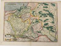
1574M6759Antwerp Belgium: Abraham Ortelius 1527-1598 1574. Very Good;. Notes: Latin text on verso. L58.<br><br>"Waclaw Grodecki his true name was Grodziecki which was latinized as Grodecius corrupt Godreccius was born about 1535. He was the son of a Silesian gentleman to whom belonged the village Grodziec in Cieszyn Silesia hence the family name. He entered Cracow University in 1550 and in 1555 was still there studying mathematics and philosophy. In 1556 he left for Leipzig as tutor to the son of a great noble and there too he entered the university. In 1557 he drew his well-known map of Poland. He travelled to Italy and after his return in 1561 took orders. In 1564 he received the degree of Master of Arts at the Cracow University. He later became canon of the chapter in Wroclaw this post having been ceded on his behalf by his elder brother Jan when he became bishop of Olomouc in 1572. Waclaw Grodecki followed his brother to Moravia in 1566 and settled for good in Brno where later he became dean of the collegiate chapter. Being to the end of his life a devoted Catholic and a protector of the Jesuits he was a major figure of the counter-reformation movement in Moravia. He was a man of humble character and good-natured. He died in Brno in 1591." Buczek<br> <br> Size : 373x498 mm 14.69x19.61 Inches Coloring: Original Hand Coloring Reference: Marcel P. R. van den Broecke #154. Category: Maps Europe Poland Lithuania; Abraham Ortelius (1527-1598) unknown
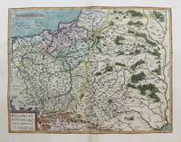
1598M3122Antwerp c.1598. Very Good. Notes: Scarce map of Poland and Lithuania during the late 16th century. <br>The map shows major cities and towns as well as geographical features. Includes a charming image of a horse-drawn sleigh in the bottom right corner. <br>Dutch text on verso. Size : 369x482 mm 14.53x18.98 Inches Coloring: Hand Colored Category: Maps Europe Poland Lithuania; unknown
157521270Amsterdam: Ortelius 1575. Very good overall. A classic map of the British Isles published in the 'Theatrum Orbis Terrarum' regarded as the first modern atlas. The map was oriented with north to the right so that the map fitted the sheet of paper as it predates the convention of north to the top of the map.<br /> <br /> Ort 16 Koeman/Meurer: 6 Karrow: 1/11 van der Krogt AN: 5000:31A. Listed on Van Den Broecke as 1575L6 100 copies printed small page number 7 mm; last line centred like 3 lines above it: sem;Ponticum Virunium;Ioannem Prisæum;&Bedam. Shirley: British Isles 1477-1650 86. <br /> <br /> Latin text on verso. 19 1/2 x 13 1/2". Centerfold and right margin strengthened. Original color heightened. Ortelius unknown
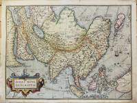
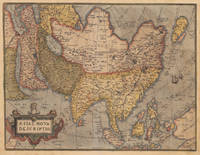
157415880Antwerp: Plantin 1574. Maps. Very good overall. The map of Asia from Ortelius' groundbreaking 'Theatrum Orbis Terrarum' considered the first modern geographical atlas 'produced in thirty-one editions between 1570 and 1612' David Parry: 'The Cartography of the East Indian Islands' 2005. Covering the area from the Middle East to Nova Guinea with part of the coast line of Australia 'Terrae Incognitae Australis Pars' in the lower right corner. Based on Ortelius' own 1567 wall map of Asia from the Theatrum Orbis Terrarum. Van den Broecke Ort #6 "Occurrence in Theatrum editions and page number: 1574L3 175 copies printed large page number 11 mm last line centered like 2 lines above it: nem in maiori Tabula ante tres annos edidimus". It has the capital "F" in La Farfana and the town "Ara" is still present above Aden. A total of only 1675 of this edition were printed compared to the more common Ort 7 edition. Image size:19 3/4 x 14 3/4". With an ornate cartouche and sailing ships. Latin text on verso. Paper size: 21 x 16 1/2". Copper engraving with original hand color. A very small burn hole at the ocean south of Japan; a defect in the plate at the lower edge to the right of the cartouche creating a short black line. Plantin unknown
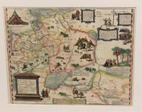
1574M10843Antwerp Belgium c.1574. Very Good. Notes: Latin text on verso. L.61<br>Decorative map of Russia by Abraham Ortelius. Size : 352x448 mm 13.86x17.64 Inches Coloring: Original Hand Coloring Reference: Marcel P. R. van den Broecke #162. Category: Maps Russia; unknown
158054214Antwerpen ca. 1580. 32 x 41 cm. Kobberstukket Danmarkskort i original håndkolorereing. Med Skåne Halland og Blekinge samt den nordlige del af Tyskland.Foldningen fint forstærket på bagsiden med japanpapir. <br/><br/><em>Et af de tidligste danmarkskort med Marcus Jordan og Cornelis Anthoniszoon som forlæg. Kortet har ingen tekst på bagsiden men stammer fra Ortelius' berømte atlas "Theatrum orbis terrarum" som udkom i 19 udgaver alle før 1584. I de senere udgaver af atlasset blev kortet revideret og opdelt i to mindre dele.Bramsen p. 56. </em> unknown
15849733Antwerp 1584. Copper engraving 34.5 x 49.5 cm modern hand-colour centrefold reinforced on verso several neat marginal restorations Latin text on verso. The British Isles aligned with west at the top of the map and north on the right which makes better use of the available space on the page; it was chiefly derived from Mercators map of 1564. Abraham Ortelius's Theatrum Orbis Terrarum is widely considered the first modern world atlas originally published in 1570. Ortelius gathered and selected the maps which he believed represented the best available cartographic knowledge of his day which he then presented it in a single volume duly credited and finely engraved in a consistent style with explanatory text. The Theatrum was highly decorative and hugely popular amongst the wealthy and educated running into over forty editions in Latin and other major European languages. Shirley British Isles 139 but cf. 86.Van den Broecke 16. Map unknown
1575M10946Antwerp 1575. Very Good with some expert restoration on the two corners of the lower margin not affecting the map. Notes: Latin Text on verso.<br>From Theatrum Orbis Terrarum Atlas Ortelius's influential map of continental Asia after Gastaldi. "While the Mediterranean coastline and the southern coastline of Asia are fairly accurate the eastern and northern coastlines are erroneous. Especially the north-western parts with the Japanese island group is quite mis-presented. Also many errors in placenames e.g. Meppo for Aleppo. . There is no doubt about the Italian source for this map viz. Gastaldi." Brandmair. Size : 372x492 mm 14.65x19.37 Inches Coloring: Original Hand Coloring Reference: Van Den Broecke #7. Category: Maps Asia Continent; unknown
158017201Antwerp: Christopher Platin 1580. Other. A very good example in excellent condition and original colors. 376 by 489mm 14 by 19 inches. Original copper engraving oldcolored published 1582 in Antwerpen in the atlas Theatrum Orbis Terrarum. This is the 2nd plate of Ortelius's "Asia Nova Descriptio". It has the lower case "Farfana" and the town "Ara" has disapeared. The map is finely hand-colored in wash and outline when published. A colored title cartouche is in the lower left corner. Villages and towns are shown as miniature views moreover the map is ornated with sea monsters. A highly decorative 16th century map of Asia. Ortelius was born on 14 April 1527 in the city of Antwerp which was then in the Habsburg Netherlands modern-day Belgium. The Orthellius family were originally from Augsburg a Free imperial city of the Holy Roman Empire. In 1535 the family had fallen under suspicion of Protestantism. Following the death of Ortelius's father his uncle Jacobus van Meteren returned from religious exile in England to take care of Ortelius. Abraham remained close to his cousin Emanuel van Meteren who would later moved to London. In 1575 he was appointed geographer to the king of Spain Philip II on the recommendation of Arias Montanus who vouched for his orthodoxy. He travelled extensively in Europe and is specifically known to have traveled throughout the Seventeen Provinces; in southern western northern and eastern Germany e.g. 1560 15751576; France 15591560; England and Ireland 1576; and Italy 1578 and perhaps twice or thrice between 1550 and 1558. Beginning as a map-engraver in 1547 he entered the Antwerp Guild of Saint Luke as an illuminator of maps. He supplemented his income trading in books prints and maps and his journeys included yearly visits to the Frankfurt book and print fair where he met Gerardus Mercator in 1554. In 1560 however when travelling with Mercator to Trier Lorraine and Poitiers he seems to have been attracted largely by Mercator's influence towards the career of a scientific geographer. Wikipedia Broe. 7. Christopher Platin unknown
15782206Antwerp: Plantin 1578. Hardcover. Very Good. 4to - over 9¾ - 12" tall. 4to. 23 x 16.5 cm 4 ff. 417 1 pp. 1 f. Bound in contemporary vellum over flexible boards head slightly chipped; early signature on t-p. Woodcut 'golden compass' device of the Plantin press on title. Generally good. First edition of this early modern geographical dictionary published alongside the first Plantin edition of Ortelius' successful Theatrum orbis terrarum Antwerp 1579 and listing thousands of names both ancient and modern for "peoples regions islands great and small towns mountains foothills forests seas bays lakes" etc. depicted in the atlas. Earlier versions of the Synonymia had previously appeared as indices to the atlas containing a little over 2000 entries; "in all this first version of Ortelius' geographical dictionary in the form of a separate book includes approximately 10000 entries" Meurer. Ortelius' methodology in the present volume differs from that of his earlier indices: a parallel glossary of non-Latin names has been turned into a bilingual appendix and Ortelius relies almost completely on classical authors quoting moderns only when he cannot go straight to the source. The significance of these alterations for the author's role not as mapmaker but as linguist and lexicographer is hard to overstate: his introduction declares that he undertook the new Synonymia largely out of frustration at the scholarly inadequacy of current Latin lexica including earlier editions of his own which frequently printed inexact or even nonexistent terms sometimes on dodgy authority. Voet 1835; Skelton Theatrum orbis terrarum facsimile 1964; Meurer in Abraham Ortelius and the First Atlas ed. Voet pp. 331-346. Plantin hardcover
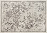
158163816<p>hand-coloured copper engraving. RARE. Stunning well-known map from 'Theatre de L'Univers contenant les cartes de tout le monde'.</p><p>This is the first French edition of his celebrated atlas - the FIRST in the World: 'Theatrum Orbis Terrarum" which was first published in Latin in 1570. The work was published by Christofle Plantin for Ortelius between 1581 and 1582 in Anvers Antwerp Belgium. Shows India and Indonesia Japan and the Philippines still without Luzon and parts of the American and Australian coastlines and the first Western map to show Formosa Taiwan.</p><p>Ortelius was a notable Dutch cartographer and 'the publication of this atlas in 1570 marked an epoch in the history of cartography. It was the first uniformly sized systematic collection of maps of the countries of the world based only on contemporary knowledge since the days of Ptolemy & in that sense may be called the first modern atlas; although that term itself was not used until 20 years later by Mercator. The Theatrum was re-issued in 42 editions with 5 supplements. with text in Latin Dutch German French Spanish Italian & English between the years 1570-1612. The protrusion of a Southern landmass initially called 'Beach' by Marco Polo is shown South of "Java Major" alluding to another "necessary" suspected landmass to keep the round earth balanced: Australia… Reference: Quirino p. 76; Cortazzi Isles of Gold p. 20 & 17; Walter Japan Nr. 11D; Broecke #166; Tooley Maps of Australia Nr. 937; Clancy Terra Australis Map 5.16; Clancy/R. S. 44/45/46; Suarez Southeast Asia; Farbabb. S. 166: Parry South Indian Islands S.; 78 mit Abb:Koeman III 8400:31:vdB 166.1; Ort 29 B Latin ed.; Lietz Insulae Indiae Orientalis 36th IMCoS Symposium Manila 2018 Gallery of Prints & Ayala Museum p.101.</p><p>Condition: centrefold as issued.</p> Anvers (Antwerp), Belgium.
158453076Antwerp. c.1584-95. A beautiful map of the British Isles north to the right. The map is based on Mercator's earlier map of the British Isles of 1564. Title in strapwork cartouche at top right text in Latin in its own cartouche at lower right scale and royal arms; ships at sea. It is difficult to put an exact date on the map because of the complex publishing history of Ortelius' atlas. Published in the Theatrum Orbis Terrarum. Size: 345 x 505 mm. Copper engraving. Coloured. Framed size: 780 x 640 mm. Fine condition good margins. Moreland & Bannister p. 200-203; Van den Broecke 16. unknown
159854753Antwerp. 1598. This glorious map is embellished with an elegant border and a bold imposing title cartouche in top right corner and a smaller oval cartouche in bottom left corner containing nine lines of Latin text. Natural topography is clearly delineated with the relief shown pictorially. Charming details include a couple of sailing ships a large flying fish and two warriors in their tented camps. This beautiful and important map still showing California as a peninsula was much copied by other cartographers. Size: 470 x 350 mm. Copper engraving. Original colour. Fine condition. Moreland & Bannister Antique Maps p.269. unknown
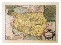
1574G1ADU6GU6IANAntwerp: Christophe Plantin 1574. Engraved map 35 x 50 cm in contemporary hand-colouring and highlighted in gold. Scale 1:9000000. 16th-century Dutch map of Persia based on the Gastaldi map with additional new cartographic information.l Alai General maps E.70; Al-Qasimi 30; Van den Broecke 167 first state. Christophe Plantin, unknown
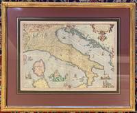
1573311532Antwerp: Ortelius Abraham 1573. framed. Map. Color engraving. Image measures 14 3/8" x 19.75". In gilt frame with empire French matting 23 x 28 1/2 inches.<br/> <br/> Gorgeous 16th century map of Italy. Elevations are beautifully colored and major towns are noted in red. Part of the Balkans Corsica and northern Sardinia are included along with part of Switzerland. Monaco is noted to the West. It was Ortelius's first map of Italy with a depiction of Neptune embracing and kissing a Neirid merwoman. A Sphinx perches atop the distance scale cartouche. Seven ships complete the composition. Some foxing and toning but otherwise a beautiful example of this uncommon edition. <br> <br> Abraham Ortelius 1527--1598 started his career as a Flemish map colorist eventually becoming a publisher cartographer and geographer. He widely regarded as one of the important and influential cartographers in history. He is known for his "Theatrum Orbis Terrarum" which was the first modern atlas. Van den Broecke 118.<br/> <br/> Ortelius, Abraham unknown
152353327Venice: Daniel Bamberg 1523. Daniel Bamberg unknown
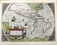
1592M8829Antwerp 1592. Very Good. Notes: Latin text on verso. L5. <br><br>A highly decorative map of the Americas. It is considered as the most beautiful map of the Western Hemisphere of the 16th century with a bulge on the coast of South America.<br>This map of the Americas by Ortelius came to be one of the most influential maps of this area having a large impact on European perspectives of the new continent. Ortelius was able to obtain cartographic information from both Spanish and Portuguese sources. From the Theatrum Orbis Terrarum by Abraham Ortelius which was the first atlas produced that uniformly covered the world with similarly sized and styled maps. Burden 39.<br><br><br><br><br><br> Size : 362x500 mm 14.25x19.69 Inches Coloring: Original Hand Coloring Reference: Burden 39. Van Den Broecke #11. Category: Maps North America; Maps South America Continent; unknown
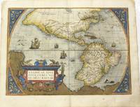
1584M11280Antwerp Belgium 1584. Very Good. Notes: Decorative and famous early map of the Americas.<br>The map shows North and South America and the Great Southern Continent extending northward to include New Guinea. The title is in a strapwork cartouche and the sea area is decorated with four ships and a sea creature.<br>Latin text on verso. <br>Abraham Ortelius April 1527 – June 1598 was a Flemish cartographer geographer and cosmographer from Antwerp in the Spanish Netherlands. He is recognized as the creator of the first modern atlas the Theatrum Orbis Terrarum Theatre of the World. Along with Gemma Frisius and Gerardus Mercator Ortelius is generally considered one of the founders of the Netherlandish school of cartography and geography. He was a notable figure of this school in its golden age approximately 1570s–1670s and an important geographer of Spain during the age of discovery. The publication of his atlas in 1570 is often considered as the official beginning of the Golden Age of Netherlandish cartography. Size : 362x500 mm 14.25x19.69 Inches Coloring: Original Hand Coloring Reference: Marcel P. R. Van Den Broecke #10.<br> Category: Maps North America; Maps South America Continent; unknown
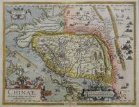
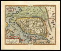
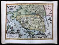
158461175<p>hand-coloured copper engraving. verso: Spanish text. EXTREMELY RARE.</p><p>The first European map of China appeared in Abraham Ortelius's atlas " Theatrum Orbis Terrarum" showing the area of Canton Mindanao no Luzon some islands to the North but only CuboCebu is marked and part of Japan – Spanish edition. An extremely important map for the Philippines here in the first state: there is no indication yet of' 'Las Philippinas' as will be shown later in the second state on the long elongated island just north of Borneo in the position and orientation of Palawan but apparently not based on Spanish knowledge.<br />Ortelius was a notable Dutch cartographer and the publication of this atlas in 1570 marked an epoch in the history of cartography. It was the first uniformly sized systematic collection of maps of the countries of the world based only on contemporary knowledge since the days of Ptolemy & in that sense may be called the first modern atlas; although that term itself was not used until 20 years later by Mercator. The Theatrum was re-issued in 42 editions with 5 supplements with text in Latin Dutch German French Spanish Italian & English between the years 1570-1612. The protrusion of a Southern landmass initially called 'Beach' by Marco Polo is shown South of "Java Major" alluding to Australia. Reference: Tooley Mapmakers S.38; Koeman III Ort 29 B; Walter Japan Nr. 11F; Karrow Mapmakers Nr. 1/152; Landmarks of Mapmaking pict. p. 21; Phillips Atlases 396; OAG Japan a cartographic vision pl. 11F; Suárez: Early Mapping… p. 170-1; Karrow Mapmakers p. 479; Lietz Insulae Indiae Orientalis 36th IMCoS Symposium Manila 2018 Gallery of Prints & Ayala Museum p.12.</p><p>Condition: Very good.</p> published in Antwerp.
158415641Antwerp: Plantin Press 1584. 450 by 540mm. 17.75 by 21.25 inches. Engraved map with hand colour loss to top right margin skilfully reinstated. The earliest printed map to focus on China and the first to illustrate the Great Wall. It was the first western map of China drawn directly from the findings of the Portuguese mapmaker Luis Jorge de Barbuda or Ludovicus Georgius. Barbuda was a Jesuit and he made a manuscript map of China from information on the area gathered by the Jesuit mission. Arias Montanus passed this map on to Ortelius. He issued this first separately published map of China in 1584 which remained the standard map of China for over fifty years. The map is oriented to the west. Japan is shown on a curved projection borrowing from Portuguese sources. Wind wagons are shown in the north a Chinese invention that also became popular in the Low Countries. The text on the reverse of the map is in Latin and gives an insight into the climate national features inhabitants and economy of China at that time. Abraham Ortelius is one of the most famous of the early mapmakers and publishers. His 'Atlas of the Whole World' 'Theatrum Orbis Terrarum' was first published in 1570 the first uniformly sized systematic collection of maps and hence can be called the first 'Atlas'. These beautiful maps were elegantly engraved by Frans Hogenberg. Plantin Press], unknown
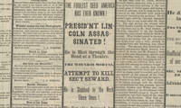
15042913315/04/1865. <blockquote><p>The Assassination:<strong><br /></strong></p></blockquote><p>Abraham Lincoln continues to stand as America’s most beloved President. Of our nation’s historical icons Lincoln is the quintessential embodiment of American possibility in his mythic-like rise from rail-splitter to Chief Executive and Emancipator of the oppressed. The admiration felt by Americans for Lincoln’s humble integrity his performance in office his noble statesmanship and his keen sense of justice is enduring. Lincoln is not given the highest marks just for character but for the transformation of the nation that he left behind which was both profound and long-lasting.</p><p>Polls of historians generally show their belief that Lincoln faced the hardest job of any president. He had to define the issues inspire the people be steadfast in the face of losses win the Civil War free the slaves and lay the groundwork to reunite the nation. All that in the face of determined opposition. He accomplished all this in four years but was assassinated on April 14 1865 and his death left him unable to finish the job a job that quite likely he was the only one with a chance to get completed in a way that would truly bring the nation together.</p><p>The end of the Civil War left the nation with two overwhelming questions: what to do with and do for the millions of freed slaves; and how to reintegrate the South into the Union. On the first point Lincoln was focused on African American access to land economic prosperity and legal rights and had just approved Gen. William T. Sherman’s order distributing parcels of former slave plantations to the slaves themselves. Lincoln wanted black Union veterans to have the right to vote which was a step to ultimately embracing full suffrage for African American males. In what proved to be his final speech three evenings before his death Lincoln had become the first president ever to support black voting. Lincoln’s successor Andrew Johnson was a Southerner uninterested in fair treatment of the liberated slaves. He opposed plans designed to guarantee the civil rights of black Americans and cancelled Sherman’s order granting land to slaves. Johnson accepted the draconian post-Civil War Black Codes which limited the rights and liberties of African-Americans something Lincoln would never have done.</p><p>On the second point the readmission of the Southern states Johnson felt that once Southern states returned their loyalty to the national government they could manage their own affairs. This meant they could pass any Jim Crow laws they liked. He opposed the Republican plan for Reconstruction of the South including provisions designed to guarantee the civil rights of black Americans. The Republican Congress had no rapport with Johnson and the initial four years era of Reconstruction which was a disaster to the nation was essentially a bitter battle between a North and South that remained locked in contention presided over by a weak President Johnson and a Congress at loggerheads with him. Lincoln had enormous power and influence some of which extended into the South. He saw the end of the war as an opportunity to not simply celebrate victory but an opportunity to move the country forward. Johnson had no such feeling. Lincoln would have been much better placed to direct moderate and ease the contentions of Reconstruction.</p><p>John Wilkes Booth was a member of a famous acting family and he enjoyed a phenomenally successful stage career during the Civil War: By 1864 he earned $20000 a year at a time when the average Northern family earned around $300 annually. A Marylander by birth Booth was an open Confederate sympathizer during the war. A supporter of slavery Booth believed that Lincoln was determined to overthrow the Constitution and to destroy his beloved South. After Lincoln’s reelection in November 1864 Booth devised a plan to kidnap the president and spirit him to Richmond where he could be ransomed for some of the Confederate prisoners languishing in northern jails. That winter Booth and his conspirators plotted a pair of elaborate plans to kidnap the president; the first involved capturing Lincoln in his box at Ford’s Theater and lowering the president to the stage with ropes. Booth ultimately gave up acting to focus on these schemes. Neither of the kidnapping plans bore fruit. On the evening of April 11 the President stood on the White House balcony and delivered a speech to a small group gathered on the lawn. Two days earlier Robert E. Lee had surrendered the Army of Northern Virginia at Appomattox Court House and after four long years of struggle it had become clear that the Union cause would shortly emerge from the war victorious. Lincoln’s speech that evening outlined some of his ideas about reconstructing the nation and bringing the defeated Confederate states back into the Union. Lincoln also indicated a wish to extend the franchise to some African-Americans—at the very least those who had fought in the Union ranks during the war - and expressed a desire that the southern states would extend the vote to literate blacks as well. Booth stood in the audience for the speech and this notion seems to have amplified his rage at Lincoln. “That means nigger citizenship†he told Lewis Powell one of his band of conspirators. “Now by God I’ll put him through. That is the last speech he will ever make.â€</p><p>Three days later Booth made good on his promise. Upon learning that Lincoln and his wife intended to see the play “Our American Cousin†at Ford’s Theater Booth used his actor’s connections there to gain access to the President’s box. He shot Lincoln at about 10 pm on April 14 1865 and Lincoln died about after 7 am on the 15th.</p><p>Dr. Charles Leale was in the audience. Leale leapt over theater seats got to the president’s box and announced that he was a doctor. As he entered the President was sitting in a chair with his eyes closed and head slumped. He already looked dead Leale recalled. He felt Lincoln’s right arm for a pulse but couldn’t find one. He and some others eased Lincoln to the floor and Leale began searching for the wound. “I quickly passed the separated fingers of both hands through his blood-matted hair…and I discovered his mortal wound†Leale recalled. “The president had been shot in the back part of the head behind the left ear.†Leale stuck the little finger of his left hand into the hole in Lincoln’s skull. “I then knew it was fatal and told the bystanders†he wrote later. Leale knew he had to get Lincoln out of the theater to treat him. But he believed a carriage ride back to the White House would kill him. He and several other men lifted the president and with Leale holding Lincoln’s head they began to maneuver him outside. Across the street from the theater was the house of William Peterson and Lincoln was taken there. Lincoln was carried to a small back room stripped of his clothes and covered with blankets. His 6-foot-4-inch frame had to be placed diagonally to fit on the bed. Leale ordered the window opened and the wait began. A parade of anguished government officials and family members came and went. The President sank steadily his breathing labored and his pulse nearly undetectable. At 7:22 am on April 15 President Lincoln breathed his last. Leale smoothed the contracted muscles of Lincoln’s features placed two coins over his eyes and pulled a sheet up over his face. Famously Secretary of War Stanton saluted the fallen President and uttered “Now he belongs to the ages.†Stanton further eulogized Lincoln with the apt observation “There lies the most perfect ruler of men the world has ever seen.â€</p><p><strong>Original report</strong> on the assassination printed the very day he died</p><p>The public was hungry for information and the newspapers equally hungry to report the momentous news. One of these was the Binghamton Daily Republican and this is its issue of April 15 1865 with black mourning columns.</p><p>The front page as was routine at the time was taken up by ads. The news then began on page two. There at top left is the headline <em>“The Assassination of President Lincoln! A Nation in Mourning!!!â€</em> It begins <em>“We feel too unfitted by this awful event to allude to the calamity in terms becoming its solemnity and importance! LINCOLN IS DEAD! Struck down by the hands of a brutal assassin in the midst of the triumphs which were commemorating his salvation of the country. A great man indeed has fallen! The foremost man of his time is no more…We dare not contemplate what may follow this sad and inscrutable providence.â€</em> This was followed by a proclamation of the governor of New York. On page three were dispatches from 12:30 AM to noon to 3:00. An early dispatch reports that<em> “the President was shot… and is not expected to liveâ€</em> and told of the events of the assassination then available in detail. It mentioned <em>“The screams of Mrs. Lincoln first disclosed the fact to the audience that the President had been shot.â€</em> Later it reported of Lincoln <em>“At midnight the Cabinet…a few personal friends with Surg. Gen. Barnes and his immediate assistants were beside his bedside…The parting of his family with the dying president is too sad for description.â€</em></p><p>At noon the newspaper had more news and reported <em>“Later concerning the President. He died this morning at 7:20. Two villains engaged in the horrible crime. The murder planned before March 4th.â€</em> At the bottom of the column is a report on the progress of the army of General William T. Sherman saying that in response to Grant’s hope Sherman would pursue the remaining Confederates Sherman said <em>“I think we’ll do it.â€</em> At 3:00 the paper printed the latest from Washington. It contained <em>“Full particulars of the Death of Abraham Lincolnâ€</em> plus <em>“Inauguration of President Johnsonâ€</em> and Johnson’s statement on taking office.</p><p>Original newspapers reporting Lincoln’s assassination have become very scarce this being our first in over a decade. This one is comprehensive and with its black borders and large headlines is evocative of the moment and would be perfect for display.</p><p><img class=""alignnone wp-image-25018 size-post-window"" src=""https://cdn.raabcollection.com/wp-content/uploads/20231204144051/Folder-site-11-1600x1327.jpg"" alt="""" width=""1600"" height=""1327"" /></p> hardcover
158415208Antwerp: Plantin Press 1584 1595. 440 by 550mm. 17.25 by 21.75 inches. Hand-coloured engraved map with fine original colour. The earliest printed map to focus on China and the first to illustrate the Great Wall. It was the first western map of China drawn directly from the findings of the Portuguese mapmaker Luis Jorge de Barbuda or Ludovicus Georgius. Barbuda was a Jesuit and he made a manuscript map of China from information on the area gathered by the Jesuit mission. Arias Montanus passed this map on to Ortelius. He issued this first separately published map of China in 1584 which remained the standard map of China for over fifty years. The map is oriented to the west. Japan is shown on a curved projection borrowing from Portuguese sources. Wind wagons are shown in the north a Chinese invention that also became popular in the Low Countries. The text on the reverse of the map is in Latin and gives an insight into the climate national features inhabitants and economy of China at that time. Abraham Ortelius is one of the most famous of the early mapmakers and publishers. His 'Atlas of the Whole World' 'Theatrum Orbis Terrarum' was first published in 1570 the first uniformly sized systematic collection of maps and hence can be called the first 'Atlas'. These beautiful maps were elegantly engraved by Frans Hogenberg. Plantin Press], unknown