Abraham OrteliusBiblio.com
155 résultats
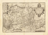
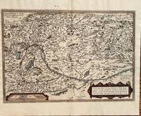
1584687Antwerp: Abraham Ortelius 1584. 19 3/4 x 13 1/2 inches. Very good but for a harpsichord shaped wormhole at the upper centerfold which is relatively of little consequence. This is a handsomely executed map of the Danube River Basin starting on the left at Vienna and passing through Austria Serbia and Romania. Belgrade is prominently displayed near the cartouche. In the lower left is a mileage scale. This is a very nice example of late 16th century mapmakers art. Abraham Ortelius unknown
1584299318Antwerp: Abraham Ortelius 1584. unbound. Map. Engraving. Image measures 14" x 18 3/4". Light staining and toning on right margin but otherwise is good condition.<br/> <br/> A representation of some islands in the Mediterranean Sea. Abraham Ortelius 1527-1598 a Flemish cartographer and geographer is widely regarded as one of the important and influential cartographers in history. He is known for his "Theatrum Orbis Terrarum" which was the first modern atlas. Van den Broecke #141<br/> <br/> Abraham Ortelius unknown
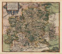
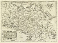
158737336Antwerp: Christopher Platin 1587. A very good example in excellent condition. 387 by 440mm 15 by 17 inches. Hand-Colored Original Copperplate Engraving by Abraham Ortelius depicting Wirtenberg Ducatus Accurata descriptio; tu qua omnia eius Opida Monasteria pagi nemora; fluminia et riuuli alicuius nominis diligentißimé exprimuntur. Auctore Georgio Gadnero. Published Antwerp Christopher Platin 1587. Sheet: 387 by 440mm 15 by 17 inches. A fine and original hand-colored example of Ortelius's celebrated cartographic work documenting this region of Germany with the precision and decorative artistry characteristic of the 15800s. Abraham Ortelius 1527-1598 was a Flemish cartographer and geographer from Antwerp widely regarded as the creator of the first modern atlas. His landmark publication Theatrum Orbis Terrarum 1570 set the standard for atlas-making for the next century presenting uniform copper-engraved maps with scholarly commentary. By Ortelius's death the Theatrum had appeared in 25 editions in seven languages. In 1575 King Philip II of Spain appointed him Royal Geographer. His maps engraved with extraordinary precision are among the most sought-after in antique cartography held in collections including the Plantin-Moretus Museum in Antwerp the Library of Congress and the British Library.This plate presents a original copperplate engraving with original hand coloring depicting the city of Wirtenberg Ducatus Accurata descriptio; tu qua omnia eius Opida Monasteria pagi nemora; fluminia et riuuli alicuius nominis diligentißimé exprimuntur. Auctore Georgio Gadnero. published in Antwerp Christopher Platin 1587. The view is framed with a decorative Baroque cartouche containing the title inscription. Such topographic views from Ortelius's workshop are primary historical documents of German urban history in the 1500s now prized equally by historians map collectors and interior decorators. Sheet measures 387 by 440mm 15 by 17 inches. In good condition overall with minor signs of age appropriate for a 16th-century engraving. Ready to frame. Broe. 113 Christopher Platin unknown
159816774Antwerp: Platin 1598. Other. A very good example a small older mended clear split in the upper centerfold. 350 by 460mm 13 by 18 inches. Original antique copper engraving published 1598 in a French textedition of the Theatrum Orbis Terrarum. Finely hand-colored in wash and outline. The map is ornated with three cartouches in the lower right corner the title cartouche in the upper right corner we find a small cartouche with privilegium and in the upper left corner a small cartouche with a milage scale. Villages and towns are shown as miniature views moreover the map is ornated with ships sea monsters and animals as well a compass rose in the sea. Ortelius was born on 14 April 1527 in the city of Antwerp which was then in the Habsburg Netherlands modern-day Belgium. The Orthellius family were originally from Augsburg a Free imperial city of the Holy Roman Empire. In 1535 the family had fallen under suspicion of Protestantism. Following the death of Ortelius's father his uncle Jacobus van Meteren returned from religious exile in England to take care of Ortelius. Abraham remained close to his cousin Emanuel van Meteren who would later moved to London. In 1575 he was appointed geographer to the king of Spain Philip II on the recommendation of Arias Montanus who vouched for his orthodoxy. He travelled extensively in Europe and is specifically known to have traveled throughout the Seventeen Provinces; in southern western northern and eastern Germany e.g. 1560 15751576; France 15591560; England and Ireland 1576; and Italy 1578 and perhaps twice or thrice between 1550 and 1558. Beginning as a map-engraver in 1547 he entered the Antwerp Guild of Saint Luke as an illuminator of maps. He supplemented his income trading in books prints and maps and his journeys included yearly visits to the Frankfurt book and print fair where he met Gerardus Mercator in 1554. In 1560 however when travelling with Mercator to Trier Lorraine and Poitiers he seems to have been attracted largely by Mercator's influence towards the career of a scientific geographer. Wikipedia Broe. 28 Platin unknown
157952409Antwerp. 1579. Based on the 1548 map by Jacques & Jean Surhonio which for security reasons was never published. Only in 1579 when Antwerp was independent for a short time did Ortelius publish it van den Broecke 70. Strapwork cartouche coats of arms two scales. Published in the wonderful Theatrum Orbis Terrarum. Copper engraving. Good condition. Some wear to lower centrefold. Narrow margins a little darkened Original colour. Size: 49 x 37 cm. Van den Broecke 70 unknown
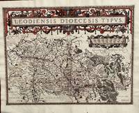
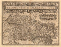
1584675Antwerp: Abraham Ortelius 1584. 19 1/2 x 14 2/4 inches. Very good condition. Ortelius was mentored by Mercator. The friendship yielded a mapmaking enterprise of great success. This map of the diocese of Liege. The main cartouche spreads across and covers the entire 2 pages. There is a secondary mileage cartouche scale. There is a major river through Liege. The Meuse runs thrash the map with primal impact showing the riverine regime as important to a large area. There is a multitude of small towns colored red. This is a very good copy with color not applied at publication. Ortelius oriented the west at the top of the map. Abraham Ortelius unknown
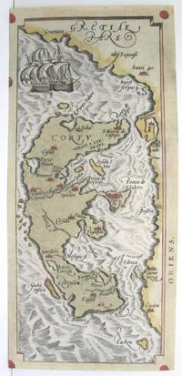
1590M3046Antwerp 1590. Very Good; left and lower margins extended. Size : 233x100 mm 9.125x3.875 Inches Coloring: Original Hand Coloring Category: ; Maps Europe Greece Macedonia unknown
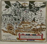
1574M8062Belgium c.1574. Very Good. Size : 220x246 mm 8.66x9.69 Inches Coloring: Hand Colored Category: Maps Europe Poland Lithuania; unknown
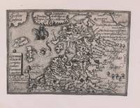
1579M8772Antwerp c. 1579. Margins are trimmed closely and laid on 19th century paper. Otherwise very good. . Notes: Map of Baltic region and Poland from the late 16th century with decorative border with sea monsters and tall ships. Size : 80x107 mm 3.15x4.21 Inches Coloring: Black & White Category: Maps Europe Estonia Latvia; Maps Europe Poland Lithuania; unknown
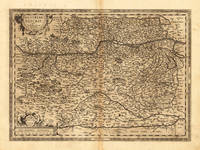
159817608Antwerp: Platin 1598. Other. In excellent condition. 356 by 486mm 14 by 19 inches. Original antique copper engraving published 1598 in a French text edition of the " Theatrum Orbis Terrarum. Uncolored example in a strong impression as published. This is the second plate of the Austria map after Wolfgang Lazius published for the first time in the "Theatrum Orbis Terrarum" after 1595. Here present in the 1598 edition. A highly decorative early map of the duchy of Austria towns are still shown as miniature engraved city views mountains woods rivers and lakes are decorative engraved. In the lower right corner a milage scale with a coat of arms. In the center of the map we find Vienna. The map reaches in the west from Linz towards the Neusiedler lake in the east. In the south with the neighbouring Carintia and Salzburg. Ortelius was born on 14 April 1527 in the city of Antwerp which was then in the Habsburg Netherlands modern-day Belgium. The Orthellius family were originally from Augsburg a Free imperial city of the Holy Roman Empire. In 1535 the family had fallen under suspicion of Protestantism. Following the death of Ortelius's father his uncle Jacobus van Meteren returned from religious exile in England to take care of Ortelius. Abraham remained close to his cousin Emanuel van Meteren who would later moved to London. In 1575 he was appointed geographer to the king of Spain Philip II on the recommendation of Arias Montanus who vouched for his orthodoxy. He travelled extensively in Europe and is specifically known to have traveled throughout the Seventeen Provinces; in southern western northern and eastern Germany e.g. 1560 15751576; France 15591560; England and Ireland 1576; and Italy 1578 and perhaps twice or thrice between 1550 and 1558. Beginning as a map-engraver in 1547 he entered the Antwerp Guild of Saint Luke as an illuminator of maps. He supplemented his income trading in books prints and maps and his journeys included yearly visits to the Frankfurt book and print fair where he met Gerardus Mercator in 1554. In 1560 however when travelling with Mercator to Trier Lorraine and Poitiers he seems to have been attracted largely by Mercator's influence towards the career of a scientific geographer. Wikipedia Broe. 106 Platin unknown
157221923Antwerpen 1572 - 73. Other. In very good to excellent condition. 370 by 500mm 14 by 19 inches. Original antique copper engraving hand colored in outline when published. Decorative map of Ortelius" first plate covering Gelderland. Based on Christiaan Sgrothen" s map of 1567 and is richly engraved with fine detail particularly along the rivers. The map is oriented with north to the left with ribbon cartouches marking the cardinal directions. Two ships sail in the Zuyder Zee and a decorative cartouche with flowers and birds. Ortelius was born on 14 April 1527 in the city of Antwerp which was then in the Habsburg Netherlands modern-day Belgium. The Orthellius family were originally from Augsburg a Free imperial city of the Holy Roman Empire. In 1535 the family had fallen under suspicion of Protestantism. Following the death of Ortelius's father his uncle Jacobus van Meteren returned from religious exile in England to take care of Ortelius. Abraham remained close to his cousin Emanuel van Meteren who would later moved to London. In 1575 he was appointed geographer to the king of Spain Philip II on the recommendation of Arias Montanus who vouched for his orthodoxy. He travelled extensively in Europe and is specifically known to have traveled throughout the Seventeen Provinces; in southern western northern and eastern Germany e.g. 1560 15751576; France 15591560; England and Ireland 1576; and Italy 1578 and perhaps twice or thrice between 1550 and 1558. Beginning as a map-engraver in 1547 he entered the Antwerp Guild of Saint Luke as an illuminator of maps. He supplemented his income trading in books prints and maps and his journeys included yearly visits to the Frankfurt book and print fair where he met Gerardus Mercator in 1554. In 1560 however when travelling with Mercator to Trier Lorraine and Poitiers he seems to have been attracted largely by Mercator's influence towards the career of a scientific geographer. Wikipedia Koe. Ort 1C / 15. Broe. 61. 1 of 2. unknown
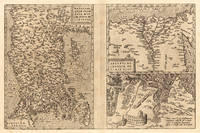
157223534Antwerp: Platin 1572/73. Other. In excellent condition. 321 by 492mm 12 by 19 inches. Original copper engraving uncolored as published 1572/73 in a German text edition of the " Theatrum Orbis Terrarum. The map shows three maps on one double page each of them with a title cartouche. Asia Minor is shown with the east to the north oriented with Cyprus in the eastern Mediterranean. The other small map of Egypt is showing mainly the Nile delta with the neighboring area. The third map shows the surroundings of Tunis Carthago. Villages and towns are shown as miniature views. Moreover the maps are ornated with ships. Abraham Ortelius received the cartographic sources for those maps by Gastaldi and Forlani 1564 for Egypt by Forlani 1566 and Carthago after an Italian one sheet source dated 1535 Broe. 174. Ortelius was born on 14 April 1527 in the city of Antwerp which was then in the Habsburg Netherlands modern-day Belgium. The Orthellius family were originally from Augsburg a Free imperial city of the Holy Roman Empire. In 1535 the family had fallen under suspicion of Protestantism. Following the death of Ortelius's father his uncle Jacobus van Meteren returned from religious exile in England to take care of Ortelius. Abraham remained close to his cousin Emanuel van Meteren who would later moved to London. In 1575 he was appointed geographer to the king of Spain Philip II on the recommendation of Arias Montanus who vouched for his orthodoxy. He travelled extensively in Europe and is specifically known to have traveled throughout the Seventeen Provinces; in southern western northern and eastern Germany e.g. 1560 15751576; France 15591560; England and Ireland 1576; and Italy 1578 and perhaps twice or thrice between 1550 and 1558. Beginning as a map-engraver in 1547 he entered the Antwerp Guild of Saint Luke as an illuminator of maps. He supplemented his income trading in books prints and maps and his journeys included yearly visits to the Frankfurt book and print fair where he met Gerardus Mercator in 1554. In 1560 however when travelling with Mercator to Trier Lorraine and Poitiers he seems to have been attracted largely by Mercator's influence towards the career of a scientific geographer. Wikipedia Broe. 174. Platin unknown
157426946Antwerpen: Platin 1574. Other. A strong impression. In excellent condition. 280 by 385mm 11 by 15¼ inches. Copper engraving uncolored as published. Latin text edition printed 1574. Broe. 102. Platin unknown
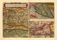
159816878Antwerp: Christopher Platin 1598. Other. A very good example in excellent condition. 332 by 4850mm 13 by 191 inches. Original copper engraving published 1598 in a French edition of the Theatrum Orbis Terrarum. Finely hand-colored in wash and outline. There are three maps on one plate each showing a title cartouche. Villages and towns are shown as miniature views. Ortelius was born on 14 April 1527 in the city of Antwerp which was then in the Habsburg Netherlands modern-day Belgium. The Orthellius family were originally from Augsburg a Free imperial city of the Holy Roman Empire. In 1535 the family had fallen under suspicion of Protestantism. Following the death of Ortelius's father his uncle Jacobus van Meteren returned from religious exile in England to take care of Ortelius. Abraham remained close to his cousin Emanuel van Meteren who would later moved to London. In 1575 he was appointed geographer to the king of Spain Philip II on the recommendation of Arias Montanus who vouched for his orthodoxy. He travelled extensively in Europe and is specifically known to have traveled throughout the Seventeen Provinces; in southern western northern and eastern Germany e.g. 1560 15751576; France 15591560; England and Ireland 1576; and Italy 1578 and perhaps twice or thrice between 1550 and 1558. Beginning as a map-engraver in 1547 he entered the Antwerp Guild of Saint Luke as an illuminator of maps. He supplemented his income trading in books prints and maps and his journeys included yearly visits to the Frankfurt book and print fair where he met Gerardus Mercator in 1554. In 1560 however when travelling with Mercator to Trier Lorraine and Poitiers he seems to have been attracted largely by Mercator's influence towards the career of a scientific geographer. Wikipedia Broe. 143 Christopher Platin unknown
159821946Antwerpen 1598. Other. A strong impression in excellent condition. 370 by 500mm 14 by 19 inches. Original antique copper engraving published 1598 in a French text edition of the " Theatrum Orbis Terrarum. Decorative map of Ortelius" first plate covering Gelderland. Based on Christiaan Sgrothen" s map of 1567 and is richly engraved with fine detail particularly along the rivers. The map is oriented with north to the left with ribbon cartouches marking the cardinal directions. Two ships sail in the Zuyder Zee and a decorative cartouche with flowers and birds. Ortelius was born on 14 April 1527 in the city of Antwerp which was then in the Habsburg Netherlands modern-day Belgium. The Orthellius family were originally from Augsburg a Free imperial city of the Holy Roman Empire. In 1535 the family had fallen under suspicion of Protestantism. Following the death of Ortelius's father his uncle Jacobus van Meteren returned from religious exile in England to take care of Ortelius. Abraham remained close to his cousin Emanuel van Meteren who would later moved to London. In 1575 he was appointed geographer to the king of Spain Philip II on the recommendation of Arias Montanus who vouched for his orthodoxy. He travelled extensively in Europe and is specifically known to have traveled throughout the Seventeen Provinces; in southern western northern and eastern Germany e.g. 1560 15751576; France 15591560; England and Ireland 1576; and Italy 1578 and perhaps twice or thrice between 1550 and 1558. Beginning as a map-engraver in 1547 he entered the Antwerp Guild of Saint Luke as an illuminator of maps. He supplemented his income trading in books prints and maps and his journeys included yearly visits to the Frankfurt book and print fair where he met Gerardus Mercator in 1554. In 1560 however when travelling with Mercator to Trier Lorraine and Poitiers he seems to have been attracted largely by Mercator's influence towards the career of a scientific geographer. Wikipedia unknown
159813893Antwerp 1598. Other. In excellent condition. 380 by 497mm 15 by 19 inches. Original antique copper engraving published 1598 in a French text edition of the " Theatrum Orbis Terrarum. Uncolored copy in a strong impression. The map is ornated a large title cartouche and below a decorative milage scale. This antique map shows Luttich in Belgium. The map is equipped with many small place names rivers woods etc. Ortelius was born on 14 April 1527 in the city of Antwerp which was then in the Habsburg Netherlands modern-day Belgium. The Orthellius family were originally from Augsburg a Free imperial city of the Holy Roman Empire. In 1535 the family had fallen under suspicion of Protestantism. Following the death of Ortelius's father his uncle Jacobus van Meteren returned from religious exile in England to take care of Ortelius. Abraham remained close to his cousin Emanuel van Meteren who would later moved to London. In 1575 he was appointed geographer to the king of Spain Philip II on the recommendation of Arias Montanus who vouched for his orthodoxy. He travelled extensively in Europe and is specifically known to have traveled throughout the Seventeen Provinces; in southern western northern and eastern Germany e.g. 1560 15751576; France 15591560; England and Ireland 1576; and Italy 1578 and perhaps twice or thrice between 1550 and 1558. Beginning as a map-engraver in 1547 he entered the Antwerp Guild of Saint Luke as an illuminator of maps. He supplemented his income trading in books prints and maps and his journeys included yearly visits to the Frankfurt book and print fair where he met Gerardus Mercator in 1554. In 1560 however when travelling with Mercator to Trier Lorraine and Poitiers he seems to have been attracted largely by Mercator's influence towards the career of a scientific geographer. Wikipedia Broe. 64. State 1/3. unknown
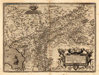
1584792Antwerp: Abraham Ortelius 1584. 18 1/2 inches x 14 inches. This is a fine engraved antique map with hand coloring. A rare map that results. from a 1570s map by Johannes Sambucus.In the lower left is /venice opening up into a northern alpine area of Italy and Southern Bavaria. Abraham Ortelius unknown
158433639Antwerpen 1584. In sehr gutem Zustand. 34.5 x 497 cm 13.5 x 195 inches. Hand-Colored Original Copperplate Engraving by Abraham Ortelius depicting Westphaliae Totius Finitimarumque Regionum Accurata Descriptio. Published Antwerpen 1584. Sheet: 34.5 x 497 cm 13.5 x 195 inches. A fine and original hand-colored example of Ortelius's celebrated cartographic work documenting this region of Germany with the precision and decorative artistry characteristic of the 15800s. Abraham Ortelius 1527-1598 was a Flemish cartographer and geographer from Antwerp widely regarded as the creator of the first modern atlas. His landmark publication Theatrum Orbis Terrarum 1570 set the standard for atlas-making for the next century presenting uniform copper-engraved maps with scholarly commentary. By Ortelius's death the Theatrum had appeared in 25 editions in seven languages. In 1575 King Philip II of Spain appointed him Royal Geographer. His maps engraved with extraordinary precision are among the most sought-after in antique cartography held in collections including the Plantin-Moretus Museum in Antwerp the Library of Congress and the British Library.This original copperplate engraving with original hand coloring depicts the region of Westphaliae Totius Finitimarumque Regionum Accurata Descriptio. published in Antwerpen 1584. The map features a decorative Baroque cartouche containing the title inscription. A distance scale is incorporated within the cartouche or alongside it. The map records the political and geographic boundaries of the region as understood in 1584 offering a fascinating window into the history of German territorial organization. Sheet measures 34.5 x 497 cm 13.5 x 195 inches. In good condition overall with minor signs of age appropriate for a 16th-century engraving. Ready to frame. Koe. Ort 23 / #46 85. Broe. 91. unknown
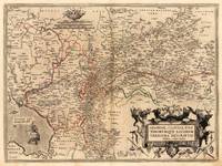
15958222Antwerp Plantin-Moretus 1595. Copper engraving 31 x 47.5 cms modern hand-colour Latin text on verso. Two maps on one sheet the Duchy of Brunswick-Lüneburg and the environs of Nuremberg.Van den Broecke 99a.1/99b.2 Map unknown
15958572Antwerp Plantin-Moretus 1595. Copper engraving 32 x 49 cms three maps on one sheet: Anatolia or modern Turkey Egypt Tunis and ancient Carthage; modern hand colour conjugate wormhole at centrefold Latin text on verso. An engraved historical note on the map of Carthage indicates that nearby Tunis which is the focus of the map was captured for Christendom by the Holy Roman Emperor and King of Spain Charles V in 1535. A version of the truth perhaps as Charles reinstated the deposed Hafsid Sultan but a Spanish governor resided at Goletta for a generation. The map was first published in 1570 just after the city had fallen into Ottoman hands and although it was briefly recaptured Tunis had been Ottoman for 20 years by the time our example of the map was published. Van den Broecke 174.2 Map unknown
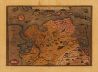
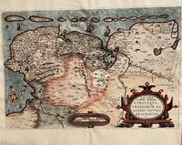
158819751Antwerpen: Platin 1588. Other. In very good condition verso skilfully reinforced with thin Japan paper due to the old oxidation of the colors. Else a very good example. 308 by 442mm 12 by 17 inches. Hand-Colored Original Copperplate Engraving by Abraham Ortelius depicting Frisiae Orientalis Descriptio. Published Antwerpen Platin 1588. Sheet: 308 by 442mm 12 by 17 inches. A fine and original hand-colored example of Ortelius's celebrated cartographic work documenting this region of Germany with the precision and decorative artistry characteristic of the 15800s. Abraham Ortelius 1527-1598 was a Flemish cartographer and geographer from Antwerp widely regarded as the creator of the first modern atlas. His landmark publication Theatrum Orbis Terrarum 1570 set the standard for atlas-making for the next century presenting uniform copper-engraved maps with scholarly commentary. By Ortelius's death the Theatrum had appeared in 25 editions in seven languages. In 1575 King Philip II of Spain appointed him Royal Geographer. His maps engraved with extraordinary precision are among the most sought-after in antique cartography held in collections including the Plantin-Moretus Museum in Antwerp the Library of Congress and the British Library.This original copperplate engraving with original hand coloring depicts the region of Frisiae Orientalis Descriptio. published in Antwerpen Platin 1588. The map records the political and geographic boundaries of the region as understood in 1588 offering a fascinating window into the history of German territorial organization. Sheet measures 308 by 442mm 12 by 17 inches. In good condition overall with minor signs of age appropriate for a 16th-century engraving. Ready to frame. Broe. 82 Platin unknown
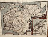
1584670Antwerp: Abraham Ortelius 1584. 19 1/2 x 14 1/4 inches. Very good condition with nice color that was not applied at the time of publication. This is a very nice original map of the western Netherlands. The is an inset map of Antique Frisiae or at the time of the Romans. it is highly detailed with forested ares and islands abutting the mainland. The main map is highly detailed as to the riverine regime of the late 1500s. Abraham Ortelius unknown
15849714<p>Original hand-colored engraving from Abraham Ortelius's <em>Theatrum Orbis Terrarum - Parergon - Nomenclator Ptolemaicus</em>. Features Latin text to verso see image. The image measures approximately 19 x 12.75 in 48 x 32.5 cm; page measures 21 x 17.25 in 53 x 44 cm.</p> Christoph Plantin Press
1584674Antwerp: Abraham Ortelius 1584. 20 1/3 2 x 13 1/2 inches. Very good condition. This is Ortelius classic map of the Netherlands up close. It has Groeningen in the upper center. It also has sailing ships and a plethora of small towns. The cartouche is an elaborate production Not only does the map show the Netherlands but also Belgium. It also has a set of island adorning the top of the coast. This is a nice copy of a rarer map that is in good condition with color not applied at the time of publication. Abraham Ortelius unknown
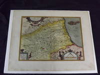
1590101237<p>Hand colored double-page engraved map 325 x 425 mm 14" x 18" Latin text on verso. Wide margins minor soiling in margins slight aging; otherwise bright and clean with strong impression. Ortelius 1527-1598 is typically viewed as the creator of the modern atlas. He started his career as a map-engraver around 1547 and by 1570 he published the first edition of his Theatrum Orbis Terrarum Atlas of the Whole World which included seventy maps many engraved by Frans Hogenberg. This map is colorful impression of Abruzzi Italy and it was probably published in 1612.</p>