Ortelius, AbrahamBiblio.com
155 résultats
1595M7934Antwerp Belgium c.1595. Very Good;. Notes: French text on verso. Size : 336x463 mm 13.23x18.23 Inches Coloring: Hand Colored Reference: Marcel P.R. van den Broecke 145. Category: Maps Europe Balkans; unknown
15958231Antwerp Plantin-Moretus 1595. Copper engraving 33 x 46 cms modern hand-colour Latin text on verso. Ortelius map of the western Balkans drew on the cartography of Augustin Hirschvogel. Van den Broecke 145.3 Map unknown
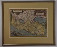
158715883Antwerp 1587. Three part old color map of Italy showing Corsica Siena and Ancona. With an Ortelius watermark on the section with Corsica. According to Dr. Marcel van den Broecke it is based on "an anonymous 'Marca Anconitana' published in 1564 by Vincenzo Luchini Meurer p. 95. On the authority of Brandmair 1914 p. 71 Karrow attributes this map to Cæsar Orlandi see Hessels nr. 39". Ornate cartouche in the map of Siena with a text block about the bountiful supply of fish. French text on verso. This map corresponds to Dr. Marcel van den Broecke and Dr. Deborah van den Broecke-Günzburger's Ort 137 classification: "Occurrence in Theatrum editions and page number: 1587F74 250 copies printed last line left aligned: se sous le Pape. A la fin elle est retournée en la puissance des Geneuoisausquels elle obeit encore. Image size: 19 x 13". Paper size: 23 1/8 x 17 1/2". Very good. unknown
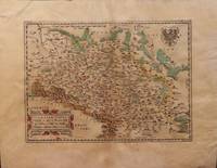
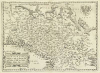
15793004<p>Paper size: 392 x 500 mm. Plate size: 278 x 386 mm. 16th century map in original hand-coloring. Depicts rivers forests ranges monasteries and towns/cities including Prague and Frankfurt. Latin text regarding Silesia to verso. Please see image. Ortelius 102. ; 392 x 500 mm ; All shipments through USPS insured Priority Mail.</p> Abraham Ortelius
157426946Antwerpen: Platin 1574. Other. A strong impression. In excellent condition. 280 by 385mm 11 by 15¼ inches. Copper engraving uncolored as published. Latin text edition printed 1574. Broe. 102. Platin unknown
15782206Antwerp: Plantin 1578. Hardcover. Very Good. 4to - over 9¾ - 12" tall. 4to. 23 x 16.5 cm 4 ff. 417 1 pp. 1 f. Bound in contemporary vellum over flexible boards head slightly chipped; early signature on t-p. Woodcut 'golden compass' device of the Plantin press on title. Generally good. First edition of this early modern geographical dictionary published alongside the first Plantin edition of Ortelius' successful Theatrum orbis terrarum Antwerp 1579 and listing thousands of names both ancient and modern for "peoples regions islands great and small towns mountains foothills forests seas bays lakes" etc. depicted in the atlas. Earlier versions of the Synonymia had previously appeared as indices to the atlas containing a little over 2000 entries; "in all this first version of Ortelius' geographical dictionary in the form of a separate book includes approximately 10000 entries" Meurer. Ortelius' methodology in the present volume differs from that of his earlier indices: a parallel glossary of non-Latin names has been turned into a bilingual appendix and Ortelius relies almost completely on classical authors quoting moderns only when he cannot go straight to the source. The significance of these alterations for the author's role not as mapmaker but as linguist and lexicographer is hard to overstate: his introduction declares that he undertook the new Synonymia largely out of frustration at the scholarly inadequacy of current Latin lexica including earlier editions of his own which frequently printed inexact or even nonexistent terms sometimes on dodgy authority. Voet 1835; Skelton Theatrum orbis terrarum facsimile 1964; Meurer in Abraham Ortelius and the First Atlas ed. Voet pp. 331-346. Plantin hardcover
159854753Antwerp. 1598. This glorious map is embellished with an elegant border and a bold imposing title cartouche in top right corner and a smaller oval cartouche in bottom left corner containing nine lines of Latin text. Natural topography is clearly delineated with the relief shown pictorially. Charming details include a couple of sailing ships a large flying fish and two warriors in their tented camps. This beautiful and important map still showing California as a peninsula was much copied by other cartographers. Size: 470 x 350 mm. Copper engraving. Original colour. Fine condition. Moreland & Bannister Antique Maps p.269. unknown
159813293451598. A map of the Holy Land by Abraham Ortelius dated 1598 first issued in 1584 as a part of Theatrum Orbit Terrarium. In Very Good condition with age toning and a central crease. Matted but not framed. w 26.5 in. x h 22 in. Shelved at Rockville PS 1101 #25. Based on material collected by the Dutch Astronomer Peter Laicksteen who travelled to the Holy Land in 1556. Christian Sgrooten here written "Schrot" royal geographer to King Phillip II of Spain produced a nine-sheet map of Palestine in 1570 from Laikstain's information. This map was condensed into the present form by Abraham Ortelius. Ortelius the creator of the first modern atlas collected and edited maps from all over Europe for his book. Many of the original mapmakers rose to fame solely through Ortelius's decision to include their maps in his atlas. Laicksteen took thorough and accurate notes and the original Laicksteen and Sgrooten map contained improvements over earlier maps. For instance the River Kishon is here shown as flowing from the mountains near the Sea of Galilee not as was previously thought from the Sea of Galilee itself. However the Levantine coastline Sgrooten and Ortelius depicted is hardly recognizable to modern eyes. The map is replete with fanciful bays and peninsulas though some of the most recognizable features of the coastline such as the outcrops of land at Haifa and Beirut are absent. Ortelius had originally used another map of the Holy Land by cartographer Tilleman Stella in the early editions of the Theatrum Orbis Terrarum. It covered a far more extensive territory including part of Egypt and Syria. Oddly the coastline in this first map was much more accurate than in the Sgrooten map. Laicksteen and Sgrooten's original map included a small inset with an extended geography. However their mapping of the Dead Sea and surrounding areas was so controversial that Ortelius chose to leave out this region completely. The strange anecdote written in the Dead Sea is Ortelius's own addition. It describes how the Dead Sea was once a fertile valley but was transformed by an act of God into a barren sea to punish the wickedness of Sodom and Gomorrah. In the bottom left hand corner is a hand colored illustration of the story of Jonah. Above the luscious cartouche Ortelius has added three miniatures featuring the Crucifixion the Nativity and the Resurrection of Christ. The French text on the verso a long-winded description with little relevance to the map was changed to a more "reader-friendly" version shortly after the publication of this edition. 525 copies were made of this edition of Ortelius's map. 1329345. Special Collections - Upstairs. unknown
15887526At London Imprinted by William How for Thomas Gubbin and T. Newman 1588. 1588 4to. 10 85 2 87-151 leaves. Folding table 'A generall Table of the whole Booke'. Later calf panelled in blind with a two line roll and small corner tools. The spine with four raised bands and blind lines. Evidence of a lost label. The spine darkened and minor rubs on the edges and corners. Internally clean and tight with pinholes of worm to the final three leaves mostly marginal but affecting three letters of text on Rrii. Later signature E. Dawson on the front pastedown. Fraunce was a member of Philip Sidney's circle and all his writings were dedicated to members of that group. His writings were commended both by Thomas Nashe and by Francis Meres. In this work he follows the Ramist principles he also employed in other works providing literary examples to demonstrate principles of logic. Here however he expands the approach by using common law cases from Plowden and others. ESTC S102621 . At London, Imprinted by William How, for Thomas Gubbin, and T. Newman, hardcover
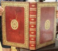
1570B6632Colophon: Antwerp: Gielis von Diest 1572-1573 Durch Abrahamum Ortelium. c. 1572 & 1570 -1595. occasional minor damp staining map of Morocco rebacked; rare oxidization spots otherwise a very good example. Binding: Expertly rebacked in style; saving the armorial seventeenth century heavily gilt panelled full red calf with Louis xiv’s fleur-de-lis bookplates on upper and lower covers; spine raised with six 6 bands gilt ornamented compartments and gilt lettered title on two; inner gilt dentelles. Notes: The 1572 German special edition plus other early maps.First very rare German 1572 edition in contemporary colour bound with maps from editions up to 1595.<br> <br>1572 Atlas with text in German and captions in Latin; extra plates in Latin one in Spanish. <br>A5v Ortelius publ. <br>“Abraham Ortelius or Ortels or Orthellius or Wortels 1527–1598 was a … cartographer geographer and cosmographer conventionally recognized as the creator of the first modern atlas the Theatrum Orbis Terrarum…. Along with Gemma Frisius and Gerardus Mercator Ortelius is generally considered one of the founders of the Netherlandish school of cartography and geography. He was also one of the most notable figures of the school in its golden age approximately 1570s–1670s. The publication of his atlas in 1570 is often considered as the official beginning of the Golden Age of Netherlandish cartography. … On 20 May 1570 Gilles Coppens de Diest at Antwerp issued Ortelius's Theatrum Orbis Terrarum the "first modern atlas" of 53 maps…. Three Latin editions of this besides a Dutch a French and a German edition appeared before the end of 1572. …†<br> <br>Tooley states: "The publication of this atlas marked an epoch in the history of cartography. It was the first uniformly sized systematic collection of maps of the countries of the world based only on contemporary knowledge".<br> <br>“The present work is the first German edition of the Theatrum with the German title “Theatrum oder Schawplatz des Erdtbodems …†The plates are identical; however the Index/ Register is reduced/ absent as explained at A5v of the German edition or Ortelius’ to the Reader or “Abraham Ortelius// Zum guetwilligen Leser.â€<br> <br>Shirley states: “From the first atlas in 1570 with 53 map sheets the work grew in size so that the final edition in 1612 contained over 160 items. Initially new maps were issued through a series of Additamenta between 1573 and 1597; in addition a classical addendum called the Parergon was produced from 1579 onwards.†<br> <br>"Shape and contents set the standards for later atlases when the centre of the map-trade moved from Antwerp to Amsterdam. The characteristic feature of the Theatrum is that it consists of two elements forming part of a unitary whole: text and maps. This concept for a 'Theatre of the world' was followed through the 17th century. Before Ortelius no one had done this" Koeman. <br> <br>Koeman 1961 mentions on p.138/ under 49.1 the 1572 German text edition following its 1570 Latin ‘Theatrum orbis terrarum’. <br> Size: Folio 414x285mm Illustration: Illustrated allegorical title; ornamental woodcut initials at openings of poetry dedication explanation of the allegorical title and the “to the Reader†as well as each of the 53 openings of explanatory texts preceding each plate; head and endpieces; all fifty-three 53 double page plates reflecting the same plates first published in the 1570 Latin edition; and various literature mention that only the first German edition is similar to First Latin edition. moreover the second edition had extra plates. the twenty 20 further double page plates representing twenty-eight 28 early maps this includes small insert maps dating up to 1595 both in contemporary hand colour and uncoloured. <br> <br> References: Lilly Library Indiana University Bloomington The Bernando Mendel Collection 1964: p.42; Koeman vol.III: pp.25-33; Shirley I: p.771 Pages: Ll: Bl. A1-6 with title and texts of poetry dedication explanation of allegory in title and to the reader; ill 53 DP plates; ill 20 interspersed DP plates bl. Category: Book Europe Germany; Book Atlas & Cartography; (Colophon: Antwerp: Gielis von Diest, 1572-[1573]) Durch Abrahamum Ortelium. unknown
15703370BNetherlands: Publisher Not Known 1570. a very good map 6 x 7"; Abraham Ortelius 1527-98. One of the first and greatest of the Dutch map makers. His "Theatrum Orbis Terrarum" of 1570 is generally considered the first modern Atlas. For this work large copper plates were engraved and from time to time alterations were made in these plates as various editions were issued even as late as 1693-- long after Ortelius' death. These Maps are much favoured by collectors because of a quaint rather archaic quality of drawing. They are exceedingly decorative and careful examination of any one of them will disclose curious little fugures scenes or other decorations. This map is one of these original engravings with nice old colouring. This map will make a nice gift and is quite scarce. First Edition. Softcover. Very Good/No Dustjacket. 6 x 7". Publisher Not Known Paperback
158464215Antwerp.: Abraham Ortelius. circa1584. Two engraved maps on laid paper each 30.3 x 19.5 cm printed on the one sheet 48 x 60 cm original fold attractive hand colour with related French text on verso slight toning and spotting to the margins but the maps in very good condition preserved in a modern window mount. Attractive maps of the German coast published in Ortelius' great atlas "Theatrum Orbis.". The left-hand map showing the mouths of the Elbe complete with sea monster and Eider Rivers and the coast of Schleswig-Holstein; the right-hand map of the Baltic coast with the Pomeranian islands of Rugen and Usedom. . (Abraham Ortelius). unknown
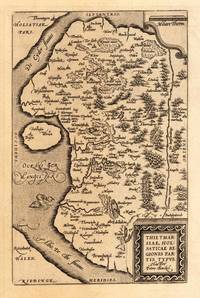
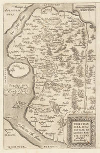
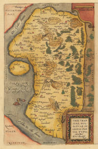
158427410Antwerpen: Platin 1584. Other. In excellent condition. 304 by 196mm 12 by 7 inches. Hand-Colored Original Copperplate Engraving by Abraham Ortelius depicting Thietmarsiae Holsaticae Regionis Partis Typus. Auctore Petro Boeckel. Published Antwerpen Platin 1584. Sheet: 304 by 196mm 12 by 7 inches. A fine and original hand-colored example of Ortelius's celebrated cartographic work documenting this region of Germany with the precision and decorative artistry characteristic of the 15800s. Abraham Ortelius 1527-1598 was a Flemish cartographer and geographer from Antwerp widely regarded as the creator of the first modern atlas. His landmark publication Theatrum Orbis Terrarum 1570 set the standard for atlas-making for the next century presenting uniform copper-engraved maps with scholarly commentary. By Ortelius's death the Theatrum had appeared in 25 editions in seven languages. In 1575 King Philip II of Spain appointed him Royal Geographer. His maps engraved with extraordinary precision are among the most sought-after in antique cartography held in collections including the Plantin-Moretus Museum in Antwerp the Library of Congress and the British Library.This original copperplate engraving with original hand coloring depicts the region of Thietmarsiae Holsaticae Regionis Partis Typus. Auctore Petro Boeckel. published in Antwerpen Platin 1584. The map records the political and geographic boundaries of the region as understood in 1584 offering a fascinating window into the history of German territorial organization. Sheet measures 304 by 196mm 12 by 7 inches. In good condition overall with minor signs of age appropriate for a 16th-century engraving. Ready to frame. Platin unknown
158430502Antwerpen: Platin 1584. Other. In excellent condition. 304 by 196mm 12 by 7 inches. Hand-Colored Original Copperplate Engraving by Abraham Ortelius depicting Thietmarsiae Holsaticae Regionis Partis Typus. Auctore Petro Boeckel. Published Antwerpen Platin 1584. Sheet: 304 by 196mm 12 by 7 inches. A fine and original hand-colored example of Ortelius's celebrated cartographic work documenting this region of Germany with the precision and decorative artistry characteristic of the 15800s. Abraham Ortelius 1527-1598 was a Flemish cartographer and geographer from Antwerp widely regarded as the creator of the first modern atlas. His landmark publication Theatrum Orbis Terrarum 1570 set the standard for atlas-making for the next century presenting uniform copper-engraved maps with scholarly commentary. By Ortelius's death the Theatrum had appeared in 25 editions in seven languages. In 1575 King Philip II of Spain appointed him Royal Geographer. His maps engraved with extraordinary precision are among the most sought-after in antique cartography held in collections including the Plantin-Moretus Museum in Antwerp the Library of Congress and the British Library.This original copperplate engraving with original hand coloring depicts the region of Thietmarsiae Holsaticae Regionis Partis Typus. Auctore Petro Boeckel. published in Antwerpen Platin 1584. The map records the political and geographic boundaries of the region as understood in 1584 offering a fascinating window into the history of German territorial organization. Sheet measures 304 by 196mm 12 by 7 inches. In good condition overall with minor signs of age appropriate for a 16th-century engraving. Ready to frame. Platin unknown
158430501Antwerpen: Platin 1584. Other. In excellent condition. 304 by 196mm 12 by 7 inches. Hand-Colored Original Copperplate Engraving by Abraham Ortelius depicting Thietmarsiae Holsaticae Regionis Partis Typus. Auctore Petro Boeckel. Published Antwerpen Platin 1584. Sheet: 304 by 196mm 12 by 7 inches. A fine and original hand-colored example of Ortelius's celebrated cartographic work documenting this region of Germany with the precision and decorative artistry characteristic of the 15800s. Abraham Ortelius 1527-1598 was a Flemish cartographer and geographer from Antwerp widely regarded as the creator of the first modern atlas. His landmark publication Theatrum Orbis Terrarum 1570 set the standard for atlas-making for the next century presenting uniform copper-engraved maps with scholarly commentary. By Ortelius's death the Theatrum had appeared in 25 editions in seven languages. In 1575 King Philip II of Spain appointed him Royal Geographer. His maps engraved with extraordinary precision are among the most sought-after in antique cartography held in collections including the Plantin-Moretus Museum in Antwerp the Library of Congress and the British Library.This original copperplate engraving with original hand coloring depicts the region of Thietmarsiae Holsaticae Regionis Partis Typus. Auctore Petro Boeckel. published in Antwerpen Platin 1584. The map records the political and geographic boundaries of the region as understood in 1584 offering a fascinating window into the history of German territorial organization. Sheet measures 304 by 196mm 12 by 7 inches. In good condition overall with minor signs of age appropriate for a 16th-century engraving. Ready to frame. Platin unknown
1584001118Antwerp: Christopher Plantin 1584. Map. Fine. Framed. Size: 328 x 447 mm. Framed size: 580 x 465mm. Hand-coloured engraved map published in the Theatrum Orbis Terrarum. Wooden moulding frames glazed and mounted late 20th century. In fine condition. A beautiful map of Transilvania with parts of Valachia with 3 decorative cartouches. Christopher Plantin Hardcover
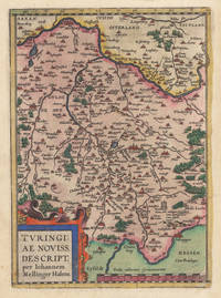
158035928Antwerpen: Platin 1580. In ausgezeichnetem Erhaltungszustand. 29.2 x 207 cm 11.5 x 825 inches. Hand-Colored Original Copperplate Engraving by Abraham Ortelius depicting Turingiae Noviss. Descript. per Iohannem Mellinger Halens. Published Antwerpen Platin 1580. Sheet: 29.2 x 207 cm 11.5 x 825 inches. A fine and original hand-colored example of Ortelius's celebrated cartographic work documenting this region of Germany with the precision and decorative artistry characteristic of the 15800s. Abraham Ortelius 1527-1598 was a Flemish cartographer and geographer from Antwerp widely regarded as the creator of the first modern atlas. His landmark publication Theatrum Orbis Terrarum 1570 set the standard for atlas-making for the next century presenting uniform copper-engraved maps with scholarly commentary. By Ortelius's death the Theatrum had appeared in 25 editions in seven languages. In 1575 King Philip II of Spain appointed him Royal Geographer. His maps engraved with extraordinary precision are among the most sought-after in antique cartography held in collections including the Plantin-Moretus Museum in Antwerp the Library of Congress and the British Library.This plate presents a original copperplate engraving with original hand coloring depicting the city of Turingiae Noviss. Descript. per Iohannem Mellinger Halens. published in Antwerpen Platin 1580. Such topographic views from Ortelius's workshop are primary historical documents of German urban history in the 1500s now prized equally by historians map collectors and interior decorators. Sheet measures 29.2 x 207 cm 11.5 x 825 inches. In good condition overall with minor signs of age appropriate for a 16th-century engraving. Ready to frame. Koeman Ort. 16A; Broe. 96. Platin unknown
15849714<p>Original hand-colored engraving from Abraham Ortelius's <em>Theatrum Orbis Terrarum - Parergon - Nomenclator Ptolemaicus</em>. Features Latin text to verso see image. The image measures approximately 19 x 12.75 in 48 x 32.5 cm; page measures 21 x 17.25 in 53 x 44 cm.</p> Christoph Plantin Press
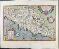
15843401<p>Very Good. 1584. 16th century map with original hand-colored outlines of Tuscany. Decorative cartouche. Some foxing most apparent to margins. Latin text to verso. Otherwise a handsome copy. Please see image. Plate size approximately 19 1/4 x 12 1/2 in. Overall size approx. 21 1/4 x 16 1/2 in 540 x 425 mm.; 1 pages; All shipments through USPS insured Priority Mail. .</p>
158415872Antwerp 1584. Maps. Original hand color map of Italy showing Tuscany. Based on Bellamarti's map of Tuscany supplemented by classical sources. Part of a series of historical maps compiled by Ortelius called the Parergon Theatri which appeared from 1579 on. With three ornate cartouches and a sailing ship. French text on verso of the right side. Image size:19 1/8 x 12 5/8". Paper size: 21 1/2 x 15 1/2". With some faint offsetting at the right hand border and in the area of the two cartouches otherwise very good. unknown
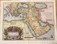
1574M10044Antwerp Belgium 1574. Very Good. Notes: Detailed and decorative map of the Ottoman Empire.<br>It depicts the Middle East by one of the founding fathers of cartography during the late 16th century. This important map features a decorative cartouche. The map depicts cities towns geographical features and has short paragraphs giving the reader information on certain areas. <br>Latin text on verso.<br>Abraham Ortelius April 1527 – June 1598 was a Flemish cartographer geographer and cosmographer from Antwerp in the Spanish Netherlands. He is recognized as the creator of the first modern atlas the Theatrum Orbis Terrarum Theatre of the World. Along with Gemma Frisius and Gerardus Mercator Ortelius is generally considered one of the founders of the Netherlandish school of cartography and geography. He was a notable figure of this school in its golden age approximately 1570s–1670s and an important geographer of Spain during the age of discovery. The publication of his atlas in 1570 is often considered as the official beginning of the Golden Age of Netherlandish cartography. Size : 375x500 mm 14.76x19.69 Inches Coloring: Hand Colored Reference: Marcel P.R. van den Broecke pg.168 Category: Maps Asia Near East Turkey; Maps Asia Middle East Arabia; unknown
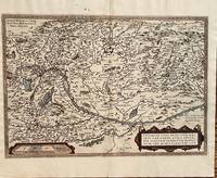
1584687Antwerp: Abraham Ortelius 1584. 19 3/4 x 13 1/2 inches. Very good but for a harpsichord shaped wormhole at the upper centerfold which is relatively of little consequence. This is a handsomely executed map of the Danube River Basin starting on the left at Vienna and passing through Austria Serbia and Romania. Belgrade is prominently displayed near the cartouche. In the lower left is a mileage scale. This is a very nice example of late 16th century mapmakers art. Abraham Ortelius unknown
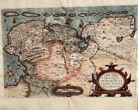
1584674Antwerp: Abraham Ortelius 1584. 20 1/3 2 x 13 1/2 inches. Very good condition. This is Ortelius classic map of the Netherlands up close. It has Groeningen in the upper center. It also has sailing ships and a plethora of small towns. The cartouche is an elaborate production Not only does the map show the Netherlands but also Belgium. It also has a set of island adorning the top of the coast. This is a nice copy of a rarer map that is in good condition with color not applied at the time of publication. Abraham Ortelius unknown
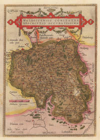
158410309Antwerpen: Platin 1584. In sehr gutem Erhaltungszustand. 31.3 x 223 cm 12.25 x 875 inches. Hand-Colored Original Copperplate Engraving by Abraham Ortelius depicting Waldeccensis Comitatus Descriptio Accuratissima. Published Antwerpen Platin 1584. Sheet: 31.3 x 223 cm 12.25 x 875 inches. A fine and original hand-colored example of Ortelius's celebrated cartographic work documenting this region of Germany with the precision and decorative artistry characteristic of the 15800s. Abraham Ortelius 1527-1598 was a Flemish cartographer and geographer from Antwerp widely regarded as the creator of the first modern atlas. His landmark publication Theatrum Orbis Terrarum 1570 set the standard for atlas-making for the next century presenting uniform copper-engraved maps with scholarly commentary. By Ortelius's death the Theatrum had appeared in 25 editions in seven languages. In 1575 King Philip II of Spain appointed him Royal Geographer. His maps engraved with extraordinary precision are among the most sought-after in antique cartography held in collections including the Plantin-Moretus Museum in Antwerp the Library of Congress and the British Library.This original copperplate engraving with original hand coloring depicts the region of Waldeccensis Comitatus Descriptio Accuratissima published in Antwerpen Platin 1584. The map records the political and geographic boundaries of the region as understood in 1584 offering a fascinating window into the history of German territorial organization. Sheet measures 31.3 x 223 cm 12.25 x 875 inches. Professionally restored; the image area is fully intact and displays well. Retains its original contemporary hand coloring. Ready to frame. Broe. 98 b; Koeman Ort. 21; Platin unknown
158433639Antwerpen 1584. In sehr gutem Zustand. 34.5 x 497 cm 13.5 x 195 inches. Hand-Colored Original Copperplate Engraving by Abraham Ortelius depicting Westphaliae Totius Finitimarumque Regionum Accurata Descriptio. Published Antwerpen 1584. Sheet: 34.5 x 497 cm 13.5 x 195 inches. A fine and original hand-colored example of Ortelius's celebrated cartographic work documenting this region of Germany with the precision and decorative artistry characteristic of the 15800s. Abraham Ortelius 1527-1598 was a Flemish cartographer and geographer from Antwerp widely regarded as the creator of the first modern atlas. His landmark publication Theatrum Orbis Terrarum 1570 set the standard for atlas-making for the next century presenting uniform copper-engraved maps with scholarly commentary. By Ortelius's death the Theatrum had appeared in 25 editions in seven languages. In 1575 King Philip II of Spain appointed him Royal Geographer. His maps engraved with extraordinary precision are among the most sought-after in antique cartography held in collections including the Plantin-Moretus Museum in Antwerp the Library of Congress and the British Library.This original copperplate engraving with original hand coloring depicts the region of Westphaliae Totius Finitimarumque Regionum Accurata Descriptio. published in Antwerpen 1584. The map features a decorative Baroque cartouche containing the title inscription. A distance scale is incorporated within the cartouche or alongside it. The map records the political and geographic boundaries of the region as understood in 1584 offering a fascinating window into the history of German territorial organization. Sheet measures 34.5 x 497 cm 13.5 x 195 inches. In good condition overall with minor signs of age appropriate for a 16th-century engraving. Ready to frame. Koe. Ort 23 / #46 85. Broe. 91. unknown