88 résultats
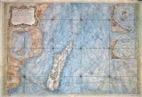
176777030Paris 1767. Originalt kobberstikk med ny hÃ¥ndkolorering. Størrelse : 86 cm X 59 cm.Original copper engraving with new hand-colouring. Size : 86 X 59 cm. Fransk. <br/><br/><em>Jacques-Nicolas Bellin 1703-1772 “Hydrographe du Roiâ€. Noe slitt ved ytterkantene og i plateranden. Et stort og dekorativt kart.Some wear at the outer edges and on the edge of the plate. A large and decorative map. </em> unknown
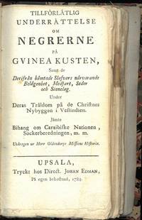
178476151Upsala 1784. Liten 8vo. Nyere skinnryggbind med tittelfelt i vinrødt skinn. Marmorerte dekler. Ubeskåret. 187 5 s. Tryckt hos Direct. Johan Edman Svensk. <br/><br/><em>Sjelden. Mangler sidene 1-14 55-66 og 105-112. </em> unknown
178769765Paris 1787. 8vo. Samtidige skinnryggbind med enkel ryggforgylling og tittelfelter i lysebrunt skinn. Marmoerte dekler. Foldet kobberstukket frontispiece xxxii 388 ; 4 366 ; 4 363 s. Med II VII VI kobberstukne plansjer hvorav de fleste er foldet. Chez Buisson Libraire Fransk. <br/><br/><em>Mangler foldekartet. </em> unknown
177521527Paris 1775. Very good condition. Detailed copper engraved map of the east coast of Africa from the Saudi Arabia coast and the Red Sea down to Zanzibar. Many coastal cities and rivers named; the countries and regions named include: Costes d'Hasbach Zeila Ajan Muji Munni and Zanjibar sic. From Prevost's "L'Histoire Generale des Voyages".<br /> <br /> Bellin 1703 - 1772 one of the most noted French mapmakers of the 18th century was named the hydrographer chief cartographer to the French Navy and later the Official Hydrographer to the French King.<br /> <br /> With compass rose. Folding 8 x 10 1/8" with ample margins. Strong impression very clean. unknown
178334326Holland: Not Atributed. Very Good with no dust jacket. 1783. First Edition. Hardcover. 8vo 8" - 9" tall; . 43221pp pages; Africa: Ou Tableau Historique et Politique de LÉtat Originaire de la Colonie du Cap de Bonne-Esperance Comparé avec LÉtat Actuel de Cette Colonie. Modern half faux leather & cloth. Contents VG indeed. French language. Worldcat finds but two copies- scarce. . Not Atributed hardcover
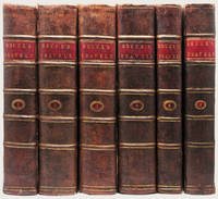
179033833Edinburgh: J. Ruthven for G.GJ. and J. Robinson et al and Printed by George Ramsay and Company for Archibald Constable and Company 1790; 1808. 6 volumes. The First Edition Edinburgh imprint sometimes called “the best edition†Cox with the First Edition of Murray's fine and important work on Bruce. Engraved title vignettes in all volumes. Vol. I with illustrated header on the dedication to the King and with 53 very finely engraved plates and maps and charts including 3 very large folding maps. The Murray volume with an additional 22 engraved plates including a portrait frontispiece of Bruce and two large folding maps at the end of the volume. A total of 75 plates and 5 large folding maps. 4to 300 x 240 mm. with the half-titles in vols. !-!V very handsomely bound in very handsome contemporary half polished calf over marbled paper covered boards. The spines with raised bands are gilt ruled and decorated with gilt lettering on red morocco labels original endleaves end-leaves and with a fine antique engraved armorial plate. Early ownership inscription to title-page and a fine early armorial bookplate. The Bruce lxxxv 535; viii 718; viii 759; viii 695; xiv 230 3 large folding maps index errata pp. The Murray xiii 5044 ads. pp 22 engraved plates and maps. A fine and desirable set in scarce contemporary bindings the paper fresh and clean and the text-blocks as solid as could be the bindings are very handsome withminor evidence of use or age at the extremities a bit of tenderness to the hinges of a few volumes but these are still sturdy and strong and the folding maps are in excellent condition. HIGHLY IMPORTANT EARLY EXPLORATION INTO AFRICA AND A RARE EDITION IN FULL CONTEMPORARY CALF WITH ORIGINAL SPINE PANELS AND WITHOUT REPAIRS. A cornerstone to any collection of Africana this is one of the earliest and greatest illustrated works on the seminal discoveries to be made on the continent over A hundred year period. This set with the added murray volume rarely encountered in matching binding as here.<br> With time on his hands and at the urging of a friend Bruce composed this account of his travels on the African continent including comments on the history and religion of Egypt an account of Indian trade a history of Abyssinia and other such material. Although Bruce would not be confused with "a great scholar or a judicious critic. few books of equal compass are equally entertaining; and few such monuments exist of the energy and enterprise of a single traveller" DNB. "The result of his travels was a very great enrichment of the knowledge of geography and ethnography" Cox II p. 389.<br> Bruce was one of the earliest westerners to search for the source of the Nile. In November of 1770 he reached the source of the Blue Nile and though he acknowledged that the White Nile was the larger stream he claimed that the Blue Nile was the Nile of the ancients and that he was thus the discoverer of its source.<br> The account of his travels was written twelve years after his journey and without reference to his journals which gave critics grounds for disbelief but the substantial accuracy of the book has since been amply demonstrated.<br> James Bruce traveled to Egypt in 1768 accompanied by the Italian artist Luigi Balugani. They spent five years in Upper Egypt Abyssinia and in the exploration of the Nile. With the exception of the French surgeon Poncet no European had visited Abyssinia in over 150 years so Bruce's account was of unique importance in providing valuable information on the region to Europeans. The plates based on his own and Balugani's drawings include maps botanical and zoological specimens antiquities artifacts and plans of monuments.<br> A cornerstone to any collection of Africana this is one of the earliest and greatest illustrated works on the seminal discoveries to be made on the continent over a hundred year period. J. Ruthven for G.GJ. and J. Robinson et al and Printed by George Ramsay and Company, for Archibald Constable and Company hardcover
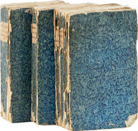
174361213Amsterdam: Jean Catuffe 1743. Third French edition. 12mo 18.5cm. Three volumes in blue pastepaper wraps with manuscript titles on plain paper spine labels; I: xxiv4282pp; II: xvi162pp; III: xx320pp; 5 folding maps and 25 line engravings one folding. Untrimmed and unbeaten. Cracks to paper over spine on vols II and III significant cracks to spine on vol. I wrappers lightly rubbed at edges with small abrasion on front wrapper of vol. I dampstaining to about 16 leaves in vol. III else clean: Very Good. <br /> <br /> Peter Kolbe 1675-1726 was an astronomer who traveled to the Cape of Good Hope in modern-day South Africa for astronomical research from 1704 to 1713. In 1719 he published this seminal work on natural history the Khoekhoen people and Dutch settlers in South Africa. The work became highly popular and was translated into multiple languages; this is the third edition in French. See MENDELSSOHN pp842-845 for the first edition and other translations. Jean Catuffe unknown
177521526Paris 1775. Very good condition. Detailed copper engraved map of the west coast of Africa from Sierra Leone and the Gulf of Guinee or St. Thomas down to Angola. Many coastal cities and rivers named; the countries and regions named include: Coste de Grain Coste d'Ivoire Coste d'Or Coste des Esclaves Benin Biafara Maiumbo Loango Congo and Angola. From Prevost's "L'Histoire Generale des Voyages".<br /> <br /> Bellin 1703 - 1772 one of the most noted French mapmakers of the 18th century was named the hydrographer chief cartographer to the French Navy and later the Official Hydrographer to the French King. <br /> <br /> With compass rose. Folding 10 x 8 1/8" with ample margins. Strong impression very clean. unknown
177521531Paris 1775. Very good condition. Detailed copper engraved map of the west coast of Africa from Gabon "ou Pongo" down to Cap Negro in Benguela modern day Angola. Many coastal and interior cities and rivers named with various kingdoms marked. From Prevost's "L'Histoire Generale des Voyages".<br /> <br /> Bellin 1703 - 1772 one of the most noted French mapmakers of the 18th century was named the hydrographer chief cartographer to the French Navy and later the Official Hydrographer to the French King.<br /> <br /> Folding 12 1/4 x 10" with ample margins. Strong impression very clean. unknown
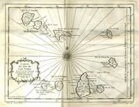
177521529Paris 1775. Very good condition. Detailed copper engraved map of the Cape Verde Islands off the west coast of Africa and the present day country of Senegal. Map extends from Isle de St. Antoine down to Isle de St. Yago sic. Additional islands named include St. Vincent Ste Lucie I. Branca Isle de S. Nicolas Isle de Sal Isle de Bonavista Isle de St. Philippe ou de Fuego Isle de St. Jean ou Brava and Isle de May. From Prevost's "L'Histoire Generale des Voyages".<br /> <br /> Bellin 1703 - 1772 one of the most noted French mapmakers of the 18th century was named the hydrographer chief cartographer to the French Navy and later the Official Hydrographer to the French King.<br /> <br /> Ornate compass rose at center of map with rhumb lines. 11 1/4 x 9" with ample margins. Strong impression very clean. unknown
177521525Paris 1775. Very good condition. Detailed hand colored copper engraved map of the west coast of Africa from Gibraltar and Tanger down to the Canary Islands and Cape Verde Islands and Gambia. Many coastal cities and rivers named. From Prevost's "L'Histoire Generale des Voyages".<br /> <br /> Bellin 1703 - 1772 one of the most noted French mapmakers of the 18th century was named the hydrographer chief cartographer to the French Navy and later the Official Hydrographer to the French King.<br /> <br /> With compass rose. Folding 8 1/4 x 10" with ample margins. Strong impression very clean. unknown
1767246252Franc. Laur. Richter Monachii 1767. Softcover Zustand: keine Beschädigungen mit zwei Stempel einer Klosterbibliothek. Rücken Ecken Kanten gut. Die Druckbögen sind ungeöffnet. Franc. Laur. Richter, Monachii, paperback
178325416Paris chez le Sr Desnos ca 1783. 465x645 cm. Engraved map of Africa with the Mediterranean Sea at north. Contemporary handcoloured. Cartouche uncoloured. A few tears showing in right grade-scale no loss. <br/><br/><em>Jaillots fine impressive map of the continent of Africa from 1695 in Brion de la Tours revision from 1783 giving much new information and details of this continent. </em> unknown
17723123Halae: Ioannis Ioach. Beyery 1772. Gebunden. Ioannis Ioach. Beyery unknown
178579604Dusseldorpii: Francisci Friderici Stahl 1785. Gebunden. Francisci Friderici Stahl unknown
179884934Hamburg: Fouche 1798. Gebunden. Fouche unknown
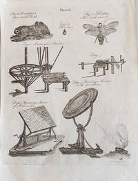
179786393london: Encyclopaedia Britanica 2 aufl 1797. blatt. Encyclopaedia Britanica 2 aufl unknown
174386373Coelln: ColonixGussen 1743. Gebunden. ColonixGussen unknown
172479697Nuernberg 1724. Gebunden. unknown
1734164821London: W. Mears 1734. First Edition Thus . Hardcover. Very Good/No Jacket. 8vo - over 7¾" - 9¾" tall. Title continues: ". Containing a particular Account of all the Battles Sieges &c. Likewise a true Relation of the most secret Intrigues and Negotiations of the Courts of France Spain Germany and Savoy. Interpreted With Variety of entertaining Amours and original Letters of the several Princes concerned. Also The Political Intrigues of the late King of Sardinia containing an Account of the ill treatment of Mr. Phelippeaux the French Ambassador at the Court of Turin contrary to the Law of Nations. Translated from the Original French of Count Bonneval now in great Esteem at the Court of the Grand-Seignior By J. Sparrow Gent. With a correct Map explaining the Seat of the Last and Present War in Italy." 13 376pp; 1 folding map "Italy divided into Its Principal States" in excellent condition. Re-bound in modern brown Buckram with gilt dec. and spine titles. A very nice copy. <br/> <br/> W. Mears hardcover
17531942Stadler: 9x15 cm 1753. Gebunden. 9x15 cm unknown
1767207Cambridge England: J. Archdeacon 1767. First. Full Leather. Fair. containing dissertations .together with an account of Ancient Egypt in its most early state and of the Shepherd Kings.324 pp. errata page. 5 engraved folding maps 1 engraved folding plate. Text and maps are clean. Rear board detached. End papers are original. Scarce items that deserves a rebinding. J. Archdeacon unknown
173479645criticum: chronologicum 1734. chronologicum unknown
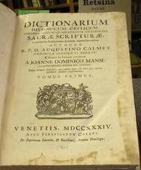
17342036Venetiis: S. Coleti 1734. Gebunden. S. Coleti unknown
178879607Boston Paris: Buisson 1788. br. Buisson unknown