[SOUTH AFRICA]. BECK, Henry HoughtonBiblio.com
20 résultats
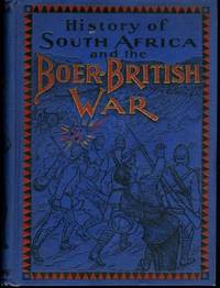
1900SKU1034401Globe Bible Publishing Co. 1900-01-01. Hardcover. Very Good. 0x0x0. Globe Bible Publishing Co.; Philadelphia 1900. Hardcover. A Very Good blue cloth binding with black and red lettering and illustration on front board illustration and tan lettering on spine binding a bit shaky starting hinges some age spotting to boards age toning to text block edges and pages spine buckram separating from backing material three tears to front free endpaper sunning to pastedown/endpaper margins mild stress crease to spine some rubbing to board and spine edges bit of crimping to spine edges mild scattered foxing to text block edges fold-out map in front without Dust wrapper. A nice clean and unmarked copy. 8vooctavo or approx. 6 x 9 inches. 496pp. b&w illustrations. We pack securely and ship daily with delivery confirmation on every book. The picture on the listing page is of the actual book for sale. Additional Scans are available for any item please inquire. Globe Bible Publishing Co., hardcover
1900007495Methuen & Co. 1900. 295 45 pp frontis portrait of the author remains of label attached to front pastedown original red cloth with gilt minimal foxing otherwise all in good / very good condition. . Signed by Author. First Edition. Hard Cover. Good. Methuen & Co. Hardcover
1896AB008046Smith Elder & Co 1896. 120pp illus photos dedicated to Cecil Rhodes. Original maroon boards tissue guard to frontis lightly foxed otherwise book is in very good condition. Scarce first edition. First Edition. Hard Cover. Very Good/No Jacket. Smith, Elder & Co Hardcover
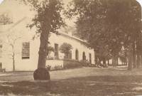
1875211691875. Ephemera. Good -. A large important looking two story South African building behind what appear to be cyprus trees. Caption verso "Wyenberg nr Cape Town" Approx. 7 by 4.5" left lower corner missing only affects tree shadows. unknown
190029149South Africa 1900. Good overall. A night permit January 1900 special permit Nov. 1899 and £5 note permits made out to Frederico Gambini who was an Italian staying at Bungalow Pritchard Str profession: barhounder. All items adhered to scrap book page 8 x 9 3/4" toned. unknown
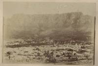
1890168731890. Slight warping plus clipping on one edge. Mounted on stiff board on a page from an album a view across the town from a hill toward Table Mountain labeled Cape Town South Africa. On the verso an exterior view of an ivy covered estate. Approx. 7 1/2 by 11 1/2. unknown
1898AB008037George Newnes 1898. 209pp with 14 illustrations by the author. Original illus boards with gilt. Firmly bound and all in very good condition . First Edition. Hard Cover. Very Good/No Jacket. George Newnes Hardcover
1880168711880. Very good condition. A light pencil note on the back states "Table Mountain Eastern slope". Approx 71/4 by 5 1/4" unknown
1875169981875. Constantia was one of the six wine regions around Capetown South Africa. Penciled caption on verso reads "Wine vaults Constantia Nr. Capetown." Note the man perhaps a traveling companion or guide standing on steps. <br /> <br /> The Constantia estate was established in 1685 by Governor of the Cape Simon van der Stel. By 1778 Constantia wines were made famous under Hendrik Cloete becoming the favorite of European rulers such as Frederic the Great and Napoleon who is said to have ordered it even in exile. Approx. 7 x 4 1/2" unknown
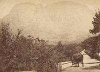
1880168621880. Very good condition. Albumen photo with black man standing nearby one in cart and driver in seat near Table Mountain at Capetown South Africa. Pencil caption on verso "Table Mountain Cape Town." Approx. 7 by 4" unknown
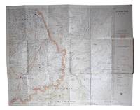
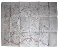
1900AQ29039Cape Town & Johannesburg: Wood & Ortlepp 1900. Colour lithograph map. Scale 1:250 000. Linen backed. Original publisher's buff printed cloth. Lightly rubbed and marked faded ownership inscriptions to covers. The fourth known copy of a map compiled for Field Intelligence Department Cape Town detailing the region of Rouxville South Africa showing farm boundaries and fences farm names divisional boundaries roads rivers telegraph lines and railways. OCLC records copies at only three locations Cape Town Stellenbosch and Wellington. . First edition. Dimensions unfolded: 620 x 490 mm folded in cover: 110 x 179 mm. Wood & Ortlepp hardcover
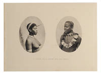
189079156No Place: No Publisher 1890. First Edition. Paperback. Very Good. No Place No Publisher circa 1890s but possibly Sallo Epstein & Co. Durban. Oblong octavo 164 × 221 mm 16 full-page captioned photogravures with blind-embossed borders printed rectos only. Card covers lightly marked and rubbed; minimal scattered light foxing a little heavier on the second plate; an excellent copy. Some of the captions are 'Chief Tshingwayo and his Adjutants'; 'A Zulu on Trial - Explaining the Charge'; 'A Council of War'; 'Zulu Warriors'; 'A Young Zulu Brave and his Bride'; 'A War Dance'; and 'Zulu Women at Work'. No Publisher paperback
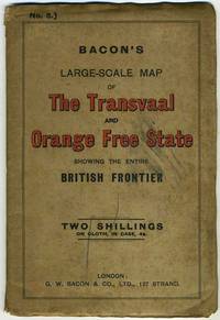
189520374London: G. W. Bacon & Co 1895. First printing. Very good overall. A second edition titled Bacon's New Large Scale Map of the South African Republic Transvaal Showing Orange Free State and Frontiers of British Territories was issued later 1899.<br /> <br /> This large color Second Boer War era map with five insets including the following: Map Showing the Routes from England and India to South Africa; Environs of Cape Town; untitled inset showing coast and Lorenco Marquez today Maputo capital of Mozambique; South Africa with surrounding countries: Bechuanaland to west Orange Free State and Cape Colony to the south; and Durban & Port Natal. The first inset shows routes from all parts of the British Empire including from Australia and New Zealand. The inset of Lorenco Marquez shows the railroad line built in 1895 connecting that Portuguese colonial city to Pretoria.<br /> <br /> Brown cloth and stiff paper wrappers with title printed in red and black. 'NO. 5' printed at upper left corner; price printed "two shillings on cloth in case 4s". Unfolded measures 35 x 26 3/4" high. Short splits at a few horizontal folds; longer split at horizontal fold just below where map attaches to stiff wrapper. Wrappers a bit dusty. OCLC 71591961. G. W. Bacon & Co hardcover
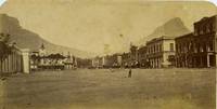
1870211701870. Ephemera. Good overall. Albumen photograph of Adderley Street in Cape Town South Africa. A man in bowler hat stands in the foreground clock tower over J. Curtis Draper on left many horse carriages lined up on the opposite side of street. Caption on verso "Atherley Street Cape Town". Approximately 9 1/4 x 4 3/4" three small spots on right where paper has thinned one slight dark spot at center. Backed with tissue paper. unknown
1880317093London: S. W. Silver & Co. Office of 'the Colonies and India' Cornhill 1880. Third Edition Revised. Folding panorama at p. X of Capetown and Table Mountain WITHOUT MAP which may never have been issued supposedly opposite title-page. x 576pp. Thick 12mo 7 x 4 5/8 inches. Publisher's brown pebbled cloth neatly recased. Bookplate of H.A. Bryden on front pastedown slight rubbing and foxing else Very Good. Third Edition Revised. Folding panorama at p. X of Capetown and Table Mountain WITHOUT MAP which may never have been issued supposedly opposite title-page. x 576pp. Thick 12mo 7 x 4 5/8 inches. Also Signned "H.A. Bryden/ 1883." on the title-page. S. W. Silver & Co. Office of 'the Colonies and India', Cornhill unknown
1875511611875. Scarce Compilation of Griqualand Statute Law South Africa. Cape Colony. Statute Law of the Territory of Griqualand West Comprising the Proclamations and Government Notices Enacted Before the Promulgation of the Constitution Ordinance And Still Wholly or in Part in Force. Printed by Authority. 2 vols. Cape Town Soul Solomon and Co. 1875 1877. Two volumes all published. Octavo 10" x 6". Original textured cloth blind frames to boards gilt titles to spines. Moderate shelfwear corners bumped some chipping to spine ends of Volume 2 most of backstrip lacking from Volume 1 interiors clean. Ex-library. Location labels to spines small inkstamps to title pages. A very scarce set. $350. Griqualand West is an area of central South Africa that now forms part of the Northern Cape Province. A British colony was established there in 1873 and in 1880 it was annexed by the Cape Colony. This was the only compilation of Griqualand statutes published during the colony's existence. A retrospective compilation The Statute Law of Griqualand West.to the Date of its Annexation to the Cape Colony was published in 1882. OCLC locates 3 copies. Not in Sweet & Maxwell. unknown
1900AQ29042Cape Town: Wood & Ortlepp 1900. Colour lithograph map. Scale 1:250 000. Linen backed. Original publisher's limp red cloth lettered in gilt. Rubbed and marked. Hinge exposed short tear to one fold. The fourth known copy of a map compiled for Field Intelligence Department Cape Town detailing the region of Bethulie South Africa showing farm boundaries and fences farm names divisional boundaries roads rivers telegraph lines and railways. OCLC records copies at only three locations Cape Town KwaZulu-Nata and Wellington. . Dimensions unfolded: 620 x 490 mm folded in cover: 110 x 179 mm. [Wood & Ortlepp] hardcover
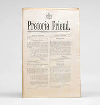
190099800Pretoria: Army Headquarters 1900. First editions. "Newspaper published by Lord Stanley at Pretoria during British occupation. Contents include military government notices proclamations advertisements and items of news. Publication commenced on Tuesday 26th June 1900 and ceased after the issue of Saturday 14th July 1900" Hackett. Text in Afrikaans and English. Folio. 17 bifolia printed all four sides loose as issued. Masthead with British royal arms. Light toning else very good. Hackett p.176; Mendelssohn II 182. unknown
1875190005London: Printed by Wertheimer Lea and Co. 1875. One of the most elusive books on the South African diamond rush First edition rare just six locations among institutional libraries all in South Africa; one copy only on auction records. This compelling firsthand account traces an overland journey from Cape Town through Stellenbosch the Great Karoo and key frontier towns before reaching the diamond fields of Kimberley. The author has evaded identification. Mendelssohn suggests in the typescript "Additions" to his bibliography that the author may be Mary Elizabeth Barber 1818-1899 poet and natural historian; although she accompanied her husband and family to the diamond fields from the Eastern Province whereas the writer of this work travelled from the Cape. However South Africa historian Alfred Graham-Brown doesn't hesitate in attributing it to her see The Settlers' Press: Seventy years of printing in Grahamstown 1979. WorldCat and the South African Bibliography cite copies at the following libraries: Mendelssohn Library South African Library now National Library of South Africa Johannesburg Public library University of the Witwatersrand Kimberley Public Library and University of Pretoria. Octavo pp. 54. Original green cloth gilt lettered and panelled on front cover blind panelled on back pale yellow coated endpapers. Binding rubbed at extremities couple of marks to back cover internally cracked at gutter in a few places but firm: very good. Not in the printed edition of Mendelssohn; South African Bibliography II p. 148; Theal p. 176. hardcover
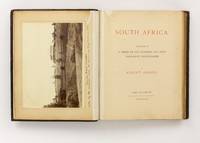
1888142115Port Elizabeth: Published by the Author 1888. First Edition. Hardcover. Very Good. Port Elizabeth Published by the Author 1888. Large quarto 375 × 305 mm vi pages plus 104 Woodburytypes four very large measuring 233 × 326 mm or the reverse the rest approximately 125 × 190 mm mounted within printed borders on 29 card leaves recto and verso. Original full leather blocked in gilt and blind later rebacked retaining most of the original backstrip; all edges gilt; leaves a little cockled and tanned with a few slightly marked and foxed; expert conservation to a split near the head of the spine to the front free endpaper and the three leaves of text comprising the title leaf and two leaves of introductory notes by the photographer; overall a very good copy with the plates in excellent condition. A lavish photographic survey of Cape Colony Natal Orange Free State and the Transvaal Republic with a particular focus on the 'scenery gold and diamond mining districts and mines seaports and the native industries and life of South Africa' from the foreword. <p>This copy has the additional interest and value of a large albumen silver photograph 205 × 282 mm mounted on the verso of the front free endpaper acting as a frontispiece. the margin below the plate is captioned '"Tweedie Hall" Natal Taken by the architect while the house was being built in 1892'. Jacqueline Kalley's book 'Farmhouses of Old Natal' records that the house was built by James and Eliza Morton and the name comes from Tweedie Hall in Scotland where they were married. They arrived at Port Natal in 1868 purchased a farm and over time acquired some 12000 acres of land. Morton sold agricultural machinery and built the first silos in Natal. The grand house was designed by the prolific Natal architect William Street-Wilson; it survives to this day and is currently owned by a great-grandson of the Mortons. Published by the Author hardcover