169 résultats
176712502London: Printed by Mark Baskett Printer to the King. and by the Assigns of Robert Baskett 1767. 1 title pp 859-860 as issued disbound. Tanned scattered light stains about Good. Printed by Mark Baskett, Printer to the King.... and by the Assigns of Robert Baskett unknown
177012506London: Printed by Charles Eyre and William Strahan Printers to the King. 1770. 1 title 315-316 pp as issued disbound. Two small tears no text loss stains Good. Printed by Charles Eyre and William Strahan, Printers to the King... unknown
1737008438London: A. Bettesworth and C. Hitch et al. vi 369 1 errata pp. Half leather and cloth. Covers endpapers and a blank in front and back detached leather chipped and peeling previous owner's name in ink "X" across errata with "corrected" written in ink beneath ink corrections of errata in text one leaf with small dampstains in margin needs rebinding but internals nice few marginal lines and checks Fair. . Fair. Hardcover. 1737. A. Bettesworth and C. Hitch et al. hardcover
173835638London: Printed for J. Walthoe et. al 1738. The Fourth Edition Corrected. Leather bound. Poor. Folio. 4 xxiv 396 pages 1. Partially restored dark calf leather binding. Partial title label on the spine. Ex-institutional copy with hand written information on the front paste down "This Book belongs to the Library of Lyons Say-Brook 1743." More hand written notes from the same period written on the front paste down about the book and library. Leather binding patched on the spine joints and covers. First 4 leaves edge torn taped in the gutters and stained this volume suffered water damage. Purplish stains in the text gradually disappearing by page 300. No mold found inside. Browning to the gutters. Several page tears at bottom and top in the gutters. Remains of the half title page pasted down onto a sheet of white paper and bound in before the title page. Some old tape stains in the gutters of the title page and preliminary pages. Printed for J. Walthoe, et. al unknown
174229879London: Thomas Baskett and Robert Baskett Printers to the King's most Excellent Majesty. 1742. Folio 7.75" x 12.25". 2 733-739 1 blank pp. Disbound else Near Fine. Thomas Baskett and Robert Baskett, Printers to the King's most Excellent Majesty. unknown
17131394685London: Printed by John Baskett 1713-1717. First Editions. Hardcover. Folio 61-174 2179-191 6 203-206 2 211-218 2 223-270 2 275-357 3 361-362 2 367-382 2 387-422 4. In Good minus condition. Bound in full contemporary calf with banded spine and tooling to boards. Boards show moderate wear to edges moderate plus wear and bumping to corners and several gouges to the front board. Cracking to leather along joint of front board. A clear lacquer appears to have been applied to the boards. Text block has light age toning to edges. Ex-Library institutional plate appears on front paste down. Ex libris of former owner appears on front pastedown. Several ink "doodles" in an 18th-century hand appear on the front paste down and front free end page. Square-inch tear to fore-edge of front free end page. Pages tightly trimmed by binder impacting some of the printed marginal annotations. BB Consignment. Shelved in Room A Oversized. Appears to contain two collections of public statutes passed in 1713 and 1714 but printed between 1713 and 1717 each with a closing contents page. The first collection contains Acts II - XVIII of 18 acts and the second contains Acts II - XXIII of 23 acts. The acts cover a range of topics including duties tariffs and taxes; the paying and management of military personnel and militias; and the management of churches. The most significant of the acts however is Act 15 of the second set of acts entitled "An Act for Providing a Publick Reward for such Person or Persons as shall Discover the Longitude at Sea". This formally established the Commissioners of the Longitude and the reward of £20000 for "the first Author or Authors Discoverer or Discoverers of any such method ." that to the satisfaction of the committee accurately determined a ship's longitude at sea accurate to within 20 geographical miles. This reward would not be claimed until 1765 when clockmaker John Harrison developed his "time-keeper" or marine chronometer. 1394685. Special Collections. Printed by John Baskett hardcover
177430571London: Printed by Charles Eyre and William Strahan Printers to the King's Most Excellen Majesty 1774. Folio two leaves folded. 1-title 1 blank 323-324pp as issued. Very Good. <br /> FIRST EDITION. Printed by Charles Eyre and William Strahan, Printers to the King's Most Excellen Majesty unknown
176930572London: Printed by Mark Baskett Printer to the King's Most Excellent Majesty 1769. Two folio leaves attached at left edge with archival tape. 1-title 1 blank 47-48 pp as issued. Very Good. <br /> FIRST EDITION. Printed by Mark Baskett, Printer to the King's Most Excellent Majesty unknown
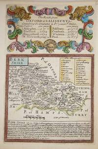
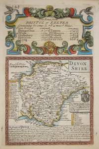
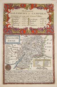
17207874London c. 1720. Copper engraving 18 x 12 cms recent hand-colour b/w strip-maps on verso. Map unknown
17207875London c. 1720. Copper engraving 18 x 12 cms recent hand-colour b/w strip-maps on verso. Map unknown
17206052London c. 1720. Copper engraving 18 x 12 cms recent hand-colour b/w strip-maps on verso. Map unknown
1717IYC44885London: J. Sturt 1717. hardback. The Pryce family copy of the BCP with records of family baptisms on 2nd fep from 1770 to 1781. Very good contemporary leather binding with gilt decoerations front and back and on with ribbed spine; marbled pastedowns with owners emblem and label on front paste down. Pages good and print very clear. Beautiful copy. 8vo 230 x 150 / 9"" x 6"". Book of Common Prayer and Administration of the Sacramanets under King George 1717 beautifully illustrated throughout. J. Sturt hardcover
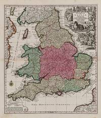
1740200029AG1740. Augsburg Seutter c.1740. Original hand-coloured engraving. Plate Size: 48.6 cm x 56.7 cm. Sheet Size: 54 cm x 62.1 cm. Original map. In very good condition. Some minor browning evident with the slightest traces of staining to outer margins. Tape repairs to reinforced reverse. Moreland and Bannister 1983: Tooley 1979. A very detailed and interesting map of England and Wales. To the north lies Scotland while offshore parts of Ireland and France are seen. Rivers headlands towns and cities are identified and relief shown pictorially. Divides England into pre-Norman Conquest: The Kingdome of West Saxons The Kingd. Of South Saxons The Kingd. Of Kent The Kingd. of East Saxons The Kingdom of East Angles The Kingdom of Mercie The Princedome of Wales and the Kingdome of Northumberland. Shows major cities and regions such as Surrey Cornwall Dorsetshire Wiltshire Somersetshire Essex Suffolk Warwikshire London Hartfordshire Denbighshire Shorpshire Yorkshire Cumberland Cambridge and Darbyshire. Includes the British Channel to the south and the Irish Sea or St. George's Channel to the west. In the top right of the map a large allegorical title cartouche represents the wealth of Britain - illustrating the sciences trade and industry agriculture and maritime activity throughout the realm. In the opposite corner a smaller cartouche shows map symbols and three scale bars. A compass rose guards the mouth of the Bristol channel. Matthäus Seutter 1678-1757 was one of the most important and prolific German map publishers of the 18th century. Matthaus Seutter the elder first published his "Atlas Geographicus" in 1720 and added to the contents in subsequent editions under the title "Atlas Novus". He was succeeded in his business by his son Georg Matthaus Seutter and after his death his son Albrecht Carl inherited but died early in 1762. Matthaus' widow then sold the business to her sons-in-law Tobias Conrad Lotter and Johann Michael Probst who eventually left it to M.A. Lotter Matthaus' grandson. Wikipedia unknown
17500009001London England Britain UK. Good. 1750. Vellum. On offer is an exemplary and rare Latin copy of the Thirty-Nine Articles of Religion the defining statements of doctrines and practices of the Church of England and one of the most important religious documents of history. While the Articles themselves were formulated in the mid-1500s this particular book dates back to c.1700. The Articles were issued in both Latin and English. The entirety of this book is written in Latin. There is a vellum cover still fully intact though there are small tears at the ends and discoloration due to age. Written on the front cover and continued on the back are a table of contents for all 39 articles. They begin with I. De Fide in sacrosanctam Trinitatem. and ending with XXIX. De Christiani Juramento. The writing is still extremely clear. Smudging or discoloration of the text throughout the entire book is non-existent. The book is roughly 160 pages long. It has been sewed together using a 3-hole pamphlet stitching. There are also some anomalies throughout. Many pages contain tiny pieces of paper sewn in that have extra writing on them. One of them reads Christ a true sacrifice vide Eph: 20 which translates to Christs sacrifice see: Ephesians: 20. Another reads vide Art: XXI. Prop: V. These little notes seem to be addendums and cross-references that the owner most probably put in himself. While most pages are fully filled with text a few pages are mostly blank with some writing on the top De sexta propositione and a blank space under which the owner meant to continue writing but did not. History: When Henry VIII broke with the Roman Catholic Church and was excommunicated in 1538 he formed a new Church of England which would be headed by the monarch himself rather than the pope. The Thirty-nine Articles of Religion were initiated by the Convocation of 1563 under the direction of Matthew Parker the Archbishop of Canterbury. The articles pulled back from some of the more extreme Calvinist thinking and created the peculiar English reformed doctrine. Adherence to the Articles was made a legal requirement by the English Parliament in 1571 and incorporated into the Anglican Book of Common Prayer. Although not the end of the struggle between Catholic and Protestant monarchs and citizens the book helped to standardize the English language and was to have a lasting effect on religion in the United Kingdom and elsewhere through its wide use. ; Manuscript; 8vo - over 7¾" - 9¾" tall; KEYWORDS: HISTORY OF THIRTY-NINE ARTICLES OF RELIGION 39 ARTICLES XXXIX ARTICLES ANGLICAN CHURCH CHURCH OF ENGLAND LATIN BOOK HENRY VIII THOMAS CRANMER EXCOMMUNICATION NON VERNACULAR RELIGION RELIGIOUS DOCUMENT PROTESTANT REFORMATION UNITED . hardcover
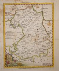
17807883London c. 1780. Copper engraving 23 x 18 cms recent hand colour printed on paper stock with a blue tint blank verso. This map was first issued in The London Magazine which between 1747 and 1754 published a complete set of English county maps by Thomas Kitchin. The maps were subsequently published as a pocket atlas and reissued as a set by Alexander Hogg in Boswell's Antiquities of England & Wales. Map unknown
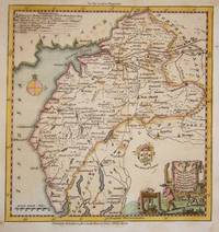
17506860London c.1750. Copper engraving 17 x 23 cms recent hand colour slight spotting blank verso; published in the London Magazine. Map unknown
17544512London: Printed for the Editor by John. Lewis 1754. New edition. Hardcover. Fair. 8vo 537 pages 106 ii; 10 pages; calf covers and title-page detached. <br/><br/>This is a collection of "classic" Anglican sermons dating back to 1562 Bound with THIRTY NINE ARTICLES OF RELIGION. Lewis 1754. Bound with A SERMON PREACHED IN PART BEFORE THE . DEAN OF THE ARCHES . Assembled in Visitation at Sevenoaks in Kent; on Friday the 21st Day of May 1742. By Rev. Henry Piers. J. Lewis: London 1754. Fourth Edition. Originally published in 1547. Lacks pages after 10. "The Books of Homilies 1547 1562 and 1571 are two books of thirty-three sermons developing the reformed doctrines of the Church of England in greater depth and detail than in the Thirty-Nine Articles of Religion. The title of the collection is Certain Sermons or Homilies Appointed to Be Read in Churches. . The 'Former Book' of homilies here contains twelve sermons and was mainly written by Cranmer. They focus strongly upon the character of God and Justification by Faith and were fully published by 1547. The 'Second Book' contains twenty-one sermons and was mainly written by Bishop John Jewel. It was fully published by 1571 - Wikipedia." OCLC cintes only 1 copy of this edition . Printed for the Editor by J[ohn]. Lewis hardcover
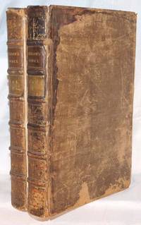
17131503260035London : Printed by J. Baskett 1713-01-01. Hardcover. Good. Folio. 2 Volumes. iv xxxi i xxx 1-712; 665-1291 82 xcviii tables index subscribers and addenda. Bound in contemporary full leather. Gilt lettering and modern red leather spine labels. 5 raised bands. Hinges and extremities repaired. Good bindings and covers. Soiling to title page. Dampstaining occurring to first few pages of Volume I. Repair to first few pages of Vol. I. Worming occurring to margins of pages. Pages with tanning and toning. Ships daily. This is an oversized or heavy book that requires additional postage for international delivery outside of Canada and the US. London : Printed by J. Baskett hardcover
17131203230056London : printed by J. Baskett 1713. Leather Bound. Good. Complete in two volumes. London : printed by J. Baskett; and by the assigns of Thomas Newcomb and Henry Hills deceas'd. And are to be sold by R. Whitledge 1713. Folio. 1291 pp Appendix of Instruments Tables Index. Contemporary full leather boards. Spine has 6 bands red and tan title plates intricate giltwork on spine and borders. Front board of volume 2 detached cracking to hinges binding starting. Red speckled page edges. Red and black title page in volume 1. Title page missing from volume 2. Foxing mostly around end pages. Ownership inked in classic hand on title page. This is an oversized or heavy book that requires additional postage for international delivery outside of Canada and the US. <br><br> London : printed by J. Baskett hardcover
17506917London c.1750. Copper engraving 19 x 18.5 cms recent hand colour blank verso; published in the London Magazine. Map unknown
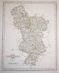
17877138London c. 1787. Copper engraving 22 x 28 cms original hand-colour blank verso. Characteristically clear and elegant map by one of the leading cartographic engravers publishers and globe-makers of the period perhaps best known for his English county atlases. Map unknown
17206061London c. 1720. Copper engraving 18 x 12 cms recent hand-colour b/w strip-maps on verso. Map unknown
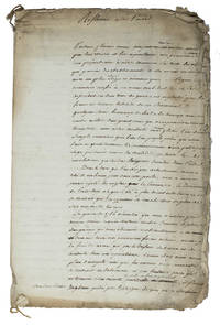
1778ABC_455321778. Sewn with two small chords in the left upper and bottom corner. Folio. First draft of an autograph manuscript in French with erasures and corrections probably written by a diplomat or strategist concerning the causes of Britains defeat of France in India during the Seven Years War 1756-1763 and analysing different ways to restore France to power on Indian soil by an alliance with the sultan Haider Ali Khan 1722-1782 who ruled Mysore and a large part of southern India and was one of the greatest enemies of the British East India Company. According to the unidentified diplomat who wrote this text Haider Ali Khan was the only one who was able to defeat the British or challenge their supremacy in India. In this manuscript he describes the best strategy not only to join Haider Ali Khan but also to negotiate with the British people on profitable Indian trade for both parties.Slightly worn and frayed around the edges first page slightly dust-soiled but still an interesting autograph manuscript in good condition. unknown
17206065London c. 1720. Copper engraving 18 x 12 cms recent hand-colour b/w strip-maps on verso. Map unknown
17306726London c. 1730. Copper engraving 19.5 x 31.3 cms recent hand-colour antiquities British coins in the margins blank verso. Herman Moll c. 1654-1732 was both map engraver and publisher one of the most prolific and significant map-makers working in England in the late seventeenth and early eighteenth-centuries. He is now known to have been of German rather than Dutch origin and he came to London at some point in the 1670s initially working with established figures such as Moses Pitt. Map unknown