71 résultats
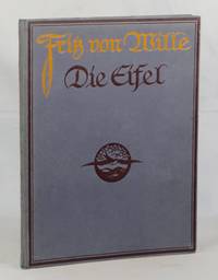
1900000012715Köln am Rhein = Colonge on the Rhine: Verlag von Hoursch & Bechstedt 1900. Hardcover. Near Fine. Folio. 8 20 mounted reproductions of watercolor paintings by Fritz von Wille. Blue paper boards with yellow and purple lettering on the front board. Green endpapers and pastedowns. The Eifel is a mountain range in Western Germany bordering Belgium. These paintings depict the environment around the mountains and the various colors of the seasons. Minor wear to the spine a bookplate on the free front endpaper. Verlag von Hoursch & Bechstedt hardcover
1832biblio109<p><i>Tombleson. London. 1832 1834. 2 volumes. Royal 8vo. 190pp; 181 4pp. Engraved title pages. Folding panoramic map; folding map. 137 6869 engraved plates. Later half calf marbled boards raised bands to spine in six compartments gilt lettering and spine rules. Marbled boards with a little shelf wear. Upper hinges reinforced. Minor worm damage to lower edge of reps Vol.II. Occasional light foxing and offsetting. Signature of Edward Lock to fep of each volume. A handsome set with all plates as listed.</i></p><p><b><i>William Tombleson</i></b><i> 1795-1846 Artist illustrator and engraver.</i></p> Tombleson hardcover
18942090202122801678Tohodo Bookstore 1894. Soft Cover. Fine. The book is in fine condition. Tohodo Bookstore paperback
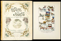
190010347AB1900. Paris Librairie Hachette um 1900. 4°. 316 S. 47 Farbtafeln dv. 1 doppelseitig und zahlr. Ill. Illustrierter Pappband. Einband mit Gebrauchsspuren. Auf dem Innendeckel eingeklebtes Ex Libris "Biblioteka Lancucka". Sauberes gut erhaltenes Exemplar. unknown
1883002132Philadelphia PA: Philadelphia PA: J.G. Kohler 1883 1883. 811 pages/illus. 8pp ads. History of Germany. German text. Clean tight volume. Hard Cover. Very Good/No Jacket. 4to - over 9¾" - 12" tall. Ex-Library. Philadelphia, PA: J.G. Kohler, 1883 hardcover
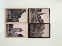
190018091AB1900. Dresden Darmstadt Stuttgar u.a. Seele Lautz Schaller u.a. 2. Drittel 1900 165 : 11 cm. 12 s/w Photographien. Mit Ansichten von Baden-Baden Augsburg Rewutlingen St. Zeno Lichten stein Dorf Schöna etc. unknown
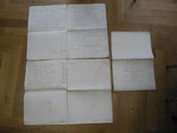
18019538AB1801. Unikate Frankfurt am Main Administration der Senckenbergische Stiftung 1801 1804 1804 Folio 12 4 12 nicht paginierte S. original handgeschriebene Bögen gute saubere Exemplare. Beiliegt die gedruckte 'Bilanz der Dr. Senckenbergischen Anatomie 1913/14' 1 Doppelblatt. Abholung im Ladengeschäft in Frankfurt am Main Nordend ggü. Musterschule möglich. Das spart die Portokosten. Pickup at the store in Frankfurt am Main Nordend close to Musterschule is possible. It saves the shipping costs. unknown
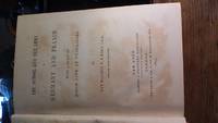
1873190006<p>An American officer's first-hand observations of German military life and service during the Franco-Prussian war and a comparison of the military and educational systems of France and Germany. Tightly bound and in very good condition no bumped corners splits underlinings or marginal comments. It carries both the names of New York and London publishers and is dated 1873 although a previous owner's ink inscription dates its purchase as in 1872. This first European London edition was issued in January 1873 but apparently was available in bookshops in December 1872. <br />Original owner Louis Tronchin was a Colonel in the Swiss Federal Army.<br />408 pages including a 25-page annex: "Organization and administration of the German Army".<br />Lower spine is gilt-letter stamped: "Trübner & Co."</p> Trübner hardcover
1880006743Frankfurt Main Germany: Bockelmann"s Kunstverlag 1880. Published in 1880's this beautiful collection contains all 150 single-sided loose engravings showing various cities and major buildings/cathedrals of Germany just prior to the turn of the century. Beautiful set covering most of Germany. Engraved title page and two page index. Engravings are clean. Sides of case are torn/worn. Overall very unique and rare collection of engravings. Individual pages may retail for as much as $50 or more each. Decorative Cloth. Very Good/Slipcase. 4to - over 9¾" - 12" tall. Bockelmann"s Kunstverlag hardcover
183511052Koblenz: Karl Baedeker. 1835. Second Edition. Hardcover. Very Good. Boards a bit sunned spine label browned and lightly chipped but still readable "Klein's Rheinreise Zweite Auflage". Neat notation with black ink on first blank page dated 1837. Bookplate. Two illustrations and two steel engraved fold out maps. Very light browning to a few single pages not affecting contents. ; This book is the expanded and revised edition of Professor J. A. Klein's Rheinreise. Converted into a guidebook by the legendary bookdealer of Coblenz Germany - Karl Baedeker. The first book to bear his original name Bädeker and the precursor of the entire series. A virtually unique publication - extremely rare ; 16mo 6" - 7" tall; 517 pages . Karl Baedeker hardcover
1900ZB1142441Saint-Cloud: Impr. Belin freres 1900. 102 pp. rebound in cloth else very good. - If you are reading this this item is actually physically in our stock and ready for shipment once ordered. We are not bookjackers. Buyer is responsible for any additional duties taxes or fees required by recipient's country. Photos available upon request. Saint-Cloud: Impr. Belin freres hardcover
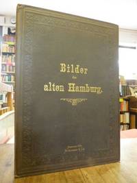
188132364AB1881. Erstausgabe Hbg. Strumper 1881 4° 10 lose Lichtdrucktafeln mit ganzs. s/w-Illustr. sowie das Titelblatt in der braunen original Leinenmappe mit goldener Deckelbeschriftung und Deckelblindprägung altersgemäß schönes sauberes und vollständiges Exemplar hhstah Enthält: 1. Der Reesendamm mit dem mittleren Dammthor 1587 / 2. Das alte Dammthor von 1549 / 3. Das alte Steinthor von 1570 / 4. Der Zeughausmarkt 1740 / 5. Der Bauhof und das alte Deichthor 1828 / 6. Der Schweinemarkt 1828 / 7. Das Deichthor 1834 / 8. Am Baumhaus 1842 / 9. Ruine des vormaligen blauen Thurmes 1842 / 10. Das Blockhaus 1844 Abholung im Ladengeschäft in Frankfurt am Main Nordend ggü. Musterschule möglich. Das spart die Portokosten. Pickup at the store in Frankfurt am Main Nordend close to Musterschule is possible. It saves the shipping costs. unknown
183812463Potsdam: Gedruckt im Decker'schen Geheimen Ober-Hofbuchdruckerei-Etablissement. Good with no dust jacket. 1838. First Edition. Hardcover. Lacks spine covering edgewear light tone and foxing otherwise light wear. Solid hardcover. ; German language. First edition of the rules of the Potsdam Royal Military Orphanage School intended for the school's internal use only. Contents: Das Knabenhaus; Die Musikschule; Die Handwerksschule; Das Lazareth. ; 156 pages . Gedruckt im Decker'schen Geheimen Ober-Hofbuchdruckerei-Etablissement hardcover
1866SZEPEBKS007408IStuttgart: Hoffmann 1866. Hardcover. Very Good. 4to. - 8390 pp. plus plates and maps. - Hoffmann Stuttgart 1866.- Newly rebound in full grey cloth with black cloth spine with title embossed in gilt on leather label from original binding. - Uncut. - With 32 engraved full-page views on heavy stock 62 woodcut text illustrations and 2 of 3 engraved full-page maps "Die Schwabische Alp" and "Der Schwarzwald". - Binding excellent; some foxing and small smudges on a few pages else very fine. - Splendid views of Stuttgart Rottenburg sic Tubingen Reutlingen Biberach Ravensburg Ulm Heilbronn and many other cities on hard stock. link to photos on request. <br/> <br/> Hoffmann hardcover
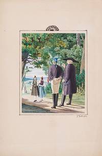
1870200077AG1870. no place c.1870. Original Gouache. Plate Size: 14 cm x 17.5 cm. Sheet Size: 21.6 cm x 32.7 cm. Original 19th century artwork. In excellent condition. Discreet duplicate stamp of 'Regia Berolin.' on reverse. Artist's Beautiful gouache of a traditional verdant rustic setting in southern Germany. Young maids in traditional dress tread the path to church followed by a young male in the company of a solemn fatherly pastor. Ferdinand Justi 2 June 1837 in Marburg Germany - 17 February 1907 in Marburg was a German linguist and Orientalist. He finished his studies of linguistics at the University of Marburg and the University of Göttingen. In 1861 he lived in Marburg where in 1865 he became associate and in 1869 full professor of comparative linguistics and Germanic philology. In addition to his academic work he studied with meticulous precision the life of the Hessian peasants in the last third of the 19th century especially in the immediate and wider area of Marburg on which he wrote his observations and described it in countless sketches and watercolors. One of his main themes included buildings furniture agricultural implements and especially costumes with all its subtleties and accessories. Wikipedia unknown
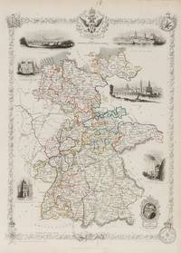
1851200104AG1851. London Edinburgh & Dublin J & F. Tallis 1851. Original steel engraving / Vintage map. Drawn and engraved by John Rapkin. Partly hand-coloured. Illustrations by N. Whitlock and Engraved by J. Rogers. Plate Size: 25 cm x 34.8 cm. Sheet Size: 27.5 cm x 37.4 cm. Vintage 19th century map in very good condition. Published in the Illustrated Atlas And Modern History Of The World Geographical Political Commercial & Statistical Edited By R. Montgomery Martin. Beautiful and fascinating map of a fragmented Germany from the Victorian Era. The coloured delineation show the patchwork of kingdoms duchies states and 'Kleinstaaterei' or mini-/micro-states that comprised much of the territory of the ancient and recently expired Holy Roman Empire. The Kingdom of Bavaria is the largest of these with Saxony and Hanover also significant local powers. The non-contiguous Coburg a tiny state exerts outsized influence due to its ties with the British Royal family: reigned Queen Victoria was the daughter of a Coburg princess. Miniature Oldenburg Hesse Biankenburg and Gottingen vie with each other in this crowded field of states. Prussia also has outposts in this busy area around which are Holland Prussia France Switzerland Tyrol Bohemia and the already-mentioned Prussia. The railway system is shown as are the numerous towns and cities of the region. Relief is depicted with hachuring. A doubled-head eagle accompanies the titular cartouche and a decorative border is adorned with armorial coat-of-arms and ceremonial medals - suggestive of the necessary pomp-and ceremony of such a thronged political and diplomatic landscape. John Tallis 7 November 1817 3 June 1876 was an English cartographic publisher. His company John Tallis and Company published views maps and atlases in London from roughly 1838 to 1851. Tallis set up as a publisher with Frederick Tallis in Cripplegate in 1842; the business moved to Smithfield in 1846 and was dissolved in 1849. From 1851 to 1854 Tallis operated as John Tallis and Company. He started The illustrated news of the world and national portrait gallery of eminent personages in 1858 selling it for £1370 in 1861; it folded in 1863. Wikipedia The most important project John Tallis undertook was the 'Illustrated Atlas' from 1851. The original map we offer here was part of this exceptional Atlas and all the maps it contained are still today considered as the last reminder of an era of lavish map production. Tallis worked the project together with John Rapkin 1815-1876 and it was Rapkin's style and talent that we have to thank for when we marvel at these maps today. What makes these maps so special is the detail of engraved vignettes that surround the map and often show indigenous scenes people in their environment and even more so historical buildings or historical views of towns and cities architecture and landscape. The project of 'The Illustrated Atlas' was designed to be finished just in time for the anxiously awaited "Great Exhibition of the Works of Industry of All Nations" or The Great Exhibition sometimes referred to as the Crystal Palace Exhibition in reference to the temporary structure in which it was held was an international exhibition that took place in Hyde Park London from 1 May to 11 October 1851. It was the first in a series of World's Fairs exhibitions of culture and industry that became popular in the 19th century and it was a much-anticipated event. The Great Exhibition was organized by Henry Cole and Prince Albert husband of the reigning monarch Queen Victoria. It was attended by numerous notable figures of the time including Charles Darwin Samuel Colt members of the Orléanist Royal Family and the writers Charlotte Brontë Charles Dickens Lewis Carroll George Eliot and Alfred Tennyson. Music for the opening was under the direction of Sir George Thomas Smart and the continuous music from the exhibited organs for the Queen's procession was "under the superintendence of William Sterndale Bennett". Wikipedia unknown
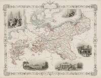
1851200103AG1851. London Edinburgh & Dublin J & F. Tallis 1851. Original steel engraving / Vintage map. Drawn and engraved by John Rapkin. Partly hand-coloured. Illustrations by J. Salmon and engravings by S. Fisher. Plate Size: 33 cm x 26.5 cm. Sheet Size: 37.4 cm x 27.4 cm. Vintage 19th century map in very good condition. Published in the Illustrated Atlas And Modern History Of The World Geographical Political Commercial & Statistical Edited By R. Montgomery Martin. Beautiful and fascinating map of Prussia from the Victorian Era. Prussia's boundaries are highlighted and illustrate its non-contiguous make up. Four De-jure 'Kleinstaaterei' or mini-/micro-states can be seen holding within the borders of Prussia - evidence of the fragmented nature of the German lands throughout the existence of the recently expired Holy Roman Empire. But this was changing: In the west lie Prussia's post-1815 acquisitions in Westphalia and the Rhineland while in the east 'Prussian Poland' and 'Posen' remind the viewers of the fate of the erstwhile Polish state. Four additional territorial possessions resemble globules from the main bodies of Prussian land. The more ancient lands of East Prussia and Brandenburg are identified also. Prussia is located in a busy neighbourhood with Denmark Sweden Russia Austria Saxony France Belgium and Holland abutting Berlin's territory. The islands of the Baltic are also identified. The much-heralded German railway system is shown on the map linking ports like Hamburg and Stettin to Berlin. The map is littered with the names of famous towns and cities such as Memel Konigsberg and Warsaw in the East Cracow Prague and Dresden in the South to Magdeburg and Dortmund in the west. The region's rivers such as the Elbe and Vistula are also identified. Relief is depicted through hachuring. A scale-bar is shown in the lower left corner. A Prussian eagle stands perched upon the highly decorative map border. John Tallis 7 November 1817 3 June 1876 was an English cartographic publisher. His company John Tallis and Company published views maps and atlases in London from roughly 1838 to 1851. Tallis set up as a publisher with Frederick Tallis in Cripplegate in 1842; the business moved to Smithfield in 1846 and was dissolved in 1849. From 1851 to 1854 Tallis operated as John Tallis and Company. He started The illustrated news of the world and national portrait gallery of eminent personages in 1858 selling it for £1370 in 1861; it folded in 1863. Wikipedia The most important project John Tallis undertook was the 'Illustrated Atlas' from 1851. The original map we offer here was part of this exceptional Atlas and all the maps it contained are still today considered as the last reminder of an era of lavish map production. Tallis worked the project together with John Rapkin 1815-1876 and it was Rapkin's style and talent that we have to thank for when we marvel at these maps today. What makes these maps so special is the detail of engraved vignettes that surround the map and often show indigenous scenes people in their environment and even more so historical buildings or historical views of towns and cities architecture and landscape. The project of 'The Illustrated Atlas' was designed to be finished just in time for the anxiously awaited "Great Exhibition of the Works of Industry of All Nations" or The Great Exhibition sometimes referred to as the Crystal Palace Exhibition in reference to the temporary structure in which it was held was an international exhibition that took place in Hyde Park London from 1 May to 11 October 1851. It was the first in a series of World's Fairs exhibitions of culture and industry that became popular in the 19th century and it was a much-anticipated event. The Great Exhibition was organized by Henry Cole and Prince Albert husband of the reigning monarch Queen Victoria. It was attended by numerous notable figures of the time including Charles Darwin Samuel Colt members of the Orléanist Royal Family and the writers Charlotte Brontë Charles Dickens Lewis Carroll George Eliot and Alfred Tennyson. Music for the opening was under the direction of Sir George Thomas Smart and the continuous music from the exhibited organs for the Queen's procession was "under the superintendence of William Sterndale Bennett". Wikipedia unknown
1871HALL147481Hardback. 1871. Sammlung der Diplomatischen Akten des Auswartigen Amtes. Im Auftrage des Auswartigen Amtes. Die Bismarck Zeit. 6 vols. Vol. 1. Der Frankfurter Friede und seine Nachwirkungen 1871-1877. Vol. 2. Der Berliner Kongress und seine Vorgeschichte. Vol. 3. Das Bismarck'sche Bundnissystem. Vol. 4. Die Dreibundmachte und England. Vol. 5. Neue Verwickelungen im Osten. Vol. 6. Kriegsgefahr in Ost und West Ausklang der Bismarckzeit. Ed.by Johannes Lepsius et al. Berlin 1922-24. Includes much on the Balkans. VG . hardcover
1899171411899. Women's Suffrage Germany P. Aug. Rosler. "Wahre und Falsche Frauen Emanzipation Truths and Lies: Women's Emancipation". Written in German. Stuttgart und Wien: Dof Roth'sche Verlagshandlung 1899. Printed by Hieronymus Muhlberger in Augsburg. 60 pages. 9 x 6 in. Original paper wraps. Very rare. At the time that this description is being written no copies are recorded in American institutions. OCLC search results are at best an estimate and can vary over time. An early German language treatise regarding popular myths on women's suffrage and the Women's Question die Frauenfrage. The volume lists the Madonna mother of Christ as one example of virtuous women whom all respect. German women were granted the right to vote and be elected from November 12 1918 immediately after the Armistice of WWI. Handwritten ink annotation on front cover. Front and back cover are detached; pages 1-16 detached; pages 49-60 detached. In good condition. unknown
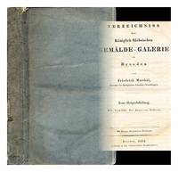
1835297363Dresden: Dedruckt in der Gartner'schen Buchdruckerei 1835. First Edition. Softcover. Near fine copy in the original stiff-card wrappers; edges very slightly dust-dulled and toned. Remains particularly and surprisingly well-preserved; tight bright clean and especially sharp-cornered. Physical description; 2 volumes in 1 ; 8 x 5 in. Subjects; Royal Saxon Picture Gallery. Directories. Genre; Illustrated. Dresden: Dedruckt in der Gartner'schen Buchdruckerei paperback
18710007700Leipzig: Wilhelm Baensch Verlagshandlung 1871. First edition. Hardcover. Good. Quarto; xvi 400 pages full embossed red cloth gilt bevelled edges raised patterns of lozenges on top cover lacks bottom 2 inches of spine; Inked inscription in 1874 on flyleaf in Deutsch all edges gilt. Very Scarce: WorldCat reports no copies outside of Europe. <br/><br/>Dozens of German poets writing about the Franco-Prussian War the Krieg of 1870. Original woodcuts by Louis Hutschenreuter: Hutschenreuter illustrated a number of works by Hans Christian Andersen after this work. Wilhelm Baensch Verlagshandlung hardcover
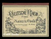
1880204683Frankfurt a.M. : Frey ca. 1880 1880. First Edition. Hardback. Very good copy bound in the original cloth-backed pictorial boards. Spine bands and panel edges somewhat dulled and rubbed as with age. The fold-out map has some minor tape repairs in places but is completely intact. Remains quite well-preserved overall.; 8vo 8"" - 9"" tall; 16 pages; Description: 1v.: 1 fold-out map folds out to 14 x 126 cm 24p. of text ; 14cm. Summary: Fold-out illustrated map of the Rhine displaying the landscape and sights of the river's course. With a 24-page description in German French and English. Subjects: Rhineland Germany -- Maps -- Rhine River Valley -- Pictorial works. Language: German. Frankfurt a.M. : Frey, [ca. 1880?] hardcover
1866256892Leipzig: Otto Wigand 1866. paperback. good. Vom Verfasser der Schrift "Adhuc stat." 147 pages. 12mo yellow printed wrappers; page margins uncut wrappers chipped and somewhat soiled last 3 pages and back wrappers are creased in upper right corner margins. Leipzig: Otto Wigand 1866.<br/> <br/> Otto Wigand unknown
1815256923Rostock: Adlers Erben 1815. pamphlet. very good. 14 pages. Slim 12mo 19th century plain green wrappers. Rostock: Adlers Erben 1815. Very good<br/> <br/> Adlers Erben unknown
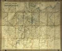
1841827CG1841. Hanau J. Edler 1841. Lithografische Karte mit Grenzkolorit. Blattgrösse: 545 x 69 cm. In Glasrahmen. unknown