AnonBiblio.com
9 résultats
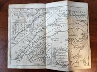
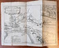
1759182869London: The London Magazine 1759. 1st Edition . No Binding. Very Good/No Jacket. Disbound from the London Magazine for November 1759. 9-1/2 x 7 in plus plain border of approx 1/4 inch. Originally folded into 4 panels. In very good condition with only minor discolouration. One insert "A Plan of the Action gained by the English near Quebec Sep.13.1759." A very nice copy. <br/> <br/> The London Magazine unknown
1759182868Londom: The London Magazine 1759. 1st Edition . No Binding. Very Good/No Jacket. Overall size 10x7.25 in. plus approx. 1/4 in. border on all four sides. From an engraving for the London Magazine September 1759 edition. Originally folded into 4 panels. Disbound but retaining the complete map. Includes three inserts: The Traverse or Passage from Cape Torment into the South Channel of Orleans Isle; A Continuation of the River St. Lawrence from Quebec to Lake Ontario; The Seven Islands. Light discoloration in places but overall a nice clean example. <br/> <br/> The London Magazine unknown
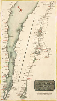
180052682c.1800. The course of the river is shown in two parts from Lake Ontario to Quebec and from Quebec to Point Manicouagan Copper engraving. In fine condition but right-hand margin close cropped 4 mm at most narrow point Later colouring. Size: 23.2 x 41.4 cm. 9 x 16½ inches unknown
171132615London: Timothy Goodwin. Good. 1711. First English Edition; First Printing. Softcover. University library withdrawal bound In plain brown paper wraps with double blank endpapers. All library markings reside on these covers/endpapers except for typed accession number and small university stamp to blank verso of title page. Contents are crisp and quite bright with only occasional light foxing. "Printed for Tim. Goodwin at the Queen's Head against St. Dunstan's Church Fleetstreet 1711." First English translation of the original Latin of 1574. First page past the newer paper covers are the half-title page: "Franco-Gallia translated by the author of the Account of Denmark." Last page is the one marked 144. One advertisement on verso of half-title page. Very scarce 1711 first English translation. ; 144 pages . Timothy Goodwin paperback
1796elala1784Quebec: William Vondenvelden 1796. 1796. 4to. pp. 2 p.l. 16 blank leaf. text in French & English on opposite pages. modern wrs. Order in council enforcing the terms of Jays Treaty 1794. The Treaty arranged reciprocal concessions regarding trade and commerce between the United States and British North America and provided for the appointment of a commission to settle the north-eastern boundary and for the withdrawal of British troops from American territory. Tremaine 994. Dionne I 40. Lande 552. TPL 692. Vlach 40. Vlach IP 66. Quebec: William Vondenvelden, 1796. unknown
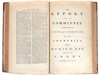
177623234London 1776. Hardcover. Near fine. Folio. Second edition of this important report first issued in 1749 and bound here as issued with 12 other committee reports first published between 1737 and 1765. Folio 486 pp with one folding map not related to the Hudson's Bay report in a later binding of quarter leather and marbled boards. Each report has its own title page but a title page for the full volume is lacking; otherwise a fine copy. According to ESTC N69513 four volumes of these committee reports were officially ordered to be printed on 28 June 1773 and were published in 1774-1776. They were reprinted along with 11 additional volumes and an index between 1803 and 1820. The 1803 reprint of this report is commonly found but this 1776 edition is scarce. See Peel 26 TPL 213. In 1749 the House of Commons appointed a committee of enquiry into the lands and trade of the Hudson's Bay Company HBC. It was undertaken as a result of a petition made by a group led by Irishman Arthur Dobbs who hoped to have the HBC''s trade monopoly revoked on the grounds that their policies had led to a loss of British control of the fur trade and that showed little interest in promoting expeditions in search of the Northwest Passage. The Report offers a history of the Company from its formation and includes the journal of Joseph La France a pioneer trader with the Indians inhabiting the region of the Great Lake who describes visits into French Canada the state of the fortresses there and French trade with the Indians. It also includes testimony given before the Committee by many witnesses including serveral people employed by the HBC as well as merchants engaged in trade in HBC territory. The Appendix includes the text of the HBC's charter a list of vessels sent by the HBC in search of a Northwest Passage tables of the HBC's annual sales and exports "A Journal of a Voyage and Journey undertaken by Henry Kelsey to discover and endeavour to bring to a Commerce the Naywatamee Poets an unidentified people who may have been the Hidatsa or Gros Ventre 1691" and much other interesting material. hardcover
175222438London: Printed for J. Payne and J. Bouquet 1752. First Edition. 8vo pp vi 84 95 with 3 folding maps. Bound in full mottled calf with gilt rules. Small bookplate "Lavington" on front pastwdown and one "From the Wilberforce Library Backsettown" on front free endpaper. Frontis map slightly misfolded but overall a near fine copy. Robson was a former employee of the Hudson's Bay Company who had worked as a surveyor and "Supervisor of the Buildings" i.e. construction superintendent. His experiences convinced him that the Company was mismanaging its holdings so badly that all of northern North America would soon be taken over by the French. Hill 1477 describes this account as one of the earliest and certainly the fullest of works that had hitherto been published on the Hudson Bay Territory" and explains that "Robson with a sound knowledge of the locale and of the personnel of the Hudson's Bay Company condemned the company for its failure to promote enterprise and development in its lands." The first 84 pages are the narrative the remaining portion of the book is an appendix giving an account of the discovery of Hudson's Bay and English activities there. The maps are: "A Draught of Nelson & Hayes's Rivers" Plate I "A Draught of Churchill River" Plate II and "Plans of York and Prince of Wales's Fort" Plate III which also includes an illustration of two snowshoe designs. Field 1312; Graff 3532; Sabin 72259; Smith 8728; Streeter VI 3648 TPL 217 Lande 1418. Printed for J. Payne and J. Bouquet unknown
17200101766London: printed for D. Browne at the Black-Swan etc. 1720. Leather Bound. pp. 4 304. 8vo. Full leather binding in Cambridge style with an expertly rebacked spine. Leather title labels lettered in gilt 5 raised bands. Ink spill to foredge of 50 pages. "An account of the expedition of 1711 by its leader written as a reply to criticisms of his conduct of the unfortunate affair" - Sabin 101050. TPL 148. With leather bookplate of W A William Alfred Westropp Foyle Beeleigh Abbey: who along with his brother founded the iconic eponymous London bookshop; and a second bookplate featuring a lion and unicorn with only "Libertas No 3494 printed for D. Browne at the Black-Swan, etc. unknown
1795E0029<b>Samuel Hearne was the first European to make an overland excursion across northern Canada to the Arctic Ocean</b><br /><br />xliv458 pages with two of four engraved plates after drawings by the author both folding and four of five folding engraved maps. Quarto 11 3/4" x 9 3/4" bound in full leather with raised spine bands and gilt lettering to spine. HillI page 141. Sabin 31181 First edition.<br /><br />Manuscript journal was found by La Pérouse when he captured Fort Albany; later one of his conditions of surrender was that it be published. Samuel Hearne 1745 – November 1792 was an explorer fur-trader author and naturalist. He was the first European to make an overland excursion across northern Canada to the Arctic Ocean In 1774 Hearne built Cumberland House for the Hudson's Bay Company its first interior trading post and the first permanent settlement in present Saskatchewan. From 1769 to 1772 Hearne was employed in north-western discovery searching especially for certain copper mines described by Indians as "Far-Away-Metal River". These copper mines were found in the Barren Lands where the ground is permanently frozen to within a few inches of the surface creating in many areas vast stretches of mosquito- and fly-infested swamp during the summer thaw. For this reason it was decided that travel in winter was preferable. His first attempt began on 6 November 1769. The large size of the expedition and too much European equipment being carried led to the desertion of his Indian guides and the failure of the expedition. His second commencing 23 February 1770 failed because his quadrant was broken and much of his equipment was stolen. Learning from the mistakes of the first two expeditions Hearne contrived to travel as the only European with a group of Indians led by the great chief Matonabbee. The group also included eight of Matonabbee's wives to act as beasts of burden in the sledge traces camp servants and cooks. This third expedition set out in December 1770 in order to reach the Coppermine River in summer by which he could descend to the Arctic in canoes. Matonabbee kept a fast pace so fast they reached the great caribou traverse before provisions dwindled and in time for the spring hunt. Here all the Indian hunters of the north gathered to hunt the vast herds of caribou migrating north for summer. A store of meat was laid up for Hearne's voyage and a band of warriors joined the expedition. Matonabbee ordered the women to wait for his return in the Athabasca country to the west. The Chipewyans were generally a mild and peaceful people however they were in a state of conflict with the Inuit. A great number of Indians joined Hearne's party to accompany them to the Coppermine River with intent to murder Inuit who were understood to frequent that river in considerable numbers.2 On July 14 1771 they reached the Coppermine River a small stream flowing over a rocky bed in the "Barren Lands of the Little Sticks". A few miles down the river just above a cataract were the domed wigwams of an Eskimo camp. At 1am on July 17 1771 Matonabbee and the other Indians fell upon the sleeping Eskimo in a ruthless massacre. Approximately twenty men women and children were killed; this would be known as the Massacre at Bloody Falls. A few days later Hearne was the first European to reach the shore of the Arctic Ocean by an overland route. By tracing the Coppermine River to the Arctic Ocean he had established there was no northwest passage through the continent at lower latitudes. This expedition also proved successful in its primary goal by discovering copper in the Coppermine River basin. However an intensive search of the area yielded only one four-pound lump of copper and commercial mining was not considered viable. Matonabbee led Hearne back to Churchill by a wide westward circle past Bear Lake in Athabasca Country. In midwinter he became the first European to see and cross Great Slave Lake. Hearne returned to Fort Prince of Wales on 30 June 1772 having walked some 5000 miles and explored more than 250000 square miles.<br /><br />Condition:<br /><br />Rebound in attractive leather with raised spine bands. Lacks frontispiece map and two plates. Plate I A North West View of Prince of Wales's Fort and Plate IV A Winter view of the Athapuscow Lake. Some internal spotting. Small repair to title page and verso and front free end paper edge else a better than very good copy. Printed for A Strahan and T Cadell hardcover