[Alaska] [M Bonne]Biblio.com
5 résultats
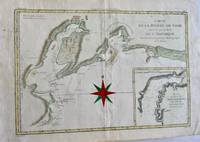
178734758Paris: M. Bonne 1787. Map. Good. Approx. 16" x 11". Hand colored map of the southern Alaska region showing Capt. Cook's discoveries in the Prince William Sound and Cook's Inlet. Light crease in the center fold. Good. M. Bonne unknown
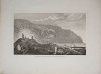
178522404London 1785. Very good condition. Copper engraved view of natives in traditional garb tending their kayaks at the water's edge. Drawn by John Webber and published in James Cook's third voyage around the world. 15 x 9 1/2" on large paper. unknown
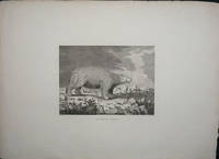
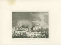
178522405London 1785. Copper engraved portrait of a polar bear on ice from the folio atlas accompanying the last voyage of Captain Cook. Very good condition extra wide margins. 9 3/4 x 8" image on paper approx 16 x 21.5 unknown
171959230Washington D.C.: Government Printing Office Hydrographic Office U.S. Navy 1917; 1930. Two vols. 8vo. ix 1 4 364 pp.; 19 mimeograph leaves. With 2 large folding colour map. First vol. in black publisher’s buckram silver lettering stamped on front cover & spine minor shelfwear slight interior toning shelfwear 2nd vol. mimeographed typescript & stapled at gutter margin minor dustsoiling edgewear predation to lower fore-edge tear to last leaf of blank lower portion still a VG set. First editions of these coast pilot guides to Arctic waters during and after World War I issued about the time of the Russian Revolution and offered key navigational guides for Naval forces during the ill-fated White Russia Revolution and over 13000 troops in the Polar Bear Expedition. Prior to modern GPS systems and satellite navigation these regularly updated and revised navigation handbooks provided key sailing instructions often drawing not only from Russian & British sources but also sailing reports from U.S. Navy vessels and those from merchant ships. The two maps serve as indexes to sailing charts to be ordered from the Hydrographic Office and keyed to sailing instructions within the coast pilots. The supplement is uncommon no copies located in Worldcat. Government Printing Office, Hydrographic Office, U.S. Navy, hardcover
178529434London 1785. Copper engraved images of Alaska & Vancouver Island from the folio atlas of Cook's 3rd voyage Pacific Ocean exploration. The plate numbers included are #40 41 48 49. 52 57 & 73. Two images are of Alaskan natives their boats and huts going about their daily lives. <br /> Sea Horses refers to seals and the white polar bear is majestic. Two with a corner waterstain one with a slight brown circle in the margin one with marginal foxing. <br /> Paper sizes 21.5 x 16.25" and one is 22 7/8 all with wide margins. Some light marginal dusting overall very good condition. unknown