(Florrie, The Florida Co-Ed)Biblio.com
247 résultats
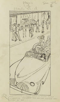
1949313357Gainesville Fla 1949. Aprox 77 pen and ink drawings with the newspaper cliping done generally for Wednesdays and Sundays. 8vo & 4to. In spiral rink notebook. Aprox 77 pen and ink drawings with the newspaper cliping done generally for Wednesdays and Sundays. 8vo & 4to. unknown
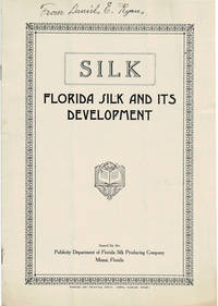
1920100096Miami Florida: Publicity Department of Florida Silk Producing Company circa 1920's. 1920's. Very good. - Octavo 10 inches high by 7 inches wide. Softcover bound in stapled off-white wraps titled & decorated in black. The front cover is lightly soiled & creased. 8 unnumbered pages including the covers with 2 full-page black & white illustrations. "From Daniel E. Ryan" is written in ink at the top of the cover. The brochure is folded twice vertically & horizontally. Very good. <p>A RARE promotional brochure for the Florida Silk Producing Company formed by Dr. Thomas DePamphilis using his special process. We have located no other copies of the brochure.<p>Laid into the brochure is a 2-page broadsheet by the fiscal agents Goodyear-Baker Company titled "The Investment Possibilities of Growing Silk in Florida".<p>The company is mentioned as seeking investment in the September 30 1924 issue of the Springfield News-Sun of Springfield Ohio. Miami, Florida: Publicity Department of Florida Silk Producing Company, circa [1920's]. paperback
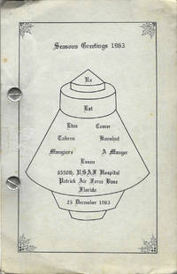
19639099Cocoa Beach Florida 1963. Octavo-sized metal post binding 21.5 x 14 cm 100 leaves printed rectos only. Illustrated. Author title and publication information from cover. A community cookbook with recipes attributed from the airmen and airmen's spouses living at Patrick Air Force. Patrick AFB is a significant location in the history of the American space program and 1963 just two years after the first manned space flight Gagarin and the first human-piloted space flight Shephard. Patrick Air Force base is now Space Launch 45 "the premier launch delta of the United States Space Force." Thor and Atlas Missiles as well as the Titan Booster were the stock in trade of PAFB from the time of this cookbook through the 1980s. The illustration of a space capsule on the front wrapper panel is of a Mercury capsule the capsule that carried John Glenn on the first American orbital flight in 1962. A bit of light soiling otherwise fine in publisher's gray card stock titled and illustrated in black. Unrecorded. OCLC locates no copies; no other references found online or otherwise. unknown
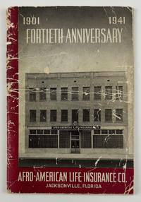
194112634N.p. likely Jacksonville Fl. 1941. 4612pp. Original pictorial wrappers stapled. Substantial creasing rubbing dust-soiling and overall wear to wrappers. Faint foxing and spotting to initial and terminal leaves but mostly clean internally. Very good. A rare pamphlet celebrating the fortieth anniversary of the Afro-American Life Insurance Company an important African-American-owned-and-operated insurance company in Florida. The work includes reproductions of congratulatory letters to the company from Florida governor Spessard Holland and others portraits and information on the company’s founders passages on the history of the company information on the successes of the company’s current operations and more. The work is interspersed throughout with a legion of photographs showing the company at work scenes from various branch offices the company’s Funeral Services Division and so forth.<br /> <br /> "Florida's First African-American Insurance Company -1901-2001. The Afro-American Insurance Company formerly the Afro-American Industrial and Benefits Association was founded in 1901 to provide affordable health insurance and death benefits to the state's African-Americans. Founded by the Reverend E.J. Gregg E.W. Latson Abraham Lincoln Lewis A.W. Price Dr. Arthur W. Smith J.F. Valentine and the Reverend J. Melton Waldron the Afro's first office at 14 Ocean Street was destroyed by the great Jacksonville Fire two months after it opened on May 3 1901. It then moved to 621 Florida Avenue the home of treasurer and future president Abraham Lincoln Lewis 1865-1947. From their next home office at 105 E. Union Street the company wrote millions of dollars of insurance policies and started district offices in Georgia Alabama Louisiana and Texas." - Historical marker at the site of the company's original location in Jacksonville.<br /> <br /> OCLC reports just two copies at Howard and the University of North Florida. unknown
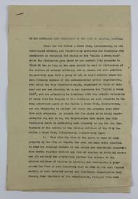
19473905Palatka Fl 1947. Very good. 5pp. typed on folio sheets stapled. Old folds minor wear and creasing light dust-soiling. An unsigned petition from the Hallie Q. Brown Club asking "The Honourable City Commission of the City of Palatka Florida.to recognise its status as the 'Hattie Q Brown Club which the Commission gave leave to use certain City property in Block 81.in furtherance of the welfare of colored children." Apparently a splinter group of the club was also claiming to be the Hallie Q. Brown Club and was illegally collecting rents on the groups club house. In asking for official recognition the group details their history of helping African-American youth in the area "by equiping and over-seeing a playground for them." The authors then detail the internal conflicts which occurred amongst the club members the procession of club leadership including several named individuals and the circumstances which led to the club's incorporation ending with the filing of a charter with a Putnam County judge. The fourth section of the club's petition enumerates their activities and plans in "furtherance of the welfare of the colored children of Palatka." The first two points detail the land clearance and construction of the park and their further plans for same; the third point relates to a study the club has undertaken "of the problem of juvenile delinquency among the colored children." Part of their plan is to work with law enforcement "to work out a parole system for first offenders of tender age" as well as "provide a method and place for the incarceration of colored children accused of or guilty of infractions of the law who are less than 12 years of age so that such children may be kept safely in custody and yet not exposed to the bad example and toughening influence of imprisonment in the County jail." Hattie Quinn Brown was a pioneering African-American educator who actively sought the formation of African-American women's clubs throughout the country. unknown
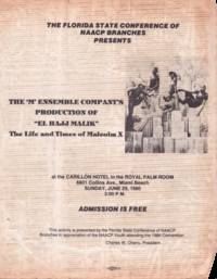
1980List3013Miami Florida: Allied Printing 1980. Single sheet measuring 8 ½ x 11 inches. Worn with some folding at corners; very good plus. A flyer for a production of Louisiana playwright professor and journalist Norbert Davidson Jr.’s “El Hajj Malikâ€: The Life and Times of Malcom X. This production sponsored by the Florida State Conference of NAACP Branches was put on by the ‘M’ Ensemble Company. Established in 1971 and still operational as of 2025 the ‘M’ Ensemble is Florida’s longest-running African American theater company. Davidson’s El Hajj Malik was written when he was a college student at Dillard University in the 1960s and was widely performed nationally and internationally according to his obituary in the Louisiana Weekly.1<br /> <br /> 1 Ryan Whirty “Playwright professor and former editor of The Louisiana Weekly dies†The Louisiana Weekly May 6 2019. Allied Printing unknown
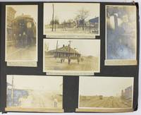
19095288Various locations mostly in Cuba and Florida: March 5 to April 1 1909. About very good. 21 leaves illustrated with 235 photographs all with typed captions. Oblong folio. Contemporary full dark brown cloth brad bound. Moderate staining and coiling to covers some edge wear. Bottom corners of all leaves chipped not costing content. Occasional minor wear to photos or captions. A well-organized and meticulously-captioned vernacular photograph album with significant content on Florida and Cuba in the first decade of the 20th century. The album is organized chronologically and features a family from Ohio traveling from home by train to Florida and thence to Cuba then returning home in the spring of 1909. The first seven and the last twenty-five photographs emanate from Ohio where the journey started Tennessee and Georgia but otherwise the album features Florida and Cuba in over 200 pictures. The scenes in Florida range from Jacksonville to Key West and other points in-between featuring the state in almost 120 photos both before and after the traveling party went to Cuba. The images capture portraits of the travelers numerous homes hotels businesses and other buildings including an ostrich farm in Jacksonville numerous scenes in Ocala including one image featuring "Mary and her old colored Mammy" various churches and other scenes in Tampa residences in Key West beach scenes at Long Key various hotels and agricultural fields in Miami and various buildings in Palm Beach Ormand and St. Augustine concluding with a front view of the "Old Slave Market" in the latter city.<br /> <br /> Most notably the album includes eighty-six photographs of Cuba the nexus point for the present trip where the party arrived on March 20. The Cuba scenes mostly feature Havana with several views of "Beautiful Residences" and other buildings plus some street views and other scenes in the city. Other interesting Havana scenes picture the railroad station "The Bone Yard -- Old destroyed Catacombs" scenes in the Malecon and more. Some of the street scenes in Havana picture local residents one of "Children on the street corner" and another showing "Children scrambling for pennies" in the middle of the street. The album also contains views of the wreck of the Maine Morro Castle the interior of Fort Cabanas and more. The travelers managed to wander outside Havana for a day when they ventured to the countryside and the town of Guines on March 23. While there the compiler took photographs of countryside outside Guines a railroad car full of sugar cane thatched houses a group photograph of the students at a "Spanish School in Guines" a "Child crying in the street" a group of locals outside a cafe captioned "Strangers in a strange land.Where we tried to get something to eat" other street scenes in the town and the local jail. The last photograph of Cuba here features a "Large Sugar Mill in Providencia." The group then returned through Florida Georgia and Tennessee where they spent a day at Lookout Mountain and Orchard Knob before their final stop in Dayton Ohio. A wonderful early-20th century travel album with significant views in Florida and Cuba. March 5 to April 1 unknown
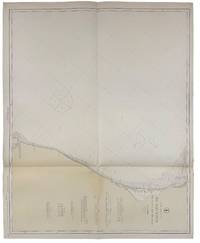
191940735Washington D.C.: Published by the United States Coast and Geodetic Survey 1919. Large folding nautical chart printed on heavy paper stock. Colored. A rare original coastal survey of Florida and Georgia from Sapelo Island to Amelia Island including St. Simons Island Sea Island Brunswick Jekyll Island Cumberland Island and Fernandina Beach.<br/> <br/> Established by President Thomas Jefferson in 1807 as the Survey of the Coast the U.S. Coast and Geodetic Survey was the United States' first civilian scientific agency. This agency has followed its mission to survey the U.S. coastline create nautical charts of the coast and help increase maritime safety since its founding and has often played fascinating roles in significant chapters of U.S. history. It served in all theaters of the Civil War in the service of the Union Army and Navy pioneered acoustic exploration in the wake of the sinking of the Titanic and during WWI it worked to detect enemy submarines. In addition this agency worked to survey and produce detailed maps and renderings of the U.S. coast. These nautical survey maps commonly referred to as "T-sheets" provide fascinating insights into the history of the United States coastline which has and will continue to shift. These maps are the most important data source for understanding the physical and ecological characteristics of the U.S. shoreline. The present map is a highly detailed and accurate sea chart of the coastal border between Georgia and Florida and an important historical view of the developing states. Published by the United States Coast and Geodetic Survey unknown
192140736Washington D.C.: Published by the United States Coast and Geodetic Survey 1921. Large folding nautical chart printed on heavy paper stock. Colored. A rare original coastal survey of Florida and Alabama from Pensacola Bay showing Perdido Bay including Pensacola Perdido Key and Orange Beach.<br/> <br/> Established by President Thomas Jefferson in 1807 as the Survey of the Coast the U.S. Coast and Geodetic Survey was the United States' first civilian scientific agency. This agency has followed its mission to survey the U.S. coastline create nautical charts of the coast and help increase maritime safety since its founding and has often played fascinating roles in significant chapters of U.S. history. It served in all theaters of the Civil War in the service of the Union Army and Navy pioneered acoustic exploration in the wake of the sinking of the Titanic and during WWI it worked to detect enemy submarines. In addition this agency worked to survey and produce detailed maps and renderings of the U.S. coast. These nautical survey maps commonly referred to as "T-sheets" provide fascinating insights into the history of the United States coastline which has and will continue to shift. These maps are the most important data source for understanding the physical and ecological characteristics of the U.S. shoreline. The present map is a highly detailed and accurate sea chart of the coastal border between Florida and Alabama and an important historical view of the developing states. Published by the United States Coast and Geodetic Survey unknown
192264060Tallahassee FL & Buffalo & New York NY: Department of Agriculture Florida The Matthews-Northrup Works 1922. One large oblong double-atlas folio colour lithograph map sized 50 x 44 in. county lines and railroad lines demarcated in colours fold creases as issued minor dustsoiling edgewear to verso some very slight weakening to a couple fold creases otherwise a VG bright copy. First edition thus of this uncommon and updated sectional map of Florida incorporating the 1920 census numbers as well as updating the agricultural statistics farm properties and average acreage values at the outset of the Roaring 20’s. Also delineated are the railroads reaching into Florida including the Atlantic Coast Line Florida East Coast RR Seaboard Air Lines Georgia Southern & FLorida RR Louisville 7 Nashville RR and others. McRae 1870-1943 headed the Florida Department of Agriculture from 1912-1923. Worldcat locates 2 physical copies U of FL WI Hist. Soc. Department of Agriculture, Florida, The Matthews-Northrup Works, unknown
191138867New York: Moffat Yard & Co. 1911. 8vo. 16 235 1 pp. Photo frntsp. numerous photo plates. Red cloth gilt lettrng plate of Chief Osceola on the frnt cvr rubbng edgewear still a G copy. Revised & expanded edition of this classic anthropological work written to support and help the few hundred surviving Seminole Indians of Florida at the end of the 19th-century. Moffat, Yard & Co., hardcover
19610904240097Peninsular Publishing Company 1961-01-01. Paperback. Very Good. Nice looking book has minor edge wear. [Peninsular Publishing Company] paperback
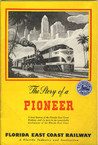
194638206St. Augustine: Private printing 1946. 1946. FLORIDA. 9" x 6" colorful pictorial wrappers. Foreword. 44pp. including wrappers. Black and white map of Florida high-lighting the Florida East Coast Railway from Jacksonville to Miami. Black and white photographs include a portrait of Henry Morrison Flagler the builder of the Florida East Coast Railway Flagler System Hotels and associated enterprises. A pioneer of the East Coast of Florida. "Linking the entire east coast of Florida with a transportation system and establishing tourism and agriculture as the basis of the state’s economy at the time was largely an uninhabited frontier demanded a great deal of foresight and perseverance. More than a century later the mainstays of Florida’s economy are still agriculture and tourism and Flagler’s incredible legacy as the inventor of modern Florida can still clearly be seen throughout Florida." This booklet is well written and provides an interesting summarized history of the Florida East Coast Railway and the development of the area it served. Soiling to wrappers a "Railroadians of America" sticker to front wrapper else a good copy of an informative booklet. Private printing, 1946. unknown
191015233St. Augustness: The Record Company 1910. First Edition. Pamphlet. Near fine. Promotional booklet for Orlando located in Orange County Florida published by The Record Company circa 1910. Oblong octavo 32pp. Publisher's maroon wrappers title printed in gold on cover bound at spine with staples. Sunning to covers staples beginning to rust. A scarce pamphlet showing the local infrastructure farming operations municipal buildings and churches all in half tone illustrations. Illustrations likely by Clarence E. Howard who worked as a photographer and newspaper editor. A reference to the first Automobile Carnival dates this pamphlet prior to 1912. OCLC 882242309 A scarce work. Orlando Florida traces its roots back to the 1830s during a period marked by the Seminole Wars where the U.S. Army built Fort Gatlin south of the present-day Orlando city limits to protect settlers from attacks by Native Americans. By 1840 the area around Fort Gatlin was settled leading to the growth of a small community that by 1856 was known as Jernigan named after the Jernigan family who established the first permanent settlement. The name Orlando was adopted in 1857 though the origin of the name is subject to various legends one of the most popular claims it was named after Orlando Reeves a soldier who allegedly died in the area during the Second Seminole War. The city was officially incorporated in 1875 and by the late 19th century Orlando became a significant hub for Florida's citrus industry. The Record Company unknown
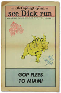
197254577Miami: Florida People's Coalition 1972. Hardcover. Very good. Hardcover. 16. Newsprint paper in tabloid format. Pages tanned as usual with horizontal fold to the middle else very good. Three color "Confront the GOP Convention" centerfod. Possible one shot published to bring attention and funds for the Florida People's Coalition. <br/><br/> [Florida People's Coalition] hardcover
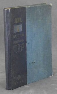
19380086079Miami Beach FL: Davis and Campbell 1938. Hardcover. Very Good. 1938. Hardcover folio spiral-bound in cloth-backed boards. 196 pp. profusely illustrated with b&w photos. Very Good. Rubbing and light soil to the boards; corners worn; faint dampstain to upper corner of the first 10 pages only; otherwise clean and unmarked. A rare book -- OCLC locates only 10 copies. A showcase of the area at its peak includes The Hollywood Beach Hotel Stetson University the Gulfstream Apartments Whitman Kenmore Hotel El Comodoro Miramar as well as sections on Cuba Key West Palm Beach Tampa Winter Haven and many many more. Davis and Campbell hardcover
192140729Washington D.C.: Published by the United States Coast and Geodetic Survey 1921. Large folding nautical chart printed on heavy paper stock. Colored. A rare original coastal survey of the Northern Gulf coast from Florida to Louisiana encompassing Panama City Rosemary Beach Seaside Grayton Destin Pensacola Gulf Shores Mobile Gulfport and the Mississippi Delta.<br/> <br/> Established by President Thomas Jefferson in 1807 as the Survey of the Coast the U.S. Coast and Geodetic Survey was the United States' first civilian scientific agency. This agency has followed its mission to survey the U.S. coastline create nautical charts of the coast and help increase maritime safety since its founding and has often played fascinating roles in significant chapters of U.S. history. It served in all theaters of the Civil War in the service of the Union Army and Navy pioneered acoustic exploration in the wake of the sinking of the Titanic and during WWI it worked to detect enemy submarines. In addition this agency worked to survey and produce detailed maps and renderings of the U.S. coast. These nautical survey maps commonly referred to as "T-sheets" provide fascinating insights into the history of the United States coastline which has and will continue to shift. These maps are the most important data source for understanding the physical and ecological characteristics of the U.S. shoreline. The present map is a highly detailed and accurate sea chart of the Gulf coasts of Florida Alabama Mississippi and Louisiana and an important historical view of the developing states. Published by the United States Coast and Geodetic Survey unknown
191940687Washington D.C.: Published by the United States Coast and Geodetic Survey 1919. Nautical chart printed on heavy paper stock. Colored. A rare coastal survey of the Florida Georgia and South Carolina including Daytona Palm Coast St. Augustine Ponte Vedra Amelia Island Jacksonville Fernandina Jekyll Island St. Simons Sea Island Tybee Savannah Hilton Head Kiawah and Folly Beach.<br/> <br/> Established by President Thomas Jefferson in 1807 as the Survey of the Coast the U.S. Coast and Geodetic Survey was the United States' first civilian scientific agency. This agency has followed its mission to survey the U.S. coastline create nautical charts of the coast and help increase maritime safety since its founding and has often played fascinating roles in significant chapters of U.S. history. It served in all theaters of the Civil War in the service of the Union Army and Navy pioneered acoustic exploration in the wake of the sinking of the Titanic and during WWI it worked to detect enemy submarines. In addition this agency worked to survey and produce detailed maps and renderings of the U.S. coast. These nautical survey maps commonly referred to as "T-sheets" provide fascinating insights into the history of the United States coastline which has and will continue to shift. These maps are the most important data source for understanding the physical and ecological characteristics of the U.S. shoreline. The present map is a highly detailed and accurate sea chart of the coasts of Florida Georgia and Alabama and an important historical view of the developing states. Published by the United States Coast and Geodetic Survey unknown
190840737Washington D.C.: Published by the United States Coast and Geodetic Survey 1908. Large folding nautical chart printed on heavy paper stock. Colored. A rare original coastal survey of the Gulf coasts of Florida Alabama Mississippi and Louisiana including the Keys Fort Myers Sarasota Tampa Panama City Destin Pensacola Gulf Shores Mobile Biloxi Gulfport New Orleans and the Mississippi Delta.<br/> <br/> Established by President Thomas Jefferson in 1807 as the Survey of the Coast the U.S. Coast and Geodetic Survey was the United States' first civilian scientific agency. This agency has followed its mission to survey the U.S. coastline create nautical charts of the coast and help increase maritime safety since its founding and has often played fascinating roles in significant chapters of U.S. history. It served in all theaters of the Civil War in the service of the Union Army and Navy pioneered acoustic exploration in the wake of the sinking of the Titanic and during WWI it worked to detect enemy submarines. In addition this agency worked to survey and produce detailed maps and renderings of the U.S. coast. These nautical survey maps commonly referred to as "T-sheets" provide fascinating insights into the history of the United States coastline which has and will continue to shift. These maps are the most important data source for understanding the physical and ecological characteristics of the U.S. shoreline. The present map is a highly detailed and accurate sea chart of the coasts Florida Alabama Mississippi and Louisiana along the Gulf of Mexico and an important historical view of the developing states. Published by the United States Coast and Geodetic Survey unknown
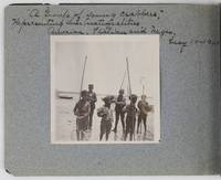
19012885Various locations in Florida 1901. About very good. 16 leaves illustrated with thirty-two original vernacular photographs all 3.5 x 3.5 inches most with manuscript captions in ink above the images. Oblong octavo. Contemporary gray paper wrappers white titles on front cover. Spine mostly split a few shallow chips to edges. Internally clean. A small but important vernacular photograph album containing rare views of the devastation wrought by the Great Fire of 1901 in Jacksonville Florida which took place on May 3 1901. The most destructive event in the history of Jacksonville the Great Fire swept through 146 city blocks destroying over 2000 buildings killing seven people and leaving almost 10000 residents without homes. It is considered the third-largest urban fire in United States history after the Great Chicago Fire and the 1906 San Francisco conflagration.<br /> <br /> The photographs in the present album were taken by an unidentified passenger aboard the Clyde Line steamer Comanche. Eight of the images capture the scene in devastated Jacksonville including a shot of the ruins of the Windsor and St. James hotels shots from atop the "Jacksonville Government Building" a group picture of the city guard "ruins of Jacksonville Court House" "An unknown ruin" a crowded scene at the Jacksonville wharf and a distant shot showing "Ruins of Jacksonville taken from Steamer Comanche May 12." All of the photographs of Jacksonville are dated in manuscript on May 12 1901 nine days after the Great Fire.<br /> <br /> In addition to the Jacksonville pictures other identified locations along the photographer's voyage include the Hillsborough River near Tampa the Tampa Court House scenes around the Tampa Bay Hotel family pictures in Florida the Comanche and its crew Fort Sumter and four views around Charleston. One particularly notable photograph shows six boys standing in shallow water holding fishing nets likely near Tampa. The image is captioned "A group of young crabbers representing three nationalities American Italian and Negro May 10 1901. unknown
191640717Washington D.C.: Published by the United States Coast and Geodetic Survey 1916. Large folding nautical chart printed on heavy paper stock. Uncolored. Rare original coastal survey of Florida's Apalachee bay.<br/> <br/> Established by President Thomas Jefferson in 1807 as the Survey of the Coast the U.S. Coast and Geodetic Survey was the United States' first civilian scientific agency. This agency has followed its mission to survey the U.S. coastline create nautical charts of the coast and help increase maritime safety since its founding and has often played fascinating roles in significant chapters of U.S. history. It served in all theaters of the Civil War in the service of the Union Army and Navy pioneered acoustic exploration in the wake of the sinking of the Titanic and during WWI it worked to detect enemy submarines. In addition this agency worked to survey and produce detailed maps and renderings of the U.S. coast. These nautical survey maps commonly referred to as "T-sheets" provide fascinating insights into the history of the United States coastline which has and will continue to shift. These maps are the most important data source for understanding the physical and ecological characteristics of the U.S. shoreline. The present map of the Florida coastline is notable for the inclusion of St Marks light house built at the head of the St Marks River to assist in navigation to and from the important 19th century agricultural port of St Marks. This map is a highly detailed and accurate sea chart of the Apalachee Bay from Fish Creek to Alligator Point and an important historical view of a developing Florida. Published by the United States Coast and Geodetic Survey unknown
191640680Washington D.C.: Published by the United States Coast and Geodetic Survey 1916. Large folding nautical chart printed on heavy paper stock. Colored. A rare coastal survey of Apalachee Bay including Alligator Point and St. George Island.<br/> <br/> Established by President Thomas Jefferson in 1807 as the Survey of the Coast the U.S. Coast and Geodetic Survey was the United States' first civilian scientific agency. This agency has followed its mission to survey the U.S. coastline create nautical charts of the coast and help increase maritime safety since its founding and has often played fascinating roles in significant chapters of U.S. history. It served in all theaters of the Civil War in the service of the Union Army and Navy pioneered acoustic exploration in the wake of the sinking of the Titanic and during WWI it worked to detect enemy submarines. In addition this agency worked to survey and produce detailed maps and renderings of the U.S. coast. These nautical survey maps commonly referred to as "T-sheets" provide fascinating insights into the history of the United States coastline which has and will continue to shift. These maps are the most important data source for understanding the physical and ecological characteristics of the U.S. shoreline. The present map is a highly detailed and accurate sea chart of the Apalachee Bay and an important historical view of a developing Florida. Published by the United States Coast and Geodetic Survey unknown
192040721Washington D.C.: Published by the United States Coast and Geodetic Survey 1920. Large folding nautical chart printed on heavy paper stock. Uncolored. A rare original coastal survey of Apalachicola Bay and Cape San Blas including St. George Island.<br/> <br/> Established by President Thomas Jefferson in 1807 as the Survey of the Coast the U.S. Coast and Geodetic Survey was the United States' first civilian scientific agency. This agency has followed its mission to survey the U.S. coastline create nautical charts of the coast and help increase maritime safety since its founding and has often played fascinating roles in significant chapters of U.S. history. It served in all theaters of the Civil War in the service of the Union Army and Navy pioneered acoustic exploration in the wake of the sinking of the Titanic and during WWI it worked to detect enemy submarines. In addition this agency worked to survey and produce detailed maps and renderings of the U.S. coast. These nautical survey maps commonly referred to as "T-sheets" provide fascinating insights into the history of the United States coastline which has and will continue to shift. These maps are the most important data source for understanding the physical and ecological characteristics of the U.S. shoreline. The present map of the Florida coastline precedes the development of the town of Eastpoint and the building of the John Gorrie Memorial Bridge which connects Eastpoint with Apalachicola. The current site of Eastpoint is marked as Godleys Bluff on the present map. This map is a highly detailed and accurate sea chart of the coastal Florida and an important historical view of the developing state. Published by the United States Coast and Geodetic Survey unknown
191840712Washington D.C.: Published by the United States Coast and Geodetic Survey 1918. Large folding nautical chart printed on heavy paper stock. Colored. A rare original coastal survey of Florida from Jupiter to Tampa including West Palm Beach Miami Boca Raton Fort Lauderdale Miami the Keys and Fort Meyers as well as the Bahamas and a partial mapping of the northern Cuban coastline including Havana.<br/> <br/> Established by President Thomas Jefferson in 1807 as the Survey of the Coast the U.S. Coast and Geodetic Survey was the United States' first civilian scientific agency. This agency has followed its mission to survey the U.S. coastline create nautical charts of the coast and help increase maritime safety since its founding and has often played fascinating roles in significant chapters of U.S. history. It served in all theaters of the Civil War in the service of the Union Army and Navy pioneered acoustic exploration in the wake of the sinking of the Titanic and during WWI it worked to detect enemy submarines. In addition this agency worked to survey and produce detailed maps and renderings of the U.S. coast. These nautical survey maps commonly referred to as "T-sheets" provide fascinating insights into the history of the United States coastline which has and will continue to shift. These maps are the most important data source for understanding the physical and ecological characteristics of the U.S. shoreline. The present map is a highly detailed and accurate sea chart of Southern Florida and the Northern Caribbean region and an important historical view of a developing Florida. Published by the United States Coast and Geodetic Survey unknown
191640693Washington D.C.: Published by the United States Coast and Geodetic Survey 1916. Nautical chart printed on heavy paper stock. Colored. A rare coastal survey of Florida from Sanibel Island to Fort Myers Beach including Naples and Marco Island.<br/> <br/> Established by President Thomas Jefferson in 1807 as the Survey of the Coast the U.S. Coast and Geodetic Survey was the United States' first civilian scientific agency. This agency has followed its mission to survey the U.S. coastline create nautical charts of the coast and help increase maritime safety since its founding and has often played fascinating roles in significant chapters of U.S. history. It served in all theaters of the Civil War in the service of the Union Army and Navy pioneered acoustic exploration in the wake of the sinking of the Titanic and during WWI it worked to detect enemy submarines. In addition this agency worked to survey and produce detailed maps and renderings of the U.S. coast. These nautical survey maps commonly referred to as "T-sheets" provide fascinating insights into the history of the United States coastline which has and will continue to shift. These maps are the most important data source for understanding the physical and ecological characteristics of the U.S. shoreline. The present map is a highly detailed and accurate sea chart of the coast around Fort Myers and an important historical view of a developing Florida. Published by the United States Coast and Geodetic Survey unknown