LouisianaABAA
2 résultats
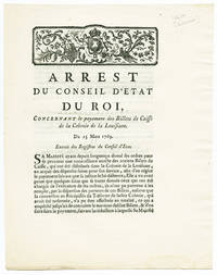
1769WRCAM34675Paris 1769. 3pp. Quarto on a folded folio sheet. Light dampstaining in bottom corner; three small worm holes in upper corner not affecting text. Near fine. A series of articles governing the settlement of certain French accounts left over from France's possession of Louisiana after the turnover of the territory to Spain in 1763. Wroth locates only the copy at the John Carter Brown Library; OCLC adds no more. Rare. MAGGS FRENCH COLONISATION OF AMERICA 571 this copy. WROTH ACTS OF FRENCH COLONIAL ADMINISTRATION 1790. unknown books
1720WRCAM48868Amsterdam 1720. Single-sheet map 9 3/4 x 7 3/4 inches. Minor foxing. Near fine. A scarce early map of the Mississippi River Valley depicting the American region between the Gulf of Mexico and the Great Lakes taken from HET GROOT TAFEREEL DER DWAASHEID. THE GREAT MIRROR OF FOLLY a scathing account of the speculative crashes that led to European financial disaster in 1720. The work was a chronicle of the failed attempts by John Law Controller General of Finances for the French government to open Louisiana to trade in order to help alleviate France's financial problems. This led to the creation of the Mississippi Company which created the "Mississippi Bubble" incident that destroyed the Banque Générale Privée the General Private Bank which Law founded. The map depicts the Mississippi River parts of Louisiana and Florida Lake Michigan referred to here as "Lac de Illionis" and Lake Superior the extent of French colonial explorations in the region and names of Indian tribes. It is decorated with a title cartouche incorporating the arms of John Law and depicting two Native Americans holding a cornucopia through which flows the mighty Mississippi River. unknown books
