231 résultats
1885WRCAM54057St. Paul Mn 1885. 64pp. with in-text illustrations. Original pictorial wrappers extracted from larger volume. Very good. An attractive 1885 promotional publication by the Northern Pacific Railroad providing detailed descriptions and numerous illustrations of attractions to be taken advantage of along their routes from Minneapolis and Saint Paul to Seattle and thence to Alaska. Includes a map illustrations and descriptions of Yellowstone. unknown books
188327620St. Paul: Brown & Treacy 1883. Original printed and illustrated wrappers. 96pp. Wraps worn blank inner margins with binding holes and some separation of the text block from the wraps. Else Very Good. Profusely illustrated. Blank verso of front wrapper with small plate 'Presented by J. Fletcher Williams St. Paul Minn.' <br/><br/> The story of the Railway its completion details of the celebration and the attractions of St. Paul "the Northwestern Metropolis."<br/>BRE 243. Brown & Treacy unknown books
188025667New York City: Eastern Office Oregon Railway and Navigation Co.; Franklin Press: Rand Avery & Co. Boston 1880. 59 1 blank pp large 17" x 19" folding Colton color map of Oregon Washington Territory part of Idaho. A few short splits along folds with no loss. Original printed wrapperssoiled and worn. Scattered spotting. A few small chips and wormholes at corners of outer leaves closed tear to title page no text loss. Good.<br/><br/> "To meet the constant and increasing demand for full information as to the climate and resources of both Eastern and Western Oregon the present pamphlet is issued. In this compilation use is made of matter entertained in pamphlets issued by Oregon State Board of Immigration. The reader is given a few of the disinterested opinions of travellers map and tables showing all that may be desired in order to arrive at a correct knowledge of this state as gathered from Facts and Figures."<br/>Adams Herd 1729. Eastern Office, Oregon Railway and Navigation Co.; Franklin Press: Rand, Avery, & Co., Boston unknown books
1852102298Pamphlet 8vo folding map 17" x 34" 16 3 pp. Rear wrapper detached with some chips and tears are extremities pencil notation and ink number on top of front wrapper with a few nicks large folding map difficult to open because of the way its attached to joint but in really nice condition; otherwise good to very good. This pamphlet presents the results of a survey between Phoenixville and Pinegrove for the purpose of building a railroad. The work includes considerable financial and survey information and an excellent folding "Map of Railroad Route from Phoenixville to Pinegrove 1852." King & Baird, books
18393117Salem: William Ives 1839. Folding map. 36 pp. 8vo. Stiff wrappers. Very good. Folding map. 36 pp. 8vo. The map shows the rail starting at the Merrimack River through Salisbury then Hampton to Portsmouth. Shaw & Shoemaker 55470; NUC 5 locations William Ives unknown books
18679683Saint Paul: Ramaley & Hall 1867. Original printed dark blue wrappers clipped at upper corner of front wrap some wear. 15pp. Folding Map of the St. Paul & Chicago Railway Connecting the Railway System of Minnesota and the Hudson Bay Company's Territory with Chicago and the East. Very Good. <br/><br/> The Road offers bonds to finance the construction of the "railway from St. Paul to Winona one hundred and one miles where it will connect with the present system of railroads leading to Chicago and Milwaukee." The route will be through a number of towns "sustained by a very rich agricultural back country" and is "almost upon an air line from St. Paul to Winona La Crosse Madison and Chicago." <br/>FIRST EDITION. 135 Eberstadt 532. Not in Modelski Phillips Maps of America. Ramaley & Hall unknown books
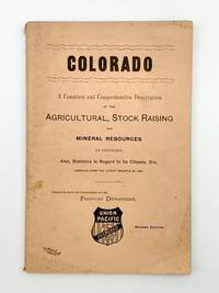
1889403718Chicago: Rand McNally & Co 1889. 8vo. 91 pp. Original salmon printed wrappers. Light wear. Second edition. The wrapper title is: 'Colorado. A Complete and Comprehensive Description of the Agricultural Stock Raising and Mineral Resources of Colorado; Also Statistics in Regard to its Climate Etc. Compiled from the Latest Reports of 1868.' Printed on the inner front wrapper is a map of the Union Pacific Overland Route from the Pacific Ocean in the West to Omaha in the East. <br/><br/> Rand, McNally & Co unknown books
186019670Trenton: Murphy & Bechtel 1860. Original printed wrappers light numerical rubberstamp rear wrap torn stitched 80pp. Scattered foxing Good. <br/><br/> The head of the wrapper title reads 'Read and Hand to your Neighbor.' "A condemnation of the Camden and Amboy Railroad Company and the railroad monopoly in New Jersey. The anonymous author examines the various railroad bills presented at the recent session of the legislature and demonstrates the power of the monopoly interests in influencing the legislators to pass or reject bills according to the wishes of the monopoly. Most of the pamphlet is devoted to the bill for a Hoboken and Newark railroad and the dispute between the Camden and Amboy Railroad Company and the New Jersey Railroad Company." Felcone. <br/>FIRST EDITION. Felcone 710. Murphy & Bechtel unknown books
1870WRCAM34145New York: E. & H.T. Anthony & Co. 1870. Single stereocard 3 1/2 x 7 inches. Stereo image mounted onto printed orange cardstock. Slight wear at edges. Very good. An appealing stereocard image showing several long stretches of railroad track heading into the small town of Ogden Utah. It is a view of an important point crossing point in American railroad history as Ogden is the point at which the Union Pacific Railroad ends and the Central Pacific begins. A train can be seen on the tracks in the far distance as well as a few clapboard buildings. The New York photographic firm of E. & H.T. Anthony & Co. produced several stereoscopic views for the Central Pacific Railroad though few are known today. A nice image of an important railroad intersection. E. & H.T. Anthony & Co. unknown books
187023299New York: Brown & Hewitt 1870. 32pp original printed wrappers light dust and wear stitched. Double-page map of the route with boundaries of Iowa Minnesota Wisconsin Missouri and Illinois outlined in yellow. Very Good. <br/><br/> The pamphlet contains much information on the resources and economic potential of the State of Iowa and the midwest the traffic that the road will bear grain markets the business of the road and the nature of the investment.<br/>BRE 190. Not in Modelski or Sabin. Brown & Hewitt unknown books
187023298New York: Brown & Hewitt 1870. 32pp original printed wrappers light dust and wear front wrap detached but present stitched. Double-page map of the route with boundaries of Iowa Minnesota Wisconsin Missouri and Illinois outlined in yellow. Map and text Near Fine overall Very Good plus. <br/><br/> The pamphlet describes the resources and economic potential of Iowa and the midwest the traffic that the Road will bear grain markets the business of the Road and the nature of the investment. <br/>BRE 190. Not in Modelski or Sabin. Brown & Hewitt unknown books
18721008158vo pamphlet original printed wrappers maps on inside front wrapper and the back of the rear wrapper 32 pp. Wrappers with a few chips in the margins and some minor soiling bottom right corner somewhat creased; otherwise very good or better. The railroad uses this pamphlet to help recoup some of its investment by selling land to immigrants and settlers. It tells prospective immigrants when to settle benefits of raising livestock in this area conditions for land purchases and the type of accommodations they can expect on arrival. It also informs people that prospective settlers can get free transportation and that soldiers and sailors can get free houses. Basically this pamphlet tells a person everything they need to know about getting land in this territory. The map on the back of the rear wrapper covers most of the United States. Northern Pacific Railroad Company, books
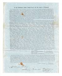
184757241Plymouth: April 17 1847. Broadside letter approx. 10¾" x 8" on blue paper signed in type by the Committee of the CCBRR J. B. Tobey Thos. J. Coggeshall Wm. Bates and Philander Washburn and also by Josiah Smith as Chairman of C. Commissioners. Signed in ink at the bottom: "A true copy / attest Branch Harlow / Shff." Petition requesting the commissioners to adjudicate damages caused to landowners from a proposed road from Middleborough through parts of Rochester and Wareham listing the names of about 100 interested parties. The petition was apparently successful: a 15 mile line was opened by the company between Middleborough and Wareham in 1848 and extended another 13 miles to Sandwich the same year. The Cape Cod Branch subsequently merged with the Old Colony and Newport Railway to form the Old Colony Railroad in 1872. Not in OCLC. <br/><br/> April 17 unknown books
188432382Chicago: compliments of Passenger Department of the Burlington Route Rand McNally printers and engravers 1884. First edition 8vo pp. 30 2; 8 wood-engraved plates on bronze paper original pictorial bronze wrappers edges a little worn chips out at the top and the bottom of the spine but in all a very good copy. <br/><br/> compliments of Passenger Department of the Burlington Route, Rand McNally printers and engravers unknown books
18851387Chicago: Chas. N. Trivess 1885. About very good. 16pp. Original printed wrappers stapled. Light to moderate foxing to covers some light wear. A promotional work for the railroad this pamphlet is subtitled "A few testimonies of the results obtained from farming in this wonderful region." The text is comprised of letters written by real residents in this "Wonderland of the Northwest" noting bountiful crop yields and cheap land. The rear cover is a map of the Chicago and Northwestern Railway showing routes from Chicago out to Iowa Minnesota Wisconsin Nebraska and the Dakotas. Relatively scarce. Chas. N. Trivess unknown books
188433877New York: Sackett 1884-1892. First Edition. 1884. 64pp. illuslarge fold map at rear. Orignal printed wrappers $100 1885. 40pp. illuslarge fold map at rear. Orignal printed wrappers $100 1887. 40 51pp. Original printed wrappers. $75 1892. 96pp. illus two large fold maps at rear. Original printed wrappers $100 Sackett unknown books
186133741Wash D.C.: Polkinhorn 1861. First Edition. 23pp. Orig ptd wrps. First ed. Signed in type at end: "Cincinnation Deals with California the Pacific Railroads Mexico Sandwich Islands etc. Scarce. Not in Eberstadt Decker Graff Cowan or Forbes Polkinhorn unknown books
18501008148vo pamphlet later paper wrappers two folding maps 117 2 pp. Minor foxing and browning a bit of staining in the margins mostly maps also have the staining in margins but are in great condition otherwise; overall very good. The goal of this bill in the House of Representatives was to connect the Atlantic and Pacific with a railroad. Specifically this undertaking was to construct a railroad and electric telegraph from the Mississippi to the Pacific Ocean. Whitney seems to have played a critical role in this process and started to work on the railroad project as early as 1841. The pamphlet contains a lot of information on early railroad issues especially imports and exports. books
1867WRCAM36119Saint Paul 1867. 15pp. plus folding map. Original printed wrappers. Lacking rear wrapper. Ex-lib. with institutional inkstamp and blindstamp on front wrapper. Small numerical ink inscriptions on front wrapper. Small tear along folds of map without loss. Overall a very good copy of this fragile and crudely printed item. The map which was printed by Baker of Chicago and then married with the text prior to issue at St. Paul delineates the extent of the rail lines in Minnesota with the trunk projected to beyond the Canadian border and branches to Sioux City Superior etc. Included are estimates of profits to be accrued from tonnage as well as the eventual sale of the granted lands. BRE p.263. unknown books
1896318708San Francisco: Issued by The Wheeler Publsishing Co. 22 Clay Street 1896. First edition. Frontispiece of Claus Speckels. Photographs taken by Tabor of San Francisco and Spooner of Stockton Cal. 224pp. 4to. Publishers three quarters green morocco faded to brown. Very nice copy. First edition. Frontispiece of Claus Speckels. Photographs taken by Tabor of San Francisco and Spooner of Stockton Cal. 224pp. 4to. The San Francisco and San Joaquin Valley Railway lasted from 1895 to 1901 when it was beame part into the Atchison Topeka and Santa Fe Railroad. Issued by The Wheeler Publsishing Co. 22 Clay Street unknown books
1873697671873. Hardcover. Good. Circa 175 pages of holograph text; remainder of book blank. Scuffed leather minute book. 34cm. Ruled pages. This railroad seems to been relatively short running from the Connecticut border south of Longmeadow Massachusetts to East Hartford. At the final 1887 meetings of the stockholders and directors recorded in this minute book the Company appeared to be facing a foreclosure suit by the Connecticut State Treasurer. The railroad appears to have ceased in 1887. <br/><br/> hardcover books
1869WRCAM38155Mexico: Tipografia Mexicana 1869. 33pp. 12mo. Dbd. Ink stamp in upper outer corner of titlepage. Upper outer corner of final blank leaf chipped. Old faint dampstain in upper edge. Withal still about very good. A rare pamphlet promoting a major Mexican railroad company with plans to build a line across Mexico to the Pacific Ocean. The by- laws are statutes of the railroad are given its capitalization is discussed and the officers listed. Mariano Riva Palacio was the President of the railroad company and Edmundo Stephenson whose name appears at the end of this report is listed as the Vice President. Mariano Riva Palacio was a prominent Mexican statesman with a distinguished record of political and economic reform. He served as governor of the State of Mexico several times and though an ardent republican defended the Emperor Maximilian at Queretero. OCLC locates only two copies - at Tulane University and New Mexico State. Rare. OCLC 16830002. Tipografia Mexicana unknown books
18861077Omaha: Burlington Route 1886. About very good. 9616pp. Original red printed wrappers. Spine worn and chipped corners worn. Internally clean. A book of "social amusements" and games "Presented with the compliments of the Passenger Department of the Burlington Route." The final few leaves contain a map of the Burlington Route from Chicago to Denver as well as numerous advertisements. Burlington Route unknown books
186323142New York: Colton 1863. Folded into original 16mo red cloth binding a bit shaken with title stamped in gilt on the front cover: MAP OF THE STATE OF NEW-YORK ACCOMPANYING THE LEGISLATIVE MANUAL Weed Parsons & Co. Map is @25" x 27 1/2" hand colored and enclosed within an ornamental border. Inner margin @10" tear affecting the border but not the map light occasional wear else Very Good. Colton unknown books
1887WRCAM41664Manchester & Concord N.H. 1887. Nineteen pamphlets being the 1st 9th 15th 20th 24th-37th and 39th Reports. All stitched in original printed wrappers except first and twentieth which are stitched as issued. Minor scattered soil. Very good. The Manchester & Lawrence Railroad was chartered in 1847 to build a railroad from Manchester New Hampshire to the Massachusetts border. The reports here detail its operations for nearly forty years. unknown books