377 résultats
1844GD012817okBC1S5Manchester: Wetmore & Wallace 1844. Manchester: Wetmore & Wallace Rare Americana 1844 First Printing. 8vo. 16 pages with folding map at rear of wrappers. The folding map titled :Plan and Profile of the Route Surveyed for the Northern Railroad from Concord to Lebanon N.H." measuring approxinately 28" long and 9" wide. The map is in extremely nice condition. The spine shows some wear but remains a very nice copy. A signature of S.Chase" appears on the front wrapper. There is an institional rubber stamp on the margin of page 3. Vermont Historical Society Montpelier Vermont. This report printed by Wetmore & Wallace Printers in Manchester New Hampshire presents the findings of an engineer's survey for the Northern Railroad route. It covers the planned railroad connections between Concord Franklin and complete with Lebanon along the Connecticut River. Published in 1844 this document provides historical insight into the development of New Hampshire early railroad infrastructure and the engineering challenges faced in the region at that time. Scarce copy last auction records 1930. First Printing. Paperback. Good/No Jacket. 8vo - over 7¾" - 9¾" tall. Manchester: Wetmore & Wallace
1851406078New York: Wm. C. Locke & Co 1851. Wrappers chipped at edges professionally rebacked some unobtrusive offsetting on map. 8vo. 50 pages. Large folding map on three joined sheets 21 x 1788 cm; 8.25 x 61.75 inches. 11 woodblock illustrations in text and with 2 more not recorded in the index but always present. Original printed wrappers with woodblock vignette. SCARCE Hudson River Railroad travel guide published the first year in which the full line was completed. It covers points of interest along the route with woodblocks illustrating the text. Topics include: the history of the Hudson River the history of the construction of the Hudson River Railroad and the cities towns and villages along the Hudson from New York City all the way to Troy. <br /> <br /> Concerning the West Point Foundry at Cold Spring the guide states: "the iron foundry was established here by Gouverneur Kemble. The works are situated about a mile west of the village upon a small stream which tumbles rapidly down the mountains affording considerable water power. It is the largest establishment of its kind in the country employing nearly five hundred hands constantly."<br /> <br /> The building of the Hudson River Railroad is another topic in the guide. The project was considered highly impractical since much of the route had to be cut through extremely difficult rock and terrain. This section includes a description of the tunnels which had to be constructed. <br /> <br /> The railroad was opened in three stages. In September 1849 it allowed passengers to travel from New York to Peekskill. By that December 6 twenty-three additional miles were opened extending to New Hamburg. By the 31st of the month it was open the remaining distance of nine miles to Poughkeepsie. <br /> <br /> The Hudson River Railroad was an extension of the Troy and Greenbush Railroad which was chartered in 1845 connecting Troy South to Greenbush now Rensselaer on the east side of the Hudson. The Hudson River Railroad was chartered on May 12 1846 to extend this line south to New York City. The full line opened on October 3 1851 the same year in which this travel guide was published. WorldCat/OCLC records 25 copies but it is scarcely found complete with the map and the map is also excluded from the digitized versions available online. Wm. C. Locke & Co unknown
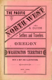
188250958New York: Land Dept. Northern Pacific Railroad Co. 1882. 1882. PACIFIC NORTHWEST. First edition. 8vo. Printed wrappers 81 pp. introductory illustrated large folding map at the rear. Scarce Western promotional travel guide to the Pacific North-West. Addressed to prospective settlers and travelers alike this guide consists of historical geographical and agricultural information and discusses at length matters such as commerce climate education taxes prices and the regions of the Pacific North-West. Each county is described and suggestions are provided to prospective emigrants such as "In mercantile pursuits the opening is good for men of enterprise and capital; but the chances for mere clerks are not good." Farm labor wages in these parts are recorded as being between $25 and $30 per month and lumber mills wages between $60 and $90 per month for first-class hands. It is also noted that "Chinamen work for the railroads and boards themselves at $1.00 a day and in winter take contracts for grubbing brush land." There are ten full-page illustrations which include a two-page "Bird's Eye View of Portland Oregon" "Saw Mill on Puget Sound W.T." "Astoria Oregon Entrance to Columbia River" "First Street Portland Oregon" and "Commercial Street Seattle W.T." with folding map of the region Unfolded 28 1/2 x 18 inches in the back. Spine and outer edges of wrappers sunned else very good copy. Land Dept., Northern Pacific Railroad Co., 1882. hardcover
1881List1934BCarson 1881. Single sided receipt measuring 7 ¾ x 4 ½ inches. Near fine with a small tear to bottom of page. Near Fine. A receipt issued for passage from Carson to Badie Nevada in 1881 aboard the Virginia and Truckee Railroad issued with a note that reads “Chinamen†in the remarks section. The Virginia and Truckee was originally built to service the Comstock Lode area in Nevada. Chinese who represented ten percent of Virginia City during the period referred to Nevada as “Yin Shan†which translates to “Silver Mountain.†Chinese people in Nevada held varied jobs in the state perhaps more so than in other parts of the United States with an 1870 census listing Chinese merchants miners laborers laundrymen cooks gamblers and harlots. Despite the heavy involvement of Chinese in Nevada during the period few ephemeral records surface in the trade likely due to the drops in population caused by the Chinese Exclusion Act and perhaps also due to the overall population drop when miners left the region. unknown
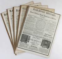
18563168Cincinnati 1856. Very good. Five issues and supplements totaling 72pp. Spines reinforced. Light tanning and dust soiling; scattered faint foxing. A lengthy extra issue of the Railroad Record with four additional eight-page supplements that together comprise a ringing endorsement from this industry periodical and its editors of the southern route through Texas and the Southwest for the American transcontinental railroad. The first two items of this extra published on October 4 1855 are by Texas Western Railroad owner and promoter Edgar Conkling who exhorts readers to examine the evidence supporting construction along the southern route and to invest in his railroad which was already sanctioned by the Texas state legislature as the text of two laws printed following his address demonstrate. Much of the issue is taken up by extracts from Secretary of War Jefferson Davis' positive report on the route through Texas and by a précis by Colonel A.B. Davis of his exhaustive survey of the proposed path through the recently completed Gadsden Purchase with a double-page map of the intended line. After several other attestations a subscription form is included at the rear for those who wish to purchase stock at $100 per share in the Texas Western Railroad Company. The additional four supplements dating from late 1855 and the first half of 1856 print more arguments in favor of the southern route including a lengthy letter from Thomas Butler King and lead articles with titles such as "What Shall Be Done for a Highway to the Pacific" and "Objections to the Construction of the Pacific Railroad reviewed." The Texas Western never built more than fifty miles of track connection Shreveport Louisiana and Marshall Texas and it was another twenty-five years before the Southern Pacific and Texas & Pacific Railroads connected near El Paso in 1881 to complete the "southern route" as it was originally conceived. unknown
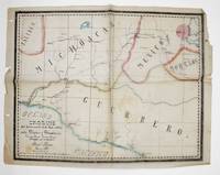
1881372908Mexico 1881. Manuscript map pen-and-ink and wash on onion skin paper. 15-1/2 x 20 inches. Folds and creases. Manuscript map pen-and-ink and wash on onion skin paper. 15-1/2 x 20 inches. Depicts the route of a railroad from Mexico City to Puente de Ixtla then north west to Toluca and west to Tancitaro with proposed transecting routes to connect the railroad from Pazo on the Atoyac River to Gihuatenejo on the Pacific coast. Pawel Primer evidently served as an engineer on the proposed railroad and this manuscript map was likely an addenda to a report issued to solicit investment in the project. The BNF holds two manuscript plans by Primer relating to archaeological sites. unknown
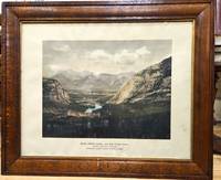
1900P5495Canada: Canadian Pacific Railway c.1900. Very Good . Notes: View of Banff Springs Hotel and Bow River Valley National Park-Rocky Mountains. It is framed in its original frame. <br>The Fairmont Banff Springs formerly and commonly known as the Banff Springs Hotel is a historic hotel in western Canada located in Banff Alberta. Image Size : 404x528 mm 15.91x20.79 Inches Platemark Size : Paper Size : 550x692 mm 21.65x27.24 Inches Coloring: Hand Colored Medium: Offset Lithograph Categories: Views Canada Alberta & British Columbia; Canadian Pacific Railway unknown
184829072New York: Van Norden 1848. The 1st annual report of the Hudson River Railroad not recorded on OCLC. Early reports authorizing the construction of the railroad from NY to Albany are dated 1848; the 2nd Annual Report of the Directors of the Hudson River Railroad is dated August 1849 <br /> The New York & Harlem Railroad NY&H was incorporated in 1831 to build a line in Manhattan from 23rd Street north to 129th Street between Third and Eighth Avenues the railroad chose to follow Fourth Avenue. At first the railroad was primarily a horsecar system but in 1840 the NY&H's charter was amended to allow it to build north toward Albany. In 1844 the rails reached White Plains and in January 1852 the NY&H made connection with the Western Railroad later Boston & Albany at Chatham New York creating a New York-Albany route. The Hudson was a busy river and the towns along it felt no need for a railroad - except during the winter when ice prevented navigation. Poughkeepsie interests organized the Hudson River Railroad in 1847. <br /> <br /> 8vo 24 page pamphlet. Printed paper wrappers one folding sheet of statistics tipped-in. Ex-lib with Hamilton College Library stamp and catalog numbers at front cover and slt foxing internally o/w very good. A fascinating first look at the Hudson River Rail line with the progress to date" now about 3000 men working between this city and Poughkeepsie the most of them between the city and Breakneck hill." p2. Van Norden unknown
187044035Omaha: Land Department Union Pacific Railroad Company 1870. 1870. First edition. First edition. 8vo. 8 3/4" x 5 3/4" printed wrappers with map on back cover 44 pp. introduction illustrated maps. The rear cover features a map of portions of Idaho Utah Wyoming Colorado Dakota Nebraska Kansas Missouri and Iowa. States where land grant bonds are available from the Union Pacific Railroad Company. The frontispiece is a map of the United States that shows the Union Pacific Railroad and its connections. A third map shows counties in Nebraska in 1870 and the Union Pacific Railroad lands first 200 miles grants of 1862-64. A description of the Nebraska lands are provided county by county. The available lands are contained in alternate sections of one square mile each within a breadth of twenty miles on either side of the railroad and extend along the entire line. They extend through central Nebraska southern Wyoming and northern Colorado and Utah and include within their limits the splendid agricultural lands of the Platte Valley the great natural pastures of the Laramie Plains and the valleys of Lodge Pole Creek and Bear River and the rich iron and coal fields between the Black Hills and the Wahsatch Mountains. Description advantages water resources climate soil live stock raising farming markets timber minerals information about homesteads advantages of living in colonies etc. Both Adams' Herd and Graff list similar titles but different years and claim their listings to be "rare." A small bump to the top edges light wear to the spine ends else a near fine copy. Land Department Union Pacific Railroad Company, 1870. unknown
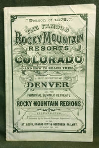
18757<b>A BRIEF DESCRIPTION </b><b>OF THE </b><b>FAMOUS ROCKY MOUNTAIN RESORTS </b><b>IN </b><b>COLORADO </b><b>and </b><b>HOW TO REACH THEM.</b><b><br />Compiled by the General Passenger and Ticket </b><b>Department of the St. Louis Kansas City &</b><b>Northern Railway</b><b><br />Season of 1875 </b><b>Illustrated </b><b><br /></b><b>COLORADO TERRITORY</b><b><br /></b><b>Publication dimensions: 4-3/4 inches by 7-3/8 inches; </b><b>52 pages </b><b><br /></b><b>Second Edition </b><b><br /></b><b>Including "Map of the Principal Resorts of Colorado" </b><b>on Page 22: </b><b>Supplement to "Guide Through Colorado" </b><b>Foldout engraving in front of publication by Arthur Lumley </b><b>"Famous Resorts in the Rocky Mountain Regions </b><b>Colorado" </b><b><br /></b><b>Dimensions: 17-1/2 inches by 11 inches </b><b><br /></b><b>Very good plus to near fine condition: some creasing on front cover; folded once vertically in distant past; interior pages clean bright and sturdy; folded engraving in near fine condition.<br />Historical Colorado railroad guide and map exhibited by: <b><b>COLORADO ARTIFACTUAL </b></b><b><b>& </b></b><b><b>MT. GOTHIC TOMES</b></b></b> General Passenger and Ticket Department of the St. Louis, Kansas City & Northern Railway
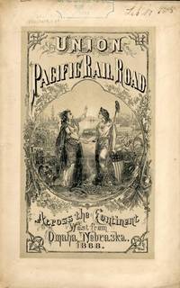
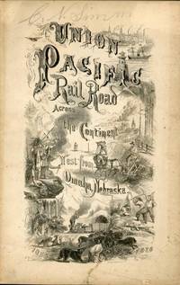
186854323New York: Published by the Company 1868. 1868. TRANSCONTINENTAL RAILROAD. First edition. Pamphlet edition. 8vo. Pictorial wrappers 40 pp. frontispiece Map of the Union Pacific Rail Road and its Connections introduction illustrated frontispiece map advertisement on rear cover for "First Mortgage Bonds at 102 principal and interest payable in gold with an annual income of "between eight and nine percent." This is an investment and advertising booklet for the first transcontinental railroad in the United States which was built by the Union Pacific Railroad and the Central Pacific Railroad in order to connect the Atlantic and Pacific coasts by rail for the first time. Begun in July of 1865 and built primarily by Civil War veterans the construction and completion of the Union Pacific line was one of the most significant technological and economic accomplishments of the 19th century creating the vital connection for commerce trade and travel and literally joining the eastern and western halves of the United States. Contents include the formation of the Union Pacific Railroad Company progress natural resources construction branch and connecting roads construction resources anticipated business & profits actual earnings and sale of first mortgage bonds. A list of officers of the company is provided. Top of front cover displays that this copy is mildly ex-library with stamp and number appearing at the upper right side a faint vertical fold to the center of the booklet tiny chips to bottom corner of front cover and a few preliminary pages. Overall a very good copy of an important railroad report. Published by the Company, 1868. unknown
186754322New York: Brown & Hewitt Printers 1867. 1867. TRANSCONTINENTAL RAILROAD. First edition. Pamphlet edition. 8vo. Pictorial wrappers 24 pp. frontispiece Map of the Union Pacific Rail Road and its Connections introduction illustrated frontispiece map advertisement on rear cover for "First Mortgage Bonds at six per cent. In gold at Ninety Cents on the Dollar. Light evidence of the entire booklet having been folded vertically penciled name to top of front cover covers lightly soiled and used small closed tear to the lower margin of the front cover Overall a very good copy of an important railroad report. Brown & Hewitt, Printers, 1867. unknown
187558911No place nor year but Paris presumably 1875. Folio. 32 plates 505 x 640 loosely incerted in two portfolios. A few plates with a few small nicks otherwise fine and clean. <br/><br/><em>Fine collection of plates distributed to pupils at "Ecole des Ponts et Chaussées". ROUTES / ROADSSerie 2_Section A_PL. 1Serie 2_Section A_PL. 2Serie 2_Section A_PL. 3Serie 2_Section A_PL. 4CHEMINS DE FER / RAILROADSSerie 4_Section D_PL. 6Serie 4_Section D_PL. 7Serie 4_Section D_PL. 8Serie 4_Section D_PL. 9Serie 4_Section D_PL. 10.Serie 4_Section D_PL. 11.Serie 4_Section D_PL. 12.Serie 4_Section D_PL. 13Serie 4_Section D_PL. 14PORTS MARITIMES / SEAPORTSSerie 6 Section F PL. 10Serie 6 Section F PL. 11Serie 6 Section F PL. 12Serie 6 Section F PL. 13TRAVAUX D'ASSAINISSEMENT DES VILLES / TOWN SANITATION WORKSSerie 8 Section B PL. 1Serie 8 Section B PL. 11Serie 8 Section B PL. 12MOTEURS À VAPEUR / STEAM ENGINESSerie 10_Section B_PL. 1Serie 10_Section B_PL. 2Serie 10_Section B_PL. 3Serie 10_Section B_PL. 4Serie 10_Section B_PL. 5Serie 10_Section B_PL. 6Serie 10_Section B_PL. 7Serie 10_Section B_PL. 8Serie 10_Section B_PL. 9Serie 10_Section B_PL. 10Serie 10_Section B_PL. 11Serie 10_Section B_PL. 12 </em> unknown
187742208St. Louis: A. Gast & Co. Lith. 1877. 1877. IOWA NEBRASKA. First edition. 8vo. 21.6 cm x 13.3 cm. Original printed yellow wrappers 31 1 pp. illustrated from two full-page pictorial plates three maps on verso of front cover and recto and verso of rear cover. Front map is of the great South Platte region. Map on inside rear cover is a map of Southern Iowa showing lands of the Chicago Burlington & Quincy Railroad Company that are available for sale Map on outside of rear cover is a map showing the leading through routes to the West and the land grants in Iowa & Nebraska of the Chicago Burlington and Quincy R. R. and Burlington & Missouri River Railroad in Nebraska. A scarce and interesting promotional for the sale of 1000000 acres of land owned along the routes of the Burlington and Missouri River Railroad. The Burlington and Missouri put out some of the most interesting and compelling railroad land promotionals in the genre nicely illustrated with maps and plates and this example is no exception. The maps show the lands for sale along the line of the railroad from Monroe Iowa to Omaha; lands in Nebraska from Omaha to Kearney along the South Platte; and a map showing railroad routes from Chicago. The plates are entitled "Looking Southwest from Lincoln Neb." and "Valley of the Big Blue South of Seward Neb." The text is devoted to detailed descriptions of the land including natural resources soil climate stock raising and homesteading opportunities and prices for land and for goods. This publication enjoyed some success; another promotional issued the next year advertised only 750000 acres of land left for sale indicating that the Burlington and Missouri had sold off a quarter million acres of land the previous year. Laid into this copy is a four-page "Circular of Rates on Tickets and Freight" for several railroads including the Burlington & Missouri. Not in Railway Economics nor in the Eberstadt or Decker catalogues. OCLC locates three copies at the American Antiquarian Society Harvard Business School Library and the DeGolyer Library. There is also a copy at Yale. This scarce promotional booklet has covers lightly soiled small chips to the covers covers holding but loose internally quite serviceable. Overall a very good copy. A. Gast & Co. Lith., [1877]. unknown
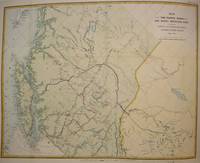
1874M7548Montreal: Canadian Pacific Railway 1874. Very Good; laid down on acid-free tissue paper for long-term preservation. Notes: A very important and early working map of Alberta and British Columbia depicting existing and suggested railways.<br>There is a note written in period ink in the lower margin in reference to a contemporary marking of newly suggested routes in black ink:<br><br>"Note -- The Surveys made since the publication of the Report & Maps of 1874 shew the routes colored full black line and thus broken black line to be the best lines for railway construction that have been found to this date Oct 1875. Mr. Smith".<br><br>"Mr. Smith" is believed to be Donald A. Smith a major partner in the yet-to-be incorporated Canadian Pacific Railway Company in 1881. <br><br>The routes marked out in red as printed depict potential lines crossing the Rockies to the west of Edmonton at Yellowhead Pass. Almost none of the suggested routes depicted on this map were eventually used--CPR dismissed the use of Yellowhead Pass for a pass farther south in order to discourage competition from railway lines south of the border. They chose instead Kicking Horse Pass which is depicted on this map. Size : 608x779 mm 23.94x30.67 Inches Coloring: Hand Colored Category: Maps Railroad; Maps Canada West British Columbia;Maps Canada West Alberta; Canadian Pacific Railway unknown
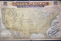
189649745Chicago: Rand McNally & Co. 1896. 1896. RAILROAD MAP. Oblong atlas folio. 37 x 56 in. One large color lithograph map mounted on linen showing the routes of the Union Pacific and subsidiary railroads in red with red yellow & black banner style lettering at upper fore-edge Union Pacific shields with mentions of subsidiary Railways mounted to upper & lower wooden rods as issued some minor lifting & creasing from being rolled over the years minor tide mark at left fore-edge upper fore-edge minor fraying and darkening still nice complete example of this map. First Rand McNally & Co. edition thus of this uncommon First Rand McNally & Co. edition thus of this uncommon Union Pacific Railroad route map intended to be used by travel agents and passenger agents in Union Pacific stations across the West. The map demarcates the Overland Route and connections with the Oregon Short Line RR Co. Oregon RR & Navigation Co. and the Southern Pacific in bold red stretching West from Kansas City Leavenworth St. Joseph Omaha Council Bluffs Sioux City & Fort Worth. A version of this map was initially released in 1892 by Reeves with the Knight Leonard & Co. and a little larger by a couple inches as it included insets for Sandwich Islands and Alaska whereas this version focuses only on the Continental United States. Rand McNally & Co., 1896. unknown
1900CANanGRA65np: c1900. 1900. oblong folio. ff. 23. 23 photographs of locomotives mounted on heavy card with specifications printed on reverse. original half leather album extremities bit worn light spotting to a few photos first photo with smudge & short tear. Hardcover. np: [c1900]. Hardcover
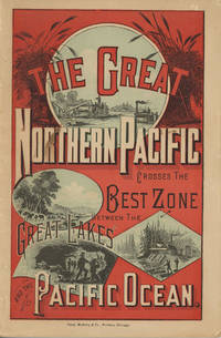
188249882Chicago: Rand McNally & Company 1882. 1882. First edition. 9" x 6" in color pictorial wrappers printed in red blue & black with vignettes of wheat threshing cattle mining and logging on front wrapper. 82pp. plus 2 pp. publisher's ads for Oregon Railway & Navigation Co. Contents. Illustrations. Maps. Uncommon Northern Pacific Railway land promotion detailing the sites and possibilities along the Northern Pacific route at the end of the 19th century. The work details the history of the NPRR divisions branch lines development opportunities for homesteaders and businesses in Western Washington the inner-mountain West Montana Yellowstone National Park the Dakotas Minnesota and specific land grants available from the NPRR in Minnesota and the Dakotas. Large color map attached to inside rear wrapper. Map fine. Light chipping to wrapper edges and with a few small closed tears to wrapper edges along with light soiling and rubbing to spine. Very good. Rand, McNally & Company, 1882. unknown
1860100432Large thick 4to contemporary calf spine and tips with marbled boards 70 very attractive color lithograph plates 358 41 pp. Extremeties worn minor aging one map has tear in lower corner plates bright and clean. The Pacific Railroad Surveys 1853-1855 explored possible routes for a transcontinental railroad. However the surveys went beyond looking for a place for a railroad they included and incredible amount of information on natural history and the peoples that inhabited the areas where the surveys explored. Representing the first part of the final volume of these surveys this installment focused on the northern route for a railroad. The 12 volumes included in these surveys is also known for rich illustrations many of which were in color. With 70 color plates one folding and three folding maps in Volume XII part 1 this edition is particularly rich in illustration and the plates are bright and clean. Thomas A. Ford hardcover
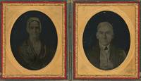
1854List1708Philadelphia 1854. Ninth plate ambrotypes in a union case measuring 2 ½ x 2 ⅛ inches visible in larger case. With the identification of Isaac Rehn with his imprint and “Patented July 4 & 11 1854†imprinted on the case. A fine pair. A striking pair of ambrotypes of Mary and Moses Pennock who were members of the Kennett Square Underground Railroad network as well as active members of the Kennett Square abolitionist and Quaker community. Moses was one of the founders of the Longwood Progressive Meeting. In R.C. Smedley’s History of the Underground Railroad in Chester and Neighboring Counties of Pennsylvania Lancaster Office of the Journal 1883 the Pennocks are mentioned on p. 301 as working as part of the network surrounding Isaac and Thamazine Meredity. Their son Samuel who would go on to secure important agricultural patents is also mentioned twice. <br /> <br /> The images are notable from a photographic history perspective as well as being early examples of the ambrotype process that had been patented in part by fellow Quaker and spiritualist Isaac Rehn. Rehn held a partial patent on ambrotypes along with James Ambrose Cutting of Boston and became unpopular among other photographers for his efforts to extend his patent. He later practiced spiritual photography and was a Professor of Chemistry at Pennsylvania Medical University in Philadelphia. Rehn was also involved in radical politics as a founder and leader of the Philadelphia section of the International Workingmen’s Association which was later disenfranchised by Karl Marx along with several other American sections. Examples of Rehn’s work are held at the National Gallery of Art the Library Company of Philadelphia and Yale’s Sterling Memorial Library. <br /> <br /> Overall a very fine and significant pair of images. unknown
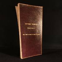
1890948F10London: Not Stated c1890 . Leather. Good. 17.5" by 9.5". Anonymous. An annotated and hand coloured lithograph map of the Severn Tunnel Railway belonging to the office of the Great Western Railway's Chief Engineer's Office. A vanishingly scarce lithograph map of the Severn Tunnel a tunnel linking South Gloucestershire to Monmouthshire built under the estuary of the River Severn and reaching a length of 4 miles 628 yards or 7012 m.Large portions of the map have been partially hand coloured with extensive annotations in both pencil and ink.With several stamps reading both 'Great Western Railway Chief Engineers Office Paddington' and 'To Be Returned to Chief Engineer's Plan Office G. W. R. Paddington' to both the recto and verso of the map.During the period of the tunnel railway's construction Chief Engineers of GWR included Joseph Armstrong William Dean and George Armstrong.The map is divided into fourteen plates mounted on linen and folding concertina style bound in morocco boards. The front board reads 'Severn Tunnel Railway: From 54 Miles 60 Chains to 7 Miles 50 Chains'.The majority of the pencil annotations detail the owner's and acreage of the pieces of land the railway runs through with the local Parishes of different sections of the railway also detailed. Further annotations include measurements and depths reference numbers for deeds and details of freeholds.A fascinating and very scarce map with a clear association to GWR the company responsible for constructing the tunnel offering insight into the land surrounding the tunnel. In the original limp morocco covered boards. Light rubbing to boards. Internally map mounted on linen and folding concertina style. Map significantly age toned with handling marks throughout. Large portion of map hand coloured with extensive pencil and ink annotations. Stamps throughout to both the recto and verso of the map. Good Not Stated hardcover
1900373823St. Louis 1900. 34 photographs mounted recto and verso on 17 cards with printed album title on each the images captioned in the negative on linen guards. Oblong small folio 10-1/8x12-1/2 inches. Contemporary half calf and cloth covered boards titled in gilt on the upper cover leather perished contents loose. The images generally dark printings in good condition. Provenance: Battery Park Hotel Asheville NC presentation in gilt on the upper cover from H. C. Townsend Gen'l Pass'r and Ticket Agent St. Louis. 34 photographs mounted recto and verso on 17 cards with printed album title on each the images captioned in the negative on linen guards. Oblong small folio 10-1/8x12-1/2 inches. The images by an unindentifed photographer comprise lovely compositions of buildings and scenes along the route in Missouri Kansas Nebraska and Arkansas. OCLC locates only a single example at University of Texas Austin. unknown
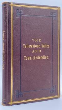
188210945St. Paul MN: The Pioneer Press Co 1882. First Edition First State. 100pp. Octavo 24 cm Presentation binding. Publisher's full grained brown leather with the title gilt stamped on the front board and backstrip. A.E.G. Satin moire endsheets. Near fine. Inscribed on the front free endsheet. 'Mr. Minnie with compliments of the author. Map of the Yellowstone Valley 42 cm x 70 cm and the Plat map of Glendive 40 cm x 56 cm present and both linen backed and in nice condition. Presentation copy. The trade edition of this work was bound in green printed wrappers with 10 pages of advertisements in the front and 3 to 10 pages of advertisements in the rear. Map of transcontinental was attached to the rear free endsheet. Our copy predates the various issues with advertisements and the map attached to the rear free endsheet. Eberstadt and Yale copies and others only list the plat and cattle trails maps. Early Montana promotional item from the Northern Pacific Railroad a year before they opened the Gardiner Gateway at the north end of Yellowstone Park. An important descriptive tract of the new country at the time of its settlement with a fine large map showing the towns and cattle trails. Eberstadt 132: 478. Howes Y8. Rampaging Herd 1535. This is the first time that we've handled or encountered this title. Rare. The Pioneer Press Co unknown
186895331868. <p>The Transcontinental Railroad made possible the winning settlement and development of the American West. It led to a revolution in interstate and international trade opening the markets of the west coast and Asia to the east and Europe while bringing products of eastern or European industry to the growing populace west of the Mississippi and beyond. The railroad caused a great production boom and was in a sense America’s first technology corridor. As it encouraged the growth of American trade and business so too did the railroad impact the nation's public discourse and intellectual life by making it possible to come and go across the length of the continent in just over a week. Now for the first time the beauties and riches of the central part of the continent could be accessed any anyone in days. Nothing was the same afterwards. Many people consider the Transcontinental Railroad the greatest technological feat of the 19th century and one of the most consequential major construction projects ever undertaken.</p><p>Before the advent of the Transcontinental Railroad a journey across the continent to the west coast meant months of careful preparation and acquisition of a conveyance and supplies then a dangerous six month trek over rivers deserts and mountains all the way risking the loss of necessities and encounters with blizzards and Indians. Alternatively a traveler could hazard a three to six month sea voyage around ferociously stormy Cape Horn which proved a graveyard to many ships or sail to Central America and cross the Isthmus of Panama through the jungle in part by pack animal and in part by rail which took five or six weeks risking exposure to any number of deadly diseases in the crossing. So it is no surprise that interest in building a railroad uniting the east and west coasts of the continent began soon after the advent of the locomotive.</p><p><strong>Early Trains in the US and the Idea to Build a Train Connecting East and West Coasts</strong></p><p>The first trains began to run in the U.S. in the 1830s along the East Coast and by the 1840s the nation's railway networks extended throughout the East South and Midwest. The annexation of the western territories including California following the Mexican War the almost immediately subsequent discovery of gold in the region in 1848 the resultant Gold Rush starting in 1849 and statehood for California in 1850 brought momentum to the idea of building a railroad across the nation to the Pacific. Meanwhile thousands of immigrants and miners sought their fortune in the West. During the 1850s Congress sponsored numerous survey parties to investigate possible routes for a transcontinental railroad. No particular route emerged as a clear favorite as the project became yet one more point of contention between the North and South before the Civil War with each wanting the railroad to go through their section.</p><p>Theodore Judah was a civil engineer who helped build the first railroad in California and he became obsessed with the idea of a transcontinental railroad running through Nebraska Wyoming Utah Nevada and California. In 1859 he drew up letters of incorporation for the Central Pacific Railroad Company. Judah surveyed the route creating maps that he used to bolster a presentation of the scheme he made to Congress in October 1861. Many Congressmen were leery of beginning such an expensive venture especially with the Civil War underway but President Abraham Lincoln a long-time supporter of railroads saw in the proposal an important additional opportunity: to help knit California and the West to the Union. He agreed with Judah and on July 1 1862 Lincoln signed the Pacific Railway Act authorizing land grants and government support which amounted to $32000 per mile of track laid to two companies the Central Pacific Railroad and the Union Pacific Railroad. The Central would start at California’s eastern rail point in Sacramento cross the Sierras go through Nevada and into northern Utah where it would meet up with the Union Pacific. The Central Pacific Railroad spiked the first rail on October 26 1863 and its construction crews began building the line east from Sacramento.</p><p>At the eastern end of the project Gen. Grenville Dodge and his assistant Peter Dey surveyed the potential route the Union Pacific would take. They recommended a line that would follow Nebraska’s Platt River along the North Fork would then cross the Continental Divide at South Pass in Wyoming and continue along to Green River then head into Utah. President Lincoln favored this route and made the decision that the eastern terminus of the Transcontinental Railroad would be Council Bluffs Iowa across the Missouri River from Omaha Nebraska.</p><p><strong>The Union Pacific</strong></p><p>Thomas Durant a medical doctor turned businessman gained control of the Union Pacific Railroad Company in July 1863. Though Durant took the office of vice president he was the actual leader of the railroad. In 1864 Congress passed the second Pacific Railway Act which doubled the size of the land grants and allowed the railroads to sell their own bonds. The Union Pacific began to lay tracks at Omaha Nebraska in July 1865. But Durant's management of the actual building of the rail line was sub par and lacked both organization and people with sufficient knowledge and skills to accomplish its ambitious task.</p><p>So as 1866 dawned Durant hired Grenville Dodge as chief engineer of the railroad Dodge began advising Durant immediately although he would not leave the service until May and Dodge insisted up front that Jack Casement and his brother be hired to lay the track and actually construct the Union Pacific line. John S. Jack Casement had worked as a railroad contractor on the Ohio Railroad prior to the Civil War. During the war he rose to the rank of General and Brigade commander and was admired for his bravery management skills and railroad experience. Jack and his brother Daniel had formed the firm of J.S. & D.T. Casement; “General Jack†was construction leader while Daniel handled financial matters.</p><p><strong>Jack and Dan Casement Build the Railroad</strong></p><p>The Casements came to an understanding with Durant and they agreed upon a proposal letter dated February 6 1866. That letter provided that the Casement firm would ""lay and fill the track on the Union Pacific Rail Road for seven hundred fifty dollars per mile on the following terms and conditions. The Rail Road Company to furnish motive power cars wood and water and tracks for boarding cars and pay for delays of over three consecutive days caused by want of material motive power or other default or neglect of Company. The track to be laid in a good and workmanlike manner and filled and surfaced with material taken from the side of the road the whole to be subject to the approval and acceptance of the Engineer of the Company in charge of the work and the track to be accepted on the completion of every twenty miles and approximate estimates to be made by the Engineer in charge and paid monthly. We will lay the track as fast as required not to exceed one mile per day and will at the option of the Company on ten days notice reduce our gang to a force sufficient to lay one half mile per day. We will furnish engineer men and all other help for the trains used in distribution of material and take the materials for track at any point on the Rail Road within one hundred feet of the track and we will furnish oil waste etc for trains in our employ. All trains used in construction or for any purpose by us are to be run subject to the regulations & schedule time of the Company & under the general control of the Superintendent of the Company. We will make no extra charge in cutting and filling in leveling ties unless it exceeds six inches. No extra charge for putting in frogs and switches for all necessary sidings. And we will place the labor of all our men at the disposal of the Company whenever the delays exceed three days and charge for their time as per our payroll. We will commence as soon as the Company requires & will lay track during the whole of the present season and longer if the Company requires.†This proposal was signed “J.S. & D.T. Casement.†Durant responded to the Casements two days later on February 8 1866. His letter stated: “J.S. & D. T. Casement Painesville Ohio. Gentlemen: Your proposition to the Union Pacific Railroad Company under date of Feb. 6 1866 in relation to track-laying is received and has been considered. The Company decides to regard your proposition and this acceptance as the agreement upon the subject. The Company reserves the right to terminate this arrangement in case you do not perform the agreement on your part. Yours truly Thomas C. Durant V. P.""</p><p>Jack Casement was responsible for all matters relating to building the Union Pacific. He hired the workers many of whom were former military personal gathered the materials and supplies and went into the field. As during the war his post was at the front in the construction camps which he ran like an army at the end of the line where the work was being done or in his car at the tail of the work train. Scrappy and hard-working he oversaw not just the laying but the grading of the track as well. As one of the necessities of his job to get to and from the work sites the Union Pacific presented him with annual passes to use their cars.</p><p><strong>Jack Casement’s engraved Union Pacific pass for 1868</strong> used by him to manage and supervise work on the Transcontinental Railroad signed by Company President John D. Perry. This pass was retained by Casement’s descendants until recently when we obtained it directly from them.</p><p>Under Casement’s leadership the Union Pacific laid 1087 miles of track from Fremont Nebraska west to Utah where the Central Pacific and Union Pacific Railroads met to form the transcontinental railroad. His was a magnificent achievement that compares well with the Central Pacific Railroad which laid 690 miles.</p><p>On April 9 1869 with construction work nearing a conclusion and both the Union Pacific and Central Pacific needing a meeting point Congress established it as Promontory Summit north of the Great Salt Lake in Utah. Less than one month later on the morning of May 10 1869 locomotives from the two railroads met nose-to-nose to signal the joining of the two lines. At 12:57 p.m. local time at a ceremony planned to connect the railroads Leland Stanford Governor of California and president of the Central Pacific and Durant as vice-president of the Union Pacific were to pound in the golden spike with silver hammers. Both men proved unable to hit the spike so Jack Casement stepped up to do the job accompanied by much cheering from the workers surrounding him. Telegraphers announced the completion of the Pacific Railway. Canons boomed in San Francisco and Washington. Bells rang and fire whistles shrieked as people celebrated across the country. The nation was indeed united.</p> unknown
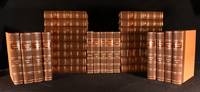
1839965Z28DLondon: The Railway Times Office 1839-63. First edition. Leather. Very Good Indeed. 11" by 9". None stated. An impressive run of early issues of the 'Railway Times' periodical an important railway periodical which documented developments and current news in the railway industry during the 1800s. A beautifully bound set of a very scarce periodical. An extensive twenty-nine volume set featuring a collection of the 'Railway Times' periodical from 1839-1863. All being the first edition. The periodical provides an impressive historical account of the current news and developments in the railway industry during the early to mid nineteenth century. The articles range from finances stock information new patents and inventions accidents and updates on railways from across the globe. Notable articles include; an article on Mr Robert Stephenson's new 1842 locomotive which proposed to use less fuel and a Testimonial to Isambard Kingdom Brunel the legendary engineer. This set includes; '1839' Vol II No. 71-72 85-94 and '1840' Vol III No. 27-41 and Vol II No. 52 of the 'Railways Magazine & Commercial Journal' bound into one volume. The rest of the years are bound over two volumes and feature complete runs of the magazine for that year with these being; '1841' Vol I- No.157 Vol III No. 1 - No.182 Vol Iv-No. 26. Vol II- No.183 Vol IV No.27 - No. 208 Vol IV No.52. '1842' Vol I- No. 209 Vol IV No.1 - No.234 Vol V-No.26. Vol II- No.235 Vol V No.27 - No.261 Vol V No.53. '1846' Vol I- No.418 Vol IX No.1 - No.443 Vol IX No.26. Vol II- nO.44 Vol IX No.27 - No.469 Vol IX No. 52. '1847' Vol I- No.470 Vol X No.1 - No.495 Vol X No.26. Vol II- No.496. Vol X No.27 - No.521 Vol X No.52. '1854' Vol I - No.836 Vol XVII No.1 - No.860 Vol XVII No.25.Vol II - No.861 Vol XXII No.26 - No.887 Vol XVII No. 52. '1855' Vol I - No.888 Vol xviii No.1 - No.913 Vol xviii No.26. Vol II - No. 914 Vol XVII No.27-No.939 Vol XVIII No. 52. '1856' Vol I - No. 940 Vol XIX No.1 - No.965 Vol XIX No.26.Vol II - No. 966 Vol XIX No.27 - No.991 Vol XIX No.52. '1857' Vol I- No.992 Vol XX No.1 - No.1017 Vol XX No.26. Vol II - No.1018 Vol XX No.27 - No.1043 Vol XX No.52. No. 18-22 have been misnumbered with No.18 numbered twice and missing No.21 however the work is complete with the pagination continuous as is expected. '1858' Vol I-No.1044 Vol XXI No.1 - No.1069 Vol XXI No.26. Two of the issues are numbered '23' but nothing is lacking. Vol II- No.1070 Vol XXI No.27-No.1094 Vol XXI No.52. '1859' Vol I- No.1095 Vol XXII No.1 - No.1120 Vol XXII No.26. Vol II - No.1121 Vol XXII No.27 - No.1147 Vol XXII No.53. '1860' Vol I- No.1148 Vol XXIII No.1 - No.1173 XXIII No.26. Vol II- No.1174 XXIII No.27 - No.1199 Vol XXIII No.52. '1861' Vol I- No.1200 Vol XXIV No.1 - No.1225 Vol XXIV No.26.Vol II - No.1251 Vol XXIV No.27 - No.1251 XXIV No.52.'1862' Vol I - No.1252 Vol XXV No.1 - No.1277 Vol XXV No.26. Vol II - No.1278 Vol XXV No.27 - No.1303 Vol XXV No.52. '1863' Vol I - No.1305 Vol XXVI No.1 - No.1329 Vol XXVI No.26.Vol II - No.1330 Vol XXVI No.27 - No.1355 Vol XXVI No.52. Illustrated heavily with numerous monochrome vignettes and the occasional full page illustration. Volume '1854' contains a folding map to pp. 356. A very scarce and important periodical with this being some of the earliest examples of the magazine currently on the market. A beautifully bound and uniform set. Bound in modern crushed quarter morocco with cloth to the boards. Endpapers renewed.All pages and issues present after the 1839-40 volumes. The occasional article clipped. Bound in modern crushed quarter morocco with cloth to the boards. Endpapers renewed. Externally lovely with only very minimal edge wear and slight leans to the odd volume. Internally generally firmly bound with the title page to pp.22 to '1854' tender and minimal strain in places otherwise firmly bound. Pages generally bright with only light age toning to the odd volume. Pages generally clean with only the odd spot slightly heavier to '1855' the occasional ink mark to '1841' and a more significant tidemark to '1856' pp. 569. Very minimal handling marks and occasional 'Railway Times' stamps to all the volumes. The odd page closely cropped to '1839-40' and the odd small closed tear and chip to the extremities. Several articles have been clipped from the pages heavier to the earlier volumes. Minor ink notations to '1847'. Hand written notes written on separate papers inserted into the odd volume. All in all a beautifully bound set with generally clean and bright pages with only the odd clipped article and mark. Very Good Indeed The Railway Times Office hardcover