231 résultats
1860WRCAM41089BWashington 1860. Twelve volumes bound in thirteen. Profusely illustrated with maps lithographic plates colored lithographic plates profiles etc. Large thick quarto. Original blindstamped cloth spines gilt. Minor edge wear. Each volume rebacked retaining original backstrip but with new endpapers. All but one volume from the Senate issue Vol. XII Part 1 is the House issue with a Senate backstrip. Lacking the general map of the routes surveyed from Vol. XI. Several maps with holes and separations along fold lines many with large tears including Warren's map of the western United States. Occasional tideline affecting text or an illustration scattered foxing and toning. Overall quite clean internally. Good plus. This large quarto set is the most important and massive compilation of exploration reports and data ever published about the trans-Mississippi West. Under the direction of Secretary of War Jefferson Davis the Pacific Railroad survey in two years increased the contemporary knowledge of the geography topography geology and natural history of the West by a quantum leap. Included herein are the reports of Humphreys Stevens Beckwith Whipple Warren Williamson Lander et al supplemented with reports on scientific observations and numerous significant achievements in cartography including Warren's "Map of the Territory of the United States from the Mississippi to the Pacific Ocean." here present in the eleventh volume which has been hailed as "the best cartographical work on the West up to its time." Howes. The illustrative material engraved and lithographed views specimens of birds fishes and other animals is of the highest quality often in colored state and encompasses thousands of illustrations either in the text or as separate plates. Wheat devotes twenty-four pages of detailed discussion to the maps in this series of reports singling out the Warren map as "among the great maps of the United States that preceded the Civil War." <br> <br> All things considered this edition of the Pacific Railroad Surveys stands as a testament to one of the greatest government sponsored projects in our history and is a foundation work for any collection devoted to Western Americana or cartography. HOWES P3 etc. WHEAT TRANSMISSISSIPPI 822 through 824 843 through 846 852 853 864 through 867 874 875 877 through 882 898 936 23 in all. TWENEY 89 59. WAGNER-CAMP 262 through 267. RITTENHOUSE 442. REESE STAMPED WITH A NATIONAL CHARACTER 75. ZAMORANO SELECT 108. REESE BEST OF THE WEST 138. hardcover books
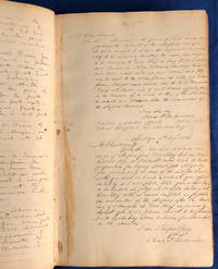
183524879<p>This volume is a fascinating primary source for the nation's oldest railroad still operating under its original name including correspondence setting the course for routes now traveled by millions of riders every month. Later use of this book by a New Jersey hatmaker and Civil War veteran gives insights into the daily life and expenses of a craftsman and farmer in the 1870s.</p> <b>LONG ISLAND RAILROAD.</b>Memorandum and Letter Book 1835-1872. 344 pp. of which 212 pp. have writing 8¼ x 13 x 1¼ in.<p><br /></p><p>This volume likely originally belonging to chief engineer James P. Kirkwood contains a wide variety of memoranda relating to the railroad. It begins with two pages of diary-like entries from February 8 to May 16 1836 including mention of Matthias W. Baldwin 1795-1866 the founder of Baldwin Locomotive Works February 8 and discussion of the route for the new Williamsburg Branch April 1 and reports on the contractors at Jamaica May 4 and 11.</p><p>It is followed by copies of two letters from the chief engineer regarding the delivery of railroad ties from Maine May 27 and August 4 1836 then six pages of estimates for grade work on new lines between Jericho and Ronkonkoma Pond between Jamaica and Jericho and between Flushing and Jericho.</p><p>Next are three draft letters totaling 40 pages to the president and directors of the railroad reporting engineering details on three different routes which had been surveyed from Jamaica to Greenport. The letters are dated November 4 1835 January 1836 and September 19 1836 and include tables estimating the costs for grading each route.</p><p>The following 37 pages include copies of letters to and from Long Island Rail Road engineer James P. Kirkwood between August 11 1835 and March 28 1837 mostly about surveying and construction issues. Among the interesting letters is one from Postmaster General Amos Kendall to the President of the Long Island Rail Road April 26 1836 asking for a map or plan of the route so the post office could update its maps. These pages also include an August 9 1836 letter from Lieutenant George Gordon Meade 1815-1872 acknowledging payment of $45.44 for "services rendered" to the railroad likely surveying shortly before he resigned from the army to pursue work as a civil engineer. Meade went on to lead the Army of the Potomac to victory at the Battle of Gettysburg in July 1863 and continued in command until the end of the Civil War.</p><p><b>James Pugh Kirkwood</b> 1807-1877 was born in Edinburgh Scotland. After his education and an apprenticeship to a land surveyor he began his own business in Glasgow in 1832. Later that same year he immigrated to the United States where he worked as an engineer on the Norwich & Worcester the Boston & Providence and the Stonington & Providence Railroads. In 1837 he became the resident engineer for the Long Island Rail Road. From 1840 to 1843 he was resident engineer for the Western Railroad of Massachusetts. Over the course of his career Kirkwood became one of the foremost civil engineers of the mid-nineteenth century. He was involved in many improvement projects to enhance the harbor of New York City. As general superintendent of the New York & Erie Railroad he pioneered the use of telegraph signals to manage trains. From 1850 to 1855 he was the chief engineer of the Missouri Pacific Railroad and managed its construction. He was a co-founder of the American Society of Civil Engineers in 1852 and served as its president from 1867 to 1868. He also became involved in a variety of water supply projects for various cities in the United States and Europe.</p><p><b>Long Island Rail Road</b> 1835-1928 1949-present is the oldest U.S. railroad still operating under its original name and charter. The New York General Assembly passed an act to incorporate the Brooklyn and Jamaica Railroad in 1831 which incorporated in 1832 to build a ten-mile line between those cities. Engineer Major D. B. Douglass planned for a continuation through the center of Long Island to near its eastern end to connect New York and Boston via rail and steamship. The legislature chartered the Long Island Rail Road Company in 1834. The railroad organized in June 1835 with Knowles Taylor as the first president and it soon acquired the Brooklyn and Jamaica line. The main line from Brooklyn to Greenport was completed in 1844 but rail and steamship service to Boston lasted only until 1847 when competing rail lines through southern Connecticut and steamships directly from New York took away business. The railroad then turned its attention to local service and added more branches to the northern and southern shores while small rival rail lines opened on the island. In 1875 New York rubber baron Conrad Poppenhusen acquired all of the railroads and consolidated them under the Long Island Railroad Company. By 1900 the Pennsylvania Railroad purchased a controlling interest in the Long Island Railroad and the railroad served more and more commuters into Manhattan. From 1928 to 1949 the railroad was largely owned by the Pennsylvania Railroad but it declared bankruptcy in 1949 and the Pennsylvania Railroad stopped supporting its debts. The Long Island Railroad came out of bankruptcy in 1954 and the State of New York purchased it in 1965. Today the railroad carries more than 300000 passengers each weekday over more than seven hundred miles of track.</p><p><b>Further items in the book:</b></p><p>Next comes eight pages of descriptions of land purchases dated between 1798 and 1842 which may be related to the Long Island Rail Road.</p><p>A three-page undated anti-Whig political letter regarding civic responsibility follows: "<i>There is no higher duty we owe to ourselves to each other and to our country in whatever situation we may be placed in whatever sphere of action we may fill than to understand the nature of our government and the civil institutions by which our rights are maintained as citizens and by which our civil duties & obligations towards each other are to be regulated</i>."</p><p>The latter half of the book was apparently used by at least two different owners who recorded property acquisitions reports on canals and railroads in different states and various memoranda.</p><p>Peter J. Butler used fifty-eight pages in the latter half of the volume for a diary with income and expenditures from January 1870 to March 1872. Later pages record Butler's individual accounts with John Allen Johnson Abner Reeves Charles Bessing the School District Nathan Squire and M. P. Hart. Four additional pages give school receipts and expenditures for school years ending August 31 1873 and July 31 1875; Butler served as clerk for the school. The diary provides an interesting view of the household finances of a craftsman and Civil War veteran in the years after the war.</p><p><b>Peter J. Butler</b> 1842-1889 was born in New Jersey as the son of Peter Butler 1806-1874 and Catherine Butler 1802-1893 both Irish immigrants. Peter J. Butler was a farmer and hatmaker in Livingston New Jersey twenty miles west of New York City. During the Civil War Butler served as a landsman for the navy steamers USS <i>North Carolina</i> and USS <i>Monticello</i> from August 1864 to June 1865. In February 1867 he married Hettie C. Denman with whom he had two children.</p><p>Among the interesting items is the following letter to a soldier perhaps Peter J. Butler from the Civil War:</p><p><i>Dear Friend</i></p><p> <i>I arrived at home on Saturday as I left on Thursday after a verry pleasant ride. I intended to write before but I have been on the go day and night since I have been home so that I have had no time yet I am anxious to hear from you as ever. The 4 of July was selebrated in great stile all over the country and all had a good time in general I am in hopes that you will not have to serve the whole of your time out in fact I think you ought to be entitled to your discharge oferd the verry reason that you have served in the army and navy ever since the commencement of the war and before and never had a bounty I think the Captain will interseed for you and he will if he has any manly principle in him whatever</i></p><p>Another owner of the book appears to have been John S. Cunningham who is likely responsible for the copy of the "<i>Speech of Adherbal to the Roman Senate imploring their Protection against Jugurtha</i>" in parallel Latin and English columns and a map of a battle from the Jugurthine War in 108 B.C. with Latin labels and narrative. Both have the initials "<i>J.S.C.</i>" at the bottom. Among other items in the book is a brief "List of John S. Cunningham's private library" including books on Greek Latin and French and an 1847 account of J. S. Cunningham with Andrew A. Smalley 1814-1893 covering two pages. Early in Butler's diary is an entry for January 9 1870: "<i>Wrote to John S Cunningham</i>" so perhaps Cunningham had given the ledger to Butler.</p><p><b>John S. Cunningham</b> 1827-1893 was born in New Jersey and educated at Orange Academy. He particularly studied surveying and civil engineering. He was involved in the manufacture of wrought bar iron for several years. In 1848 he became an assistant engineer with the Morris & Essex Railroad and then the Patterson & Ramapo Railroad. From 1849 to 1851 he worked as an engineer on the Chesapeake and Ohio Canal. He then returned to railroad work through the 1850s. He settled in Coalsmouth Virginia St. Albans West Virginia thirty-five miles east of Huntington. During the Civil War he served as an officer in a loyal Virginia regiment then returned to St. Albans where he held a variety of local offices including from 1889 judge of the Kanawha County Court.</p><p><b>Condition</b></p><p>Overall good. Cover wear and some missing spine cap; marbled endpapers; one torn page; interior clean.</p> hardcover books
18871408San Francisco 1887. About very good. 668pp. including numerous in-text or full page illustrations and eight photolithographed plates plus large folding map. Folio. Original pictorial wrappers. Wraps with some soiling wear at edges; front wrap with a few signs of biopredation; two small chips to rear wrapper; spine perishing at extremities. Minor worming at upper corner of a few interior leaves. Light tanning. A rare and extravagant promotional for the Pacific Cable Railway Company which manufactured installed and operated the famous streetcar system of San Francisco and in several other American cities. The present work also serves as a declaration of patent with a list of patents and patent holders at the rear and the text comprises a detailed technical description of the wire cable system with many illustrations of its mechanisms and operation as well as general accounts of the systems running in San Francisco Los Angeles Chicago and Kansas City. In addition to the technical diagrams are several attractive line illustrations and eight photolithographed plates reproduced by artotype of the cable cars of San Francisco in action all by Britton & Rey. The folding map at the rear provides a detailed delineation of the lines running across the city. Very scarce OCLC locates only five copies.<br /><br />Cowan II p.512. books
1868WRCAM33573AWashington: Government Printing Office 1868. 39pp. plus large color folding map 23 1/4 x 44 3/4 inches. Original printed wrappers. Presentation inscription on front wrapper see below. Wrapper edges chipped minor soiling and tanning to wrappers spine partially chipped old vertical fold to pamphlet. Light foxing and tanning and occasional soiling throughout Map with a few small closed tears at cross-folds with no loss. About very good. This copy is inscribed on the front wrapper: "With Regards of James Tilton C.E." Tilton 1819-78 was then chief engineer of the Washington Division of the Northern Pacific Railroad. Thanks in part to his support for Franklin Pierce's presidential campaign Tilton was appointed the first Surveyor General of Washington Territory and served from 1853-61. Both the Tilton River and Fort Tilton near Fall City Washington are named for him. <br> <br> An important report to Congress by the Northern Pacific Railroad headed by Minnesota railroad magnate James J. Hill for federal aid to support the Railroad's expansion to the West Coast. The petition reviews the railroad's original charter printing with it a memorial from the NPRR's Board of Directors and supporting communications from military figures including Montgomery Meigs and Ulysses S. Grant. Since the early 1850s Edwin Johnson described by Wheat as a "visionary" engineer had been associated with the plan to build a railroad across the northern part of the United States from the Great Lakes to the Pacific Coast. In 1867 he was named chief engineer of the Northern Pacific and this memorial is a work of major importance for the history of the railroad. It includes Johnson's topographical survey of the route to the Pacific a discussion of potential problems that may be encountered and a detailed economic and military survey of the area in justification of construction. <br> <br> The exceptional large folding "Map of the Country from Lake Superior to the Pacific Ocean from the Latest Explorations and Surveys" was produced by the Colton firm in New York. One of the finest maps of the region to date it shows the area from Detroit to the Pacific well into Canada and south to about the 39th parallel. Johnson has drawn the route of the Northern Pacific from Lake Superior to Washington Territory where the line splits with one branch heading toward Fort Vancouver and the other to Puget Sound. Among the details shown on the map are the Pony Express route wagon routes and overland mail routes exploration routes and other proposed railroad routes the locations of Indian tribes mineral deposits military forts and much more. Wheat gives a long description of the map and remarks that "the detail of such a map defies cataloging." Construction on the Northern Pacific Railroad began in 1870 and was completed in 1883. Edwin Johnson did not see its completion dying in 1872. An edition of this report with the supporting documents and map was also privately published in Hartford. <br> <br> A significant early account of railroad expansion in the Northwest. We could find only ten copies listed in OCLC and this is the first copy we have seen in wrappers and with a presentation from an important engineer on the project. RAILWAY ECONOMICS pp.242-43. SABIN 55819 Hartford edition. WHEAT TRANSMISSISSIPPI WEST V item 1169 pp.205-09. PHILLIPS MAPS p.916. DECKER 37:266 Hartford ed. MIDLAND NOTES 68:164. OCLC 60578657. Government Printing Office unknown books
1860100432Large thick 4to contemporary calf spine and tips with marbled boards 70 very attractive color lithograph plates 358 41 pp. Extremeties worn minor aging one map has tear in lower corner plates bright and clean. The Pacific Railroad Surveys 1853-1855 explored possible routes for a transcontinental railroad. However the surveys went beyond looking for a place for a railroad they included and incredible amount of information on natural history and the peoples that inhabited the areas where the surveys explored. Representing the first part of the final volume of these surveys this installment focused on the northern route for a railroad. The 12 volumes included in these surveys is also known for rich illustrations many of which were in color. With 70 color plates one folding and three folding maps in Volume XII part 1 this edition is particularly rich in illustration and the plates are bright and clean. Thomas A. Ford hardcover books
1868WRCAM33573Washington 1868. 39pp. plus large color folding map. Modern maroon cloth gilt maroon morocco label. Minor dust soiling in text. Map bright and clean. Overall very good. An application to Congress by the Northern Pacific Railroad headed by Minnesota railroad magnate James J. Hill for federal aid to support the Railroad's expansion to the West Coast. The petition reviews the railroad's original charter and includes an impressive color folding map "Map of the Country from Lake Superior to the Pacific Ocean" which illustrates the railroad's route from Duluth to Seattle and Portland. This map was originally produced to accompany Edwin Johnson's report on the feasibility of the railroad. This is one of the finest maps of the region traversed to be issued up to this time and was produced by Colton in New York not by the government. Wheat devotes several pages to discussing it noting that "the detail of such a map defies cataloging." Above the map appears an elevation chart for the same distance. <br> <br> A fine account of railroad expansion in the Northwest. Rare. Not on OCLC. MIDLAND NOTES 68-164. WHEAT TRANSMISSISSIPPI 1169. hardcover books
18821204Portland Or: George H. Himes 1882. About very good. 328pp. plus photograph frontispiece. Original printed wrappers. Spine ends chipped; some light dust soiling and wear to wraps. Slight fading to frontispiece photo but a clear image. Light even tanning internally; three leaves with small patches of damp staining. A scarce 1882 promotional for potential excursions from Portland Oregon published in conjunction by the Northern Pacific Railroad and the Oregon Railway & Navigation Company. The work is illustrated with a real photograph of the Multnomah Falls east of the city on the Columbia River. The text prints itineraries for ten trips from Portland in the Pacific Northwest to the Cascades the Dalles Seattle Tacoma Olympia Ilwaco and even Alaska almost all via the steamers of the Oregon Railway & Navigation Company. The final four leaves of text contain numerous illustrated advertisements for Portland businesses. The frontispiece photograph of the Multnomah Falls is credited in print to Issac Grundy Davidson. "One of the Northwest's premier photographers Davidson published an extensive series of scenic photographs covering many aspects of life and scenes throughout Oregon Washington and Alaska. He operated portrait studios a traveling gallery and contracted with the Northern Pacific Railroad. A keen businessman who produced the finest photographic record of Oregon during the 1870s-80s" - Mautz. An excellent example of the collaboration between a pre-eminent photographer of the Pacific Northwest and the Northern Pacific Railroad as well as an unusual and scarce specimen of a rail and river travel promotional illustrated with a real photographic print. George H. Himes unknown books
1851406078New York: Wm. C. Locke & Co 1851. Wrappers chipped at edges professionally rebacked some unobtrusive offsetting on map. 8vo. 50 pages. Large folding map on three joined sheets 21 x 1788 cm; 8.25 x 61.75 inches. 11 woodblock illustrations in text and with 2 more not recorded in the index but always present. Original printed wrappers with woodblock vignette. SCARCE Hudson River Railroad travel guide published the first year in which the full line was completed. It covers points of interest along the route with woodblocks illustrating the text. Topics include: the history of the Hudson River the history of the construction of the Hudson River Railroad and the cities towns and villages along the Hudson from New York City all the way to Troy. Concerning the West Point Foundry at Cold Spring the guide states: "the iron foundry was established here by Gouverneur Kemble. The works are situated about a mile west of the village upon a small stream which tumbles rapidly down the mountains affording considerable water power. It is the largest establishment of its kind in the country employing nearly five hundred hands constantly." The building of the Hudson River Railroad is another topic in the guide. The project was considered highly impractical since much of the route had to be cut through extremely difficult rock and terrain. This section includes a description of the tunnels which had to be constructed. The railroad was opened in three stages. In September 1849 it allowed passengers to travel from New York to Peekskill. By that December 6 twenty-three additional miles were opened extending to New Hamburg. By the 31st of the month it was open the remaining distance of nine miles to Poughkeepsie. The Hudson River Railroad was an extension of the Troy and Greenbush Railroad which was chartered in 1845 connecting Troy South to Greenbush now Rensselaer on the east side of the Hudson. The Hudson River Railroad was chartered on May 12 1846 to extend this line south to New York City. The full line opened on October 3 1851 the same year in which this travel guide was published. WorldCat/OCLC records 25 copies but it is scarcely found complete with the map and the map is also excluded from the digitized versions available online. <br/><br/> Wm. C. Locke & Co unknown books
1884280East Tennessee Virginia and Georgia Railway Company O'Brien John F. General Superintendent and Flippen T. D. Auditor. <i>East Tennessee Virginia and Georgia Railway Company List No. 14. List of Stations and Names of Agents. </i>ETV&G Railway Office of the Auditor Knoxville January 31 1884. A broadside directory listing the agents by name and by town for the East Tennessee Division and branches for the Alabama division the Atlanta division and the Brunswick division and branches. A broadside sheet 34 cm x 36 cm black ink on white paper fold creases otherwise very good. The ETV&G railway became part of the Southern Railway in 1894. The ETV&G made Knoxville Tennessee a wholesaling center as it provided both passenger and freight rail service to many small communities in Appalachia. East Tennessee, Virginia and Georgia Railway Company books
1896WRCAM56242Chicago: Poole Bros. 1896. Chromolithographic broadside 24 x 9 inches. Old horizontal folds. Small tear at upper margin likely from posting no text affected. Very good. Rare and colorful broadside advertising "the Shortest and Quickest Route" to "all points West" on the Wabash Line connecting through St. Louis. The sheet features a full-color image of the famous Wabash flag as well as the seals of Colorado and California. Customers are promised that all trains feature "Free Reclining Chair Cars and Pullman Buffet Sleeping Cars" and are provided a name and address to acquire maps and timetables. <br> <br> At the time this broadside was issued Charles M. Hays was general manager and the Wabash railroad was under the control of financier Jay Gould who was working feverishly to establish a full coast-to-coast system. He had merged the St. Louis Kansas City & Northern Railroad with Wabash creating the Wabash St. Louis & Pacific Railroad. Then as with many other Eastern and Midwest railroads Wabash partnered with Union Pacific to provide service further west. By 1896 Gould's son George had taken over the railroad and proceeded to expand it further swallowing up the Missouri Pacific Western Pacific Denver & Rio Grande Western Western Maryland and Wheeling & Lake Erie railroads. Hays left in 1896 to become general manager and later president of the Grand Trunk Railway in Canada which helped extend the Wabash network north. <br> <br> An attractive artifact from one of the great American railroads. We could find no copies recorded in OCLC. Poole Bros. unknown books
185833688Chicago: Illinois Central Rail Road Office 1858. 8vo 5 p.l. pp. 5-80; full-page map of Illinois double-page map of the guide to the Illinois Central Railroad Lands wood-engraved frontispiece 6 wood-engraved illustrations in the text; slight nibble out of the fore-margin of the first 3 leaves else a near fine copy in original yellow pictorial wrappers. Another edition with same text has imprint: Boston G.C. Rand & Avery printers 1857. Byrd 2683; Ante-Fire Imprints 263. <br/><br/> Illinois Central Rail Road Office unknown books
1859790831859. SCIENCE/ZOOLOGY REPORTS OF EXPLORATION AND SURVEYS TO ASCERTAIN THE MOST PRACTICABLE AND ECONOMICAL ROUTE FOR A RAILROAD FROM THE MISSISSIPPI RIVER TO THE PACIFIC OCEAN. VOLUME X. Washington: Beverley Tucker 1859. 400 27 97 13 pp. plus 28 hand colored plates and 94 b/w plates. 4to. brown cloth. As is. Binding poor block split at pp. 8-9 of 27 pp. report. Spine chipped cloth split at joints. Moderate to light foxing to text although plates are in excellent condition. Contents: Parts III IV. General Report upon the Zoology of the Several Pacific Railroad Routes. Zoological portion of the reports by Lieut. E. G. Beckwith.upon the Route near the Thirty-Eighth and Thirty-Ninth Parallels/Nos. 2-5 of Part IV of the Report by Lieut. A. W. Whipple.upon the route near the Thirty-Fifth Parallel/Zoological portion of the Report by Lieut. J. G. Parke.upon the route near the Thirty-Second Parallel from the Rio Grande to the Pimas Villages/Part IV of the Report by Lieut. R. S. Williamson.upon routes to California to connect with routes near the Thirty-Fifth and Thirty-Second Parallels/No. 4 of Part IV of the Report by Lieut. Henry L. Abbot.upon the routes in Oregon and California explored by parties under the command of Lieut. R. S. Williamson.in 1855. unknown books
186028774Hannibal Mo.: Hannibal and St. Joseph Railroad Office 1860. 60pp plus double-page frontis map entitled 'Railway Guide to the Hannibal & St. Joseph Rail Road Lands in Missouri' engraved on wood by W. Mackwitz St. Louis; plus 'Map of Northern Missouri Showing the Hannibal & St. Joseph Railroad Lands'; plus six full-page engraved illustrations including views of Grand Valley and St. Joseph. Original printed yellow wrappers spine and corner wear light contemporary ink stamp of 'General Market Office 21 State St. Boston' on front wrapper stitched. The rear wrapper describes the routes connections and transit times of the Railroad. Very Good plus. <br/><br/> The Road was one of the earliest to reach the Missouri River in northwestern Missouri at St. Joseph the starting point of the Pony Express. Taylor The Transportation Revolution page 86. It traversed Northern Missouri connecting Chicago and St. Louis with Kansas and Nebraska. <br/> The pamphlet describes the route; lands offered for sale; connecting roads; prices and terms of payment; the advantages of the "rolling and healthy" "well-watered" "well- wooded" properties. The location of the Road and lands is "unequaled by any other portion of the country." Agriculture and stock raising are the best in the Nation. Similarly advantaged are markets-- with cheap freight rates-- and cultural and educational opportunities. St. Louis St. Joseph and Hannibal are described. The State Geologist and other experts weigh in with testimonials.<br/>Bureau of Railway Economics 211. Not in Sabin Eberstadt Graff Decker Soliday. A number of institutional locations on OCLC. Hannibal and St. Joseph Railroad Office unknown books
1867102297Pamphlet 8vo original printed wrappers colored folding map 8 1/2" x 23 1/2" 16 pp. Some minor chips at corners and extremities pencil notation on top of the front wrapper normal aging; otherwise very good. This pamphlet relates to a bond offering the company was issuing to raise capital. Management claims that the company has favorable prospects and the mortgage bonds being offered are a secure and profitable investment. Railroad bonds were a popular investment during the second half of the 19th century which helped prompt Henry Varnum Poor to publish his "History of Railroads and Canals in the United States" in 1860. The work enabled investors to see comprehensive financial information on just about all railroad companies. This pamphlet includes typical financial data about the company and a folding "Map of the Union Pacific Railroad and its Connections." The map is in wonderful condition. Offices, books
1880100458<p>Large thick folio 15x10 1/2 bound in soft tan calf maroon morocco corners and spine label marbled endpapers 26 425 111 blank pp. Hinges reinforced with cloth front joint split leather chipped at spine ends and corners are a bit worn light rubbing and finger soiling to contents; else very good. Fascinating piece of railroad memorabilia that documents railroad company mergers deeds for track expansion and other contractual correspondence dated from 1839-1915 chiefly between Massachusetts and New York. Many of the transactions mention concern the Boston and Albany Railroad connecting Boston to Albany. The ledger appears to record events from the original documents. Sometimes it cites the individual who copied the document. While the the dates of documents it refers to go back to the before the mid 19th century these entries were probably done in the late 19th century or early 20th century. The ledger contains over 400 pages of hand-written contract documents most one to three pages long plus 26 pages indexing 166 contracts at the front. Nearly all with Public Notarization as well as signatures of the people involved. These are copies of the originals inked in various highly legible hands. Many of the documents are of the Boston and Albany Railroad which would become part of the New York Central Railroad system. </p> books
1836016450Boston: Dutton & Wentworth Printers 1836. Book. Very good condition. Hardcover. First Edition. Octavo 8vo. A bound volume containing a collection of ten publications relating to the Western Rail-Road Corporation from the incorporation in 1836 to 1840. The First Annual Report from 1836 is included twice. Bound in contemporary original three quarter leather which is moderately to heavily worn with the front board nearly detached. There is minor to moderate foxing and the final half of the text is lightly stained at the top corner. The 1836-37 Reports of the Engineers is complete with two fold-out maps which were printed on very thin onion-skin paper. These two maps have been detached and are misfolded with minor tearing as well as some foxing. A ready-made collection of the founding documents of this railroad company which starts in Boston winding its way across the state where it enters New York State at West Stockbridge. Dutton & Wentworth, Printers Hardcover books
188135023Ottawa: Printed by MacLean Roger & Co. 1881. Original printed salmon wrappers stitched. 2 10 large folding map short closed tear 20 11 3 2 2 pp as issued. Vertical fold light edgewear. Very Good.<br/> offered with Booth C.J. President: THE CANADA ATLANTIC RAILWAY CO'Y. PROSPECTUS. Ottawa: 1889. 4 pp printed on rectos only. Caption title as issued. Pinned at upper blank corner and docketed in ink on final blank "Canada Atlantic RR Prospectus January 1889." Fine.<br/><br/> The map in excellent condition is titled "Canada Atlantic Railway Map December 1881" accomplished by "Geo. Bishop & Co. Lith. Montreal." It measures 18" x 35" with the route of the railway; extensions and other railways also notes; other boundaries in green. All the documents creating the Company set forth in the title of the pamphlet are printed each individually numbered. The Railway as the Prospectus states "extends from Ottawa in a south easterly direction a distance of 142 miles and connects with the Central Vermont Railroad at the village of Alburgh Springs Vt. U.S.A."<br/> "The Canada Atlantic Railway CAR was a small regional railway created in 1880 by lumber baron John Rodolphus Booth. Initially planned as part of the transportation network for his vast lumber holdings the railway quickly grew into a general-purpose railway serving passengers and communities along the route. Booth's first target was to gain access to Vermont in order to connect with the Central Vermont Railway CV and further exploit the US markets" "Canada Atlantic Railway" Ontario Railways accessed at Canada-Rail website May 2018.<br/> As of May 2018 we do not locate either of these documents-- or the map-- on OCLC. Printed by MacLean, Roger & Co. unknown books
1850WRCAM26680Chicago: W.J. Patterson Printer 1850. 816pp. Dbd. Some foxing staining. Last page torn with loss of a few words. A few contemporary markings. Good. Includes a report to the stockholders by William Ogden president; a specific progress report by John Van Nortwick chief engineer; and a financial statement by F. Howe treasurer. The railroad appears to be flourishing. HOWES G17. McMURTRIE CHICAGO IMPRINTS 214. BYRD 1573. GRAFF 1476. W.J. Patterson, Printer unknown books
188530584np 1885. 299 12 100 52 32 20 47 8 6 pp. Pleadings and other court documents bound together in contemporary red morocco with decorated borders gilt-lettered spine and front cover. Raised spine bands and gilt rules. Binding with a bit of extremity scuffing Very Good.<br/><br/> The Railway an Iowa corporation entered into agreements to finance the construction of a railroad from Burlington to a point near Mankato Minnesota a distance of 270 miles. The Railway defaulted and the mortgage holders began a foreclosure action which is the subject of these documents. This book a series of separate printings collects the Complaint and other pleadings Exhibits Amendments to the Complaint the stipulated facts and the briefs and arguments of counsel. The claims of various lienholders rendered the case quite complicated; aspects of the case arrived at the U.S. Supreme Court reported at 159 U.S. 278 1895. unknown books
1882WRCAM46974N.p. but Chicago 1882. 24pp. Narrow octavo. Original printed pictorial wrappers. Light soiling and wear vertical crease to center of pamphlet. Minor internal soiling. Just about very good. Promotional pamphlet for the Burlington & Missouri River Railroad Company advertising lands for sale in Nebraska. The cover claims "No state offers greater advantages in soil climate rail roads market facilities or grand opportunities to the farmer and stock raiser than Nebraska." The text commences on a high note: "This is the State whose latch string is out and offers homes and promises of prosperity to all who will come." The emphasis is agriculture and stock raising with glowing essays including "Great Grazing District" "Livestock in the State" "Orchards and Groves Planted" "The Pure Air of the Prairies" "The Herd Law - No Fences Allowed" "The Cheapest Lands in America" "Sheep Raising in Nebraska" "Education the Birthright of Every Nebraska Child" etc. OCLC lists two similar items each in a single copy: one at Yale with the imprint of Lincoln: State Journal Co. 1881; and one at the Huntington with the imprint of St. Louis: A. Gast 1881 The present copy has no imprint. A. Zeese & Co. the Chicago engraving firm who is attributed on the first map specialized in half tones zinc etching relief-line lithogravure and photoelectric type. Chicago seems to us the most likely place of printing for all the editions noted above. unknown books
18851099Chicago: Geo. F. Cram 1885. Good plus. Large folding pamphlet approximately 20 x 41.5 inches. A few small chips and short closed tears at edges; several short separations and very minor losses along folds. Contemporary agent's ink stamp on cover panel. Tape repair across portion of horizontal fold; one panel with patches of light staining. A scarce colorful promotional for the Rock Island Route as well as its national and international connections with a fascinating stamp of an Australian sales agent. One side of the sheet prints an extensive promotional text and timetables for the various routes and services of the Chicago Rock Island & Pacific Railway. The main side of the sheet prints a map of the United States with state borders shaded in four colors highlighting the principal routes of the Rock Island from Chicago to Minnesota Iowa and Kansas and its connections to points on both the East and West Coasts. An inset map at lower right promotes the Rock Island as part of a transcontinental route between the United Kingdom Ireland and Australia. Most interestingly this copy is stamped on the cover panel with the information of a George. H. Hibbard "Australian Passenger Agent America's Cons'd Trans-continental Railways 6 Bridge Street Sydney N.S.W." Hibbard was evidently the agent in charge of distributing information about the trans-America route in Sydney one of its end points. Several issues of this map were published during the 1880s all scarce. We locate copies of the present 1885 issue at Stanford SMU and the Library of Congress. Geo. F. Cram unknown books
1886LIST112Cincinnati: St. Andrews Bay Railroad and Land Company 1886. Various Formats. Near Fine. An unusual collection of ephemera relating to the early development of the area of the Florida Panhandle east of Pensacola and an interesting ephemeral window into the type of land schemes that led to the population of Florida by northerners. In the late nineteenth century the area of Port Panama City in the Florida Panhandle was largely undeveloped though the town had strategic interest as a supplier of salt for the confederacy. In the 1880s the St. Andrews Bay Railroad and Land and Company was the second of two companies to sell land in the St. Andrews Bay region to unsuspecting northerners only to go bankrupt. The company promised to build a railroad from Alabama down to Southport crossing North Bay and eventually terminating in St. Andrews. Though the railway project was abandoned many people settled in the area as a result of the land sales. The company became known locally as the "Cincinnati Company."<br /> <br /> <br /> Includes: <br /> <br /> Warranty deeds for land sold to Lizzie Kegema Hosley of Somerville MA. 1886-1887.<br /> <br /> Letter from the St. Andrews Bay Railroad & Land Co to L.K. Hosley of Somerville Mass. explaining why the offer of 40 acres for $1 was contingent on her purchasing 299 building lots. On color lithographed letterhead featuring oranges and fishing.<br /> <br /> Notice on taxes to be paid by owners of property at St. Andrews Bay.<br /> <br /> Two envelopes with printed notices "This sealed envelope contains one Free Land Warrant" no contents.<br /> <br /> Envelope addressed to Lizzie Kegema Hosley of Somerville Mass. from the St. Andrews Bay R.R. and Land Co. Northern Office Cincinnati Oh.<br /> <br /> An interesting and early collection of Floridian real estate detritus. Generally well preserved in very good to near fine condition. St. Andrews Bay Railroad and Land Company unknown books
18581100Cincinnati: Enquirer Print 1858. Good. Broadside approximately 14.5 x 7 inches. Matted. Internal tear near top edge slightly affecting text. Light dust soiling heavier at foot; some creasing and foxing at edges. An attractive broadside advertisement for the Ohio & Mississippi Railroad promoting its newly completed line from Cincinnati to St. Louis. The broadside highlights the O&M as the "Shortest and Quickest" route from Cincinnati to Indianapolis Vincennes and St. Louis travelling on the "Only Wide Gauge in the West" with two trains leaving Cincinnati daily and arriving in St. Louis "two hours in advance of any other route." Ohio & Mississippi passengers enjoy "wide and spacious Saloon Cars unattainable on narrow gauge Roads and cross the River at Illinoistown on arrival." By contrast the dimwitted passengers of the Terre Haute and Alton "wait on bank of River one hour before crossing." With a woodcut illustration and a bracing combination of woodcut types. Not in OCLC; the line was completed at the end of 1857. Enquirer Print unknown books
186744783Boston: n.a. 1867. First edition. A very good copy some toning at the center crease minor wear to edge. 1 sheet. 1 p. 19 x 24 inches 48.5 x 61 cm. Broadside printed on yellow paper advertizing a combined railroad and steamer trip from Boston to Rocky Point RI. The train would travel to Falls River where it connected with the Steamer Canonicus which then traveled to Rocky Point. Lists stops and fares. Notes that "A Band of Music will accompany the Excursion." Signed and dated in type "Boston August 15 1867. W.H. Bullock William Henry Sup't." OCLC locates no copies of this broadside but shows the American Antiquarian Society holding a similar item issued a year later American Broadsides and Ephemera. Series 1; no. 14733. n.a. unknown books
18571004304to 11 ½ x8 ¾ original law calf morocco illustrated 4 134 85102 114 2 iv 64 pp. Some scuffing and wear to covers slight gouge to front joint chipping to edges. Two plates detached one with a chipped corner. Overall very good. Organized by the War department under the direction of Jefferson Davis who was Secretary of War at that time a collection of volumes was produced in the quest for the best route for a railroad to the West. Jefferson Davis wrote part of the introduction to this series and outlines the goals of the project. This report is on routes explored in Northern California and Oregon. Specifically the expedition was to look for a railroad route crossing the Sierra Nevada near the source of the Carson River and to see if it was feasible to connect the Sacramento valley with the Oregon Territory. Most of the color plates in this volume are located in the first three parts of the publication which is focused on topography geology and botanical subjects. This volume includes 23 color lithographs of scenery and botanical subjects 2 hand colored plates of birds and 24 steel engraved plates. Wagner-Camp 264a. Beverly Tucker, unknown books