49 résultats
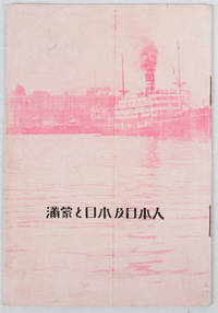
1933171122Circa1933. Map in text with outline colour graphs black and white mainly photographic illustrations 16pp original pictorial wrappers. Very good copy. 18.9 x 12.8cm. This booklet argues the importance of Manchuria and Inner Mongolia for Japan and its people as a new frontier for migration and development. It points out that the development of railway networks and in agricultural production should be of benefit for not only for Japan and its migrants but also for Manchuria through its growth prosperity and stable governance. It seems likely this booket was published a few years after the Manchurian Incident when Japan was keen to expand its influence and rights throughout the area. . unknown
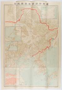
1904216818東京. Tokyo.: 電報新聞社. Denpō Tsūshinsha. Fifth Edition. Meiji 37 1904. Colour folding map with four inset maps 78.2 x 54.5cm folds into light card covers measuring 21 x 14cm. Very good copy. This the fifth edition of this map was published on 7th June 1904 reflecting the high level of public interest in receiving up-to-date information on the war particularly while the siege of Port Arthur continued without a decisive Japanese victory. The map includes four inset maps among them detailed views of Port Arthur and Vladivostok. It also records distances between key ports in Japan Korea and China. . 電報新聞社. [Denpō Tsūshinsha]. unknown
19262091502135501301South Manzhou Railway Beijing Office Laboratory 1926. Soft Cover. Fine. Number of pages: 169p Standard size: 15x22cm South Manzhou Railway Beijing Office Laboratory paperback
19362091502135501308South Manzhou Railway 1936. Soft Cover. Fine. Number of pages: 264p Standard size: B6 size 15x23cm South Manzhou Railway paperback
19242091502135417045South Manchuria Railway KK 1924. Soft Cover. Fine. Number of books: 1 South Manchuria Railway KK paperback
193373809New York: The South Manchuria Railway Company 1933. A promotional piece extolling "The Progress of Manchuria" following the establishment of Manchukuo a puppet state of the Empire of Japan in northeast China and Inner Mongolia produced in conjunction with the 1933 Century of Progress International Exposition at Chicago. Established in 1906 the Japanese-owned and operated South Manchuria Railway Company or Mantetsu for short was charged with a government-like role in managing the rail transportation and urban planning after the Japanese invasion in 1931.<br/> <br/> "It is conceded by all that the rapid industrial agricultural and educational development of Manchuria during the past 28 years is chiefly due to Japanese investments and the enterprise of her industrialists and skilled technicians. In all this important work the South Manchuria Railway Company has taken the lead and it is largely through the foresight confidence and intelligence of the administration of this great artery of commerce that has made Manchuria a prosperous and peaceful land for the past twenty years. This explains why the great migration of nearly 8000000 to Manchuria took place in the last few years. Here they found a land of peace and plenty until the war lords taxed and exploited them to the limit so they declared their independence as did the Americans in 1776."<br/> <br/> This folding brochure opens to a railway map of the region which shows four sections under construction. There are also 12 photographic images highlighting Manchuria's historic sights modern infrastructure and abundant resources. Printed in color on a 12" x 18" sheet of white paper that folds to 4" x 9" 12 panels. A fine fresh example with just a hint of edgewear. Scarce OCLC locates only three holdings Michigan National Library of Australia Canadian Centre for Architecture. The South Manchuria Railway Company unknown
196965212Milano: Grafica Uno 1969. Molto buono Very Good. Litografia a 5 colori. cm 76x545. . Molto buono Very Good. Bruniture leggere ai margini del foglio Some light browning and spotting. Tiratura 42. Grafica Uno, unknown
19262091502135500944South Manchuria Railway Co. Ltd. Harbin Office Investigation Section 1926. Soft Cover. Fine. Number of pages: 116p 2 illustrations Size: 15x22cm South Manchuria Railway Co., Ltd. Harbin Office Investigation Section paperback
19382091502135409279South Manzhou Railway 1938. Soft Cover. Fine. Number of books: 1 South Manzhou Railway paperback
19922080502106402950Green Shadow Book 1992. Soft Cover. Fine. The book is in fine condition. Green Shadow Book paperback
196989904Milano: Grafica Uno 1969. Molto buono Very Good. Acquaforte acquatinta originale a colori. Cm 22x21 Foglio 53x40. . Molto buono Very Good. . Grafica Uno, unknown
19252092902137602032South Manshu Railway General Affairs Department Research Division 1925. Soft Cover. Fine. Number of pages: 220p 26 maps Map size: B5 26cm Number of books: 1 South Manshu Railway General Affairs Department Research Division paperback
19822091502135500324Not Available 1982. Soft Cover. Fine. Number of pages: 83 pages Booklet size: 16x23 cm Not Available paperback
19862091502135413218Heilongjiang People's Publishing House 1986. Soft Cover. Fine. Number of books: 1 Heilongjiang People's Publishing House paperback
19392110502150410819South Manzhou Railway 1939. Soft Cover. Fine. Volume: 1 South Manzhou Railway paperback
1910151371910. Very good. B&w photo taken by the photographer Digby Bassett who traveled widely in Siberia and was the author of 'Mammoth and Mammoth Hunting'. Bassett studied and photographed mammoths as they thawed from glaciers. The photograph shows the governor general out of doors with a brick edifice in the background receiving visitors; on the verso is a handwritten explanatory note & signature of the photographer. 5 3/4 x 3 3/4" unknown
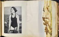
193075178Manchuria: N.p. 1930s. Oblong quarto 10 x 6 inches. 56 leaves with various kinds of ephemera throughout. The opening two pages each have an original watercolor. The next 5 leaves each bear 2 images of various aspects of life in Manchuria these are reproduced drawings with captions in Japanese the next 9 leaves bear 17 photographic illustrations of daily life in Manchuria with an emphasis on Dairen now Dalian. Tjhese are likely postcards. Following is a hodge-podge of 20 cigarette wrappers and cards eight original photographs and various other interesting bits. Original string tied silk boards some lifting of the cloth on the boards and some soiling. Overall in quite good conditionObviously assembled by a Japanese civilian there are no images of the Japanese Army the album gives the impression of life in Manchuria under Japanese rule as a quiet contented and peaceful place. History tells a different story. As part of earlier treaty agreements the Japanese had troops protecting the railroad in Southern Manchuria. The Japanese wanted to expand their control over Manchuria so on September 18 1931; the Japanese planted a small explosive device next to the tracks owned by Japan's South Manchuria Railroad near Mukden. The explosion that followed became known as the Mukden incident and provided an excuse for the Japanese to seize all of the cities along the railroad. At the same time the Japanese army in Korea which was occupied by the Japanese sent forces into Manchuria and quickly seized all the major cities in Liaoning and Kirin provinces. All of this took place without the approval of the civilian government in Japan. The Japanese continued to advance despite Chinese opposition. By February 27 1932 the last Chinese opposing the Japanese were forced to surrender all of Manchuria was in Japanese hands. N.p. hardcover
19242091502135501228South Manchuria Railway Co. Ltd. Harbin Office Investigation Section 1924. Soft Cover. Fine. Number of pages: 23 Standard size: 22x32cm South Manchuria Railway Co., Ltd. Harbin Office Investigation Section paperback
196965213Milano: Grafica Uno 1969. Molto buono Very Good. Litografia originale a colori. cm 535x72. . Molto buono Very Good. . Grafica Uno, unknown
1923188890Perhaps Tokyo: Mantetsu tetsudobu c.1923. The backbone of Japan's overseas empire A large and colourful tourist map of the mainline running from Jilin and Changchun to Lushun Port Arthur recording stations branchlines rivers and the belt of mountains skirting the mainline's south side. The text on the verso provides essential information on major destinations along the route. This map was issued during a period when Japan both consolidated its economic and political hold over South Manchuria but also faced heightened Chinese opposition in the form of strikes and protests. Tourist traffic however flowed unabated. Colour map formed from 2 joined sheets each 750 x 250 mm text and tipped-on errata slip on verso. Folding away into original illustrated wrappers. General creasing 55 mm split at head of first fold archival tape repair to wrappers: very good. unknown
19302091502135419796South Manchuria Railway KK 1930. Soft Cover. Fine. Number of books: 1 South Manchuria Railway KK paperback
1917156891Dalian: Minami manshu tetsudo 1917. A rare guide to the South Manchuria Railway with 13 well-preserved maps First edition first printing of this scarce and profusely illustrated handbook for business and tourist travellers on the South Manchuria Railway the economic powerhouse of Japan's East Asian empire. WorldCat records only three copies all in Japanese institutions. The South Manchuria Railway Company was founded in 1906 under the direction of Goto Shinpei 1857-1929 to manage railway lines seized from Russia in the wake of the Russo-Japanese War. By the end of 1907 it already had 9000 Japanese and 4000 Chinese employees and during its first decade of operations the company invested in a range of industries including coal mining including the major mine at Fushun natural gas extraction shipping and hotels and hospitality. In 1917 the company took over management of the entire railway network in Japanese-controlled Korea cementing its position as the backbone of Japan's imperial expansion between the wars. This guide focuses on major stops along the railway including Dalian Fengtian Changchun and Yingkou together with descriptions of and directions to notable visiting spots. The maps and plans show the extent of the network the layout of important destination cities and the course of key battles in the Russo-Japanese war. A selection of the plates stress the vibrancy of Japanese economic development. Octavo. With 54 plates 11 colour 13 folding maps and plans 6 colour folding table of fares colour pagoda vignette on title page vignettes in text. Original illustrated green stiff card wrappers spine and front cover lettered in white pictorial endpapers. Covers bright extremities rubbed small closed tear to penultimate map professionally repaired with Japanese tissue maps otherwise exceptionally well-preserved small loss to p. 7 of table of contents slightly affecting text contents clean. A near-fine copy. Institutional holdings: National Diet Library Waseda and International Research Center for Japanese Studies. unknown
19842091502133905972Kokusho Publishing Association 1984. Soft Cover. Fine. Volume: 1 Kokusho Publishing Association paperback
19732111902154606690full iron society 1973. Soft Cover. Fine. The book is in fine condition. full iron society paperback
19312090202122801315Not Available 1931. Soft Cover. Fine. Number of pages: 2733 pages Size: A5 Number of books: 2 Not Available paperback