447 résultats
1987ZB394513Korea International Economic Association. 1987-1993. volumes 1-7. 1987-1993 an uninterrupted run of complete volumes partly bound library markings textually clean & tight PRICE IS FOR THE LOT. - If you are reading this this item is actually physically in our stock and ready for shipment once ordered. We are not bookjackers. Buyer is responsible for any additional duties taxes or fees required by recipient's country. Photos available upon request. Korea International Economic Association. unknown
19723532z1972. Soft Cover. Good. PB spiral/pub. 1972/Gd. condition/253 pages - Foods from around the world. The text is in English and Korean. G63532z paperback
19852092902143900342Tarumizu Post Office Burial Liberation Study Group Kanba City 1985. Soft Cover. Fine. Number of books: 1 book Tarumizu Post Office Burial Liberation Study Group (Kanba City) paperback
19852092902143800364Tarumizu Post Office Burial Liberation Study Group Kanba City 1985. Soft Cover. Fine. Number of books: 1 book Tarumizu Post Office Burial Liberation Study Group (Kanba City) paperback
19892091502133901760Kokusho Publishing Association 1989. Soft Cover. Fine. Volume: 1 Kokusho Publishing Association paperback
19902091502133905451Kokusho Publishing Association 1990. Soft Cover. Fine. Volume: 1 Kokusho Publishing Association paperback
19922091502133903012Kokusho Publishing Association 1992. Soft Cover. Fine. Volume: 1 Kokusho Publishing Association paperback
19742091502135413940Gen iwa-sha 1974. Soft Cover. Fine. Number of books: 1 Gen iwa-sha paperback
19922090202120404845Shinkansha 1992. Soft Cover. Fine. Number of books: 1 Shinkansha paperback
19922091502133904878Shinkansha 1992. Soft Cover. Fine. Volume: 1 Shinkansha paperback
19922091502135404577Shinkansha 1992. Soft Cover. Fine. Number of books: 1 Shinkansha paperback
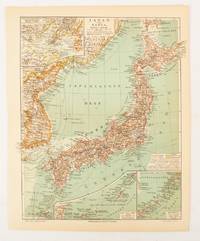
1902174898Leipzig.: Bibliographisches Institut. 1902-1908. Map printed in colour 27.2 x 21.4 cm inset colour key to territorial administration by country inset "western continuation of the main chart" including the Gulf of Tschili and Tsientsin and two insets at the foot of the map to the Kuril and the Ryuku Islands text in Geman central fold slight edge toning but in very good condition. Attractive map text in German prepared for Meyers Großes Konversations-Lexikon. . Bibliographisches Institut unknown
19972080302106809263Akashishoten 1997. Soft Cover. Fine. The book is in fine condition. Akashishoten paperback
19712091502135406755Toa shubbansha 1971. Soft Cover. Fine. Number of books: 1 Toa shubbansha paperback
19832091502135403625educational book publisher 1983. Soft Cover. Fine. Number of books: 1 educational book publisher paperback
19832091502135417784Not Available 1983. Soft Cover. Fine. Number of books: 1 Not Available paperback
19872091202133212230Not Available 1987. Soft Cover. Fine. Volume: 1 Not Available paperback
19912091202133208950Not Available 1991. Soft Cover. Fine. Volume: 1 Not Available paperback
19862091202133212345Sanwa Publishing Company special city 1986. Soft Cover. Fine. Volume: 1 Sanwa Publishing Company (special city) paperback
19412081002108301684Not Available 1941. Soft Cover. Fine. Number of books: 1 Not Available paperback
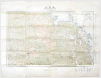
1917167697Tokyo: Rikuchi Sokuryobu 1917. First edition first printing of this bilingual tourist map of Mount Kumgang produced by the nascent Japanese colonial administration in Korea. In the 1910s politicized textbooks for Korean students singled out Fuji and Kumgang as the largest mountains in Japan and Korea while always stressing Fuji's status as the tallest. We have traced a single institutional copy at the National Diet Library. Kumgang was a popular destination for western travellers and naturalists. In 1917 the areas was visited by the legendary plant-hunter E. H. Wilson who discovered two species of maple as well as several new taxa on its slopes. In his notes he wrote how the mountain "drives a photographer to despair for no sooner has he taken one superb view than another seemingly more superb presents itself" quoted by Arnold Arboretum. Colour lithographed map 630 x 820 mm folding away to 209 x 110 mm as issued. Text in Japanese and English. Several contemporary ink circles and annotations. A few small splits along folds not affecting map area old brown paperclip mark a little creasing and soiling. A very good bright example. "1917-1919: Expedition to Eastern Asia" Arnold Arboretum available online. unknown
19992091502133903967Korea Cultural Heritage Foundation 1999. Soft Cover. Fine. Volume: 1 Korea Cultural Heritage Foundation paperback
19392091502135500430Geumgangsan Electric Railway Co. Cheolwon-gun Gangwon-do Korea 1939. Soft Cover. Fine. Number of pages: Many photographs 181 text pages Size: 19 x 26 cm Geumgangsan Electric Railway Co., Cheolwon-gun, Gangwon-do, Korea paperback
19952090202117900374Keisoshobo 1995. Soft Cover. Fine. The book is in fine condition. Keisoshobo paperback
19782091502133905050diamond company 1978. Soft Cover. Fine. Volume: 1 diamond company paperback