21 résultats
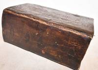
1836185920Leipzig: Hirschfeld 1836. Hardcover. G Cover has fading cracking edge/corner damage. Bookblock has age toning. Interior pages have age toning foxing some water staining. Title page has some text work away. Brown leather decorative boards with 2 metal clasps. Decorative carved and colored bookblock. VIII 920 257 pages. Hirschfeld hardcover books
1875WRCAM50727London 1875. 349-356pp. Modern blue wrappers printed paper label. Fine. The report extracted from a larger volume was compiled by George Richards Francis M'Clintock and Sherard Osborn to provide guidance to the impending proposed British expedition to the North Pole to be led by Sir George Strong Nares. In late May of the same year Nares would command two ships north around Greenland failing to reach the North Pole but becoming the first explorer to successfully pilot ships through the channel between Greenland and Ellesmere Islands; the channel was later named for him. In this report Richards M'Clintock and Osborn recommend two ships the Alert and the Bloodhound for Nares though the Bloodhound would be renamed the Discovery before the expedition began. The scope of the expedition is defined: "to attain the highest northern latitude and if possible to reach the North Pole." Also includes information on the route of the expedition the orders to be given various kinds of stores and provisions to be taken whether or not dogs should be used and much more. No listing in OCLC. unknown books
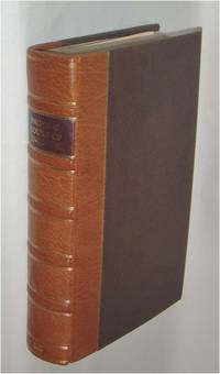
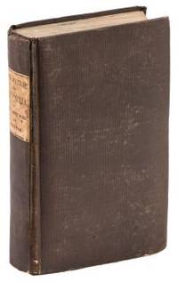
1808E0058ix366 pages. Duodecimo 7 1/4" x 4 1/4" in the original leather binding with black label in gilt to spine. Howes:354 First printed in 1806 in London in three volumes. Second printing.<br /><br />Thomas Ashe 1770-1835 was born in Dublin Ireland and was a soldier and memoirist. Much of his life was checkered with intrigue and fraud. His Memoirs and Confessions 1815 is an autobiographical account of 'criminal and delinquent' escapades beginning with the seduction of a girl in France. In America he edited the National Intelligencer and was arrested when attempting to steal treasures from churches in Latin America. His Travels in America first appeared in 1806. The narrative chronicles Ashe's travels by flatboat down the Ohio and Mississippi Rivers in 1806 and is one of the first travelogues written by a foreigner to comment specifically on the American inhabitants of the region. A unrestrained hatred of Americans can be found throughout the work. While the account is interesting and highly readable it was to create quite a stir and added to the wave of anti-British sentiment that would ultimately lead to the War of 1812. Printed Newburyport [Mass.] Reprinted for W. Sawyer and Co. by E.M. Blunt hardcover books
182232323Philadelphia: Harrison Hall 1822. 8vo. 8 5/8 x 6 inches. 4 449-532pp. Engraved frontispiece plate after T. R. Peale depicting a skin lodge Kaskaias. Foxing. Publisher's lettered wrappers.<br/> <br/>Ephemeral announcement of the publication of the account of the Long Expedition to the Rocky Mountains.<br/> <br/>Major Stephen Long was the principal proponent of government-sponsored exploration of the West following the War of 1812. He travelled farther than Pike or Lewis and Clark and blazed trails that were susequently followed by Fremont Powell and others. The expedition travelled up the Missouri and then followed the River Platte to its source in the Rocky Mountains before moving south to Upper Arkansas. From there the plan was to find the source of the Red River but when this was missed the Canadian River was explored instead. The expedition added significantly to the earlier discoveries of Lewis and Clark and Zebulon Pike. Edwin James was the botanist geologist and surgeon for this important government expedition initially named the Yellowstone Expedition. In addition to his duties on the expedition James subsequently served as the editor and compiler of the official account of the expedition relying "upon his own records the brief geological notes of Major Long and the early journals of Thomas Say who served as the expedition's naturalist" Wagner-Camp. The present December 1822 issue of The Port Folio Vol. II No. 6 includes a full-page announcement on the rear wrapper advertising the publication of the first edition of James account of the Long Expedition. In addition pages 496 to 503 include a lengthy review of the work and the engraved frontispiece depicts a skin lodge of the Kaskaias after expedition artist T. R. Peale printed from the same plate as the engraving within the first edition atlas to the James account. Rare and ephemeral. Harrison Hall unknown books
1844E0023xcii616 pages with bibliography. Octavo 8 1/2" x 5 1/2" bound in contemporary half calf with black spine label and gilt lettering. Publications de la Societe d'Etudes pour la colonisation de la Guyane francaise Number 4. The bibliographical catalogue occupies pages 579-616 and contains descriptions of 240 works on Guiana. Sabin 56097. First edition.<br /><br />French Guiana French: Guyane française officially Guyane is an overseas department French: département d'outre-mer or DOM of France located on the northern coast of South America. It has borders with two nations Brazil and Suriname. Like the other DOMs French Guiana is also an overseas region of France one of the 26 regions of France. Its currency is the euro. The prefecture is Cayenne. The addition of the adjective "French" comes from colonial times when three such colonies existed: British Guiana now Guyana Dutch Guiana now Suriname and French Guiana. The three are still often collectively referred to as the Guianas. French Guiana was originally inhabited by a number of indigenous American people. It was settled by the French during the 17th century. After the Treaty of Paris in 1763 Louis XV sent 12000 settlers to French Guiana to colonise the region. One and a half years later only a few hundred survived.2 Its infamous Île du Diable Devil's Island was the site of penal settlements from 1852 until 1951. More than 70000 French convicts were deported to French Guiana between 1852 and 1939.3 In 1809 a Portuguese-British naval squadron took French Guiana for the Portuguese Empire. With the signing of the Treaty of Paris in 1814 the region was handed back to the French though a Portuguese presence remained until 1817. A border dispute with Brazil arose in the late nineteenth century over a vast area of jungle leading to the short-lived pro-French independent state of Counani in the disputed territory and some fighting between settlers before the dispute was resolved largely in favor of Brazil by the arbitration of the Swiss government.<br /><br />Condition:<br /><br />Front inner hinge cracked rubbing to hinges and corners some internal foxing else a very good copy. Imprimerie de Bethune and Plon hardcover books
188439550Washington: GPO 1884. "Voluminous documentation on the bungled attempt to rescue Greely and his men. The rescue expedition consisted of the Yantic and the Proteus the latter being lost in Kane Basin. The head of the expedition never followed his orders for re-supplying Greely" -. Arctic Bib 18416. A very good copy in quarter calf over boards. sep 22 2017. 310 265 pp. b/w photo plates folding maps. GPO hardcover books
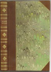
1818E0061323 pages with a portrait frontispiece and five colored aquatints. Octavo 8 3/4" x 5 1/2" bound in attractive half leather with marbled boards and gilt lettering to spine. Hill 1168 Second and best edition<br /><br />The Alceste brought Lord Amherst to China to serve as ambassador and specifically to negotiate the China trade at the time a matter of dispute between China and Great Britain.M'Leod who was surgeon on the ship describes the voyage out the various calls in the East Indies including touching at Batavia surveying off Korea the visit to Okinawa another to Manila and the shipwreck off the coast of Sumatra and subsequent rescue from Malay pirates. A brief but interesting interview with Napoleon at St. Helena is also included in the narrative. This was one of the most popular travel books of its time portraying the Far East to a much wider audience than had been reached by earlier accounts. The idyllic descriptions of Lewchew undoubtedly appealed to the romantic sensibilities of the era. Indeed buoyed by its success M'Leod published another work recounting his time as a slaver <i>A Voyage to Africa with some Account of the Manners and Customs of the Dahomian People</i>.<br /><br /><b>Condition:</b><br /><br />Attractive half rebind some foxing through out with no spotting to plates else a very good copy. John Murray hardcover books
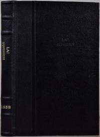
18584741baY2Toronto Ontario: John Lovell 1858. Book. Very good condition. Hardcover. First Edition. Octavo 8vo. Canada; Manitoba; Red River expedition 1857; Assiniboine and Saskatchewan expedition 1858; 258pages; 25.5cm; full black leather binding re-backed; inserted folded map: 35 x 77cm; part of Red River Valley north of 49th parallel to accompany report of H. Y. Hind's Canadian Red River expedition; small tear bottom left corner small breaks at 2 folds; detached folded map: 76.5 x 142cm; plan 'shewing' proposed route from Lake Superior to Red River settlement compiled from Dawson & Napier's maps T. Devine surveyor branch west Crown Lands Department Toronto 29th May 1858 Andrew Russell assistant commissioner; across map bottom: Profile of canoe route by Professor Hind horizontal scale 10 miles to 1 inch vertical scale 600 feet to 1 inch; center top of map: Plan of country between Red River settlement and Lake of the Woods scale 8 miles to inch; signed S. J. Dawson note-this is reduced copy of map from actual survey accompanying Dawson's report of 15th March 1858; Red River expedition under direction of George Gladman 1800-63 and Simon James Dawson 1820-1902; report by Henry Youle Hind 1823-1909; Canada Legislative Assembly Victoria 21 appendice No 3. A. 1858. First edition. John Lovell Hardcover books
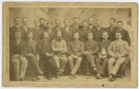
1885WRCAM54151Newburyport Ma.: S.C. Reed 1885. Cabinet photograph mounted on card 5 x 8 inches. Minor edge wear two later presentation inscriptions and photographer's studio stamp on verso. Very good. A rare cabinet card photograph picturing the members of the ill-fated Greely Arctic Expedition. Greely led a scientific expedition aboard the Proteus to Lady Franklin Bay in 1881. He and his crew were stranded at Fort Conger on Ellesmere Island without supplies. Nineteen of the twenty- five crew members would perish in the Arctic and one more would die on the journey home after Greely's party was rescued near Cape Sabine. Rumors of cannibalism would haunt the survivors of the expedition for the rest of their lives. Pictured here are several of the expedition members including Adolphus Greely just before they departed. The standing men are identified as follows: D. Schneider D. Cross D. Linn S. Long S. Frederick D. Henry S. Connell D. Bender D. Salor S. Bierdersack D. Gardner D. Ellis and D. Ralston; and the men seated are identified from left to right as: S. Brainard D. Keslingbury S. Greeley leader D. Lockwood D. Israil D. Jewell and D. Rice. S.C. Reed unknown books
189677993Washington: Printed by the Journal Publishing Company in Meriden Conn 1896. 1st ed. Hardcover. Very Good. frontis photos folding map 125p. Original cream-colored cloth. 21cm. Moderate soil and creasing on covers. Old paper clip mark. Clara Barton's report as President and treasurer appears at pages 3-44 of this scarce report; George H. Pullman reports as Financial Secretary at pages 45-55; and various other reports on relief field work in Anatolia are found at pages 57-96 and then followed by the text of various telegrams. <br/><br/> Printed by the Journal Publishing Company in Meriden, Conn hardcover books
1848E0530<p> 614 pages illustrated with 64 lithographed or engraved plates 3 battle-plans plus some figure drawings within the text. Octavo 8¾x5¼" bound in original publisher's black cloth and paper spine label. Thirtieth Congress - First Session. Ex. Doc. NO. 41. Cowan page 195; Graff 1249; Howes E145; Wagner-Camp 148:5; Zamorano Eighty 33 First edition House of Representatives issues of the report containing the reports of Lieutenant Abert Colonel Cooke and Captain Johnson as well as that of Emory; the Senate issue only contained the Emory report.</p><p><br />In 1844 Emory served in an expedition that produced a new map of Texan claims westward to the Rio Grande. He came to public attention as the author of the <i>Notes of a Military Reconnaissance from Fort Leavenworth in Missouri to San Diego California</i> published by the Thirtieth United States Congress in 1848. This report described terrain and rivers cities and forts and made observations about Indians Mexicans primarily in New Mexico Territory Arizona Territory and Southern California. It was and is considered one of the important chronicles and descriptions of the historic Southwest particularly noted for its maps. Emory was a reliable and conscientious cartographer. There is a story of testament as to Emory's dedication to accuracy that says John Bartlett his supervisor in the Corps of Topographical Engineers made him sign off on a misplaced boundary marker creating a sweet revenge for Emory who replaced him as Head of the International Boundary Commission in 1855. So accurate were his maps that when topographical engineers were surveying possible routes for the transcontinental railroad the most Southern route did not need to be surveyed thanks to the outstanding work by William H. Emory. But William H. Emory did more than just map the terrain; he also made notes about the plant life as well as the people who inhabited the sparsely populated southwest. Notating the social relations of some of the Native American people he wrote: "Women when captured are taken as wives by those who capture them but they are treated by the Indian wives of the capturers as slaves and made to carry wood and water; if they chance to be pretty or receive too much attention from their lords and masters they are in the absence of the latter unmercifully beaten and otherwise maltreated. The most unfortunate thing which can befall a captive woman is to be claimed by two persons. In this case she is either shot or delivered up for indiscriminate violence.<br /><br /><b>Condition:</b><br /><br />Binding worn at edges and spine ends cloth splitting along front joint; occasional light foxing lacking the two maps as noted very good.</p> Wendell & Van Benthuysen, Printers hardcover books
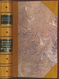
1853E0014198 pages with 23 plates. Royal octavo 9 1/2" x 6" rebound in 3/4 leather with marbled boards and black label with gilt lettering to spine. 79 plates with one Buffalo Dance folding and some with a single tint in this first issue there are errors in the list of illustrations corrected in later issues viz. Landscapes etc. 23 plates numbered as 1-13 15-23 plus one unnumbered at end; Mammals 6 plates; Birds 5 plates numbered 1 3-6 plate 2 Struthus Canicops Woodhouse male is called for but not present and most likely not to be found in this issue; Reptiles 21 plates with 10a miss-numbered as 10 12 as 13 and 13 as 16; Fishes 3 plates; Plants 21 plates plate 21 Aploppus Nuttalii present but not called for. Includes <i>Reconnaissance of the Zuni Little Colorado and Colorado Rivers Made in 1851</i> map as called for but includes Lithographed map <i>Boundary of the Creek Country</i> 24" x 36" laid in not called for. Senate Executive Document 59 Howes: 528 First edition.<br /><br />Survey of the watershed of the Canadian River and Red Fork of the Arkansas River in Indian Territory extending from Fort Smith to the border with Texas. The lands of the Cherokee Creek Seminole and Choctaw Indians are located. The map locates numerous forts including Smith Coffee Gibson and Old Fort Holmes and their connecting wagon roads. Talasee is shown at the site of Tulsa. This map was issued with the "Northern and Western Boundary Line of the Creek Country" report by Sitgreaves and Lt. J.C. Woodruff. The surveys were made in 1848 and 1850 but the report in which the map was issued wasn't published until 1858.<br /><br />After the conquest of New Mexico and California it was apparent that transportation and communications needed to be improved between these new territories and the rest of the United States east of the Mississippi. Geographical knowledge of most of this area particularly northwestern New Mexico now northern Arizona was very limited and inaccurate. Some maps of the day showed a river system that might provide a possible navigable water corridor between New Mexico and the Gulf of California via the Zuni Little Colorado and Colorado Rivers. In September of 1851 Captain Lorenzo Sitgreaves along with a small crew of topographers naturalists artists and support personnel and an escort of 30 infantrymen left the Zuni Pueblo in western New Mexico by pack train with instructions to explore and map the Zuni and Colorado Rivers and evaluate their navigability in light of a possible impending war with the Mormons in Utah. They traveled southwest along the Zuni River to its mouth and then headed northwest along the Little Colorado intending to follow it to the Colorado. When they reached Grand Falls northwest of present-day Winslow Arizona their guide Antoine Leroux advised them that it was unwise to follow the river any further because it flowed in a deep canyon for the rest of its course and emptied into the great canyon of the Colorado River. They left the river and struck off due west around the north side of the San Francisco Mountains discovering the Wupatki Indian Ruins along the way and looped southwestward around the south side of Bill Williams Mountain. The rest of their westward march followed near the future alignment of Route 66 to the Colorado River near the modern town of Bullhead City Arizona. After a difficult march south along the Colorado River they reached Camp Yuma on November 30. Of course Sitgreaves discovered that the Zuni and Little Colorado Rivers were not at all navigable and would be useless to transport troops and supplies. The Colorado River however was found to be navigable along the entire distance that he explored. Sitgreaves' official report "Report of an Expedition Down the Zuni and Colorado Rivers in 1851" was published in 1853.<br /><br /><b>Condition:</b><br /><br />Foxing left margin trimmed as issued for folding all other plates present as called for in Howes as well as Lithographed map <i>Boundary of the Creek Country</i> laid in and not called for some folding. Rebound in attractive three quarter leather else a about very good. Robert Armstrong hardcover books
1843E01482 volumes. xxxvii23878 ad pages with frontispiece woodcuts in text and 7 steel-engraved plates; vi2474 pages with frontispiece woodcuts in texts and 10 steel-engraved plates. Royal octavo 9¼x5½" in publisher's original green cloth spine lettered in gilt covers decorative blind stamped. First Edition.<br /><br />In 1825 Edward Belcher accompanied Frederick William Beechey's expedition to the Pacific and Bering Strait as a surveyor. In 1836. he commanded a surveying ship on the north and west coasts of Africa and in the British seas. Belcher took up the work which Beechey had left unfinished on the Pacific coast of South America. He was on board the bomb vessel HMS Sulphur which was ordered to return to England in 1839 by the Trans-Pacific route. Belcher made various observations at a number of islands which he visited having been delayed by being dispatched to take part in the war in China in 1840. On 26 January 1841 the then Commander Belcher landed on Possession Point at the north shore Hong Kong Island and made the first British survey of Hong Kong harbor. After the war's end in 1842 he reached home and for his services was made a Knight Bachelor in the following year. He was then engaged in HMS Samarang in surveying work in the East Indies the Philippines Geomun-do Port Hamilton and other places until 1847. In 1852 Belcher led the last and largest Admiralty expedition to rescue Sir John Franklin. He was also to look for his former surveying officer in Hong Kong Richard Collinson and Robert McClure whose ships had not been seen after entering the Bering Strait. He did a great deal of sledge exploration rescued McClure and abandoned four of his five ships in the ice. He had five ships: Assistance Belcher Resolute Henry Kellett second mate George Nares the steam tenders PioneerSherard Osborn and Intrepid Leopold McClintock and the depot ship North Star William Pullen. Belcher and one tender were to enter Wellington Channel where Franklin was thought to be while Kellett was to go west to Melville Island and look for Collinson and McClure. North Star was to stay at Beechey Island as a supply base. He left the Nore in April 1850. By early winter Assistanceand Pioneer were frozen in at Northumberland Sound to the north of Wellington Channel while Resolute and Intrepid were frozen in off Melville Island Arctic—the first ships this far west since William Edward Parry in 1819. A great deal of exploration was done by man-hauled sledges. In April 1853 Leopold McClintock and others left the Resolute on sledges and returned 105 days later having covered 1400 miles and discovered Prince Patrick Island. Another party went west and discovered Robert McClure whose ship was frozen in at Mercy Bay. Belcher went north by sledge and found a channel at the northern tip of Devon Island hinting that Franklin might have used it to escape to Baffin Bay. When the ice broke up that summer he pushed his ships up Wellington Channel and became trapped again. By February 1854 Belcher was becoming increasingly worried about the safety of his ships and men. In April he ordered Kellett to abandon his ships and return by sledge to North Star. Belcher abandoned his two ships in late July. Aided by two ships that showed up at Beechey Island Phoenix and Breadalbane the whole party returned to England. Belcher went through a court martial which was automatic for any captain who had lost a ship. He was exonerated but his sword was returned to him 'without observation'. He never again received an active command. Curiously Resolute broke free of the ice and drifted all the way to Davis Strait where it was picked up by an American whaler.<br /><br />Condition:<br /><br />Some staining and wear to covers spines a bit faded ends chipped and worn rear joint of Vol. I with chipping and loss; hinges repaired at endpapers some light foxing and occasional mostly marginal damp staining within the three folding maps which should be loose in a pocket not present; overall good uncommon in the original cloth. Henry Colburn hardcover books
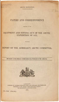
1875WRCAM50678London 1875. 402pp. plus folding map. Folio. 20th-century three-quarter calf and marbled paper boards spine gilt. Stefansson Library stamp on titlepage deaccessioned. Toned minor chipping at edges of some leaves. Final leaf repaired with archival paper with no loss to text; small tears in margin of map. Very good. This scarce document describes the plans for the 1875 Nares Expedition includes specifications for the H.M.S. Discovery data on supplies needed estimations of costs and a hydrographer's report as well as a color chart of the North Polar Sea. The chart is a Polar projection map showing the seas navigated by British expeditions as well as coasts discovered by British American German Swedish and Austrian explorers through 1874. <br> <br> The Nares expedition which sailed from 1875 to 1876 strove to be the first to reach the North Pole and to explore its coasts and region. Though unsuccessful in this venture the expedition was the first to sail ships through the channel between Greenland and Ellesmere Island and as far north as the Lincoln Sea recording valuable information about the mysterious region. A sledging party under Captain Albert Hastings Markham also set a new record on land reaching as far north as 83° 20'. The British Parliament printed occasional reports of the various expeditions and related Arctic subjects which became known as the Arctic "blue books" named after the distinctive blue wrappers in which they were originally issued. This copy has the stamp of the Stefansson collection at the Dartmouth library but was deaccessioned as a duplicate to his widow. ARCTIC BIBLIOGRAPHY 45251. hardcover books
1855E0558xx383 pages with hand colored frontispiece 3 maps in pockets plates many colored; vii41923 ad pages with color frontispiece and plates some colored. Small quarto 10 1/2" x 6 3/4" bound in original publisher's pictorial brown cloth with blind-stamped cover with gilt pictorial in gilt. Notes on the Natural History by John Richardson. Abbey Travel 645; Arctic Bibliography 1241; Books on Ice 5.8a; Hill 106; Sabin 4389; TPL 3409 First edition.<br /><br />Belcher's five-ship 1852-54 expedition in search of Franklin would be the last official British attempt. On the HMS Assistance Belcher successfully navigated through the Wellington Channel but beset by ice was unable to return to Lancaster Sound and was forced to abandon the ship. This account of the expedition also includes several essays on the natural history of the region by Richardson Owen Bell Salter and Reeve.<br /><br /><b>Condition:</b><br /><br />Minor wear re-backed with parts of original back-strips laid down; minor foxing short separations at folds to the largest map; inked stamps on title pages Edinger bookplates else a good set internally very good. Lovell Reeve hardcover books
1831E01322 volumes. xxi472 pages with three maps two folding and one double page figures and 13 plates; iv452 pages with 10 plates some folding tables and appendices. Octavo 9 1/2" x 5 1/2" Bound in contemporary half leather with marbled boards and gilt lettering to spine. Ferguson 1418; Hill I p. 19; Howes B309; Lada-Mocarski 95; Sabin 4347. Second edition published after quarto edition of the same year.<br /><br />Frederick William Beechey 17 February 1796 – 29 November 1856 was an English naval officer and geographer. He was the son of Sir William Beechey RA and was born in London. 1806 he entered the Royal Navy and saw active service during the wars with France and America. In 1818 he served under Lieutenant afterwards Sir John Franklin in David Buchan's Arctic expedition of which at a later period he published a narrative. In the following year he accompanied Lieutenant W. E. Parry in HMS Hecla. In 1821 he took part in the survey of the Mediterranean coast of Africa under the direction of Captain afterwards Admiral William Henry Smyth. He and his brother Henry William Beechey made an overland survey of this coast and published a full account of their work in 1828 under the title of Proceedings of the Expedition to Explore the Northern Coast of Africa from Tripoly Eastward in 1821-1822. In 1825 Beechey was appointed to command the HMS Blossom. His task was to explore the Bering Strait in concert with Franklin and Parry operating from the east. In the summer of 1826 he passed the strait and a barge from his ship reached 71°23'31" N. and 156°21'30" W. near Point Barrow which he named a point only 146 miles west of that reached by Franklin's expedition from the Mackenzie river. The whole voyage lasted more than three years and in the course of it Beechey discovered several islands in the Pacific and an excellent harbor near Cape Prince of Wales. In July 1826 he named the three islands in the Bering Strait. Two were the Diomede Islands that Vitus Bering had named in 1728: "Ratmanoff Island" Big Diomede and "Krusenstern Island" Little Diomede. Beechey called the uninhabited third islet "Fairway Rock" which is still its contemporary name. One of his crew Petty Officer John Bechervaise gave a detailed account of the voyage in his Thirty Six Years if a Seafaring Life by an Old Quartermaster published privately in 1839. In 1831 there appeared his Narrative of a Voyage to the Pacific and Beering's Strait to Co-operate with the Polar Expeditions 1825-1828. In 1835 and the following year Captain Beechey was employed on the coast survey of South America and from 1837 to 1847 carried on the same work along the Irish coasts. He was appointed in 1850 to preside over the Marine Department of the Board of Trade. In 1854 he was made rear-admiral and in the following year was elected president of the Royal Geographical Society. Beechey Island where Sir John Franklin wintered is named after him.<br /><br />Condition:<br /><br />Name neatly excised from head corner of titles small inconspicuous stamp to last pages. Inner hinges beginning marble to boards rubbed some stains to map. some toning to some plates some plates not bound in order to the printer but are all accounted for corners gently bumped else about a very good set. Henry Colburn and Richard Bentley hardcover books
1802E01512 volumes with Atlas. 4xxiv385 pages with xxii-xxiv lists books of voyages available from the publisher; 4418 pages with appendix containing vocabularies of the languages of Yukagir Yakut Tungoose Kamchatka the Aleutian Islands and Kadiak and inex. Atlas with title list of plates 14 engraved plates & large folding engraved map. Text volumes are small octavo 7¾" x 4½" 19th century quarter calf & boards spines tooled in gilt morocco lettering pieces; atlas is quarto 11" x 7½" in period tree calf spine tooled in gilt. Translated by J Castéra. Howes S-117 First French Edition.<br /><br />Martin Sauer was an English civil servant who knew Russian French and German. He became acquainted with Joseph Billings in St Petersburg in the 1780s. He agreed to join Billings expedition as his secretary and interpreter. It was agreed that he would write the official account but there is some controversy about his actives when he returned to St Petersburg in 1794. It has been suggested that he left hurriedly for England with much of the important archival material from the voyage including diaries and secret reports so that he could publish a record of the expedition before Russian authorities and scholars in the Academy of Sciences could review its details. Sauer's <i>An account of the Geographical and Astronomical Expedition to the Northern Parts of Russia</i> was published in London in 1802. It contains an abundance of detail about eastern Siberia and the Aleutian Islands and records the expeditions visits to Kodiak Island Prince William Sound and the coast south as far as Yakutat Bay. <br /><br />The chart was made by Aaron Arrowsmith from Sauer's notes and Billings observations and the whole complements well the other contemporary accounts of the expedition by the cartographer Gavriil Sarychev and the naturalist Carl Heinrich Merck. Aaron Arrowsmith 1750–1823 was an English cartographer engraver and publisher and founding member of the Arrowsmith family of geographers. He moved to Soho Square London from Winston County Durham when about twenty years of age and was employed by John Cary the engraver and William Faden. He became Hydrographer to the Prince of Wales ca. 1810 and subsequently to the King in 1820. In January 1790 he made himself famous by his large chart of the world on Mercator projection. Four years later he published another large map of the world on the globular projection with a companion volume of explanation.<br /><br /><b>Condition:</b><br /><br />Some rubbing and wear to coves of both atlas and text volumes some chipping to spine ends small gouge at back of atlas and stamp to front end paper else in very good condition. Chez F Buisson hardcover books
1856E05603 volumes: xvii1537 pages with 90 lithographs plates including the usual expunged bathing plate many in color including 3 "facsimiles" of Japanese woodblock prints 2 folding; 6 maps and charts 2 folding; 79 woodcuts in the text; 2414414-1xi pages with 4 color lithographs of Chinese scenes; 2 uncolored natural history engraved plates; 6 hand-colored lithographs of birds; 10 hand-colored steel-engravings of fish; 5 lithographs of shells 2 hand-colored; 16 diagram plates of winds and currents; 14-page facsimile of Japanese language version of the U.S.-Japan treaty; 17 folding charts on 16 sheets; numerous woodcuts in the text; xliii17051 pages woodcut star charts throughout. Volume III titled "United States Japan Expedition. Observations on the zodiacal light from April 2 1853 to April 22 1855 . by Rev. George Jones A.M. chaplain United States Navy". Quarto 11½ x8 ¾" bound in the original blind stamped cloth. Volume 1 rebacked with the original cloth spine laid down. Hill 1332; Sabin 30968 First edition of the House Issue.<br /><br />Detailed and profusely illustrated account of Perry's expedition to open Japan to the West; Upon his return to the U.S. his chief duty for the following year was to compile his reports of the expedition aided by Francis Hawks. The first volume has the account of the voyage and lithographs of the travel; the second volume has the natural history reports by D.S. Green and others and includes hand-colored plates of Japanese fishes and shells. In addition to the artist W. Heine from whose drawings a great number of the lithographs were made the daguerreotypist E. Brown Jr. went on the expedition taking what were undoubtedly the earliest photographic images of Japan many of them reproduced lithographically in this work. This copy with the nude bathing plate which was not included on the list of plates and not issued in all copies. <br /><br />In advance of his voyage to the Far East Commodore Perry read widely amongst available books about Tokugawa Japan. His research even included consultation with the increasingly well-known Japanologist Philipp Franz von Siebold who had lived on the Dutch island of Dejima for eight years before retiring to Leiden in the Netherlands. In 1852 Perry embarked from Norfolk Virginia for Japan in command of a squadron in search of a Japanese trade treaty. Aboard a black-hulled steam frigate he ported Mississippi Plymouth Saratoga and Susquehanna at Uraga Harbor near Edo modern Tokyo on July 8 1853. His actions at this crucial juncture were informed by a careful study of Japan's previous contacts with Western ships and what could be known about the Japanese hierarchical culture. He was met by representatives of the Tokugawa Shogunate who told him to proceed to Nagasaki where there was limited trade with the Netherlands and which was the only Japanese port open to foreigners at that time. Perry refused to leave and demanded permission to present a letter from President Millard Fillmore threatening force if he was denied. Perry ordered his ships to attack several buildings around the harbor to demonstrate US naval power. The Commodore was fully prepared for more hostilities if his negotiations with the Japanese failed and threatened to use unrestrained fire if the Japanese refused to negotiate. He sent two white flags to them telling them to hoist the flags when they wished a bombardment from his fleet to cease and to surrender. Perry's ships were equipped with new Paixhans shell guns capable of wreaking great destruction with every shell. The Japanese military forces could not resist Perry's modern weaponry; the term "Black Ships" in Japan would later come to symbolize a threat imposed by Western technology. Perry returned in February 1854 with twice as many ships finding that the delegates had prepared a treaty embodying virtually all the demands in Fillmore's letter. Perry signed the Convention of Kanagawa on March 31 1854 and departed mistakenly believing the agreement had been made with imperial representatives. The agreement was made with the Shogun the de facto ruler of Japan. On his way to Japan Perry anchored off Keelung in Formosa modern day Taiwan for ten days. Perry and crew members landed on Formosa and investigated the potential of mining the coal deposits in that area. He emphasized in his reports that Formosa provided a convenient mid-way trade location. Formosa was also very defensible. It could serve as a base for exploration as Cuba had done for the Spanish in the Americas. Occupying Formosa could help the US to counter European monopolization of the major trade routes. President Franklin Pierce declined the suggestion remarking such a remote possession would be an unnecessary drain of resources and that he would be unlikely to receive the consent of Congress. When Perry returned to the United States in 1855 Congress voted to grant him a reward of $20000 in appreciation of his work in Japan. Perry used part of this money to prepare and publish a report on the expedition in three volumes titled Narrative of the Expedition of an American Squadron to the China Seas and Japan. He was also advanced to the grade of rear-admiral on the retired list when his health began to fail as a reward for his services in the Far East.<br /><br />Condition:<br /><br />Wear and fading to cloth first volume rebacked; large map detached several others with stub tears and splitting to folds; light foxing else good to very good. A O P Nicholson hardcover books
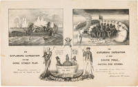
1838WRCAM55549New York: H.R. Robinson 1838. Lithograph 12 1/2 x 20 inches. Light foxing and soiling. Two short closed tears in the right edge and left edge of the sheet. Very good. A very rare print satirizing the recently undertaken United States Exploring Expedition commanded by Charles Wilkes. The Expedition departed in August 1838 and Robinson's eagerness to satirize it and the politicians who supported it is ample evidence that the endeavor was not universally popular. The print is made up of three humorous vignettes. "The upper left is Charles Wilkes in a rowboat with an oarsman and two members of the scientific corps who make observations with a transit or telescope and draw fauna. The upper right image depicts a group of sailors and Charles Wilkes huddled together on the snow surrounded by a ring of polar bears and an upturned rowboat foxes penguins and a campfire. They are flying an inverted U.S. flag to signal distress. At the bottom between the two titles is an inset of the three Navy Commissioners Isaac Chaucey Charles Morris and Alexander S. Wadsworth at sea in a bowl. They are framed by a shield surmounted by a jester and flanked on the left by a man in naval uniform James Kirke Paulding Secretary of the Navy and a sailor with a sad expression on the right" - Harry T. Peters Collection at the Smithsonian Institution online catalogue. The print is "Respectfully inscribed to the Secretaries of the Navy and Army and the Board of Navy Commissioners by their humble servant Robinson Crusoe." <br> <br> Not in Reilly's catalogue of American political prints in the Library of Congress though OCLC does locate a copy at the Library of Congress. That is one of two copies listed on OCLC the other copy is at the American Antiquarian Society. There are also copies in the Peters collection at the Smithsonian and at the Australian National Maritime Museum. OCLC 299947747 752795742. Herman J. Viola ed. MAGNIFICENT VOYAGERS THE U.S. EXPLORING EXPEDITION 1838-1842 Washington 1985 p.13. H.R. Robinson unknown books
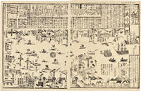
1855WRCAM46844Tokyo 1855. 24 1/2 x 16 inches. Matted. Old fold lines some minor wear and soiling. Near fine. Large wood block print comprised of two sheets showing the disposition of the Japanese soldiers and ships in preparation for the arrival of Commodore Perry's American fleet seen sailing into Tokyo harbor at the right side of the image. The top third of the print is comprised of text in Japanese characters. Three large American ships dominate the right side of the print while several smaller boats dot the rest of the harbor. The whole is dotted with Japanese characters denoting various people and places around the harbor. <br> <br> Perry first arrived in Japan on July 8 1853 with a fleet of four ships flying his pennant on the steam frigate Susquehanna. This first visit lasted ten days and culminated on July 14 with Perry's presentation of a letter from the President of the United States to the Japanese commissioners. Perry then absented himself for seven months returning on February 11 1854 for a stay of over four months. He negotiated a treaty opening Japan to trade with the western world providing for a U.S. consul in Japan and protecting visiting ships and crews. Perry's visit to Japan remains one of the most important events in the diplomatic history between western and eastern nations. <br> <br> A handsome print showing the Japanese side of this important historic event. unknown books
1853347471853. 31; 31; 61pp. plus a loose sheet. Original paper wrappers stitched. Contemporary manuscript annotations in red ink in one volume Scattered worming heavy in places. Some dampstaining and dust soiling. About very good.<br/> <br/>Separate Accounts of the Arrival of Commodore Perry<br/> <br/>Three fascinating Japanese manuscript accounts of the arrival of Commodore Perry to Japan in 1853. Then first Uraga Kurotone Ni Kansaru or "The Black Ship Arriving in Uraga" comprises the official government report of events when Perry steamed into Uraga Bay. This volume contains contemporary edits to the text in red ink. The second account of Perry's arrival Edo Urgga Bikoku Fune Torai Ikken or "Arrival of the Ships at Uraga" contains a double-page manuscript sketch of the coastline of Uraga Bay together with the disposition of Perry's ships. The final volume consists of a third manuscript entitled GASSHUKKO SHOKAN WAGE UTSUSHI a copy of the report on the Perry arrival prepared by Abe Masahiro Chief Senior Councillor in the Toguwara Shogunate which includes translations of the letters from Fillmore and Perry delivered by Perry on July 8 1853. Also with a single manuscript sheet that provides a description of Perry's ship. Vital contemporary manuscript accounts of this monumental transformation in Japanese foreign relations from significant Japanese participants in events. unknown books