84 résultats
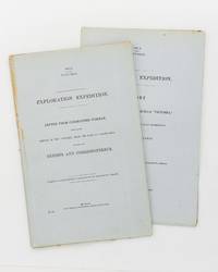
186257939Melbourne: Government Printer 1862. First Edition. Paperback. Melbourne Government Printer 1862 and 1862. Foolscap folio two papers 51 and 31 pages. Title-wrappers stab-sewn as issued; a few uncut edges a little foxed; an excellent pair. Victorian Parliamentary Papers Number 108 and 109 of 1861-2. The expedition was 'for the purpose of rendering relief if possible to the missing explorers under the command of Mr Burke; and directing the movements of the two land parties organized and despatched on the same mission of humanity from Brisbane and Rockhampton' under Landsborough and Walker respectively. Paper 109 gives Norman's account of the activities of his own party; Paper 108 in spite of its prosaic title is almost exclusively devoted to detailed accounts by Landsborough 33 pages and Walker 16 pages. Landsborough's reports include an account of the voyage and wreck of the hired transport 'Firefly'; two on the Albert River and the surrounding country and the journal of his south-western expedition 20 pages. Walker's reports include the journal of his expedition from Rockhampton to the Albert River 12 pages; its first and only publication. Three maps are referred to in the list of contents of Paper 108; these maps are rarely seen and were apparently issued only in copies made available to Victorian Members of Parliament. 2 items. Government Printer paperback
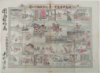
1893214562大阪. Osaka.: 福井榮之助. Fukui Einosuke. Meiji 26 1893. Handcoloured folding engraving 37.5 x 51cm. A prior owner's name is recorded in brush strokes down the left margin. Few small washi repaired tears two old repaired tears on the reverse some occasional browning particularly at centre fold light staining upper margin intruding a little into the printed image. Overall an attractive copy. Scarce. Lieutenant Colonel Fukushima Yasumasa 1852 – 1919 undertook a remarkable solo horseback expedition across Eurasia in 1892. Starting in Poland he traversed Russia and Siberia on his journey. Stationed in Berlin as a military attaché in 1887 he was tasked with researching the Trans-Siberian Railway under construction by Russia. His successful expedition was followed by further explorations in India and the Balkan Peninsula.<br><br>This sheet divided into 24 illustrated panels narrates Fukushima's story from his youth to his triumphant return after the expedition. Filled with adventure the story depicts his encounters with both danger and excitement. The narrative unfolds in a clockwise direction starting from the bottom right corner similar to a sugoroku game which this may be but it is uncertain. The central panel featuring a newly erected statue represents the final goal of his journey. Each panel is accompanied by a caption that furthers the story. . 福井榮之助. [Fukui Einosuke]. unknown
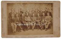
18811002651881. Cabinet photo. fine. Horizontal albumen cabinet photo on white mount 4 7/8" X7 7/8" image:4 1/8" X6 1/8". Nice group portrait of members of the expedition - Standing from left to right: D. Schneider D. Cross D. Linn S. Long S. Frederick D. Henry S. Connell D. Bender D. Salor S. Bierdersack D. Gardner D. Ellis and D. Ralston - Seated from left to right: S. Brainard D. Keslingbury S. Greeley leader D. Lockwood D. Israil D. Jewell and D. Rice. fine Rare. Portrait of members of the U.S. International Polar Year Scientific Expedition to Lady Franklin Bay Ellesmere Island sponsored by the U.S. Signal Service and other government agencies. After two winters and the failure of relief expeditions in 1882 and 83 Greeley abandoned Fort Conger and moved to Cape Sabine as per his orders. Eighteen men would die that winter including one by suicide and one execution - Pvt. Charles B. Henry Seven survivors were rescued by Schley's relief expedition on the June 22 1883 but Elison would perish before they reached St. John's on July 17. 1881 unknown
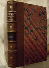
18694478London: MacMillan. Near Fine. 1869. xi 271pp 53 pg list of publisher's adverts dated 1869 at rear. Rebound in 1/4 leather marbled sides leather spine with raised bands gilt dec & title pieces. 1cm piece missing to top corner pg 72 date pencilled onto preface pg contents otherwise very good.; 225 x 150mm . MacMillan hardcover
1857324349New Haven 1857. Separately-issued offprint from the American Journal of Science and Arts 2nd series Vol. xxiv July 1857. 21-38 pp. plus folding map. 8vo. Period plain green wrappers stitched. Separately-issued offprint from the American Journal of Science and Arts 2nd series Vol. xxiv July 1857. 21-38 pp. plus folding map. 8vo. "Redfield's last contribution to meteorological science was a memoir upon the cyclones or typhoons of the north Pacific Ocean prepared at the request of Commodore Perry to accompany his Narrative of the United States Expedition to Japan; and was printed in the second volume of that work . He showed that the hurricanes of the Pacific followed the same general laws as those of the Atlantic and traced the paths of several remarkable storms among which was one of great force encountered by the steamer 'Mississippi' one of the vessels of Commodore Perry's squadron on route from Simoda to the Sandwich Islands in October 1854" Recollections of John Howard Redfield p. 302. Page 37 includes a description of the Kona or southerly winds of Hawaii as well as the effects of cyclones on the Hawaiian islands.<br /> <br /> Following its publication within Perry's Narrative in 1856 the work was issued in a slightly more condensed form within the July 1857 issue of the American Journal of Science and Arts. The present separately-issued offprint from the AJSA is the only separately-issued edition of the work. Scarce. Sabin 68512. Not in Forbes unknown
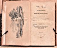
1825W1883New York: Collins and Hannay 1825. 459 pages fold-out map of the "western country" and 3 engraved plates missing is the sketch of the lead mine district. First printing. Octavo. 3/ leather over marbled paper-covered boards. According to Wikipedia Henry Rowe Schoolcraft 1793-1864 was an American geographer geologist and ethnologist noted for his early studies of Native American cultures as well as for his 1832 expedition to the source of the Mississippi River. He is also noted for his major six-volume study of Native Americans published in the 1850s. The book offered here is his report on an 1821 expedition from Missouri through Illinois and Indiana into Michigan. There is heavy emphasis on lead mining in Missouri and on treatymaking with the Chippewa and Potawatomi tribes. Howes S196. Quite scarce. The book is in about very good condition: sympathetically rebacked in gilt-ruled tan leather with new brown leather title patch; clean and tight; foxing throughout; previous owners' names and date on front endpaper. First Edition. Hardcover. Collectible-Very Good. 8vo - over 7¾" - 9¾" tall. Book. Collins and Hannay Hardcover
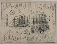
1854215028Japan. Circa1854. Black and white woodblock map with illustrations 32.2 x 41.5cm. Laid down on thick paper. Printed black border line at lower corner and occasionally in other areas along the border not printed otherwise good. This woodblock print map shows the defence layout around Tokyo Bay against the arrival of the American fleet. Names of lords who are responsible for defending particular areas are written with their rankings in terms of wealth sizes. In the centre the American ships are illustrated in detail. There are five sailing ships painted in red and three steam ships. These eight ships entered the bay on 6 February 1854. Thus this map most likely depicts the scene around that time. A caption on the left reads: 'The United States of America founded by Washington 77 years ago sent Matthew Perry with the President's letter in 1853; Perry revisited Edo in 1854.' . unknown
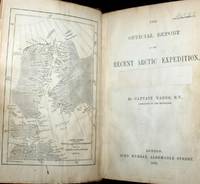
187661115030126John Murray London 1876. First Edition. Hardcover. Good Condition/No Dust Jacket. Report to the Admiralty of the expedition that left Upernivick on 22 July 1875 and returning in October 1876. This is an ex-library copy with flaws as described. Black half-leather binding with banded spine and dark blue covers are lightly rubbed at edges binding is sound with strengthened inner hinges. Crossed and stamped large library label is pasted to the inside of the front cover additional end-papers darkened no half-title-page frontis map has been pasted to previous end-paper with resultant wrinkles on both surfaces and a stamp of "Free Public Library Westminster S.W." on the obverse of the frontis shows through the pasted end-paper although not visible from the map. Title-page is darkened has a crossed out reference number in the upper leading corner and a psted paper rectangle covering a "Free Public Library Westminster S.W." stamp small feint stamp on reverse and short closed tear approx 1cm on leading edge. Pages are little darkened with some smudge marks mainly in margins page 84 to 91have a very small ink mark on the lower corner "Free Public Library Westminster S.W." stamp acorss the bottom of the final page. Quantity Available: 1. Shipped Weight: under 1 kg. Pictures of this item not already displayed here available upon request. Inventory No: 61115030126. All our books music and maps are sent by a tracked mail service. John Murray hardcover
189531933København 1895-96. Alle 3 bind i originale bogtrykte omslag ubeskårede og uopskårede. Omslagene lettere falmede og med et par smårifter ellers aldeles frisk eksemplar. 8374;8513;8272 pp. talrige tekstillustrationer 40 plancher heriblandt farvelitograferede plancher kort m.v. <br/><br/><em>First edition of one of the first scientific expedition to Greenland lead by The Greenlandic Commission. It contains the first scientific survey of the huge areas around Scoresby Sound. Meddelelser om Grønland Bind 17-19. </em> unknown
1878W1292London: C. KEGAN PAUL & CO. 1878. x 237 pages. First printing of Stevenson's first book a description of his experiences traveling in Belgium and France. The edition is reported to have been limited to only 750 copies and few copies in collectible condition come on the market. In an early twentieth century 3/4 blue morocco binding by Riviere & Son; gilt ruled spine with 5 raised bands; gilt spine decoration and lettering; top edge gilt;. The book is clean and tight with very minor rubbing of leather and slight toning of pages. First Edition. Hardcover. Collectible-Fine-/No Dust Jacket as Issued. Illus. by Walter Crane. 12mo - over 6¾" - 7¾" tall. Book. C. KEGAN PAUL & CO. Hardcover
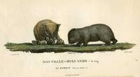
180718812Paris: Imprimerie de Langlois 1807. Very good condition. One of the most attractive prints of wombats a pair of wombats with 4 offspring clambering about. This is plate XXVIII from the work illustrating Nicolas Baudin's expedition. At the time the French were the most progressive at sending teams of artists & scientists around the world with their explorers. Copper engraving with original hand color. Platemark measures 12 1/2 x 9 1/2'' with small margins. A large early representation of the infrequently depicted wombat. Imprimerie de Langlois unknown
185514056London: Smith Elder & Co. 1855. Book. Poor / Fair. Hardcover. First Printing of the First Edition. Volume 1has a broken and separating binding wear and bumping to extremities and a little foxing throughout. Complete with Folding map and lithographed frontis. Vol. 2 has worn extremities cracked front hinge still attached prev. owner name on back of frontis and some light scattered foxing throughout. Original embossed boards could easily be re-cased. Scarce. Smith, Elder & Co. Hardcover
186454080Berlin Decker 1864-73. Lex8vo. 3 contemp. hcalf. Gilt spines and with gilt lettering. Spines slightly rubbed. XXII4352;VI4375;XI4426 pp. 24 engraved plates and 3 folded maps. Faint brownspots to margins in volume 1. <br/><br/><em>First edition. The offered volumes contains the general description of the expedition which relates to Japan and China. They do not comprise the scientific parts zoology botany of the expedition and not the landscape plates published as "Ansichten aus Japan China und Siam". </em> unknown
186153686Wien Kaiserlich-königl. Hof-und Staatsdruckerei 1861-62. Small 4to. Bound in 3 orig. full pictorial cloth. Vol. 1 rebacked preserving orig. spine. Vol.2 with a tear in backhinge. Vol. 3 a bit loose first inner hinge weak. Small stamp on title-pages. Lithographed tinted frontispiece. X368;VI434;IX436 pp. Each vol. with Beilagen 42207 music etc. 34 lithographed folded maps in colour 42 plates mostly tinted woodcuts profusely textillustrated with woodcuts. Internally clean and fine. <br/><br/><em>First edition. - Sabin 77625. </em> hardcover
180272327London: A. Arrowsmith 1802. A fine and high quality facsimile of this seminal map commissioned in 2001 by renown Lewis & Clark collector Roger Wendlick. Backed on canvas and measuring 150 x 58 inches in color Wendlick commissioned the firm of Ford Graphics of Portland to make this map. Only 21 copies were made and this is the last one with a letter from Wendlick attesting to this fact. Fine. "The 1802 revision of the map of North America on display delineates the complete length of the Missouri River as well as Mackenzie's journey to the Pacific in 1793. The depiction of the Missouri headwaters which Arrowsmith studied from Peter Fidler's drawing of a map by the Blackfoot Indian Ac Ko Mo Ki shows several streams joining into two branches of the Missouri which flow almost due east. The southern branch of the Missouri appears to be the main branch of the river and connects to the Knife River; the northern branch is a good representation of the actual course of the Missouri.Although the revised map still shows a single ridge of mountains in the west a note near the southern sources of the Missouri states: "Hereabout the Mountains divide into several low Ridges." This note which was based on the reports of Fidler Mackenzie and Thompson was more encouraging to Jefferson and Lewis than the note about the Stony Mountains on the 1795 map which unfortunately turned out to be more accurate. Arrowsmith's map situates the Great Lake River on the western slopes of the mountain range and connects this river to the Columbia River with a dotted line. Since another note claims that this river can be descended to the sea in eight days the Arrowsmith map supported the erroneous belief in a convenient route to the Pacific Ocean.Both the 1795 and 1802 versions of Arrowsmith's map served as resources that Nicholas King consulted as he prepared his map for the Lewis and Clark Expedition. Lewis and Clark in fact carried the 1802 Arrowsmith map along on the expedition. Thomas Jefferson owned the 1802 map as well as an 1802 edition of Arrowsmith's map of the United States. Arrowsmith's 1802 map of North America was the most comprehensive map of the West available to Jefferson and Lewis and it was probably the most important map used in the planning of the expedition." University of VirginiaAaron Arrowsmith's 1802 map was the most current and accurate cartographic representation of the American West available to Lewis on the eve of the journey. Lewis studied this edition closely during the summer of 1803 and even carried a copy on the first leg of the expedition. Among Arrowsmith's sources were Indian maps reports and manuscript maps from the British fur trade and British Navy exploration reports and charts of the Pacific Coast. But various elements in the map reinforced Jefferson's misconceptions of western geography among these were depictions of the Rocky Mountains as a single long chain and the headwaters of the upper Missouri River at the eastern edge of the Rockies suggesting those mountains were readily portaged. A. Arrowsmith unknown
1843E01482 volumes. xxxvii23878 ad pages with frontispiece woodcuts in text and 7 steel-engraved plates; vi2474 pages with frontispiece woodcuts in texts and 10 steel-engraved plates. Royal octavo 9¼x5½" in publisher's original green cloth spine lettered in gilt covers decorative blind stamped. First Edition.<br /><br />In 1825 Edward Belcher accompanied Frederick William Beechey's expedition to the Pacific and Bering Strait as a surveyor. In 1836. he commanded a surveying ship on the north and west coasts of Africa and in the British seas. Belcher took up the work which Beechey had left unfinished on the Pacific coast of South America. He was on board the bomb vessel HMS Sulphur which was ordered to return to England in 1839 by the Trans-Pacific route. Belcher made various observations at a number of islands which he visited having been delayed by being dispatched to take part in the war in China in 1840. On 26 January 1841 the then Commander Belcher landed on Possession Point at the north shore Hong Kong Island and made the first British survey of Hong Kong harbor. After the war's end in 1842 he reached home and for his services was made a Knight Bachelor in the following year. He was then engaged in HMS Samarang in surveying work in the East Indies the Philippines Geomun-do Port Hamilton and other places until 1847. In 1852 Belcher led the last and largest Admiralty expedition to rescue Sir John Franklin. He was also to look for his former surveying officer in Hong Kong Richard Collinson and Robert McClure whose ships had not been seen after entering the Bering Strait. He did a great deal of sledge exploration rescued McClure and abandoned four of his five ships in the ice. He had five ships: Assistance Belcher Resolute Henry Kellett second mate George Nares the steam tenders PioneerSherard Osborn and Intrepid Leopold McClintock and the depot ship North Star William Pullen. Belcher and one tender were to enter Wellington Channel where Franklin was thought to be while Kellett was to go west to Melville Island and look for Collinson and McClure. North Star was to stay at Beechey Island as a supply base. He left the Nore in April 1850. By early winter Assistanceand Pioneer were frozen in at Northumberland Sound to the north of Wellington Channel while Resolute and Intrepid were frozen in off Melville Island Arctic—the first ships this far west since William Edward Parry in 1819. A great deal of exploration was done by man-hauled sledges. In April 1853 Leopold McClintock and others left the Resolute on sledges and returned 105 days later having covered 1400 miles and discovered Prince Patrick Island. Another party went west and discovered Robert McClure whose ship was frozen in at Mercy Bay. Belcher went north by sledge and found a channel at the northern tip of Devon Island hinting that Franklin might have used it to escape to Baffin Bay. When the ice broke up that summer he pushed his ships up Wellington Channel and became trapped again. By February 1854 Belcher was becoming increasingly worried about the safety of his ships and men. In April he ordered Kellett to abandon his ships and return by sledge to North Star. Belcher abandoned his two ships in late July. Aided by two ships that showed up at Beechey Island Phoenix and Breadalbane the whole party returned to England. Belcher went through a court martial which was automatic for any captain who had lost a ship. He was exonerated but his sword was returned to him 'without observation'. He never again received an active command. Curiously Resolute broke free of the ice and drifted all the way to Davis Strait where it was picked up by an American whaler.<br /><br />Condition:<br /><br />Some staining and wear to covers spines a bit faded ends chipped and worn rear joint of Vol. I with chipping and loss; hinges repaired at endpapers some light foxing and occasional mostly marginal damp staining within the three folding maps which should be loose in a pocket not present; overall good uncommon in the original cloth. Henry Colburn hardcover
1823040517John Murray. Good with no dust jacket. 1823. First Edition. Hardcover. Hardcover; Hardcover. Brown leather boards with gold design at board edges. Title in gold over black leather label on gold decorated spine. Boards are noticeably scuffed and worn. Frayed edges some sunning. Marbleized edges match marbleized endpapers. Occasional foxing throughout. 4 maps 30 plates of which 11 are hand colored. All are in nice condition some light foxing/soil. Always carefully wrapped and shipped in cardboard boxes to protect your purchase.; B/w Illus; 4TO . John Murray hardcover
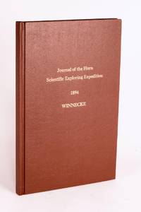
189658059Adelaide: C.E. Bristow Government Printer 1896. First Edition. Hardcover. Fine. Adelaide C.E. Bristow Government Printer 1896. Foolscap folio 32 pages including Appendix B: Report of the Physical Geography of Central Australia by Professor R. Tate and J.A. Watt plus 24 plates on 13 leaves printed rectos only and a folding meteorological chart 2 folding maps a topographical map of Mount Watt and a Survey of Hermannsburg Mission Station and a very large folding colour map 1210 × 1210 mm. Modern cloth lettered in gilt on the front cover; blank bottom margin of the main map slightly creased with one tiny tear expertly sealed; a fine copy. South Australian Parliamentary Paper 19 of 1896: only 650 copies printed. Winnecke was the leader of the expedition and in 'the natural order of things these journals and maps should have been published in connection with the scientific and other records of the Horn Expedition as both supplementary and complementary to them'. After a financial disagreement with W.A. Horn the organiser and backer of the venture this did not occur and this first edition was published under the auspices of the South Australian branch of the Royal Geographical Society of Australasia in conjunction with the Department of the Minister for the Northern Territory and the Survey Department. McLaren 16973; an octavo edition was published the following year see McLaren 16969 - not noting the very large map. C.E. Bristow, Government Printer hardcover
1831E0132<p>2 volumes. xxi472 pages with three maps two folding and one double page figures and 13 plates; iv452 pages with 10 plates some folding tables and appendices. Octavo 9 1/2" x 5 1/2" Bound in contemporary half leather with marbled boards and gilt lettering to spine. Ferguson 1418; Hill I p. 19; Howes B309; Lada-Mocarski 95; Sabin 4347. Second edition published after quarto edition of the same year.<br /><br />Frederick William Beechey 17 February 1796 – 29 November 1856 was an English naval officer and geographer. He was the son of Sir William Beechey RA and was born in London. 1806 he entered the Royal Navy and saw active service during the wars with France and America. In 1818 he served under Lieutenant afterwards Sir John Franklin in David Buchan's Arctic expedition of which at a later period he published a narrative. In the following year he accompanied Lieutenant W. E. Parry in HMS Hecla. In 1821 he took part in the survey of the Mediterranean coast of Africa under the direction of Captain afterwards Admiral William Henry Smyth. He and his brother Henry William Beechey made an overland survey of this coast and published a full account of their work in 1828 under the title of Proceedings of the Expedition to Explore the Northern Coast of Africa from Tripoly Eastward in 1821-1822. In 1825 Beechey was appointed to command the HMS Blossom. His task was to explore the Bering Strait in concert with Franklin and Parry operating from the east. In the summer of 1826 he passed the strait and a barge from his ship reached 71°23'31" N. and 156°21'30" W. near Point Barrow which he named a point only 146 miles west of that reached by Franklin's expedition from the Mackenzie river. The whole voyage lasted more than three years and in the course of it Beechey discovered several islands in the Pacific and an excellent harbor near Cape Prince of Wales. In July 1826 he named the three islands in the Bering Strait. Two were the Diomede Islands that Vitus Bering had named in 1728: "Ratmanoff Island" Big Diomede and "Krusenstern Island" Little Diomede. Beechey called the uninhabited third islet "Fairway Rock" which is still its contemporary name. One of his crew Petty Officer John Bechervaise gave a detailed account of the voyage in his Thirty Six Years if a Seafaring Life by an Old Quartermaster published privately in 1839. In 1831 there appeared his Narrative of a Voyage to the Pacific and Beering's Strait to Co-operate with the Polar Expeditions 1825-1828. In 1835 and the following year Captain Beechey was employed on the coast survey of South America and from 1837 to 1847 carried on the same work along the Irish coasts. He was appointed in 1850 to preside over the Marine Department of the Board of Trade. In 1854 he was made rear-admiral and in the following year was elected president of the Royal Geographical Society. Beechey Island where Sir John Franklin wintered is named after him.<br /><br /><strong>Condition:</strong><br /><br />Name neatly excised from head corner of titles small inconspicuous stamp to last pages. Inner hinges beginning marble to boards rubbed some stains to map. some toning to some plates some plates not bound in order to the printer but are all accounted for corners gently bumped else about a very good set.</p> Henry Colburn and Richard Bentley hardcover
1855E0558<p>2 volumes. xx383 pages with hand colored frontispiece 3 maps in pockets plates many colored; vii41923 ad pages with color frontispiece and plates some colored. Small quarto 10 1/2" x 6 3/4" bound in original publisher's pictorial brown cloth with blind-stamped cover with gilt pictorial in gilt. Notes on the Natural History by John Richardson. Abbey Travel 645; Arctic Bibliography 1241; Books on Ice 5.8a; Hill 106; Sabin 4389; TPL 3409 First edition.<br /><br />Belcher's five-ship 1852-54 expedition in search of Franklin would be the last official British attempt. On the HMS Assistance Belcher successfully navigated through the Wellington Channel but beset by ice was unable to return to Lancaster Sound and was forced to abandon the ship. This account of the expedition also includes several essays on the natural history of the region by Richardson Owen Bell Salter and Reeve.<br /><br /><strong>Condition:</strong><br /><br />Minor wear re-backed with parts of original back-strips laid down; minor foxing short separations at folds to the largest map; inked stamps on title pages Edinger bookplates else a good set internally very good.</p> Lovell Reeve hardcover
1802E0151<p>2 volumes with Atlas. 4xxiv385 pages with xxii-xxiv lists books of voyages available from the publisher; 4418 pages with appendix containing vocabularies of the languages of Yukagir Yakut Tungoose Kamchatka the Aleutian Islands and Kadiak and inex. Atlas with title list of plates 14 engraved plates & large folding engraved map. Text volumes are small octavo 7¾" x 4½" 19th century quarter calf & boards spines tooled in gilt morocco lettering pieces; atlas is quarto 11" x 7½" in period tree calf spine tooled in gilt. Translated by J Castéra. Howes S-117 First French Edition.<br /><br />Martin Sauer was an English civil servant who knew Russian French and German. He became acquainted with Joseph Billings in St Petersburg in the 1780s. He agreed to join Billings expedition as his secretary and interpreter. It was agreed that he would write the official account but there is some controversy about his actives when he returned to St Petersburg in 1794. It has been suggested that he left hurriedly for England with much of the important archival material from the voyage including diaries and secret reports so that he could publish a record of the expedition before Russian authorities and scholars in the Academy of Sciences could review its details. Sauer's <em>An account of the Geographical and Astronomical Expedition to the Northern Parts of Russia</em> was published in London in 1802. It contains an abundance of detail about eastern Siberia and the Aleutian Islands and records the expeditions visits to Kodiak Island Prince William Sound and the coast south as far as Yakutat Bay. <br /><br />The chart was made by Aaron Arrowsmith from Sauer's notes and Billings observations and the whole complements well the other contemporary accounts of the expedition by the cartographer Gavriil Sarychev and the naturalist Carl Heinrich Merck. Aaron Arrowsmith 1750–1823 was an English cartographer engraver and publisher and founding member of the Arrowsmith family of geographers. He moved to Soho Square London from Winston County Durham when about twenty years of age and was employed by John Cary the engraver and William Faden. He became Hydrographer to the Prince of Wales ca. 1810 and subsequently to the King in 1820. In January 1790 he made himself famous by his large chart of the world on Mercator projection. Four years later he published another large map of the world on the globular projection with a companion volume of explanation.<br /><br /><strong>Condition:</strong><br /><br />Some rubbing and wear to coves of both atlas and text volumes some chipping to spine ends small gouge at back of atlas and stamp to front end paper else in very good condition.</p> Chez F Buisson hardcover
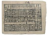
1853347481853. Three woodblock-printed sheets on mulberry paper. Mild edge wear old folds. A detailed revealing group of late Tokugawa samurai reference sheets recording the names ranks stipends heraldry standards and service obligations through which the shogunate and Edo public understood military readiness at the moment of Perry's arrival.<br/> <br/> Commodore Matthew C. Perry anchored off Uraga at the entrance to Edo Bay in July 1853. His arrival made visible the vulnerability of the Tokugawa capital and produced an immediate demand for information about coastal defence domain strength and the lords responsible for guarding the approaches to Edo. Kawaraban and related broadsides answered that demand in compressed visual form combining names crests military symbols income figures and geographical or administrative data. The first printed sheet appears to be an earlier roster of Edo office-holders or guard personnel. Its tabular format with names offices crests and standards records the recognitional system already in place within Tokugawa administration before the Perry crisis sharpened the public appetite for such information. The manuscript sheet is ruled into a large grid with headings formed from the twelve zodiac signs and the four seasons including Rat Ox Tiger Hare and the seasonal headings. The entries appear to record named houses Lords or retainers against recurring seasonal and cyclical categories probably for service attendance or ceremonial obligation. The third sheet is headed "Rekko yushinroku" here translated as "Register of Valiant Retainers of the Lords." It lists major daimyo houses and their principal retainers with domain or house headings names titles stipend figures in koku family crests standards and related insignia. Visible regional or house designations include "Kaga" "Owari" "Kii" "Satsuma" "Higo" and "Tosa." The sheet gives a graphic register of the daimyo world mobilised or imagined as mobilised around the defence of Edo Bay. Together the sheets preserve the administrative and visual language of Tokugawa defence at a moment of acute pressure. They are not formal shogunal orders and the first sheet may predate Perrys arrival but they show how late Edo Japan translated rank obligation military identity and coastal defence into portable tabular form. Their compression the names of Lords and retainers the scale of domains the crests and standards by which armed households could be recognised and the bureaucratic habits of a regime suddenly forced to account for its capacity to defend the country reveals these documents' immediacy and importance. unknown
18932712376Adelaide: C.E. Bristow 1893. Wrappers torn at edges but well repaired as are the boards of the map section. Octavo complete with maps; original wrappers and boards preserved in a brown morocco bookform box. <p><p>First edition: one of 500 copies printed of the narrative of one of the last great Australian exploring expeditions written by the leader of the expedition and complete with its maps.</p> <p>Lindsay led this extensive expedition - it ran to eight men forty-four camels and five Afghan camel drivers - organised by the South Australian Branch of the Royal Geographical Society and equipped by Sir Thomas Elder to explore the unknown interior between South Australia and the west coast and to look for Leichhardt. Lindsay's exhaustive report includes the surveyor L.A. Wells's journal of the expedition. Also included is an extensive Aboriginal vocabulary collected by Wells from the Pidong tribe at the head of the Murchison River the Minninng tribe at Fraser Range from the Everard Ranges at Mount Illbillee and from the "Wallawe" tribe at Yarragabie Station Western Australia. He states "Appended is a list of native names which I have collected from four tribes met with during the expedition.".</p> <p>The separate large folding maps are original lithographs coloured to illustrate geological changes. Compiled and drawn by both Lindsay and Wells these maps show in great detail the earlier discoveries of Giles Gosse Forrest and Hunt as well as the route taken by the Elder explorers.</p> </p> . C.E. Bristow unknown
185546629Gotha Julius Perthes 1855-1874. 4to. Bound in 18 contemp. hcalf some wear to the first 10 vols. some a bit rubbed. Some scattered brownspots to the first volumes. Gilt spines. Wear to top of spines. With a huge amount of original maps plates profiles etc. lithographed and engraved large and folded and mainly in colour. This set does not include the "Ergänzungsbände". <br/><br/><em>The first 19 lacking vol. 14 volumes of this importent periodical from its "Golden Period". "Petermann's Mittheilungen" became the leading geographic publication of the world and remained so until World War I. All the new geographical discoveries all the reports from the latest exploratory expeditions were published and flowed into Petermann's Geographische Anstalt and he took care to see that it was translated into cartographic form as quickly as possible. The maps soon came to have a reputation for containing the latest and the most accurate information available. Not only German but international readers as well came to see the 'Mitteilungen' as an indispensable organ for the world of geographical research. </em> unknown
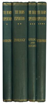
189695477London: Dulau 1896. First Edition. Hardcover. Very Good. London Dulau 1896. Quarto four volumes ii xviii 220 pages with illustrations and a map plus 11 pages of plates and a large folding map 650 × 615 mm; ii iv 432 pages with illustrations plus 28 pages of plates 1 folding 11 in colour and a corrigenda slip at page 1; vi 204 pages with illustrations plus 9 pages of plates 2 folding; and vi 200 pages with illustrations plus 20 pages of plates 6 folding 4 of them in colour. Original blue cloth lightly scuffed and bumped with the spines a little sunned; front board of Volume 2 partially cracked creasing the cloth a little; edges untrimmed and a trifle foxed in places; an excellent set uncut and with the last three volumes completely unopened. The purpose of this scientific expedition sponsored by mining magnate and philanthropist William Austin Horn and with Charles Winnecke as commander and surveyor was to examine the MacDonnell Ranges on the not unreasonable premise that 'when the rest of the Continent was submerged the elevated portions of the McDonnell sic Range existed as an island and that consequently older forms of life might be found in the more inaccessible parts'. This in fact proved not to be the case but the expedition of some fourteen weeks and 2000 camel miles was an outstanding success. 'It was not the intention . to explore a new region . But in the pursuit of natural history the expedition split into independent groups and explored undiscovered areas thus filling in more of the blank spaces in this vast region' Feeken Feeken and Spate. 'These volumes constitute one of the most substantial contributions in nineteenth-century Australian exploration but perhaps more importantly the expedition is a landmark in anthropological history because it resulted in Baldwin Spencer meeting Frank Gillen' Mulvaney. 4 items. Dulau hardcover