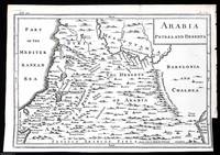
MAP OF ARABIA PETRAEA AND DESERTABiblio.com
4 résultats
1748372049Printed for T. Osborne in Gray's Inn; A. Miller in the Strand; and J. Osborn in Paternoster Row London 1748. Unframed Print. Very Good Condition. This 1748 engraved map provides a detailed representation of Arabia Petraea the region covering parts of modern-day Jordan Sinai and northwestern Saudi Arabia and Arabia Deserta the vast desert lands of the Arabian Peninsula. It highlights key geographical features ancient trade routes and settlements reflecting the European understanding of the region at the time. The engraving was printed in London by T. Osborne A. Miller and J. Osborn.1 folding plate. Close cropped at the right margin. Size: 20 x 30 cms. Category: Universal History; PRINTS : Antiquarian Interest; Printed before 1800; Special Features. This item may require more postage than the rates shown for delivery outside the UK. If extra postage is required we will contact you before processing your order and you will be given the details and option to decline the extra cost. Printed for T. Osborne, in Gray's Inn; A. Miller, in the Strand; and J. Osborn, in Paternoster Row unknown
1780144401780. IRWIN Eyles. A Series of Adventures in the Course of a Voyage up the Red Sea on the Coast of Arabia and Egypt; and of a Route through the Deserts of Thebais Hitherto Unknown to the European Traveller in the year MDCCLXXVII in Letters to a Lady. Dublin: Sleater Whitestone Potts Colles Wilson Jenkins Flin Etc. 1780. 4to 576 pp. With the original attached fold-out map of The Red Sea wants 2 other maps. Antique full leather binding with gold inlay on the spine. <br /> <br /> First edition of Eyles Irwin's exciting personal account and observations in Arabia and Egypt in the 18th century. Irwin was born in Calcutta and served with the East India Company. Irwin was dismissed from the East India Company in 1776 and traveled through Arabia and Egypt on his return to England to seek redress. He left India in 1777 for England when his ship was captured by pirates. From Cossier he was forced to cross the desert to Suez and then on to Luxor Cairo and Alexandria. His journey lasted eleven months. Irwin's narrative is comprised of letters to an unnamed "Lady" which provides the reader with candid observations of the convergence of European and Arab cultures in the late 1700's. The letters detail the journey to various ports cities and deserts of modern day Saudi Arabia. This book was published in 1780 a time when European exploration and travel was at its peak. The Arab world during the 1700's was considered mysterious enchanting and exotic thus attracting European travelers like Irwin. Tidrick remarks that Irwin's "travel narrative of 1780 was a long recitation of Bedouin treachery." Includes two poems by Irwin 'Ode to the dessert' and 'Ode to the Nile.' The title panel on the spine remains the reverse board was detached and has been sewn back on with dark thread. There is a 3 1/2" split on the front hinge although the hinge is still strong. Corners bumped and worn with the top and base of the spine worn with some chipping. The inside pages are very good. Overall in good condition. Blackmer Collection 865; Atabey Collection 609. unknown
1710144631710. Arabia Eudaemon ex Plinio LibVI Beautiful original hand colored engraved map of the Arabian Peninsula printed in 1710 by Cluverius Brun. A Ptolomic map. Copper Engraved. Saudi Arabia. Titled: Arabia Eudaemon ex Plinio LibVI. Condition: General age related toning vibrant coloring. Size in inches: Measures approximately 8 1/2" x 12."Overall in very good condition. unknown
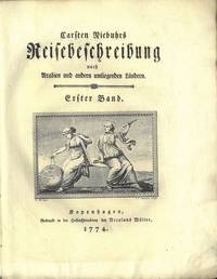
177471463Kopenhagen 1774. Stor 4to. Samtidig stivt blankt omslag. Ubeskåret. XVI 4 505 1 s. LXXII kobberstukne plansjer hvorav flere foldet. Med et stort foldet kart over Jemen. Gedruckt in der Hofbuchdruckerey bey Nicolaus Möller Tysk. <br/><br/><em>KUND BIND I. Plansjene delvis trykt på blålig papir. </em> unknown