44 résultats
189863151898. First Edition. Hardcover. Very Good/No Dust Jacket. International Navigation Co. Pub. NY 1898; 1st edition; Art Work by various artists; very good condition; bound in hard cover cloth with picture paste-downs to front and rear cover; mild rubbing to edges of photo on front cover and previous owner's bookplate to front end-page else a fine copy; Maritime hardcover
18820007631Chicago: Fergus Printing 1882. First Collected edition. printed wrappers. Fine. 12mo 208 pages as new folded but never sewn. <br/><br/>Fergus Historical Series no.18. Includes William Mosley Hall's speech "A National Railroad to the Pacific" the first speech promoting a trans-continental railroad for America. Illinois Congressman Abraham Lincoln was a delegate to this Convention: his brief speech there was his first before a nationwide platform - and it caught the ear and mind of Horace Greely also a delegate that this Lincoln was an up-and-comer. see Howes C371; Gutter Between the Waters and the Wind 14. Fergus Printing unknown
1882DEMO016530IChicago: Fergus Printing 1882. First Collected edition . Flexible covers. Very Good. 12mo208 pages untrimmed wrappers 1 short tear else fresh <br/><br/>Fergus Historical Series no.18. Includes William Mosley Hall's speech "A National Railroad to the Pacific" the first on this subject Chicagoans focussed on getting support for the Illinois & Michigan Canal which would tie together the western waters of the Great Lakes with the great inland navigable rivers. "The meeting of that Convention raised the value of the Chicago property at once and was the starting point of its unheard of prosperity - Wm. M. Hall Commissioner." This is a much expanded annotated and indexed treatment of the original 1847 publication. This convention caused Abraham Lincoln's first visit to Chicago which he addressed on two occasions in its 3 days. see Howes C371; Gutter Between the Waters and the Wind 14. Fergus Printing unknown
187838742Brazil 1878. A few small holes affecting a few letters some folds reinforced on verso additions in manuscript. Broadside. 20 3/4x29 inches. The Companhia Nacional de Navegação a Vapor replaced the Companhia Brasileira de Navegação a Vapor as the government sponsored line along the southern route in 1872. Montevidio was the furthest stop of this important Brazilian shipping company from which it also provided river service to upper Brazil. The broadside contains a listing of the rates of passage from Rio de Janeiro to Montevideo as well as the limitations and restrictions for passengers which included a prohibition on weapons and flammable materials. unknown
1878z015742Marseille: Compagnie De Navigation Mixte 1878. Good. Letter of transmittal from a Compagnie De Navigation Mixte agent to James M. Lincoln of the Pacific Mail Steamship Co. New York. French language measures 8.5 by 7 inches recto only. Good. Paper repair to verso. Lightly creased stain to upper right corner else clean and unmarked. Compagnie De Navigation Mixte unknown
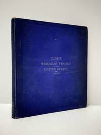
1898111111113294Government Printing Office 1898. Hardcover. Good. Government Printing Office; Washington 1898. Hardcover. A Good blue cloth binding with gilt lettering on front board and spine binding intact starting hinges handling/scuffing and some discoloration to boards bit frayed spine edges age toning to pages small abrasions to board corners rubbing along board edges sunned spine bit of scattered foxing to front and back matters mild musty odor without Dust wrapper. A good copy. 8vooctavo or approx. 6 x 9 inches 405pp. We pack securely and ship daily with delivery confirmation on every book. The picture on the listing page is of the actual book for sale. Additional Scans are available for any item please inquire. Government Printing Office hardcover
1859102259Richmond Va.: Ritchie Dunnavant & Co. 1859. First Edition. Paperback. Good. 45 p. 23 cm. Fold-out map of the Coal River at Boone and Kanawha Counties with minor repairs mild spotting a few tears. Rebound with original front cover applied and new back. Mild spotting former owner's label on title page. <br/><br/>Includes president and directors of the company charter company stock by-laws rates of toll info on coal fields and shipping coal. Ritchie, Dunnavant & Co. paperback
1878z015739Paris: Chargeurs Reunis Compagnie Francaise de Navigation a Vapeur 1878. Good. Letter of transmittal from a Compagnie Francaise de Navigation a Vapeur agent to James M. Lincoln of the Pacific Mail Steamship Co. New York. French language measures 8.5 by 10.5 inches recto only. Good. Chipping and paper repair to extremities edges toned else clean and unmarked. Chargeurs Reunis Compagnie Francaise de Navigation a Vapeur unknown
1868285943Washington: Government Printing Office 1868. Soft Cover. Very Good binding. The Bureau of Navigation Navy Department's booklet General Instructions for Hydrographic Surveyors. Dampstaining to the bottom edge of the second half of the textblock. Writing in ink on the front wrapper. Engraved plate of "Brooke's Deep Sea Sounding Apparatus" at the rear. Blue printed paper wrappers. Very Good. 62 pp. Very Good binding. Government Printing Office unknown
1883030508Annapolis: United States Naval Institute 1883. 1st Edition . Hardcover. Near Fine. Fourteen Folding Plates. 595 -631 14 Folding Plates A End. Brown Pebbled Cloth Gilt. Interesting Descriptions And Assessments Of Then-New Cruisers Armored But Powered By Both Steam And Sail. Ownership Signature Of Engineer George F Kutz See Journal Of The American Society Of Naval Engineers February 1921 For His Obituary; Also Ownership Signature Of "M. Fletcher" On Title Page. <br/> <br/> United States Naval Institute hardcover
183349821New York: G & C & H Carvill 1833. First Edition. Octavo. Original pebble-grained boards; paper spine title; 1-78-1582pp. Backstrip partially detached ; spine label faded barely legible; text fresh and unmarked - Good or better. Ex-U.S. Naval Lyceum with ink pressure stamp to endpapers and title page with de-accession dated 1927 on verso of title page. Pencil ownership inscription of a "Thos. J. Manning U.S. Navy" at head of title page. Verso of final text leaf prints a brief list of errata. G & C & H Carvill unknown
1857ABC_46672HMS Cyclops:: Oman Khuriya Muriya Islands Yemen Egypt Red Sea Arabian Sea Pakistan Sri Lanka and other places 1857. Contemporary brown cloth over boards rebacked in period-style black calf with the spine lettered in gold: "Log H.M.S. Cyclops". Folio 20 x 31.5 cm. Over 360 pp. of manuscript entries written with brown ink in a legible hand on watermarked laid paper with a blue cast. With 8 pen and ink nautical charts and 5 sketches of coastal sites including the city of Muscat 8 on the logbook pages and 5 on separate thick album leaves. Historically significant manuscript logbook containing a detailed record of the first attempt to lay a submarine telegraph cable to connect London with British India. The expedition took place from May 1859 the Red Sea leg from Suez to Aden to February 1860 from Aden to the Khuriya-Muriya Islands Muscat and Karachi. The two specially designed cable ships the Imperador and Imperatrix were supported by HMS Cyclops which surveyed the coastlines and reported on the depth and structure of the ocean floor.The entries from February 1859 to May 1860 documenting the ship's Red Sea and Arabian Sea mission span over 200 pages. We first find the Cyclops near Cape Ras al Hadd on the eastern coast of Oman at the entrance to the Gulf of Oman: "Cape Ras al Hadd . terminates in a low sandy spit at the head of which is a village and mud fort. There is an inlet about 4 miles to the northward of the cape but inaccessible to large vessels. There is a heavy surf on the beach during northerly winds" 9 February 1859. The ship then plied in the Red and Arabian Seas between Egypt Yemen and Oman eventually finishing in Bombay.During its expedition the Cyclops visited and moored in Quseer and Zabardag Island Egypt Suakin Sudan Perim Island Strait Bab-el-Mandeb Yemen the Hanish Islands Yemen Palinurus Shoal and Cape Fartak Yemen al-Hallaniyah and al-Qibliyah Khuriya Muriya Islands Oman Ras Madrakah and Ras al Hadd Oman Charna Island and Karachi Pakistan. The logbook entries record the soundings and the laying of cable along with quotidian ship activity. Brief entries touch on the death of crew members; discharging coal; punishing men for wrongdoing; maintenance of the ship; other ships in company; visits on board by local notables etc. Six larger entries occupying up to two pages of text describe the topography landmarks soundings and economy of Karachi Zabargad Island and Muscat Cove this last harbour said to be "formed by Muscat Island on the east and Ras Muscat on the West it is one mile deep by half a mile wide with 12 fathoms at entrance decreasing to 3 fathoms ahead of the town. It is defended by two . batteries on the island one on the height to the seat of town and two on Ras Muscat. They are all in a stay ! - or: state of decay. The entrance to the cove is difficult to make out when coming from the eastward . The exports of Muscat are wheat dried fish dates and cattle the imports being European and Indian manufactured goods sugar etc. The revenue is about £100000. The Imaum's Palace faces the water his army generally consists of from 10 to 12000 men and the fleet of 2 frigates 2 corvettes a transport and brig the greater part of the Navy having been removed to Zanzibar the Captains of these vessels being educated at Bombay or Calcutta. Supplies of all kind are cheap and plentiful. Boats may be hired thro' the medium of the Agent of the Indian Government for the shipment of coals" 26 November 1859.Illustrated with eight well-executed pen and ink nautical charts showing the routes of the Cyclops in the Red and Arabian Seas as well as the harbours of Muscat Cove and other places. Five beautiful ink sketches show the city of Muscat "Hallani Bluff from Addington Cove" al-Hallaniyah the largest of the Khuriya Muriya Islands Oman Ras Fartak Yemen Karachi harbour and Colombo.The cable too lightly armoured and laid with too little slack soon failed: indeed the 1859 section had already broken down by the time the route was completed in 1860. Messages were passed over individual sections but the entire cable never worked as a unit. Communication to India would not be established until the 1864 Persian Gulf cable was laid. The captain of the Cyclops the noted British navigator and Arctic explorer William Pullen 1813-87 took part in the unsuccessful 1849 attempt to rescue Sir John Franklin's disastrous expedition in search of a northwest passage then in the same year became the first European to sail along the north coast of Alaska in his voyage from the Bering Strait to the Mackenzie River in Canada.A final part of the log comprising some additional 150 pp. May 1860-May 1861 covers the Cyclops's survey of the southeast coast of Ceylon and her return voyage to England. Overall an important content-rich source on the early history of the submarine telegraph cable around the Arabian Peninsula to British India.In good condition. Oman, Khuriya Muriya Islands, Yemen, Egypt, Red Sea, Arabian Sea, Pakistan, Sri Lanka and other places, hardcover
18471008098vo slate blue cloth stamped in gilt and blind illustrated with frontispiece and folding charts viii 21 429 3 24 pp.Wear to spine ends spine faded small splits to joints hinges cracked copious nautical notes to endpapers slight aging but text and charts are generally clean and unworn; about very good. This is rare first edition of what is known as "The Atlantic Navigator" which includes detailed sailing instructions for the North and South Atlantic. Includes ten folding charts and much of the text is from various captains and navigators familiar the routes contained in this work. The first numbered section of 21 pages is an 1847 supplement and the catalogue at the rear is dated 1851. Sabin noting 2300 only an 1854 fourth edition. James Imray,
181555781New York: Printed for Edmund M. Blunt Oct. 1815. 8vo. xvi 297 86 pp. plus 2 pp. publisher’s ads. Woodcut-engraved front of the Blunt New York Shop 9 of 15 maps & charts 1 w/ partial loss several w/ additional sailing instructions and printed notices pasted-in manuscript sailing instructions and notes on versos of some. Original calf spine & calf on rear cover perished shaken dampstaining & toning still fair reference copy from the library of Captain Thomas Hall II 1804-1829 son of Captain Thomas Hall 1778-1816 who was lost at sea while sailing from Charleston to Boston in Feb. 1829 which his brother Charles Hall 1810-1829 ownership markings on endpapers of both w/ manuscript note on verso of ffep. that this is “good for a pint of ale†facing clippings about new lighthouses ca. 1821 listing the Ten Pound Island stone tower light house first built on the site in 1821. Preserved in brick-coloured linen cloth clamshell slipcase w/ printed label on spine. Eighth edition of this early vital tool for American sea captains and navigators first published in a much shorter version of only 122 pp. in 1796 and the first edition to bear only Edmund Blunt’s name as author. The original commissioned from Captain Lawrence Furlong proved so crude and unusable that Blunt arranged for it to be edited and rewritten. Blunt’s Coast Pilots were the earliest works of their type published in North America to cover the Atlantic Coast of the U.S. with sailing directions tide tables tables of latitudes and longitudes and as this copy shows were often working evolving documents with additional manuscript annotations and printed additions including in this case the Charleston Harbour map which is not included in the binding instructions and supposedly left out of the 8th edition. Printed for Edmund M. Blunt, hardcover
180755849Philadelphia: Published by B.B. Hopkins and Co. and sold by W.P. Farrand No. 170 Printed by T. & G. Palmer 1807. 8vo. xxiii 1 270; 271-275 1 40 16 15-16 17-220 4 pp. including binders instructions and publisher’s advertisement. With 7 copper-engraved plates & maps 6 engraved by Benjamin Tanner. Contemporary polished brown calf red & gilt morocco spine label chipping to head of spine minor edgewear occasional interior foxing & toning still a VG- copy from the library of John L. Gow 1797-1866 noted Pennsylvania attorney w/ ownership label and markings on front pastedown. First American edition of this classic navigation handbook which was first published in 1804 and here contained substantial corrections to the tables of the latitudes and longitudes of places on the American coast and in the West Indies as well as an improved system of finding the longitude by P. Delamar of Philadelphia. Mackay 1760-1809 was noted Scottish mathematician and astronomer taught navigation and instructed in methods of how to find longitude. Shoemaker 12965. Published by B.B. Hopkins and Co., and sold by W.P. Farrand, No. 170, Printed by T. & G. Palmer, unknown
1839331758London: Smith Elder and Co 1839. Softcover. Good. First edition. Octavo. Disbound. 49pp. folding map. Lacking wrappers; title page and folding map detached from sewing; good. A scarce report establishes an early point for the English empire’s interest in establishing a steam boat line in India and the methods by which they proposed to go about doing so. Commercial manufacturers and various merchants from Manchester Liverpool and India were enlisted to support the proposal and the report outlines navigational routes estimations of cost and the enthusiasm of changing maritime trading methods up and down the Ganges. The idea for an East India Inland Steam Navigation Company apparently began percolating in 1837 and this report fits nicely within the small pantheon of material devoted to this literature. Not in OCLC. One copy found at the British Library. Smith, Elder and Co unknown
181539889Lisbon: Simao Thaddeo 1815. hardcover. very good. 144pp. 8vo. Lisbon 1813. Second Edition. BOUND WITH: Taboa da Declinacao do Sol ao Meio Dia no Meridiano da Cidade de Lisboa . IV 64pp. 8vo full leather. Lisbon 1815. Scarce. Very good.<br/> <br/> Tables of latitude and longitude for marine navigation.<br/> <br/> Simao Thaddeo unknown
188740498N.p.: N.p. 1887. Paperback. 8vo. Self-cover. 7pp. Very good. Outer wrappers faintly soiled and mildly edgeworn. Probable sole edition of this bibliographically-cryptic pamphlet presenting the case of Lefferts W. Lloyd Catherine W. Mitchell and Samuel F. Engs each the administrator of the estate of a deceased versus the United States in this "French Spoliation Claim" -- claims made by U.S. citizens against France Holland and Spain for ships and goods seized by privateers prior to September 30 1800 at ports controlled by those countries -- a rather sizeable and definitely bizarre category of strange maritime documents with claims made by descendants into the 20th century. This particular claim involves John and Abraham Franklin and their ship "Hunter" commanded by William Whitlock. In 1798 she sailed from New York headed for France and then China but was captured by a Spanish and then a French privateer -- it all gets hairy and convoluted but in the end the ship and goods were damaged and the descendants seek $75000 in damages. N.p. paperback
18966694Washington. Government Printing Office. 1896. Bound in gilt titled royal blue cloth. Square 8vo. First Edition. Mild scuffing to covers corners gently rubbed mild foxing to prelims. A Very Good copy. Government Printing Office. hardcover