44 résultats
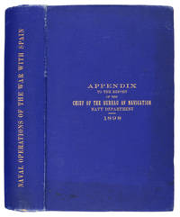
1898106031Washington: Government Printing Office 1898. Hardcover. very good. 1st Edition. 740pp. tipped-in erratapp. Octavo in original gilt lettered blue cloth with plates from photos and drawings some folding - including ship plans and elevations and folding maps including colour. Faint dampstain to edges of text block top corner else very good. very good Spine Title: "Naval Operations of the War with Spain.". An appendix to the official report by the United States Navy Department Bureau of Navigation "relating to the operations of the war with Spain and covering as well important operations of the Department before during and after the war." pp.3 grouped according to general subject. 1898 Government Printing Office hardcover
1868285943Washington: Government Printing Office 1868. Soft Cover. Very Good binding. The Bureau of Navigation Navy Department's booklet General Instructions for Hydrographic Surveyors. Dampstaining to the bottom edge of the second half of the textblock. Writing in ink on the front wrapper. Engraved plate of "Brooke's Deep Sea Sounding Apparatus" at the rear. Blue printed paper wrappers. Very Good. 62 pp. Very Good binding. Government Printing Office unknown
1878z015738London: Russian Steam Navigation and Trading Company/ George Russell and Co 1878. Very Good. Letter from George Russell on Russian Steam Navigation and Trading Company letterhead to James M. Lincoln of the Pacific Mail Steamship Co. New York. The letter details the chaos to company affairs caused by the Russo-Turkish war 1877-78. Measures 8.5 by 10.5 inches recto only. Very good. Light chipping to extremities stain to top corner light creasing. Otherwise clean and unmarked. Russian Steam Navigation and Trading Company/ George Russell and Co unknown
185854442n.p. n.d. 1858. 8vo pp. 20; self-wrappers; fine. UC-Riverside and AAS only in OCLC. In 1855 while charting the Rio de Plata Basin the United States ship U.S.S. Water Witch was fired upon by a Paraguayan fort killing the helmsman Samuel Chaney. This outraged the U.S. government who along with the U.S. & Paraguay Navigation Company decided to bring the incident to the Supreme Court. In 1858 began the Paraguay Expedition the purpose of which was to demand an apology from the Paraguyan government and to address alleged insults against the Navigation Company. The result of the expedition was that Paraguay apologized the Chaney's family was indemnified and a new advantageous commercial treaty between Paraguay and the United States was forged. unknown
187355613Washington Government Printing Office 1873. Royal8vo. Orig. full calf. Gilt boders and gilt lettering on covers. Gilt spine. Lithographed frontispiece in colour. XVI107203268 pp. 3 lithographed colourplates one large folded. unknown
180755849Philadelphia: Published by B.B. Hopkins and Co. and sold by W.P. Farrand No. 170 Printed by T. & G. Palmer 1807. 8vo. xxiii 1 270; 271-275 1 40 16 15-16 17-220 4 pp. including binders instructions and publisher’s advertisement. With 7 copper-engraved plates & maps 6 engraved by Benjamin Tanner. Contemporary polished brown calf red & gilt morocco spine label chipping to head of spine minor edgewear occasional interior foxing & toning still a VG- copy from the library of John L. Gow 1797-1866 noted Pennsylvania attorney w/ ownership label and markings on front pastedown. First American edition of this classic navigation handbook which was first published in 1804 and here contained substantial corrections to the tables of the latitudes and longitudes of places on the American coast and in the West Indies as well as an improved system of finding the longitude by P. Delamar of Philadelphia. Mackay 1760-1809 was noted Scottish mathematician and astronomer taught navigation and instructed in methods of how to find longitude. Shoemaker 12965. Published by B.B. Hopkins and Co., and sold by W.P. Farrand, No. 170, Printed by T. & G. Palmer, unknown
18880009730New York 1888. First edition. Map. Fine. 15 x 11 inches / 36 x 26 cm 3 folds matted glazed and framed. Very Scarcce <br/><br/>This map was removed from an Annual Report. The black-and-white map shows the boundaries of Illinois in outline presenting the Illinois River improved passage from Chicago to Grafton where it pours into the Mississippi River. It also shows the Rock River traversing to the Quad Cities. Toward the east is the Illinois & Michigan Canal the DesPlaines River the Little Calumet River and the Little Kankakee River and Calumet Harbor. The map is attributed to Thomas H. Handburg. The University of Illinois-Urbana has a photocopy of it from the photocopy in the National Archives. I have not identified to which Annual Report this belonged Nor can I find another map attribued to Thomas H. Handburg. unknown
187838742Brazil 1878. A few small holes affecting a few letters some folds reinforced on verso additions in manuscript. Broadside. 20 3/4x29 inches. The Companhia Nacional de Navegação a Vapor replaced the Companhia Brasileira de Navegação a Vapor as the government sponsored line along the southern route in 1872. Montevidio was the furthest stop of this important Brazilian shipping company from which it also provided river service to upper Brazil. The broadside contains a listing of the rates of passage from Rio de Janeiro to Montevideo as well as the limitations and restrictions for passengers which included a prohibition on weapons and flammable materials. unknown
188217482New York: Leve & Alden's Publication Department 1882. Very good condition. Folding brochure with map of the St. Lawrence and Saguenay River and timetable with cover illustration of the river and with advertisement for Leve & Alden General Agents for the United States and list of ticket office locations. Yellow stock with black text. Descriptive text on points of interest along the route including Ha! Ha! Bay; with a Time Table commencing June 27 1882 "Until about September 10 1882" and listing departure times for the steamer "Saguenay" and "Union". With full page b&w map on the verso with the map of the Saguenay River at the top and below the map of the St. Lawrence "traversed by the Saguenay boats". The St. Lawrence route originates in Quebec and shows stops in Murray Bay Riviere du Loup and Tadousac. <br /> Lists Hon. Thomas McGreevy President Julien Chabot Manager and A. Gaboury Secretary of the Company. Folded 3 1/2 x 7 1/2". Unfolded 17 1/2 x 15". Very small area of loss at fold on lower map of St. Lawrence; short split at horizontal fold left edge o/w very good. Leve & Alden's Publication Department unknown
189677014Washington DC: U.S. Department of the Navy Bureau of Navigation Hydrographic Office 1896. Presumed First Edition First printing thus. Map. Good. This was published at the Hydrographic Office in Washington D.C. in February 1896. No. 1530. Charles D. Sigabee Commander U.S. N. Hydrographer. Format is approximately 26 inches by 17 inches folded. This map is disbound from Volume I of the Commercial Directory of the American Republics compiled by the Bureau of American Republics International Union of American Republics Joseph P. Smith Director 1897 Title page from Directory is present. Taped to top right of map in margin is the statement "This chart is intended solely to show tracks of steam vessels on the ocean and no authority is assumed for the boundary lines as drawn between the countries." Map has some color differentiation and several inserts presenting distance information between major ports of call. Map has been folded with approximately the top third folded down. It is also folded into four sections of different lengths to fit as the frontis to the Directory. Map has some wear and soiling/staining. This is similar to the large-scale and detailed World chart on Mercator's projection produced by the British Admiralty under the "Superintendence of Captain Wharton R.N. F.R.S Hydrographer" engraved by Edward Weller and sold by J. D. Potter chart agent. The map has no internal landmass detail unless relevant to steam ship routes thus the Suez and Panama canals are marked as is the Canadian Pacific Railway. Panels along the lower edge list major ports and give distances dependent on routes taken and average knots-per-hour speeds with daily distances covered in miles. The world's major ports are linked by ship-routes each track with its relevant distance and so on. An interesting chart at the time steam took over from sail. Charles Dwight Sigsbee 1845 - 1923 was a Rear Admiral in the United States Navy. In his earlier career he was a pioneering oceanographer and hydrographer. He is best remembered as the captain of the USS Maine which exploded in Havana harbor Cuba in 1898. U.S. Department of the Navy, Bureau of Navigation, Hydrographic Office unknown
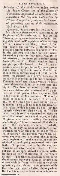
1831350541Knight and Lacey London 1831-32. Card Covers. Very Good Condition. The Mechanics' Magazine issues from November 1831 to January 1832 contained an extensive report on steam navigation accidents documenting the findings of a Select Committee of the House of Commons. This committee was formed to investigate the frequent calamities occurring in steam-powered vessels and to propose solutions to prevent future disasters. The report primarily written by Colonel Sibthorpe the committee chairman ran to approximately 70 columns and covered : Detailed accounts of steamship accidents including causes and consequences ; Technical assessments of steam engine failures and structural weaknesses in vessels ; Safety recommendations including improved boiler designs and operational protocols ; and economic and legislative considerations discussing the impact of regulations on steam navigation. These discussions were crucial in shaping early maritime safety regulations influencing the development of safer steamship designs and operational standards. The Mechanics' Magazine played a vital role in disseminating these findings to engineers shipbuilders and policymakers. The collection consists of the following seven complete issues: No. 433 Nov 26th 1831 to No. 439 Jan 7th 1832. Genuine Original and Packed with Innovation! This weekly magazine isn't just a fragment of history it's a window into the cutting-edge advancements of the Victorian era! Since 1823 The Mechanics' Magazine has tackled revolutionary topics from printing presses to vapor baths hydrostatics and hydraulics. It dives into breakthrough safety measures preventing explosive contaminated air while exploring the mechanics of oxy-hydrogen blowpipes and self-laying rail carriages. Every page crackles with Victorian-era engineering brilliance capturing the relentless drive for invention that shaped the modern world! This is an exclusive standalone issue carefully separated from its original volume; authentic original and uniquely crafted. It is not a reprint or reproduction but a distinct piece in its own right. Preserved in a modern card cover prepared for practicality - an unassuming but serviceable presentation that favours function over finery. Size: 13 x 21 cms. Category: Mechanics' Magazine; New Arrivals; This item may require more postage than the rates shown for delivery outside the UK. If extra postage is required we will contact you before processing your order and you will be given the details and option to decline the extra cost. Knight and Lacey unknown
1845114410Bristol: Philip Rose Printer. Very Good with no dust jacket. 1845. Unknown. Pamphlet. Original 1845 Printed Broadside for the Bristol Steam Navigation Company. "Steam Communication between BRISTOL and CARMARTHEN for TENBY & CARMARTHEN". Broadside measuring 11.3" x 9" 28.5cm x 22. 7cm with text typography and an illustration of the STEAMSHIP 'Phoenix' in black. In very good plus condition with a few small marks light creasing where previously lightly folded and a few tiny pinpoints to the top left corner by the first 'S' of steam. Some old faded writing relating to a trip on the ship on the verso which shows through slightly to the left side on the front. This Broadside reads: "Steam communication Between Bristol and Carmarthen For Tenby & Carmarthen The Bristol Steam Navigation Company's Fast and Splendid Steam Ship PHOENIX Lieut . T. Jackson R. N. Commander" Is intended to Sail as follows with Passengers Goods Live Stock etc. affording a most desirable and speedy Communication between the various Places in the County of Carmarthen and the Metropolis via Bristol and the Great Western Railway; also with Manchester and the North via the Gloucester and Birmingham Railway. ". Under this are the Dates and Times and Fares - Cabin 17s ; Children under 12 years of age 9s 6d ; Servants 11s 6d . Deck 8s; Carriage 42s ; Pair Horse Phaeton 31s 6d. ; . Dog 3s ; etc. Notice. - The Proprietors. Will not be accountable for any Cabin Passengers Luggage. Etc. " This broadside provides an interesting and most attractive record of U. K. Maritime Railway and transport history. A wonderful historical ephemeral item in great condition. See Images ; 4to 11" - 13" tall . Philip Rose, Printer, unknown
181555781New York: Printed for Edmund M. Blunt Oct. 1815. 8vo. xvi 297 86 pp. plus 2 pp. publisher’s ads. Woodcut-engraved front of the Blunt New York Shop 9 of 15 maps & charts 1 w/ partial loss several w/ additional sailing instructions and printed notices pasted-in manuscript sailing instructions and notes on versos of some. Original calf spine & calf on rear cover perished shaken dampstaining & toning still fair reference copy from the library of Captain Thomas Hall II 1804-1829 son of Captain Thomas Hall 1778-1816 who was lost at sea while sailing from Charleston to Boston in Feb. 1829 which his brother Charles Hall 1810-1829 ownership markings on endpapers of both w/ manuscript note on verso of ffep. that this is “good for a pint of ale†facing clippings about new lighthouses ca. 1821 listing the Ten Pound Island stone tower light house first built on the site in 1821. Preserved in brick-coloured linen cloth clamshell slipcase w/ printed label on spine. Eighth edition of this early vital tool for American sea captains and navigators first published in a much shorter version of only 122 pp. in 1796 and the first edition to bear only Edmund Blunt’s name as author. The original commissioned from Captain Lawrence Furlong proved so crude and unusable that Blunt arranged for it to be edited and rewritten. Blunt’s Coast Pilots were the earliest works of their type published in North America to cover the Atlantic Coast of the U.S. with sailing directions tide tables tables of latitudes and longitudes and as this copy shows were often working evolving documents with additional manuscript annotations and printed additions including in this case the Charleston Harbour map which is not included in the binding instructions and supposedly left out of the 8th edition. Printed for Edmund M. Blunt, hardcover
1839331758London: Smith Elder and Co 1839. Softcover. Good. First edition. Octavo. Disbound. 49pp. folding map. Lacking wrappers; title page and folding map detached from sewing; good. A scarce report establishes an early point for the English empire’s interest in establishing a steam boat line in India and the methods by which they proposed to go about doing so. Commercial manufacturers and various merchants from Manchester Liverpool and India were enlisted to support the proposal and the report outlines navigational routes estimations of cost and the enthusiasm of changing maritime trading methods up and down the Ganges. The idea for an East India Inland Steam Navigation Company apparently began percolating in 1837 and this report fits nicely within the small pantheon of material devoted to this literature. Not in OCLC. One copy found at the British Library. Smith, Elder and Co unknown
184041654Paris ca. 1840. Folio. 36x25 cm. Contemp. hcalf. Spine gilt but somewhat rubbed. 264 pp. numerous illustrations in margins and in the text. 2 folded maps. The text is handwritten and reproduced with an etching technique probably zinkography. Internally clean and fine. unknown
18471008098vo slate blue cloth stamped in gilt and blind illustrated with frontispiece and folding charts viii 21 429 3 24 pp.Wear to spine ends spine faded small splits to joints hinges cracked copious nautical notes to endpapers slight aging but text and charts are generally clean and unworn; about very good. This is rare first edition of what is known as "The Atlantic Navigator" which includes detailed sailing instructions for the North and South Atlantic. Includes ten folding charts and much of the text is from various captains and navigators familiar the routes contained in this work. The first numbered section of 21 pages is an 1847 supplement and the catalogue at the rear is dated 1851. Sabin noting 2300 only an 1854 fourth edition. James Imray,
1892184592Karachi: Published by the Chairman Karachi Port Trust 1892. Traced in only one institutional library First edition of this scarce guide for pilots and mariners with the tipped-in compliments slip of the secretary of the Karachi Port Trust addressed in manuscript to the Swedish shipping firm K. O. F. Dalman. The guide details the specifications of the harbour mooring charges pilotage and towage charges and the size of recent trade. The four appendices include a July 1892 notice to mariners a list of steamers to leave port in the preceding year a name list for the Karachi's chamber of commerce and foreign consuls and the text of a Sind Gazette article on a recent survey by the port engineer. WorldCat records a copy at the University of Western Australia. Octavo pp. 34. Tissue-guarded frontispiece 3 colour folding maps regional map extending from Tibet to Arabia; plan of Karachi harbour plan of suggested additional wharfage. Original blue cloth front cover lettered in gilt. Text block now loose in covers but in itself sturdy cloth with some staining and marking wharfage plan with small closed tear just crossing neatline: very good. hardcover
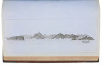
1900176895Shanghai: Brewer & Co. c.1900. From the Chefoo Bluff to Lamtong Head Sole edition untraced institutionally the copy of Vice-Admiral Seymour's chief of staff in Tianjin during the Boxer Uprising. This photographic guide is designed for "the navigator of this changeable and frequently foggy locality" preface. We have traced only one other copy which appeared in commerce in 2017. Navigators in the late Qing period could rely on only a small network of lighthouses and fixed navigational aids when sailing the Chinese coast. "In thick weather even a person familiar with the coast is at a loss to identify a well-known Islands with its summit" preface. The thirty views include the Chefoo Bluff in the Pechili Gulf the waters near the Hieshans Light House Zhejiang and Hong Kong's Lamtong Head. A concerted period of lighthouse-building in the 1910s and 1920s obviated the need for further publications of this kind. Provenance: though unmarked as such this copy was owned by Captain Edward Henry Bayly C.B. 1849-1904 Commander of the International Forces at Tianjin in June 1900. Bayly had a lifelong career in the Royal Navy. He was promoted to the rank of lieutenant in September 1873 commander in June 1887 and captain in January 1894 having served overseas in numerous ships. Bayly captained HMS Pelorus during the fleet review for Queen Victoria's diamond jubilee in 1897 and in 1899 became captain of the armoured cruiser HMS Aurora on the China station. During the Boxer Uprising he replaced the wounded John Jellicoe as chief of staff to Seymour was mentioned by Seymour in dispatches and remained at Tianjin until the withdrawal of naval forces. He retired at his own request in February 1904. Landscape octavo. With 30 mounted collotypes within red frames. Original red cloth front cover lettered in gilt white coated endpapers leaves hinged with white linen as issued. A little shaken binding sunned and stained contents well preserved a little toning at fore edges: a very good copy. hardcover
1857ABC_46672HMS Cyclops:: Oman Khuriya Muriya Islands Yemen Egypt Red Sea Arabian Sea Pakistan Sri Lanka and other places 1857. Contemporary brown cloth over boards rebacked in period-style black calf with the spine lettered in gold: "Log H.M.S. Cyclops". Folio 20 x 31.5 cm. Over 360 pp. of manuscript entries written with brown ink in a legible hand on watermarked laid paper with a blue cast. With 8 pen and ink nautical charts and 5 sketches of coastal sites including the city of Muscat 8 on the logbook pages and 5 on separate thick album leaves. Historically significant manuscript logbook containing a detailed record of the first attempt to lay a submarine telegraph cable to connect London with British India. The expedition took place from May 1859 the Red Sea leg from Suez to Aden to February 1860 from Aden to the Khuriya-Muriya Islands Muscat and Karachi. The two specially designed cable ships the Imperador and Imperatrix were supported by HMS Cyclops which surveyed the coastlines and reported on the depth and structure of the ocean floor.The entries from February 1859 to May 1860 documenting the ship's Red Sea and Arabian Sea mission span over 200 pages. We first find the Cyclops near Cape Ras al Hadd on the eastern coast of Oman at the entrance to the Gulf of Oman: "Cape Ras al Hadd . terminates in a low sandy spit at the head of which is a village and mud fort. There is an inlet about 4 miles to the northward of the cape but inaccessible to large vessels. There is a heavy surf on the beach during northerly winds" 9 February 1859. The ship then plied in the Red and Arabian Seas between Egypt Yemen and Oman eventually finishing in Bombay.During its expedition the Cyclops visited and moored in Quseer and Zabardag Island Egypt Suakin Sudan Perim Island Strait Bab-el-Mandeb Yemen the Hanish Islands Yemen Palinurus Shoal and Cape Fartak Yemen al-Hallaniyah and al-Qibliyah Khuriya Muriya Islands Oman Ras Madrakah and Ras al Hadd Oman Charna Island and Karachi Pakistan. The logbook entries record the soundings and the laying of cable along with quotidian ship activity. Brief entries touch on the death of crew members; discharging coal; punishing men for wrongdoing; maintenance of the ship; other ships in company; visits on board by local notables etc. Six larger entries occupying up to two pages of text describe the topography landmarks soundings and economy of Karachi Zabargad Island and Muscat Cove this last harbour said to be "formed by Muscat Island on the east and Ras Muscat on the West it is one mile deep by half a mile wide with 12 fathoms at entrance decreasing to 3 fathoms ahead of the town. It is defended by two . batteries on the island one on the height to the seat of town and two on Ras Muscat. They are all in a stay ! - or: state of decay. The entrance to the cove is difficult to make out when coming from the eastward . The exports of Muscat are wheat dried fish dates and cattle the imports being European and Indian manufactured goods sugar etc. The revenue is about £100000. The Imaum's Palace faces the water his army generally consists of from 10 to 12000 men and the fleet of 2 frigates 2 corvettes a transport and brig the greater part of the Navy having been removed to Zanzibar the Captains of these vessels being educated at Bombay or Calcutta. Supplies of all kind are cheap and plentiful. Boats may be hired thro' the medium of the Agent of the Indian Government for the shipment of coals" 26 November 1859.Illustrated with eight well-executed pen and ink nautical charts showing the routes of the Cyclops in the Red and Arabian Seas as well as the harbours of Muscat Cove and other places. Five beautiful ink sketches show the city of Muscat "Hallani Bluff from Addington Cove" al-Hallaniyah the largest of the Khuriya Muriya Islands Oman Ras Fartak Yemen Karachi harbour and Colombo.The cable too lightly armoured and laid with too little slack soon failed: indeed the 1859 section had already broken down by the time the route was completed in 1860. Messages were passed over individual sections but the entire cable never worked as a unit. Communication to India would not be established until the 1864 Persian Gulf cable was laid. The captain of the Cyclops the noted British navigator and Arctic explorer William Pullen 1813-87 took part in the unsuccessful 1849 attempt to rescue Sir John Franklin's disastrous expedition in search of a northwest passage then in the same year became the first European to sail along the north coast of Alaska in his voyage from the Bering Strait to the Mackenzie River in Canada.A final part of the log comprising some additional 150 pp. May 1860-May 1861 covers the Cyclops's survey of the southeast coast of Ceylon and her return voyage to England. Overall an important content-rich source on the early history of the submarine telegraph cable around the Arabian Peninsula to British India.In good condition. Oman, Khuriya Muriya Islands, Yemen, Egypt, Red Sea, Arabian Sea, Pakistan, Sri Lanka and other places, hardcover