HOYT, Edwin PBiblio.com
87 résultats
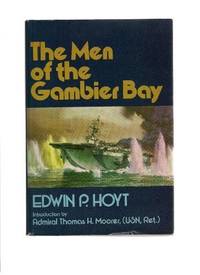
197936377Middlebury VT: Paul S. Eriksson 1979. Hardcover. Introduction by Thomas H. Moorer. Small 4to. Blue cloth spine and tan paper over boards pictorial price-clipped dust jacket. xii 254pp. Illustrations maps map endpapers. Fine/near fine. Tight attractive first edition of this surprisingly uncomon history of this World War Two aircraft carrier. Paul S. Eriksson hardcover
195540503City Not Stated: Peninsular & Oriental Steam Navigation Company P & O 1955. Each card: Folded small octavo 14 x 21 cm very good condition colour drawing front cover corner tips some cards little scuffed card 1 is slightly shorter at the top presumed as issued no text missing minor edgewear. Each card: 4 pp. A set of 11 of 12 in set menu cards designed by the artist Strom Gould. Card No. 1 Red-Crowned Pigeon & Purple-Crowned Pigeon. Card No 2 Fairy Wrens. Card No. 3 Gouldian Finch. Card No. 4 Pink Cockatoo. Card No. 5 Count Raggi's Bird Of Paradise. Card No. 6 Rainbow Bird. Card No. 7 Regent Bower-Bird. Card No. 8 Scarlet Honey-Eater. Card No. 9 Red-Capped Robin. Card No. 10 Laughing Kookaburra. Card No. 11 Rainbow Lorikeet Red-Winged Parrakeet & Green Leek Parrakeet. MISSING: Card No. 12 Kingfisher. The artist also known as Charles Sidebotham Gould was born in Letchworth England on 2/8/1910 and came to Australia in 1937. He was employed as the Sydney Morning Herald's first art director and he also drew its first comic strip in 1944. He died in 1992. No date but about 1955. Peninsular & Oriental Steam Navigation Company (P & O) unknown
1986058800Los Angeles Air Force Station CA: Joint Program Office Air Force Systems Command Space Division 1986. Fourth Edition . Paper Back. Very Good/No Jacket. 8vo - over 7¾" - 9¾" tall. 74pp.; SC white w/blk.; slight rub w/lt.wear; inked-out PONs; cleantight pgs. YEE-82-009B. "This document has been prepared to acquaint potential users with the fundamental principles of the Navstar Global Positioning System GPS and the use of GPS equipment in host vehicles." illus. <br/> <br/> Joint Program Office, Air Force Systems Command, Space Division unknown
192119891Washington D. C.: Gpo. Very Good. 1921. First Edition. Hardcover. Covers are very lightly soiled. ; Small 4to 9" - 11" tall; 576 pages . Gpo hardcover
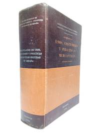
196448395Madrid: Consejo Superior de Cámaras de Comercio de España 1964.- 1391 p.; 4º 25 x 18 cm; Tela Ed.- RARO. HACIENDA DERECHO FISCAL MERCANTIL BOLSA BANCA SEGUROS. Libro en español Consejo Superior de Cámaras de Comercio de España hardcover
1952007395France: Société d'Editions Géographiques Maritimes et Coloniales 1952. Very informative book on the history of the Orbigny shipping Company FRENCH TEXT NO English translation. Original thick embossed and decorated card covers have been preserved and the whole book recased in a blue hard coverthis has been done for the Institute of Transport London single stamp on blank page. 170 pages in very bright clean condition just a few pencil marks on last couple of pages easily erased. Many B/w photographs facsimile documents and illustrations all present plus very informative text in FRENCH NO dustwrapper outer boards are clean and sound HEAVY BOOK 1.6 Kg with packing EXTRA POSTAGE REQUIRED FOR OVERSEAS.a very nice example of this book SEE IMAGES. DETAILED IMAGES AVAILABLE ON REQUEST. First Edition. Boards. Very Good/No Jacket. 11 x 8¾ Inches. Hardcover. Société d'Editions Géographiques, Maritimes et Coloniales Hardcover
193390592Paris: Commission Internationale de Navigation Aeriennne 1933. Presumed First Edition First printing thus. Pamphlet. Good. The format is approximately 5 inches by 8 inches. TEXT IS IN FRENCH. 2 28 28 blank verso pages. Tabular Data. RARE SURVIVING COPY. The International Commission for Air Navigation ICAN was an international organization established by the Paris Convention of October 1919 which was the precursor to the current International Civil Aviation Organization ICAO . Its role was to establish international standards for managing air navigation. ICAN was truly active from 1922 to 1939 but ceased in 1947 when it was replaced by ICAO. In March 1919 an Aeronautics Commission of the Peace Conference was established at the initiative of President Clemenceau who rallied his allies and partners to his cause: President Wilson Alfred Milner United Kingdom and Vittorio Emanuele Orlando Italy. In less than four months the Commission and its military technical and legal subcommittees drafted the Convention regulating air navigation which was signed in Paris on October 13 1919 and which forms part of the treaties protocols and conventions of the Paris Peace Congress. The International Commission on Air Navigation was established by Article 34 of the Paris Convention. The convention entered into force on July 11 1922. It had been signed by fourteen states. At the first session held in Paris under the chairmanship of Raymond Poincaré he specified the role that the Commission was to play in the future and emphasized its innovative nature in the field of international law as it gave the Commission the power to make decisions binding on the contracting states by majority vote. Among the topics of this set of Aeronautical Instructions are Aerodromes Meterorological services phrases flight plans frontiers/boundaries Transportation and hazards to aviation. It addresses treaty/conventions and relevant Belgian legislation. Commission Internationale de Navigation Aeriennne unknown
196938798Santa Barbara CA: Coast Navigation School c1969. Black-plastic covered case. Good. Instructional kit for sailing navigation; includes 8 x 8 plastic navigation wheel for calculating speed time and distance and verso plastic Simex Course Converter wheel to find true course from compass bearing with instructions both in black plastic 9 x 9 carry-case plus unmarked folded navigational training map plus hinged parallel rulers tool 12 right-angle tool 360-degree round tool 7-in German steel calipers - all in black hard carry-case. Very good usable conditon. Rare item. <br/><br/>Carry-case case is 9-1/2 x 15 map is 8 x 11 folded 32 x 22 unfolded. Coast Navigation School unknown
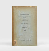
1920185017Likely Shanghai: no stated publisher 1920. Held in only one institutional library First edition the majority of the 31 notices concerning pilotage harbours and port sanitation. Accompanying the text are two anchorage plans and the full bilingual text of the 1918 Ningbo harbour regulations which were formally propagated in 1919. The ports and harbours covered include Shanghai Wenzhou Chefoo Tianjin Hankou Fuzhou Amoy Swatow Santuao and Canton. While some notices merely repeal or tweak existing orders 14 provide substantial new directions for navigators and shipping often extending across multiple pages. This and one other copy were sometime deaccessioned from the Foreign Office Library. The library's retained copy held in the FCDO Historical Collection at King's College London is the only other example we have traced. Octavo. With folding plans of Ningbo and Zhenhai anchorages 4 folding text sheets with Ningbo harbour regulations in English and Chinese. Original buff boards brown cloth backstrip front cover lettered in black. Ex-Foreign Office Library with its date label and stamps on boards bookplate accession notation and withdrawal stamp. Volume hole-punched top left throughout contents unaffected save for numerical code at head of first page boards toned folding matter well preserved: very good. hardcover
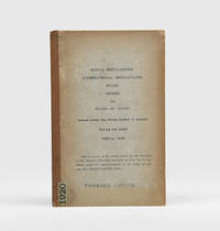
1924185018Likely Shanghai: no stated publisher c.1924. First edition. Alongside notices amending and repealing existing directions the volume includes the text of four newly propagated and substantial documents concerning the ports of Amoy Yingkou Newchwang Wuhu and Qingdao as well as several non-maritime orders. This copy now deaccessioned was one of at least two sent to the Foreign Office Library in August 1924 by Judge Skinner Turner 1868-1935 the chief justice of the British Supreme Court for China from 1921 to 1927 Skinner's bequest is noted on the bookplate. The library's retained copy held in the FCDO Historical Collection at King's College London is the only other example we have traced. Octavo. Original buff boards brown cloth backstrip front cover lettered in black. Ex-Foreign Office Library with its date label and stamps on boards bookplate accession notation and withdrawal stamp. Covers and contents toned: very good. hardcover
1980133049Shanghai 1980. First Edition. Hardcover. Good/Good. Unpaginated. 38 cm. 85 paintings of the Yangtze listed by author and described at rear. 56 are in colour. Blue hardcover in dustjacket. jacket has tears to edges. Book itself has shelf wear. Small ink notation on jacket flap. Ink inscription on brown front endpaper. Text in English and Chinese. <br/><br/> hardcover
1980BOOKS028140IShanghai:. VG unmarked 10 1/2" x 15" Hardback; DJ-G/VG 2 small taped. 1980. ISBN: tears. 85 Plates 56 color of Chinese paintings. Catalogs: CHINA. Keywords: CHINA YANGTZE RIVER CHINESE ART CHINESE PAINTING. hardcover
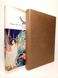
19873114La Coruña: Ed. Cámara Oficial de Comercio Industria y Navegación de La Coruña 1987.- 440 p. 4 h.: Ilustraciones fotográficas en negro y color; Folio 305 x 218 cm; Buena impresión en offset sobre papel satinado tipo cuché; Tela Ed. con camisa. La camisa reparada de unos pequeños desgarros en la cabeza. Por lo demás en excelente estado. GEOGRAFÃA ECONÓMICA HUMANA Y ECONOMÃAS REGIONALES Libro en español Cámara Oficial de Comercio, Industria y Navegación de La Coruña hardcover
19916439Cámara oficial de Comercio Industria y Navegación de Valencia 1991. paperback. Bueno. Cámara Oficial de Comercio Industria y Navegación de Valencia. Valencia 1991. Rústica. 486 pp. 21x15. Pequeña marca de humedad no afecta al texto. Cámara oficial de Comercio, Industria y Navegación de Valencia paperback
197448469Bilbao: Servicio de Estudios de la Cámara Imp. Industrial 1974.- 4 VOLS. XXXI 600 p.; XVI 564 p.; VIII 499 p.; XIV 417 p. 1 h.: Profusión de estados cuadros ilustraciones y varios mapas plegados; 4º 24 x 167 cm; Cartulina Ed.- Ya RARO en el mercado. GEOGRAFÃA ECONÓMICA HUMANA Y ECONOMÃAS REGIONALES Libro en español Servicio de Estudios de la Cámara paperback
197148464Bilbao: La Editorial Vizcaina 1971.- XXIV 911 p. 1 h.; 4º 25 x 188 cm: Estados mapas y planos plegados; Pleno Guaflex Ed. imitando piel camisa. Excelente estado. Tan solo la camisa tiene algunas faltas y rozaduras. GEOGRAFÃA ECONÓMICA HUMANA Y ECONOMÃAS REGIONALES Libro en español La Editorial Vizcaina hardcover
1941Alibris.0024602Washington: U S DEPARTMENT OF COMMERCE 1941. Trade paperback. Good. No dust jacket. Signed by previous owner. CONTENTS; TANK VESSELS-GENERAL PROVISIONS-INSPECTION AND CERTIFICATION-REQUIREMENTS FOR HULLS MACHINERY AND EQUIPMENT-LIFE SAVING APPLIANCES-FIRE FIGHTING EQUIPMENT-OPERATION-LICENSED OFFICERS AND CERTIFICATED MEN-SPECIFICATIONS FOR LIFE SAVING APPLIANCES-TRANSPORTATION OF LIQUEFIED INFLAMMABLE GASES. INDEX U S DEPARTMENT OF COMMERCE paperback
1995biblio617Bethesda Md: Defense Mapping Agency Hydrographic / Topographic Center pub no 9 1995. Fine. <p>4to 873p ill maps full red cloth</p> Defense Mapping Agency Hydrographic / Topographic Center, pub no 9 hardcover
1931030972Edinburgh: The Porpoise Press 1931. First Edition 1st Printing. Blue Cloth. Fine/Fine DJ. Eight Woodcuts By Freda Bone. 160 Pp. Sea Chanteys. Extensive Glossary At End. Fine Book No Wear Or Marks Gilt Bright In Fine As New Dj No Wear Or Fading At All Small Areas Of Faint Blue Offsetting To Spine And Front Panel Not Price-Clipped; Dj Was Preserved Separately From The Book. Exhibition Quality. <br/> <br/> The Porpoise Press hardcover
196747805Stockholm Sundbyberg: Lo edita Le Comité Nordique d'Organisation Imp. Solna Tryckeri Sundbyberg 1967.- 414 p.: Ilustraciones fotográficas entre el texto; 4º 232 x 185 cm: Buena impresión sobre papel satinado de excelente calidad; Texto en francés;Tela Ed. lomo dorado y plancha dorada en la tapa anterior. Excelente estado. MARINA PIRATAS CORSARIOS BUCANEROS Livre en français Le Comité Nordique d'Organisation hardcover
195447806Rome Roma: Edita el Secrètariat Général du Congrès Imp. du Sénat du dt. J. Bardi 1954.- XCV 450 pp.: Al principio in frontis 4 láminas con los retratos fotográficos de los responsables del Congreso siguen diversas ilustraciones entre el texto muchas a toda plana y dos mapas plegados; 4º 248 x 183 cm; Papel satinado; Texto en francés; Tela Ed. lomo dorado yplancha dorada en la tapa anterior. Mínimo desperfecto en la base del lomo. Por lo demás en muy buen estado. MARINA PIRATAS CORSARIOS BUCANEROS Livre en français Secrètariat Général du Congrès hardcover
191236542North Yakima: Yakima Commercial Club 1912. 1912. WASHINGTON. 10 1/2" x 7" in color pictorial wrappers. 64 pp. introduction illustrations. Very brief history followed by extensive information on the Yakima Valley to include geography topography climate the Indian Reservation irrigation products produced methods of orchard development live stock dairying transportation communities industries etc. Numerous black and white photographs many full page photos of scenery residential homes buildings agriculture industries public buildings etc. Wrappers disbound from text. Light bleeding to first and last page wrappers lightly soiled and with chipping to top of front wrapper and with tiny fold to tops of page corners. Yakima Commercial Club, 1912. unknown
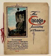
190922859Chicago: Chicago Association of Commerce 1909. First Edition. Quarto; 8pp. Four string-tied and stapled leaves with ten 3 1/2" x 5 1/2" mounted colored illustrations each titled in red along with a map of the route. Near Fine copy in grey cardstock titled and color photograph tipped to front cover. Rare promotional piece; we fine only 1 copy at University of Michigan. This booklet was prepared by the Oregon Railroad & Navigation Company the Oregon Short Line Railroad the Union Pacific Railroad and the Chicago & Northwestern Railway as an itinerary for the approximately 40 Chicago merchants' return trip ". calling your attention to a few of the points of interest in a country of marvellous scenes wonderful accomplishments and a still more wonderful future." Lists 38 members of the Chicago Association of Commerce making the return trip. Uncommon attractive & elaborate promotional piece. Chicago Association of Commerce unknown
192059233Washington D.C.: Government Printing Office Hydrographic Office U.S. Navy 1920-1930. Seven vols. 8vo. 4 365 1; 584; v 1 4 447 1 pp.; 2 22; 1; 2 57 1; 1 36 2 leaves. With 3 large folding colour maps numerous photo plates elevation views. Three uniformly bound in blue publisher’s buckram gilt lettering stamped on front covers & spines edgewear dustsoiling very slight uniform toning bowing to covers on vol. III some scuffing supplements all w/ self-printed softcovers edgewear rippling toning to fore-edges some predation still a G set w/ maps in bright condition. First editions stated of these uncommon coast pilot guides to Australian waters drawing upon British Royal Navy coast pilots Australian and U.S. Navy reports. Prior to modern GPS systems and satellite navigation these regularly updated and revised navigation handbooks provided key sailing instructions. The maps outlines the available charts for the designated areas surrounding Australia as well as those for the East Indies Pilot. First editions of these Hydrographic Office pilots are quite scarce and seldom seen with the supplements. Government Printing Office, Hydrographic Office, U.S. Navy, paperback
192659234Washington D.C.: Government Printing Office Hydrographic Office U.S. Navy 1926; 1930. Two vols. 8vo.viii 478 pp.; 1 22; 1 leaves. With 1 large folding colour map. First vol. in tan publisher’s buckram black lettering front cover & spine minor soiling spotting fore-edges of covers darkening to spine very slight uniform interior toning; 2nd. vol. w/ self-printed softcovers toning to fore-edges minor chipping still VG set. Second edition stated of vol. I and 1st edition of Supplement. These uncommon coast pilot guides to Eastern Mediterranean waters the Black Sea and the Sea of Azov draw upon British Royal Navy Ottoman Empire & Turkish coast pilots Russian & U.S. Navy reports. Prior to modern GPS systems and satellite navigation these regularly updated and revised navigation handbooks provided key sailing instructions. The maps outlines the available charts for the designated areas surrounding the Black Sea as well as detailing those for the extensive set of the Mediterranean Sea. Government Printing Office, Hydrographic Office, U.S. Navy, paperback