44 résultats
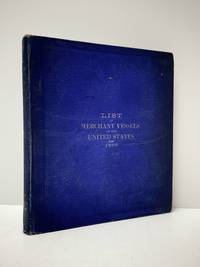
18834003Washington DC: GPO 1883. fair ex-lib. 176 plates fold-out illus. sm tears & soiling tables pencil notes ins fr bd bds scuffed & edges worn sm tears at spine & lib sticker. GPO unknown
1879z015731Batavia: Netherlands India Steam Navigation Company 1879. Very Good. Measures 8.5 by 10 inches printed recto only with corrections in contemporary hand. Very good. Edge wear and creasing else complete and clean. Netherlands India Steam Navigation Company unknown
188738573Washington DC: Govenment Printing Office 1887. First edition. Hardcover. Good. 8 3/4 x 9 3/4 inches. 421 pages. Condition is Good Very light wear to spine ends and edges rear cover lightly soiled stains on endpapers a few light stains on text pages binding is tight. STK Govenment Printing Office hardcover
1859102259Richmond Va.: Ritchie Dunnavant & Co. 1859. First Edition. Paperback. Good. 45 p. 23 cm. Fold-out map of the Coal River at Boone and Kanawha Counties with minor repairs mild spotting a few tears. Rebound with original front cover applied and new back. Mild spotting former owner's label on title page. <br/><br/>Includes president and directors of the company charter company stock by-laws rates of toll info on coal fields and shipping coal. Ritchie, Dunnavant & Co. paperback
1878z015709Marseille: Nouvelle Compagnie Marseillaise de Navigation A Vapeur 1878. Good. 2p. brochure of sailing schedule and rates measures 5.5 by 8 inches French language. With letter of conveyance on company letterhead addressed to James M. Lincoln of the Pacific Mail Steamship Co. 1878. Good. Tape and paper repair to brochure spine perforation along spine. Burn stain to corner of letter else both remain clean and unmarked. Nouvelle Compagnie Marseillaise de Navigation A Vapeur unknown
1845114410Bristol: Philip Rose Printer. Very Good with no dust jacket. 1845. Unknown. Pamphlet. Original 1845 Printed Broadside for the Bristol Steam Navigation Company. "Steam Communication between BRISTOL and CARMARTHEN for TENBY & CARMARTHEN". Broadside measuring 11.3" x 9" 28.5cm x 22. 7cm with text typography and an illustration of the STEAMSHIP 'Phoenix' in black. In very good plus condition with a few small marks light creasing where previously lightly folded and a few tiny pinpoints to the top left corner by the first 'S' of steam. Some old faded writing relating to a trip on the ship on the verso which shows through slightly to the left side on the front. This Broadside reads: "Steam communication Between Bristol and Carmarthen For Tenby & Carmarthen The Bristol Steam Navigation Company's Fast and Splendid Steam Ship PHOENIX Lieut . T. Jackson R. N. Commander" Is intended to Sail as follows with Passengers Goods Live Stock etc. affording a most desirable and speedy Communication between the various Places in the County of Carmarthen and the Metropolis via Bristol and the Great Western Railway; also with Manchester and the North via the Gloucester and Birmingham Railway. ". Under this are the Dates and Times and Fares - Cabin 17s ; Children under 12 years of age 9s 6d ; Servants 11s 6d . Deck 8s; Carriage 42s ; Pair Horse Phaeton 31s 6d. ; . Dog 3s ; etc. Notice. - The Proprietors. Will not be accountable for any Cabin Passengers Luggage. Etc. " This broadside provides an interesting and most attractive record of U. K. Maritime Railway and transport history. A wonderful historical ephemeral item in great condition. See Images ; 4to 11" - 13" tall . Philip Rose, Printer, unknown
1883030508Annapolis: United States Naval Institute 1883. 1st Edition . Hardcover. Near Fine. Fourteen Folding Plates. 595 -631 14 Folding Plates A End. Brown Pebbled Cloth Gilt. Interesting Descriptions And Assessments Of Then-New Cruisers Armored But Powered By Both Steam And Sail. Ownership Signature Of Engineer George F Kutz See Journal Of The American Society Of Naval Engineers February 1921 For His Obituary; Also Ownership Signature Of "M. Fletcher" On Title Page. <br/> <br/> United States Naval Institute hardcover
1839331758London: Smith Elder and Co 1839. Softcover. Good. First edition. Octavo. Disbound. 49pp. folding map. Lacking wrappers; title page and folding map detached from sewing; good. A scarce report establishes an early point for the English empire’s interest in establishing a steam boat line in India and the methods by which they proposed to go about doing so. Commercial manufacturers and various merchants from Manchester Liverpool and India were enlisted to support the proposal and the report outlines navigational routes estimations of cost and the enthusiasm of changing maritime trading methods up and down the Ganges. The idea for an East India Inland Steam Navigation Company apparently began percolating in 1837 and this report fits nicely within the small pantheon of material devoted to this literature. Not in OCLC. One copy found at the British Library. Smith, Elder and Co unknown
1878z015738London: Russian Steam Navigation and Trading Company/ George Russell and Co 1878. Very Good. Letter from George Russell on Russian Steam Navigation and Trading Company letterhead to James M. Lincoln of the Pacific Mail Steamship Co. New York. The letter details the chaos to company affairs caused by the Russo-Turkish war 1877-78. Measures 8.5 by 10.5 inches recto only. Very good. Light chipping to extremities stain to top corner light creasing. Otherwise clean and unmarked. Russian Steam Navigation and Trading Company/ George Russell and Co unknown
188438574Washington DC: Govenment Printing Office 1884. First edition. Hardcover. Good. 8 3/4 x 9 3/4 inches. 412 pages.Green Cloth as issued. Condition is Good Very light wear to spine ends and edges rear cover lightly soiled very light foxing on endpapers a few light stains on text pages a few pages at the beginning are loose but present binding is tight. STK Govenment Printing Office hardcover
187838742Brazil 1878. A few small holes affecting a few letters some folds reinforced on verso additions in manuscript. Broadside. 20 3/4x29 inches. The Companhia Nacional de Navegação a Vapor replaced the Companhia Brasileira de Navegação a Vapor as the government sponsored line along the southern route in 1872. Montevidio was the furthest stop of this important Brazilian shipping company from which it also provided river service to upper Brazil. The broadside contains a listing of the rates of passage from Rio de Janeiro to Montevideo as well as the limitations and restrictions for passengers which included a prohibition on weapons and flammable materials. unknown
181539889Lisbon: Simao Thaddeo 1815. hardcover. very good. 144pp. 8vo. Lisbon 1813. Second Edition. BOUND WITH: Taboa da Declinacao do Sol ao Meio Dia no Meridiano da Cidade de Lisboa . IV 64pp. 8vo full leather. Lisbon 1815. Scarce. Very good.<br/> <br/> Tables of latitude and longitude for marine navigation.<br/> <br/> Simao Thaddeo unknown
181555781New York: Printed for Edmund M. Blunt Oct. 1815. 8vo. xvi 297 86 pp. plus 2 pp. publisher’s ads. Woodcut-engraved front of the Blunt New York Shop 9 of 15 maps & charts 1 w/ partial loss several w/ additional sailing instructions and printed notices pasted-in manuscript sailing instructions and notes on versos of some. Original calf spine & calf on rear cover perished shaken dampstaining & toning still fair reference copy from the library of Captain Thomas Hall II 1804-1829 son of Captain Thomas Hall 1778-1816 who was lost at sea while sailing from Charleston to Boston in Feb. 1829 which his brother Charles Hall 1810-1829 ownership markings on endpapers of both w/ manuscript note on verso of ffep. that this is “good for a pint of ale†facing clippings about new lighthouses ca. 1821 listing the Ten Pound Island stone tower light house first built on the site in 1821. Preserved in brick-coloured linen cloth clamshell slipcase w/ printed label on spine. Eighth edition of this early vital tool for American sea captains and navigators first published in a much shorter version of only 122 pp. in 1796 and the first edition to bear only Edmund Blunt’s name as author. The original commissioned from Captain Lawrence Furlong proved so crude and unusable that Blunt arranged for it to be edited and rewritten. Blunt’s Coast Pilots were the earliest works of their type published in North America to cover the Atlantic Coast of the U.S. with sailing directions tide tables tables of latitudes and longitudes and as this copy shows were often working evolving documents with additional manuscript annotations and printed additions including in this case the Charleston Harbour map which is not included in the binding instructions and supposedly left out of the 8th edition. Printed for Edmund M. Blunt, hardcover
180755849Philadelphia: Published by B.B. Hopkins and Co. and sold by W.P. Farrand No. 170 Printed by T. & G. Palmer 1807. 8vo. xxiii 1 270; 271-275 1 40 16 15-16 17-220 4 pp. including binders instructions and publisher’s advertisement. With 7 copper-engraved plates & maps 6 engraved by Benjamin Tanner. Contemporary polished brown calf red & gilt morocco spine label chipping to head of spine minor edgewear occasional interior foxing & toning still a VG- copy from the library of John L. Gow 1797-1866 noted Pennsylvania attorney w/ ownership label and markings on front pastedown. First American edition of this classic navigation handbook which was first published in 1804 and here contained substantial corrections to the tables of the latitudes and longitudes of places on the American coast and in the West Indies as well as an improved system of finding the longitude by P. Delamar of Philadelphia. Mackay 1760-1809 was noted Scottish mathematician and astronomer taught navigation and instructed in methods of how to find longitude. Shoemaker 12965. Published by B.B. Hopkins and Co., and sold by W.P. Farrand, No. 170, Printed by T. & G. Palmer, unknown
187355613Washington Government Printing Office 1873. Royal8vo. Orig. full calf. Gilt boders and gilt lettering on covers. Gilt spine. Lithographed frontispiece in colour. XVI107203268 pp. 3 lithographed colourplates one large folded. unknown
1844054743Glasgow: Printed for the author and sold by Blackie and Son 1844. First Edition . Hardcover. Good. Small Octavo. Frontispiece; engraved title-page . FIRST EDITION. GLASGOW : 1844. Hardback. Frontispiece and engraved secondary title-page. Original brown cloth; gilt lettered cover. Later cream end-papers. Owner names. Frontispiece repaired to bottom margin and slightly foxed and stained to one corner as is the engraved title-page. Main title-page clean. Binding has moderate wear. Internally tight and clean. Overall a GOOD copy of a scarce book. vi 175 viii pages. "List of subscribers' names": p. 1-8 to the rear. Referenced by: OCLC 18332799. Sm.8vo. Will be well-packed for posting/shipping. Rosley Books for Antiquarian books CHS Cumberland Everyman GKC Inklings Keswick Literature MacDonald Rarities Theology and History. . <br/> <br/> Printed for the author, and sold by Blackie and Son hardcover
1898111111113294Government Printing Office 1898. Hardcover. Good. Government Printing Office; Washington 1898. Hardcover. A Good blue cloth binding with gilt lettering on front board and spine binding intact starting hinges handling/scuffing and some discoloration to boards bit frayed spine edges age toning to pages small abrasions to board corners rubbing along board edges sunned spine bit of scattered foxing to front and back matters mild musty odor without Dust wrapper. A good copy. 8vooctavo or approx. 6 x 9 inches 405pp. We pack securely and ship daily with delivery confirmation on every book. The picture on the listing page is of the actual book for sale. Additional Scans are available for any item please inquire. Government Printing Office hardcover
188217482New York: Leve & Alden's Publication Department 1882. Very good condition. Folding brochure with map of the St. Lawrence and Saguenay River and timetable with cover illustration of the river and with advertisement for Leve & Alden General Agents for the United States and list of ticket office locations. Yellow stock with black text. Descriptive text on points of interest along the route including Ha! Ha! Bay; with a Time Table commencing June 27 1882 "Until about September 10 1882" and listing departure times for the steamer "Saguenay" and "Union". With full page b&w map on the verso with the map of the Saguenay River at the top and below the map of the St. Lawrence "traversed by the Saguenay boats". The St. Lawrence route originates in Quebec and shows stops in Murray Bay Riviere du Loup and Tadousac. <br /> Lists Hon. Thomas McGreevy President Julien Chabot Manager and A. Gaboury Secretary of the Company. Folded 3 1/2 x 7 1/2". Unfolded 17 1/2 x 15". Very small area of loss at fold on lower map of St. Lawrence; short split at horizontal fold left edge o/w very good. Leve & Alden's Publication Department unknown
189677014Washington DC: U.S. Department of the Navy Bureau of Navigation Hydrographic Office 1896. Presumed First Edition First printing thus. Map. Good. This was published at the Hydrographic Office in Washington D.C. in February 1896. No. 1530. Charles D. Sigabee Commander U.S. N. Hydrographer. Format is approximately 26 inches by 17 inches folded. This map is disbound from Volume I of the Commercial Directory of the American Republics compiled by the Bureau of American Republics International Union of American Republics Joseph P. Smith Director 1897 Title page from Directory is present. Taped to top right of map in margin is the statement "This chart is intended solely to show tracks of steam vessels on the ocean and no authority is assumed for the boundary lines as drawn between the countries." Map has some color differentiation and several inserts presenting distance information between major ports of call. Map has been folded with approximately the top third folded down. It is also folded into four sections of different lengths to fit as the frontis to the Directory. Map has some wear and soiling/staining. This is similar to the large-scale and detailed World chart on Mercator's projection produced by the British Admiralty under the "Superintendence of Captain Wharton R.N. F.R.S Hydrographer" engraved by Edward Weller and sold by J. D. Potter chart agent. The map has no internal landmass detail unless relevant to steam ship routes thus the Suez and Panama canals are marked as is the Canadian Pacific Railway. Panels along the lower edge list major ports and give distances dependent on routes taken and average knots-per-hour speeds with daily distances covered in miles. The world's major ports are linked by ship-routes each track with its relevant distance and so on. An interesting chart at the time steam took over from sail. Charles Dwight Sigsbee 1845 - 1923 was a Rear Admiral in the United States Navy. In his earlier career he was a pioneering oceanographer and hydrographer. He is best remembered as the captain of the USS Maine which exploded in Havana harbor Cuba in 1898. U.S. Department of the Navy, Bureau of Navigation, Hydrographic Office unknown