133 résultats
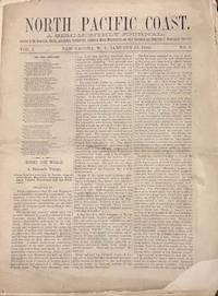
188035140New Tacoma W.T.: North Pacific Coast Publishing Company 1880. Newspaper. Fair. Newspaper. Pages 33-48. Pages are separated and detached. Front page has a corner chip with slight loss of print both sides. Edge wear and small tears to the fragile paper. <br /> <br /> Contents include North Pacific Exploration; The Chehalis and the Willapa; Opportunities for Settlers; The Ascent of Takhoma and more. Fair condition. Territorial imprint. North Pacific Coast Publishing Company unknown
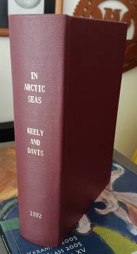
189261686Philadelphia: Rufus C. Hartranft. Good with no dust jacket; Usual library stamps and markings. 1892. First Edition. Hardcover. Rebound in maroon reinforced cloth binding vii 524pp photos illustrations maps. Account of the 1891 Peary expedition to explore the shores of Greenland. ; Ex-Library; 8vo 8" - 9" tall . Rufus C. Hartranft hardcover
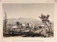
185714427Washington DC: Bevery Tucker Printer 1857. First Edition. Very Good. A.H Campbell. 8.25x11in One litho tinted illustrated plate Part I plate V; Light age-toning along edges with several light spots in margin. Samuels p. 81 Taft p. 265. This plate is from from Volume VII of the quarto edition of twelve volumes were published from 1855 to 1861 as exploration and survey reports became available. These volumes contained not only the survey maps and elevations but a monumental collection of scientific reports on geography geology zoology botany and ethnology of the Native American tribes. The surveys also included 11 artists to record the landscape and indigenous peoples of the west. <br /> <br /> <br /> <br /> Albert Henry Campbell 1826-1899 was a Railway survey artist-explorer civil engineer and surveyor. He was one of the more important artist of the surveys and participated in several survey expeditions across the west from 1853 to 1854. In the fall of 1854 he joined the Parke survey expedition for a coastal railroad route from San Francisco to San Diego and the survey along the 32nd parallel to Arizona. All eight of the full-page illustrations are credited to Campbell in the report three of California and five of Arizona scenes After the surveys he was assigned to Washington as Superintendent of Pacific wagon roads to 1860. During the Civil war he was a map maker for the Confederate Army and chief engineer of railroads based in West Virginia. from Samuels <br /> <br /> The twelve volumes were disorganized in publication with no overall all arrangement or indexing. Some of the plates and maps referred to in volumes were published in other volumes various reports were also published out of sequence relating to the four routes. Preliminary reports published were updated in latter volumes. From Wagner-Becker-Camp In 1853 Senator Gwin of California lead the inclusion of Congressional funding for 1853-54 of a series of surveys to determine the best and most economical railroad routes from the Mississippi River to the Pacific coast. The act directed the Secretary of War Jefferson Davis to plan and direct Army topographical engineers to conduct surveys of four routes. The first was between the 47th and 49th parallels generally along the Lewis and Clark route to the Pacific. The Second route between the 37th and 39th parallels was promoted by Senator Thomas Hart Benton of Missouri. The Third route was along the 35th parallel. The Fourth route was promoted by Secretary Davis along the 32nd parallel that followed Emory's 1846-47 reconnaissance. Bevery Tucker, Printer unknown
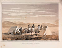
186014426Washington DC: Thomas H. Ford Printer 1860. First Edition. Very Good. 8.25x11in One litho tinted illustrated plate Part I plate XXXII; Some age-toning along edges with several light spots in margin and print. Samuels p.460 Taft p. 1. This plate is from from Volume XII of the quarto edition of twelve volumes were published from 1855 to 1861 as exploration and survey reports became available. These volumes contained not only the survey maps and elevations but a monumental collection of scientific reports on geography geology zoology botany and ethnology of the Native American tribes. The surveys also included 11 artists to record the landscape and indigenous peoples of the west. The twelve volumes were disorganized in publication with no overall all arrangement or indexing. Some of the plates and maps referred to in volumes were published in other volumes various reports were also published out of sequence relating to the four routes. Preliminary reports published were updated in latter volumes. From Wagner-Becker-Camp In 1853 Senator Gwin of California lead the inclusion of Congressional funding for 1853-54 of a series of surveys to determine the best and most economical railroad routes from the Mississippi River to the Pacific coast. The act directed the Secretary of War Jefferson Davis to plan and direct Army topographical engineers to conduct surveys of four routes. The first was between the 47th and 49th parallels generally along the Lewis and Clark route to the Pacific. The Second route between the 37th and 39th parallels was promoted by Senator Thomas Hart Benton of Missouri. The Third route was along the 35th parallel. The Fourth route was promoted by Secretary Davis along the 32nd parallel that followed Emory's 1846-47 reconnaissance.<br /> <br /> The illustration "Awaiting the Return of Mr. Tinkham" was done to support part of the report narrative by Stevens starting on p. 127 of the report. Mr. Tinkham was one of several civilian members of the survey that fanned out along the general route to identify better terrain for a railroad line. They were generally accompanied by Native American guides the knew the terrain. Mr. Tinkham proceed without a guide and became disoriented for a number of days before finding his way back to the camp. <br /> <br /> John Mix Stanley 1814-1872 was an artist-explorer American painter of landscapes and of Native American portraits and tribal life. In 1842 he traveled to the West to paint Native Americans and spend the next ten years painting and exhibiting in eastern cities and the Smithsonian. During the Mexican War in 1846 he was a draftsman for the Corps of Engineers assigned to Colonel Kearney's expedition to California and Oregon Territory. He produced maps and illustrations for the Army. After the war he spent time in Hawaii painting the Royal family native life and landscapes. In 1853 Stanley was appointed the chief artist to Isaac Stevens survey expedition for a Pacific railroad route from St. Paul to Puget Sound the Northern Survey. During the survey he produced the stunning 70 illustrations and fold out panoramas in the Stevens report. When he returned to Washington in 1854 he produced an exhibition of his paintings and large panoramas of western scenes from the Northern survey. from Wiki and Samuels in part. Thomas H. Ford, Printer unknown
19002716ml1900. Soft Cover. Good. Gd. condition : Gay Literature . A mag to match the movie . . L6a paperback
1880233129np.: np. c. 1880. Soft cover. . Near fine very light marginal foxing. 8 1/5" x 11". Hand-tinted lithograph. Very scarce in this condition. np. paperback
1900ZB377716Washington: GPO 1900. 22 pp issued as 56th Congress 1st Session SD 192; light extraction roughness at spine now disbound in self wrappers. - If you are reading this this item is actually physically in our stock and ready for shipment once ordered. We are not bookjackers. Buyer is responsible for any additional duties taxes or fees required by recipient's country. Washington: GPO, unknown
1869ZB386909Washington 1869. 40th Cong. 3rd Sess. Senate Rep Committee No. 219 3 pp. ex library good. - If you are reading this this item is actually physically in our stock and ready for shipment once ordered. We are not bookjackers. Buyer is responsible for any additional duties taxes or fees required by recipient's country. Washington unknown
1896011575Portland OR: The Register Publishing Company 1896. First Edition. Hardcover. Good. 286pp; Blue cloth boards with gilt lettering to front & spine decoration to front original decorated endpapers hinges professionally repaired previous owner's name to front pastedown wear to spine ends frontispiece tissue guard intact text unmarked binding is tight Good condition. Register of the Republican party in the state of Oregon with photos history and biographical sketches. The Register Publishing Company hardcover
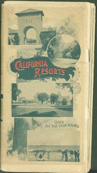
1896289350Southern Pacific Company 1896. Pamphlet. Pamphlet 7 x 14 inches of 18 pages folded into quarters 7 x 3.5 inches when folded. Highlights the Hotel del Monte Santa Cruz Santa Maria Del Mar San Jose Leland Stanford Junior University Lick Observatory and Mount Hamilton Paraiso Hot Springs and El Paso De Robles Hot Mineral Springs with a suggested route and schedule of the Coast Line Route. 4-panel folding map 'Bird's-Eye View Map of California. Very good copy with tears along some folds with all pages complete. Cover leaves are tanned. Uncommon.<br> Southern Pacific Company unknown
1878z015741Liverpool: Panama Railroad Company/ Royal Mail Steam Packet Company/ Pacific Mail Steam Ship Co 1878. Very Good. Letter of transmittal from a Panama Railroad Company/ Royal Mail Steam Packet Company/ Pacific Mail Steam Ship Co. agent to James M. Lincoln of the Pacific Mail Steamship Co. New York. Measures 8 by 10 inches recto only. Very good. Stain and paper repair to top corner letter creased else clean and unmarked. Panama Railroad Company/ Royal Mail Steam Packet Company/ Pacific Mail Steam Ship Co unknown
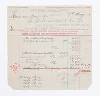
1883108441Montreal 1883. receipt. Invoice to the Canadian Pacific Railway dated 9th May 1883 for hose couplings and oil cups. approximately 21 X 21 CM folded twice. Several tears along folds. Several stamps with signature or initials on front and note in ink on verso signed and dated by F. G. Shaughnessey. Thomas George Shaughnessy 1853-1923 1st Baron Shaughnessy was president of the Canadin Pacific railway from 1899-1918. 1883 unknown
188900006509Boston: Houghton Mifflin and Company 1889. First edition. Hardcover. Very Good. 8vo. 4 iv-xi 2 2-352 2 pp. Original brown cloth with black illustrations and gold lettering on the front board and the spine; brown topstain. A handsome copy of this 19th century travel narrative. A Very Good book with a few hints of wear to the edges of the boards especially to the top and bottom edges of the backstrip. Houghton, Mifflin and Company hardcover
1898ZB333719Washington: GPO 1898. 2 pp issued as 55th Congress 2d Session HR 644; one leaf light chipping at margins with no loss; concerns a time extension for construction. - If you are reading this this item is actually physically in our stock and ready for shipment once ordered. We are not bookjackers. Buyer is responsible for any additional duties taxes or fees required by recipient's country. Washington: GPO, unknown
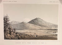
185714424Washington DC: A. O. P. Nicholson Printer 1857. First Edition. Very Good. 8.25x11in Four litho tinted illustrated plates I II VIII and XII; Some age-toning along edges one with large stain along right edge not affecting neatline of illustration. These plates are from from Volume VI of the quarto edition of twelve volumes were published from 1855 to 1861 as exploration and survey reports became available. These volumes contained not only the survey maps and elevations but a monumental collection of scientific reports on geography geology zoology botany and ethnology of the Native American tribes. The surveys also included 11 artists to record the landscape and indigenous peoples of the west. <br /> <br /> The plates were drawn in 1855 by John J. Young 1830-1879 a staff artist for the War Department. He was assigned in 1855 as a draftsman for the Lt. Williamson railway survey to connect California's Sacramento Valley with Oregon's Columbia River.Young's views of the Cascade Range included 14 landscape scenes one geologic scene and 10 drawings of trees in there habitat from Samuels p 545 <br /> <br /> The Illustrations are: Plate 1 - Lassens Butte From Vicinity of Camp 18 Plate II Mouth of Fall River near Camp 20 Plate VIII Canon of Psuc-See-Que Creek near Camp 41A Plate XII Shasta Butte and Shasta Valley from a point near Camp 70A.<br /> <br /> The twelve volumes were disorganized in publication with no overall all arrangement or indexing. Some of the plates and maps referred to in volumes were published in other volumes various reports were also published out of sequence relating to the four routes. Preliminary reports published were updated in latter volumes. From Wagner-Becker-Camp In 1853 Senator Gwin of California lead the inclusion of Congressional funding for 1853-54 of a series of surveys to determine the best and most economical railroad routes from the Mississippi River to the Pacific coast. The act directed the Secretary of War Jefferson Davis to plan and direct Army topographical engineers to conduct surveys of four routes. The first was between the 47th and 49th parallels generally along the Lewis and Clark route to the Pacific. The Second route between the 37th and 39th parallels was promoted by Senator Thomas Hart Benton of Missouri. The Third route was along the 35th parallel. The Fourth route was promoted by Secretary Davis along the 32nd parallel that followed Emory's 1846-47 reconnaissance. A. O. P. Nicholson, Printer unknown
1894ZB326378Washington: GPO 1894. 37 pp issued as 53d Congress 2d Session HED 194; light extraction roughness at spine now in self wrappers; concerns the company going into receivership. - If you are reading this this item is actually physically in our stock and ready for shipment once ordered. We are not bookjackers. Buyer is responsible for any additional duties taxes or fees required by recipient's country. Washington: GPO, unknown
18480008767circa 1848-9. Fine. 8.5 x 14.5 cm / 11 x 17.5 cm; <br/><br/>Having already accepted Texas as its 29th state in 1845 the U.S.A. in The Treaty of Guadalupe Hidalgo 2 February 1848 acquired 6 additional territories including Californa which eventually acquired statehood. This map was the recto of leaf 378/379 in probably a then-new history textbook. It is the same map with the identifier DLMW148 on the ImageBase of Virginia Tech University. This hand-colored in outline map shows the old boundaries and the new boundaries of Texas Upper California and Mexico and eastward to the Mississippi River and the Gulf of Mexico. unknown
1858DEMO013873IWashington 1858. First & Quarto edition. Hardcover. 4to 1005 pages worn orig. sheep lacks t-pg. Ex libris U.S. House of Rep. #799 <br/><br/>This is the BIRDS. By Spencer F. Baird with John Cassin and Geo. N. Lawrence. Sitwell p. 74. This is a text-only volume. House Exec. Doc. no. 91 Pt. 9. Howes P3; Wheat TRANSMISSISSIPPI 822ff; Wagner - Camp - Becker 266b; Rittenhouse 442. "This widely known work requires no comment - Cowan CALIFORNIA p.512." hardcover
1855DEMO015981IWashington: Beverly Tucker 1855. First & Quarto edition. Hardcover. fair. chromolithographs. 4to 12813245185 pages orig. sheep lacks t-pg. Ex libris U.S. House of Rep. #792. <br/><br/>Comprised of 7 reports each paginated separately by J. W. Gunnison Edw. Beckwith F. W. Lander John Pope Wm. P. Blake. "This widely known work requires no comment - Cowan CALIFORNIA p.512." Chromolithographs. Also John Grubb Parke Wm. H. Emory. House Exec. Doc. no. 91 Pt. 792. Howes P3; Wheat TRANSMISSISSIPPI 822ff; Wagner - Camp - Becker 262a: nos. 1-7. Twelve chromolithographs 24 botanical and geological lithographs 2 folding maps in pt. 5 lacks four maps and title-page in pt.1. Part 1 has a semicircular stain on the lower margin affecting the chromos. Beverly Tucker hardcover
1894ZB326377Washington: GPO 1894. 11 pp issued as 53d Congress 2d Session HED 203; light extraction roughness at spine now in self wrappers; concerns the company going into receivership. - If you are reading this this item is actually physically in our stock and ready for shipment once ordered. We are not bookjackers. Buyer is responsible for any additional duties taxes or fees required by recipient's country. Washington: GPO, unknown
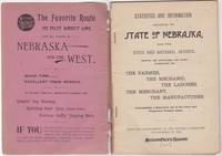
189246034St. Louis: Woodward & Tiernan Print. Co. 1892. Stapled paper wrappers. A good copy wrappers chipped soiled starting to detach seller stamp to front wrapper occasional soiling to contents. Lacking folding map. 64 pp. Illus. with b/w engravings. 12mo. Promotional booklet published by the Missouri Pacific Railway encouraging settlement in Nebraska. Lacks folding map. Woodward & Tiernan Print. Co. unknown
18704845Boston: Fields Osgood & Co. 1870. First edition. Hardcover. Good. 16mo green cloth cracking hinges <br/><br/>Coffin was a war correspondent in the Civil War and was called "the Ernie Pyle of his era". Most of his post-war books were historical fiction but this details his travel by train - especiallly the Northern Pacific R.R. - from Chicago up the Mississippi to Duluth then across to Portland. Large folding map in rear pocket. Woodcuts. Fields, Osgood, & Co. hardcover
1899u2337Northern Pacific Railway Company 1899 Full red cloth black titling. Spine ends frayed light general wear some spotting rear endsheets grubby. Text clean; 153 pages index figures. Handbook on general operating principles of the railway including duties of various personnel rules of transportation signals orders and forms movement of trains loading of cars removal of snow grade operation US Mail handling air brakes diagrams of hand and lamp signals first aid. This is copy # 16812 of Form 3526. Cloth. Good. 4½" by 6¾". Northern Pacific Railway Company hardcover
1870vot622Philadelphia: Jay Cooke & Co. Financial Agents of the Northern Pacific Railroad Company n.d. ca. 1870. Octavo stiff printed wrappers title printed in red & black 46 2 ads pp. Rear cover is a “Map of the Northern Pacific Railroad and Its Connections.†Good; spine is repaired with cloth tape. Jay Cooke & Co., Financial Agents of the Northern Pacific Railroad Company, n.d. [ca. 1870.] hardcover
1856DEMO013876IWashington 1856. First & Quarto edition. Hardcover. Fair. lithographs folding map. 4to orig. full sheep lacks t-p. Ex libris House of Repr. Vol. #794. <br/><br/>House Exec. Doc. no. 91. Howes P3; Wheat TRANSMISSISSIPPI 822ff; Wagner - Camp - Becker 263a; Rittenhouse 442. "Report on the Botany of the Whipple Expedition" & "Report on the Zoology of the Expedition." "This widely known work requires no comment - Cowan CALIFORNIA p.512." Lithographs folding map. hardcover