133 résultats
1870354322San Francisco: Thomas Houseworth & Co 1870. Single stereocard 3½ x 7 inches. Stereo image mounted onto printed orange cardstock. Slight wear at edges. Very good. Single stereocard 3½ x 7 inches. A very attractive single stereocard image of the Central Pacific Railroad's "Long Ravine Trestle Bridge." The bridge is located in Nevada County California in the Sierra Nevada mountain range just west of the Nevada state line. The image comes from a set sixty-two stereocards created by Thomas Houseworth & Company for the railroad some time after the railroads completion in 1869. According to the website of the Central Pacific Railroad www.cprr.org the Houseworth company produced more than one hundred such stereocards for the railroad including more than a dozen views of the 878-foot long Trestle Bridge. A nice early stereoscopic image of an engineering wonder from an important American railroad. Thomas Houseworth & Co unknown
1870354323New York: E. & H.T. Anthony & Co 1870. Single stereocard 3½ x 7 inches. Stereo image mounted onto printed orange cardstock. Slight wear at edges. Very good. Single stereocard 3½ x 7 inches. An appealing stereocard image showing several long stretches of railroad track heading into the small town of Ogden Utah. It is a view of an important point crossing point in American railroad history as Ogden is the point at which the Union Pacific Railroad ends and the Central Pacific begins. A train can be seen on the tracks in the far distance as well as a few clapboard buildings. The New York photographic firm of E. & H.T. Anthony & Co. produced several stereoscopic views for the Central Pacific Railroad though few are known today. A nice image of an important railroad intersection. E. & H.T. Anthony & Co unknown
1900373823St. Louis 1900. 34 photographs mounted recto and verso on 17 cards with printed album title on each the images captioned in the negative on linen guards. Oblong small folio 10-1/8x12-1/2 inches. Contemporary half calf and cloth covered boards titled in gilt on the upper cover leather perished contents loose. The images generally dark printings in good condition. Provenance: Battery Park Hotel Asheville NC presentation in gilt on the upper cover from H. C. Townsend Gen'l Pass'r and Ticket Agent St. Louis. 34 photographs mounted recto and verso on 17 cards with printed album title on each the images captioned in the negative on linen guards. Oblong small folio 10-1/8x12-1/2 inches. The images by an unindentifed photographer comprise lovely compositions of buildings and scenes along the route in Missouri Kansas Nebraska and Arkansas. OCLC locates only a single example at University of Texas Austin. unknown
187072298Philadelphia: Jay Cooke & Co. ca.1870. First edition Octavo. 46 2 ads pp. Cover printed in red and black. Original printed wrappers with a map of the railroad's line on rear small piece excised but not affecting map and an old center crease. Very good.One of the ads is for development in Montana and bears a letter from Governor Potts. Includes - "Puget Sound-Its Harbors. Climate and Resources."Together withSpecial Report of a Reconnoissance of the Route for the Northern Pacific Railroad between Lake Superior and Puget Sound via the Columbia River Made in 1869 by W. Milnor Roberts U.S. Civil Engineer. Philadelphia: Jay Cooke and Co. ca. 1870. First edition. Octavo. 51 1 4 ads pp. Publisher's printed wrappers. Very good. Jay Cooke & Co. unknown
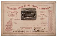
1862332701San Francisco: Towne & Bacon Printers 1862. Unaccomplished stock certificate for shares in a missionary vessel going to the Gilbert Islands Micronesia with a woodcut view of a tropical island printed in black the rest printed in red. Signed by John T. McLean and L. B. Benchley. 5-1/2 x 8-1/2 inches. Fine. Unaccomplished stock certificate for shares in a missionary vessel going to the Gilbert Islands Micronesia with a woodcut view of a tropical island printed in black the rest printed in red. Signed by John T. McLean and L. B. Benchley. 5-1/2 x 8-1/2 inches. The woodcut is signed by Loomis and shows a tropical atoll with palm trees small huts and several sailing vessels. The prospectus for the company survives at the University of Hawaii at Manoa dated 1862 and titled: Proposals for forming a children's Joint Stock Company for the purchase of a missionary vessel for the Gilbert Islands Micronesia. <br/><br/> Towne & Bacon, Printers unknown
185275869Oregon City: Surveyor General's Office 1852. First edition. 15 3/4 x 26 inches. Printed in various shades of green blue red and black. Some light toning long fold-lines else a very good map of a vastly underpopulated Territory.The map above shows the surveyed portion of the Oregon Territory as of October 21 1852. It was prepared by John B. Preston first surveyor general of Oregon."With the establishment of the Oregon Territory on August 14 1848 all grants of claims of land in the territory were nullified. It was not until the passage of the Donation Land Act on September 27 1850 that new provisions were made for acquiring unclaimed land to be based upon government surveys. John B. Preston was appointed first surveyor general of Oregon where he arrived on April 20 1851. On June 7 1851 Preston drove the “starting stake†for the base surveys of the territory at what is today known as the Willamette Stone. The east-west Willamette Base Line and the north-south Willamette Meridian still define surveying and legal land descriptions in Oregon and Washington state.Preston and his crew were able to carry out their surveying and mapping to the extent depicted on this map in just over one year. Each square of the grid termed a section is one mile on each side and includes 640 acres of land—the maximum acreage allowed for a married couple making a claim under the Donation Land Act; a single man could claim up to 320 acres. Thirty-six sections make up a township.The surveyors took careful note of waterways hills prairies and roads. Some recognizable places are already viable communities such as Salem and Lafayette; other communities of the period—Champoeg Fairfield Cincinnati for example—have vanished as meaningful places. All three of those were river landings that were affected by floods channel changes and the eventual disappearance of river transportation. Notably absent from the map is Mission Bottom or Mission Landing the by-then-abandoned site of the Methodist mission of the 1830s and St. Paul on French Prairie. The roads that are mapped include ancient routes such as the California-Oregon Trail which had sections that paralleled both sides of the valley as well as newer roads established in recent years. The roads converging on Salem from the outlying farming districts for instance reflect its recent importance as a mill town powered by the waters of Mill Creek Surveyor General's Office unknown
190074021Port Townsend WA and others: N.p. ca. 1900. Original quarto album of full morocco measuring 9 1/2 x 6 1/2 inches. There are 24 think leaves mounted on stubs with each leaf bearing four windows for photographs measuring 3 7/8 x 2 7/8 inches. Most of the leaves in the rear bear no photographs but in the front there are 64 inserted silver gelatin photographs. Of these 36 bear images of people places and activities in the Puget Sound/Port Townsend area The remainder are quotidian shots of England. A chief concern in this album is mining and likely they brought in some British miners which would explain the shots of England. No surnames are given so it is all a bit of a mystery but the pictures speak for themselves. Finding a mining album of the Northwest is a rather rare occasion.The photographs of interest are; Log Cabin; Ranch House with two women and an infant in front; the nanny appears to be a Native American; Ore Coming out of a Tunnel; Harry Smith Cabin with two gents relaxing on the front porch; Cook House a mess tent with many miners taking their meal; Bunk homes for the workers; Blacksmith shop and Ore Dump with two men pushing a cart of trailings down the hill; Swamp grass three foot high; Dumping ore from car; Road Gang at Dinner; Railroad Station near mountains; Road Makers to the Mine a posed group shot of 20 men; Sunset near Port Townsend; Mates at the Boiler Makers; A river near our mine faded. The rest are uncaptioned but we can see the same camp and people in the winter snow; 2 shots of a sailing vessel trying to come up the Columbia ; and seven photographs of Native Americans unposed. One of them seems to be wearing a mask or bag over his head. A fascinating album of a rough and tumble time in the Pacific Northwest. N.p. unknown
189071195San Francisco: Southern Pacific Co. ca. 1890. Two original albumen photographs taken by a staff photographer for the Southern Pacific Railroad Company. Each photograph is 8 1/8 x 5 7/8 inches. Both are captioned and mounted on original boards with gilt edges. The first entitled 'Rotary Snow Plow in Action' and the second 'Snow Shovelling at Cascade'. Each photo shows a large group of men working on removing snow from the tracks. The Cascade mentioned is probably Cascade Trestle near Truckee although it is conceivable that it is Cascade Summit Oregon. Southern Pacific Co. hardcover
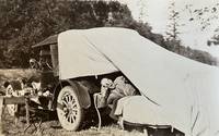
188059310Portland OR & Seattle WA: Walter Angus MacKay Julia Rose Eder MacKay Cross & Dimmitt ca. 1880-1958. Two vols. 1st - Thick oblong 4to. 11.5 x 8.75 x 2.25 in. 128 pp unpaginated. on thick black paper. With 461 photographs sized 1.75 x 2.75 in. up to 4.5 x 5.5 in. including 2 CDV’s 1 cyanotype several albumen and range of silver gelatin snapshots on matted and glossy paper stock many w/ annotations either on verso below images or w/in the margins at lower fore-edge or in pencil some w/ white ink alongside the images. Contemporary flexible polished calf post-binder punch-sewn at gutter margin in gold silk braid RPPC of Tillamook Bay OR by Gregg mounted on front cover chipping & wear to front cover wear to corners wear & rubbing to some fore-edges occasional chipping minor closed tears still VG exemplar; 2nd vol. -- Oblong 8vo. 8 x 5.75 in. 78 pp unpaginated. on thick tan paper stock. With 101 silver gelatin photographs mounted sized from 1.75 x 2.75 in. up to 4 x 6 in. some w/ sepia effect either mounted directly on the pages or many affixed with small strips of black paper or old paper corners affixing the images to the leaves a few w/ annotations on verso or below. Contemporary flexible diced calf “Housh†photo album chipping & wear to spine wear & bumping to corners some pages reworked by compilers at some point still a G exemplar both albums’ photos with bright strong contrast. These photo albums faithfully follow the sporting and leisure activities of two gearheads from Chicago -- Walter MacKay and his brother Carrol MacKay who together with their extended families and friends drive and auto-camp across the West. The large first album opens with many photos following a trip to Yosemite National Park as well as scenes along the route and upon the return of Walter & Julia. Their follow-up automobile trip in 1928 takes them to Yellowstone National Park via Spokane Idaho and Montana with photos included of Old Faithful a photo by Haynes of the Grand Geyser as well as auto camping at “Mammoth Hot Springs.†Subsequent photos trace their travels through the Columbia River Gorge the Snake River Mount Rainier National Park Ariel Dam near Ariel WA Hoods Canal WA and Newport OR. Their speed boat launch the Carmen is featured in some photos along with several views of pumps hoisting engines giant diesel and gas engines under repair. Other trips include those to Snoqualmie Falls Trout Lake WA near Mt. Adams working a hoist at logging camp partying with friends in Renton WA and even views of Walter MacKay advertising his Automobile Repair Shop with a cover on his rear tire. Other outings include auto camping and picnicking along the Mt. Hood Loop Grant’s Park on the Clackamas River Mt. Hood the Rogue River Table Mountain and views of Grants Pass. Walter and his gearhead friends were known for their stripped-down roadster racing cars and were also early participants in the Seattle Motorcycle Club and Motorcycle races. A couple photos within the two albums show early motorcycles and even gallivanting on some stripped down chassis without engines or tires. The second album includes a series of photos featuring Walter and his car beneath a towering Cedar Stump with arch cut into the base and him holding gun as well as standing on the fenders of the car. The second also includes automobile camping photos with tent and cots folded out of the rear of the automobile driving into Vancouver B.C. as well as driving to Mount Rainier and more along the Columbia River Highway and Mount Hood. Also featured are hunting shots in Eastern Oregon construction of a summer log cabin and much more. Mackay 1883-1959 was a mechanical engineer machinist gearhead racecar builder who came West working for the railroad as a machinist before working for Paragon Co. in Seattle as parts manager. He owned and operated the MacKay Automotive Repair at 165 E. 39th in Portland OR on the SW corner of 39th Cesar Chavez and Belmont for years before working at Albina Engine & Machine Works at the end of the Great Depression. One of the photos in the 2nd album shows MacKay with his camera shooting a photo and several show Julia MacKay’s 1880-1958 sisters and family. Should be noted we unknowingly catalogued an album on Seattle Auto Racing and Motorcycle Clubs from before World War I without having had access to these unknown albums. See: The Origins and Growth of the Club Scene in Western Washington 1910-1941 Jolly Rogers Motorcycle Club Feb. 7 2009; Seattle Motorcycle Races Pantages Theater Program Early Advertising in the West 1867-1918 Univ. of Washington Spec. Collections. Walter Angus MacKay, Julia Rose Eder MacKay, Cross & Dimmitt, unknown
189431668San Francisco 1894. Original staples and printed wrappers with wrapper title as issued. 12pp lightly toned Very Good.<br /> <br /> The Mass Meeting attacked the "Railroad Octopus" which assails the people "by unjust accumulations and intelligent and determined concentration of power for bad ends . . . Its cupidity its selfishness its trickery the debasing pressure exerted upon every form of industry and the unprincipled use of money and of purchased intellect by a powerful railroad monopoly has checked our progress and reduced us to virtual slavery for twenty-five years." <br /> OCLC lists twelve copies under two accession numbers as of October 2024. Not located in Rocq Cowan or BRE. unknown
1889354257San Francisco: H.S. Crocker & Co 1889. 70pp. Original printed wrappers. Spine chipped. Small old stamp on titlepage. Very good. 70pp. Introductory material by Leland Stanford. A positive report on the Central Pacific's dealings with the government. <br/><br/> H.S. Crocker & Co unknown
189837912Chicago: Poole Bros. 1898. 1898. COLORADO. 8 1/2" x 6 1/2" in color pictorial wrappers. 44 pp. illustrations. Information on Manitou Colorado Springs Pikes Peak the Manitou and Pike's Peak Railway side trip to the Grand Canon of the Arkansas various parks the Rocky Mountain Limited etc. Double-page drawing of "The Rocky Mountain Limited" above the floor plan of the train above a line map of the route from Chicago to Denver. Numerous illustrations of scenes along the Great Rock Island Route. Wear and rubbing to corners and spine. A nicely produced booklet. Poole Bros., 1898. unknown
18851099Chicago: Geo. F. Cram 1885. Good plus. Large folding pamphlet approximately 20 x 41.5 inches. A few small chips and short closed tears at edges; several short separations and very minor losses along folds. Contemporary agent's ink stamp on cover panel. Tape repair across portion of horizontal fold; one panel with patches of light staining. A scarce colorful promotional for the Rock Island Route as well as its national and international connections with a fascinating stamp of an Australian sales agent. One side of the sheet prints an extensive promotional text and timetables for the various routes and services of the Chicago Rock Island & Pacific Railway. The main side of the sheet prints a map of the United States with state borders shaded in four colors highlighting the principal routes of the Rock Island from Chicago to Minnesota Iowa and Kansas and its connections to points on both the East and West Coasts. An inset map at lower right promotes the Rock Island as part of a transcontinental route between the United Kingdom Ireland and Australia. Most interestingly this copy is stamped on the cover panel with the information of a George. H. Hibbard "Australian Passenger Agent America's Cons'd Trans-continental Railways 6 Bridge Street Sydney N.S.W." Hibbard was evidently the agent in charge of distributing information about the trans-America route in Sydney one of its end points.<br /> <br /> Several issues of this map were published during the 1880s all scarce. We locate copies of the present 1885 issue at Stanford SMU and the Library of Congress. Geo. F. Cram unknown
189132829St. Louis: Woodward & Tiernan Printing Co. n.d. 1891. 1891. First edition. Third edition. 12mo. Original orange wrappers printed in black ink 82 2 pp. illustrated map. advertising. Issued by the general passenger department of the Missouri Pacific Railway. A general description of the state and its place in history is provided. Plus soil rainfall churches schools higher educational opportunities newspapers population and wealth corn wheat oats stock farming wild flowers orchards and vineyards salt lead and zinc stone brick and lime coal gas hunting and fishing cities irrigation etc. Views are offered of farms and ranches parade grounds city parks etc. of various cities. Herd 1204 says "Issued by the Missouri Pacific Railway Company this book appeared in many editions though all are now rare." Prior to this copy the earliest edition of a similar booklet was a 13th edition and that was 15 years ago. Fine clean copy with a fine folding map. An exceptional copy of a rare item. Woodward & Tiernan Printing Co., n.d. (1891)]. unknown
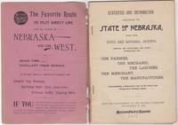
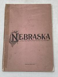
189246034St. Louis: Woodward & Tiernan Print. Co. 1892. Stapled paper wrappers. A good copy wrappers chipped soiled starting to detach seller stamp to front wrapper occasional soiling to contents. Lacking folding map. 64 pp. Illus. with b/w engravings. 12mo. Promotional booklet published by the Missouri Pacific Railway encouraging settlement in Nebraska. Lacks folding map. Woodward & Tiernan Print. Co. unknown
189287869St. Louis MO: Printed by Woodward and Tiernan Printing Co 1892. Second Edition. Staplebound Pamphlet. Good Plus. Stapled pamphlet. 7.5 in. x 5.25 in. pp. 64. Illustrated with in-text drawings and a fold-out map of Nebraska 21 in. x 26 in. Pink cardpaper wraps with black title to front. Light soiling to covers with chips to top/bottom of spine; older tape repairs to length of spine reattaching front cover and to left edge of rear cover. Fragile edges with chips to corners and several short closed tears to cover edges. Clean interior with very good plus map. This brochure was presented "With the Compliments of the General Passenger Department of the Missouri Pacific Railway." The text provides description and chart of information related to population geography geology weather land prices distances horticulture churches and more. Printed by Woodward and Tiernan Printing Co unknown
1890300405Pacific Electric Railway 1890. 1890. Photograph depicting 37 passengers at the Echo Mountain Terminal 3500 feet above sea level with printed descriptive information on the verso of mount with pictorial borders. 4 1/2" x 7 3/4" image on stiff 10" x 7" mount. No Binding. Very Good/No Jacket. Pacific Electric Railway [1890]. unknown
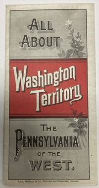
188853587Chicago: Rand McNally & Co. 1888. 1888. 20 3/4" x 13 1/2" sheet folded to 24 panels. Map. One cover panel; one panel showing N.P.R.R. route from Minneapolis to Washington Territory; and 10 panels of information to include information on the area's location and physical features climate agriculture stock raising manufacturing mining public schools cities and towns etc. Opposite 12 panels offer a map of Washington Territory printed in red and black. A rare promotional piece to encourage sales of Northern Pacific Railroad lands in Washington Territory. Light soling a few small splits to creases and with minor wear to the extremities. Very good. Rand, McNally & Co., 1888. unknown
188210945St. Paul MN: The Pioneer Press Co 1882. First Edition First State. 100pp. Octavo 24 cm Presentation binding. Publisher's full grained brown leather with the title gilt stamped on the front board and backstrip. A.E.G. Satin moire endsheets. Near fine. Inscribed on the front free endsheet. 'Mr. Minnie with compliments of the author. Map of the Yellowstone Valley 42 cm x 70 cm and the Plat map of Glendive 40 cm x 56 cm present and both linen backed and in nice condition. Presentation copy. The trade edition of this work was bound in green printed wrappers with 10 pages of advertisements in the front and 3 to 10 pages of advertisements in the rear. Map of transcontinental was attached to the rear free endsheet. Our copy predates the various issues with advertisements and the map attached to the rear free endsheet. Eberstadt and Yale copies and others only list the plat and cattle trails maps. Early Montana promotional item from the Northern Pacific Railroad a year before they opened the Gardiner Gateway at the north end of Yellowstone Park. An important descriptive tract of the new country at the time of its settlement with a fine large map showing the towns and cattle trails. Eberstadt 132: 478. Howes Y8. Rampaging Herd 1535. This is the first time that we've handled or encountered this title. Rare. The Pioneer Press Co unknown
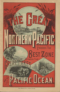
188249882Chicago: Rand McNally & Company 1882. 1882. First edition. 9" x 6" in color pictorial wrappers printed in red blue & black with vignettes of wheat threshing cattle mining and logging on front wrapper. 82pp. plus 2 pp. publisher's ads for Oregon Railway & Navigation Co. Contents. Illustrations. Maps. Uncommon Northern Pacific Railway land promotion detailing the sites and possibilities along the Northern Pacific route at the end of the 19th century. The work details the history of the NPRR divisions branch lines development opportunities for homesteaders and businesses in Western Washington the inner-mountain West Montana Yellowstone National Park the Dakotas Minnesota and specific land grants available from the NPRR in Minnesota and the Dakotas. Large color map attached to inside rear wrapper. Map fine. Light chipping to wrapper edges and with a few small closed tears to wrapper edges along with light soiling and rubbing to spine. Very good. Rand, McNally & Company, 1882. unknown
1871761New York 1871. Good plus. Folding pamphlet 6 x 17 inches. Separated along one fold. A few later pencil annotations. Light wear and tanning. A scarce advertisement for bond investment in the Northern Pacific Railroad issued in 1871 during the first great construction push on the line. Although the company was founded in 1865 ground was only broken on construction in 1870 after considerable backing by Jay Cooke. This pamphlet outlines the plans for the railroad to be built from St. Paul to Portland and Seattle the prospects for passenger and freight business upon completion and the extent of the land grants afforded the railroad by the federal government. The text goes on to describe the financial instruments on offer their advantages over Treasury bonds chiefly a greater yield at 7-8% vs. 5-6% and their security against the commercial and financial assets of the railroad as well as its land grants. With a map of the proposed route on the rearmost panel. A scarce call for investment in the Northern Pacific from its early history. unknown
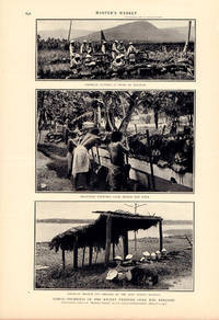
1899219046New York.: Harper's Weekly. July 11899. Three photographic prints each approx 11 x 20 cms and three black and white engravings together 33.5 x 20.4 cms all captioned printed on two conjoined newspaper leaves pp 645-648 41 x 28.5 cms the associated articles: "Samoa in War-Time" in full with a cameo portrait of the Chief Justice of Samoa and "The Philippine Revolt." partial with a small sketch map of Malolos printed on the verso central fold a few small edge tears and faint toning but in good condition. Malcolm Ross the author and photographer of "Samoa in War-time" was a New Zealand freelance journalist and war correspondent for the New Zealand press as well as the Melbourne Age. In 1899 he spent three months in Samoa covering the clashes for the leadership of the colony that followed the death of Malietoa Laupepa the incumbent chief at the time. <br>Unusual late 19th Century coverage of Samoa especially by a New Zealand photojournalist. <br> <br>The second spread with the incomplete accompanying article by Joh F. Bass a "Special Correspondent of "Harper's Weekly" on "The Philippine Revolt" has an unsurprising pro-American tone: the armed conflict between the First Philippine Republic and the United States 1899-1902 was clearly viewed by the United States as an insurrection rather than as a continuation of the struggle for independence by Filipino nationalists that had begun in 1896 with the Philippine Revolution. . Harper's Weekly. unknown
186854075New York: John W. Amerman Publishers No. 47 Cedar St. 1868. 8vo. 17 3 pp. Very light salmon-coloured printed softcovers slight shelfwear NF copy. First edition of this informative work providing a concise history of the United States legal claims to the Oregon Territory detailing the efforts of missionaries such as Whitman and Perkins the fur growth of the fur trade the Whitman massacre by the Cayuse as well as extolling the tremendous economic potential of the West Coast. He makes specific mention of the newly constructed Transcontinental Railroad and the tremendous advantages this provided in transporting the mineral timber and agricultural production East. He also notes the purchase of Alaska the tremendous fisheries and the potential sources of wealth. Not in Smith Graff or Wickersham. John W. Amerman, Publishers, No. 47 Cedar St., paperback
189556659Mount Angel OR: Typis Monasterii S. Benedicti 1895. 8vo. 73 3 pp. Black embossed cloth embossed blind-stamped lettering on front cover minor edgewear rubbing slightly shaken still VG- copy from the library of Edwin Vincent O’Hara 1881-1956 Roman Catholic Priest educator social reformer and author of the Pioneer Catholic History of Oregon. whose manuscript note indicates this copy was acquired after he became the bishop of Great Falls MT in 1923. First edition of this scarce Oregon imprint and one of the earliest publications issued by the Mount Angel Seminary Press. This work publishes in Latin the orders and decrees describing and outlining the work and efforts of the Catholic missionaries and churches in the Oregon Territory and later state. It includes orders decrees and letters concerning missions and churches in Walla Walla Vancouver Island Portland Willamette Valley from and to the Archbishops and Bishops in Oregon Idaho Washington and Vancouver Island. Of particular interest the second Provincial Council was vehemently opposed to Public Schools and that due to the “swearing cursing and Profane expressions . . . of public school children†all good Catholics were “enjoined to preserve the little ones from the poisoned atmosphere of these godless institutions.†The Third Provincial Council was overseen by Archbishop William Gross who was also responsible for urging the Benedictine Monks to establish the Mount Angel Seminary to train Pacific Northwest priests. Typis Monasterii S. Benedicti, hardcover
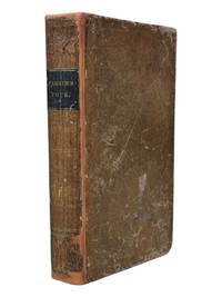
18389126Ithaca NY: Published by the Author 1838. First edition. 8vo xii 13-371pp. Folding map of Oregon Territory at front and one plate here between pgs 208 and 209. Contemporary sheep with black spine label gilt lettering. Rebacked with original spine laid down. Front pastedown stained mild to moderate foxing throughout. Map with single small tear at fold neat tape repair at edge few spots of foxing. A very good example with attractive fragile map. <br /> <br /> First edition in contemporary binding of this popular book which went through at least four editions in the 1840s and contained one of the first widely circulated maps to contain reliable information about the Oregon Territory. Parker's journal details his fur trading expedition in the Rockies in 1835 for part of which he was accompanied by Marcus Whitman. The group arrived in Walla Walla in October 1835 and returned East 2 years later via ship around Cape Horn. A cornerstone Pacific Northwest title. <br /> <br /> Howes P89. Wagner-Camp 70. Washington 89 60. Published by the Author unknown