384 résultats
192771713large black and white paper map of Liddar Valley India at scale of 2 inches to a mile Published by The Survey of India Offices unknown
192771714large black and white paper map of Liddar Valley India at scale of 2 inches to a mile Published by The Survey of India Offices unknown
194571942black and white map Scale of 1;1000000 1 millimetre = 1 kilometre heights and depths are in metres and feet contains both english and french text double sided map scaling and formatting is the same on either side handwritten note on map detailing travel information dated 1945 Published by the Survey of India Offices paperback
1921NL-02287<p><strong>Frontier warfare and colonial cartography: 1921 Survey of India "Confidential" atlas documenting the British campaign in Waziristan.</strong></p><p>This highly detailed 1921 confidential British-Indian general staff report produced by the Survey of India documents the Waziristan military operations of 19191920 along the volatile frontier of the Northwest Boundary. The publication includes a frontispiece 31 plates seven maps three of which are pocket-folded and eight folding panoramic illustrations that chronicle both the terrain and troop dispositions. The maps provide tactical clarity on routes native strongholds topographic obstacles and British positions. At the same time the accompanying text analyzes operational strategy lessons learned and the emergent use of air power in tribal warfare.</p><p>Waziristan now in Pakistan had long been viewed by the British as a strategically critical and persistently unstable frontier region inhabited by fiercely autonomous Waziri and Mahsud tribes. The 19191920 campaign followed the Third Anglo-Afghan War during which boundary tensions and local insurrections compelled renewed military intervention. This report presents not just the operational narrative but also the institutional mindset of early 20th-century colonial warfare combining detailed cartography with doctrinal reflection.</p><p>Cartographers:</p><p>The <strong>Survey of India</strong> established in 1767 under Major James Rennell and expanded during British rule served as the paramount cartographic and geodetic agency in India. By 1921 it had become central to mapping the subcontinent for both civil administration and military planning. In this instance the Survey's maps reflect the dual imperative of geographic precision and strategic control making this report an indispensable source for scholars of South Asian military history cartography and colonial frontier dynamics.</p><p>Condition Description</p><p>Good. Some wear on cover. Fold lines and some marginal imperfections on maps views and illustrations.</p> Survey of India
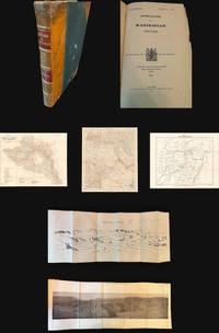
1921NL-02287a<p><strong>Frontier warfare and colonial cartography: 1921 Survey of India "Confidential" atlas documenting the British campaign in Waziristan.</strong></p><p>This highly detailed 1921 confidential British-Indian general staff report produced by the Survey of India documents the Waziristan military operations of 1919–1920 along the volatile frontier of the Northwest Boundary. The publication includes a frontispiece 31 plates seven maps three of which are pocket-folded and eight folding panoramic illustrations that chronicle both the terrain and troop dispositions. The maps provide tactical clarity on routes native strongholds topographic obstacles and British positions. At the same time the accompanying text analyzes operational strategy lessons learned and the emergent use of air power in tribal warfare.</p><p>Waziristan now in Pakistan had long been viewed by the British as a strategically critical and persistently unstable frontier region inhabited by fiercely autonomous Waziri and Mahsud tribes. The 1919–1920 campaign followed the Third Anglo-Afghan War during which boundary tensions and local insurrections compelled renewed military intervention. This report presents not just the operational narrative but also the institutional mindset of early 20th-century colonial warfare combining detailed cartography with doctrinal reflection.</p><p>Cartographers:</p><p>The <strong>Survey of India</strong> established in 1767 under Major James Rennell and expanded during British rule served as the paramount cartographic and geodetic agency in India. By 1921 it had become central to mapping the subcontinent for both civil administration and military planning. In this instance the Survey's maps reflect the dual imperative of geographic precision and strategic control making this report an indispensable source for scholars of South Asian military history cartography and colonial frontier dynamics.</p><p>Condition Description</p><p>Good. Some wear on cover. Fold lines and some marginal imperfections on maps views and illustrations.</p> Survey of India
194642874Survey of India 1946. Folding coloured map on paper measuring 44 x 31 ins approx. 112 x 79 cms folding in 36 panels to 7.5 x 5.25 ins approx. 19 x 13 cms; printed wrapper covers mildly age-soiled but map itself remakably bright and clean a bright copy. A SCARCE SURVIVAL. Survey of India, unknown
1948018911India: Survey of India 1948. Book. VG. No Binding. 3rd Edition. Large folded colored map with minimal wear thus very good plus. . Survey of India unknown
1999x-0415117682Routledge 1999. Hardcover. New. 1st edition. 303 pages. 9.75x6.75x0.75 inches. Routledge hardcover
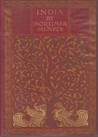
191220853London: A & C Black. 1912. Second Edition. Hardcover. Very Good. Boards with light rubbing to extremities. Slight bumping to one corner. First and last few pages browned. Light foxing to half-title page and very light occasional foxing but not affecting the illustrations. ; Dark red cloth boards with gilt lettering and ornate design in gilt green and orange. Top edge gilt. 75 tissue guarded illustrations from watercolors by the famous artist Mortimer Menpes. 20 Shilling Series. Inman 38 ; 8vo 8" - 9" tall; 216 pages . A & C Black hardcover
191220480London: A & C Black. 1912. Second Edition. Hardcover. Very Good. Light dampstaining to bottom of back boards. Tanning and extremely light foxing to first and last few pages. Former owner's name on front free endpaper. An unusually handsome and tight copy; Dark red cloth boards with gilt lettering and ornate design in gilt green and orange. Top edge gilt. 75 tissue guarded illustrations from watercolors by the famous artist Mortimer Menpes. Inman 38 ; 8vo 8" - 9" tall; 216 pages . A & C Black hardcover
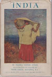
192920614London: A & C Black. 1929. Hardcover. Very Good in Very Good- dust jacket. DJ darkened and with light chipping. Slight loss to spine ends. Very light foxing to fore edge bottom edge and first few pages. Else a handsome and tight copy. ; This is the more popular version of the rare India guide from the 20 Shilling series. Blue cloth with beautiful blindstamped decoration. Gilt spine lettering and black lettering to front board. 32 illustrations from watercolors by Mortimer Menpes. ; Black Popular Series of Colour Books; 8vo 8" - 9" tall; 220 pages . A & C Black hardcover
191120640London/new York: John Lane the Bodley Head. 1911. Second Edition. Hardcover. Very Good. Boards with light wear to extremities. Former owner's name on front free endpaper. ; "Illustrations by the author and others". ; B&W Photographs; 8vo 8" - 9" tall; 307 pages . John Lane the Bodley Head hardcover
1935ZB599295Calcutta: Macmillan 1935. Volume 1 January-June 1935 viii 616 pp library book plate and markings but a sound copy in later cloth; a Catholic journal of general interest dealing with the various fields of human culture and higher concerns for the educated reader in India . - If you are reading this this item is actually physically in our stock and ready for shipment once ordered. We are not bookjackers. Buyer is responsible for any additional duties taxes or fees required by recipient's country. Calcutta: Macmillan hardcover
1936ZB599296Calcutta etc.: Macmillan 1936. Volume 3 January-June 1936 only; small quarto viii 616 pp library book plate and markings but a sound copy in later cloth; a Catholic journal of general interest dealing with the various fields of human culture and higher concerns for the educated reader in India . - If you are reading this this item is actually physically in our stock and ready for shipment once ordered. We are not bookjackers. Buyer is responsible for any additional duties taxes or fees required by recipient's country. Photos available upon request. Calcutta (etc.): Macmillan, hardcover
191720036Clarendon Press Oxford 1917. 8vo. First Edition with coloured frontispiece 14 plates 5 full-page maps in the text and 3 folding maps on japon title lightly dust-soiled; handsomely bound in full burgundy crushed morocco sides with gilt frame border back with raised bands second and fourth compartments lettered and ruled in gilt all other compartments tooled in gilt gilt top hand-made endpapers ribbon marker custom-made-slip-case an elegant copy ideal as a gift or for presentation. THIS COPY WAS FORMERLY IN THE LIBRARY OF SIR REGINALD SPENCE AND BEARS HIS FINE ENGRAVED ARMORIAL BOOKPLATE ON FRONT PASTE- DOWN. IT WAS SUBSEQUENTLY PRESENTED BY SPENCE TO THE LIBRARY OF CHRIST'S HOSPITAL SCHOOL HORSHAM AND BEARS THAT INSTITUTION'S PRESENTATION BOOKPLATE ON FRONT FREE ENDPAPER. Sir Reginald Spence prominent merchant philanthropist and educationalist spent much of his career in India. He was a prominent wine merchant Master of the Worshipful Company of Distillers 1949-1950 and an eminent freemason District Grand Master of Bombay and Northern India; the Lodge Reginald Spence was founded in his memory. A fervent educationalist he co-founded Barnes School in Devlavi one of the finest institutions of its type in Western India where a school house now bears his name. A NOTABLE ASSOCIATION COPY OF A WORK SELDOM FOUND IN THE ORIGINAL EDITION. Clarendon Press, Oxford, hardcover
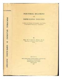
1967342790New Delhi: The Research Programmes Committee Planning Commission Government of India 1967. First Edition. Hardcover. Good cloth copy in a good if somewhat edge-torn with some loss and dust-toned dust-wrapper now mylar-sleeved. Remains quite well-preserved overall; tight bright clean and strong. Physical description; xxiii 292 p. ; 26 cm. Notes; Sponsored by the Research Programmes Committee Planning Commission Govt. of India. ""Copies: 500."" Subjects; Hindustan Shipyard Limited. Shipbuilding industry Employees. Industrial relations India. Shipbuilding India. New Delhi: The Research Programmes Committee Planning Commission Government of India hardcover
19369363University of Calcutta. 1936. Softcover. Good. Spine is sunned and former owner has written title in ink to spine. Small dampstaining stain to top of textblock. Light soiling with small tears to ffep.; Systematic presentation of post-Samkara dialectics of the Advaita-Vedanta.; 322 pages . University of Calcutta paperback
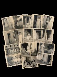
1958231781958. Bombay red light district photographs of women seated in brothel doorways gathered in interior rooms and receiving male visitors circa 1958 recording the sex trade as it operated in post independence India under the combined pressures of urban poverty migration and state regulation. Drawn from a merchant marine album and anchored by a source page marked 1958 the group preserves an outsider's view of brothel based sex work at the moment when independent India's Suppression of Immoral Traffic in Women and Girls Act had just come into force. British rule had already concentrated prostitution into regulated urban zones in Bombay with districts such as Kamathipura shaped by segregation policing and the management of commercial sex. The 1956 law effective 1 May 1958 targeted brothel keeping procuring and related activities without removing the economic structures that kept poor women in the trade. <br /> Photo archive of 17 silver gelatin photographs each 2.75" x 4" Bombay India circa 1958. Several images show women in saris seated on stone thresholds and steps outside narrow ground floor rooms watching the street conversing with one another or facing the camera from darkened doorways. Other photographs move inside the premises where a group of young women pose on a sofa beneath patterned wallpaper one beside a Western man holding a camera while another interior view shows several women crowded before a wall mirror with the same man visible in reflection behind them. Street level exterior views record a worn multistory building with open upper windows shuttered lower bays pedestrians passing and an automobile and hand pulled or cycle traffic in front fixing the brothel within a dense commercial streetscape rather than an isolated interior world. One of the most arresting images shows a white clothed man carrying a tray as he faces several figures in a narrow passage potentially showcasing the work surrounding and upkeeping the trade.<br /> The archive belongs to a longer history in which Bombay's sex districts were formed under colonial urban governance and continued after 1947 as sites where caste class migration policing and women's labor met in highly unequal ways. These photographs show the raw historical context of such professions with women waiting at entrances living in cramped quarters and occupying semi public thresholds where domestic space commercial exchange and street visibility collapse into one another. Light surface wear small edge chips and album glue residue en verso. Overall very good condition. The album context fixed 1958 dating and repeated views of the same doorway spaces make this a concise photographic record of brothel based sex work in postcolonial Bombay. unknown
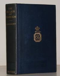
192819681John Murray 1928. 8vo. First Edition with portrait frontispiece original tissue guard present and 20 plates some light and mainly marginal age-spotting; navy cloth boards ruled in blind upper board blocked in gilt gilt back edges mildly spotted expertly rebacked with old backstrip laid down a bright fresh copy. VERY SCARCE. John Murray, hardcover
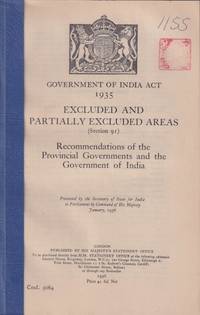
1936214466London.: His Majesty's Stationery Office. January 1936. Charts and tables xl 248pp mylar front cover and card rear cover prior owner chop on title page. A good copy. 24 x 13.5cm.<P> The term 'Excluded Areas' and 'Partially Excluded Areas' originated in the Government of India Act 1935. These were regions which had a significant population of Scheduled Tribe communities and for that reason were considered to require special administrative provisions.<P> <b>When referring to this item please quote stockid 214466</b> . His Majesty's Stationery Office. unknown
190320643New York: Century. 1903. First Edition. Hardcover. Very Good-. Moderate wear to boards. Front hinge has a bit of play. Rough spot from removed label on front pastedown. Rear hinge started ; The author seems not to have enjoyed the country but describes it as "absorbingly interesting so packed with problems so replete with miracles accomplished by alien rule so ripe with possibilities that one soon overlooked the unnecessary hardships and discomforts of travel." ; Ex-Library; B&W Photographs; 8vo 8" - 9" tall; 400 pages . Century hardcover
2000Star-9783790812688Springer 2000. Hardcover. New. Springer hardcover
1905153020Lahore: Printed at the North Western Railway Press 1905-06. The Raj by rail Lavishly produced souvenirs of a six-month tour of India by the future George V and Queen Mary. Both are scarce: in the UK Cambridge holds a copy of each and we have traced a further copy of Time Table at Leiden. The 1905-06 royal visit was an opportunity for the prince and princess to broaden their imperial experience. The ambitious program included visits by rail to all four corners of India - Peshawar Rangoon Mysore and Karachi - and represented the most wide-ranging survey undertaken in India by any member of the royal family. "As with his father in 1875-6 he the prince was struck by the complacent sense of superiority of many of the white civil servants and on his return made a speech calling for 'a wider sympathy' on the part of the Indian Civil Service" ODNB. The success of the trip set the stage for the couple's return in 1911 for the coronation durbar the only durbar attended by a British monarch. The two brochures cover the legs from Bhatindi to Umballa Cantonment 28 November - 11 December 1905 and Delhi to Karachi Cantonment 8-17 March 1906 the last part of the tour. Besides detailed itineraries each includes views taken along the route such as the tomb of Ranjit Singh at Lahore the tunnel into the Upper Bolan Pass and the Chappar Rift Bridge. Special Trains also has portraits of local inhabitants. Provenance: Herbert Henry Spalding 1874-1943 District Locomotive Superintendent Bhatuda with his address on the mailing envelope. Spalding was born in India his father worked as an engineer on South Indian Railway in the 1870s and 1880s and joined the colonial civil service in 1897. In 1922 he was appointed Locomotive and Carriage Superintendent Indian State Railways retiring in 1929. Though unmarked as such these copies were subsequently owned by Major David Cecil Underwood Jr. 1970-2023 who compiled an extensive collection of material relating to royal visits to India. Two works large octavo ff. 17; ff. 9. Special Trains with 12 collotype views laid down on leaves with printed captions and ornamental borders 5 letterpress leaves; Time Table with 12 collotype views mounted 2-to-a-page on leaves with printed captions and ornamental borders 3 letterpress leaves. Both printed in blue and gold internally and interleaved with tissue guards. Original decorative wrappers printed in gold and lettered in blue stitched with blue cord Special Trains glued into wrappers as issued. With original envelope 300 x 195 mm. Covers lightly creased and soiled more so to rear wrapper of Time Table cockling caused by mounting adhesive as usual collotypes well preserved: very good copies. unknown
192853267London: HMSO 1928. First Edition. . Hardcover. Very Good/No Jacket. Library markings; library binding; 755p maps illus. NB: This is a heavy volume which may incur a non-standard postage charge. Size: 8vo - over 7¾" - 9¾" tall <br/> <br/> HMSO hardcover