142 résultats
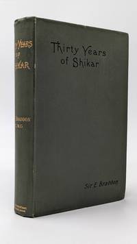
1888040755London: Spencer Blackett 1888. xi 388pp 8 bw ills. Or green gilt cloth with title and elephant in gilt. Cloth lightly rubbed at edges front hinge a little tender. A nice clean copy. Originally published in 1881 this undated second edition 1888. Lots of hunting tiger and other military comment social comment and information on the various states. . Second Edition. Hard Cover. Very Good. Illus. by The Author; Burton Miss C.G.M. 8vo. Spencer Blackett Hardcover
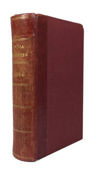
185484658London: Wm. H. Allen & Co 1854. Hardcover. Very Good. index c 145p. plus 6p. advertisements. Rebound in a red 20th century quarterbinding red leather backstrip and red cloth. 17cm. Rear joint tender. Richard F. Burton shows up in the list as does John H. Speke. Wm. H. Allen & Co hardcover
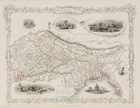
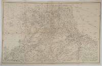
1851200119AG1851. London & New York John Tallis & Company 1851. Original steel engraving / Vintage map. Drawn and engraved by John Rapkin. Partly hand-coloured. Illustrations by A.H. Wray and Engraved by J.H. Kernot. Plate Size: 31.5 cm x 25 cm. Sheet Size: 37.2 cm x 27.2 cm. Vintage 19th century map in very good condition. Beautifully bordered map of northern India from Cambay to Chittagong and Aracan in the Bay of Bengal. The political subdivisions are colourfully included marking out independent Nepal and Bhutan. The regions of Jemer Malwa Allahabade and Assam can also be seen on the map along with the names of many towns and cities The regions rivers including the Ganges are shown and relief is depicted with hachuring. John Tallis 7 November 1817 3 June 1876 was an English cartographic publisher. His company John Tallis and Company published views maps and atlases in London from roughly 1838 to 1851. Tallis set up as a publisher with Frederick Tallis in Cripplegate in 1842; the business moved to Smithfield in 1846 and was dissolved in 1849. From 1851 to 1854 Tallis operated as John Tallis and Company. He started The illustrated news of the world and national portrait gallery of eminent personages in 1858 selling it for £1370 in 1861; it folded in 1863. Wikipedia The most important project John Tallis undertook was the 'Illustrated Atlas' from 1851. The original map we offer here was part of this exceptional Atlas and all the maps it contained are still today considered as the last reminder of an era of lavish map production. Tallis worked the project together with John Rapkin 1815-1876 and it was Rapkin's style and talent that we have to thank for when we marvel at these maps today. What makes these maps so special is the detail of engraved vignettes that surround the map and often show indigenous scenes people in their environment and even more so historical buildings or historical views of towns and cities architecture and landscape. The project of 'The Illustrated Atlas' was designed to be finished just in time for the anxiously awaited "Great Exhibition of the Works of Industry of All Nations" or The Great Exhibition sometimes referred to as the Crystal Palace Exhibition in reference to the temporary structure in which it was held was an international exhibition that took place in Hyde Park London from 1 May to 11 October 1851. It was the first in a series of World's Fairs exhibitions of culture and industry that became popular in the 19th century and it was a much anticipated event. The Great Exhibition was organized by Henry Cole and Prince Albert husband of the reigning monarch Queen Victoria. It was attended by numerous notable figures of the time including Charles Darwin Samuel Colt members of the Orléanist Royal Family and the writers Charlotte Brontë Charles Dickens Lewis Carroll George Eliot and Alfred Tennyson. Music for the opening was under the direction of Sir George Thomas Smart and the continuous music from the exhibited organs for the Queen's procession was "under the superintendence of William Sterndale Bennett". Wikipedia unknown
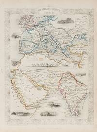
1851200124AG1851. London & New York John Tallis & Company 1851. Original steel engraving / Vintage map. Drawn and engraved by John Rapkin. Partly hand-coloured. Illustrations by H. Warren and Engraved by J. Rogers. Plate Size: 34.5 cm x 34 cm. Sheet Size: 27.2 cm x 37.4 cm. Vintage 19th century map in very good condition. Published in the Illustrated Atlas And Modern History Of The World Geographical Political Commercial & Statistical Edited By R. Montgomery Martin. Beautifully bordered and fascinating double map of the overland route between Britain and India. The upper map shows Europe and the links - both land and sea - running from England through to Alexandria Egypt. The routes are; the 'Mail Steam Packet Route' which runs around Gibraltar through Malta and onto Egypt; the 'Marseilles Overland Route' that runs across France to Marseilles and onto Alexandria via Malta and; the 'German Overland Route' that runs through across Belgium Germany before reaching Trieste and then onto the Mediterranean and then Egypt. The second map shows the differing routes on the next part of the journey - either across the Turkish controlled Middle East and through the Persian Gulf or down the Red Sea and across the Indian Ocean. What the map clearly illustrates is the importance attached to India 'Hindoostan' in the Imperial mind and the need for secure communication and transport links which necessitated control of certain choke points on the link such as Gibraltar Malta Suez etc. John Tallis 7 November 1817 3 June 1876 was an English cartographic publisher. His company John Tallis and Company published views maps and atlases in London from roughly 1838 to 1851. Tallis set up as a publisher with Frederick Tallis in Cripplegate in 1842; the business moved to Smithfield in 1846 and was dissolved in 1849. From 1851 to 1854 Tallis operated as John Tallis and Company. He started The illustrated news of the world and national portrait gallery of eminent personages in 1858 selling it for £1370 in 1861; it folded in 1863. Wikipedia The most important project John Tallis undertook was the 'Illustrated Atlas' from 1851. The original map we offer here was part of this exceptional Atlas and all the maps it contained are still today considered as the last reminder of an era of lavish map production. Tallis worked the project together with John Rapkin 1815-1876 and it was Rapkin's style and talent that we have to thank for when we marvel at these maps today. What makes these maps so special is the detail of engraved vignettes that surround the map and often show indigenous scenes people in their environment and even more so historical buildings or historical views of towns and cities architecture and landscape. The project of 'The Illustrated Atlas' was designed to be finished just in time for the anxiously awaited "Great Exhibition of the Works of Industry of All Nations" or The Great Exhibition sometimes referred to as the Crystal Palace Exhibition in reference to the temporary structure in which it was held was an international exhibition that took place in Hyde Park London from 1 May to 11 October 1851. It was the first in a series of World's Fairs exhibitions of culture and industry that became popular in the 19th century and it was a much-anticipated event. The Great Exhibition was organized by Henry Cole and Prince Albert husband of the reigning monarch Queen Victoria. It was attended by numerous notable figures of the time including Charles Darwin Samuel Colt members of the Orléanist Royal Family and the writers Charlotte Brontë Charles Dickens Lewis Carroll George Eliot and Alfred Tennyson. Music for the opening was under the direction of Sir George Thomas Smart and the continuous music from the exhibited organs for the Queen's procession was "under the superintendence of William Sterndale Bennett". Wikipedia unknown
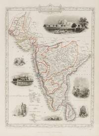
1851200109AG1851. London & New York John Tallis & Company 1851. Original steel engraving / Vintage map. Drawn and engraved by John Rapkin. Partly hand-coloured. Illustrations by A.H. Wray and Engraved by J.H. Kernot. Plate Size: 31.8 cm x 25.5 cm. Sheet Size: 37.2 cm x 27.2 cm. Vintage 19th century map in very good condition. Beautiful map of the southern Indian subcontinent from Sinde at the mouth of the Indus Estuary in the north down through Gujerat Bejapor and Mysore and down into the Carnatic region in the south. Hydrabad and Circars border the Bay of Bengal. Ceylon is also included in the map as are the Laccadive and Maldive islands in the Indian Ocean. Relief is depicting with hachuring. The major cities such as Bombay Sernigapatam and Madras are shown as are the rivers - including the Godavery and Beema rivers. This was an India dominated by the East India Company the British joint-stock company that came to rule large areas of India with its private armies exercising military power and seizing administrative functions. Formed in the early 1600s to compete with the Dutch for trade and commerce in the East the company rose to account for half of the world's trade at one point. Company rule in India lasted until 1858 when following the Indian Rebellion of 1857 the Government of India Act 1858 led to the British Crown's assuming direct control of the Indian subcontinent in the form of the new British Raj. The company was dissolved in 1874 as a result of the East India Stock Dividend Redemption Act passed one year earlier as the Government of India Act had by then rendered it vestigial powerless and obsolete. The official government machinery of British India assumed the East India Company's governmental functions and absorbed its navy and its armies in 1858. Wikipedia John Tallis 7 November 1817 3 June 1876 was an English cartographic publisher. His company John Tallis and Company published views maps and atlases in London from roughly 1838 to 1851. Tallis set up as a publisher with Frederick Tallis in Cripplegate in 1842; the business moved to Smithfield in 1846 and was dissolved in 1849. From 1851 to 1854 Tallis operated as John Tallis and Company. He started The illustrated news of the world and national portrait gallery of eminent personages in 1858 selling it for £1370 in 1861; it folded in 1863. Wikipedia The most important project John Tallis undertook was the 'Illustrated Atlas' from 1851. The original map we offer here was part of this exceptional Atlas and all the maps it contained are still today considered as the last reminder of an era of lavish map production. Tallis worked the project together with John Rapkin 1815-1876 and it was Rapkin's style and talent that we have to thank for when we marvel at these maps today. What makes these maps so special is the detail of engraved vignettes that surround the map and often show indigenous scenes people in their environment and even more so historical buildings or historical views of towns and cities architecture and landscape. The project of 'The Illustrated Atlas' was designed to be finished just in time for the anxiously awaited "Great Exhibition of the Works of Industry of All Nations" or The Great Exhibition sometimes referred to as the Crystal Palace Exhibition in reference to the temporary structure in which it was held was an international exhibition that took place in Hyde Park London from 1 May to 11 October 1851. It was the first in a series of World's Fairs exhibitions of culture and industry that became popular in the 19th century and it was a much anticipated event. The Great Exhibition was organized by Henry Cole and Prince Albert husband of the reigning monarch Queen Victoria. It was attended by numerous notable figures of the time including Charles Darwin Samuel Colt members of the Orléanist Royal Family and the writers Charlotte Brontë Charles Dickens Lewis Carroll George Eliot and Alfred Tennyson. Music for the opening was under the direction of Sir George Thomas Smart and the continuous music from the exhibited organs for the Queen's procession was "under the superintendence of William Sterndale Bennett". Wikipedia unknown
1885INDIA007593Henry Hansard London. 1885. First edition. Folio. 288 pages. Original wrappers. Bookseller's rubber stamp on upper cover and title-page. Spine cracked but largely intact. Wrappers a bit creased. Very good. Rare. Henry Hansard, London. unknown
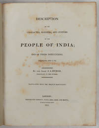
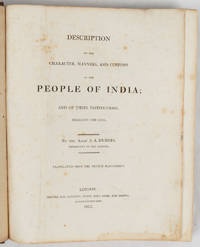
1817223218London.: Longman Hurst Rees Orme and Brown. 1817. xxvii 565pp 2 publisher's advertisements; half calf over marbled boards 27.5 x 22 cms endpapers renewed the title page and prelims spotted scant foxing elsewhere the final ten leaves tide-marked a good sound copy. Detailed account of the social cultural and religious practices of India during the late 18th and early 19th centuries. Abbé Dubois a French Catholic priest and missionary was stationed in India from 1792-1823 and his manuscript was purchased by the East India Company in 1807 publishing this English translation in 1817. . Longman, Hurst, Rees, Orme and Brown. hardcover
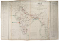
1859189711Calcutta.: Surveyor Generals Office. 1870. Reissue of 1859 edition. Lithographed map 57.2 x 93 cms; 61.1 x 96 cms sheet original folds old paper repairs to the verso and a sealed marginal tear central folds archivally strengthened some toning to the folds and creasing but the map in remarkably good clean condition. Impressive large Calcutta printing from the Survey of India showing Rajasthan Uttar Pradesh and surrounding states with extremely detailed delineation of settlements roads railways rivers and major points of interest the Taj Mahal is highlighted. . Surveyor Generals Office. unknown
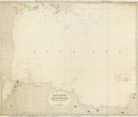
1881143683London: James Imray and Son 1881. Good. London James Imray and Son 1881. A very large engraved chart in two sheets combined printed surface 1039 × 1240 mm overall sheet size 1039 × 1264 mm with minimal hand-colouring mounted together on the original blue backing paper with the publisher's title-label on the verso. Minor chipping at the edges with minimal loss to the headline title above the top border; a few light stains and creases; a short sealed tear to the middle of the left and right sides one extending about 100 mm into the printed surface; a few old pencil annotations; in good condition. A very large and detailed blueback chart of the western part of the Java Sea the passages connecting it to the Indian Ocean the Sunda Strait and the South China Seas the Karimata Gaspar and Bangka Straits and Batavia Jakarta. Lighthouses are highlighted with spots of red and yellow colouring. <p>The publisher's inkstamp dated 1882 appears near the imprint. The title-label on the verso reads 'Chart No. 161. Western Route to China. In Six Charts. Chart No 1. Price 7s. 6d.'. James Imray and Son unknown
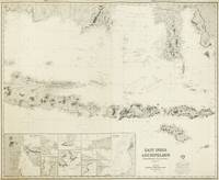
1881143682London: James Imray and Son 1881. Very Good. London James Imray and Son 1881/ 1863. A very large engraved chart in two sheets combined size approximately 1040 × 1285 mm with minimal hand-colouring mounted together on the original blue backing paper with the publisher's title-label on the verso. Head and foot slightly cropped with slight loss to the text outside the border; some marginal chips and tears with two that extend slightly into the printed surface now expertly sealed; short left-hand portion of the top margin a little waterstained not affecting the printed surface; a few trifling spots of foxing and some unobtrusive creases; overall in very good condition. A very large and detailed blueback chart of the Java Sea including the eastern half of the Indonesian archipelago and the southern coasts of Borneo and Sulawesi. It includes twelve inset charts: the Baly Bali Strait; Sapie Bay; Labuan Tring Bay; Tafel Hoek; Segoro Wedie Bay; Beliling and Sangsit Roads; Bunkolan and Lirang Roads; Koeboe Road; Amok Bay and Padang Cove; Tiulik Road; Oedyon Road; and Macassar. Lighthouses are highlighted with small spots of red and yellow colouring. <p>The publisher's inkstamp dated 1882 appears below the title. The title-label on the verso reads 'Chart No. 171. Eastern Passages to China & Japan in Nine Charts. Chart No 1. Price 7s. 6d.'. James Imray and Son unknown
18358652First edition. Octavo. Descriptive account by Rev. Hobart Caunter. 22 engravings from original drawings by William Daniell. 263 pages 4 pages of advertisements. Original gilt and blindstamped dark brown morocco spine with gilt stamped design of a palm tree and camel covers with gilt stamped vignette of 3 men riding on an elephant surrounded by blindstamped border of intertwined snakes a.e.g. rubbing to extremities. Very good. No foxing. Binder's ticked of F. Westley. Bookplate of H. Scofield and C.W. Nicolay with Nicolay's ink signature dated 1835. Bull and Churton hardcover
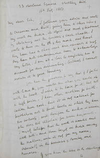
186130491033 Norland Square Notting Hill 1861. 4pp. 12mo. Old folds. 4pp. 12mo. Born in Bombay in 1799 Duncan was the illegitimate son of the Governor of Bombay. Duncan's father's wealth enabled him to pursue a literary life and he published regularly from 1825-57. <br /> <br /> He summarises the work thus: "The object of this book is to enable those who have never studied India to acquire a knowledge of its institutions with the best possible expenditure of time." A book on India would be seemingly inevitable for a writer with his background yet the work described here was seemingly never published. unknown
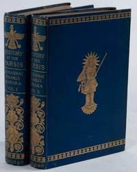
1884223672London.: Macmillan & Co. First Edition. 1884. Two volumes 8 full -page illustrations including 4 chromolithograph plates two photographic illustrations tipped in and two black and white steel engravings xxxiii 332pp; viii 350pp the final leaf unopened original azure linen cloth-covered boards elaborately gilt with a cover vignette and highly embellished spine gilt lettered extremities a trifle rubbed and bumped scant foxing a highly attractive copy in very good condition. Foundational work on the Parsis for a Western audience by influential Indian newspaper editor and adminstrator Dosabhai Framji Karaka 1829-1902. . Macmillan & Co. hardcover
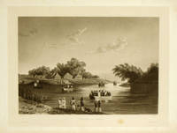
1835198166Paris.: A. Bertrand. 1835. Aquatint 27.1 x 36.3 cms; 32 x 47.6cms sheet trimmed including platemark margins outside the platemark toned and discoloured edge tears one encroaching on the platemark image unaffected small bloom of browning at the foot near caption the image a fine dark impression in very good condition. Tranquil river view by artist and draughtsman Barthelemy Lauvergne 1805-1875 from the official account of the Laplace voyage in the Favorite 1830-32. . A. Bertrand. unknown
1891173786London.: Her Majesty's Stationery Office. 1891. Large folding map 64.7 x 71.7cm map size 67.5 x 100cm sheet size with railway gauges highlighted in original colour three small tears without loss along the folds and two longer fold tears strengthened on the verso without loss the left margin of the sheet chipped with some overall toning but a striking map in good condition. Impressive large map from the exhaustive Survey of India with the burgeoning railway network highlighted in attractive detail. A lengthy gazetteer listing "Principal centres of traffic showing goods and passenger traffic separately and combined" is printed either side of the map. . [Her Majesty's Stationery Office]. unknown
1817223216London.: Longman Hurst Rees Orme and Brown. 1817. xxvii 565pp 2 publisher's advertisments; contemporary diced morocco the boards with an elaborate double-border blind-stamped and gilt-embossed rubbed at the edges re-backed mounting the original gilt-decorated and lettered backstrip 27 x 22 cms marbled fore edges marbled endpapers the title page rather spotted and stained scant foxing elsewhere with the armorial bookplate of J. E. Saunders Finsbury Square and the neat pencilled inscription of a later owner to the initial blank a good copy. Detailed account of the social cultural and religious practices of India during the late 18th and early 19th centuries. Abbé Dubois a French Catholic priest and missionary was stationed in India from 1792-1823 and his manuscript was purchased by the East India Company in 1807 publishing this English translation in 1817. . Longman, Hurst, Rees, Orme and Brown. hardcover
1842182100London W. H. Allen & co. 1842. Third Edition. Hardback. Very good copy in the original plain cloth. Professionally re-cased with the original spine laid back; very impressively finished. Remains particularly well-preserved overall; tight bright clean and strong. Scans etc. on request.; 8vo 8"" - 9"" tall; 773 pages; Related names: East India Company. Great Britain. Laws statutes etc. Description: xiv 773 p. 28 x 23 cm. London, W. H. Allen & co. hardcover
189521117Edinburgh And London: William Blackwood and Sons. 1895. First Edition. Hardcover. Very Good. Boards with light rubbing to extremities. Bookplate. Light marginal dampstaining. ; The story of a hunting adventurer in India. Including a large rear fold-out map in VG condition. Numerous illustrations. ; 8vo 8" - 9" tall; x 373 32 pages . William Blackwood and Sons hardcover
184989449Agra: The Secundra Orphan Press 1849-51. First editions. Interesting collection of technical papers relating to the government of the North Western Provinces. Includes the description of a bridge built at Seoni by Major Boileau with plan; detailed plans for the cutting of a canal from the Sutlej at Tihara with excellent maps; an account of the "Oothaeegeeras" or Sunoreahs "professional thieves of Bundelcund" including a glossary of "Bolee" their argot; a important "Report upon the Tea Plantations in the North Western Provinces" by Robert Fortune noted botanist and plant collector for the HEIC; together with some revenue surveys of the region submitted by William Muir as secretary of the revenue board to John Thomason the lieutenant-governor. Attractive group of uncommon Indian imprints. Octavo 200 x 126 mm Twentieth-century blue cloth title gilt to the spine original upper wrappers bound in. pp. ii 66-108 3 folding lithographic maps with colour; pp. ii 213-250 folding lithographic map and 3 folding letter-press table; ii 251-286pp. folding letter-press table and tables to the text. Cloth clean and sound Patent Office Library ink-stamps to the wrappers maps and occasionally to the text light toning overall very good. hardcover
1874949F34Bombay: The Times of India Offive 1874 . First edition. Leather. Good Only. 8.5" by 6". Not Stated. The vanishingly scarce 1874 edition of the Times of India's illustrated calendar and directory to Bombay. A very scarce work.Illustrated with a frontispiece and two further plates. Collated complete.A fascinating and informative alphabetically arranged guide to the businesses buildings statistics army and economy of Bombay and India at large in India in 1874 issued by the Times of India.Also included are army lists marine lists and civil lists. With a calendar of important events taking place throughout the year also present and tables of weights and measurements. With sixty-four pages of contemporary advertisements to the rear.With the stamp of the United Kingdom Law Society to the title page and one or two further leaves and with their name to the back strip tail.An impressively detailed reference work offering insight into life in Bombay in the 1870s. In a half calf binding with cloth covered boards. Major rubbing to calf of back strip and boards. Front board detached but present. Rear joint starting with board firmly held. Lacking front free endpaper. Frontispiece detached and loosely inserted. Internally firmly bound. Pages lightly age toned with the odd light handling mark. Library stamp to title page head and one or two further leaves. Good Only The Times of India Offive hardcover
1874B7111Hyderabad India: Residency Press. 1874-5. Bindings rubbed interior generally clean. Binding: 1874 vol in printed paper wraps backed in green cloth. 1875 in publisher’s limp printed paper boards rebacked in blue cloth. Notes: Ex-library ink stamps on titles.<br>Very good example. Rare volumes on India. <br><br>1874 volume with errata slip bound in.<br> Size: 8vo. 240 x 150 mm Volume: 2 volumes. Category: Book Asia Central India & Ceylon / Sri Lanka; Residency Press. paperback
1828214811London.: John Murray Albemarle Street. First Edition. 1828. First Edition two volumes in 1: xvi 4 xvii-xlviii 632pp; full-page map coloured in outline 5 plates 21 wood engravings in text List of Subscribers etc. last blank; viii 516pp 5 plates 4 wood engravings in text contemporary calf boards scuffed sympathetically rebacked with the gilt monogram of the Church Missionary Society 27 x 20cm considerable foxing to plates & adjacent leaves with small waterstain to several plates in Volume I neat sealed tears to five leaves in the Appendix of Volume II otherwise clean with the label of the Church Missionary Society and of Kumars the Calcutta Booksellers to the front pastedown neat ownership inscription of W. R. Crocker to the front free endpaper a good copy. A seminal work describing India's geography and people with an interesting provenance. Sir Walter Russell Crocker KBE 1902 – 2002 was an Australian ambassador and he authored a well-received biography of Jawaharlal Nehru: "Nehru: A Contemporary's Estimate" 1966. He was ambassador or high commissioner to eleven countries including India twice Indonesia Canada Italy Belgium Nepal the Netherlands Ethiopia Kenya and Uganda. He headed the Department of International Relations at the Research School of Pacific and Asian Studies Australian National University 1949–1954 and was a Lieutenant-Governor of South Australia for more than nine years. . John Murray, Albemarle Street. hardcover
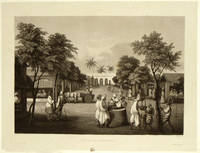
1835196250Paris.: A. Bertrand. 1835. Aquatint 27.1 x 36 cms; 31.6 x 47.2 cms sheet trimmed including platemark margins outside the platemark toned and discoloured edgewear with small chips mark at the foot of the caption split without loss at the lower corner of the platemark the image a fine dark impression in very good condition. Fine view of the market square at Pondicherry showing the well and the prison in the background from the official account of the Laplace voyage in the Favorite 1830-32 by voyage artist François-Edmond Pâris 1806-1893. The important French expedition encompassed India Southeast Asia and the Pacific. . A. Bertrand. unknown
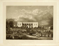
1835196251Paris.: A. Bertrand. 1835. Aquatint 27.1 x 36 cm; 32.3 x 47.2 cm sheet trimmed including platemark margins outside the platemark toned and discoloured with soft crease and small split not affecting the image to an upper corner the image a fine dark impression in very good condition. Beautifully executed view of the Governor's Palace in the Pondicherry showing soldiers and officials trouping out from the official account of the Laplace voyage in the Favorite 1830-32 by voyage artist François-Edmond Pâris 1806-1893. The important French expedition encompassed India Southeast Asia and the Pacific. . A. Bertrand. unknown
18790009094London: John Murray 1879. First edition. Hardcover. Fine. 8vo; cxxvii 444 12 pages blue cloth <br/><br/>Burton's contributions occupy the first 190 pages. Also Prof. George Rolleston's lecture to the RGS an early ecology talk "The Modifications of the External Aspects of Organic Nature produced by Man's Interference". " I propose . to notice a few of the many alterations produced by disforesting in our own and other countries". John Murray hardcover