Mallet Manesson Allain (1630-1706)Livre Rare Book
7 résultats
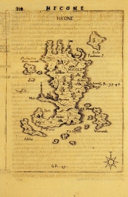
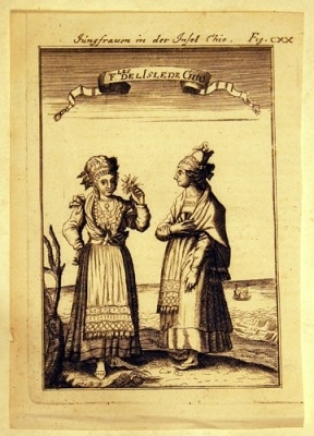
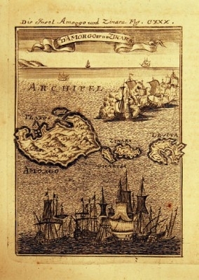
GRA075Copper plate engravings from 'Beschreibung des gantzen Welt-Kreises' Frankfurt 1684/85 und 1719 (Description de l’Univers..) Engraved surface c. 15 X 10,2 cm, clean plates all decorated with ships. Each
GRA243Glogan, Flemming 1845, Carte gr. sur acier, contours colories, 32 x 42 cm avec liste de Eparchies et Nomarchies
1852GRA103Gotha: Justus Perthes, 1852. Steel engraved map with coloured outlines and 2 cartouches with Athenes and Piraeus
GRA076Copper plate engravings from 'Beschreibung des gantzen Welt-Kreises' Frankfurt 1684/85 und 1719 (Description de l’Univers..) Engraved surface c. 15 X 10,2 cm, clean plates all decorated with ships. Each
1852GRA238Gotha, Justus Perthes, 1852. Engraved map of Greece, hand coloured in outline and 2 cartouches with Athens and Pireus, 32 X 40 cm plus margins
GRA078Copper plate engravings from 'Beschreibung des gantzen Welt-Kreises' Frankfurt 1684/85 und 1719 (Description de l’Univers..) Engraved surface 15 X 10,2 cm, clean plates, the first decorated with ships. Both
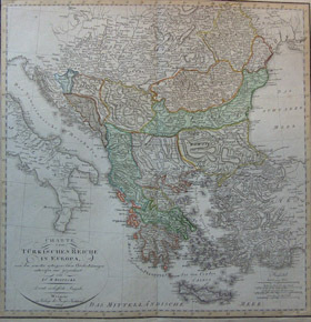
1807GRA061Geograph. Instituts Weimar 1807. Gravee sur acier, frontieres coloriees -ou les etats balkaniques sont tres differents de ceux de nos jours-, 47 x 47 cm sans les marges.